
Scan the QR code and open PeakVisor on your phone
Boasting sandy beaches, jagged snow-capped mountains, vast deserts, and vibrant cities, California is a large state located in the western region of the United States. It contains 8008 named mountains, the highest and most prominent of which is Mount Whitney (14,505ft/10,085m).
The state of California is located along the western coast of the contiguous United States. It shares a border with three US states—Oregon to the north, Nevada to the east, and Arizona, to the southeast— as well as the state of Baja California in Mexico.
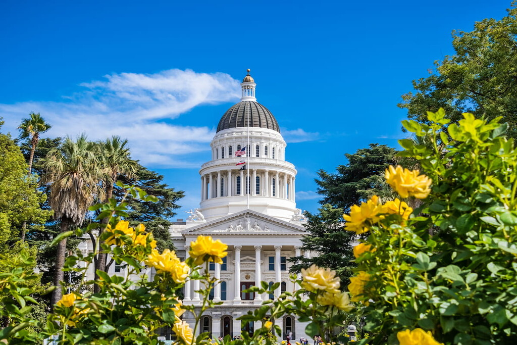
With a total land area of 163,696 square miles (423,970 square kilometers), California is the third-largest state in the US by area after Alaska and Texas. It is also home to nearly 40 million people, which makes it the most populous state in the country, leading the next largest, Texas, by more than 10 million people.
The geography of California is highly varied thanks to its many distinct regions. However, while areas of California can be categorized in many different ways, including as “Northern California” and “Southern California,” none of these hold official weight within the state.
Indeed, perhaps the easiest way to categorize California’s 58 counties is to use the state’s census regions. The California Census Regions are an informal grouping of the state’s counties into regions that share similar geographical and cultural features.
While they are not a perfect representation of the sheer diversity of California’s topography and human population, these census regions are helpful for understanding the geography of the state.
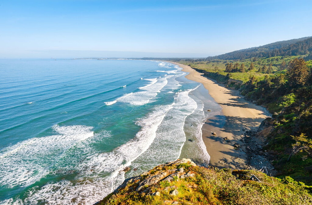
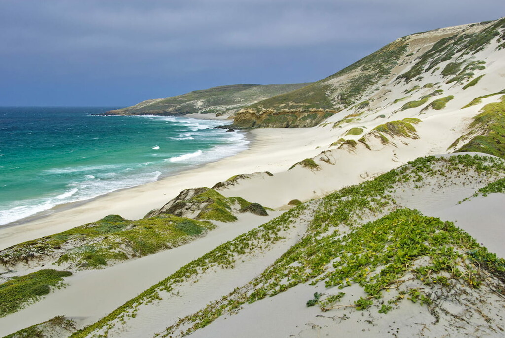
Sometimes called the Redwood Empire, the North Coast of California contains the mostly coastal regions located to the north of the San Francisco bay. This includes Humboldt, Mendocino, Del Norte, Napa, Lake, Sonoma, and Trinity counties, though common use of the term may also refer to Marin County.
Much of the North Coast is quite rural and a substantial portion of the coastline is rugged and mostly inaccessible. The more interior sections of the region are heavily forested, particularly in the northern part of the state.
The North Coast is home to a superb collection of national and state parks, including:
Furthermore, the region is home to a great collection of federal wilderness areas, such as:
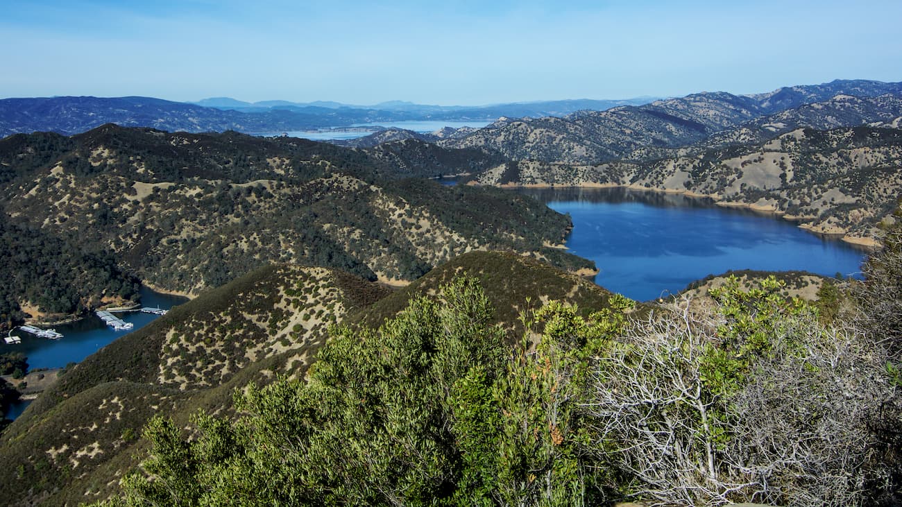
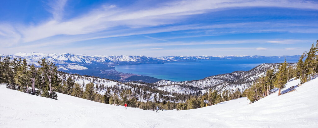
Superior California includes much of the northeastern part of the state, including the region that’s often called “Shasta-Cascades,” parts of the northern Sacramento Valley, and the Lake Tahoe Basin.
It also coincides with a number of economic regions that can be called the Northern California, Northern Sacramento Valley, Greater Sacramento, and Central Sierra regions. However, Superior California is defined as containing Butte, Colusa, Yuba, El Dorado, Glenn, Lassen, Modoc, Yolo, Nevada, Placer, Siskiyou, Plumas, Sacramento, Shasta, Sierra, Sutter, and Tehama counties.
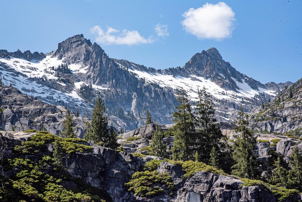
This region is heavily forested and is highly mountains. The northernmost parts of the region are home to the southernmost part of the Cascade Range while the southernmost part of the region is home to the northernmost extent of the Sierra Nevada.
Here, there are dozens of parks and protected areas, including:
There are also quite a few popular wilderness areas, including:
Aptly named, the San Francisco Bay Area is a region situated around the San Francisco, Suisun, and San Pablo Bay estuaries. It can be defined in a number of ways, but it is often considered to contain Alameda, Santa Clara, Marin, San Francisco, Contra Costa, San Mateo, and Solano counties.
This region is highly urban as it contains some of the largest cities in California, including San Francisco, Oakland, and San Jose. In fact, the region contains nearly 8 million residents, which makes it one of the largest urban areas in the world. Furthermore, the San Francisco Bay Area is one of the most ethnically diverse places in California and in the United States as a whole.
Despite being heavily urbanized, however, the San Francisco Bay Area is also home to a fantastic collection of parks and protected areas. These include:
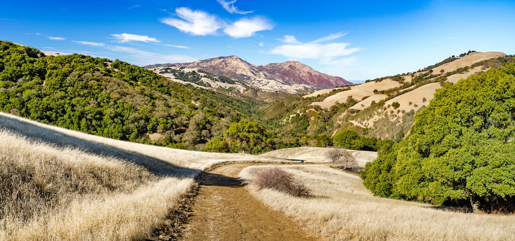
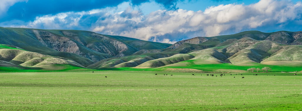
The Northern San Joaquin Valley is a bit of a misnomer because it contains, not only the northern part of the San Joaquin Valley, but a sizable portion of the northern Sierra Nevada. This includes Alpine, San Joaquin, Amador, Madera, Mariposa, Calaveras, Merced, Mono, Stanislaus, and Tuolumne counties.
In particular, the San Joaquin Valley comprises the bulk of the California Central Valley to the south of the Sacramento Valley. However, this region also includes the parts of the Sierra Nevada as far south as Tuolumne and Alpine counties.
This region is, for the most part, either highly agricultural or very mountainous and rural. It contains a superb array of federally-protected areas, including:
Encompassing the southern half of the San Joaquin Valley and the southern Sierra Nevada, the Southern San Joaquin Valley is home to Fresno, Kings, Inyo, Kern, and Tulare. Like its northerly neighbor, much of this region is either highly agricultural or highly mountainous.
However, the Southern San Joaquin Valley is also home to some of California’s most famous outdoor recreation areas. This includes:
Additionally, some of California’s most famous wilderness areas are also located in this region of California. This includes:
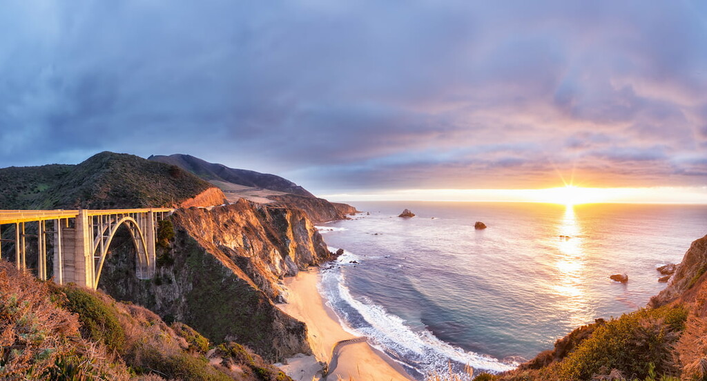
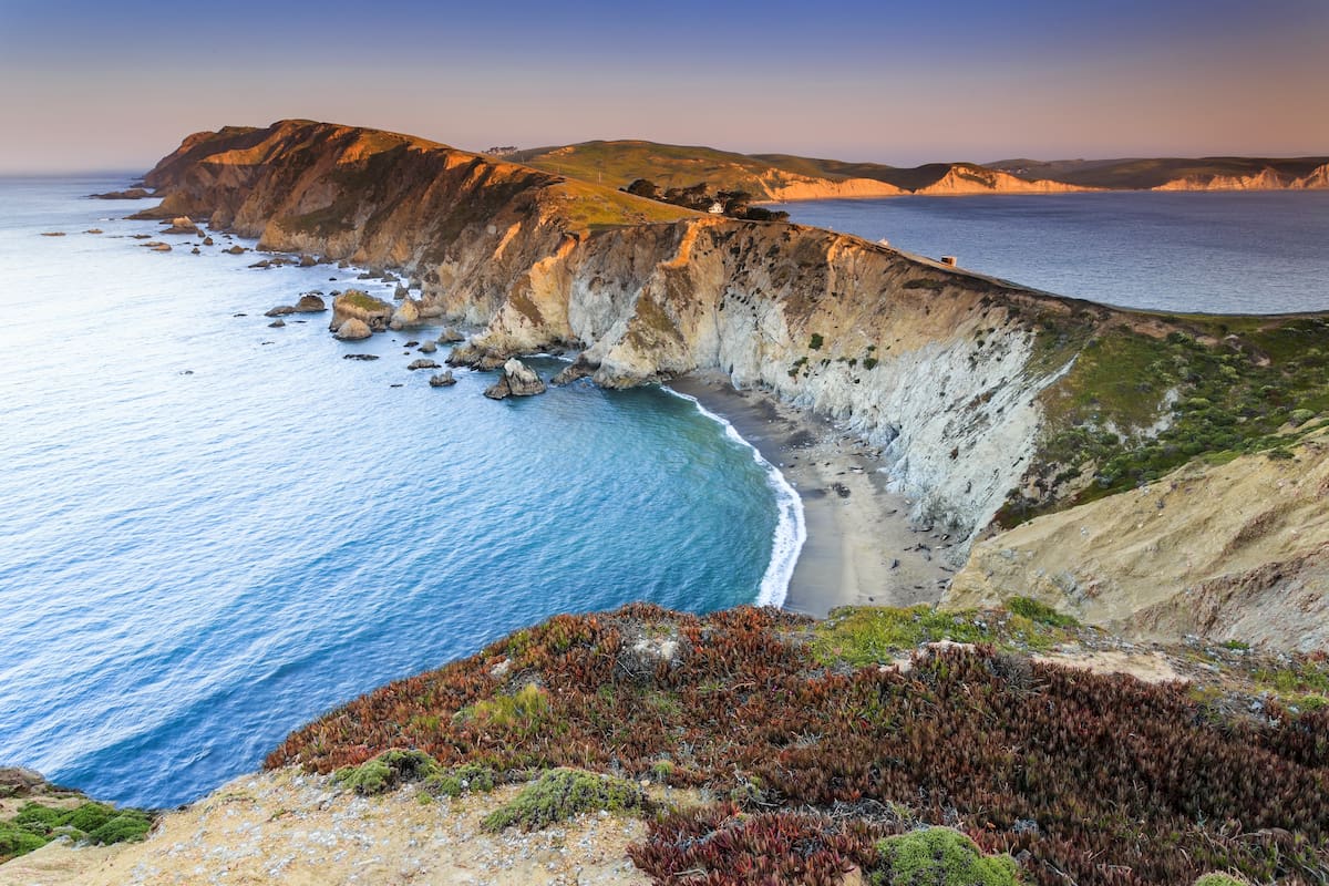
The California Central Coast is a major coastal region that contains about one-third of all of the coastline in the state. This includes Monterey, Ventura, San Luis Obispo, Santa Barbara, San Benito, and Santa Cruz counties, but it can also be roughly defined as the distance between Monterey Bay and Point Mugu.
The California Central Coast is a region that’s known for its particularly rugged coastline. This region contains the famous Big Sur, which is home to some of the most stunning coastline in the contiguous United States.
As a result of its natural beauty, the Central Coast is a particularly popular tourist destination. It’s also well-suited for agriculture, with wine being one of the largest economic outputs in the region. There are a number of wine regions within the California Central Coast, with the Santa Ynez Valley and Santa Rosa Valley being popular hotbeds for wine tasting.
Furthermore, the region is home to quite a few parks and protected areas. These include:
There are also a number of wilderness areas in the Central Coast region, such as:
The most populous county in the state of California and in the United States as a whole, Los Angeles county is its own census region.
It is home to more than 10 million people, which, for scale, means that it has a larger population than 41 US states. It also has a larger total land area that Rhode Island and Delaware combined.
The region is dominated by the city of Los Angeles, which itself has about 4 million residents. However, the city is surrounded by over 80 other incorporated cities that sprawl throughout the county.
That being said, while the southern half of the county is highly urbanized, the northern half is actually quite rural. In fact, the northern half of the county, which includes Antelope Valley is comparatively sparsely populated.
Furthermore, Los Angeles County is home to a surprising number of public land areas. This includes the massive Angeles National Forest, San Bernardino National Forest, and San Gabriel Mountains National Monument, as well as:
Located just inland of Los Angeles, the Inland Empire includes Riverside and San Bernardino counties. This area is heavily populated and it is home to about 4 million people.
Furthermore, this region is massive in terms of its total land area. It is actually bigger than 10 US states, including Rhode Island, Delaware, New Jersey, Connecticut, Massachusetts, Vermont, Maryland, Hawaii, and West Virginia.

The Inland Empire has become a hub for both manufacturing and commerce in California. Its relatively inexpensive land prices (at least when compared to Los Angeles) make it an attractive place for large corporations to open warehouses and factories. It is also quickly becoming quite suburban as many of the region’s cities are now commuter communities for Los angeles.
There are a number of popular national parks, forests, and monuments in the region, including:
Furthermore, the Inland Empire includes a great assortment of wilderness areas, such as:
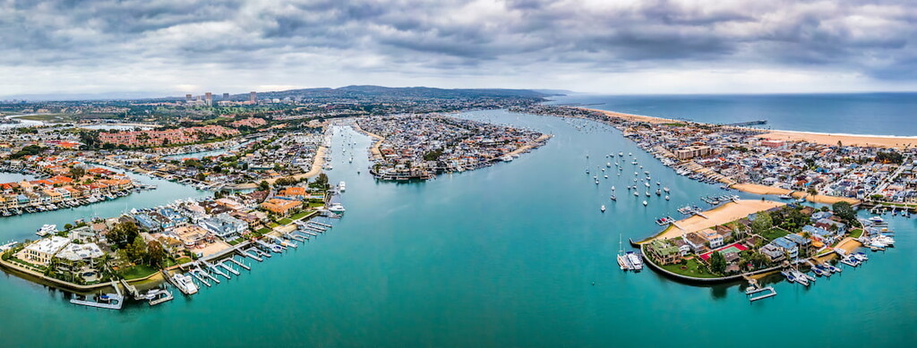
The second of two counties in California to have its own region, Orange County is located just to the southeast of Los Angeles along the Pacific Coast. It is home to about 3 million people, which makes it the sixth most populous county in the country.
Orange County contains a number of major cities, such as Anaheim, Irvine, and Santa Ana. It is also well known for its seaside communities, which include Laguna Beach, Huntington Beach, and Newport Beach.
The county has also become a major tourist destination. It is home to amusement parks, like Disneyland and Knott’s Berry Farm. Plus, its stunning beaches draw their own fair share of tourists each year, too.
While Orange County is now quite urbanized, it does contain some relatively large areas of public land, such as:
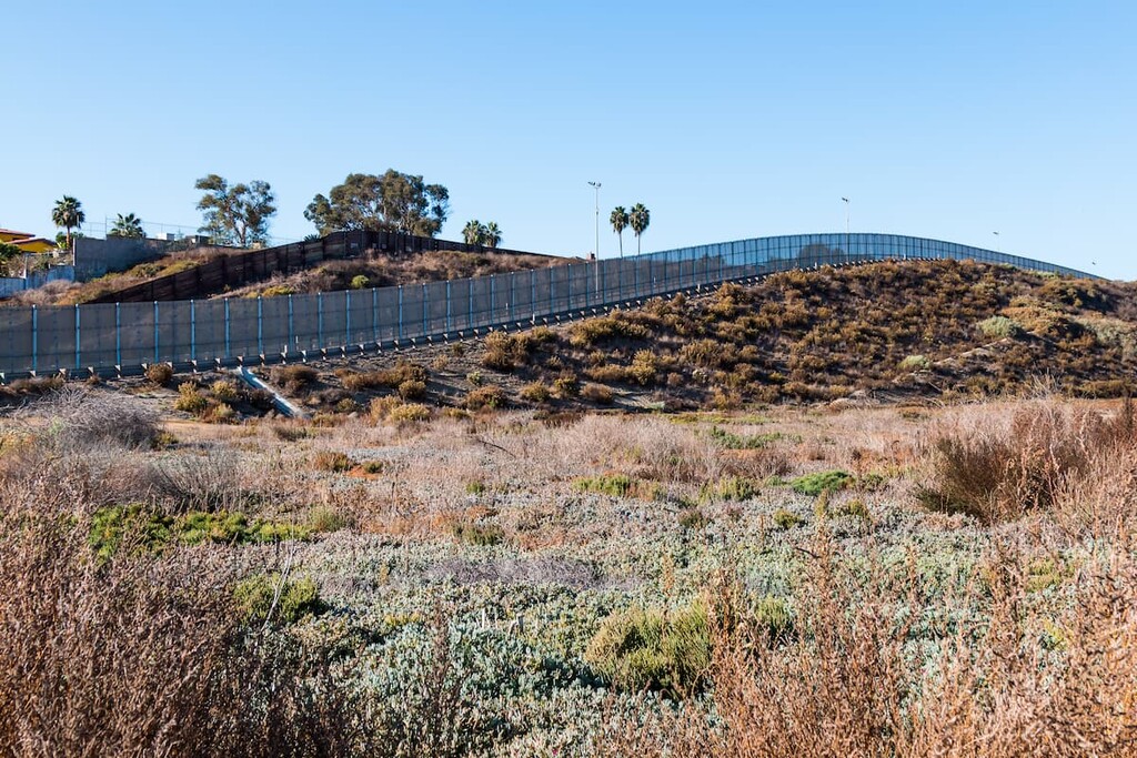
The southernmost region of California, the San Diego-Imperial region contains Imperial and San Diego counties. This region includes both San Diego, which is the second largest city in California with about 1.4 million residents, and the major desert that covers the bulk of Southern California.
Additionally, the San Diego-Imperial region has strong economic and cultural ties to the neighboring state of Baja California in Mexico. San Diego is part of a major transborder metropolitan area with Tijuana, which happens to tbe the second largest in the western hemisphere after the Detroit-Windsor area between the US state of Michigan and the Canadian province of Ontario.
Furthermore, the San Diego-Imperial region is also home to a fantastic assortment of protected areas. It contains one of the largest state parks in the contiguous US—Anza-Borrego Desert State Park—as well as an assortment of other wildernesses and parks, such as:
The geology of California is particularly complex. California contains a number of major geologic provinces and regions, each of which has its own unique history.
Additionally, the state contains a number of major mountain ranges that dominate the landscape. These include the Sierra Nevada, the California Ranges, the Great Basin Ranges, the Klamath Mountains, the Cascade Range, and the Northwest US Coast Ranges.
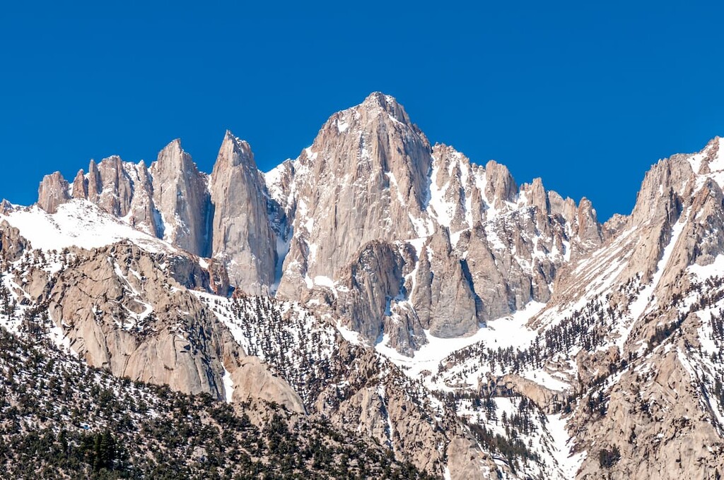
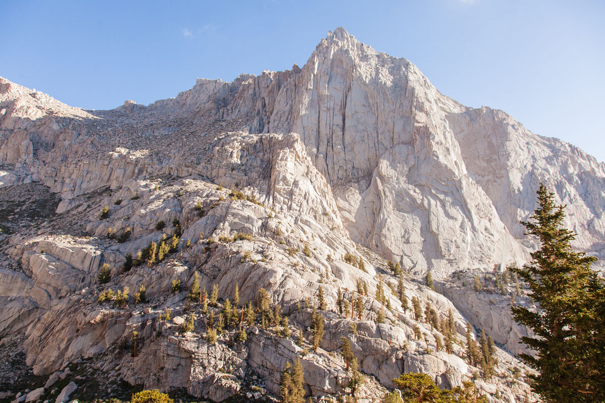
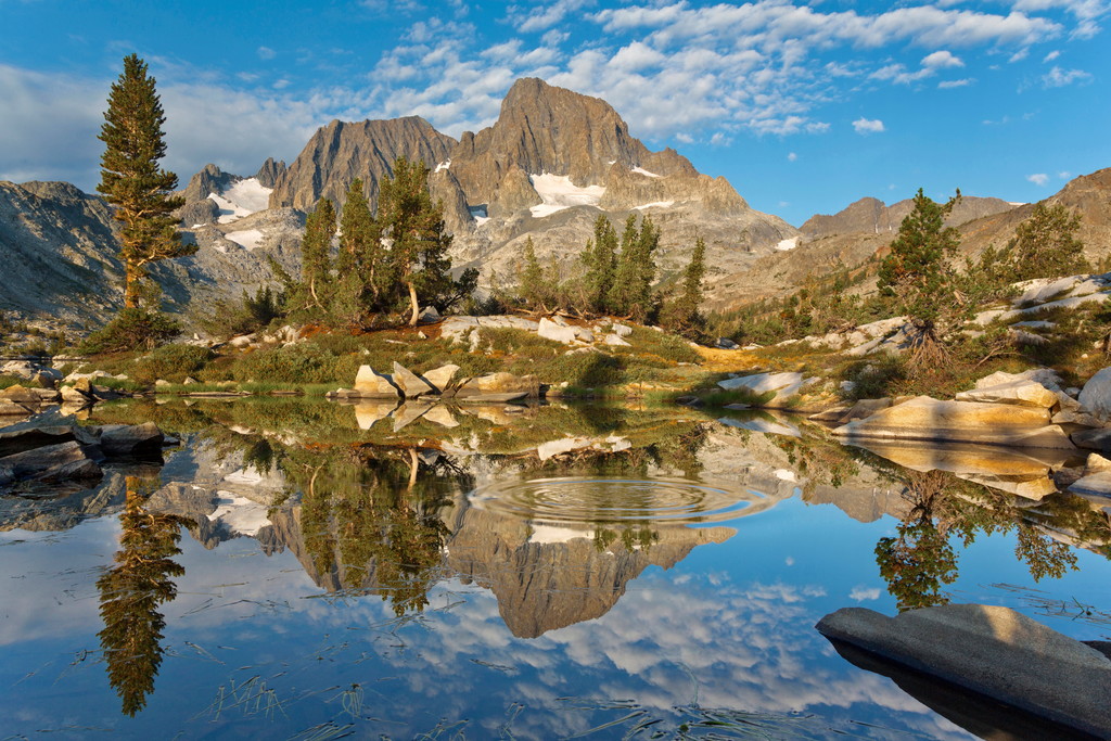
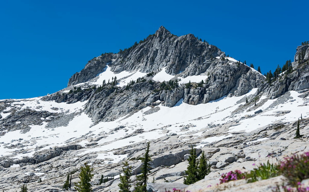
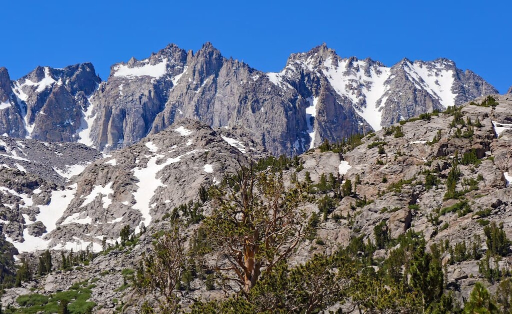
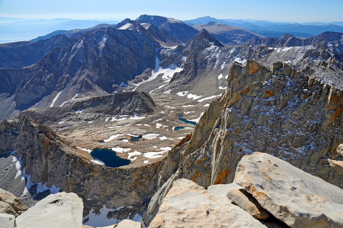
California’s highest mountain range, the Sierra Nevada runs along the eastern edge of the state. It contains 2,074 named mountains, the highest and most prominent of which is Mount Whitney.
The rocks in the Sierra Nevada vary in age, though the oldest date back to the Paleozoic. Much of the region is also underlain by the Sierra Nevada Batholith, which formed as the Farallon plate subducted under the North American plate. This batholith can be seen throughout the range in the form of the many exposed granite peaks in the Sierra.
Major peaks include Mount Ritter, Mount Rose, Mount Williamson, Breckenridge Mountain, El Capitan, and Half Dome.
The California Ranges are a collection of peaks that are found throughout southwestern California. They include 1,792 named peaks, the highest of which is San Gorgonio Mountain, and the most prominent of which is San Jacinto Peak.
Geologically, much of the range can be divided up into subranges that include the California Coast Ranges, the Transverse Ranges, and the Peninsular Ranges. Each subrange has its own unique geologic past with some areas being part of the Salinian Block and others being home to some of the same granites found in the Sierra Nevada.
Major peaks include Mount San Antonio, Junipero Serra Peak, Sugarloaf Mountain, Pine Mountain, and Mount Baden-Powell.
One of the largest geographic provinces in the United States, the Great Basin Ranges covers most of Nevada as well as parts of Utah, Idaho, Oregon, and eastern California. In California, the Great Basin Ranges are located just to the east of the Sierra Nevada, the Cascades, and the California Ranges.
The Great Basin is also a particularly geologically complex area. It’s believed that the region’s characteristic alternating mountain ranges and valleys formed as a result of tectonic extension during the Miocene. Furthermore, much of the region is rich in minerals, including gold, copper, silver, and barite.
The bulk of California’s Great Basin Ranges is located in southern California in the Mojave Desert. Here, there are dozens of smaller named ranges that dot the landscape, such as the Panamint Range, the Black Mountains, the White Mountains, and the Inyo Mountains.
Covering much of northwestern California, the Klamath Mountains are one of California’s most remote ranges. The range contains 583 named mountains, the highest and most prominent of which is Mount Eddy.
The Klamath Mountains are believed to have originated as island arcs that date back hundreds of millions of years. As the Farallon plate and the North American plate collided about 200 million years ago, the island arcs were accreted onto the continent. This led to metamorphism of the rocks, leading to the formation of serpentines, which are abundant in the area.
Major peaks in the range include Mount Hilton, Sawtooth Mountain, Gibson Peak, Boulder Peak, Brandy Peak, and Mount Ashland.
One of North America’s major mountain ranges, the Cascade Range stretches from the southern part of the province of British Columbia in Canada through Washington and Oregon, all the way to the northernmost region of California.
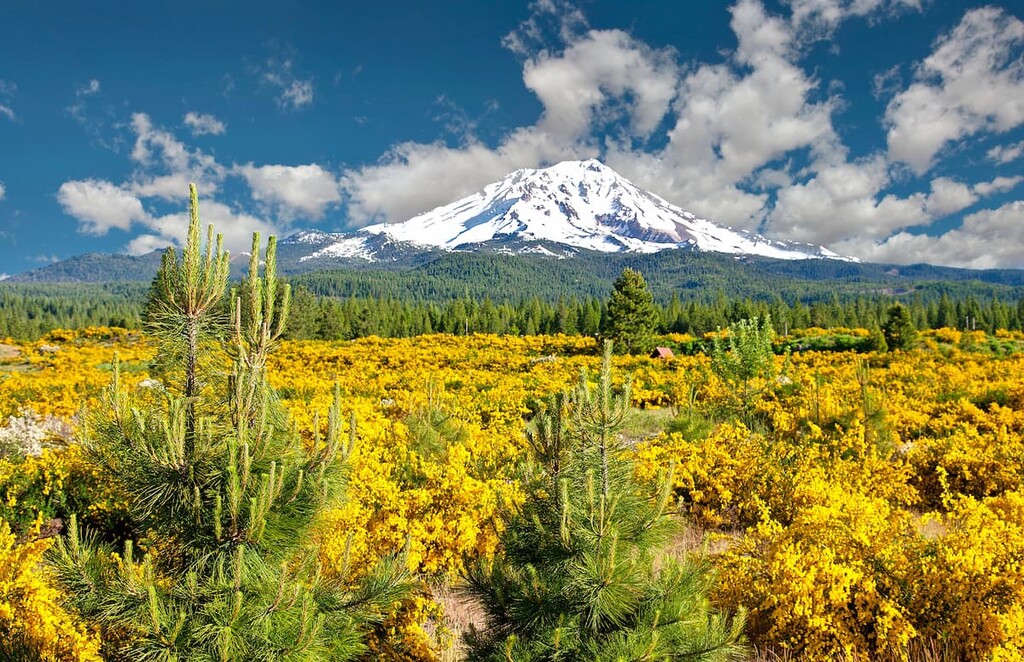
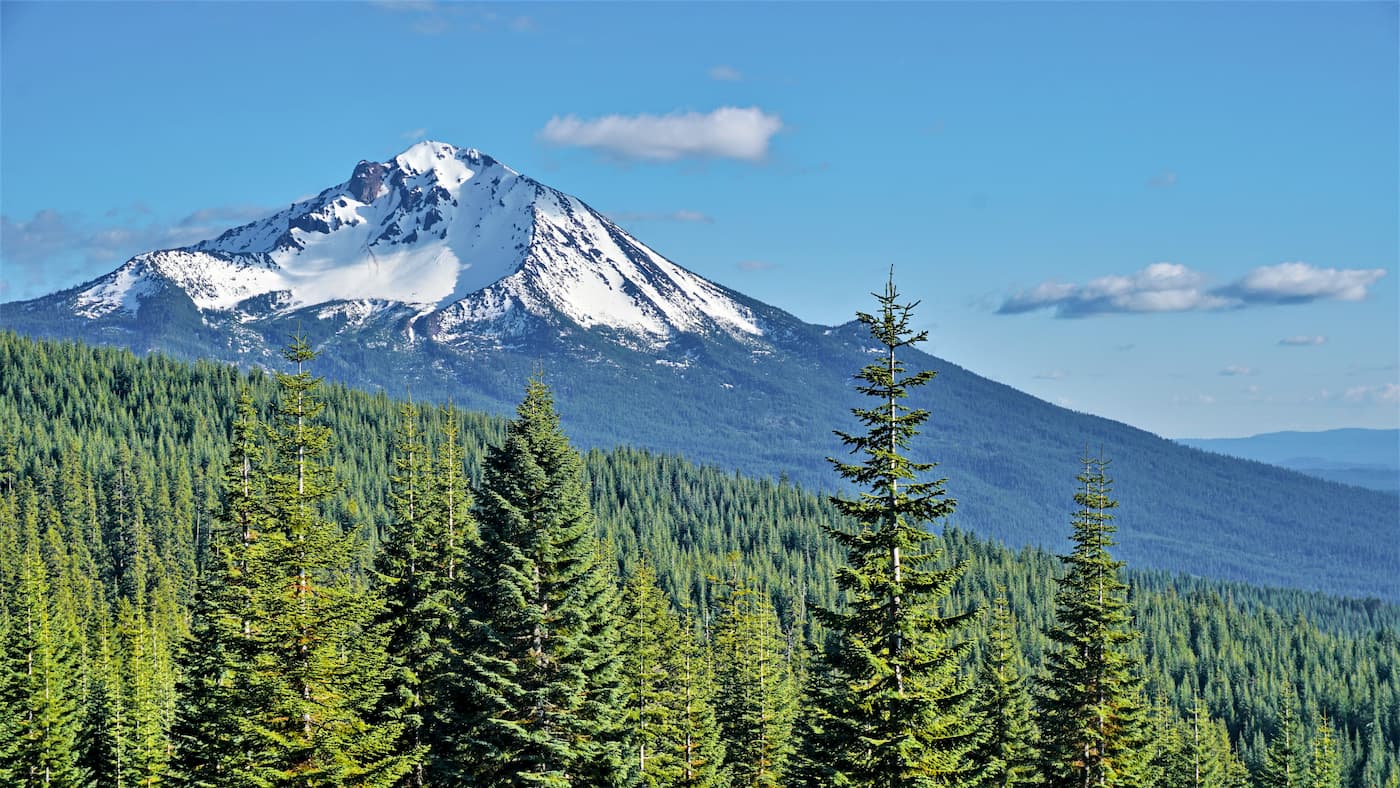
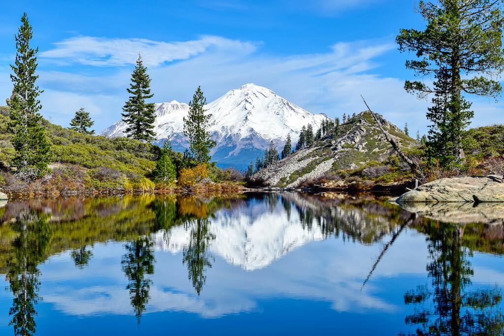
The Cascades are a volcanic mountain range that formed partially as the Juan de Fuca plate subducted under the North American plate. Many of the range’s volcanoes are still active, including the potentially active Mount Shasta and the active Lassen Peak, the latter of which is the southernmost volcano in the range.
A long chain of peaks that stretches from northern California all the way to northern Washington, the Northwest US Coast Ranges dominate the coastline of northwestern California. The highest mountain in the range, Mount Eddy, is located in California, though the most prominent, Mount Olympus, is situated in Washington.
The Northwest US Coast Ranges are actually a collection of smaller ranges, each of which has their own unique geologic history. However, many of the ranges got their start as small plates off the coast of the North American plate that later accreted onto the continent and developed into the ranges that we see today.
In a state as large and topographically varied as California, a superb amount of biodiversity is to be expected. Thankfully, California doesn’t disappoint.
In general, California’s many ecoregions can be categorized as follows:
There are three primary mountain ecoregions in California: the Klamath Mountains, the Eastern Cascades Slopes and Foothills, and the Sierra Nevada.
These three ecoregions are notable for being hotspots of biodiversity in the state. In particular, the Klamath Mountains contain an impressive number of species, partly as a result of some of the region’s serpentine soils.
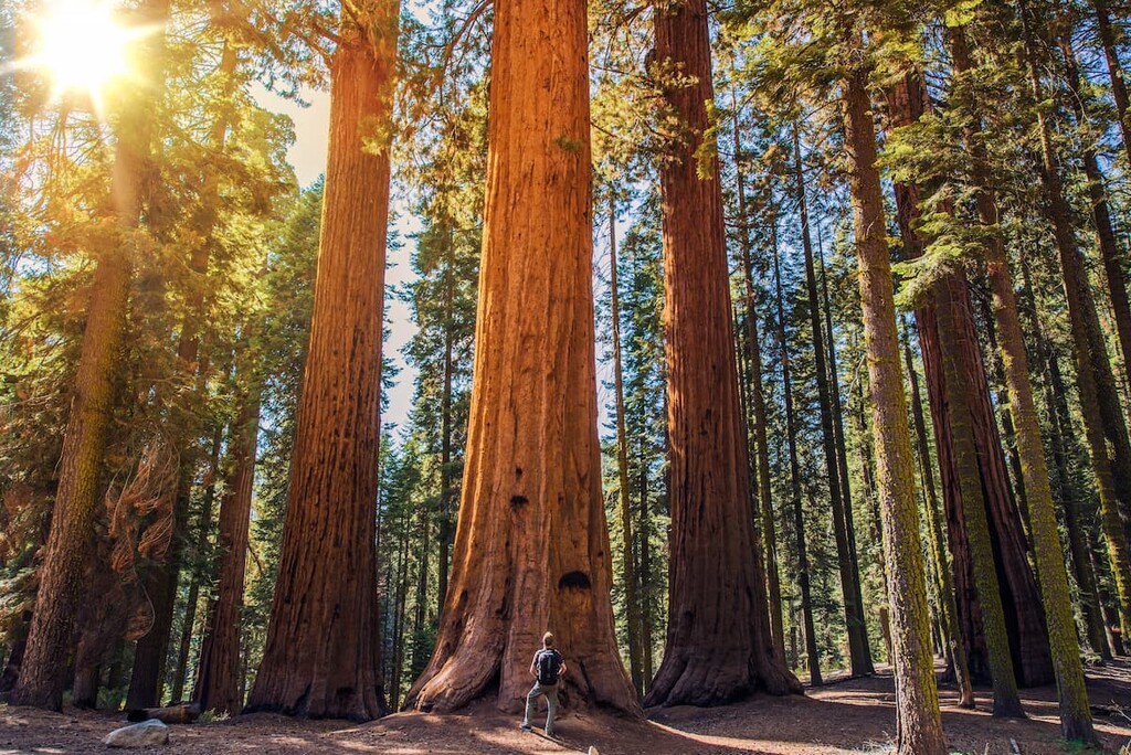
In general, the montane forests of California boast various ecosystems of lodgepole, whitebark, and Jeffrey pine, depending on elevation, with other species, such as ponderosa pine mixed in. There are also giant sequoias throughout parts of the Sierra, particularly around Yosemite and Sequoia national parks.
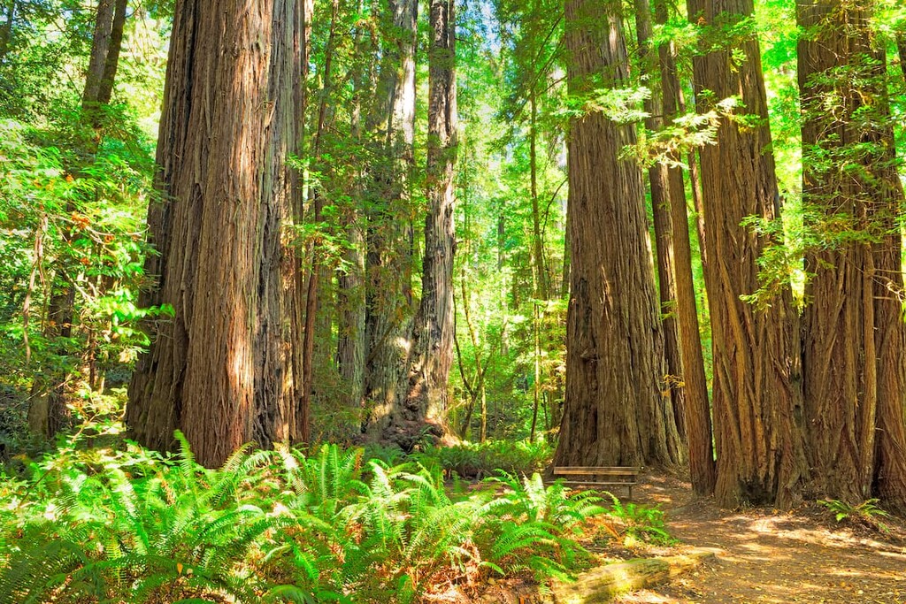
To the north of San Francisco, California’s landscape is dominated by an ecoregion known as the Northern California Coastal Forest. These forests are technically a sub-ecoregion of the greater Pacific temperate rainforests, which extend northward up the coast to Kodiak Island in Alaska.
Here, the landscape is home to stunning redwood trees, which live mostly within a 35 mile (56 km) radius from the coastline. There are also other major tree species such as coast Douglas-firs, Sitka spruce, western hemlock, and madrone, as well as an assortment of oaks.
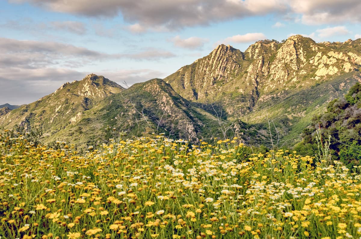
Located throughout southwestern and central California, the state’s Mediterranean natural areas include the California coastal sage and chaparral, California montane chaparral and woodlands, and California interior chaparral and woodlands ecoregions.
Each of these ecoregions contains its own array of flora and fauna. However, the dominant climate throughout these regions is generally quite hot and arid, particularly in the summer months. Chaparral and oak savannas dominate these ecoregions with various areas of coastal grasslands interspersed throughout.
The California Central Valley is also usually included with this ecoregion, though it was once a temperate grassland before it was cultivated for agriculture. Carrizo Plain in southern California is one of the few places in the state where this native grassland remains.
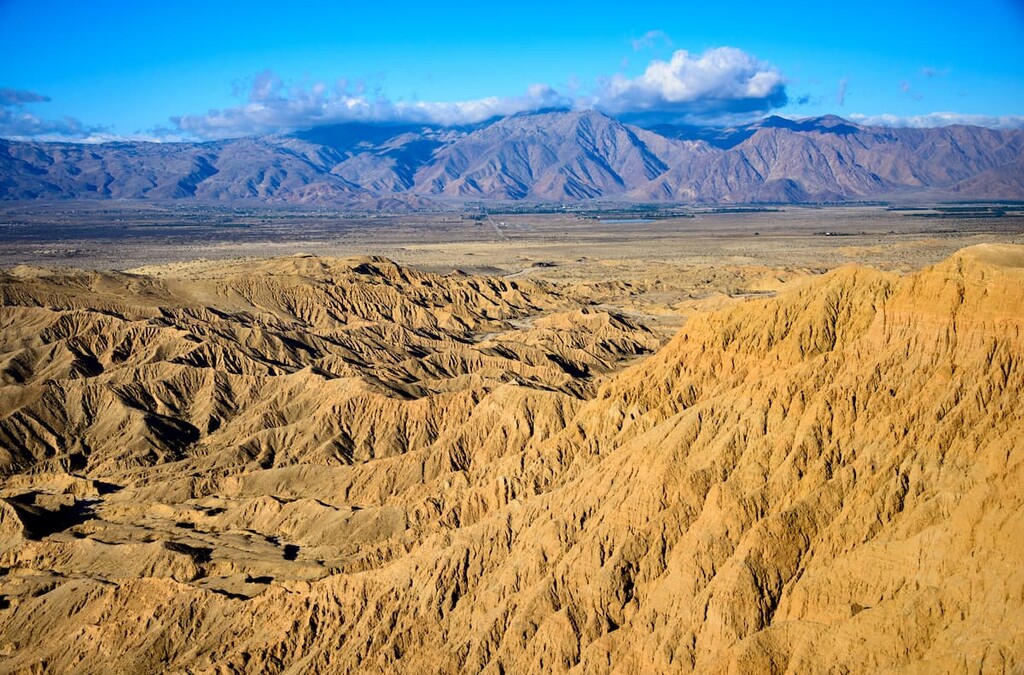
Covering much of southeastern California, the state’s desert regions include the low-lying Sonoran Desert and the high Great Basin and Mojave deserts.
Each of these deserts has its own characteristic species, but, being hot deserts, they are all quite hot and dry. They get, on average, less than 10 inches (254 mm) of rain each year, so most of the dominant species are creosote bush, saltbush, and other shrubs.
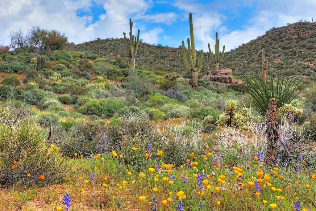
Some of the most notable tree species include Joshua trees (actually a Yucca, not a tree), pinyon pine, and western juniper.
The area that is now part of the state of California has been inhabited by humans for tens of thousands of years.
While the modern-day boundaries of California do not coincide perfectly with the traditional territories of many tribal nations in the region, there are well over 100 sovereign nations that consider parts of California to be within their ancestral homelands. This number does not include the many more nations that were victims of genocide, violence, and introduced diseases at the hands of colonizers of European descent.
The first peoples of European descent to visit what is now California were likely members of a Spanish expedition that was led by Juan Rodríguez Cabrillo in 1542. Cabrillo and his expedition sailed along the coast of California, reaching a point as far north as the Channel Islands.
Later, other sailors, such as Sir Francis Drake of Britain, sailed as far north as San Francisco Bay in 1579. Furthermore, people of Asian descent, including a group of sailors from what is now the Philippines, also arrived in Morro Bay in the 1580s.
However, in the aftermath of Cabrillo’s 1542 expedition, the Spanish believed that California was actually an island, a belief that persisted until about the early eighteenth century.
One of the first European overland expeditions in what is now California was led by Gaspar de Portolà in the 1770s. Afterward, Spanish missionaries began constructing missions throughout the coast of what Spain called “Alta California.”
These missions were constructed throughout what is now California, including in San Diego. Many missions also led to the formation of cities and towns, including Los Angeles, San Francisco, and San Jose.
However, the missions, which were created to convert Indigenous peoples to Christianity, led to the decimation of tribal populations. Most Indigenous peoples did not have natural immunity to European diseases. These introduced diseases, alongside violence and forced labor in the missions, led to the deaths of countless Indigenous peoples.
Spanish colonization of California continued throughout the eighteenth and early nineteenth centuries. However, in the aftermath of the Mexican War of Independence, Mexico gained both its own sovereignty and control over what is now California.
During this period of Mexican rule, California was a fairly sparsely populated place. This was particularly true in the aftermath of the secularization of the California missions, which took place in the 1830s.
Afterward, much of the land, which had already been taken from tribal nations, was granted by the governor of Mexico to wealthy and powerful individuals in the form of massive ranchos.
Around this same time, California became a popular destination for trappers from the United States and what is now Canada. Many trappers ventured to the region using the California Trail, the Oregon Trail, and the Siskiyou Trail in order to navigate the many high mountain passes of the Sierra.
During this period of Mexican rule, relatively large numbers of settlers from the United States made their way to California. In 1846, a group of settlers from the US rebelled against the Mexican government during what is now known as the Bear Flag Revolt.
This led to the founding of the California Republic in 1846. Unfortunately for the republic, its sovereignty was short-lived as the same year saw the start of the Mexican-American War. After Mexico's defeat in the war, California became a territory of the United States during the Treaty of Guadalupe Hidalgo.
A few weeks before California was officially annexed to the United States, prospectors found gold in the region. This discovery led to a massive influx of immigrants to the region in the hopes of striking it rich.
The California Gold Rush brought immigrants from the United States, as well as from Europe, China, and Canada. Thus, by the time California became a state in 1850, its population was already well over 100,000 people.
However, this massive influx of settlers led to the further forced removal of many Indigenous peoples from their ancestral lands as settlers sought their own property for ranching, mining, and prospecting.
Due to the distance between California and the rest of the states in the Union, travel and communication between the regions was difficult in the nineteenth century. As a result, the Transcontinental Railroad was constructed in the 1860s to connect the two coasts of the country.
Although the Gold Rush had long since ended, the twentieth century saw an even further influx of settlers to California. Immigration boomed during the early 1900s, both from other countries and from other parts of the United States.
The nice weather, affordable land (then, certainly not now), and beautiful scenery in the state also led to the development of a number of filmmaking studios near Los Angeles in what is now Hollywood.
During the twentieth century, California established itself as a major player within the US economy. It was, and continues to be a strong location for aerospace, marine, and defense manufacturing. Furthermore, the development of Silicon Valley as a hub for technological development has also helped California grow into an economic powerhouse.
The latter part of the twentieth century and the early twenty-first century was also a tumultuous time in California’s history with the Rodney King riots, the energy crisis of 2001, among other events. In more recent years, wildfires have also become an increasingly pressing issue within the state.
Despite its challenges, California remains one of the most popular places to live, work, and visit in the United States. There is no shortage of outdoor recreation opportunities in California. So, whether you want to walk along the beach, climb in the mountains, or trek through the desert, California has a lifetime of adventure for you to experience.
With nine national parks, twenty national forests, over 140 wilderness areas, 280 state parks, and countless other protected areas, there’s a lifetime of adventure to be had in the great state of California. Here’s a quick look at some of the most popular parks in the state.
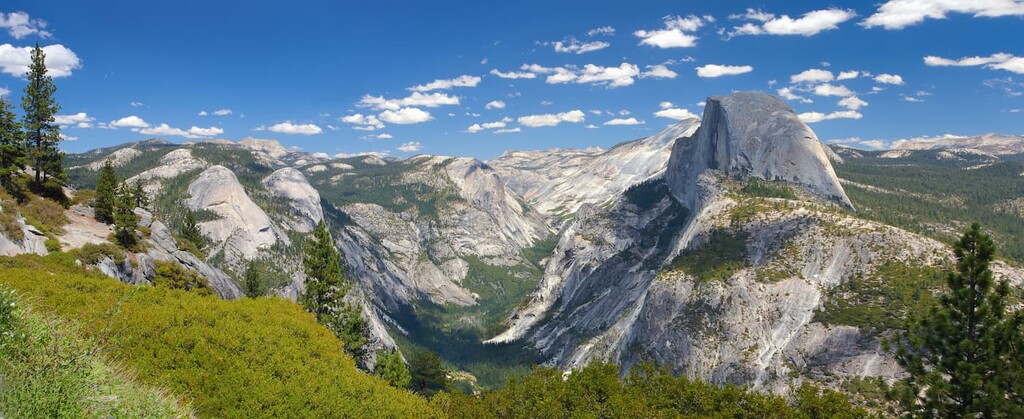
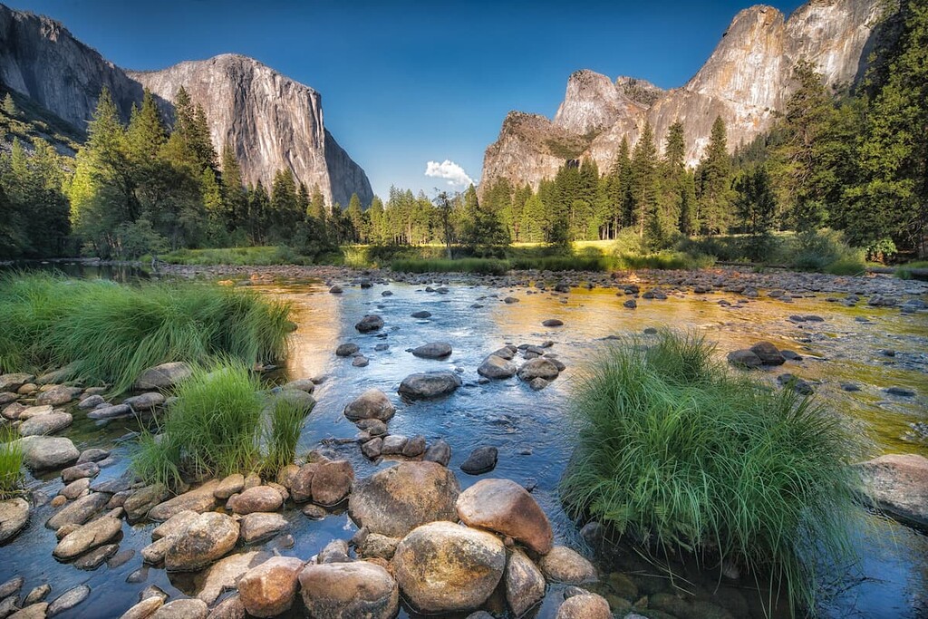
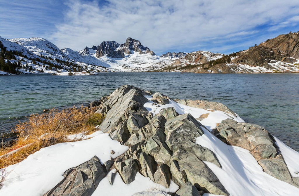
One of the most popular national parks in the country, Yosemite National Park is located in east-central California in the heart of the Sierra Nevada. It contains 187 named mountains, the highest of which is Mount Lyell, and the most prominent of which is Mount Conness.
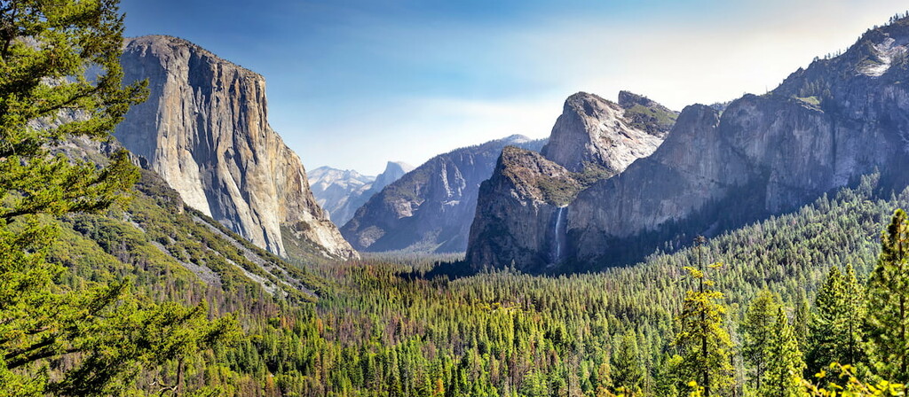
Yosemite is famous for its stunning granite formations, including El Capitan and Half Dome. It also offers some fantastic hiking opportunities as well as plentiful camping, rock climbing, and wildlife spotting opportunities.
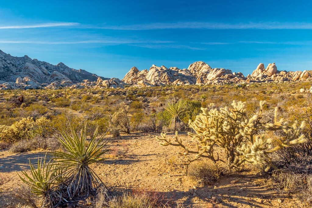
Located in southern California, Joshua Tree National Park contains a vast swath of the Mojave Desert and some world-famous rock formations. It contains 30 named mountains, the highest and most prominent of which is Quail Mountain.
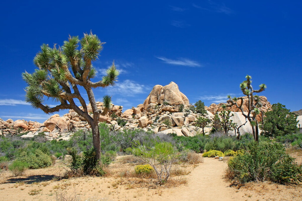
Joshua Tree is home to its namesake Joshua trees, which dot the landscape. The park is also a popular hiking destination during the fall through spring months when the temperatures are much more manageable. There are plenty of peak ascents, craggy scrambles, and trails to hidden oases to enjoy in this funky national park.
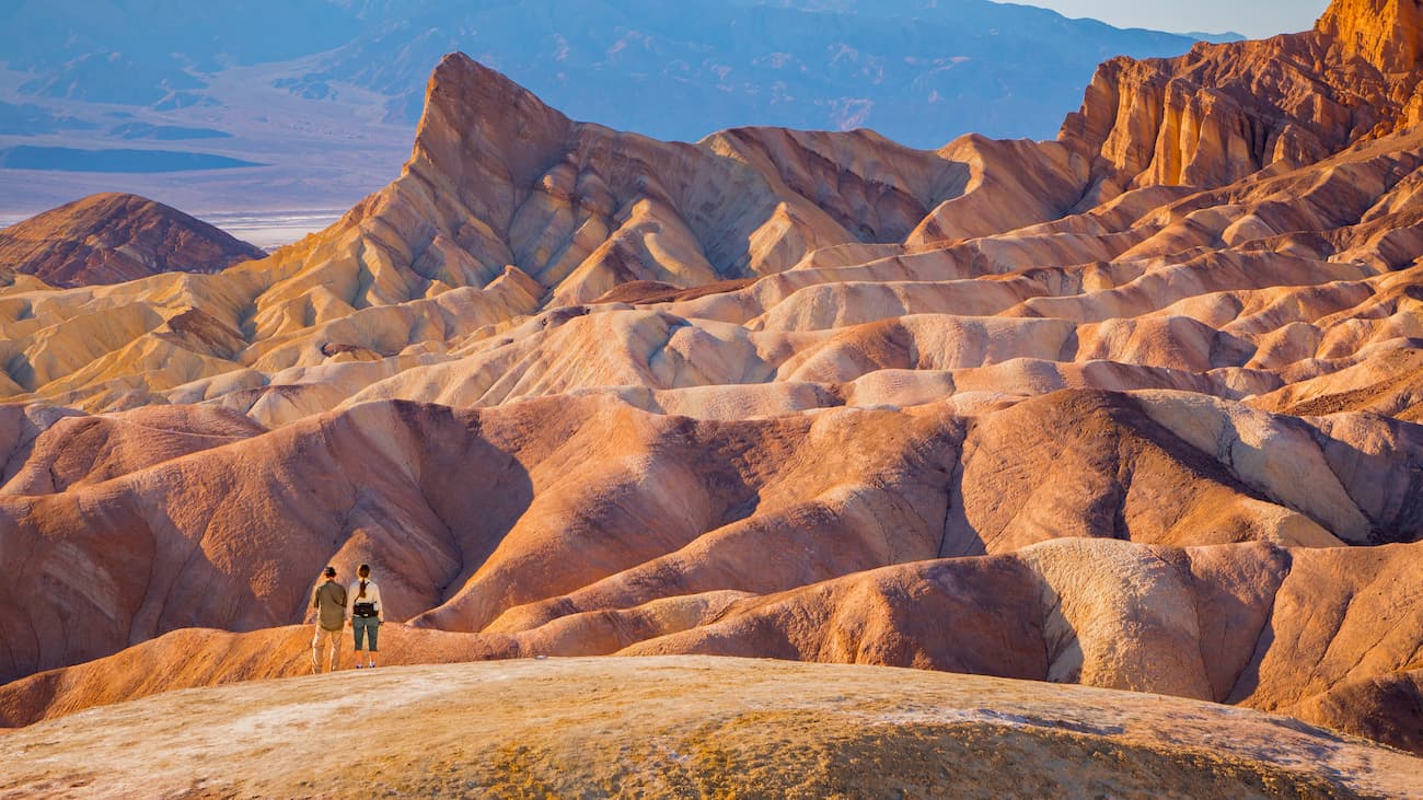
One of the largest national parks in the contiguous United States, Death Valley National Park covers a massive swath of land in eastern California. It contains 70 named mountains, the highest and most prominent of which is Telescope Peak.
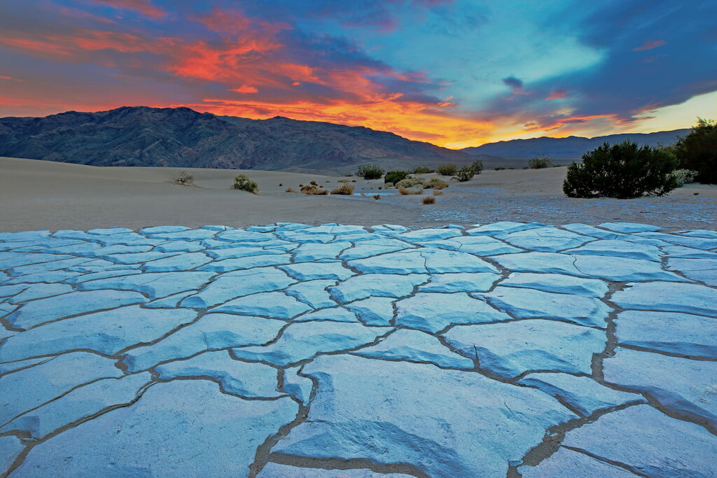
Death Valley is best known for being the hottest, driest, and lowest place in North America. Badwater Basin, the lowest point on the continent sits at a cool -282 feet (-86m) below sea level. Hiking is plentiful in the park, but do take care if you’re visiting in the summer months. It can get really, really hot!
Although Sequoia and Kings Canyon national parks are technically two separate parks, they have been administratively combined since the 1940s. These two parks are located in the heart of the Sierra where they protect some of the most stunning mountain landscapes and giant sequoia groves in the state.
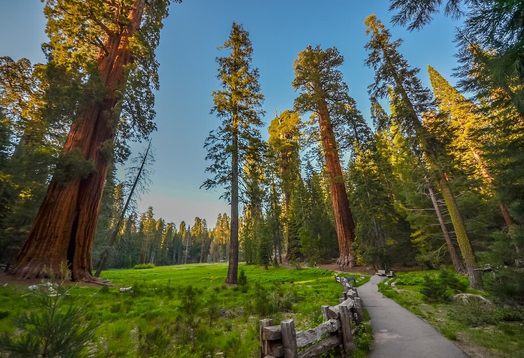
Both parks over hundreds of miles of hiking trails to suit all experience levels. There are also plenty of snowsports opportunities in the park for winter visitors.
California’s only island national park, Channel Islands National Park is located just off the coast of Southern California. It contains 18 named mountains, the highest of which is Montañon Peak, and the most prominent of which is Soledad Peak.
Channel Islands National Park contains 5 of the 8 islands in the Channel Islands archipelago. These islands are noted for their biodiversity, ruggedness, and exceptional scenery. However, there are relatively few services on the islands and campground reservations can be hard to come by. So plan early if you want to visit Channel Islands National Park.
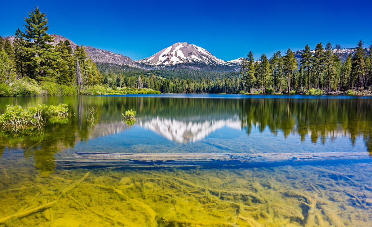
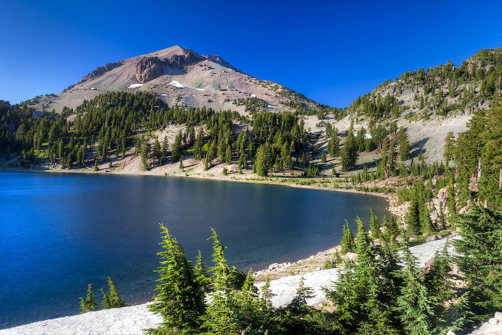
Home to one of California’s most active volcanoes, Lassen Volcanic National Park is a protected area in northern California. It contains 38 named mountains, the highest and most prominent of which is Lassen Peak.
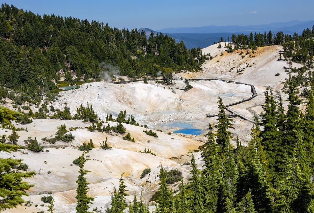
The main attraction of Lassen Volcanic is, of course, Lassen Peak, which also happens to be a popular winter snowsports destination. Hiking opportunities are abundant in the park, so it’s the perfect place to visit if you’re looking for an adventure in northern California.
California’s northernmost national park, the aptly-named Redwood National Park protects the state’s gorgeous coastal redwoods. There are 11 named high points in the park, the highest of which is Coyote Peak, and the most prominent of which is Rodgers Peak.
Visitors to Redwood National Park can enjoy plentiful hiking opportunities in the region’s redwood groves. The park is also located near an assortment of state parks, which offer further hiking opportunities. Moreover, Redwoods is a coastal park, so there are plenty of opportunities to check out Northern California’s rugged coastline.
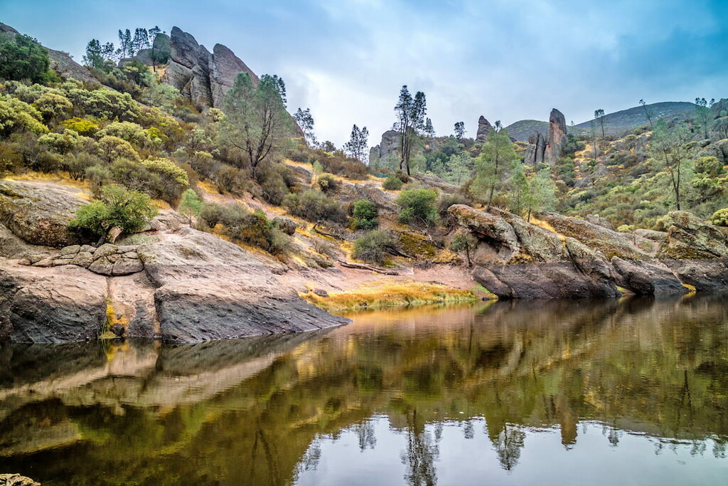
California’s newest and smallest national park, Pinnacles is located in west-central California near the city of Soledad. It contains 12 named mountains, the highest and most prominent of which is North Chalone Peak.
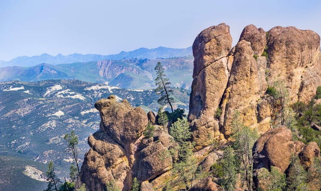
Pinnacles is perhaps known for its unique rock formations and caves. However, the park is also home to one of the largest populations of California condors. As a result, it’s a fantastic place to visit and wander around if you’re hoping to see some of these majestic birds first-hand.
California has 15 mountains that extend beyond 14,000 feet (4,267m) and have more than 300ft (91m) of prominence. All—except for two—are located in the Sierra Nevada Range. Most of them are quite popular day trips or backpacking adventures, though some off-trail travel is often required to reach the summit.
If you want to climb a California 14er, be sure to come prepared with the right gear for your trip. Also, do keep in mind that the weather conditions on these peaks can change rapidly, even during the summer months.
The 15 California 14ers are:
Looking for a good hike for your visit to California? Here are some of the most popular options to check out:
Mount Whitney is California’s most popular fourteener. The Mt. Whitney trail is a well-maintained, 11-mile (17km) out-and-back footpath that begins at 8,360 ft (2,548m) and continues to approximately 14,498 feet (4,418m). There are over a dozen routes to the summit, for varying levels of hikers. A permit is required.
Mt. Langley is the southernmost of all the California 14-ers and has an incredible vantage point of the Southern Sierras. Mt. Langley is considered to be a great starter climb for those interested in acclimating to fourteen thousand-foot peaks. The peak can be easily accessed via the Cottonwood Lakes Trail, a 19-mile (30.6mi) trail, which sits at 10,000 ft (3,048m).
Thousand Island Lake Loop, is a 22-mile (35.4m) trek that overlaps with two of the most iconic thru-hikes in the states: The Pacific Crest Trail and John Muir Trail. However, you don’t need to travel the whole trail to experience some of the best wilderness in California.
From the High Trail you can catch a glimpse of craggy summits Mt. Ritter, Banner Peak and the Minarets in as little as 3 miles (4.8km). Continue on for 7.8 miles (12.6km) to experience an unobstructed view of Banner Peak.
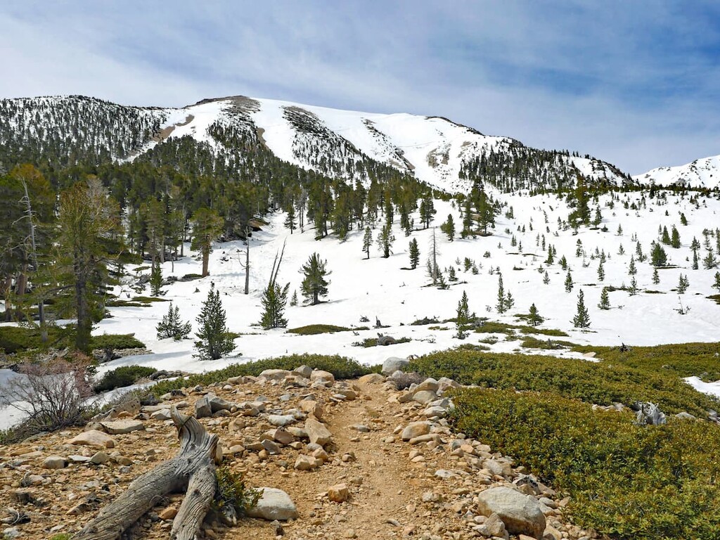
Lassen Peak is a 6-mile (9.7km) round trip trek up to the 10,000-foot (3,048m) summit in Lassen National Park. It only requires 2,000 feet (609.6m) of elevation gain, because the trail starts at 8,000 feet (2,438.4m). From the top you can see all the way to Mt. Shasta.
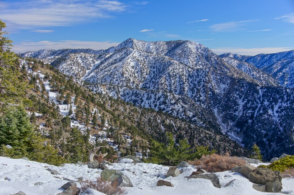
Mount Baldy, also known as Mount San Antonio, is a Southern California icon located in the San Gabriel Mountains. An 11-mile (17.7km) out-and-back hike and 3,800 feet (1,158m) of elevation, will take you to two peaks: one at 10,064 feet (3,067m) and a sub-peak at 9,988 feet (3,044m). The high attitude and easy access makes this a popular hike to train for other fourteeners, like Mt. Whitney.
San Gorgonio is a challenging 18.5 mile (29.8km) out-and-back hike that brings you to the highest peak in Southern California. San Gorgonio is the only mountain that can be seen from Mt. Whitney, 190 miles (305km) away. The San Gorgonio hike is a tough climb, so it’s recommended that you hike San Jacinto or Mount Baldy, first.
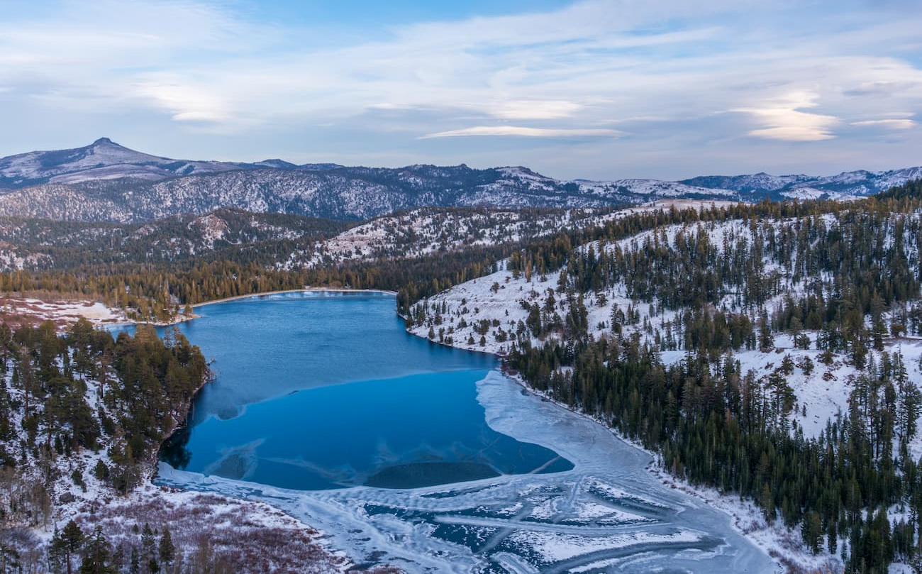
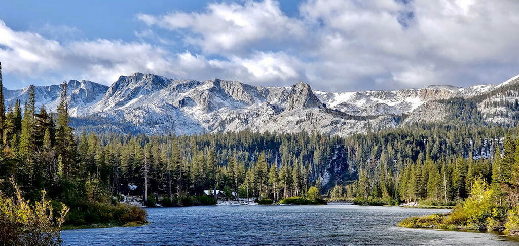
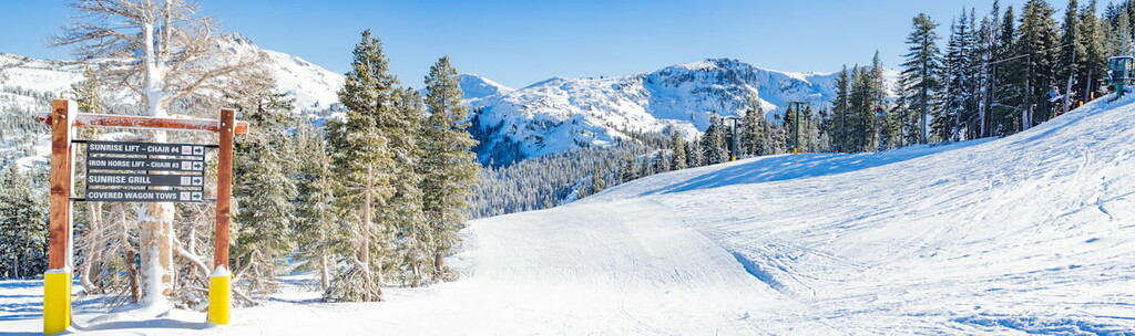
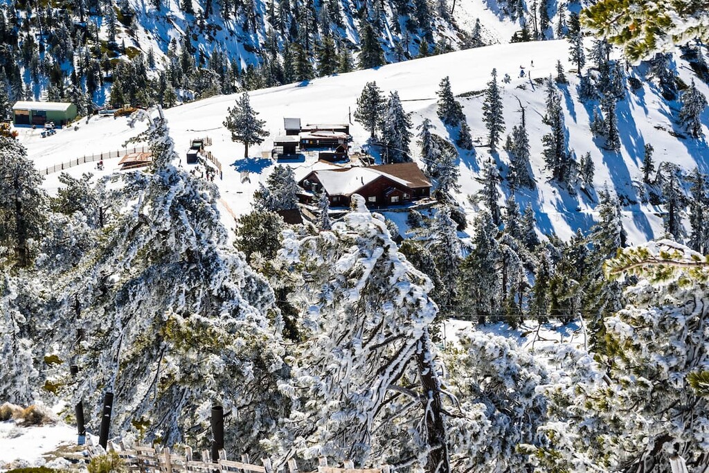
California boasts numerous ski resorts for all tastes and skill levels. Most of the ski areas are clustered northeast of San Francisco around Lake Tahoe and northeast of Los Angeles in the San Gabriel and San Bernardino Mountains.
You can find these ski resorts, as well as many others, in the PeakVisor app, which provides real-time status information about open lifts and ski runs.
Within California, ski areas tend to be clustered in certain regions. For example, Mount Shasta Ski Park is the northernmost ski resort in California at the foot of iconic Mount Shasta.
The largest cluster of ski resorts in California surrounds Lake Tahoe close to the border with Nevada.
Farther south of Lake Tahoe there are several smaller resorts:
Moving further south toward Yosemite National Park, one can find such gems of ski resorts as:
The southernmost Los Angeles cluster of ski resorts is comprised of:
Check the California ski resorts map and the larger USA ski resorts map in the World Mountain Lifts section of the site. It includes information about open ski lifts / slopes in California in real-time with opening dates and hours. There are also year-round cable cars, funiculars, cog railways, aerial tramways, and all other types of mountain lifts.
Looking for a place to stay during your visit to California? Here are some of the best cities to check out:
Located 120 miles (193 km) south of Los Angeles, San Diego is California’s second largest city and the eighth largest in the United States. With over 1.3 million residents, San Diego is known for its renowned Gaslamp District, Balboa Park, the San Diego Zoo, San Diego Zoo Safari Park, and the massive Anza-Borrego Desert State Park.
San Diego is often considered the “birthplace of California” and offers over 70 miles (112 km) of pristine beaches along the Pacific Ocean. The city has approximately 200 deep canyons and hills separating its various mesas, which create idealistic pockets of natural, open space.

San Diego’s large city limits include many natural preserves, including Torrey Pines State Reserve - a 2,000-acre (809 ha) coastal state park located in the community of La Jolla. Interestingly, it also has one of the highest counts of animal and plant species that appear on the endangered species list in the United States.
Adventurers will appreciate a variety of hiking trails sprawled throughout San Diego County like the famed Potato Chip Rock on Woodsen Mountain, Stonewall Peak in Cuyamaca Rancho State Park, Corte Madera Mountain and Cowles Mountain in Mission Trails Regional Park.
Los Angeles is the second most populated city and metropolitan area in the United States. The city is located in a large basin surrounded by the Pacific Ocean and both the San Gabriel Mountains—home to Mount San Antonio—and the Santa Monica Mountains. Los Angeles boasts over 75 miles (120 km) of coastline and several accessible hiking trails.
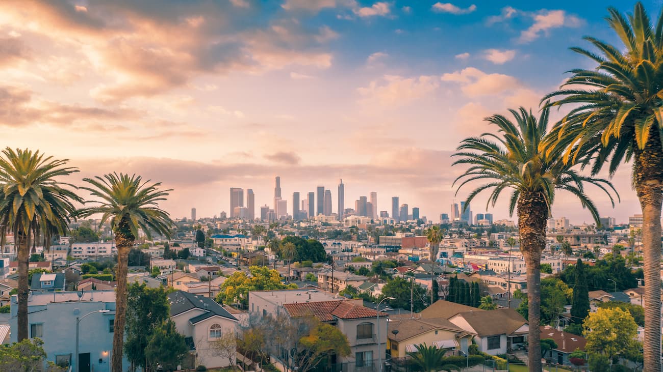
In addition to being the entertainment capital of the world, Los Angeles is well known for its idyllic weather and Hollywood stardom. The city offers a variety of tourist attractions which include over 100 museums, Universal Studios, The Hollywood Walk of Fame, The Getty Center and Venice Beach.
At the base of the Santa Monica Mountains, you’ll find Mount Hollywood, where you’ll see the famed Hollywood sign and the Griffith Observatory. Los Angeles is known to be a cultural mecca and has hosted the Summer Olympics, twice. It comes as no surprise that more than 47 million people visit the city, annually.
Located on a peninsula between the Pacific Ocean and San Francisco Bay, San Francisco is one of the most popular tourist destinations in California. The city offers breathtaking views of the San Francisco Bay, a drowned river valley that was submerged during the melting of the last glacial ice sheet, and the famed Golden Gate Bridge (which is actually red).
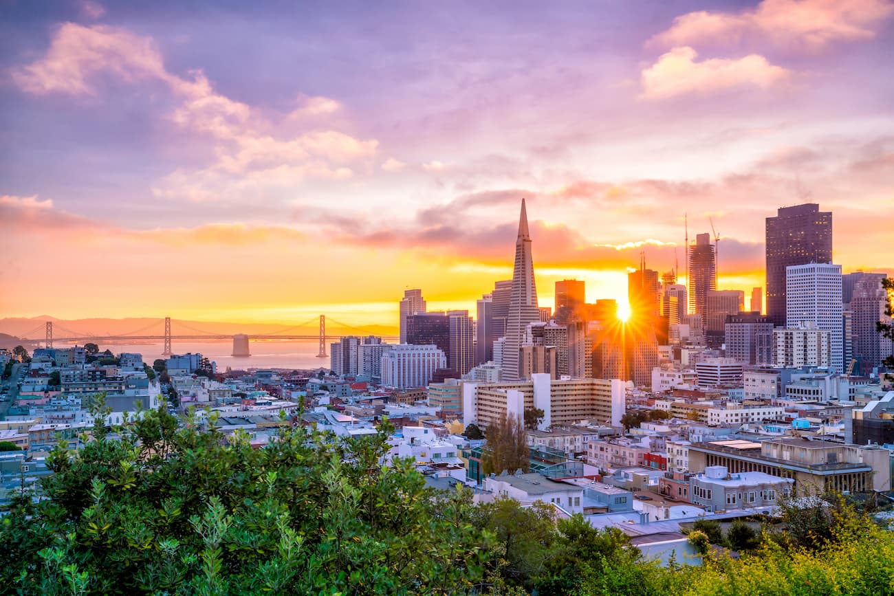
San Francisco is best known to be a city where contemporary art and culture merge to form a hilly, uniquely featured city surrounded by mountains and coast. Noteworthy San Francisco attractions include Alcatraz, a rocky island in San Francisco Bay that once served as a federal prison, Pier 39, Golden Gate Park, Lombard Street, and a variety of contemporary museums.
Within the nine-county San Francisco Bay Area, you'll find several iconic mountains including Mount Allison (2,602 ft/793m), Mount Boardman (3,586ft/1,093m), Mission Peak (2,517ft/767m), Mount Diablo (3,849 ft/1,173m), and the famous Mount Tamalpais (2,571ft/783m). Within city limits, the most notable San Francisco hills are Twin Peaks, Mount Davidson, and Mount Sutro, all of which exceed 900 feet (274 m)


14er
ultra
california-13ers
las-vegas-mountaineers-classics
porcella-burns
western-state-climbers
western-state-climbers-star
sierra-club-sierra-peaks-section
sierra-peaks-section-emblem
sierra-sampler
vagmarken-sierra-crest
fred-beckey-great-peaks
california-ultras
14er
california-13ers
las-vegas-mountaineers-classics
porcella-burns
western-state-climbers
western-state-climbers-star
sierra-club-sierra-peaks-section
sierra-peaks-section-emblem
sierra-sampler
14er
ultra
california-13ers
las-vegas-mountaineers-classics
porcella-burns
western-state-climbers
western-state-climbers-star
desert-summits-book
sierra-club-desert
great-basin
great-basin-star
california-ultras
14er
glacier
california-13ers
porcella-burns
western-state-climbers
western-state-climbers-star
sierra-club-sierra-peaks-section
sierra-peaks-section-emblem
vagmarken-sierra-crest
fred-beckey-great-peaks
14er
ultra
glacier
volcano
cascade-range-9000ers
california-13ers
porcella-burns
western-state-climbers
western-state-climbers-star
chemeketan-18-nw
cascade-volcanoes-pin
mazamas-16-nw-award
fred-beckey-great-peaks
california-ultras
14er
california-13ers
porcella-burns
western-state-climbers
western-state-climbers-star
sierra-club-sierra-peaks-section
sierra-peaks-section-mountaineers
vagmarken-sierra-crest
california-13ers
porcella-burns
western-state-climbers
western-state-climbers-star
14er
ultra
california-13ers
las-vegas-mountaineers-classics
porcella-burns
western-state-climbers
western-state-climbers-star
sierra-club-sierra-peaks-section
sierra-peaks-section-emblem
sierra-sampler
vagmarken-sierra-crest
fred-beckey-great-peaks
california-ultras
14er
ultra
glacier
volcano
cascade-range-9000ers
california-13ers
porcella-burns
western-state-climbers
western-state-climbers-star
chemeketan-18-nw
cascade-volcanoes-pin
mazamas-16-nw-award
fred-beckey-great-peaks
california-ultras
ultra
sierra-club-100
100-peaks-section-emblem
california-ultras
ultra
san-bernradino-9-challenge
sierra-club-100
100-peaks-section-emblem
california-ultras
14er
ultra
california-13ers
las-vegas-mountaineers-classics
porcella-burns
western-state-climbers
western-state-climbers-star
desert-summits-book
sierra-club-desert
great-basin
great-basin-star
california-ultras
ultra
sierra-club-100
100-peaks-section-emblem
california-ultras
ultra
las-vegas-mountaineers-classics
western-state-climbers
western-state-climbers-star
desert-summits-book
bartells-death-valley
sierra-club-desert
desert-peaks-section-emblem
great-basin
california-ultras
ultra
volcano
cascade-range-9000ers
western-state-climbers
western-state-climbers-emblem
chico-hiking-association
cascade-volcanoes-pin
california-ultras
ultra
western-state-climbers
california-coastal
california-ultras


