
Scan the QR code and open PeakVisor on your phone
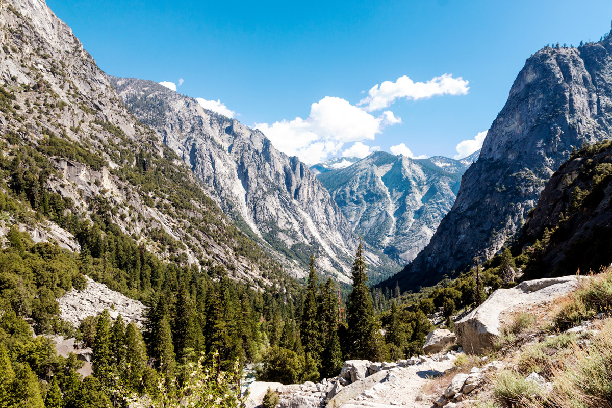
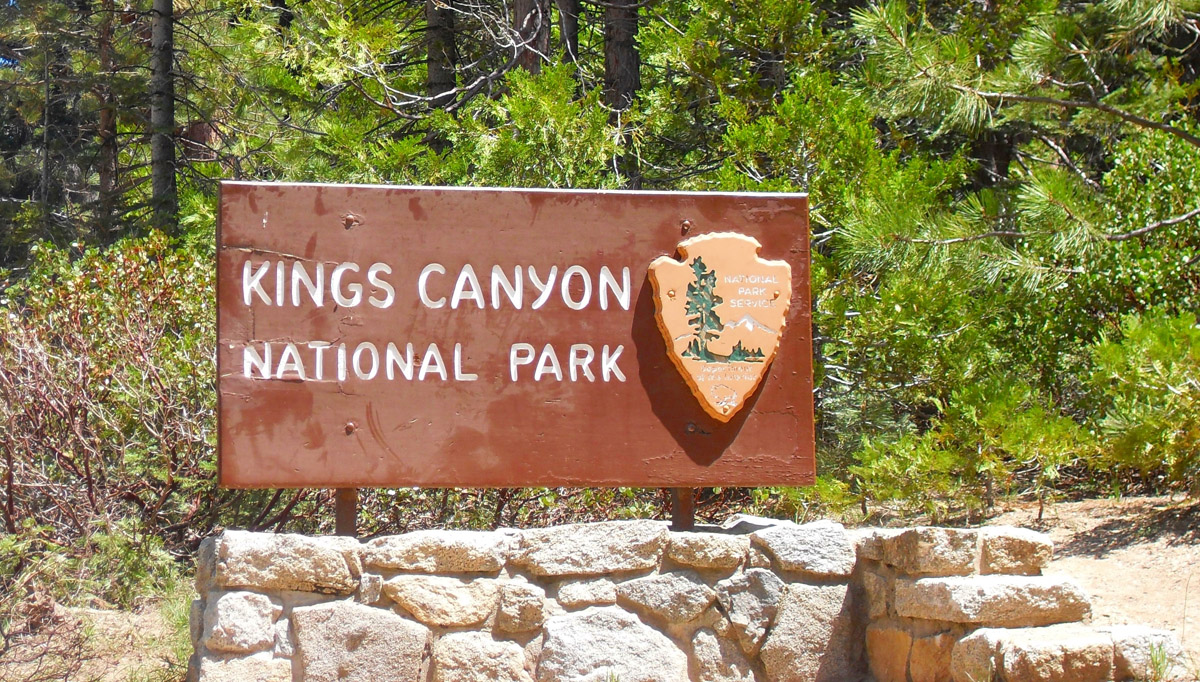
Located on the western slope of the Sierra Nevada, Kings Canyon National Park protects 461,901 acres of high mountain meadows, 14,000-foot summits, and some of the world’s largest giant sequoia trees. The park’s namesake canyon, Kings Canyon is a glacier-carved valley that is more than a mile deep and is characterized by some of the steepest vertical relief in North America.
The park was initially established in 1890 as General Grant National Park to protect and preserve a small area of giant sequoias. Prior to being expanded and renamed in 1940, the park was in danger of being destroyed by logging and development interests. Though Kings Canyon is contiguous with Sequoia National Park, it has far less visitors than its northerly neighbor.
The park is generally divided into two distinct sections – the smaller and older western section and the larger eastern section. Most tourist facilities are located in the western part of the park near Grant Grove. Grant Grove houses the park’s infamous sequoias, including General Grant, the second largest tree in the world (measured by trunk volume).
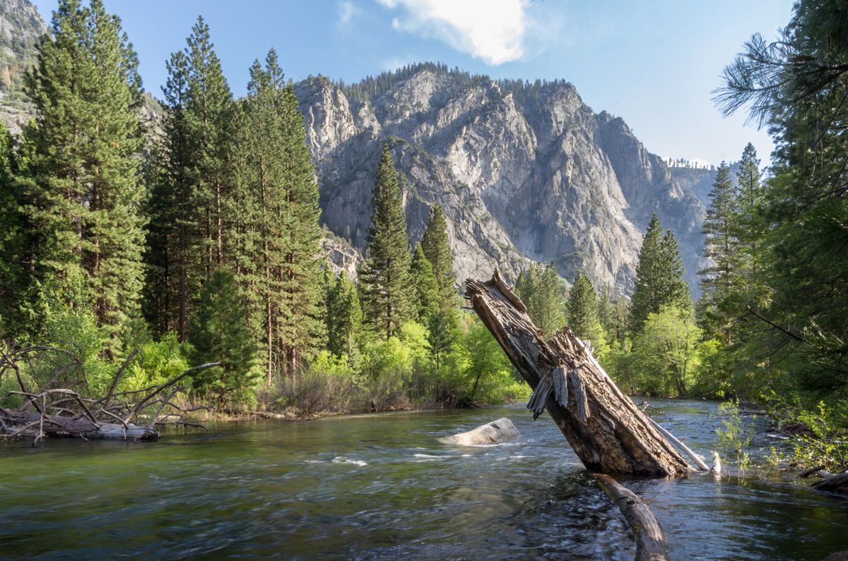
The eastern section of the park contains the majority of the park’s area and is almost entirely wilderness. Cedar Grove, which sits at the bottom of Kings Canyon, is the only part of the eastern section that is accessible by road and is the most popular destination for travelers looking to explore the more rugged reaches of the canyon.
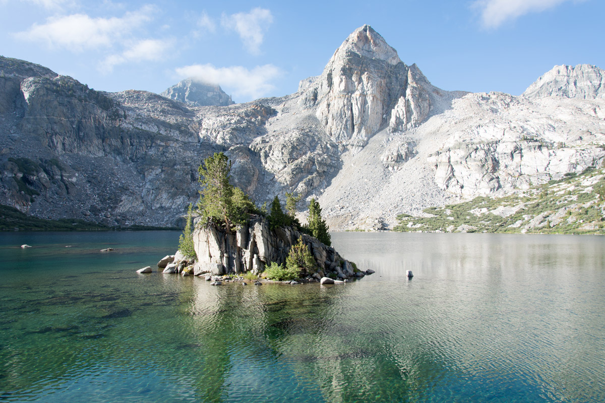
Kings Canyon impressive mountainous landscape contains several Sierra Crest peaks that exceed 14,000 feet in elevation, including North Palisade, the third highest mountain in the Sierra Nevada range, Mount Sill, Polemonium Peak, Split Mountain, and Thunderbolt Peak. Nearby, craggy, iconic Sierra Nevada summits like Middle Palisade, Disappointment Peak, and Mount Stanford reach well beyond 13,000 feet. The Sierra Crest forms the eastern boundary of the park, from Mount Goethe to the north to Junction Peak at the boundary of Sequoia National Park. The park’s highest peaks also retain permanent snowfields and glaciers, like Palisade Glacier, the largest in the Sierra, which is located near the park’s edge in the John Muir Wilderness.
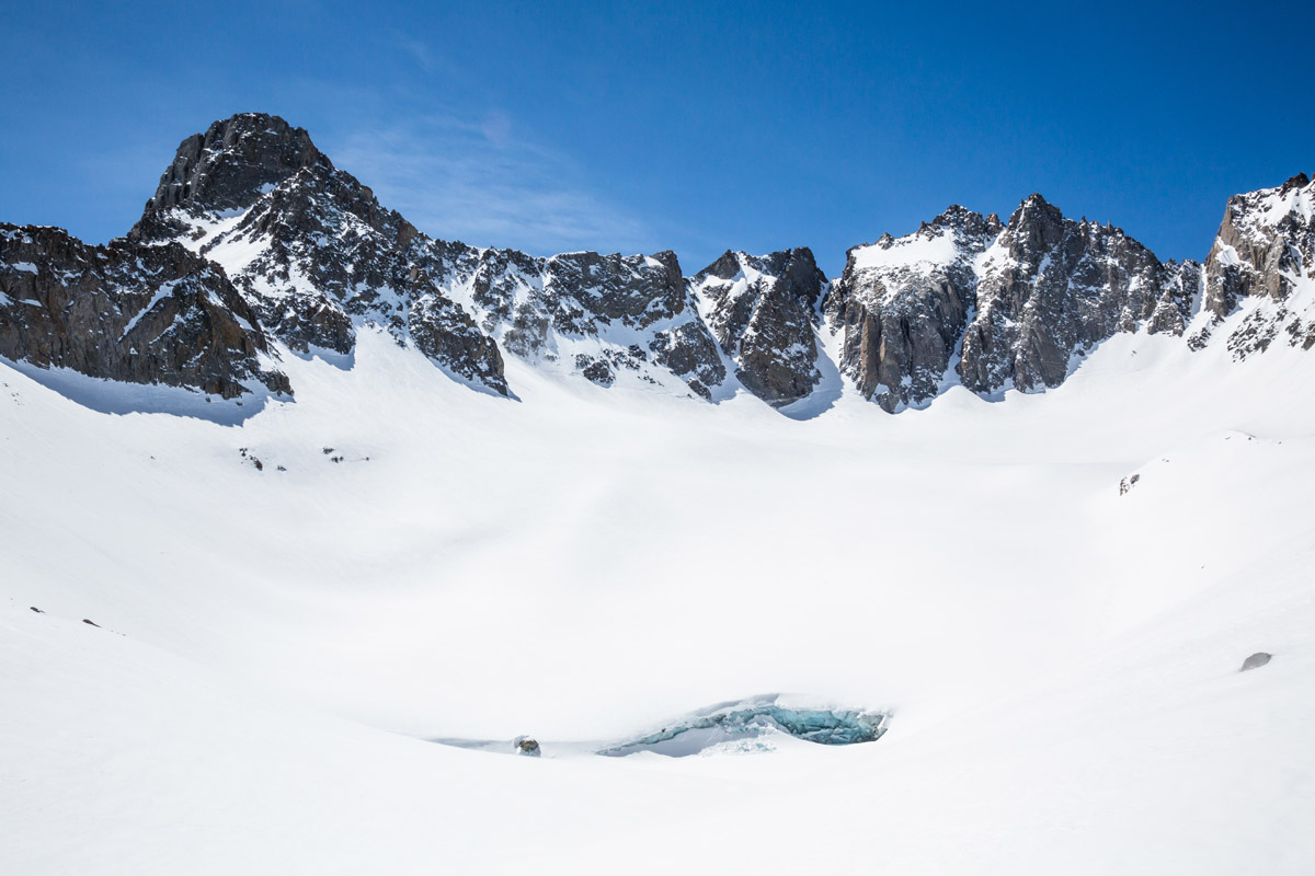
Mount Sill, Polemonium Peak, and the North Palisade towering over the Palisade Glacier
Several 11,000-foot passes crisscross the landscape, including Bishop Pass, Taboose Pass, Kearsarge Pass, and Sawmill Pass. Needless to say, although the park is best-known for its stunning forested landscape, it contains plenty of alpine regions to explore. Hanging valleys, cascading waterfalls, and serrated ridges can be found scattered throughout the high country. Like nearby Yosemite Valley, U-shaped glacial valleys found in Kings Canyon are characterized by flat floors and exposed, craggy, granite cliffs and domes. Glacial features like Tehipite Dome, the largest granite dome in the Sierra, rise abruptly from the valley floor.
Kings Canyon’s impressive elevation gradient supports many diverse habitats for plants and animals. In fact, both Sequoia and Kings Canyon are recognized as International Biosphere Reserves for their important role in conserving biodiversity. The foothills support populations of gray fox, bobcat, black bear, white-footed moose, and pocket gopher, while the mixed-forests found at mid-montane elevations house a variety of deer, mountain lion, and resident birds.
Despite the park’s limited road access, it receives an average of 600,000 visitors every year. The park’s long, arduous hikes and technical climbs tend to deter the everyday hiker and climber from venturing too far off the beaten path, though towering, exposed granite cliffs draw expert climbers and long-distance hikers from around the world.
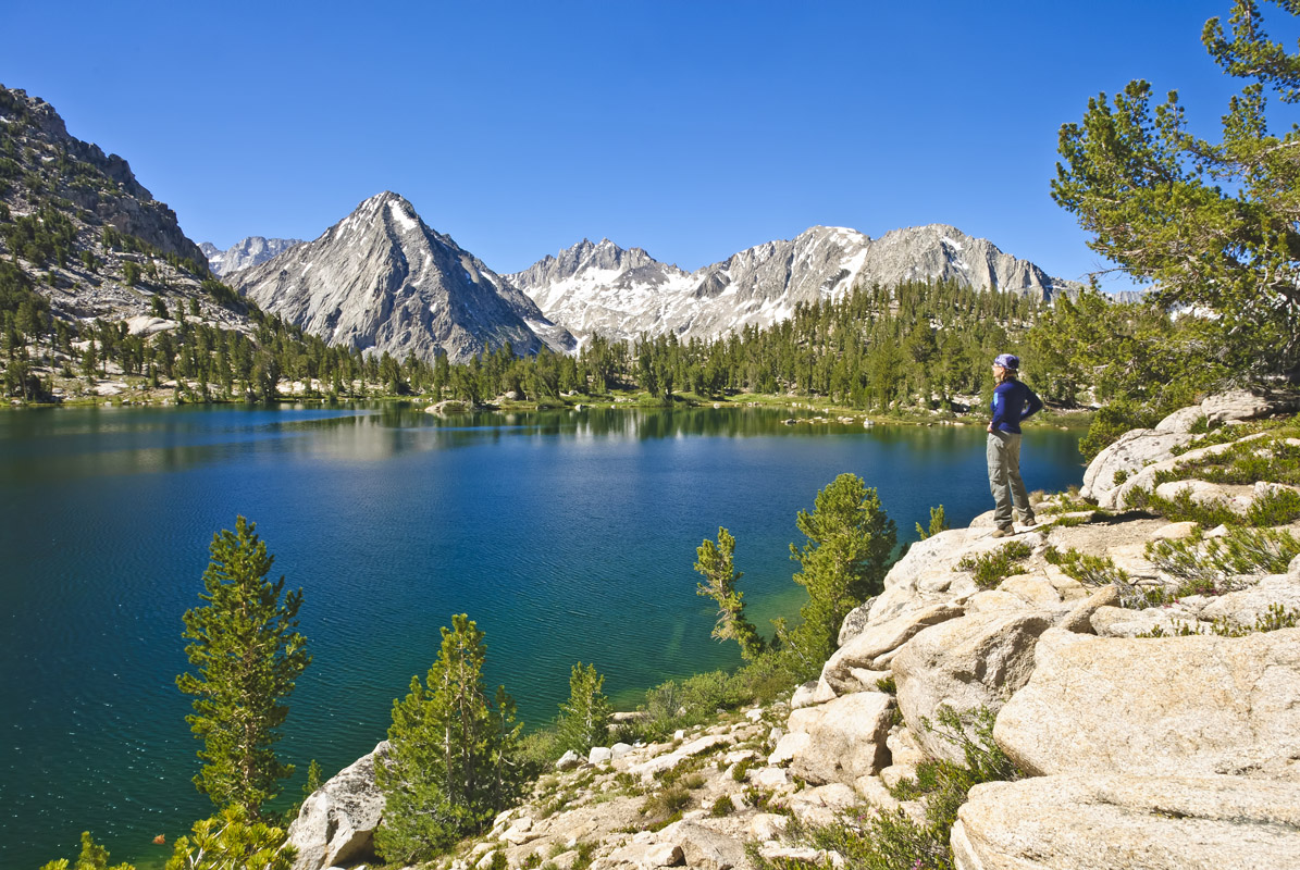
Rae Lakes is one of the very best backpacking destinations in the Sierras. The loop is 41.4 miles long and climbs from 5,035 feet at the trailhead to 11,978 feet at Glen Pass. The trail, which consists of three connecting footpaths, passes through glacially carved canyons, beneath towering granitic crags, and passes several sapphire blue alpine lakes. Along the way, hikers will pass through a variety of biotic zones, each with jaw-dropping views and scenery. Due to the trail’s popularity, several restrictions are in place and a wilderness permit is required.
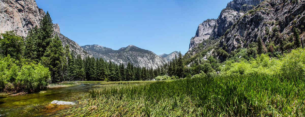
Zumwalt Meadow is a place of stark contrast. Towering rock formations surround a lush, flat meadow dotted with wildflowers. This scenic 1.5-mile self-guided trail circles an area filled with stunning alpine views and is an excellent family-friendly alternative to more strenuous footpaths in the park. Rangers will often recommend this trail as a must-do for visitors in the Cedar Grove area.
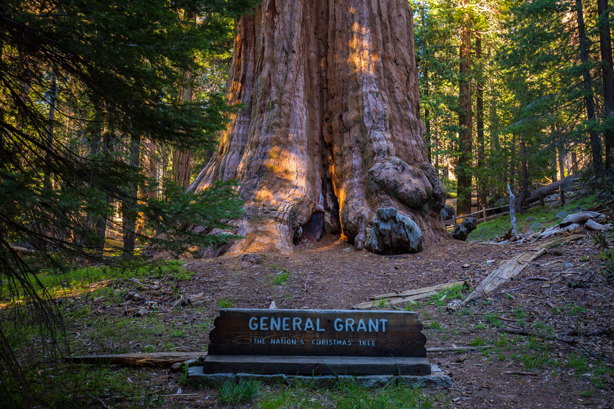
Known as ‘the nation’s Christmas tree,’ General Grant is 267 feet tall and nearly 29 feet wide. This 3,000-year-old wonder is the icon of Grant Grove and is known as one of the most iconic attractions in the American national park system. The trail to General Grant is an easy 1/3-mile paved loop that features several popular attractions like Gamlin Cabin, the Fallen Monarch, and the Centennial Stump.
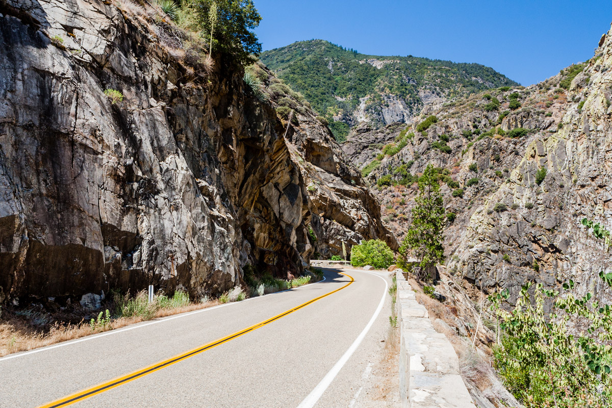
The Kings Canyon Scenic Byway traverses 50 striking Sierra Nevada miles from the foothills outside of Fresno to Grants Grove. The byway is the only vehicle route into the canyon and travels through many of the park’s varied life zones. There are several scenic overlooks to stop and snap photos, so take your time! Stop by the Converse Basin Grove, the largest contiguous grove in the world, and check out the Boole Tree, Stump Meadow, and Chicago Stump.
The Cedar Grove Lodge is located in the heart of Kings Canyon at 4,600 feet. The lodge is within walking distance of the Cedar Grove Visitor Center, making it an ideal basecamp for hiking through the park’s tallest trees. Visitors will often take advantage of nearby trails and attractions, like North Dome, Grand Sentinel, Roaring River Falls, Zumwalt Meadow, and Muir Rock. The lodge is open May through mid-October.
Located at 6,500-feet, the Grant Grove Cabins are within walking distance of Grant Grove and the world-famous General Grant Tree, a market, restaurant, visitor center, and gift shop. There are both tent-style and rustic timber cabins available. The cabins are ideal for visitors hoping to explore Grant Grove or hike Panoramic Point, the Big Stump, or the Sunset Loop.
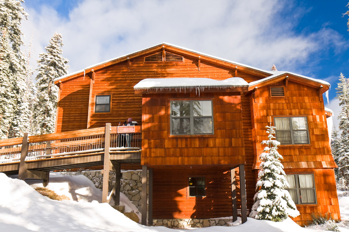
The Wuksachi Lodge is a modern lodge located at over 7,000 feet in the popular Giant Forest area of Sequoia National Park. The lodge features 102 guest rooms, a full-service restaurant, a cocktail lounge, and a gift shop. The lodge is also just minutes from popular hiking trails near Cahoon Meadow, Twin Lakes, and Lodgepole, as well as the Giant Forest Museum.


14er
glacier
california-13ers
porcella-burns
western-state-climbers
western-state-climbers-star
sierra-club-sierra-peaks-section
sierra-peaks-section-emblem
vagmarken-sierra-crest
fred-beckey-great-peaks
14er
california-13ers
porcella-burns
western-state-climbers
western-state-climbers-star
sierra-club-sierra-peaks-section
sierra-peaks-section-mountaineers
vagmarken-sierra-crest
california-13ers
porcella-burns
western-state-climbers
western-state-climbers-star
14er
california-13ers
porcella-burns
western-state-climbers
western-state-climbers-star
sierra-club-sierra-peaks-section
sierra-peaks-section-emblem
sierra-sampler
vagmarken-sierra-crest
14er
california-13ers
porcella-burns
western-state-climbers
western-state-climbers-star
sierra-club-sierra-peaks-section
sierra-peaks-section-mountaineers
sierra-sampler
vagmarken-sierra-crest
california-13ers
porcella-burns
western-state-climbers
western-state-climbers-star
sierra-club-sierra-peaks-section
sierra-peaks-section-mountaineers
vagmarken-sierra-crest
13er
california-13ers
western-state-climbers
western-state-climbers-star
sierra-club-sierra-peaks-section
vagmarken-sierra-crest
13er
california-13ers
western-state-climbers
western-state-climbers-emblem
sierra-club-sierra-peaks-section
california-13ers
western-state-climbers
western-state-climbers-emblem
sierra-club-sierra-peaks-section
vagmarken-sierra-crest
14er
glacier
california-13ers
porcella-burns
western-state-climbers
western-state-climbers-star
sierra-club-sierra-peaks-section
sierra-peaks-section-emblem
vagmarken-sierra-crest
fred-beckey-great-peaks
13er
western-state-climbers
western-state-climbers-emblem
sierra-club-sierra-peaks-section
13er
california-13ers
western-state-climbers
western-state-climbers-star
sierra-club-sierra-peaks-section
vagmarken-sierra-crest
13er
california-13ers
western-state-climbers
western-state-climbers-star
sierra-club-sierra-peaks-section
sierra-peaks-section-emblem
vagmarken-sierra-crest
13er
california-13ers
western-state-climbers
western-state-climbers-star
sierra-club-sierra-peaks-section
sierra-peaks-section-emblem
sierra-sampler
14er
california-13ers
porcella-burns
western-state-climbers
western-state-climbers-star
sierra-club-sierra-peaks-section
sierra-peaks-section-emblem
sierra-sampler
vagmarken-sierra-crest
13er
california-13ers
western-state-climbers
western-state-climbers-star
sierra-club-sierra-peaks-section
western-state-climbers
western-state-climbers-star
sierra-club-sierra-peaks-section
sierra-peaks-section-mountaineers


