
Scan the QR code and open PeakVisor on your phone
The Sierra Nevada Mountains, also referred to as the Sierra or High Sierra, is a major mountain range that stretches along the eastern edge of California in the western United States. A small, but historically significant spur of the Sierras, the Carson Range, also extends into neighboring Nevada.
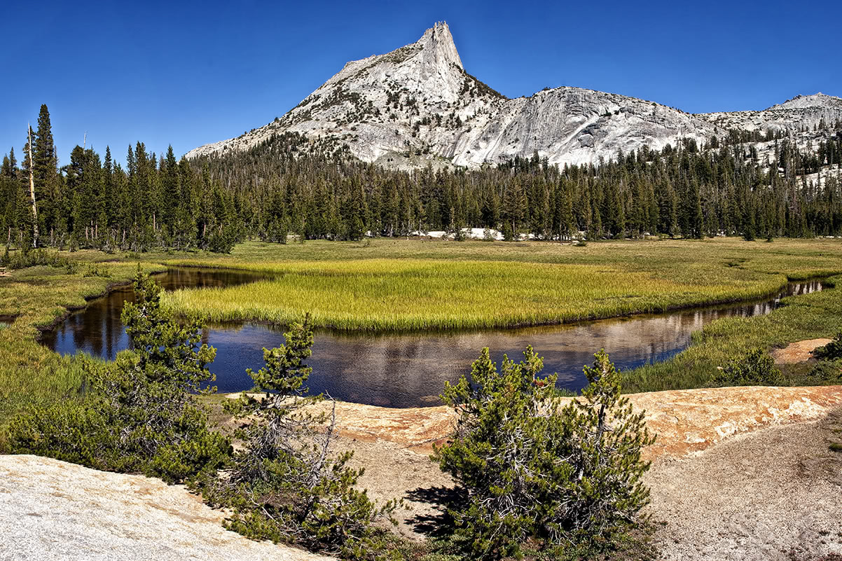
Superlatives do little justice in describing the grandeur of the Sierra. Home to the largest trees in the world (the giant sequoias), the tallest peak in the contiguous United States—Mount Whitney, and over 5,300 sq. mi (13,727 sq. km) of protected wilderness, the Sierra are a paradise of lofty summits and stunning alpine scenery.
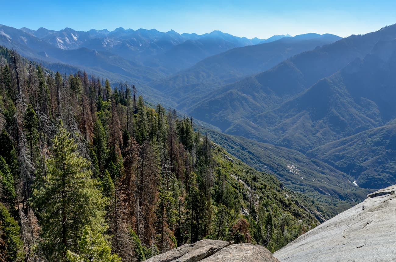
Part of the larger Cascade-Sierra Mountains province and the Pacific Mountain System, the Sierra extend roughly 400 miles (650 km) north to south and 60 to 80 miles (95 to 29 km) east to west. The bulk of the range lies between the Central Valley depression to the west and Basin and Range Province to the east.
The Sierra Nevada Mountains span eighteen counties and contain the headwaters of 24 river basins. Interestingly enough, the range is asymmetric in terms of topography. If you were to travel from the western Sierra to the eastern Sierra, you’d not only notice a significant change in elevation, but also a variation in geographic features.
The eastern Sierra are generally characterized by sheer escarpments and steep canyons, while the western Sierra contain mostly gradual foothills and alluvial fans.
Between Fredonyer Pass and Lake Tahoe, peaks range from 5,000 feet (1,500 m) to over 9,000 feet (2,700 m). Impressive peaks near Lake Tahoe include Mount Tallac and Pyramid Peak, both of which exceed 9,000 feet (2,700 m) in elevation. Nearby, in the Carson Range, Freel Peak and Mount Rose extend to over 10,000 feet (3,000 m).
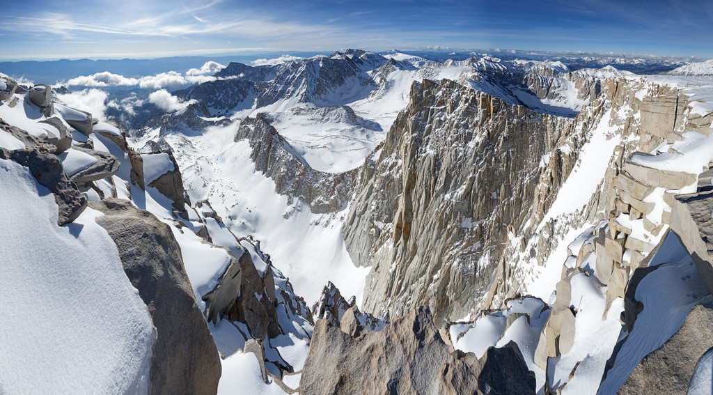
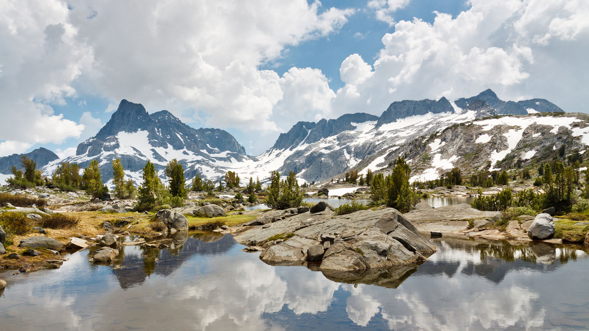
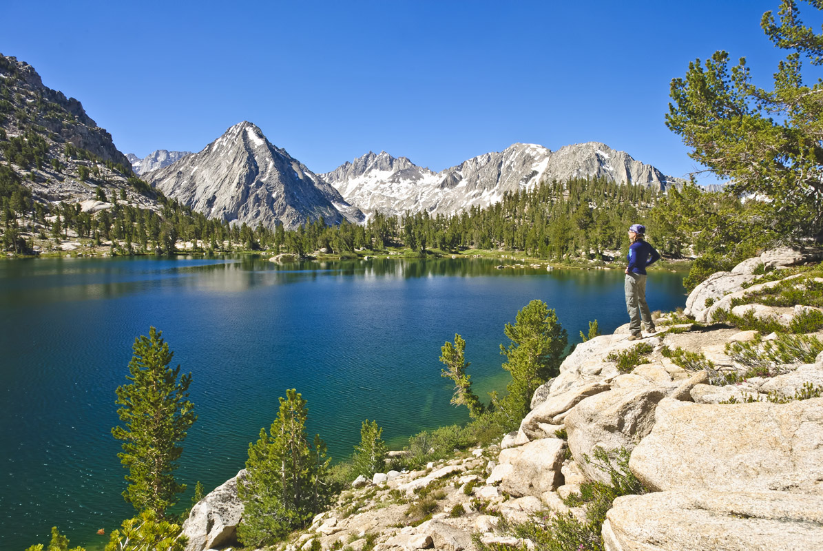
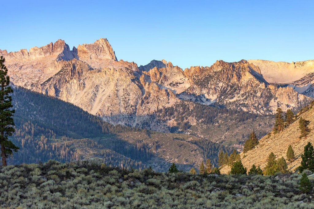
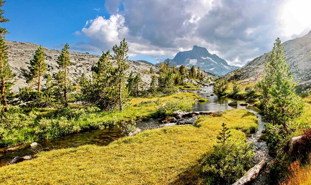
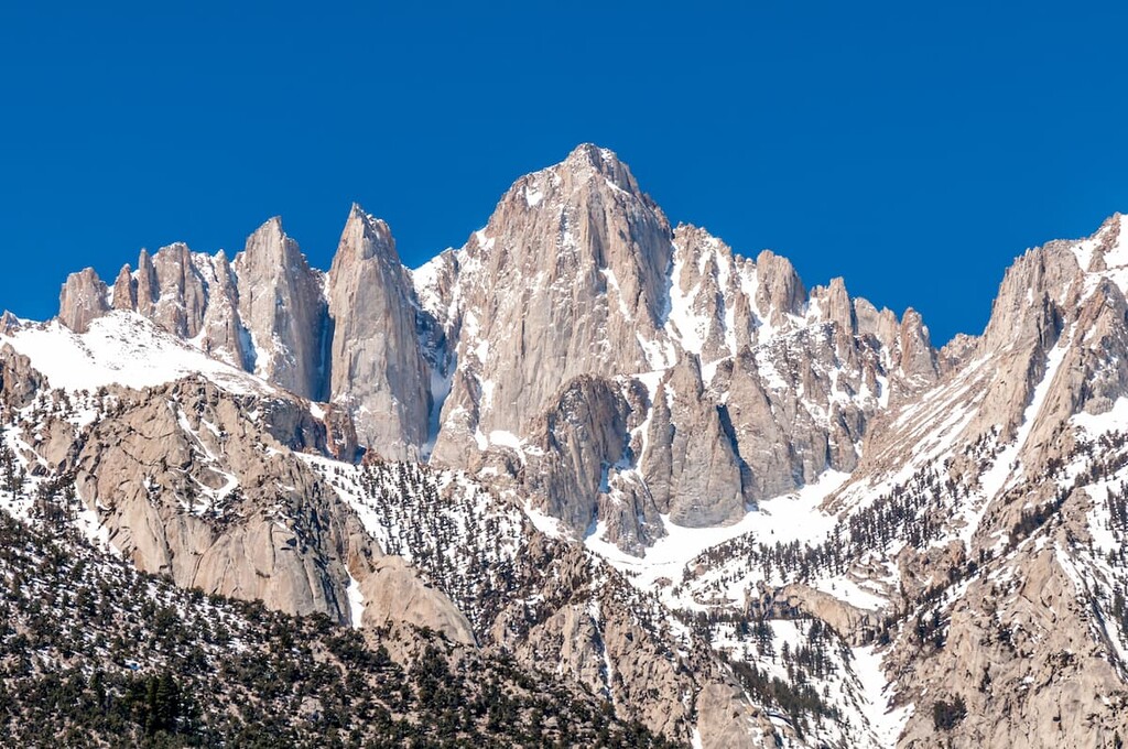
To the south of Lake Tahoe, the ‘High Sierra,’ which is a heavily glaciated region within the range, extends north from the tallest point in the continental United States, Mount Whitney, to Yosemite National Park. Here, impressive Sierra Nevada summits, including Mount Dana, Mount Lyell, Mount Humphreys, and North Palisade, rise to over 13,000 feet (3,900 m).
A few 12,000+ foot (3,600 m) summits, including Florence Peak and Olancha Peak, lie south of Mount Whitney. However, generally speaking, elevations decline to 8,000 feet (2,400 m) south of Lake Isabella.
The Sierra, however, is much more than a single collection of peaks, this expansive mountain range contains several major subranges and ridges, including the following:
World-renowned for its natural beauty, the Sierra Nevada boasts some of the country’s most iconic landmarks, parks, and recreation areas. An impressive 12 million acres of public land is tucked within the Sierra Nevada, and conservation groups are continually working to find ways to protect more of the range.
The Sierra Nevada contains one of the longest stretches of protected wilderness in the contiguous United States. Currently, three National Parks, two national monuments, ten national forests, and 26 wilderness areas are protected in the Sierra.
National parks in the Sierra Nevada include:
Additionally, the range contains a number of stunning national forests, such as:
Finally, the range contains a fantastic array of wilderness areas, each of which protects this amazing landscape from future development. Some of the many wildernesses in the Sierra include:
Naturally, the Sierra Nevada encompasses some of North America’s most cherished geographic features.
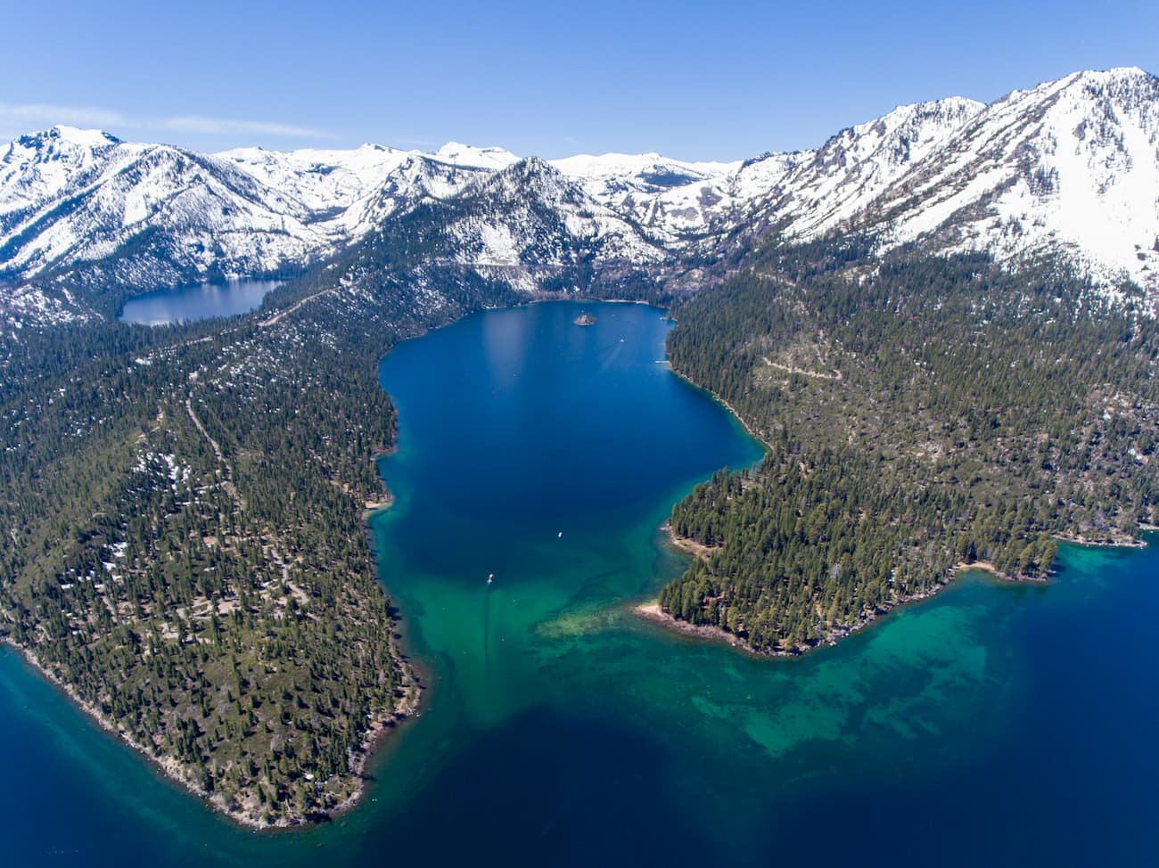
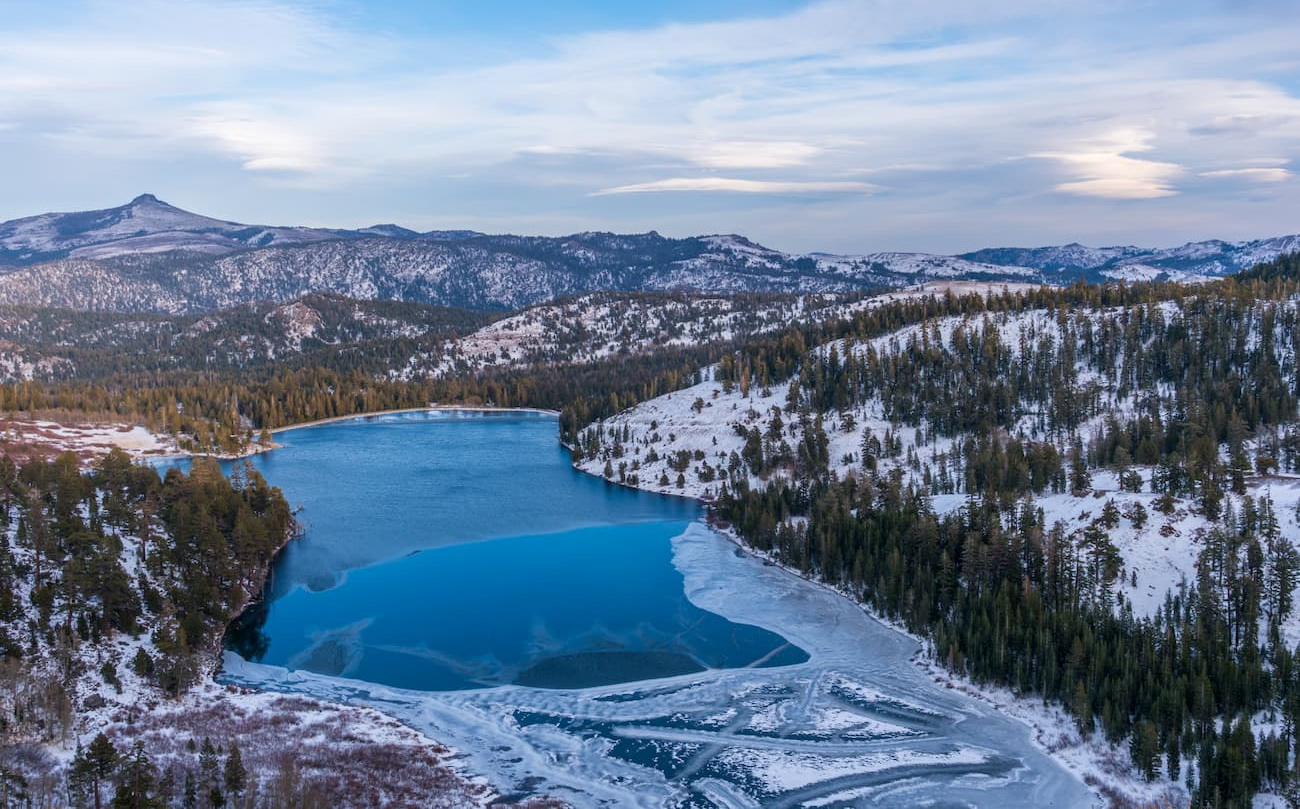
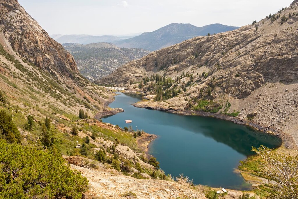
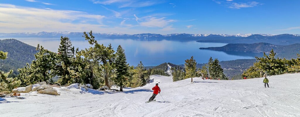
Lake Tahoe, a freshwater lake that lies between the Sierra and Carson Range, is North America’s largest alpine lake. At 1,645 feet (501 m) deep, Lake Tahoe is the second deepest lake in the United States and the sixteenth deepest lake in the world.
The lake is 22 miles (35 km) long and 12 mi (19 km) wide, and it boasts 72 miles (116 km) of shoreline. Renowned for its crystalline waters and mountainous views, Lake Tahoe is understandably a major tourist attraction.
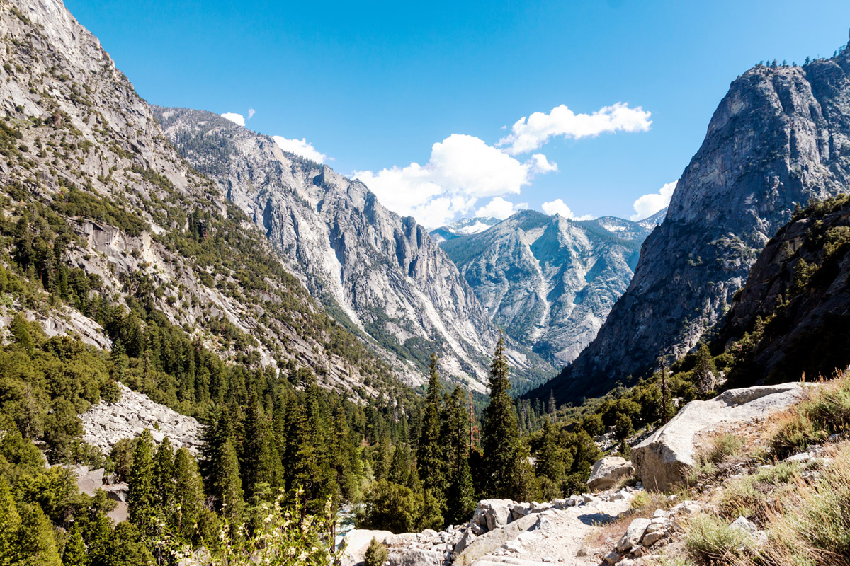
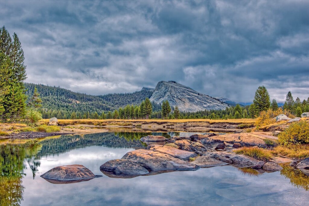
To the south of Lake Tahoe, Hetch Hetchy Valley, Yosemite Valley, Tenaya Canyon, Kings Canyon, and Kern Canyon are some of the best-known, glacially carved canyons in the country. Kings Canyon in particular, has the greatest riverbed-to-summit height differential of any canyon in North America.
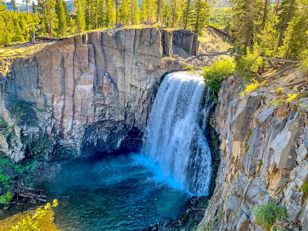
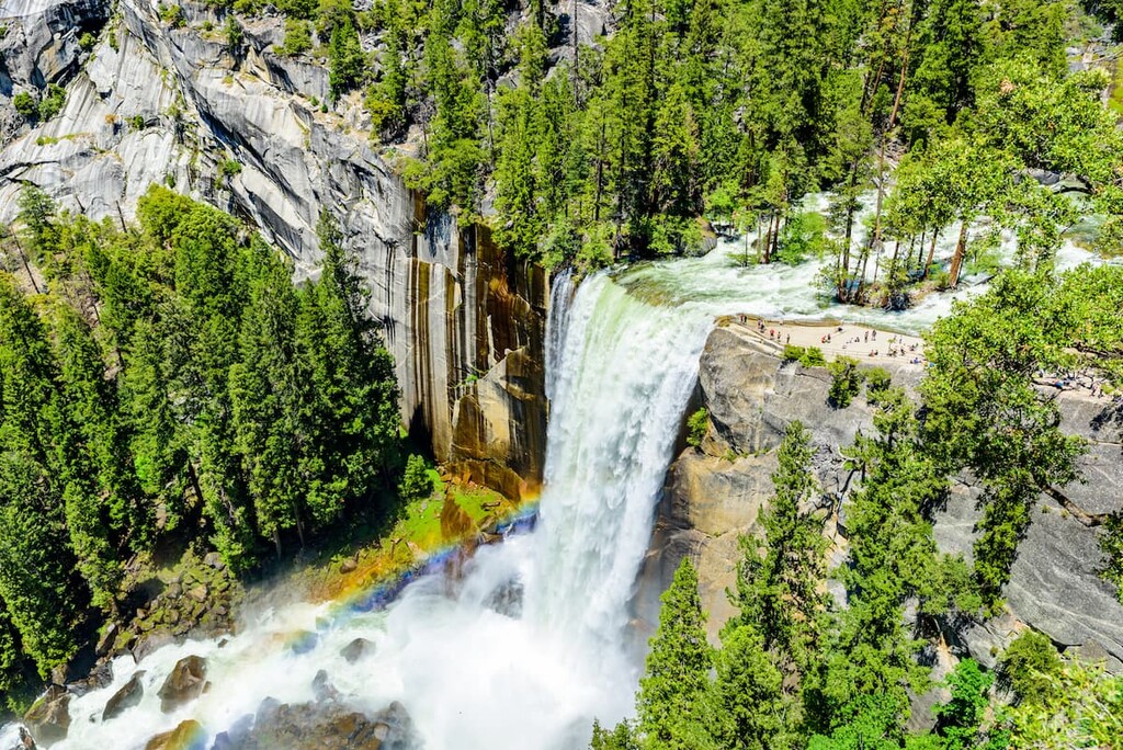
Also tucked away in the Sierra, Devil’s Postpile, a striking columnar basalt formation shaped by ancient lava flow serves as the focal point of its namesake national monument. Meanwhile, the tallest waterfall in the United States, 2,425-foot (740 m) Yosemite Falls, can be found in one of the country’s most visited and iconic national parks — Yosemite National Park.
Though considered a young range in comparison to other notable North American mountain ranges, the oldest rocks in the Sierra Nevada are believed to be over 450 million years old.
In fact, the Sierra Nevada is best-described as a huge block of the earth’s crust that has broken free on the east and has been tilted westward. The shape of the Sierra Nevada has been heavily influenced by both the shifting of tectonic plates beneath the surface of the Earth and repeated glaciation.
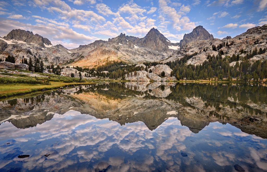
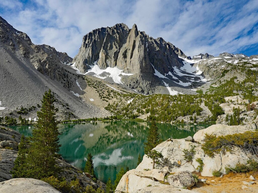
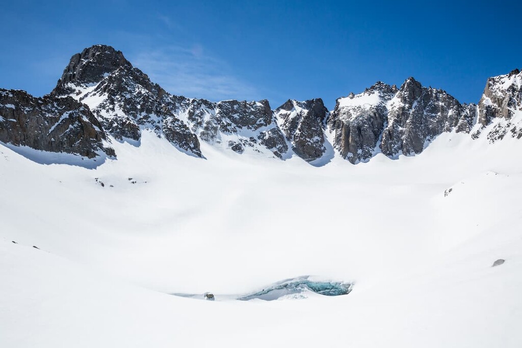
Massive glaciers carved out the region’s characteristic U-shaped canyons and incredible hanging valleys that we see in the range. Even today, visitors can still experience the region’s glacial past by exploring cirques, circular basins, moraines, and glacial lakes in the region.
The core of the Sierra Nevada Mountains is composed of a large batholith, or intrusive igneous rock. The Sierra Nevada Batholith is composed of individual masses of rock that formed during volatile episodes of magma intrusion millions of years ago.
The batholith was exposed as tectonic forces initiated the formation of the Basin and Range geologic province, including the Sierra Nevada. Over millions of years, erosion wore down the material covering the batholith. Though most of the batholith remains below the surface, the imposing, granitic peaks in the Sierra Nevada are an incredible display of the exposed portions of the batholith.
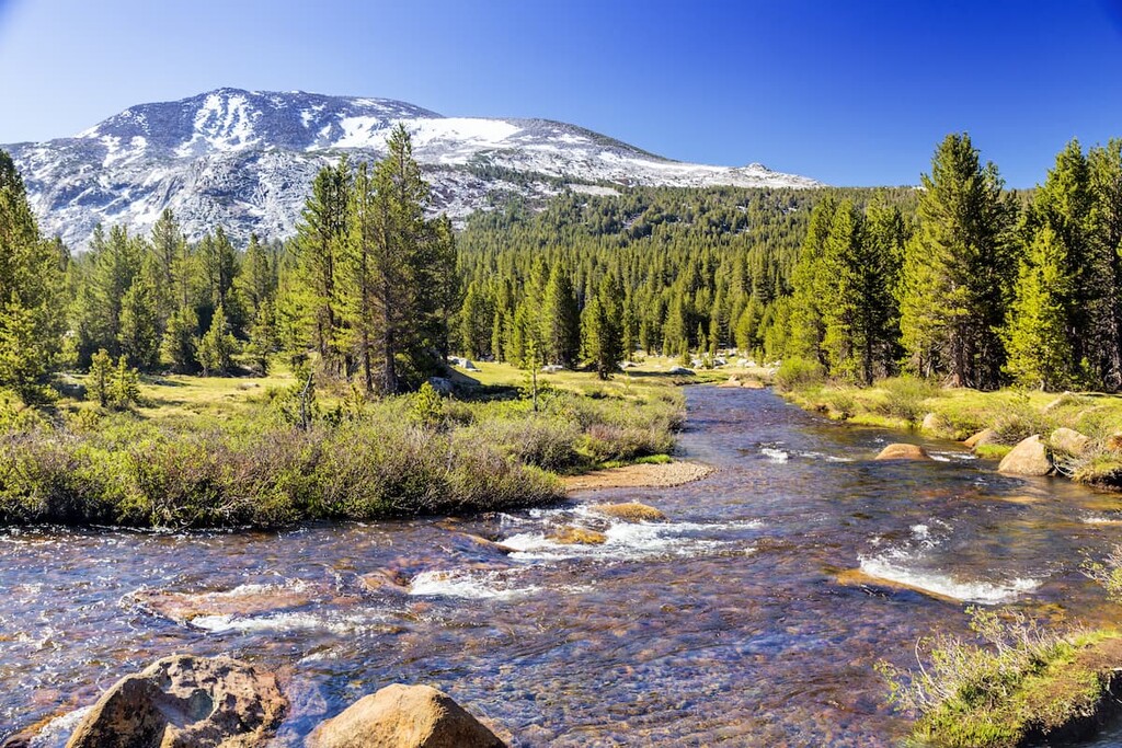
The Sierra Nevada ecoregion contains an extraordinary range of habitat types and sustains many unusual plant and animal species. The western and eastern Sierra Nevada have significantly different flora and fauna, because the east lies in the rain shadow of the crest.
Roughly half of California’s 7,000 species of vascular plants can be found in the Sierra Nevada, including 400 endemics and 200 rare species. The southern Sierra contains the highest concentration of species and rare endemic species, but the eastern slope, west of the Owens River Valley, also contains many unusual plant species.
Six unique biotic zones exist in the western Sierra Nevada: The foothill woodlands and chaparral zone, lower montane forest, mid-montane Forest, upper-montane forest, subalpine forest, and alpine zone. Like the western Sierra, the eastern Sierra has alpine, subalpine forest, upper montane forest, and lower montane forest biotic zones.
Each zone is defined by its climate and supports a number of interdependent species. The northern and southern Sierra biotic zone elevations also vary, with the southern Sierra biotic zones beginning at higher elevations.
Lower elevation biotic zones, like the foothill woodland and chaparral zone in the western sierra and Pinyon-Juniper woodland zone in the eastern Sierra are characterized by non-native and mixed grasslands and single-leaf pinyon pines and sierra junipers, respectively.
The lower, mid, and upper montane forest zones generally contain a mix of ponderosa pine, Jeffrey pine, California black oak, sugar pine, white fir, incense cedar, Douglas-fir, live oak, back oak, red fir, and lodgepole pine. Red fir and lodgepole pine generally thrive at higher elevations, while California black oak, sugar pine, white fir, ponderosa pine, and black oak dominate lower elevations.
In the northern stretch of the western Sierra, however, the lower, mid, and upper montane forest zones occur at a much lower elevation than in the southern Sierra. So, while you might find the mid-montane forest at 3,000 to 6,000 feet (900 to 1,800 m) north of Lake Tahoe, you won’t generally encounter this zone until 5,000 to 7,000 feet (1,500 to 2,100 m) south of Yosemite.
Near 9,000 feet (2,700 m), the climate cools and the growing season shortens due to much harsher weather conditions. The montane forest gives way to the subalpine forest, a zone dominated by subalpine meadows, western white pine, mountain hemlock, and lodgepole pine.
Above the treeline, in the alpine zone, trees no longer can grow due to the harsh climate. This is where you’ll find incredible talus slopes, boulder fields, and striking granitic outcroppings. During brief, warmer summer months, various flora, including cushion plants, willows, sedges, and grasses, are known to grow in the alpine zone.
Roughly 60 percent of California’s vertebrate species are found in the Sierra Nevada. 13 of these species are endemic to the range, including the Yosemite toad, Mount Lyell salamander, Limestone salamander, kern salamander, long-eared chipmunk, alpine chipmunk, yellow-eared pocket-mouse, and golden trout.
The Sierra is also rich in birdlife, with over 60 species inhabiting the region, including golden eagles, Bonelli’s eagles, peregrine falcons, griffon vultures, rock thrushes, red-billed choughs, and skylarks.
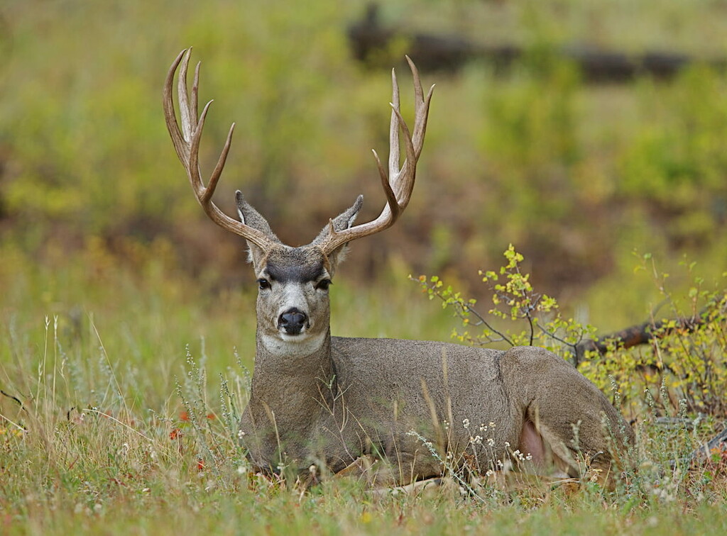
Black bear, ringtail cat, coyote, gray squirrel, bobcat, California mule deer, and skunk are known to roam the foothills of the Sierra, while the American pika, Belding’s ground squirrel, yellow-bellied marmot, and endangered Sierra Nevada bighorn sheep are generally found above the tree line.
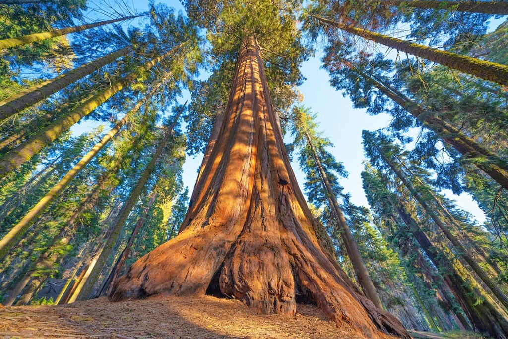
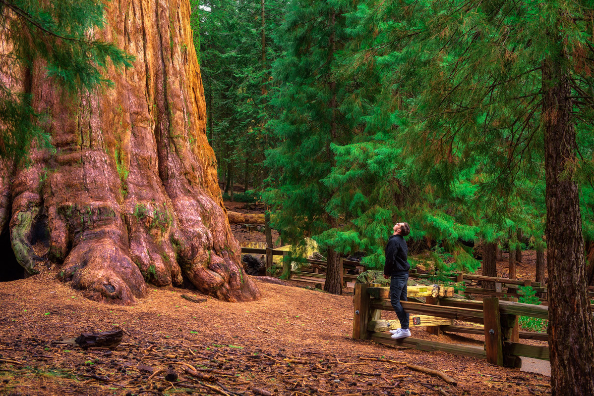
The last remaining natural groves of giant sequoias lie along the western side of the Sierra Nevada. These giants only grow on the western slopes of the Sierra Nevada between 4,000 and 8,000 feet (1,219 and 2,438 m) in elevation.
Giant sequoias occur naturally in over 70 groves located between Fresno County and Placer County. There are a number of famous groves in the Sierra that are located within Yosemite, Sequoia, and Kings Canyon national parks, as well as in Giant Sequoia National Monument.
Within the range, there are a number of notable giant sequoia trees. This includes the General Sherman in the Giant Forest of Sequoia National Park, which is the world’s largest living single-stem tree by trunk volume and the largest giant sequoia by height.
The range is also home to the General Grant tree in the General Grant Grove of Kings Canyon National Park, which is one of the largest living single-trunk trees in the world by trunk diameter.
The Sierras have a rich and complicated human history that includes millennia of Indigenous inhabitation of the land, and the more recent advent of gold miners, ranchers, loggers, farmers, conservationists, and recreationists.
Archaeologists believe that at least five main Native American tribes thrived in the Sierra Nevada: the Yokut, Sierra Miwok, Maidu, Paiute, and Washoe. Long before the first peoples of European descent arrived in the Sierra, Indigenous peoples thrived in the region thanks to the range’s abundance of natural resources.
Unfortunately, Indigenous peoples were decimated by introduced disease, forced labor, and forcible relocation not long after the arrival of the first settlers of European descent to the range in the early 1800s.
In 1805, a Spanish military expedition stumbled upon a canyon in the southern Sierra and subsequently named the river El Rio de los Santos Reyes. However, it would take two more decades for hunters and fur trappers from the United States to pass through the range.
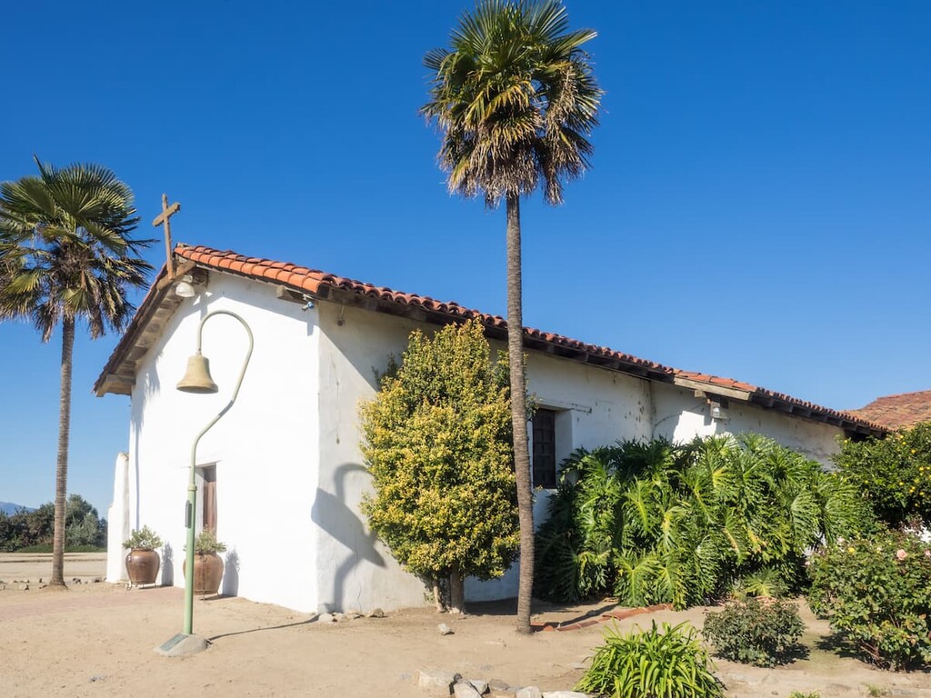
Still, the Sierra Nevada region was largely uncharted by peoples of European descent until 1848, wheMission Nuestra Senora de la Soledad is a Spanish mission located near the present-day town of Soledad, Californiahundreds of thousands of people would travel to the Sierra in the hopes of striking it big.
Both the potential for outdoor recreation and the need for preservation were recognized early in the Sierra. Yosemite Valley was protected by the government in 1864, though this came at the expense of the forced relocation of the Ahwahnechee who had lived in the valley since time immemorial.
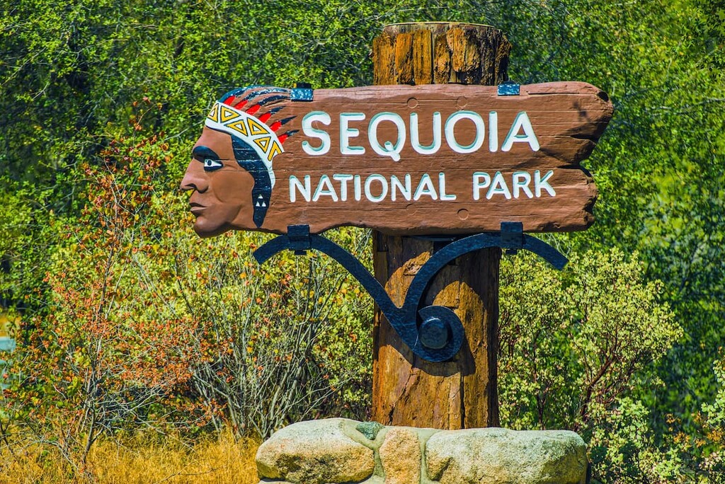
In 1866, a state park was formed to protect Mariposa Grove and in the late 1890s, President Benjamin Harrison signed a bill into law creating California’s first national park: Giant Forest (now known as Sequoia National Park).
Today, the Sierra are home to four iconic national parks, nine national forests, 32 state parks and over 5,300 square miles (13,730 sq. km) of protected wilderness.
Home to three popular national parks, two national monuments, ten national forests, and dozens of wilderness areas, the Sierra Nevada is packed with outdoor recreation opportunities. Some of the most popular places in the Sierra include:
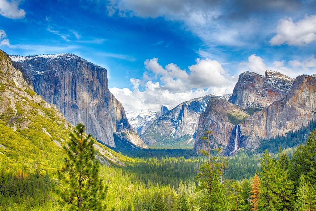
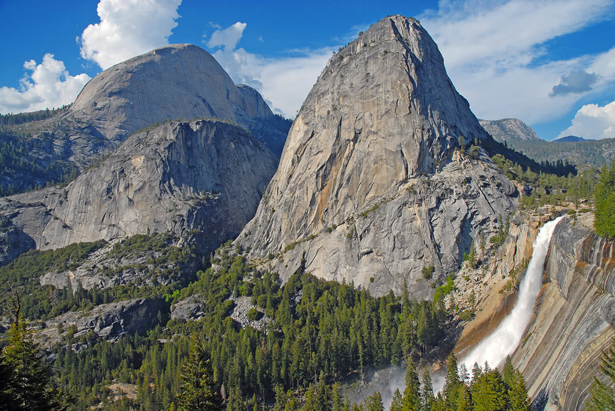
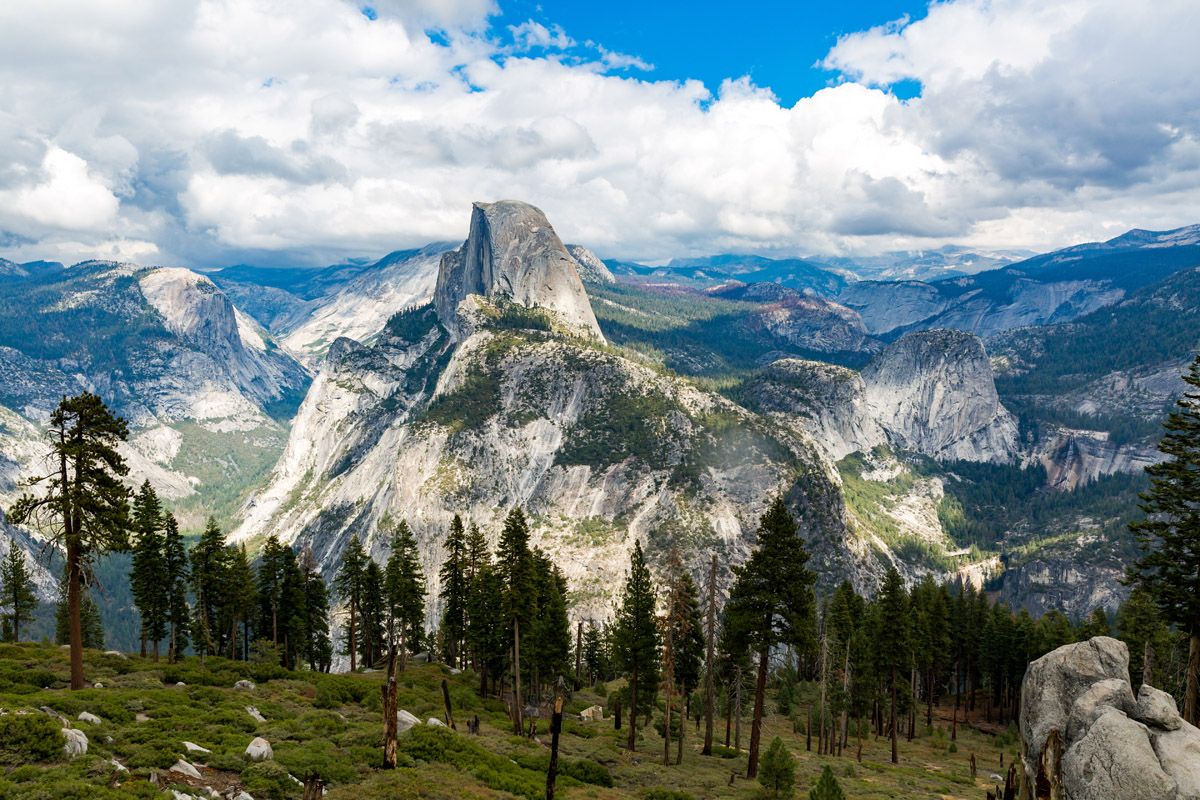
Located in the western Sierra Nevada, Yosemite National Park is one of the most iconic parks in the states. Famed for its giant, ancient sequoias, deep valleys, cascading waterfalls, and impressive granite peaks, Yosemite encompasses 1,200 square miles (3,100 sq. km) of mountainous scenery and boasts more than 800 miles (1,290 km) of hiking trails.
Visitors to the park often remain in Yosemite Valley, taking in views of granite icons like Half Dome and El Capitan. However, Yosemite Valley only represents a small fraction of the park. Yosemite high country is where avid hikers and backpackers go to explore beautiful mountain peaks like Mount Gibbs, Mount Conness, and Mount Lyell, the highest point in the park.
Located beside Kings Canyon National Park, Sequoia National Park protects 404,064 acres (631 sq mi; 163,519 ha; 1,635 km2) of spectacular forest and summits. The park encompasses a striking vertical relief of nearly 13,000 feet (4,000 m) and contains the highest point in the contiguous United States, Mount Whitney.
Originally established in 1890 to protect an area of giant sequoia trees from logging, Sequoia remains a popular destination for admiring lofty sequoia trees. The park’s giant sequoia forests draw over a million visitors every year. However, the park also contains the highest-elevation region of the High Sierra and acres of protected, roadless wilderness filled with high-alpine wonders.
Established in 1890, Kings County National Park protects 461,902.2 acres (721.7 sq mi; 1,869.3 sq. km) of the southern Sierra Nevada. The park is home to a variety of impressive natural features, including the third tallest mountain in California, North Palisade, the Palisade Glacier, and Grant Grove of giant sequoias. The park’s namesake canyon, Kings Canyon, also has the greatest riverbed-to-summit height differential of any canyon in North America.
The park is generally divided into two distinct sections – the smaller and older western section and the larger eastern section. Most tourist facilities are located in the western part of the park near Grant Grove.
Devils Postpile National Monument contains two popular attractions – Rainbow Falls, a 101-foot (31 m) waterfall, and Devils Postpile, a distinctive rock formation of columnar basalt. Initially, the monument and adjacent land was protected within Yosemite National Park. However, the discovery of gold in the early 1900s prompted a boundary change and made the region susceptible to development. Fortunately, the monument and surrounding 800 acres (43,560 sq ft; 13,277 sq. km) of wilderness was federally protected as a National Monument in 1911.
In addition to the Postpile, visitors can take a stroll along the Middle Fork of the San Joaquin River, trek to the high sierra, or make a quick trip to Rainbow Falls. Keep in mind, a mandatory shuttle is in place to reduce congestion in the park.
Located in southern Sierra Nevada, the Giant Sequoia National Monument protects roughly half of the sequoia groves in existence. This 328,00-acre (514 sq mi; 1,330 sq. km) park houses 38 of the 39 giant groves in Sequoia National Forest and protects massive sequoias, including the Boole Tree, a 269-foot (82m) high giant sequoia with a base circumference of 112 feet (38m).
The Giant Sequoia National Monument is generally divided into two sections. The northern part of the park is administered by the Hume Lake Ranger District and surrounds General Grant Grove. The southern part of the park lies directly south of Sequoia National Park. This part of the park is administered by the West Divide Ranger District and contains Long Meadow Grove.
The Inyo National Forest covers over 1.9 million acres of the eastern Sierra Nevada and White Mountains. The forest protects over 800,000 acres of designated wilderness and contains nine unique wilderness areas: Ansel Adams,Boundary Peak, Golden Trout, Hoover, Inyo Mountains, John Muir, Owens River Headwaters, South Sierra, and theWhite Mountains. Roughly 30 million people live within a few hours’ drive from the Inyo National Forest making it a popular destination for local hikers and backpackers.
The largest National Forest in the contiguous United States, Humboldt-Toiyabe National Forest protects over 6.3 million acres of the rugged eastern slope of the Sierra Nevada. The Forest is highly dispersed through portions of eastern California and Nevada. As a result, terrain in Humboldt-Toiyabe is highly variable, ranging from wide open desert with cactus to snow-capped summits and alpine tundra. Humboldt-Toiyabe also manages 24 designated wilderness areas that protect over 1.2 million acres. Popular attractions in the Humboldt-Toiyabe National Forest include: the Virginia Lakes Basin, Hoover Wilderness, Jarbidge Wilderness Area, Santa Rosa Mountains, Mount Moriah, and East Humboldt Mountain Range.
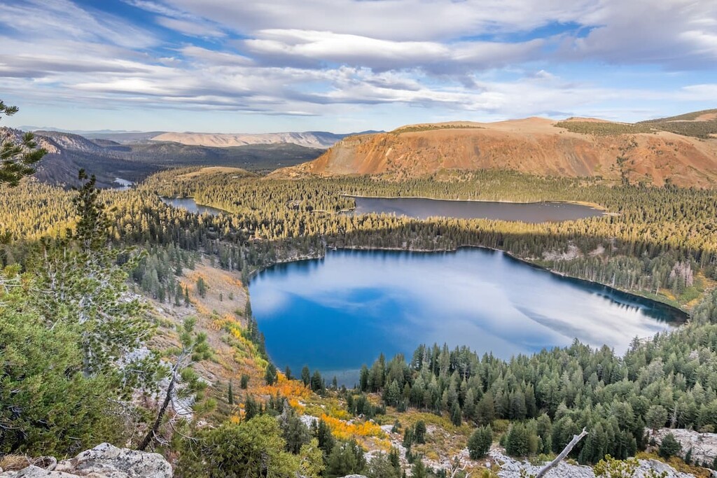
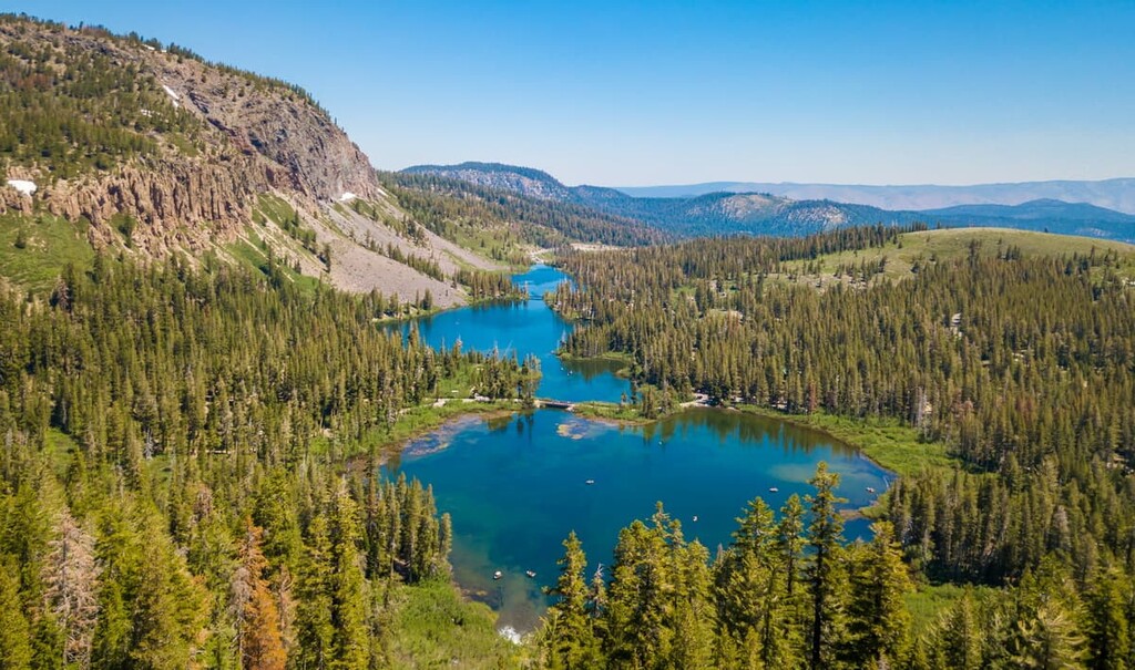
Located near Mammoth Lakes, partially within the John Muir Wilderness, the Mammoth Lakes Basin is home to large stands of towering pine forests, dozens of dazzling alpine lakes, and miles of picturesque mountain vistas.
The Mammoth Lakes Basin area features over 50 miles (80.5 km) of designated hiking trails, five campgrounds, and a Nordic ski center. Popular trails in the Mammoth Lakes Basin include: Crystal Lake, Duck Pass and Pika Lake, and Horseshoe Lake.
More than a dozen 14,000-foot (4,267 m) peaks and millions of acres of beautiful rock structures, lake basins, meadows, and alpine lakes lie within the Sierra Nevada region. Unsurprisingly, this extensive set of summits is cherished for its incredible network of hiking trails. Some of the most popular trails in the Sierra Nevada include:
Located in the heart of the John Muir Wilderness, this 11-mile (17.7 km) trail passes Mount Alice, and features seven incredible alpine lakes, several of which highlight the majestic Temple Crag in the background.
Along the way, hikers take in astonishing views of the northeast side of the Palisades, a group of 14,000-foot (4,267 m) peaks on the Sierra Crest. Palisade Glacier, the largest glacier in the Sierra Nevada can also be reached using a continuation of this route.
The 8-mile (12.9 km) Pacific Crest Trail (PCT High trail is a popular section of the 2,650-mile (4,265 km) Pacific Crest Trail that enters the Ansel Adams Wilderness.
The High Trail not only offers unobstructed views of the Minarets, Mount Ritter, and Banner Peak, but also leads to Thousand Island Lake, which is regarded as one of the most spectacular lakes in the Eastern Sierra.
The John Muir trail is a long-distance trail that traverses 210 miles of the Sierra Mountains, passing through portions of Yosemite, Sequoia, and Kings Canyon National Parks. The path is often referred to as "America's most famous trail,” and traverses what is often considered to be the most scenic portions of the Sierras.
Some trail highlights include stunning views of Cathedral Peak at Lower Cathedral Lake, awe-inspiring views of Mt. Lyell via Donahue Pass, Thousand Island Lake, Forester Pass, which sits high above the treetops at over 13,000 feet, and the trail’s southern terminus, Mount Whitney. For approximately 160 miles, the JMT also follows the same footpath as the notorious Pacific Crest Trail.
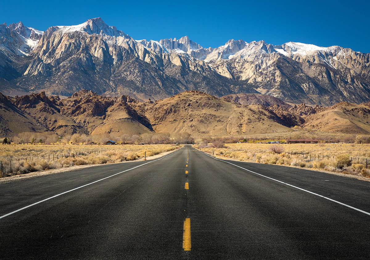
It’s not uncommon to find the tallest peak in the contiguous united states at the top of a peak baggers bucket list. Although no mountaineering skills are required to hike to the top of Mt. Whitney, because of the mountain’s increasing popularity, a permit system is in place to minimize the impact of day-hikers.
The shortest and most popular route to climb Mt. Whitney is the 10.7-mile (each way) trail from Whitney Portal on the east side of the Sierra. Hikers are urged to spend a day or more adapting to the elevation and should have a good amount of experience prior to attempting Mt. Whitney.
Mount Sill is a recognizable thumb-shaped peak in the Sierras, is another popular peak for backpacking, climbing, and hiking. There are at last 10 established trails to the peak, ranging in difficulty and length.
Along the route, hikers can stop at a number of alpine lakes and will be surrounded by iconic Sierra Nevada peaks like North Palisade, Thunderbolt Peak, Mt. Gayley, and Mount Winchell.
Looking to explore the Sierra Nevada? These are some of the best cities to check out in and around the range:
The area surrounding Lake Tahoe, often referred to as “Tahoe,” is a popular basecamp for outdoor enthusiasts, particularly in winter months.
Two of the most popular resorts in the Lake Tahoe area include an award-winning ski resort, which hosted the 1960 Winter Olympics and offers hundreds of trails to explore, and Heavenly Valley, Tahoe’s largest ski resort that sits on the California-Nevada state line.
Located at the south end of Lake Tahoe, just north of the Carson-Iceberg Wilderness, South Lake Tahoe is a bustling epicenter for outdoor recreation. South Lake Tahoe is one of the most popular destinations for visitors to the Tahoe Valley and boasts a variety of excellent restaurants, hotels, and attractions.
Mammoth Lakes is a popular year-round destination for visitors looking to explore the best of the Sierra. Surrounded by peaks, valleys, and alpine lakes, Mammoth Lakes is close to popular attractions like Yosemite National Park, Mt. Whitney, and the Mammoth Lakes Basin.
There is a variety of lodging available ranging from campsites to popular resorts like the Tamarack Lodge, Mammoth Mountain Inn, and Juniper Springs Resort. Mammoth Mountain, California’s highest four-season resort, is one of the most visited for winter sports.
Located directly west of the northern section of the Giant Sequoia National Monument, Fresno is the cultural and economic hub of California’s Central Valley. Though it’s not directly linked to an interstate highway, Fresno is served by State Route 99, a major north/south freeway in the Central Valley, as well as State Route 41, which travels north to Yosemite National Park, and State Route 180, which travels east to Kings Canyon National Park. Fresno is also home to an active international airport and Amtrak station.
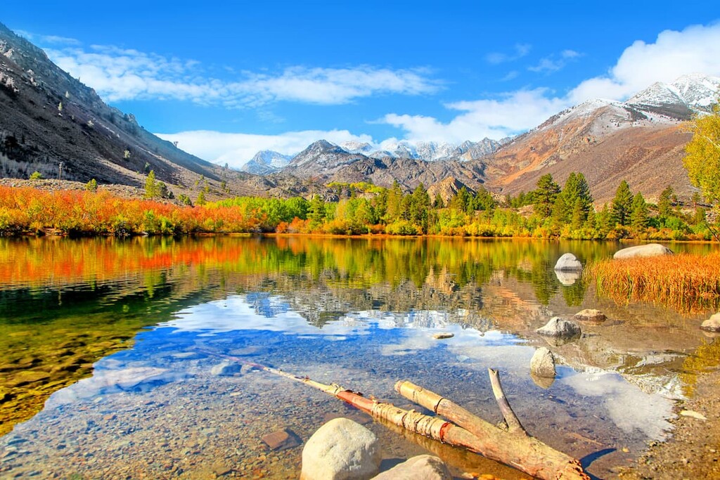
Known as the ‘small town with a big backyard,’ Bishop lies in the eastern High Sierra region of California. This charming town houses dozens of hotels, cabins, and Inns, as well as a variety of restaurants, shops, and heritage sites. Mt. Whitney, Bishop Creek Canyon, and Alabama Hills are also easily accessible from Bishop.
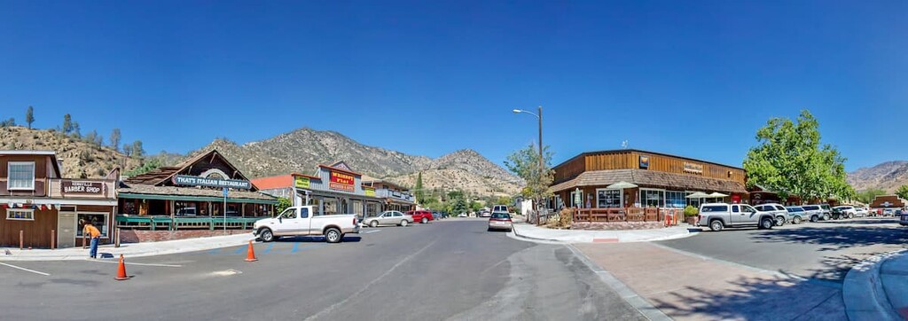
Located in the southern Sierra Nevada, Kernville lies just 42 miles (68 km) northeast of Bakersfield in Kern County. The city’s namesake river, the Kern River, is fed by snowmelt near Mount Whitney and passes through a series of incredible cliffs and canyons. For that reason, Kernville and the Kern River are popular among adventurous whitewater rafters and kayakers. Kernville also lies just outside of Sequoia National Forest and is just a 45 minute drive from the Trail of 100 Giants.


14er
ultra
california-13ers
las-vegas-mountaineers-classics
porcella-burns
western-state-climbers
western-state-climbers-star
sierra-club-sierra-peaks-section
sierra-peaks-section-emblem
sierra-sampler
vagmarken-sierra-crest
fred-beckey-great-peaks
california-ultras
14er
california-13ers
las-vegas-mountaineers-classics
porcella-burns
western-state-climbers
western-state-climbers-star
sierra-club-sierra-peaks-section
sierra-peaks-section-emblem
sierra-sampler
14er
glacier
california-13ers
porcella-burns
western-state-climbers
western-state-climbers-star
sierra-club-sierra-peaks-section
sierra-peaks-section-emblem
vagmarken-sierra-crest
fred-beckey-great-peaks
14er
california-13ers
porcella-burns
western-state-climbers
western-state-climbers-star
sierra-club-sierra-peaks-section
sierra-peaks-section-mountaineers
vagmarken-sierra-crest
california-13ers
porcella-burns
western-state-climbers
western-state-climbers-star
14er
california-13ers
porcella-burns
western-state-climbers
western-state-climbers-star
sierra-club-sierra-peaks-section
sierra-peaks-section-mountaineers
vagmarken-sierra-crest
14er
ultra
california-13ers
las-vegas-mountaineers-classics
porcella-burns
western-state-climbers
western-state-climbers-star
sierra-club-sierra-peaks-section
sierra-peaks-section-emblem
sierra-sampler
vagmarken-sierra-crest
fred-beckey-great-peaks
california-ultras
13er
western-state-climbers
western-state-climbers-star
sierra-club-sierra-peaks-section
sierra-peaks-section-emblem
sierra-sampler
fred-beckey-great-peaks
nevada-peaks-club
western-state-climbers
western-state-climbers-star
sierra-club-sierra-peaks-section
sierra-sampler
tahoe-ogul
great-basin
great-basin-star
western-state-climbers
western-state-climbers-star
sierra-club-sierra-peaks-section
sierra-peaks-section-emblem
sierra-sampler
vagmarken-sierra-crest
western-state-climbers
western-state-climbers-star
sierra-club-sierra-peaks-section
sierra-sampler
tahoe-ogul
14er
glacier
california-13ers
porcella-burns
western-state-climbers
western-state-climbers-star
sierra-club-sierra-peaks-section
sierra-peaks-section-emblem
vagmarken-sierra-crest
fred-beckey-great-peaks


