
Scan the QR code and open PeakVisor on your phone
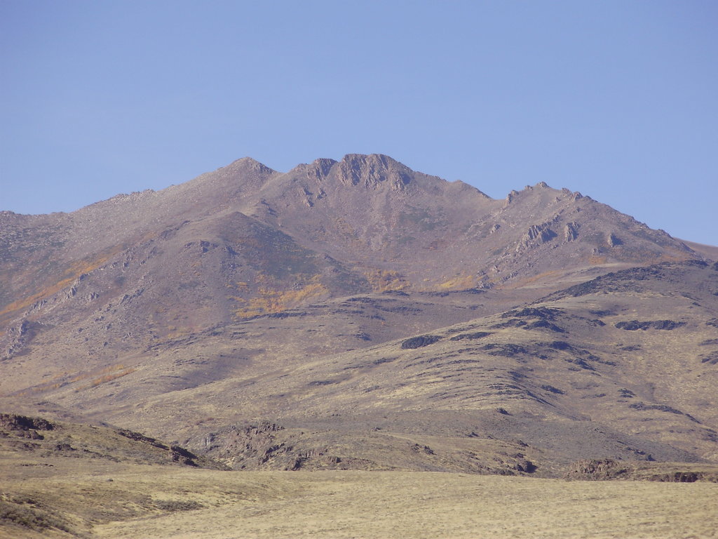
The Santa Rosa Mountains are a mountain range located in the north central region of the US state of Nevada. The remote and rugged peaks are rarely visited and showcase some of the stunning scenery found within the Great Basin Ranges. There are 75 named mountains within the range, the tallest and most prominent of which is Granite Peak at 9,747 feet (2,971 m) tall with 4,413 feet (1,345 m) of prominence.
The majority of the Santa Rosa Mountains lie within the US state of Nevada, with a portion extending into the states of Oregon and Idaho.
The rugged and remote peaks span across Humboldt County. The range extends roughly 75 miles (121 km) of terrain from north to south within the Humboldt National Forest and the Santa Rosa- Paradise Peak Wilderness Area.
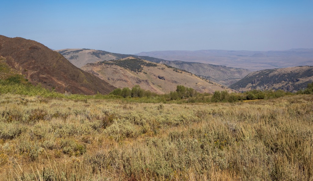
Terrain found in the range is similar to that of other Great Basin Ranges. Here hikers will not find alpine lakes, lush meadows or sweeping sections of coniferous forests. Instead the range is marked by sweeping basins and narrow ridgelines.
Though there are no large sections of forests, hikers will spot pockets of tree coverage along with patches of wildflowers and low growing shrubs. The lack of year round water sources in the region also requires hikers to take extra precautions when hiking the Santa Rosa Mountains.
The small city of Winnemucca lies just south of the range along with the Humboldt River which cuts across northern Nevada. Lack of lakes and tree coverage have made this range a less popular hiking spot compared to the nearby Humboldt Range or Ruby Mountains.
Elevations rise steeply on either side of the Santa Rosa Mountains, characteristic of the region. The Quinn River lies along the west side of the range while the Little Owyhee River travels eastward from the range.
The Santa Rosa Mountains are also situated near numerous other areas for outdoor recreation. The range lies within the Humboldt National Forest and the Santa Rosa- Paradise Peak Wilderness Area. To the west lies the South and North Jackson Mountains Wilderness Areas and the Mahogany Ridge Wilderness Study Area. The North Fork Owyhee Wilderness is situated to the northeast and the Ruby Mountains Wilderness to the southeast.
The Santa Rosa Mountains are a subrange of the Great Basin Ranges, which encompass portions of the states of Nevada, Utah, Idaho, Oregon, and California.
This expansive region was formed by a tilted fault block. Beginning in the Early Miocene, widespread tectonic extension caused the Earth’s crust to continually fold and stretch. Over the course of millions of years, this process formed a series of alternating peaks and valleys, thus giving the region its name.
Outer layers of the Santa Rosa Mountains, and a majority of the mountains in the region, consist of sedimentary rocks. The core of the range is composed of both metamorphic and igneous rocks.
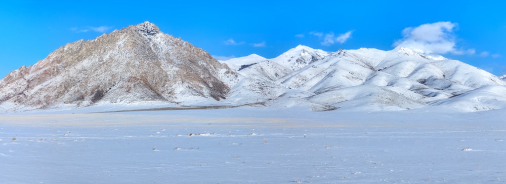
Remnants of this geological formation can be seen through the changes in elevation in the range. The eastern slopes feature a steep escarpment while the western side tends to have more gradual slopes. Much of the region was heavily glaciated during the last glacial maximum.
Glacial retreating carved out some of the sweeping valleys, U-shaped canyons, and cirques still visible today. In the nearby East Humboldt Wilderness Area and Ruby Mountains Wilderness hikers spot glacial alpine lakes.
Major peaks within the Santa Rosa Mountains include Granite Peak, Santa Rosa Peak, Bloody Run Peak, Capitol Peak, and Buckskin Mountain.
Sagebrush and low growing shrubs dominate the lower elevations in the range, especially within the western foothills. Though there are no densely forested patches of land, hikers can spot pockets of quaking aspen amidst the range.
The vast majority of the range features various low-growing grasses, spring wildflowers, and barren rock fields. The tallest peaks are free of flora, providing hikers with panoramic views of the region.
Fauna found in the range is similar to that found throughout much of the Great Basin Ranges. Populations of mule deer, coyotes, and mountain goats all thrive alongside the elusive mountain lions and bobcats. California bighorn sheep have been introduced to the region and are continuing to thrive.

The skies in the region are home to eagles and hawks while lower elevations feature partridge, grouse, and upland game birds. The few cold streams in the range provide an ideal habitat for trout including the threatened Lahontan cutthroat.
The land in and around the Santa Rosa Mountains has been home to humans for thousands of years. Prior to the arrival of European settlers, Indigenous peoples lived harmoniously with the land in present-day north central Nevada.
Numerous tribes and bands migrated throughout the region over the millennia. However, this land holds important ancestral ties to the Western Shoshone and Northern Paiute people. These Tribal Nations traditionally migrated with the seasons and were rather amicable with one another.
The two tribes shared a similar language, practices, and system of beliefs with one another. During the 1820s the first people of European descent arrived in the area, with their population steadily increasing over the coming decades.
As the Indigenous peoples fought to protect and preserve their native homelands, a series of battles broke out between them and the people of European descent. Some of the most prominent battles that took place included the Pyramid Lake War, Owens Valley Indian War, Snake War, and Bannock War.
Continual fighting, and the arrival of infectious diseases such as smallpox and measles, drastically reduced the number of Indigenous peoples. Those who did survive were ultimately forced onto reservations, oftentimes far away from their native homelands. Indigneous children were forced to assimilate with western culture, as the US government tried to eradicate and erase their traditional ways of life.
The population of settlers continued to grow as travelers passed through northern Nevada as they were en route to the California Gold Rush. Minimal amounts of rainfall in Nevada led many of these settlers to flee the region during the twentieth century.
The Santa Rosa Mountains were placed under federal management with the establishment of the Humboldt National Forest in 1908. In 1989, part of the range was formally protected by the US government with the formation of the Santa Rosa - Paradise Peak Wilderness Area which spans 31,000 acres (125 sq km).
The Santa Rosa Mountains are a relatively remote range and do not feature many hiking trails. Those traveling to the region should be well-versed in hiking safety and able to navigate using a compass and a map. Here are a few hikes in the region:
Falls Canyon Trail is the most popular hiking route in the range, situated in the southern portion of the Santa Rosa Mountains. This trail follows along Forest Road 539 and climbs gently throughout.
A vehicle with high clearance can help hikers get closer to the falls, shortening the length of the hike. After climbing gradually the trail steepens slightly before reaching the small waterfall that cascades down the rocky cliffs. Round trip this route is 4.3 miles (6.9 km) in length and features 1,079 feet (329 m) of total elevation gain.
Granite Peak is the tallest peak in the range, offering hikers unobstructed views of the surrounding landscape. This hiking route follows along forest roads and a rough trail along a fenced region. Parts of this trail can become overgrown due to the lack of visitors.
The last few hundred feet require some mild scrambling to climb over boulders in order to reach the summit. From the top of the peak hikers have sweeping views in every direction, showcasing the unique beauty of the Great Basin Ranges. This out and back trail is 5.4 miles (8.7 km) and features 1,902 feet (580 m) of total elevation gain.
The Singas Creek Trail requires a high-clearance 4WD vehicle to reach the trailhead. Situated in the Santa Rosa- Paradise Peak Wilderness, the trail winds through some forested patches before reaching the expansive ridgelines that define this region.
Seasonal wildflowers, sweeping basins, and rocky summits can be found throughout the route. This out and back trail is 10.4 miles (16.7 km) in length and features 2,650 feet (808 m) of total elevation gain.
Looking for a place to stay near the Santa Rosa Mountains? Here are some of the best cities and villages to check out in the region.
The closest city to the Santa Rosa Mountains is Winnemucca, which lies just south of the range. Home to around 8,000 residents, Winnemucca is named after Chief Winnemucca who led the Northern Paiute tribe of the region.
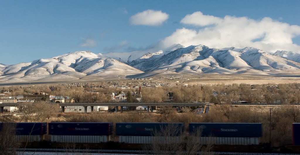
Situated along the Humboldt River, the city was established during the 1800s as the Central Pacific Railroad reached the region. This community is known for being located roughly halfway between San Francisco, California and Salt Lake City, Utah.
Winnemuccas’ close proximity to the Santa Rosa Mountains, Humboldt Range, and Ruby Mountains makes it a hub for exploring some of Nevada’s more remote hiking regions. Similar to other cities in Nevada, Winnemucca also features casinos and opportunities for gambling.
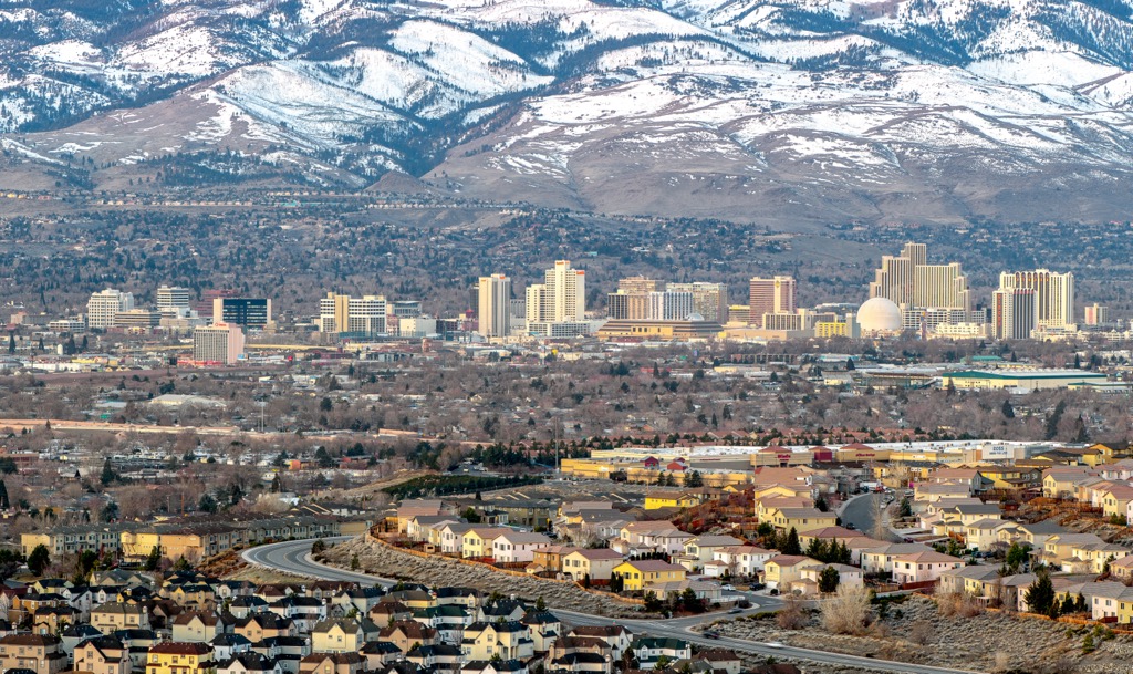
Reno is the closest major city to the Santa Rosa Mountains, situated a two and half hour drive southwest from Winnemucca. Known as the “The Biggest Little City in the World,” Reno is home to around 425,000 residents, making it the second largest city in the state. Reno is known for its mixture of casinos, gambling, and close proximity to outdoor recreation.
Downtown Reno is home to the Nevada Museum of Art and the National Automobile Museum. During the summer months both locals and tourists alike can enjoy hiking, mountain biking, running, and rock climbing.
The city’s close proximity to Lake Tahoe also provides opportunities for winter recreation. Multiple ski resorts lie within an hour and half drive of the city along with opportunities for snowmobiling and cross country skiing.


nevada-peaks-club
western-state-climbers
western-state-climbers-emblem
great-basin
nevada-peaks-club
western-state-climbers
western-state-climbers-emblem
great-basin


