
Scan the QR code and open PeakVisor on your phone
Utah is home to 3,442 named mountains. The highest is Kings Peak at 4,123 m.
Featuring a stunning mix of rocky, snow-capped peaks and sprawling desert landscape, Utah is one of the most popular outdoor recreation destinations in the western region of the United States. Utah is home to 3442 named mountains, the highest and most prominent of which is Kings Peak (13,527ft/4,123m).

The state of Utah is located in the western part of the United States. It shares a border with 6 other states, including Idaho and Wyoming to the north, Colorado to the east, New Mexico to the southeast, Arizona to the south, and Nevada to the west.
Technically speaking, the state’s border with New Mexico is, well, just a technicality, as the 2 states border each other solely at the Four Corners quadripoint intersection at 37ºN and 109º03’W. Interestingly, this is the only location in the entire country where 4 states share a single border, however the majority of the region is on Navajo Nation, Hopi Tribe, Pueblo of Zuni, and Ute Mountain Ute land.
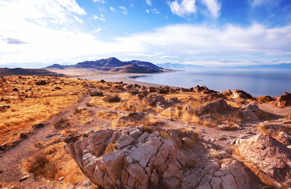
Utah contains 84,899 square miles (219,887 sq. km) of land, which ranks it as the 13th largest state in the union. However, it is just the second most air state in the United State in the country, behind Nevada, as it has just 2,775 square miles (7,136 sq. km) of water, much of which is the salt water of the Great Salt Lake.
The geography of Utah is especially interesting due to its impressive diversity. Although much of the state is considered to be a desert, it is exceptionally rugged and one can find mountains in nearly all of its counties.
One can categorize the state in a number of different ways, though there are 3 primary physiographic regions within the state, namely the Colorado Plateau, the Western Rocky Mountains, and the Great Basin Ranges.
Utah’s status as a major ski and mountain sports destination is driven by its highly rugged topography in and around its major cities. In particular, the north-central, central and northeastern parts of the state are covered with mountains which are all part of the Western Rocky Mountains system.
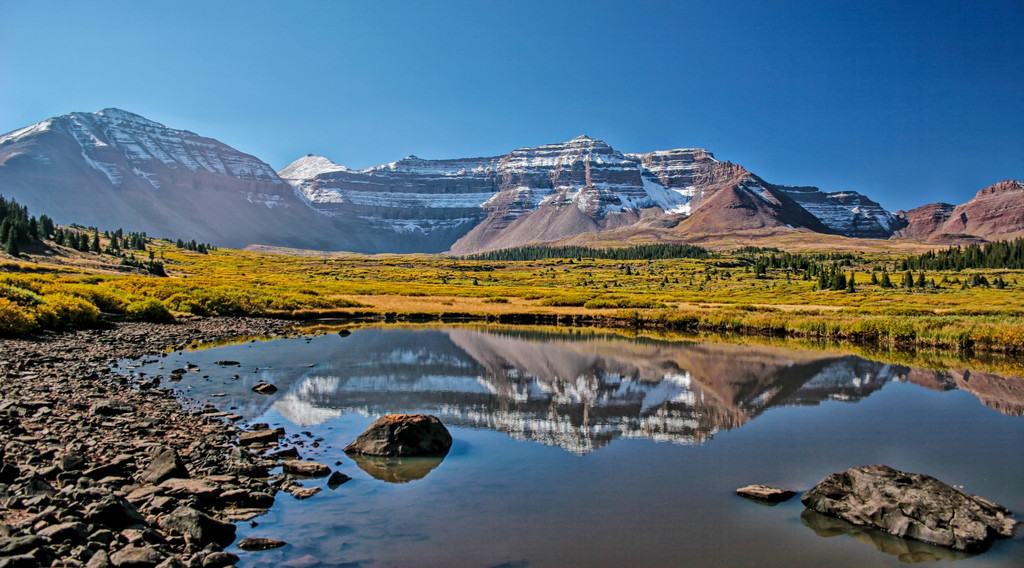
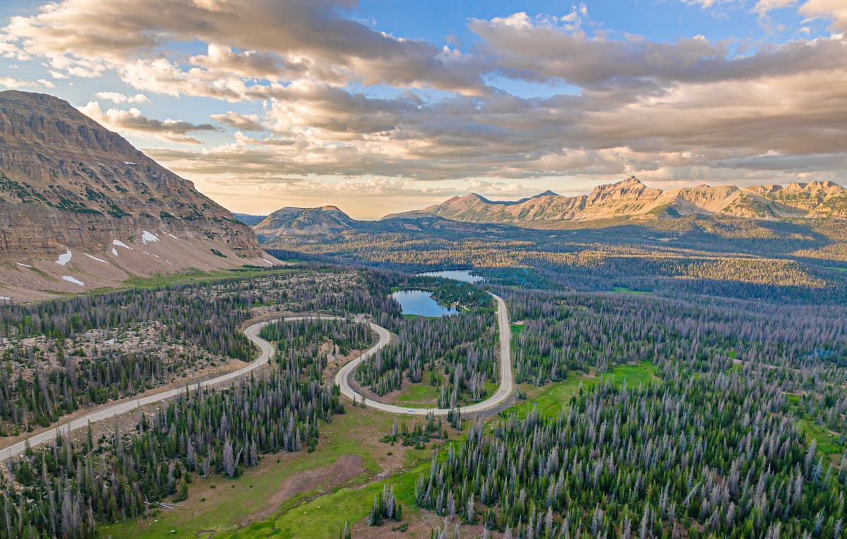
Most of this mountain system within the state of Utah is split between 2 primary ranges: the Wasatch Range and the Uinta Mountains. The Wasatch Range runs from north to south, starting just north of the state’s border with Idaho and continuing southward until approximately I-70 in the central part of the state.
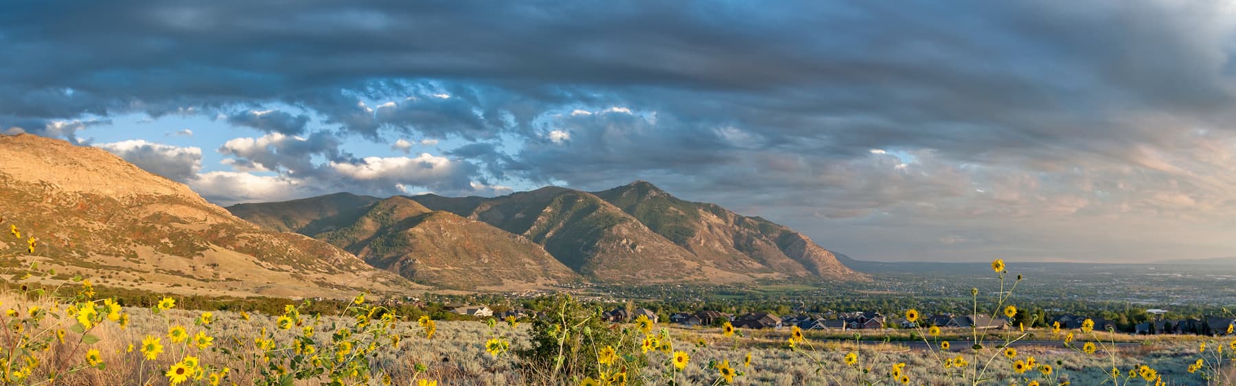
Along the edges of the Wasatch Range is a metropolitan region that’s often referred to as the “Wasatch Front.” The Wasatch Front is effectively a chain of cities that connects Brigham City to Nephi and contains some 80% of the state’s population.
Meanwhile, the Uinta Mountains are one of the US’ only major mountain ranges that has a distinct east to west orientation. The Uintas nearly intersect the Wasatch Range near Park City and they continue eastward past the city of Vernal and into Colorado’s Dinosaur National Monument.
The Western Rocky Mountains region of Utah contains quite a few major outdoor recreation areas, including the Ashley National Forest, parts of the Manti-La Sal National Forest, and the Uinta-Wasatch-Cache National Forest.
The Great Basin is a physiographic region that covers all of neighboring Nevada, as well as eastern California, southeastern Oregon, northwestern Arizona, southern Idaho, and western Utah.
In particular, the Great Basin occupies much of the area in Utah that’s west of the Great Salt Lake and the Wasatch Range and north of the Colorado Plateau. Here, the topography is markedly different from that of the Western Rocky Mountains to the north and west as the region is dominated by an alternating series of ranges and valleys (hence, the name).
Within this region of Utah there are many smaller mountain ranges that dot the landscape. This includes:
Moreover, the Great Basin Ranges section of Utah Contains a handful of outdoor recreation destinations, including the Sawtooth National Forest, the Uinta-Wasatch-Cache National Forest, and the Dixie National Forest.
Like the Great Basin Ranges, the Colorado Plateau is what’s known as a physiographic region or province, which means it has a distinct set of landforms and physical features. The Colorado Plateau covers much of easter and southern Utah as well as parts of northern Arizona, northwestern New Mexico, and western Colorado.
In this region, the landscape is mostly high desert, though it has deep canyons, rocky peaks, and some scattered forests.
As the name suggests, the landscape is comprised of a number of different plateaus, some of which include:
There are also quite a few mountain ranges in the Colorado Plateau region of Utah, such as:
Additionally, the Colorado Plateau region of Utah is home to a truly amazing concentration of protected areas. This includes:

Due to its varied topography, the geology of Utah is particularly complex and is best understood in terms of its physiographic regions: the Western Rocky Mountains, the Colorado Plateau, and the Great Basin Ranges.
The Western Rocky Mountains, which cover the northernmost and central parts of Utah, as well as parts of Idaho and Wyoming, is a subset of the Rocky Mountain range, which stretches from British Columbia in Canada to the north all the way south to New Mexico.
While the ranges within the Western Rockies and the Rockies, in general, share a similar history, they each were formed through a series of unique geological processes. Indeed, while the Uinta Mountains uplifted primarily during the Laramide Orogeny, the Wasatch Range is substantially younger, having taken its current shape during the last 17 to 12 million years.
The Western Rockies within Utah are comprised of a mix of rock types, including sedimentary and metasedimentary bedrock with substantial areas of igneous intrusions.
Major peaks in the region include Kings Peak, Mount Agassiz, Mount Nebo, Mount Timpanogos, and Mount Ogden.
The Great Basin Ranges, including those in Utah, all share a similar geologic history which dates back to a period of tectonic extension that’s believed to have started during the Early Miocene.
Many of the region’s mountain ranges are rich in mineral resources. Some of the many minerals and ores mined in the region include lead, zinc, copper, silver, gold, beryllium, arsenic, and iron. This puts it in stark contrast to the uranium and vanadium mines which are mostly found in the Colorado Plateau region of the state.
Major peaks in the Great Basin Ranges of Utah include Flat Top Mountain, Deseret Peak, and Ibapah Peak.
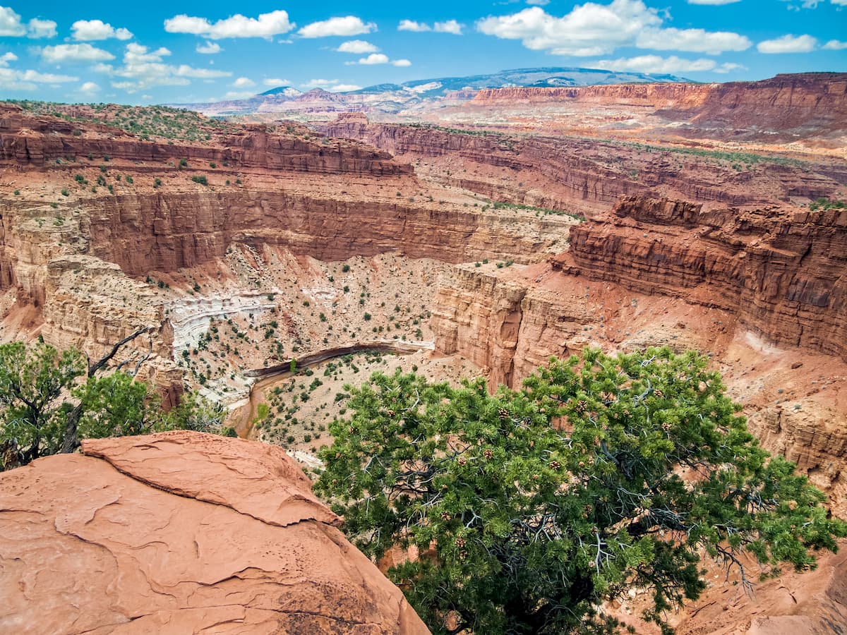
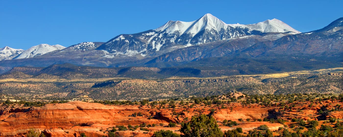
The Colorado Plateau is a massive physiographic province which is actually a series of plateaus, rather than one single plateau as the name might suggest. Most of the region experienced a period of uplift over a number of phases, the first phase of which is believed to have occurred some 80 to 50 million years ago.
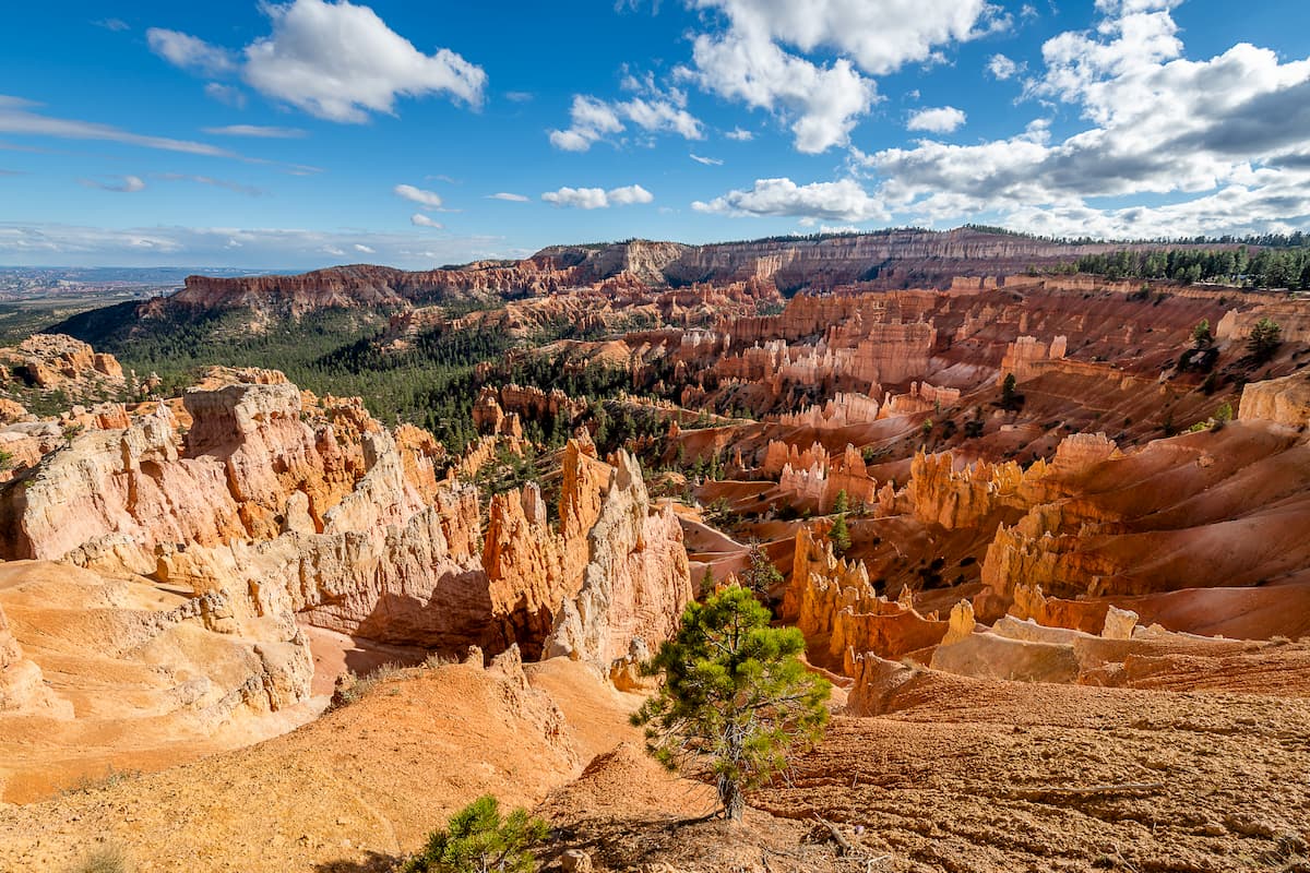
However, the most iconic part of the Colorado Plateau and, indeed, of the southern Utah desert is the stunning rocky formations that are scattered around the landscape. This part of the state is the result of hundreds of millions of years worth of layered sedimentary rock which has been eroded away by wind and water over time to create the features that we see today, including buttes, mesas, towers, arches, and steep canyons.
Indeed, all of Utah’s national parks are located within the Colorado Plateau region of the state, a testament to the area’s natural beauty.
Major peaks in the Colorado Plateau region of Utah include Mount Peale, Mount Ellen Peak, Mount Tukuhnikivatz, Mount Waas, Mount Tomasaki, and Manns Peak.
Within the state of Utah, the ecology and physiography of the region are intertwined. Indeed, the 3 primary regions of the state are defined by their own ecoregion, each of which is home to a unique mix of flora and fauna.
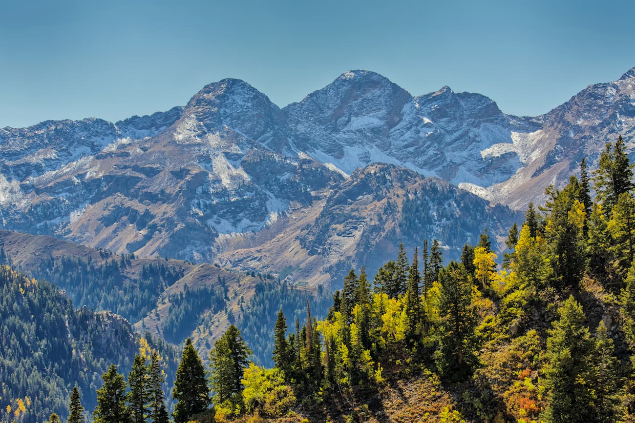
The aptly named Wasatch and Uinta Montane Forests are found almost exclusively within the Wasatch and Uinta mountain ranges. They happen to be some of the driest forests in the Rockies, though you can still find some stunning woodlands in this region.
Most of the forests within these ranges are comprised of ponderosa pine, lodgepole pine, Rocky Mountain Douglas fir, subalpine fir, and quaking aspen.
You can also find plenty of wildlife in the region, including mountain lions, mountain goats, black bears, foxes, weasels, badgers, bighorn sheep, mule deer, moose, elk, and, infrequently, grey wolves.
Within the Colorado Plateau region of Utah, the landscape is mostly desert and shrublands with isolated communities of woodlands at higher elevations or in riparian areas.
Much of the most arid parts of the landscape are dominated by grasses, shrubs, and sagebrush while the hottest and driest regions are home to various succulents. Meanwhile, the woodlands in the area are mostly pinyon pine and juniper, with the exception of the highly mountainous regions, which contain stands of lodgepole pine, ponderosa pine, and quaking aspen.
Wildlife in the area includes bobcats, mountain lions, coyotes, mule deer, elk, and pronghorn, as well as a great array of birds and reptiles.

In the western part of Utah, the landscape is part of the Central Basin and Range ecoregion, which is similar to what’s found in central Nevada. This part of the state is hot and arid, much like the Colorado Plateau Shrublands to the east.
Indeed, much of the lowest elevations of western Utah are shrublands though you can find pinyon pine and juniper woodlands at higher elevations. Major wildlife species (particularly mammals) are also similar between this ecoregion and that of the Colorado Plateau.
The area that is now called Utah has a long and storied history of human inhabitation that dates back millenia. Countless peoples have lived in this region over the millenia and many groups consider it to be part of their ancestral homelands.
Some of the many groups which have ties to this land include the Shoshone Bannock, the Eastern Shoshone, the Goshute, the Southern Paiute, the Ute, the Puebloans, the Hopi, and the Navajo.
Among the first Europeans to venture into what would later be called Utah were led by the Spaniard Francisco Vázquez de Coronado, who came in the 1540s in search of Cíbola, a mythical city of gold. Over 2 centuries later, the Domínguez-Escalante expedition traveled through the region in the 1700s in an attempt to find a route to California.
Not long after, fur traders from a number of different European countries made their way into the mountains of Utah in search of valuable furs to sell to wealthy individuals and companies in their home countries. In fact, the city of Provo was named for one of these fur traders, the French-Canadian Étienne Provost, who traveled extensively around the region.
Although the Great Salt Lake was certainly well-known to the many Indigenous peoples of the region long before the arrival of Europeans, there is some debate over whether Provost or another fur trapper, Jim Bridger, was the first European to sight the lake in the 1800s. Regardless of which European saw the lake first, though, the sighting started a frenzy of activity in the region and encouraged thousands of immigrants to settle in the area in the 19th century.
Perhaps the most famous group of immigrants to the state of Utah, however, were the Mormons and their slaves, who first arrived in the state in 1847 under the lead of Brigham Young. Technically speaking, Utah was part of Mexico’s territory when the first settlers arrived in the region, though the Mexican-American War and the Treaty of Guadalupe Hidalgo transferred the territory to the US.
Mormon settlers in the region quickly established themselves and turned Utah inot a popular destination for others of their faith. Indeed, Utah continues to have the largest population of Mormons in the United States and the world with some 2 million of the country’s 6.5 million LDS members living in the state.
Over the years Utah’s economy has relied heavily on agriculture, mining, and petroleum production, however, the region’s dense concentration of outdoor recreation areas and ski resorts has led to a massive increase in tourism. In the Wasatch Front area, both finance and information technology are rapidly growing economic sectors.
Utah is a true outdoor recreation paradise, with everything from snow capped mountains to raging rivers and high desert landscapes. With 5 national parks, 7 national monuments, 6 national forests, and 2 national recreation areas, there’s plenty to see and do in the Beehive State. Here are some of the most popular areas to check out:
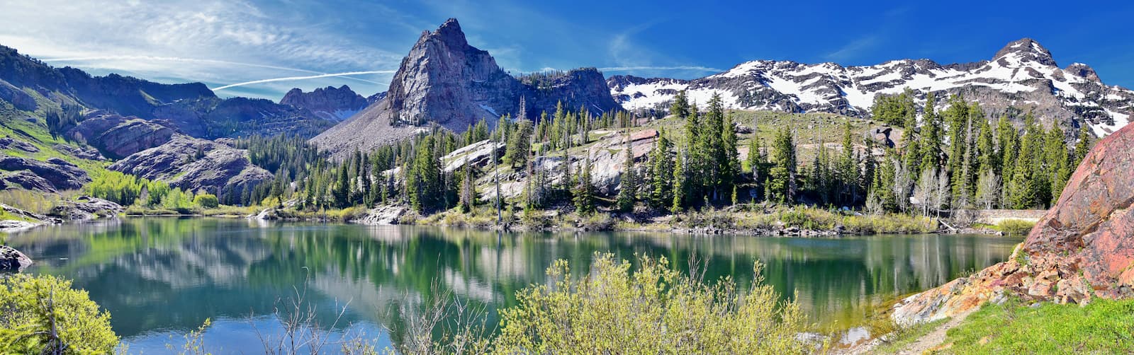
The Twin Peaks Wilderness Area offers over 11,000 acres of wilderness for hiking, backpacking, and rock climbing. Due to its proximity to Salt Lake City and the rest of the Wasatch Front, the wilderness’ narrow canyons and towering peaks are highly popular among locals and visitors, alike.
Notable peaks in this area include Twin Peaks, Mount Superior, and Dromedary Peak.
Popular hiking trails include the Lake Blanche Trail, a 6-mile round trip trail that meanders through aspen trees and offers views of the quartzite mountains and Sundial Peak, and the Sunset Peak trail, a 4.2-mile out and back trail that features panoramic views of Brighton Lakes, Mount Timpanogos, and Big Cottonwood Canyon.
The Uinta Mountains are Utah’s hidden gem. Located just outside of Park City, adventurous visitors can backpack to Kings Peak, Utah’s tallest mountain, via a 28-mile infrequently traversed trail, or take the 6-mile hike to Amethyst Basin and spend the afternoon taking in views of Ostler Peak soaring over a beautiful alpine meadow.
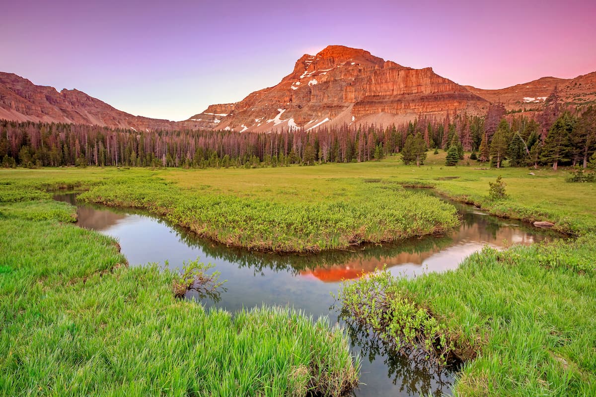
Other notable hiking trails in the Uinta Mountains include Red Castle, Island Lake, and Ibantik Lake. With a variety of trails to choose from, visitors are sure to get their fill of alpine scenery and towering mountain peaks in the Uinta Mountains.
Arches National Park is one of the most popular areas in Utah for hiking, biking, and exploring Utah’s unique sandstone rock formations. The park contains 7 named mountains, the highest of which is Elephant Butte. Other notable high points include the Tower of Babel and Sheep Rock.
Home to the world’s highest concentration of natural sandstone arches, visitors to Arches National Park can enjoy a variety of hiking trails that traverse awe-inspiring pinnacles, bright red balancing rocks, and over 2,000 unique natural arches.
Delicate Arch is one of the most iconic landmarks in the state of Utah and a must-see for anyone visiting the park. Visitors can hike 3-miles of challenging terrain to get right beneath the arch or view the arch from two easily accessible viewpoints.
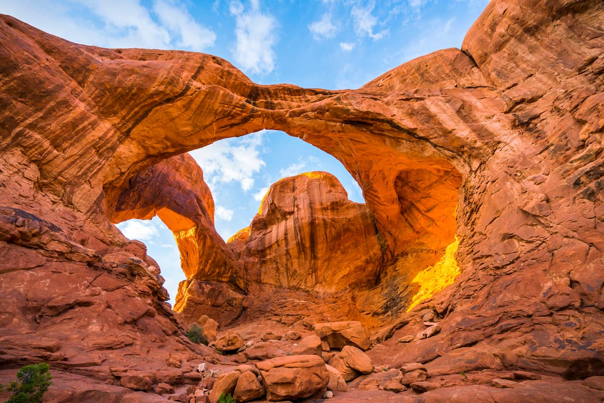
Other popular hiking trails include the Double Arch trail and Park Avenue trail. Visitors can also opt for a scenic drive through the park, where several accessible pullouts overlook beautiful scenic vistas and other notable landmarks.
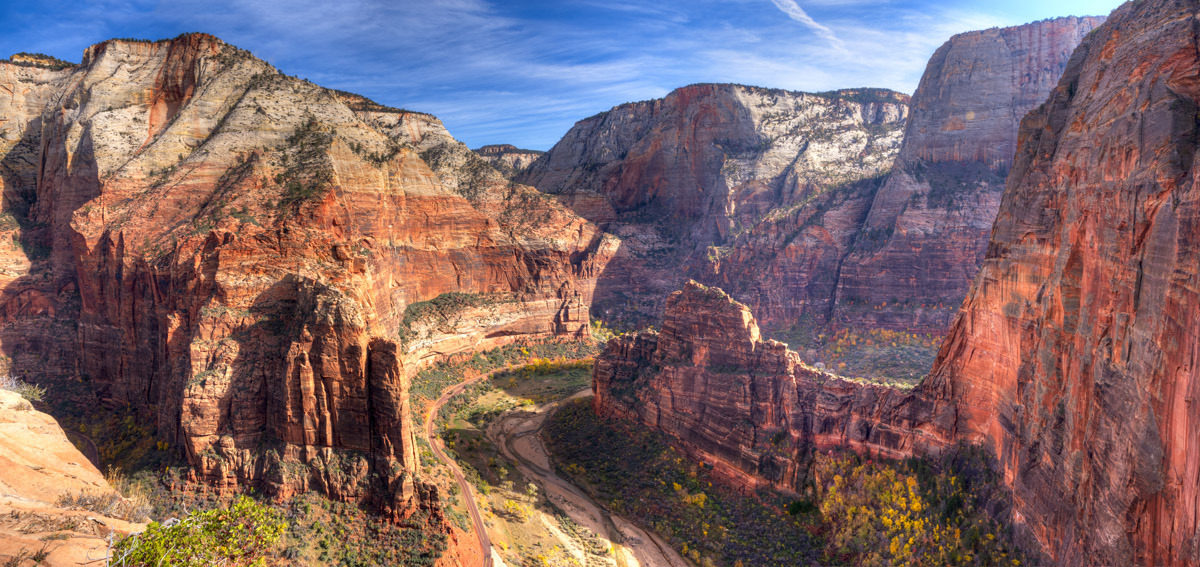
Zion National Park is another must-see National Park in Utah that features beautiful sandstone cliffs, narrow slot canyons, and a wide array of scenic trails. The park contains 80 named summits, the highest of which is Horse Ranch Mountain and the most prominent of which is The West Temple.
It is known for being highly accessible as most of the park’s most popular trailheads are located along the Zion Canyon Scenic Drive. Instead of driving, visitors can also hop on the free Zion Canyon Shuttle, which stops periodically to allow visitors to jump on and off at various trailheads.
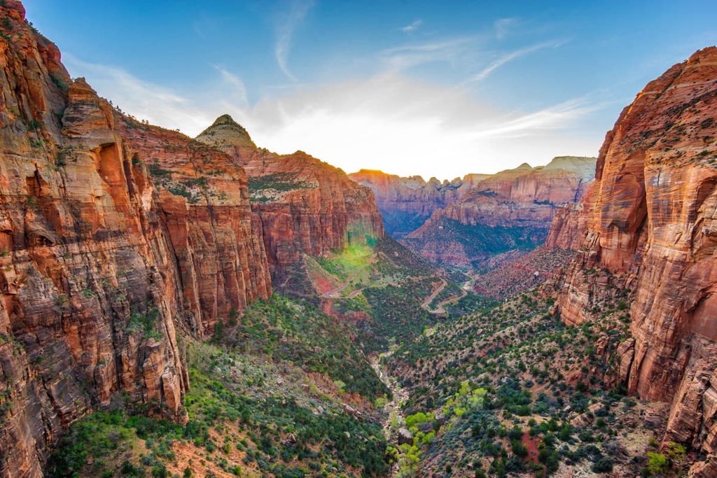
The most notable trails in Zion include the Canyon Overlook Trail, a 1-mile hike that offers views of Pine Creek slot canyon, Angel’s Landing, a strenuous hike to the most iconic landmark in the park, and the Narrows, which traverses the Virgin River as it flows through a slot canyon.
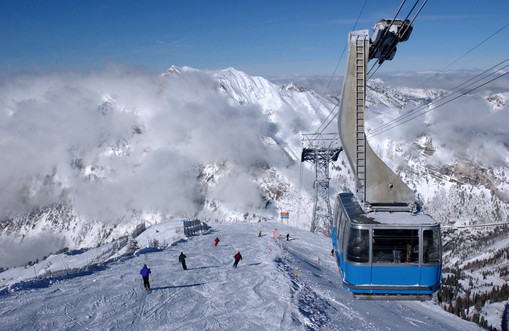
For skiing and snowboarding enthusiasts, there are more than 20 ski resorts in Utah.
The largest ski resorts near Salt Lake City on the north of the state are also the largest in its entire territory. These are Park City Mountain Ski Resort with more than 250 km (155 mi) of slopes and 42 ski lifts; Deer Valley Ski Resort, Snowbird Mountain Ski Resort, and Alta Ski Resort with more than 100 km (62 mi) of slopes and more than 10 ski lifts each; and Brighton Ski Resort and Solitude Mountain Ski Resort with more than 60 km (37 mi) of slopes and more than 5 ski lifts.
There are also two large ski resorts in the south of Utah: Brian Head (70+ km / 43+ mi of slopes) and Eagle Point (20+ km / 12+ mi of slopes), as well as one to the north of Salt Lake City—Powder Mountain (135+ km / 84+ mi of slopes). Each of them has more than 5 ski lifts.
Check the Utah ski resorts map and the larger USA ski resorts map in the World Mountain Lifts section of the site. It includes information about open ski lifts / slopes in Utah in real-time with opening dates and hours. There are also year-round cable cars, funiculars, cog railways, aerial tramways, and all other types of mountain lifts.
Looking for a place to stay in Utah? Here are some of the best cities to check out:
Visitors looking to experience a vibrant city while visiting the Utah mountains, will likely find themselves in Salt Lake City. Nestled in the Wasatch Front, Salt Lake City is an ideal place to stay to experience Wasatch Mountains’ many hiking trails.
In addition to providing visitors easy access to outdoor recreation, there are four world-renowned elegant ski resorts located just 30 minutes from downtown Salt Lake City: Alta, Snowbird, Brighton, and Solitude.

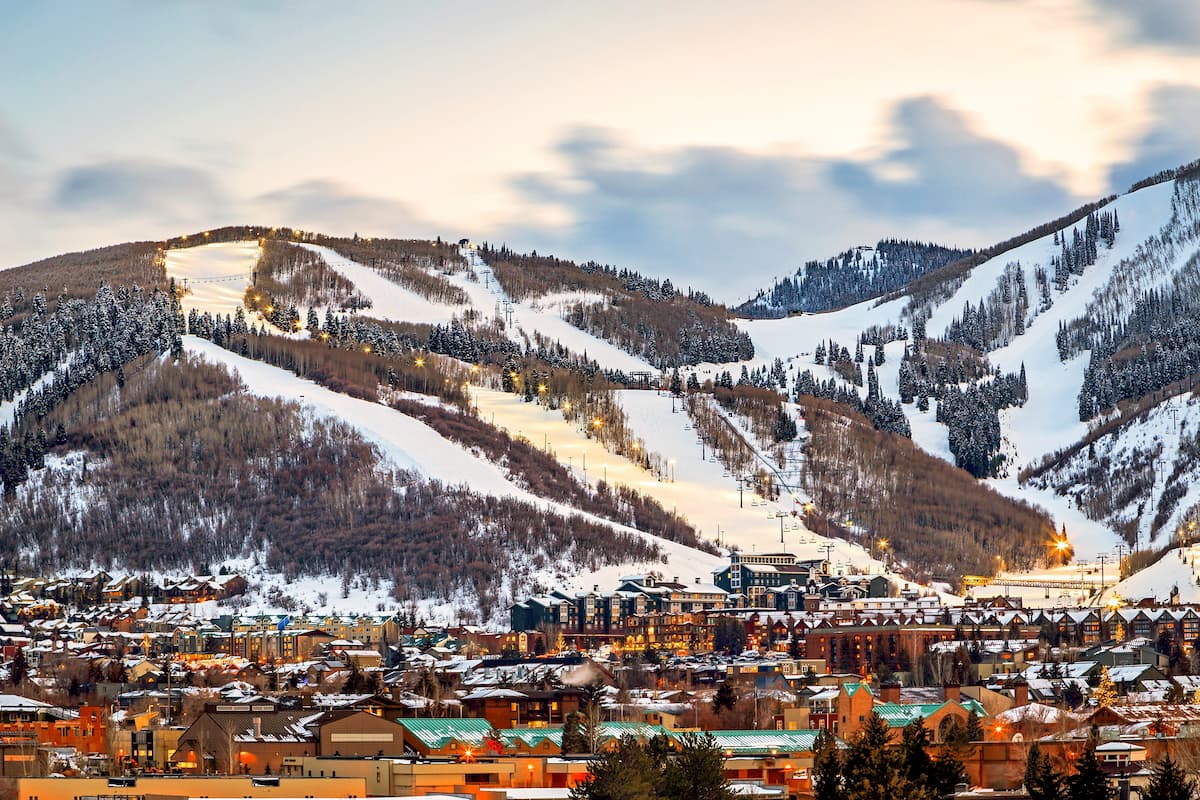
Park City is known for its world-class skiing, the Sundance Film Festival, and for hosting the 2002 Winter Olympics. Although Park City is commonly considered a ski town, it also offers over 400 miles of hiking trails, a variety of quaint boutiques and galleries.
The city is also home to two of Utah’s most notable resorts: Park City Mountain and Deer Valley Resort. Moreover, it is a perfect starting location for visitors who hope to experience the Twin Peaks Wilderness or Wasatch Mountains State Park.
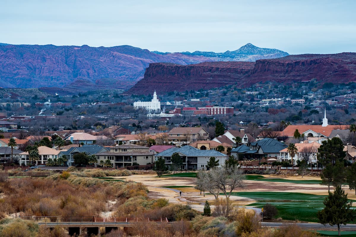
Located just outside of Zion National Park, St. George is known as the link between three geographical regions: the Mojave Desert, Colorado Plateau, and Great Basin.
In addition to its close proximity to Zion National Park, St. George is also a short distance from Bryce Canyon National Park, Snow Canyon State Park, Grand Canyon National Park, Grand Staircase-Escalante National Monument, and Vermilion Cliffs National Monument.


13er
ultra
utah-13ers
utah-ultras
13er
ultra
utah-13ers
utah-ultras
ultra
western-state-climbers
western-state-climbers-star
great-basin
great-basin-star
utah-ultras
Yes. Utah has 3,442 named mountains. The highest is Kings Peak at 4,123 m.
The highest mountain in Utah is Kings Peak, at 4,123 m.
Utah has 3,442 named mountains.


