
Scan the QR code and open PeakVisor on your phone
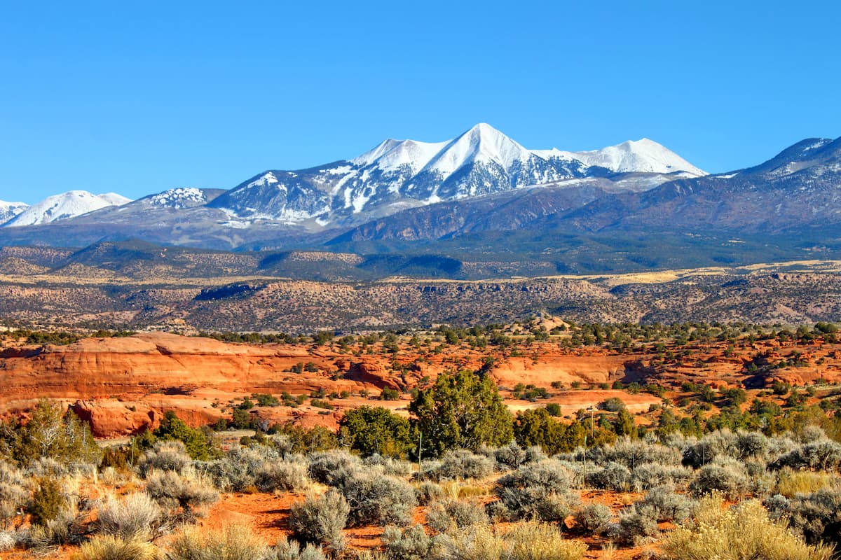
One of the region’s most topographically diverse national forests, Manti-La Sal National Forest encompasses a wide swath of mountainous and desert terrain in the central and eastern parts of the US state of Utah and the westernmost part of the state of Colorado. The forest includes 143 named mountains, the highest and most prominent of which is Mount Peale (12,720ft/3,877m).
Manti-La Sal National Forest covers an area of around 1.2 million acres (485,000 ha) in the southeastern and central parts of Utah as well as a small section of western Colorado. It is included within Sevier, Sanpete, San Juan, Emery, Carbon, and Grand counties in Utah, as well as Montrose and Mesa counties in Colorado.
Due to the forest’s size and number of non-contiguous land parcels, it is divided up into 5 ranger districts and 3 divisions: the Ferron and Price Ranger Districts, the Sanpete Ranger District, and the Moab/Monticello Ranger District. These areas are each home to their own unique geographical features and mountain ranges.
The Ferron and Price Ranger Districts cover the central part of the Manti-La Sal National Forest along the main crest of the Wasatch Range of the Western Rocky Mountains between Highway 10 to the east and Highway 89 to the west.
These ranger districts are located within a highly mountainous part of the state of Utah to the south of the Uinta-Wasatch-Cache National Forest and the Ashley National Forest. They are also situated to the north of the Fishlake National Forest.
Moreover, the Ferron and Price Ranger Districts are located to the west of the Sanpete Ranger District and to the east of the Desolation Canyon Wilderness, the Turtle Canyon Wilderness, the Sids Mountain Wilderness, and the Mexican Mountain Wilderness.
Located to the west of the Ferron and Price Ranger Districts, the Sanpete Ranger district includes the westernmost part of Manti-La Sal National Forest in and around Maple Canyon near the town of Ephraim.
This region encompasses some of the southernmost reaches of the Wasatch Range of the Western Rocky Mountains. It is located to the south of the Mount Nebo Wilderness Area of the Uinta-Wasatch-Cache National Forest and to the east of Scofield State Park and Ashley National Forest. Moreover, it is situated just a short distance to the north of the Fishlake National Forest.
Perhaps the most geographically diverse part of the Manti-La Sal National Forest, the Moab and Monticello Ranger Districts encompass a major part of the southeastern corner of Utah as well as a small section of western Colorado. As the name of the districts suggest, they are located near the towns of Moab and Monticello in 2 non-contiguous sections.
The Moab Ranger District is situated just to the southeast of the town of Moab and includes the small section that’s also in Colorado. It covers nearly all of the La Sal Mountains of the Colorado Plateau.
This area is to the southeast of Arches National Park, Behind the Rocks Wilderness Study Area, Mill Creek Canyon Wilderness Study Area, Grandstaff Canyon Wilderness Study Area, and Dead Horse Point State Park. It is also located to the west of the Dominguez-Escalante National Conservation Area, Uncompahgre National Forest, Grand Mesa National Forest, San Juan National Forest, and Gunnison National Forest.
Meanwhile, the Monticello Ranger District is located to the west of the town of Monticello. It is part of a major contiguous area of public land that also includes Grand Staircase-Escalante National Monument, Capitol Reef National Park, Vermilion Cliffs National Monument, and even land as far away as Grand Canyon National Park in Arizona.
Within the Monticello Ranger District, there are 2 primary mountain ranges: the Abajo Mountains and the Elk Ridge of the Colorado Plateau. The district also includes parts of the Bears Ears National Monument and the Dark Canyon Wilderness Area.
The Monticello Ranger District is located to the south of Canyonlands National Park and to the east of both the Glen Canyon National Recreation Area and the Fiddler Butte Wilderness Study Area.
It is also situated to the north of the Grand Gulch ISA Complex and the Road Canyon Wilderness Study Area as well as to the west of Canyons of the Ancients National Monument.
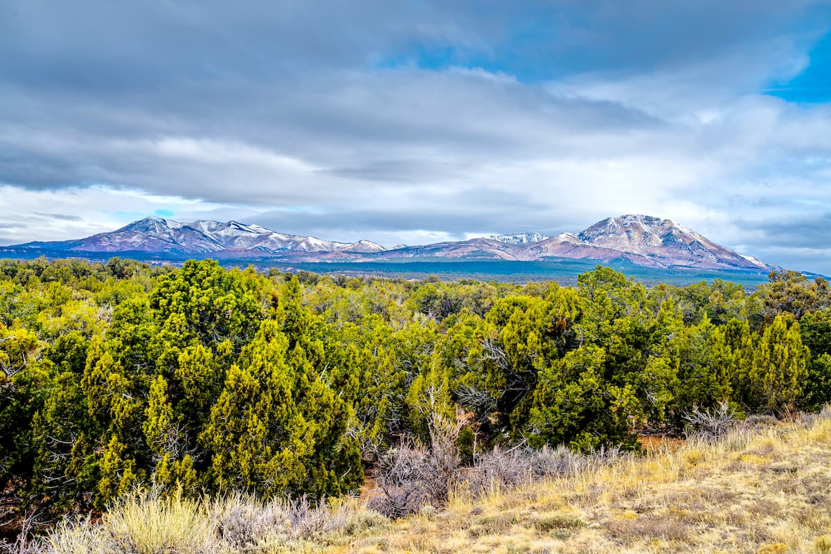
Within the sprawling Manti-La Sal National Forest, there are 2 primary geologic regions - the Western Rocky Mountains in the northern and western parts of the forest and the Colorado Plateau in the southern and eastern sections. Each of these regions has its own distinct geologic history which has shaped its landforms into what we see today.
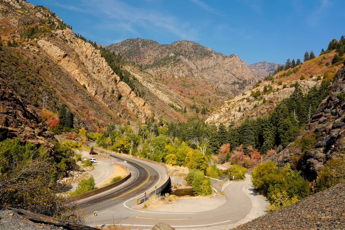
The Western Rocky Mountains stretch from southern Idaho and western Wyoming all the way through to central Utah. This mountain system includes a number of ranges, but the primary chain found in the Manti-La Sal National Forest is the Wasatch Range, which is included as part of the Sanpete, Ferron and Price Ranger Districts.
For the most part, the peaks within the Wasatch Range are geologically very young, having formed only within the last 12 to 17 million years. However, the rocks within the range are substantially older and are predominately sedimentary bedrock with a large number of igneous intrusions.
Major peaks in the Western Rocky Mountains section of the Manti-La Sal National Forest include Salt Creek Peak, South Tent Mountain, North Tent Mountain, Heliotrope Mountain, Lowry Top, Marys Nipple, Mount Baldy, and High Top.
In stark contrast to the Western Rocky Mountains in the western part of the Manti-La Sal National Forest, the eastern and southern regions of the forest are part of the Colorado Plateau. The Colorado Plateau is a massive physiographic region that includes much of southeastern Utah, western Colorado, northwestern New Mexico, and northern Arizona, as well as a small part of Nevada.
This region is home to a substantial number of mountain ranges and plateaus, the vast majority of which are drained by tributaries, like the Green River, which ultimately feed into the Colorado River that empties into the Gulf of California near Baja California in Mexico.
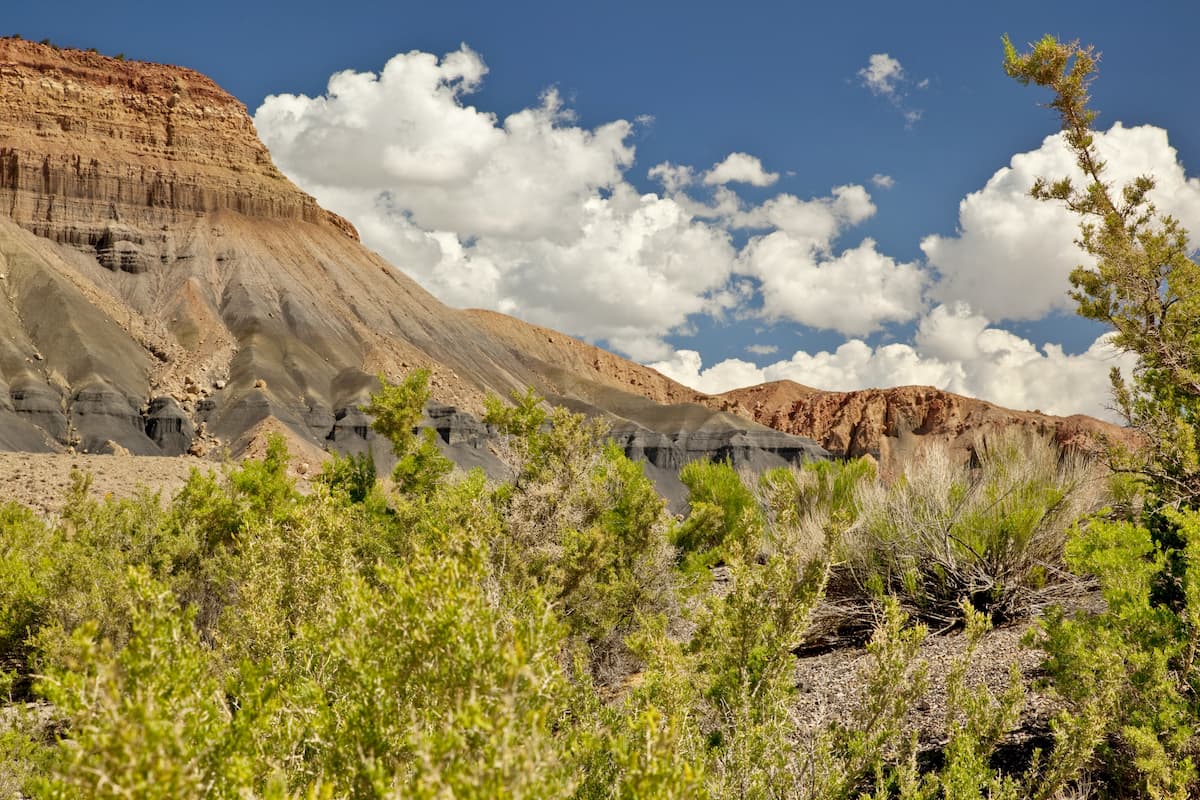
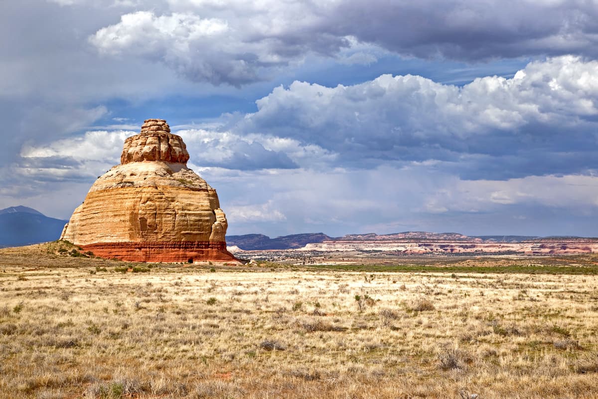
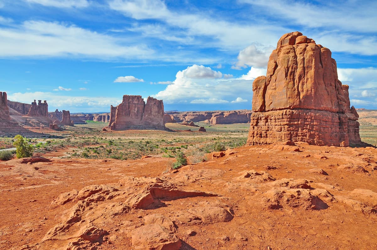
Throughout the Colorado Plateau, the bedrock is predominantly sedimentary. This area is particularly well-known for its mesas, canyons, buttes, arches, and other similar features that are typical of desert regions.
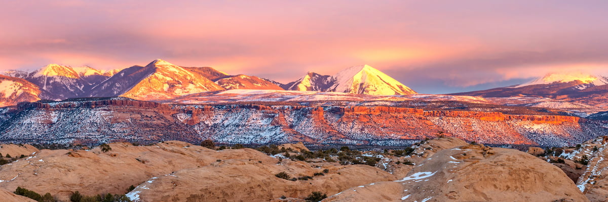
However, the Colorado Plateau section of the Manti-La Sal National Forest also includes the La Sal Mountains, the Abajo Mountains, and the Elk Ridge.
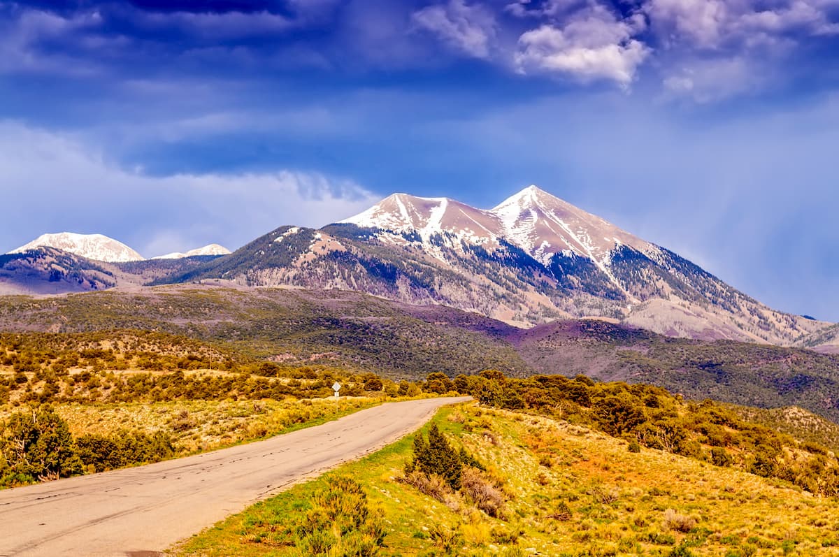
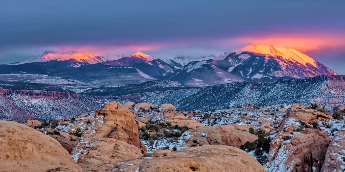
In particular, the La Sal Mountains are among the tallest and most prominent mountains in the state of Utah. This range is found within the Moab Ranger District just to the south of the town of Moab and it is known for its stunning beauty.
The La Sal Mountains are a bit of an anomaly in the region, however, because they are mostly igneous in origin, unlike the rest of the Colorado Plateau, which is mostly sedimentary. Moreover, the Abajo Mountains (found in the Monticello Ranger District) to the south and west of the La Sal Mountains are also the result of a widespread igneous intrusion.
That being said, while the northernmost parts of the Monticello and Moab Ranger Districts are part of the La Sal and Abajo Mountains, the southern and western portions are dominated by canyon country. This region includes parts of the famous Bears Ears National Monument and the Dark Canyon Wilderness Area, both of which are home to some truly stunning sandstone formations and canyons.
Major peaks in the Colorado Plateau region of the Manti-La Sal National Monument include Mount Peale, Mount Mellenthin, Mount Tukuhnikivatz, Mount Wass, Abajo Peak, and Manns Peak.
Manti-La Sal National Forest is home to a fantastic array of flora and fauna. Much like its geology, the ecology in the forest roughly follows the boundaries of its primary physiographic regions - the Western Rocky Mountains and the Colorado Plateau.
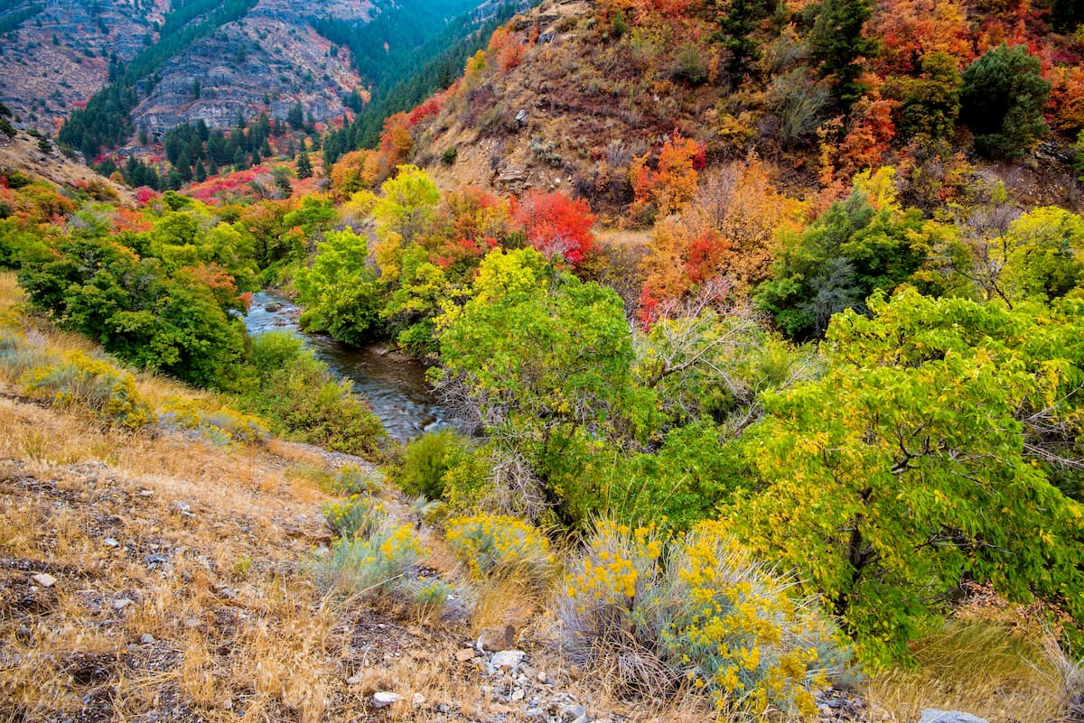
In the Western Rocky Mountains region of the Manti-La Sal National Forest, which is dominated by the Wasatch Range, the land is generally part of the Wasatch and Uinta Montane Forests ecoregion.
This ecoregion is among the driest in the Rocky Mountains, however there are some fairly large areas of coniferous forest at higher elevations. Some of the many tree species that can be found in this part of Manti-La Sal include Rocky Mountain Douglas fir, Engelmann spruce, subalpine fir, lodgepole pine, and quaking aspen.
Wildlife in the Wasatch Range section of the forest includes bighorn sheep, mountain goats, mule deer, moose, elk, black bears, foxes, mountain lions, and, rarely, grey wolves.
Most of the eastern and southern sections of the Manti-La Sal National Forest are part of the Colorado Plateau physiographic region. A sizable portion of this area is also part of an ecoregion called the Colorado Plateau Shrublands, which is home to 3 distinct plant communities.
The lowermost elevations in this ecoregion are arid grasslands and shrublands, where you can find sagebrush, grasses, and other shrubs. However, in the most arid parts of the forest, the landscape is only able to support drought-tolerant succulents and yucca.
Meanwhile, most of the mid-elevations of Manti-La Sal are home to stands of pinyon pine, juniper, mountain mahogany, and big sagebrush. If you venture even higher in this region, you’ll likely come across forests of quaking aspen and lodgepole pine.
That being said, the very highest sections of the Manti-La Sal National Forest, particularly in the La Sal Mountains, are home to stunning alpine ecosystems. These ecosystems are particularly abundant around the summits of Mount Peale, Mount Tukuhnikivatz, and Mount Mellenthin, where.
Here, you can find some beautiful and endemic plant species, including Besseya alpine, Eastwood’s podistera, and yellow dot saxifrage, which aren’t found anywhere else in the state of Utah except the La Sal Mountains.
As far as wildlife goes, the Colorado Plateau section of the Manti-La Sal National Forest boasts many of the same mammal species that you might find in the Wasatch Range, including mule deer, elk, moose, bighorn sheep, pronghorn, black bears, mountain lions, foxes, and coyotes.
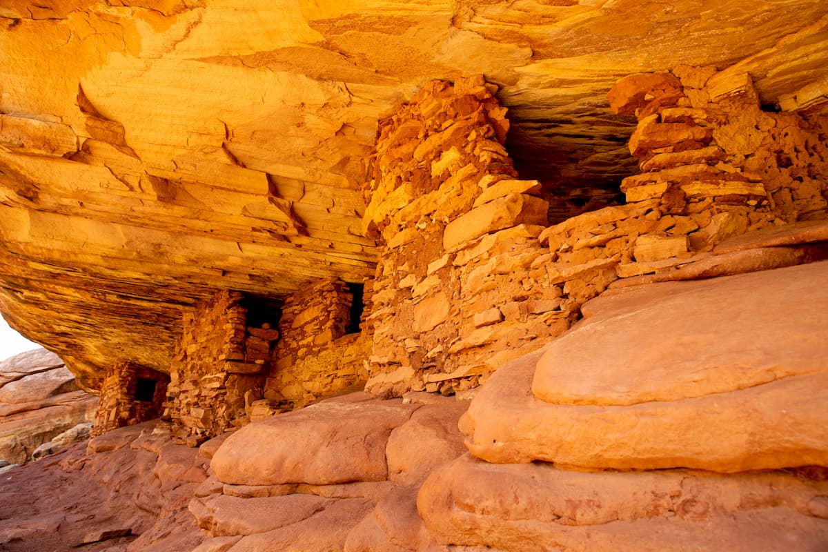
The entirety of the Manti-La Sal National Forest is located on land that has been inhabited for thousands of years. Indeed, the forest encompasses lands that are part of the traditional territory of many groups of people, including the Ute Mountain Ute Tribe, the Navajo Nation, the Ute Indian Tribe of the Uintah and Ouray Reservation, the Hopi Tribe, and the Pueblo of Zuni.
Many parts of the region, including the area in and around the drastically reduced current boundaries of the Bears Ears National Monument in the southern part of the Manti-La Sal National Forest, are also considered to be sacred.
Perhaps the first Europeans to visit the region that is now part of the Manti-La Sal National Forest were members of the 1776 Domínguez-Escalante Expedition. This Spanish expedition was meant to find an overland crossing between Santa Fe, New Mexico and Monterey, California.
During their travels, the expedition’s leaders, Silvestre Vélez de Escalante and Atanasio Domínguez ventured throughout what is now southern Utah, visiting many parts of what is now part of the Manti-La Sal National Forest.
More widespread settlement of the region by people of European descent, however, didn't start until nearly a century later. By the mid-1800s, a fairly large group of Mormon settlers, led by Brigham Young, established communities throughout the Wasatch Front area near the western part of the Manti-La Sal National Forest.
Not long after their arrival, in the late 1870s, Brigham young then sent another group of settlers to establish a town near the La Sal Mountains. These settlers were eventually successful in establishing the town of Moab, which is now a major destination for outdoor recreation in the region.
Interestingly, around the turn of the century, a group of local residents actually requested that the US Government establish a forest reserve around the southern part of the Wasatch Range. In 1903, President Theodore Roosevelt granted this request and officially designated the Manti Forest Reserve.
A few years later, in 1906, Roosevelt also established the La Sal Forest Reserve around the La Sal Mountains. Just one year after, the 2 reserves formally became National Forests after the establishment of the US Forest Service.
In 1915, the Nebo National Forest became part of the Manti National Forest, thereby expanding its boundaries. Manti National Forest and La Sal National Forest officially merged in 1949 and, funny enough, the forest service held a mock wedding at Joes Valley in 1950 to celebrate the merger. A forest ranger from Ephraim served as the groom and another from Moab served as the bride to officially create the Manti-La Sal National Forest.
Where exactly does the name “Manti-La Sal National Forest” come from, you might ask? Well, the name “Manti” comes from a city in the Book of Mormon and the name “La Sal” comes from the Spanish meaning “white salt.” It’s believed that early Spanish-speaking travelers in the region gave the La Sal Mountains their name because of their white summits, which reminded them of salt.
To this day, the Manti-La Sal National Forest remains a very popular, albeit remote in some areas, place to recreate in the state of Utah. That being said, in keeping with the forest service’s motto of “Land of Many Uses,” it’s important to note that the forest is open to permitted resource extraction. Indeed, the forest is actually the source of upwards of 85% of Utah’s coal production.
Keen visitors to the Manti-La Sal National Forest can easily find a lifetime’s worth of adventure to keep them busy. So, if you’re traveling to Manti-La Sal, here are some of the best places to check out:
Located in the westernmost part of the Manti-La Sal National Forest in the Sanpete Ranger District, Maple Canyon is one of central Utah’s premier outdoor recreation destinations.
The canyon itself is a world-class rock climbing location, thanks to its unique cobblestone cliffs. Unlike many other climbing areas in the region, Maple Canyon stays cool and comfortable in the middle of the summer, thanks to the narrow canyon walls, which offer plenty of shade.
Within this part of the national forest, there are even plenty of hiking opportunities, including the Maple Canyon Loop Trail and the Maple Canyon Arch Trail for those who’d rather keep both feet firmly planted on the ground. Plus, there’s also a large campground in the eastern part of the region, which makes for a great basecamp for your adventures.
The La Sal Mountains encompass the easternmost part of the Manti-La Sal National Forest. They are situated just to the southeast of the town of Utah and their lofty elevation provides quite a bit of reprieve from the desert heat during the summer months.
Although many visitors to Moab simply see the La Sal Mountains in the distance as they visit Arches National Park, the range is actually ripe with excellent hiking opportunities. There are plenty of great trails to check out in the La Sal Mountains, including a path up to the summit of Mount Peale, as well as the Gentry Canyon Trail, the Bull Pasture Trail, and the Horse Canyon Trail.
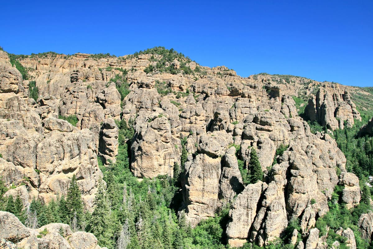
Located in the southwestern part of the Manti-La Sal National Forest, the Dark Canyon Wilderness encompasses 47,000 acres (19,000ha) of some of the most rugged terrain in the region. As the name suggests, the wilderness is centered on the Dark Canyon, which is a 40 mile (64km) long canyon with exceptionally steep sides that block out all but the mid-afternoon light.
Within the wilderness there are some truly stunning geologic formations, including massive sandstone towers and arches. Visitors can also find hanging gardens and some spectacular archaeological remains from the Ancestral Puebloans. However, it’s important to note that visitors are not allowed to remove archaeological remains from the area.
There are quite a few trailheads that lead into the Dark Canyon wilderness, but many of the region’s trails are quite difficult to follow. Popular trails, such as the Woodenshoe Trail, the Dark Canyon West Trail, and the Peavine Canyon Trail can even be combined to form a long 3 to 7 day backpacking loop through the canyon.
Looking for a place to stay during your visit to the Manti-La Sal National Forest? Here are some of the best cities and towns to check out:
The town of Moab, Utah is home to about 5,000 residents and is located just to the northwest of the Moab and Monticello Ranger Districts. Moab is also situated right outside both Arches and Canyonlands National Parks, so it’s an ideal place to stay if you’re looking to see a lot of the state’s southeastern corner.
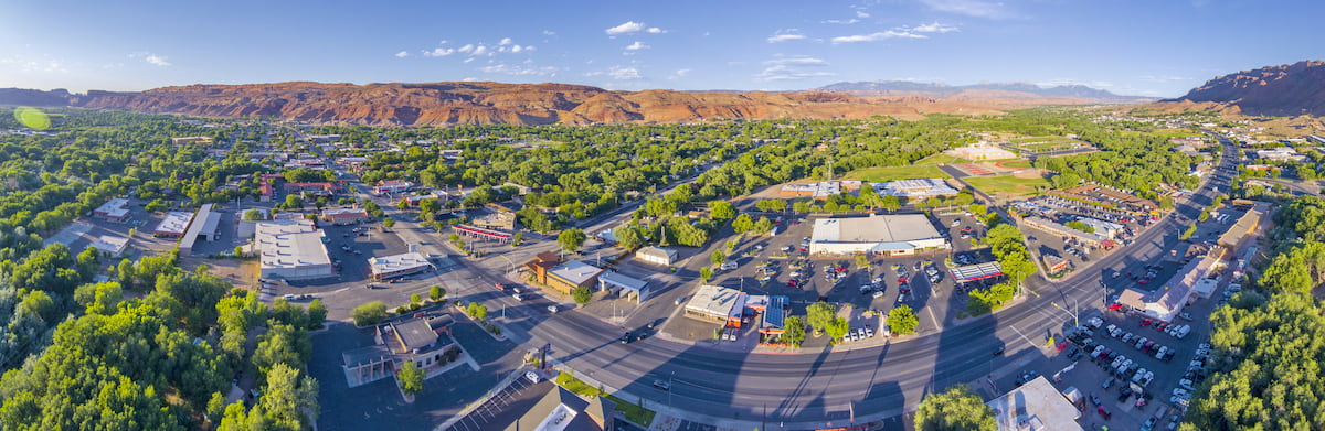
In the town of Moab, you can find plenty of gerat restaurants, shops, campgrounds, outdoor gear stores, and cafes. The town also has a small airport, which offers regular service to Denver.
Nestled within the Juab Valley just to the west of the Wasatch Mountains, the town of Nephi is a community of some 5,000 people right outside of Maple Canyon. The town itself is fairly small, though it has some great restaurants and plenty of hotels for visitors to check out. Nephi is also easy to get to by road on I-15 from Salt Lake City, so it’s the perfect stopping point before you head into the Manti-La Sal National Forest.
The capital and largest city in Utah, Salt Lake City is home to about 200,000 residents who live just at the base of the Wasatch Range. Although the city is a decent drive away from Manti-La Sal, its size and status as a transportation hub help cement it as a solid place to stay before you travel south into the forest. Salt Lake City is also a good place to stay if you also want to visit the Uinta-Wasatch-Cache National Forest.


