
Scan the QR code and open PeakVisor on your phone
Located in Southeastern Utah, near the town of Moab, Canyonlands National Park is a vast swath of land dedicated to protecting the colorful canyon-filled landscape surrounding the Colorado and Green Rivers. Canyonlands National Park is divided into three distinct sections, Island in the Sky, the Needles, and The Maze, each with their own unique characteristics.
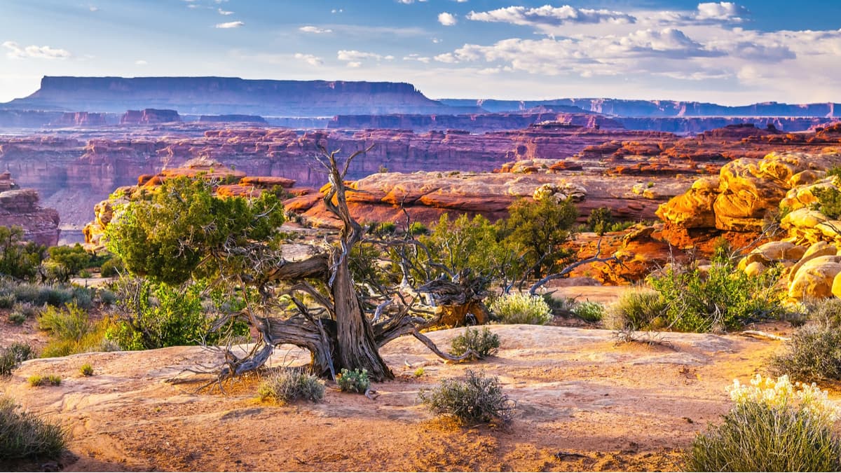
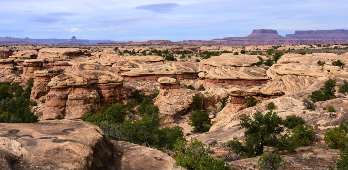
Although the park is best known for its canyons, the Needles District is home to 7 named mountains, the highest and most prominent of which is Cedar Mesa. Geologically, the park was carved out from sandstone, thanks to the erosion powers of the mighty Colorado and Green Rivers, whose intersecting paths create the three districts within Canyonlands.
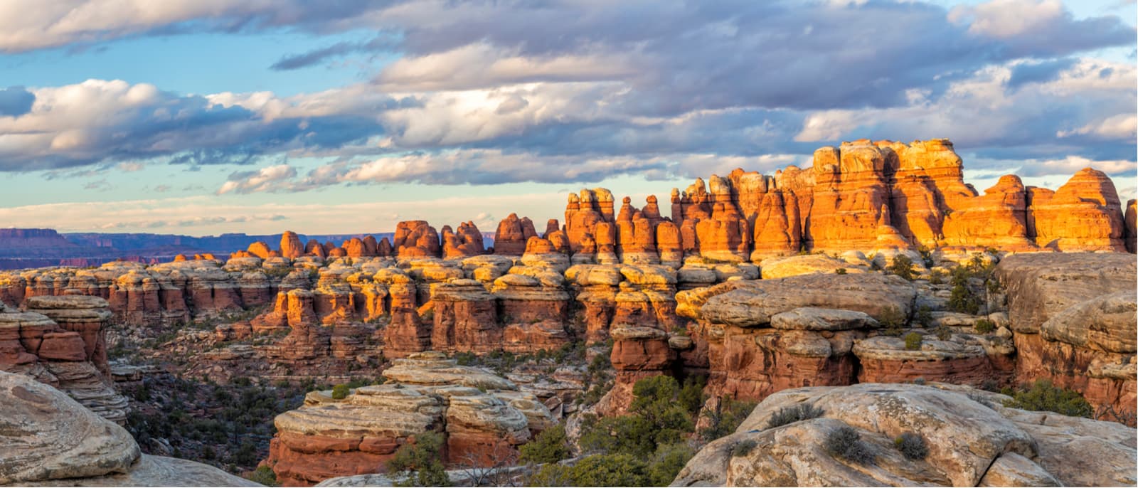
The Needles District is situated just south of the Island in the Sky District. Bordered to the west by the Colorado River, the Needles District gets its name from the rocky pinnacles that are abundant within the area. The Needles are also known for their sculpted rock formations, such as grabens, potholes, and arches, however, most of the arches within Canyonlands are quite remote and require a long hike or four-wheel drive trip to see.
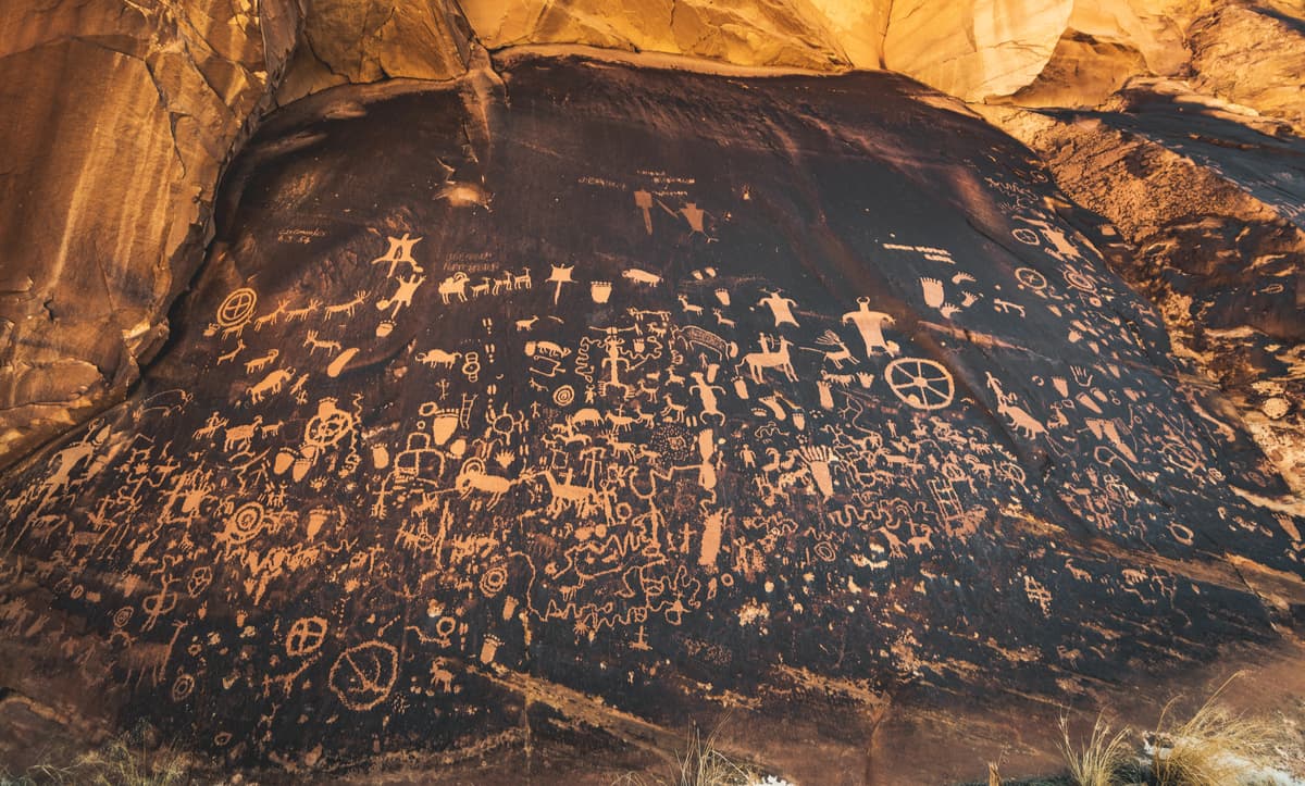
Historically, the region of Canyonlands was home to the Ancestral Puebloans, who lived in the area for millennia inside stone and mud dwellings. Many of these dwellings are fantastically well preserved, though the original tools and other artifacts have mostly been removed over the centuries by looters and other visitors. Other evidence of the Ancestral Puebloans includes their prolific rock art, which can be seen in the form of petroglyphs around Canyonlands National Park, especially on Newspaper Rock along the access road to the Needles.
Despite its proximity to Moab, Utah, Canyonlands didn’t come onto the radar of the National Park Service until the 1950s when the then-superintendent of Arches National Park began traveling through the region to the south and west of Moab. Eventually, after many years of debate and questioning, Canyonlands officially became a national park when it was signed into law by President Johnson in 1964.
These days, the park sees a significant amount of visitors, who enjoy the region’s plentiful hiking, biking, backpacking, and four-wheeling opportunities. Unlike Island in the Sky, the Needles District is a bit more remote and, thus, sees fewer visitors. However, it accounts for nearly a quarter of the park’s visitors and is well worth the trek for the more adventurous among us.
Since it’s not as popular as Island in the Sky, the Needles has significantly fewer trails, but it still has about 60 miles of connected trails for your hiking adventures. Here are some of the best options:
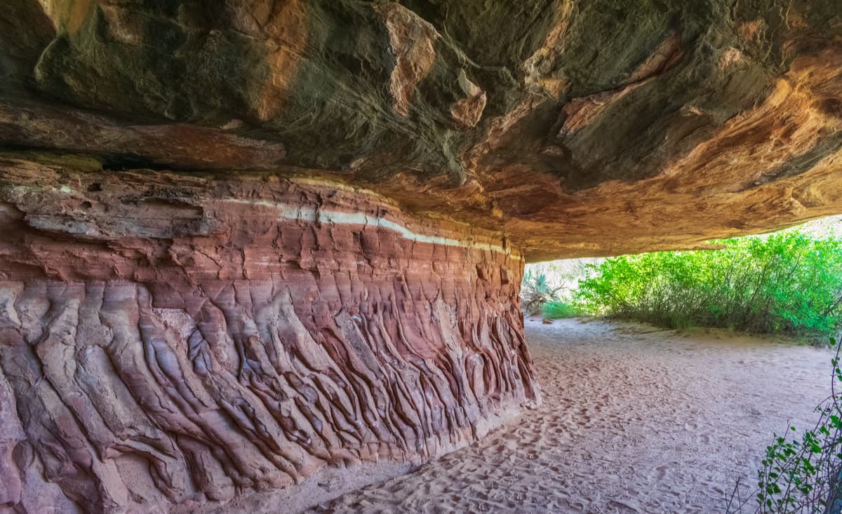
This 0.6 mile (1km) path takes you on a short loop to see an old cowboy camp and a selection of prehistoric rock paintings. Plus, it includes two short ladders to get you through the canyons for a bit of adventure.
Slickrock is a nice, 2.4 mile (4km) walk along a stunning trail with fantastic 360 degree views. There’s a geology guide available from the Visitors’ Center to educate you on your surroundings as you walk.
This strenuous 7.5 mile (12km) walk acts as a great introduction to the geology and landscape of the Needles District as it connects two canyons and takes you over varied terrain. However, the trail can be dangerous when wet and involves steep grades, which aren’t good for people with heights. But, there are two backpacking sites in each canyon for people looking for more adventure.
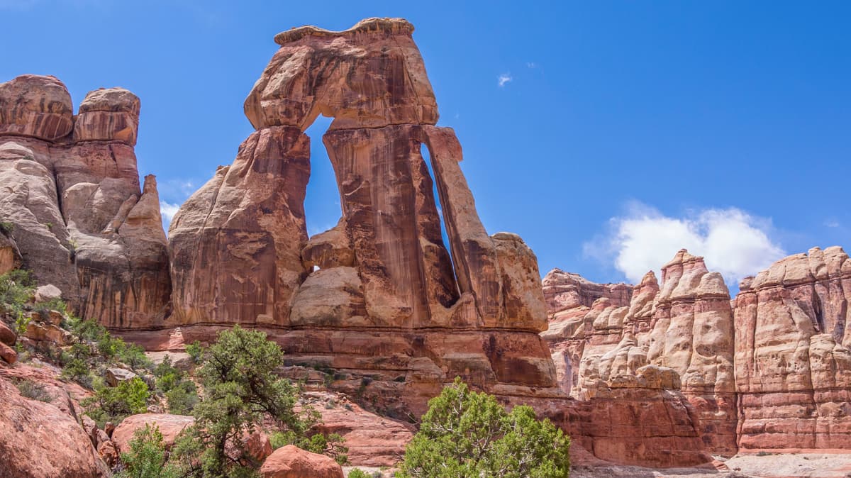
The Druid Arch trail has perhaps the best views in all of the Needles. This trail is 11 miles (18km) round trip and takes you through to see Elephant Canyon and involves some fun scrambling.
The Needles are slightly less accessible than Island in the Sky, but still aren’t too terribly far from some of the bigger towns in the area. Here are some nearby places to stay:
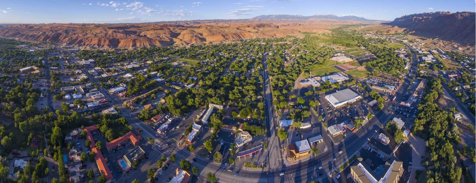
The town of Moab is the official gateway to Canyonlands National Park and is just a 1.5 hour drive to get to The Needles. Moab is home to plenty of hotels, campgrounds, restaurants, and outdoor gear shops, so you’ll find what you need in town. Plus, it’s just a 10-minute drive from Arches National Park and two hours from Capitol Reef, so what’s not to love?
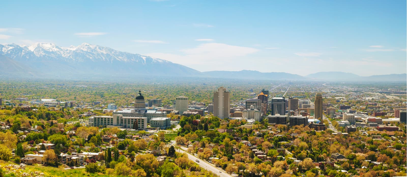
Just a five-hour drive north of Canyonlands’ Needles District, Salt Lake City is Utah’s largest city and is home to an international airport as well as an abundance of hotels, restaurants, and gear shops, so it’s a great place to start your adventures.


