Scan the QR code and open PeakVisor on your phone
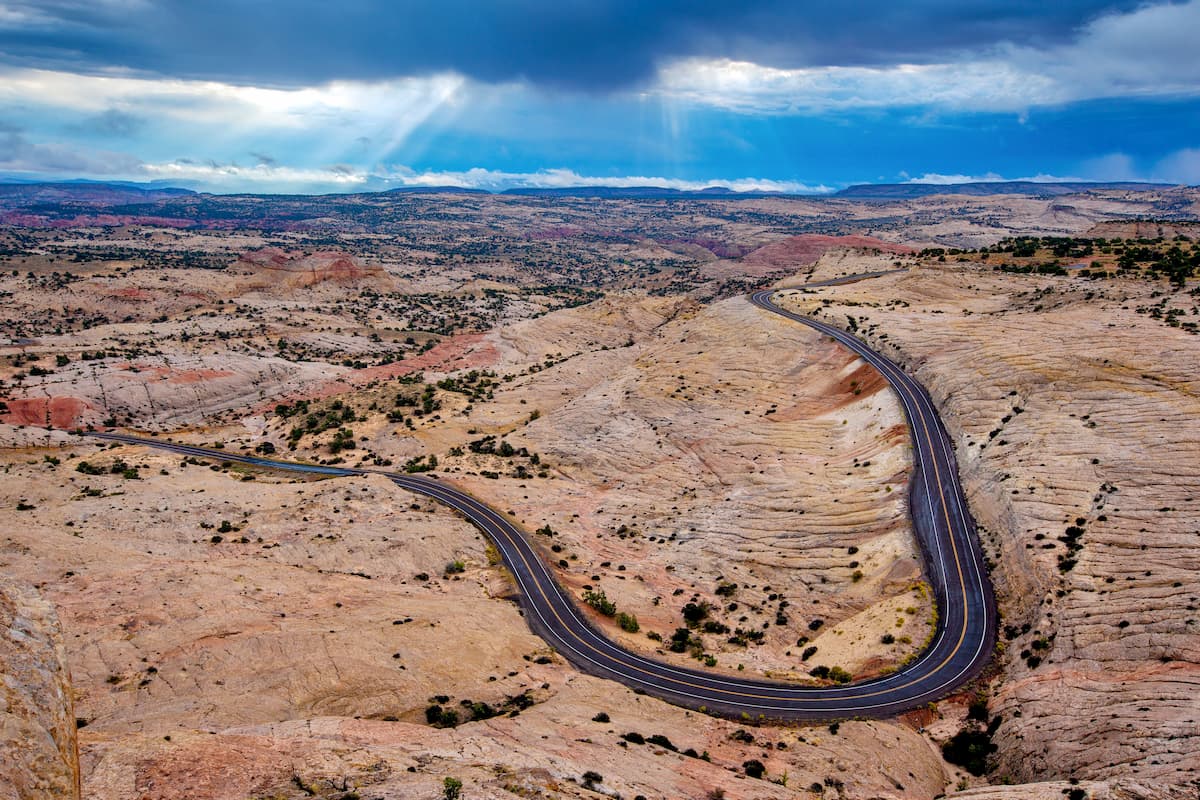
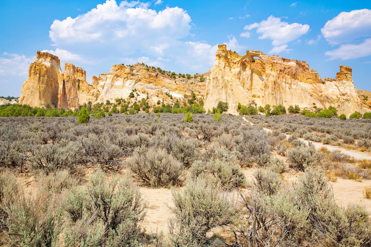
Containing some of the most remote land in the contiguous United States, the rugged canyons and stunning desert landscape of Grand Staircase-Escalante National Monument is a favorite destination of hikers, climbers, paddlers, and anglers in the southwestern part of the country.
The monument covers over 1 million acres (4,000 sq. km) of land in southern Utah and it contains 80 named high points, the tallest of which is The Blues (8,573ft/2,613m), and the most prominent of which is Cougar Knoll (7,608ft/2,319m).
Grand Staircase-Escalante National Monument includes a massive swath of land in southern Utah, along the state's border with Arizona.
It is managed by the Bureau of Land Management (BLM), which is an agency within the US Department of the Interior, alongside the US National Park Service. Interestingly, it was the first national monument to be managed by the BLM, as the majority of monuments are managed by the Park Service while some are managed by the US forest service.
When it was first established in 1996, Grand Staircase-Escalante National Monument contained over 1.8 million acres (7,600 sq. km) of land, which made it larger than all but 8 national parks in the country, trailing behind only Wrangell-St. Elias, Gates of the Arctic, Denali, Katmai, Death Valley, Glacier Bay, Lake Clark, and Yellowstone. Indeed, if it were a national park, Grand Staircase would've been the third largest in the contiguous United States.
However, Grand Staircase was reduced in size by just under 50% in 2017 by a presidential proclamation, leaving it at just barely over 1 million areas (4,000 square miles). These days, it is included mostly within Garfield County and Kane County.
The monument is located in a highly rugged part of Utah and it is surrounded by other major areas of public land.
This includes Vermilion Cliffs National Monument, Paria Canyon-Vermilion Cliffs Wilderness, and Grand Canyon National Park to the south.
Meanwhile, the monument is bordered to the east by the Glen Canyon National Recreation Area, the Manti-La Sal National Forest, Canyonlands National Park, and the Bears Ears National Monument, which is sacred to many Indigenous peoples, including the Navajo Nation, the Ute Indian Tribe, the Ute Mountain Ute Tribe, the Hopi Tribe, and the Pueblo of Zuni, among others.
The northern part of Grand Staircase-Escalante is located near Capitol Reef National Park, Goblin Valley State Park, the Box-Death Hollow Wilderness Area, the Phipps-Death Hollow Outstanding Natural Area, Fishlake National Forest, and the Dixie National Forest. Finally, the monument is situated to the east of Zion National Park and Bryce Canyon National Park.
Within Grand Staircase-Escalante, there are 3 primary regions, including: Kaiparowits Plateau/Basin in the center, Canyons of the Escalante to the east, and the Grand Staircase in the west. Each of these regions has its own distinct features and attractions. There are also 4 visitors centers in this massive monument, which are strategically located at Big Water, Kanab, Escalante, and Cannonville.
From a geological perspective, the entirety of Grand Staircase-Escalante National Monument is part of the Colorado Plateau, which is a huge physiographic province that covers much of Utah, Colorado, New Mexico, and Arizona.
Additionally, the northern part of the monument is part of the Aquarius Plateau. The monument is also located to the east of the Sevier Plateau, to the north of the Paria Plateau, and to the south of the Fish Lake Plateau. Meanwhile, there are some more mountain-like features to the west and north, including the Henry Mountains and Elk Ridge.
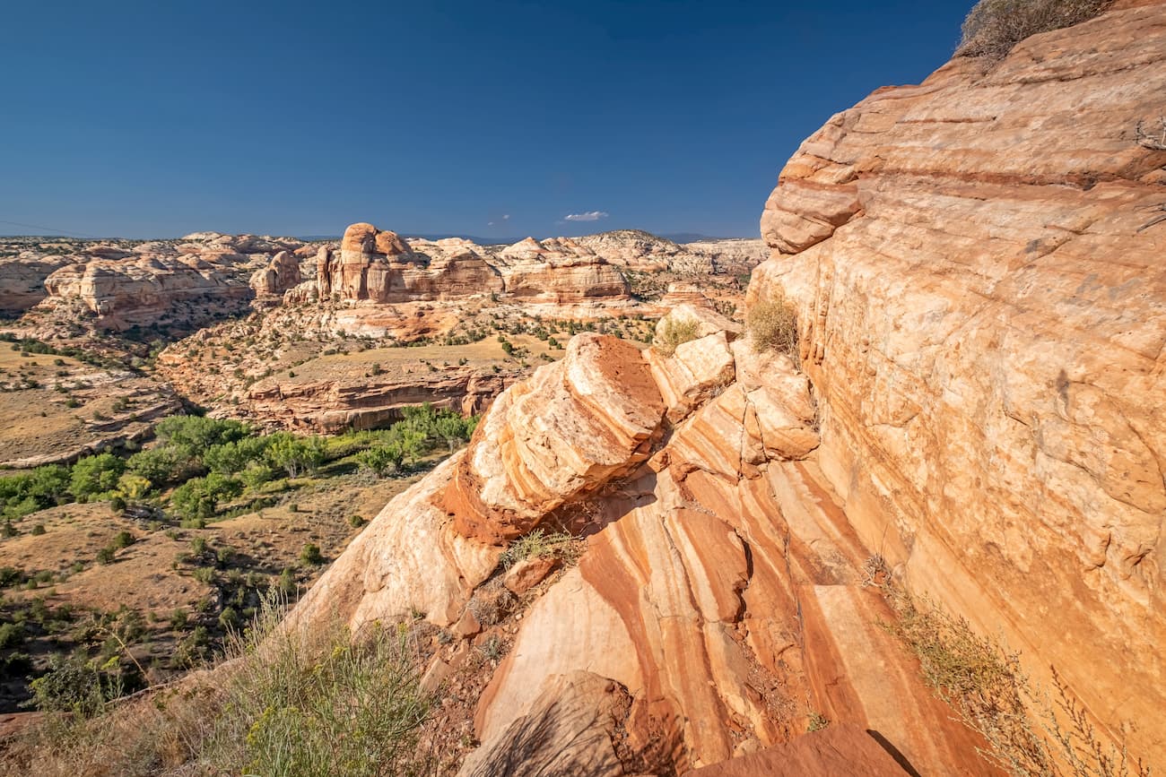
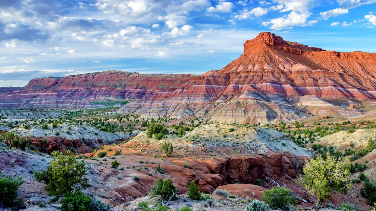
Grand Staircase-Escalante is home to a dizzying array of geologic features, including canyons, mesas, plateaus, spires, buttes, and cliffs.
Rocks in the monument vary substantially in age, with layers dating between the Permian and the Cretaceous. The majority of the rocks within Grand Staircase-Escalante, like much of the surrounding region, is sedimentary and dips generally to the north.
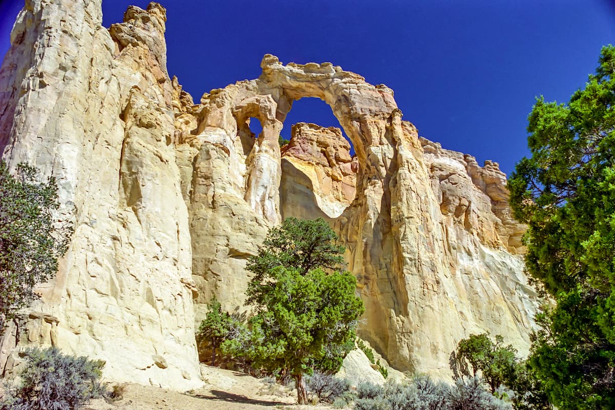
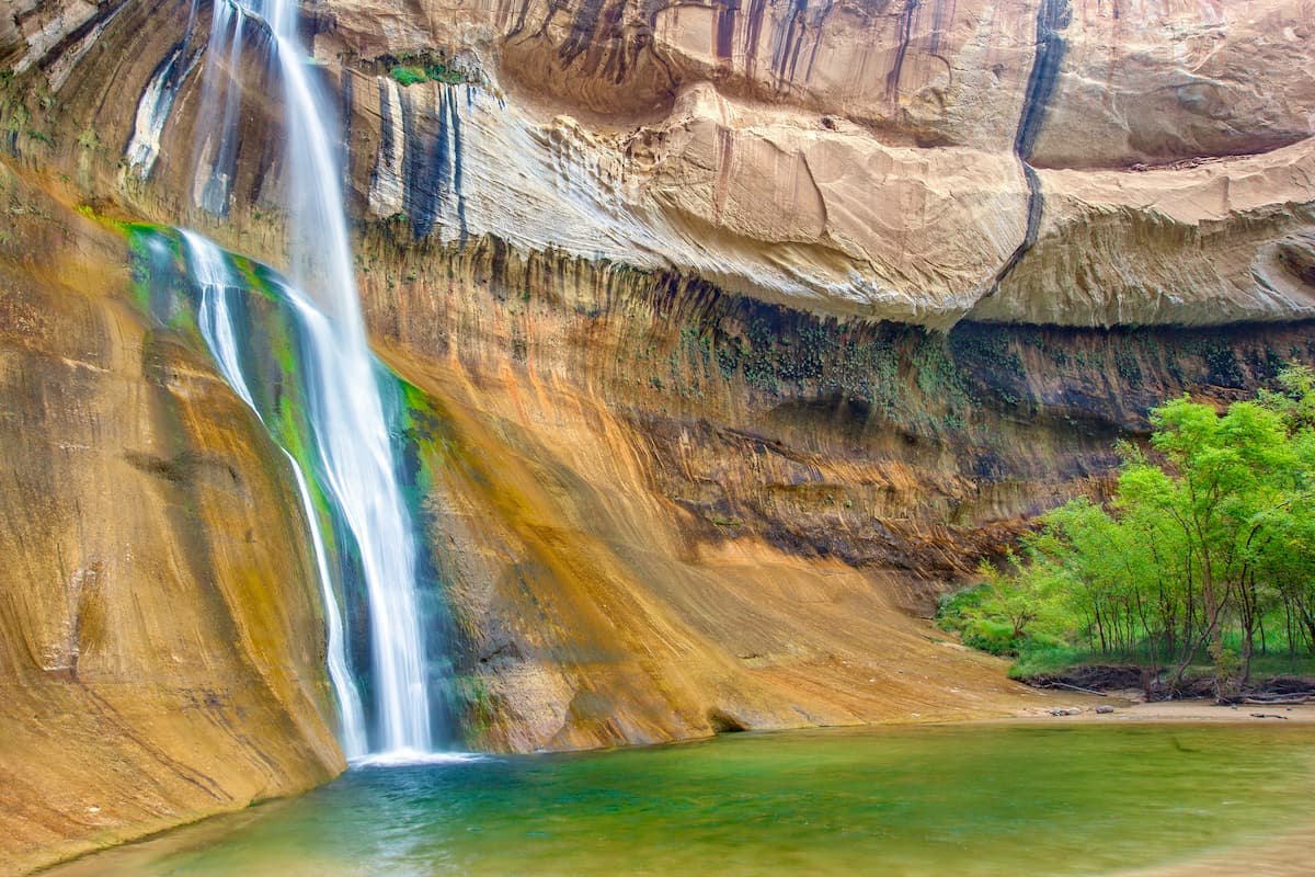
Within the monument, there are some especially exciting geologic features that visitors can see if they're willing to venture into the monument on foot. These include Grosvenor Arch, Buckskin Gulch, Calf Creek Falls, Devils Garden, and Circle Cliffs.
There are some substantial coal, gas, oil, and mineral reserves within the monument. However, mining and resource extraction has never been overwhelmingly viable in the region due to the remoteness of much of the monument.
Moreover, multiple dinosaur fossils have been located within Grand Staircase-Escalante over the years. Some of the most notable findings include the Gryposaurus monumentensis, the Lythronax argestes, and the Diabloceratops eatoni. The first of these dinosaurs is believed to have lived around 75 million years ago and it has been found in a number of different locales, including in Alberta, Canada and in Texas.
Major high points within Grand Staircase-Escalante National Monument include Cougar Knoll, Mollies Nipple, Deer Point, Timber Mountain, Deer Spring Point, No Mans Mesa, and Deer Range Point.
Despite its arid climate, Grand Staircase-Escalante is a veritable treasure trove of ecological diversity. In fact, the monument is home to hundreds of species of plants and animals, some of which are endemic to the area.
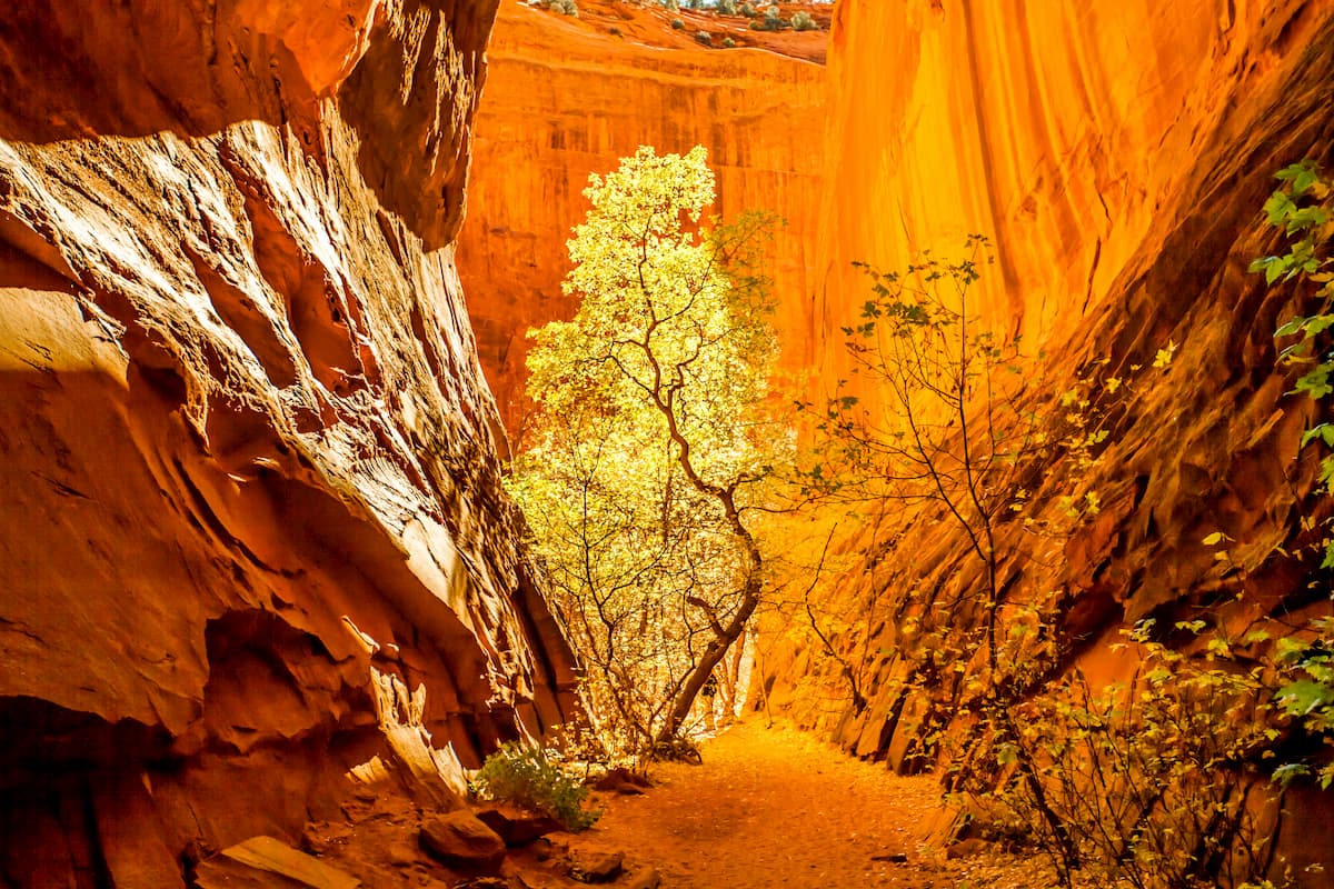
In the riparian canyon areas around the region's major rivers, one can often fund horsetails, rushes, sedges, rabbitbrush, cacti, yuccas, Indian paintbrush, and slatbrush, as well as Fremont cottonwood. Meanwhile, at higher elevations, stands of ash, pine, gamber oak, juniper, and pinyon pines are fairly common.
The monument is home to hundreds of species of birds, reptiles, amphibians, and mammals, some of the most notable of which include mountain lions, desert bighorn sheet, mule deer, pronghorns, elk, black bear, coyotes, and bobcats.
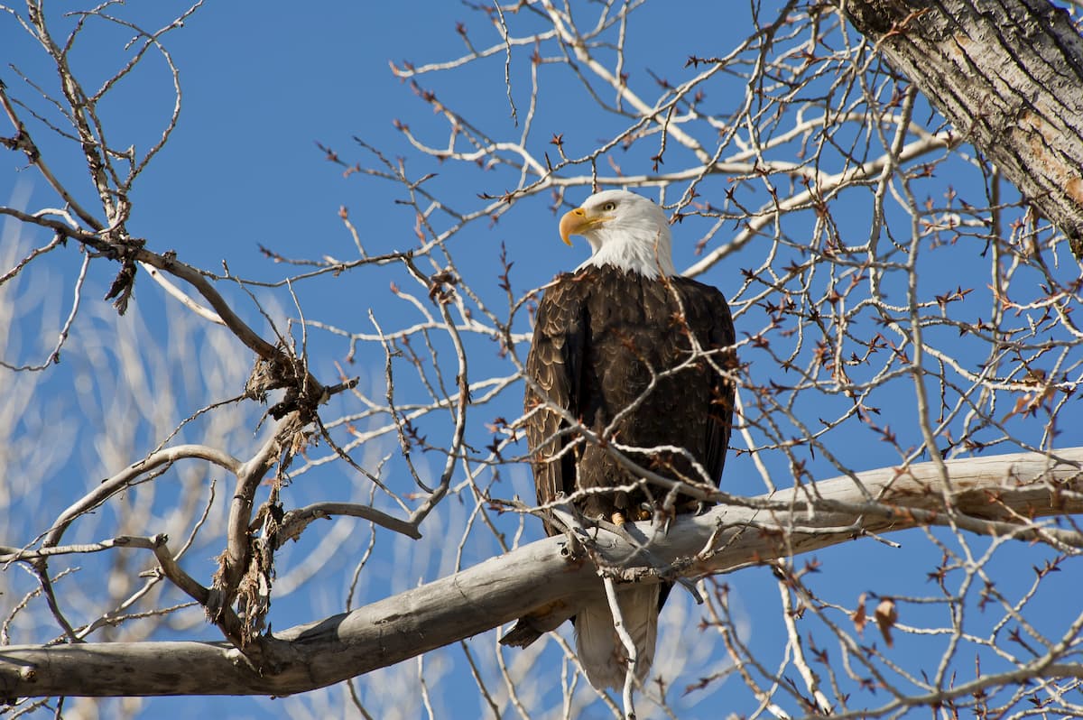
Some of the most exciting bird species that you can see in Grand Staircase-Escalante include bald eagles, California condor, peregrine falcons, and the southwestern willow flycatcher. Meanwhile, the tiger salamander California kingsnake, the red spotted toad, and the long-lived desert tortoise also call this rugged landscape home.
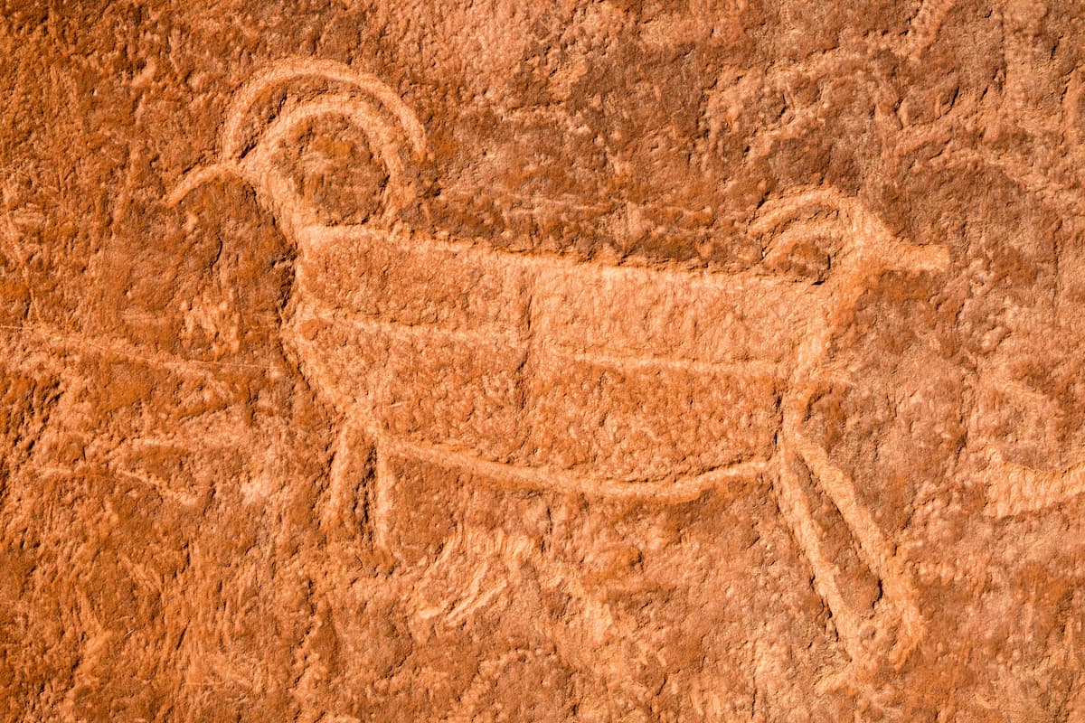
Grand Staircase-Escalante National Monument has long been home to humans. Thousands of years before it was ever designated as a national monument, the region was home to the people of the Fremont culture and Ancestral Puebloans, as well as the Southern Paiute, the Pueblo people, the Ute, and their ancestors, among countless others.
Perhaps the first people of European descent to visit the region were Captain James Andrus and his men, who traveled down the headwaters of the Escalante in the 1860s. Not long afterward, John Wesley Powell's second expedition floated past the region as they traveled through Glen Canyon.
However, it wasn't until Powerll sent one member of his party to search for the Dirty Devil River that they realized that they were not, in fact, in the canyon of the Dirty Devil but in the canyon of a river that they gave the English language name Escalante. They named the river after Friar Silvestre Vélez de Escalante, who traveled the Glen Canyon in the 1770s with Francisco Antasio Domínguez on the Domínguez-Escalante expedition.
In the latter part of the 19th century, settlers established 2 primary towns in the region - Escalante and Boulder. Both towns have a long history of ranching, farming, mining, and logging which continues to this day. However, both towns are very remote and Boulder, in particular, was one of the last towns in the contiguous US to receive road access and electricity.
In 1903, much of the upper portions of the Escalante River and its associated canyons were included within the boundaries of Aquarius National Forest. The forest was initially established in 1903 as a forest reserve and it was renamed Powell National Forest before being transferred to Dixie National Forest in 1944.
However, during this time, the portion of the monument that was within Dixie National Forest and the other portion which was on BLM land weren't overly well known for their scenic beauty. It took decades until the region was officially recognized for its natural and cultural significance and it was officially designated as a national monument in 1996 by President Bill Clinton.
In 2017, the Grand Staircase-Escalante was reduced in size by over 800,000 acres (3,240 sq. km), or just under 50% of its total land area by President Donald Trump. The executive order also decreased the size of the nearby Bears Ears National Monument, however, the move was controversial, in part because it is unclear if the Antiquities Act allows for the reduction of national monuments.
It was argued in the executive order that both monuments were larger than necessary for the protection of the scientific, cultural, and natural resources that it contained and there was a move to open up more of the land for private use. This move was contested in court by many, including the Navajo Nation, for whom the land in and around Bears Ears and Grand Staircase-Escalante National Monuments is sacred.
Grand Staircase-Escalante National Monument covers a huge swath of land, much of which is accessible only on foot. While there are quite a few hiking trails in the monument, there is a seemingly unlimited amount of adventure waiting to be had for those willing to venture further afield. Here are some of the most popular hikes to check out in the monument:
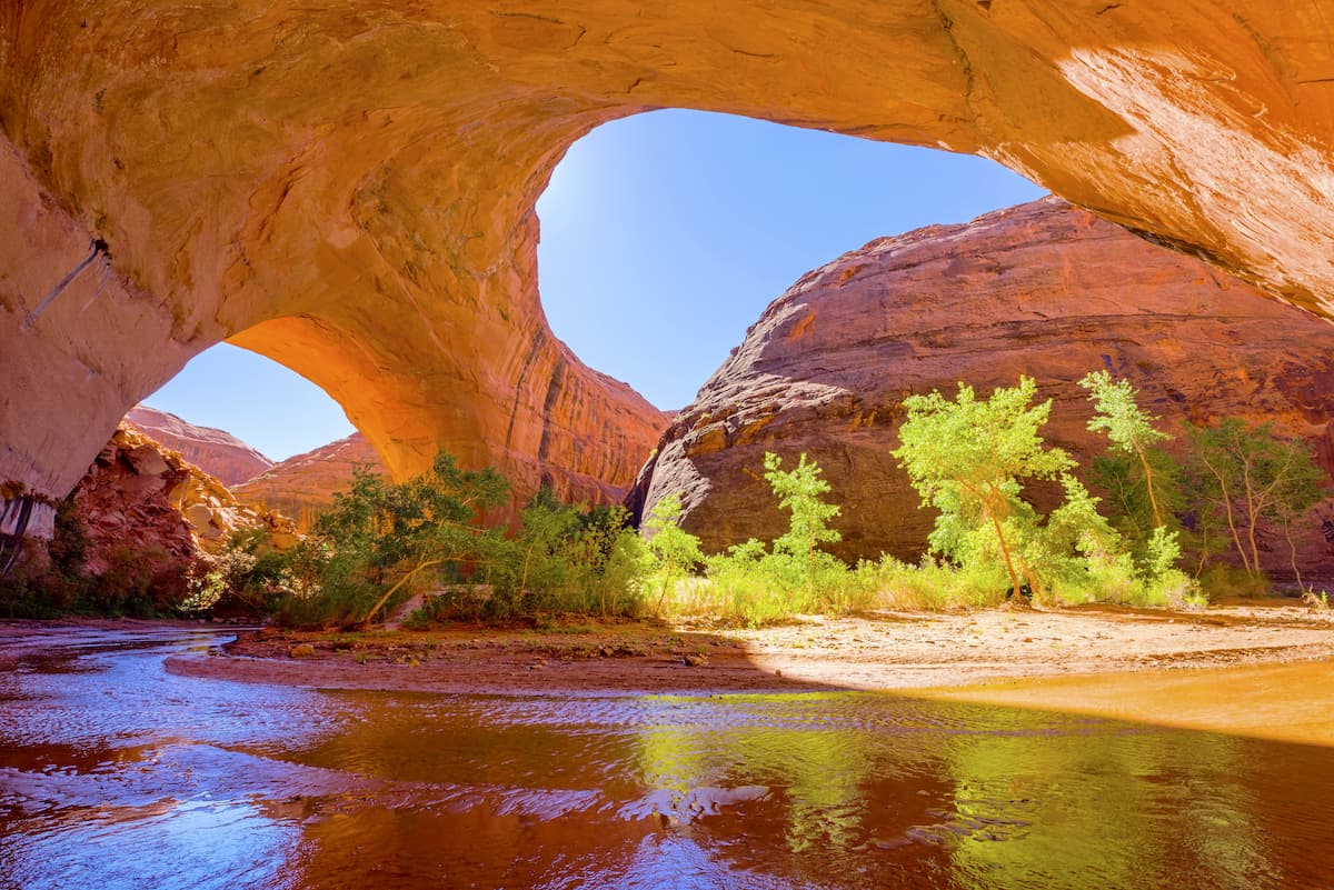
This 4.4 mile (7.1km) hike from the Escalante River Trailhead takes you to see the beautiful Escalante Natural Bridge, a large sandstone arch that rises up dramatically from the wooded landscape below. Keep in mind, though, that you will need to complete quite a few river crossings on the hike, however, you will also get a chance to see some fantastic cultural sites, including rock arch and a cliff dwelling.
Starting out near the Calf Creek Campground, the 6 mile (9.7km) hike to Lower Calf Creek Falls is particularly popular. The trail offers some excellent opportunities to see rock art as well as the 126' (38m) tall Lower Calf Creek Falls, which empties out into a small pool that makes for an excellent swimming spot in the summer months.
Perhaps the most famous of hikes in Grand Staircase-Escalante, Coyote Gulch is an superb option if you're looking to spend a few nights in the monument's backcountry. Technically speaking, most people start their trip into Coyote Gulch from Glen Canyon National Recreation Area, but you can travel deep into the moenument's canyon country if you're willing to go on an adventure.

Permits are required to backpack in Coyote Gulch and can be obtained in the town of Escalante at the Escalante Interagency Visitor Center. On the other hand, day hikes do not require a permit.
It's important to note that the gulch is prone to flash floods, just like most places in canyon country. So, keep a lookout for rapidly changing water and weather conditions and be sure that you know what to do if a flash flood were to strike.
Getting to Grand Staircase-Escalante requires a bit of driving, but there are quite a few towns and cities nearby that make for good starting points for your adventures. Here are some of the best places to visit during your trip.
Kanab is situated at the southeastern edge of Grand Staircase-Escalante National Monument near Utah's border with Arizona and with the reservation of the Kaibab Paiute Tribe. The town is home to approximately 5,000 residents and it is a great starting point for adventures in southern Utah and northern Arizona.
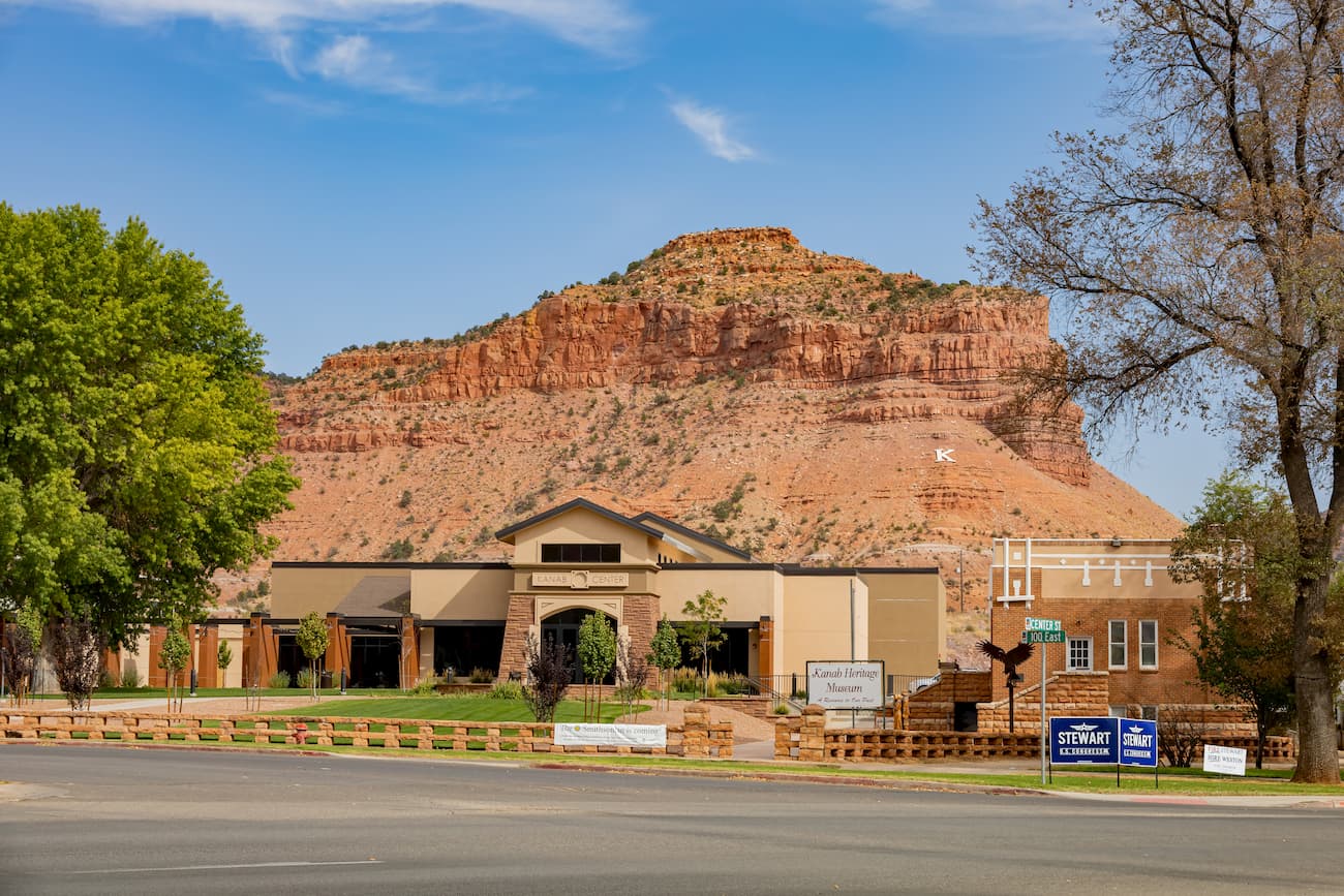
In fact, Kanab is within driving distance of Grand Staircase-Escalante, Vermilion Cliffs National Monument, Grand Canyon National Park, Bryce Canyon National Park, Zion National Park, and Pipe Spring National Monument. The town is accessible by road only, though it is just 1.5 hours from St. George.
The town of Escalante is home to just about 800 people, however, its location on the edge of Grand Staircase-Escalante make it an excellent place to visit. Escalante has become a fairly popular tourist destination, as many of the monument's visitors stop by the town. Access to the town is only available by road, but it is 3 hours from St. George and just under 5 hours from Salt Lake City.
Moab is located in eastern Utah, about a 4 hour drive from the town of Escalante and the northern part of the monument. While Moab is a good distance away from Grand Staircase-Escalante, it's popularity as an outdoor recreation destination and its proximity to both Arches and Canyonlands National Parks make it a popular hub area for southern Utah adventures.
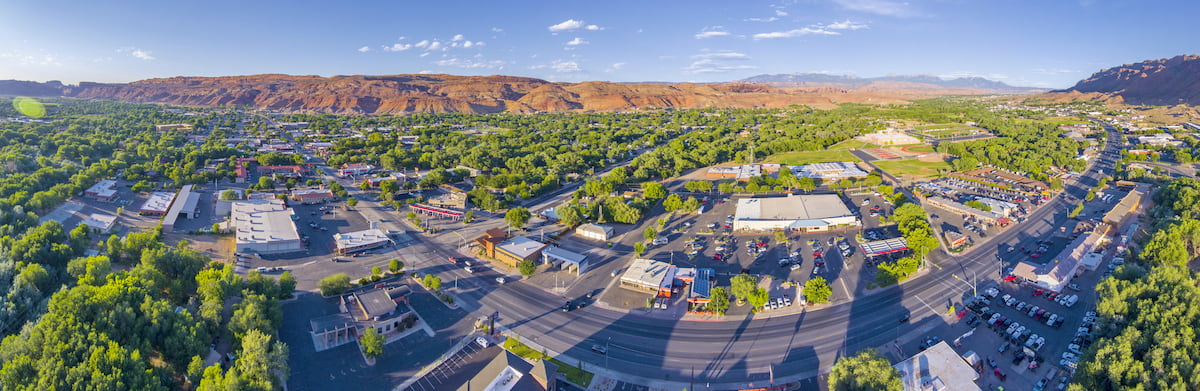
The city is home to about 5,300 residents and it is a popular tourist spot. Moab is accessible by road from either Salt Lake City, Utah or Grand Junction, Colorado. It also has a small regional airport that offers regular flights to Denver.
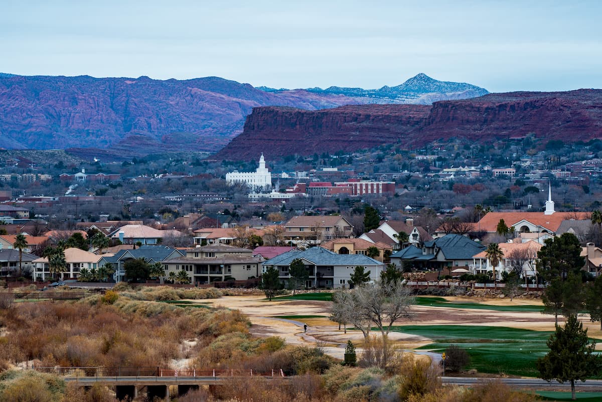
St. George is situated about 3 hours to the west of the town of Escalante and the central part of the national monument. It is home to about 90,000 residents, which makes it the largest city in the state outside the Wasatch Front.
The city is a hub for southwestern Utah and it is a well-known outdoor recreation destination, thanks to its short driving distance to both Zion National Park and Grand Canyon National Park. St. George is located along I-15 and it has a regional airport with regular flights to major cities in the western US.