
Scan the QR code and open PeakVisor on your phone
The Sevier Plateau include 121 named peaks. The highest is Signal Peak at 3,421 m. Other notable peaks include Glenwood Mountain, Monroe Peak and Devils Dutch Oven.
The Sevier Plateau is a physiographic region located in southern Utah in the southwestern US. The tallest and most prominent point on the plateau is Signal Peak at 11,224 ft (3,421 m) in elevation and with 4,111 ft (1,253 m) of prominence.
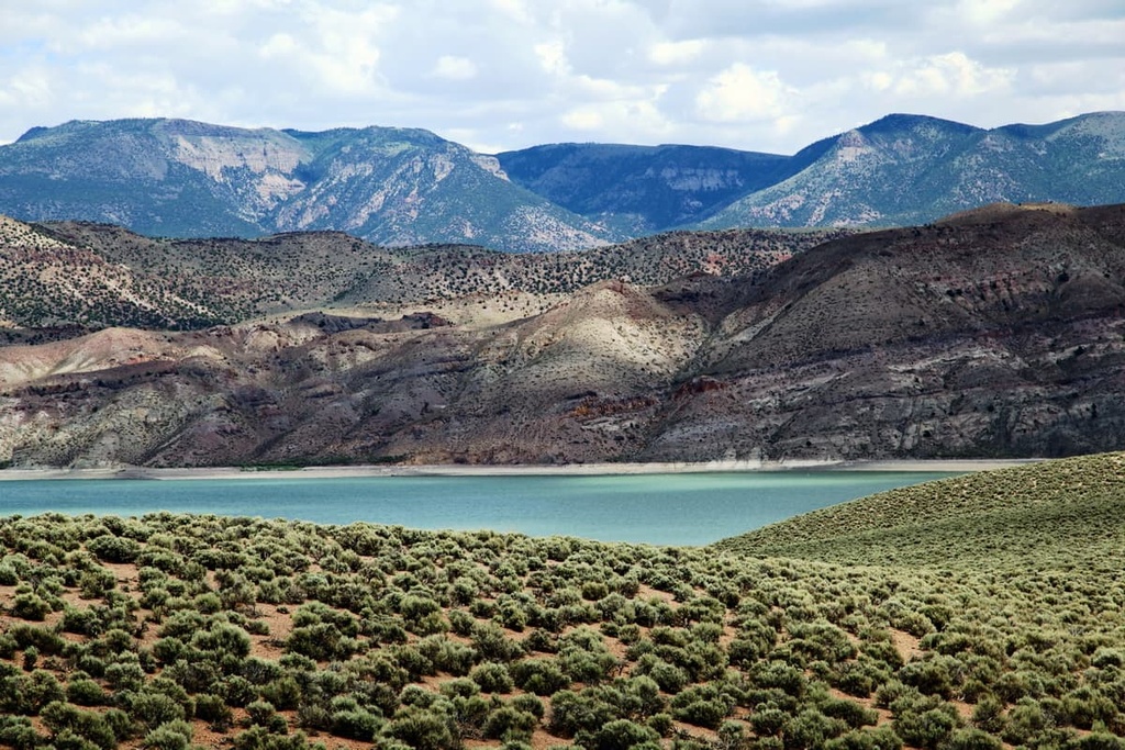
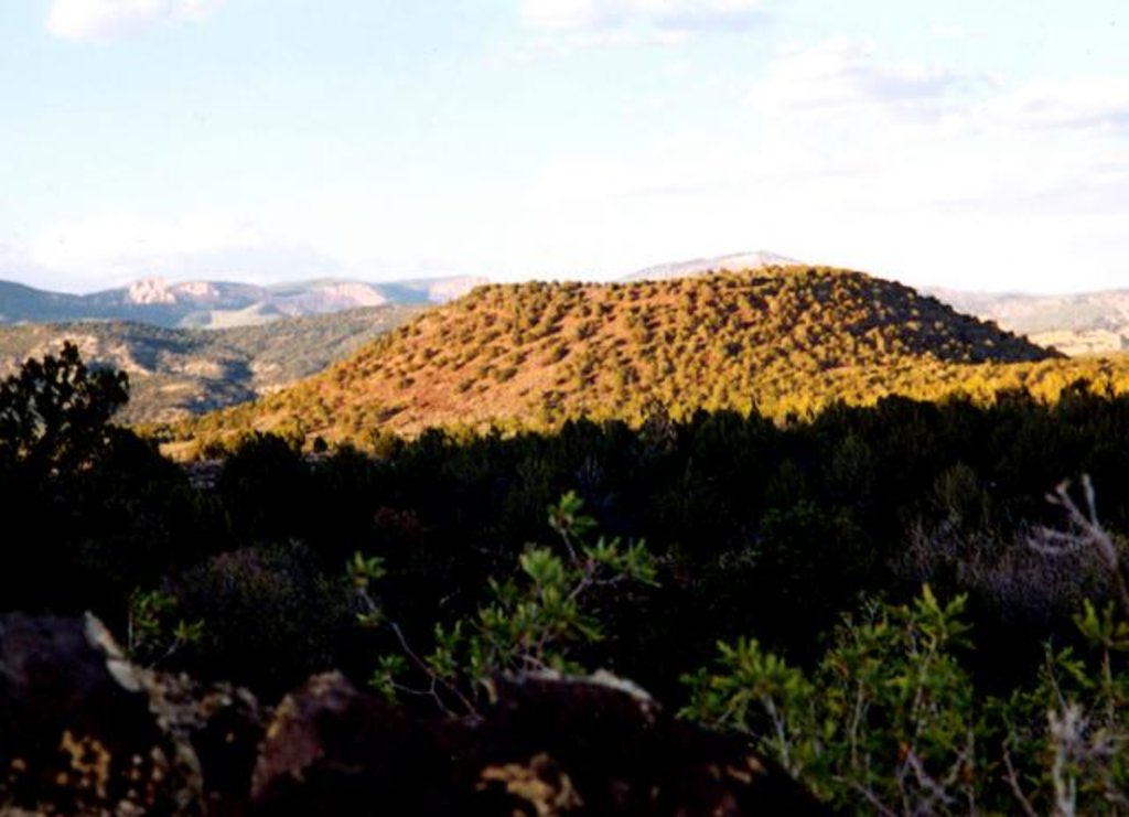
The Sevier Plateau is located in southern Utah, and it consists of a series of high plateaus. Elevations throughout much of the plateau sit around 8,000–9,000 feet (2,438–2,743 m).
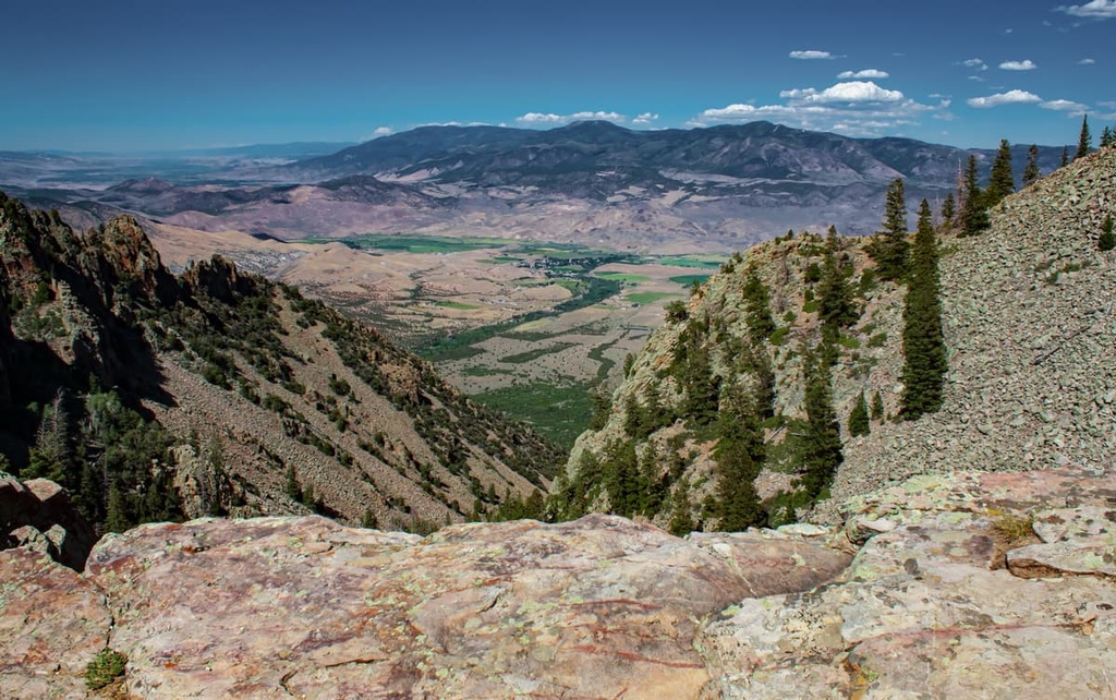
The narrow Sevier plateau spans around 15 miles (24 km) from east to west and about 75 miles (121 km) from north to south. The region is often divided into a northern and southern section, separated by Kingston Canyon.
The northern section of the plateau lies within Fishlake National Forest, which is home to alpine plateaus, and forested hillsides. The southern portion of the Sevier Plateau is located within Dixie National Forest.
To the east of the plateau lies the Aquarius Plateau, which is known for being the highest timber plateau in all of North America. Meanwhile, to the southeast of the Sevier Plateau lies the Grand Staircase, which marks the edge of the plateau. The western edge of the plateau is marked by Interstate 15.
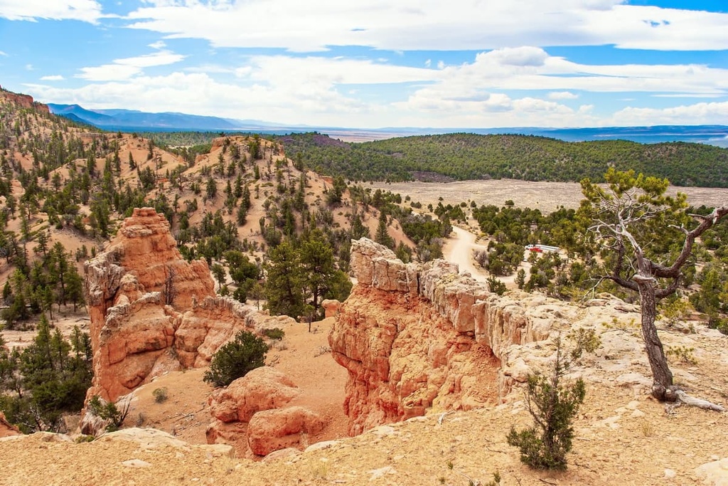
Rolling peaks that feature minimal flora dominate much of the landscape throughout the region. Despite the beauty of the region, the plateau receives few visitors each year compared to other nearby national forests and parks.
Though the plateau is situated within two national forests, it is also located near numerous other forests, wildernesses, and parks.
To the north of the plateau lies Manti-La Sal National Forest while Zion National Park is situated to the west. To the east is the Grand Staircase-Escalante National Monument and Glen Canyon National Recreation Area. To the south of the Sevier Plateau lies the Vermilion Cliffs National Monument and Grand Canyon National Park.
The Sevier Plateau shares a geological history with the Colorado Plateau and the Great Basin Ranges.
The Colorado Plateau is much older than the Sevier Plateau, which was only formed around 20 million years ago. The region encompassed by the Colorado Plateau is a fairly stable geological feature.
Over the past 600 million years, the plateau region has experienced minimal folding and shifting. Slow movements in the Earth’s crust have slowly uplifted the region to its current elevation.
Further folding in the region eventually formed the Sevier Plateau section of the Colorado Plateau. As the elevation began to change, the rivers and streams stepened, allowing them to further carve out the region’s canyons.
Since minimal geologic movement has occurred in the region in recent millennia, the land surrounding the Sevier Plateau offers important geological insight for those studying the Earth's history.
The Sevier Plateau also marks the eastern edge of the Great Basin Ranges. Stretching of the Earth’s crust throughout the Great Basin region has given the area its distinct landscape of alternating ranges and plateaus.
Some of the major peaks within the Sevier Plateau include Signal Peak, Glenwood Mountain, Mount Dutton, Monroe Peak, Black Butte, and Langdon Mountain.
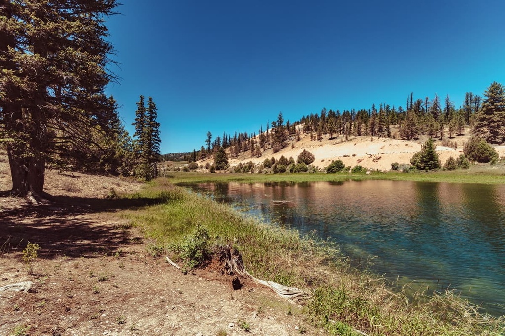
Forested sections within the Sevier Plateau are interspersed with more barren landscapes. Common trees found in the forested regions of the plateau include aspen, spruce, ponderosa pine, pinyon, and juniper.
Other portions of the plateau are home to sagebrush, mountain mahogany, and Douglas fir. During the summer months, wildflowers bloom amidst the region’s alpine meadows and along its barren peaks.
Throughout the plateau, there are sizable populations of black bears, cougars, bobcats, coyotes, and mountain goats. Common bird species include golden eagles, wild turkeys, grouse, woodpeckers, and various hummingbirds.
The land within the Sevier Plateau has been inhabited by humans for thousands of years. Prior to the arrival of people of European descent, the land was traditionally home to the Paiute. Indeed, the land around the Sevier Plateau is the ancestral homelands of many Indigenous peoples.
This includes the Havasupai Tribe, the Hopi Tribe, the Kaibab Band of Paiute Indians, the Las Vegas Paiute Tribe, the Moapa Band of Paiutes, the Hualapai Tribe, the Navajo Nation, the Paiute Indian Tribe of Utah, the San Juan Southern Paiute Tribe, the Yavapai-Apache Nation, and the Pueblo of Zuni, among others.
The first people of European descent arrived in the region during the 1770s. Many of these first settlers were either fur trappers or soldiers searching for a route to connect present day New Mexico and California.
By the early 1800s, Brigham Young had sent a group of missionaries to settle in the Salt Lake region. Mormons traditionally believe this region is their promised land, and, as a result, the region’s Mormon population steadily grew into what it is today.
During the mid-1800s, small factions of Mormons and other settlers began establishing communities near the Sevier Plateau. Despite resistance from local Tribal Nations, the settler communities in southern Utah began to grow in size.
The groups of settlers were usually supported by US troops in their continual efforts to claim the land as their own. Many of Tribal Nations were forcibly killed, removed, and displaced from their homelands.
Many battles, massacres, and wars broke out during the 1800s. The Circleville Massacre occurred in 1866 when settlers captured and killed dozens of Paiute men, women, and children. This marked the most fatal massacre for Native Americans in present day Utah.
Dixie National Forest was established in 1905, which made it one of the first federally managed areas in the region. In 1907 the Fishlake National Forest was established, and was later expanded in 1923 to its current size.
The Sevier Plateau is home to numerous parks, forests, and hiking routes. Here are some of the most popular hiking regions on the plateau:
The Arches Trail is situated in Dixie National Forest. This short yet accessible trail is 0.6 miles (1 km) long with just 187 ft (57 m) of elevation gain. The loop trail takes hikers up to a scenic viewpoint, where they can look out over the stunning red rock formations in the region.
Starting from the same parking lot as the Arches Trail is the Losee Canyon Trail. The route is 5.8 miles (9.3 km) long with 531 ft (162 m) of elevation gain. The wide and shallow canyon features sheer red rock cliffs, forested patches, and unique rock formations.
At the turn-around point of the trail lies at the Cassidy Trail. From there hikers can head back to the start or continue along the Cassidy Trail, which runs north to south.
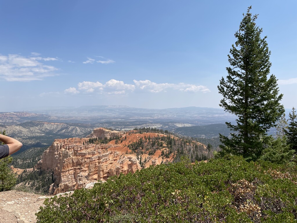
Situated just off of Highway 12 in the middle of the plateau lies the Thunder Mountain Loop. This route is 15.7 miles (25 km) long with 1,801 ft (549 m) of elevation gain. This trail is also located along the edge of Dixie National Forest and Fishlake National Forest.
The route can be completed in one long day, or it can be used for backpacking. Hikers should be aware that the route is also used by many mountain bikers.
Looking for a place to stay near the Sevier Plateau? Here are some of the best cities and villages to check out in the region:
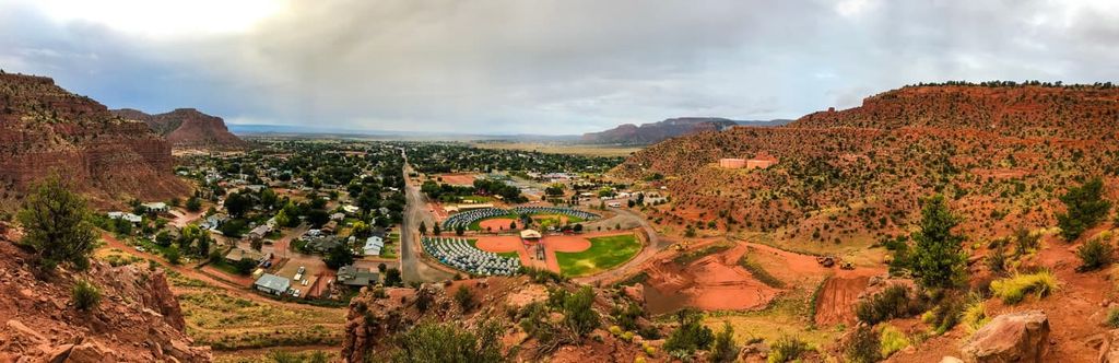
Kanab lies directly to the south of the Sevier Plateau, near the border of southern Utah and northern Arizona. Though the city is home to just 5,000 residents, it acts as a hub for outdoor recreation. Numerous forests, parks, and monuments are located around the small city.
Major places to visit that are within a short drive of Kanab include Dixie National Forest, Zion National Park, Grand Canyon National Park, Bryce Canyon National Park, and the Grand Staircase-Escalante National Monument.
Red rock desert landscape surrounds Kanab, too, a feature that is characteristic of many cities in the southwest. Along with a plethora of outdoor activities, the city is also home to old abandoned film sets that attract thousands of tourists each year. The downtown is full of locally owned shops and restaurants.
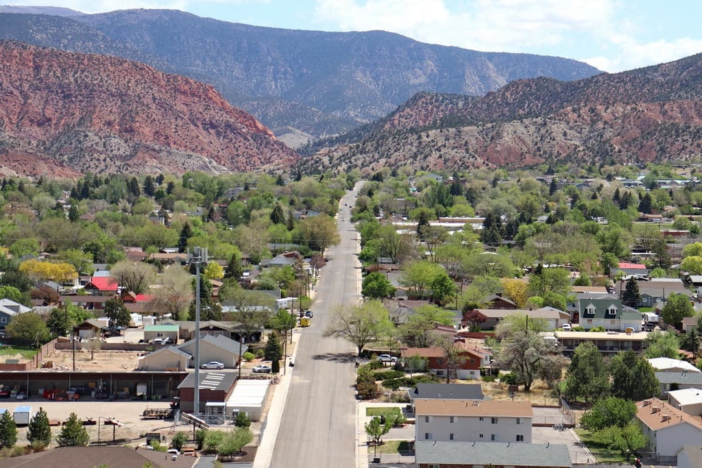
Cedar City is located just to the west of the plateau. The city has around 35,000 residents and is home to Southern Utah University. Situated within the foothills of both Dixie National Forest and Zion National Park, the city is known for its ample options for outdoor recreation.
Besides outdoor activities, Cedar City is also home to the Utah Shakespeare Festival, Simon Fest Theatre and the Utah Summer Games. Numerous local restaurants can be found throughout the downtown area, offering the perfect setting for relaxation after a long day of adventure.


The highest peak in the Sevier Plateau is Signal Peak, at 3,421 m.
The Sevier Plateau have 121 named peaks.


