
Scan the QR code and open PeakVisor on your phone
The rugged and beautiful desert of the Colorado Plateau is home to some of the most popular outdoor recreation areas in the entire United States. It covers parts of the US states of Utah, Colorado, Arizona, New Mexico, and the extreme southwestern tip of Nevada. Within the Colorado Plateau there are 5,001 named mountains and high points, the highest and most prominent of which is Mount Peale (12,720ft/3,877m).
Technically speaking, the Colorado Plateau is what’s known as a “physiographic province,” which means that it’s a large area of land that shares a similar pattern of land features and geologic structures.
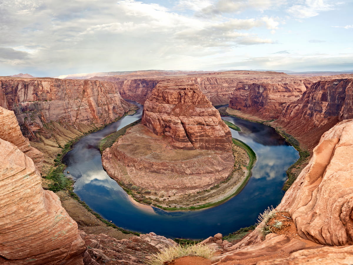
For the most part, the land in the Colorado Plateau is drained by the Colorado River, which starts at its headwaters in the Southern Rocky Mountains of Colorado and passes through Utah, Arizona, Nevada, California, and the states of Sonora and Baja California in Mexico before emptying into the Gulf of California. Other major rivers in the region include the Colorado’s tributaries, such as the Green River, Little Colorado River, and the San Juan River.
The Plateau covers a wide swath of the southwestern United States, including most of northwestern New Mexico, northern Arizona, eastern and southeastern Utah, western Colorado, and the extreme southeast tip of Nevada.
It is surrounded by other major physiographic provinces and mountain ranges, including the Great Basin Ranges to the west, the Southwest Basins and Ranges to the south, the Southern Rocky Mountains to the east, and the Western Rocky Mountains to the north.
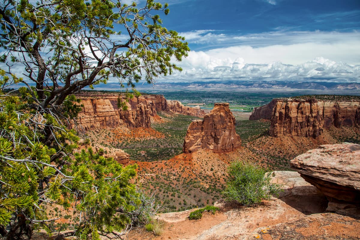
Within the Colorado Plateau, there are dozens of sub-mountain ranges and outdoor recreation areas. In fact, the region contains one of the densest collections of national park and national forest service units in the United States, with 9 national parks and dozens of national forests and monuments.
Due to the sheer size of the Colorado Plateau and its plethora of recreation areas, it’s easiest to categorize the region’s mountain ranges and public lands and by state.
Home to the northernmost part of the Colorado Plateau, Utah is a treasure trove of outdoor recreation. Within Utah, the plateau covers much of the desert regions in the southern and eastern half of the state.
There are a number of subranges and plateaus within Utah’s Colorado Plateau region, including:
Moreover, all 5 of Utah’s national parks, as well as a substantial number of the state’s other public lands are located within the Colorado Plateau, such as:
Finally, some of the state’s most popular wilderness areas are located in the Colorado Plateau. These include:
Although Colorado is known for being particularly mountainous, the Southern Rocky Mountains occupy only about the middle third of the state. To the west of the Southern Rockies lies the Colorado Plateau, which encompasses much of Colorado’s western border with Utah, as well as the entirety of the Four Corners region.
Here, you can find a handful of Colorado Plateau subranges, including the Uncompahgre Plateau, the La Sal Mountains, and the Abajo Mountains.
The plateau region of Colorado is also home to a collection of excellent outdoor recreation areas, such as:
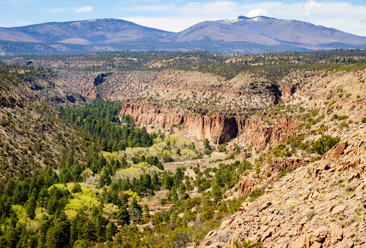
The Colorado Plateau covers the northwestern corner of the state of New Mexico, to the east of the Southern Rocky Mountains and to the north of the Southwest Basins and Ranges.
This region is known for its rolling hills and plateaus, though there are some distinct mountain ranges, including:
New Mexico’s Colorado Plateau region also contains quite a few federally-protected recreation areas, such as:
There’s also a substantial number of wilderness areas, recreation areas, and wildlife management areas in this region, including:

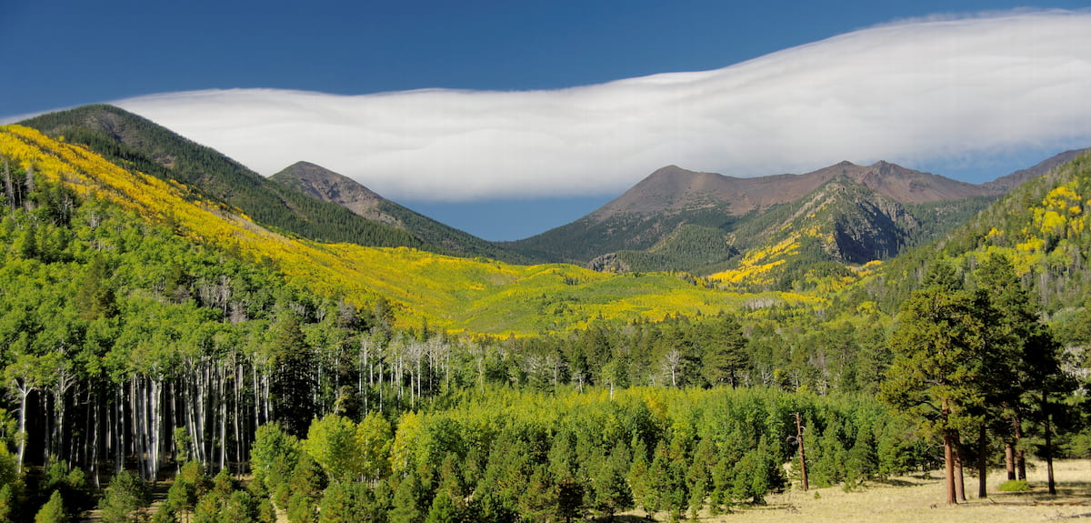
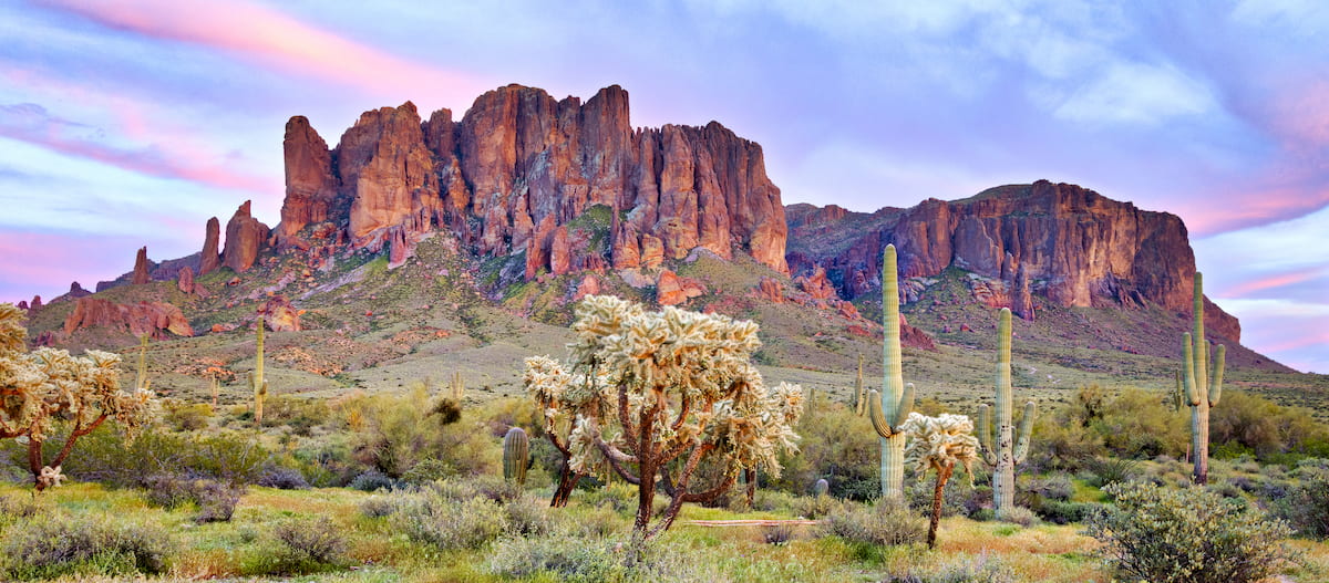
A substantial section of the state of Arizona is covered by the Colorado Plateau, including most of the state’s major recreation areas. Although much of the region is high plateaus and desert, there are quite a few named mountain subranges and plateaus to check out. These include:
Arizona’s list of Colorado Plateau region parks and recreation areas is particularly impressive. It contains some world-famous parks and forests, such as:
Moreover, the Colorado Plateau in Arizona contains a fantastic array of wilderness areas, which are perfect for anyone looking to venture deeper into the plateau’s backcountry. Popular wilderness areas in this part of the state include:
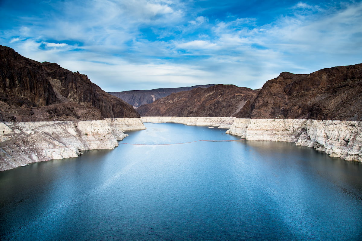
For the most part, the state of Nevada is included within the Great Basin Ranges, however, the extreme southwest corner of the state around the northern shores of Lake Mead is technically part of the Colorado Plateau.
In this part of Nevada, there are 2 primary subranges, the Virgin Mountains and the South Virgin Mountains. These ranges are almost entirely encompassed within the Gold Butte National Monument and its 2 wilderness areas: Lime Canyon Wilderness and Jumbo Springs Wilderness.
Although each individual subrange and plateau of the Colorado Plateau physiographic region has a slightly different geological structure, the entire region shares a similar geologic history.
Indeed, the plateau is a massive, mostly completely structurally intact, province so, although some small-scale local factors have played into the development of individual ranges, the region’s shared history is quite extensive.
As mentioned previously, the vast majority of the plateau is drained by the mighty Colorado River and its associated tributaries while a small fraction (about 10%) is drained by the Rio Grande.
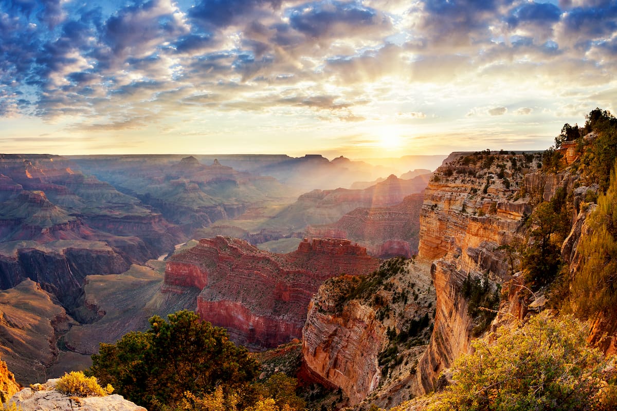
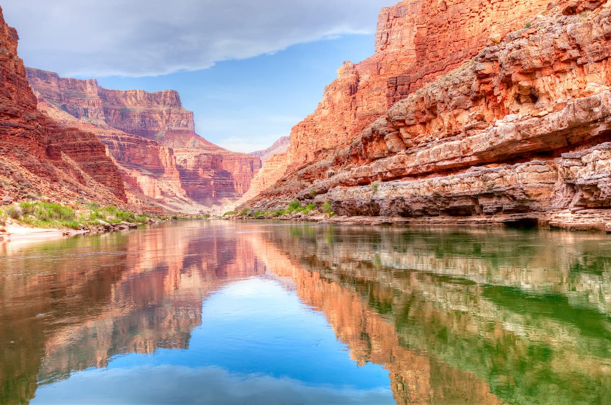
Therefore, anyone wishing to understand world-famous geologic features that were carved by the Colorado River or its tributaries, such as the Grand Canyon, needs to start with an understanding of the Colorado Plateau as a whole.
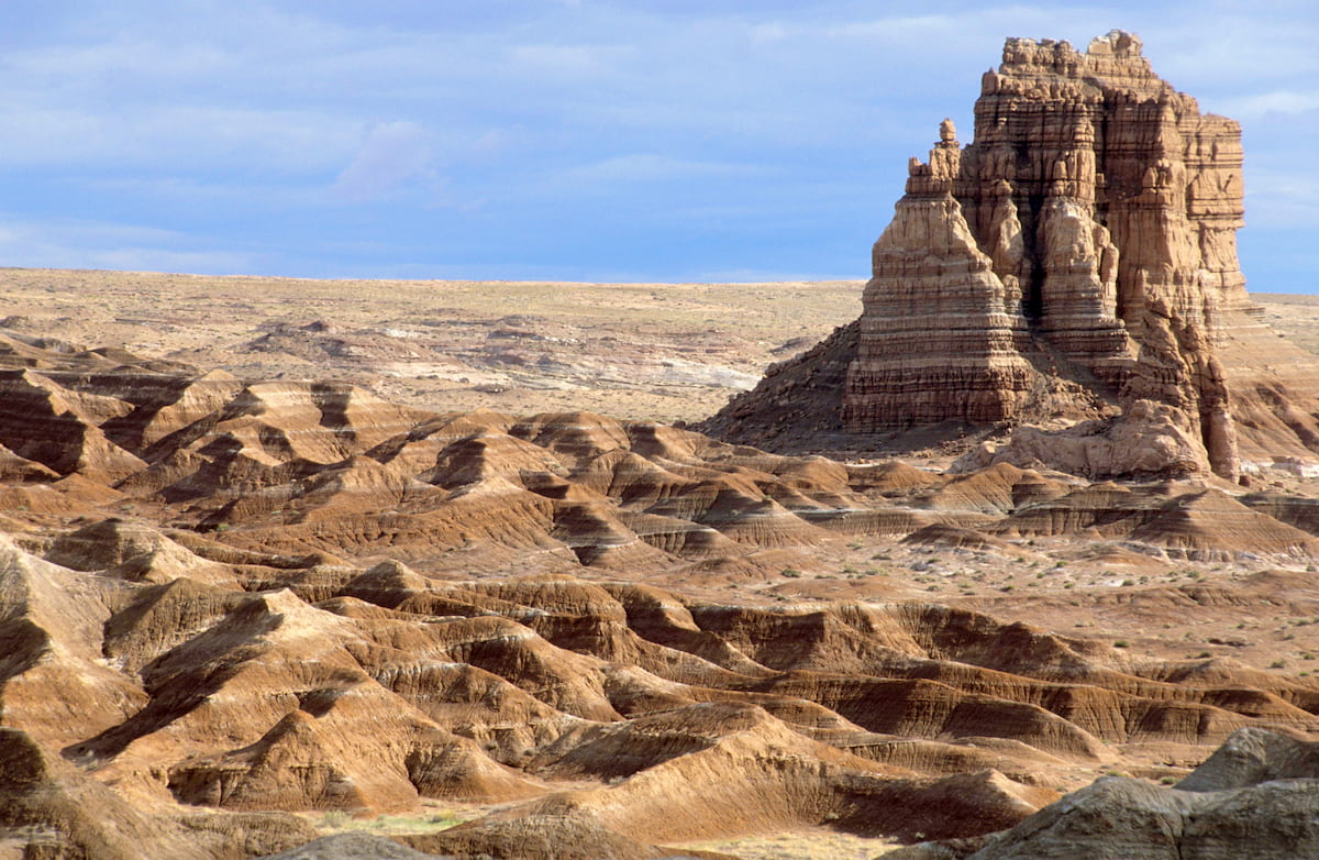
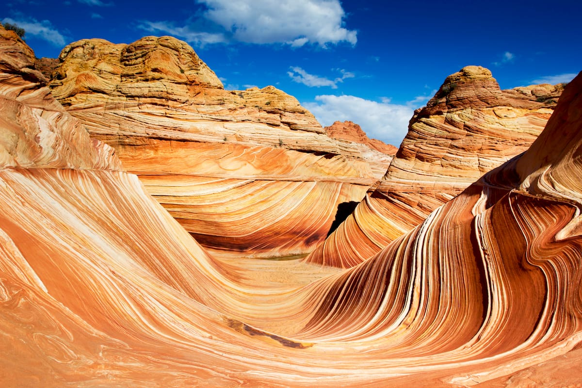
For the most part, the surface rocks in the Colorado Plateau are sedimentary in origin. However, the oldest rocks in the region date back to the Precambrian and are metamorphic in origin. There are also quite a few igneous intrusions throughout the region, though these can be seen only in the deepest of canyons.
Moreover, the Colorado Plateau contains a sizable number of valuable mineral and fossil fuel deposits, which have been a major part of the region’s economy for quite some time. Mining is a big industry in the region, especially for resources like petroleum, coal, uranium, and even gilsonite, the latter of which is used for cements, foundry, and even printing ink.
As far as the uplifting and structural formations go, the Colorado Plateau did experience a slight amount of uplift during the Laramide orogeny some 70 million years ago. However, unlike the Rocky Mountains to the north, the Colorado Plateau did not experience any widespread deformity or mountain building during this time.
After the Laramide orogeny, the ranges of the Great Basin started to form, though, again, this did not lead to any widespread deformation within the Colorado Plateau. Indeed, the uplift of the Colorado Plateau didn’t start in earnest until well into the start of the Cenozoic. That being said, it’s still unclear what caused this widespread uplift in the region.
While the cause of this uplift is relatively unknown, the uplift’s effects are quite extensive. As the plateau uplifted, it started to tilt the region toward the west about 20 million years ago, greatly increasing the overall gradient of the region’s streams and leading to rapid erosion.
This erosion helped carve out some of the Colorado Plateau’s most characteristic landforms, including its massive plateaus and canyons. In fact, many of the region’s best-known features, including the Grand Canyon and Zion Canyon, owe their existence to the uplift of the Colorado Plateau and the increased rates of erosion that it caused.
While the Colorado Plateau is perhaps best known for its canyons, however, it is also home to some fairly sizable mountains. These include Mount Peale, Humphreys Peak, Mount Wass, Agassiz Peak, Mount Ellen Peak, and Baldy Peak, though most of these high points are located within the La Sal Mountains.
The vast majority of the Colorado Plateau is located within an ecoregion known as the Colorado Plateau Shrublands. This ecoregion includes most of the basin of the Colorado River, as well as part of the uppermost basin of the Rio Grande. Here, you can find 3 distinct plant communities, each of which supports its own unique array of flora and fauna.
At the lowest elevations, the Colorado Plateau is dominated by arid grasslands. These grasslands, as the name suggests, contain mostly shrubs, grasses, and sagebrush, as well as some sizable areas that can support only yucca and cacti.
In woodland areas at the mid-elevations, the Colorado Plateau is actually home to some sizable forests. The most common tree species in this region include pinyon pine and juniper, though you can also find shrubs such as alder-leaf mountain mahogany and big sagebrush at these elevations.
Finally, the highest elevations of the Colorado Plateau are home to some funky montane plant communities. Some of these communities are ponderosa pine woodlands and you can even find some stands of quaking aspen and lodgepole pine in the loftiest parts of the plateau.
When it comes to wildlife, the Colorado Plateau does not disappoint. Some of the mammal species in the region include elk, pronghorns, mule deer, bobcats, foxes, coyotes, mountain lions, and black bears.
Also, do keep in mind that there are quite a few reptiles in this region, including the venomous western rattlesnake. There are also other venomous reptiles in the Colorado Plateau, such as the Gila monster, so be sure to keep your distance if you happen to stumble across one of these animals.
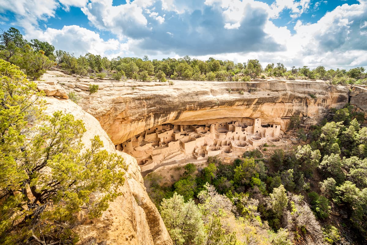
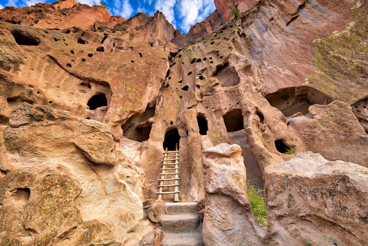
The Colorado Plateau has long been home to humans. In fact, the Ancestral Puebloan people lived in the region for thousands of years and the region is the ancestral homelands of many tribes and nations.
To this day, the region is considered sacred to many Indigenous peoples including the Navajo Nation, the Pueblo of Zuni, the Hualapai Tribe, the Ute Indian Tribe, the Ute Mountain Ute Tribe, the Southern Ute Indian Tribe, the San Juan Southern Paiute Tribe, the Paiute Indian Tribe of Utah, the Kaibab Band of Paiute Indians, the Hopi Tribe, the Yavapai Apache Nation, the Nde-San Carlos Apache, and the Havasupai Tribe, many of whom have reservations in the Colorado Plateau which represent just a fraction of their traditional territory.

The first Europeans to visit the area were likely Spanish soldiers and missionaries who traveled throughout the Colorado Plateau, particularly in the southern parts of the region, in the 1500s. However, the first people of European descent to permanently settle in the region didn’t arrive until some 200 to 300 years later.
These early European-American settlers included a sizable group of Mormons who had ventured to what is now Utah in the mid-19th century. Some of these settlers started homesteads in the southern parts of Utah, particularly around what is now Zion National Park and Arches National Park.
Perhaps the most famous US-sponsored expedition to the Colorado Plateau was John Wesley Powell’s Grand Canyon expedition in the late 1860s. This expedition rafted the Green River to its confluence with the Colorado and then floated the river through the Grand Canyon.
The latter part of the 19th century saw an even further increase in the number of settlers to the Colorado Plateau, many of whom came in search of ranching and mining opportunities. Ultimately, this increase in settlement led to the forced removal of many Indigenous peoples from their ancestral homelands, particularly after President Chester Arthur passed an executive order in 1882 that declared land adjacent to the Grand Canyon to US property.
Not long after, much of the plateau’s most famous and stunning landmarks, including the Grand Canyon, Zion Canyon, and what’s now Arches National Park, became placed under federal protection as national monuments and, later, national parks.
To this day, the Colorado Plateau remains one of the country’s premier hiking and outdoor recreation destinations due to its sheer density of amazing places to visit.
With quite literally dozens of hiking areas to see in the Colorado Plateau, it’s impossible to describe them all in detail here. However, here are some of the most popular destinations in the Colorado Plateau to check out during your next visit.
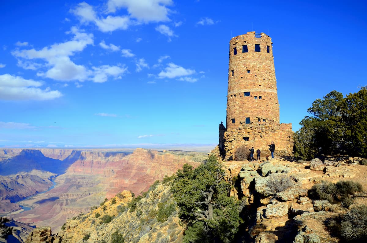
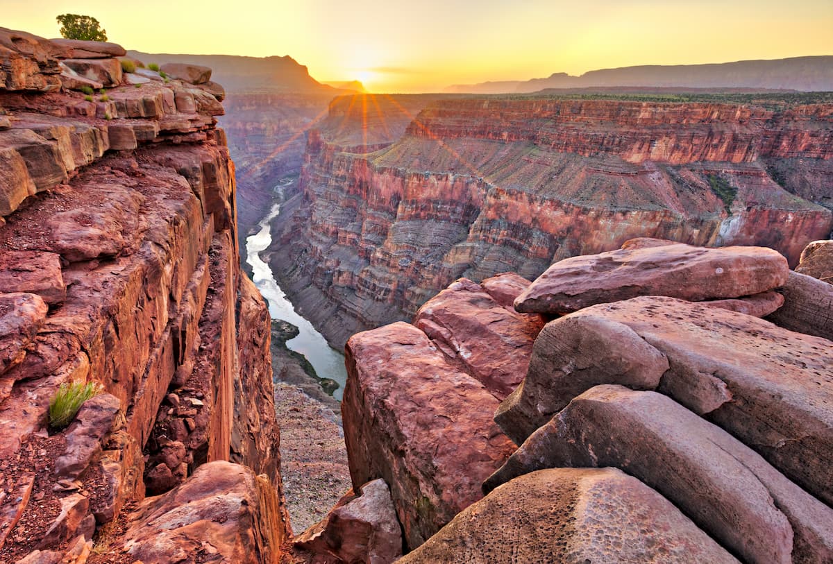
One of the most popular national parks in the United States, the Grand Canyon National Park of northwestern Arizona is a true jewel in the crown of the US National Park Service. The park contains 278 named mountains, the highest and most prominent of which is Lindbergh Hill.
The biggest attraction of Grand Canyon National Park is easily the canyon itself, which is one of the most massive and scenic river canyons in the world. There are plenty of hiking opportunities to check out for the intrepid adventurer, including the Bright Angel Trail, the Rim Trail, the South Kaibab Trail, and the North Kaibab Trail.
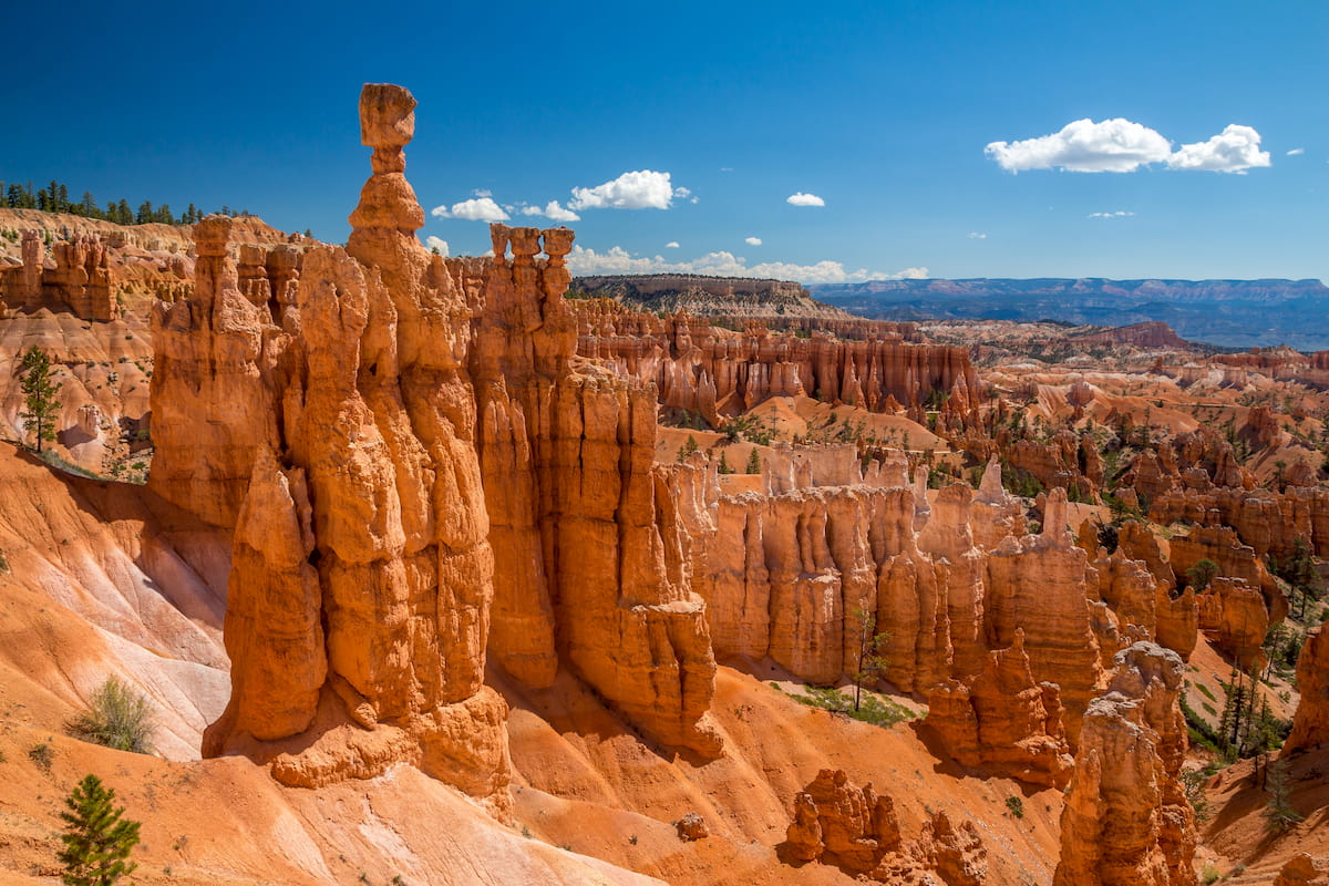
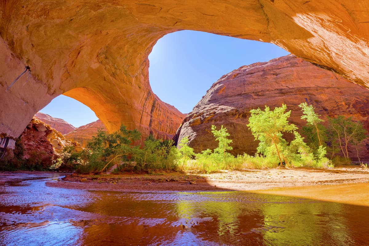
Situated in the south-central part of Utah, the Grand Staircase-Escalante National Monument is home to some exceptionally remote and magnificent landscapes, which make for a fantastic place for any extended hiking or climbing trip. The monument includes 80 named high points, the tallest of which is The Blues, and the most prominent of which is Cougar Knoll.
With over 1 million acres (4,000 sq. km) of land in the monument to enjoy, there are more than enough hiking opportunities to keep you occupied for years on end. That being said, while there are quite a few hiking trails in the monument, including the Escalante Natural Bridge, Lower Calf Creek Falls, and Coyote Gulch, some of the best adventures in the region happen off-trail.
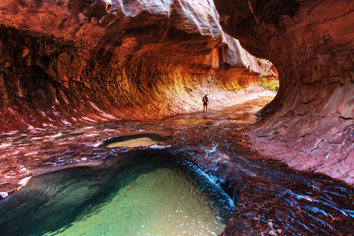
Boasting amazingly steep canyon walls and some fantastic slot canyons, Zion National Park of Utah is a wonder to behold. The park contains 80 named high points, the highest of which is Horse Ranch Mountain.
Zion is one of the most accessible national parks in the country for hikers due to the sheer number of well-maintained hiking trails that start in Zion Canyon. During the busy season, visitors can access the canyon using the park’s free shuttle service, which takes you to popular trailheads for hikes such as the Narrows, Angels Landing, and Observation Point.
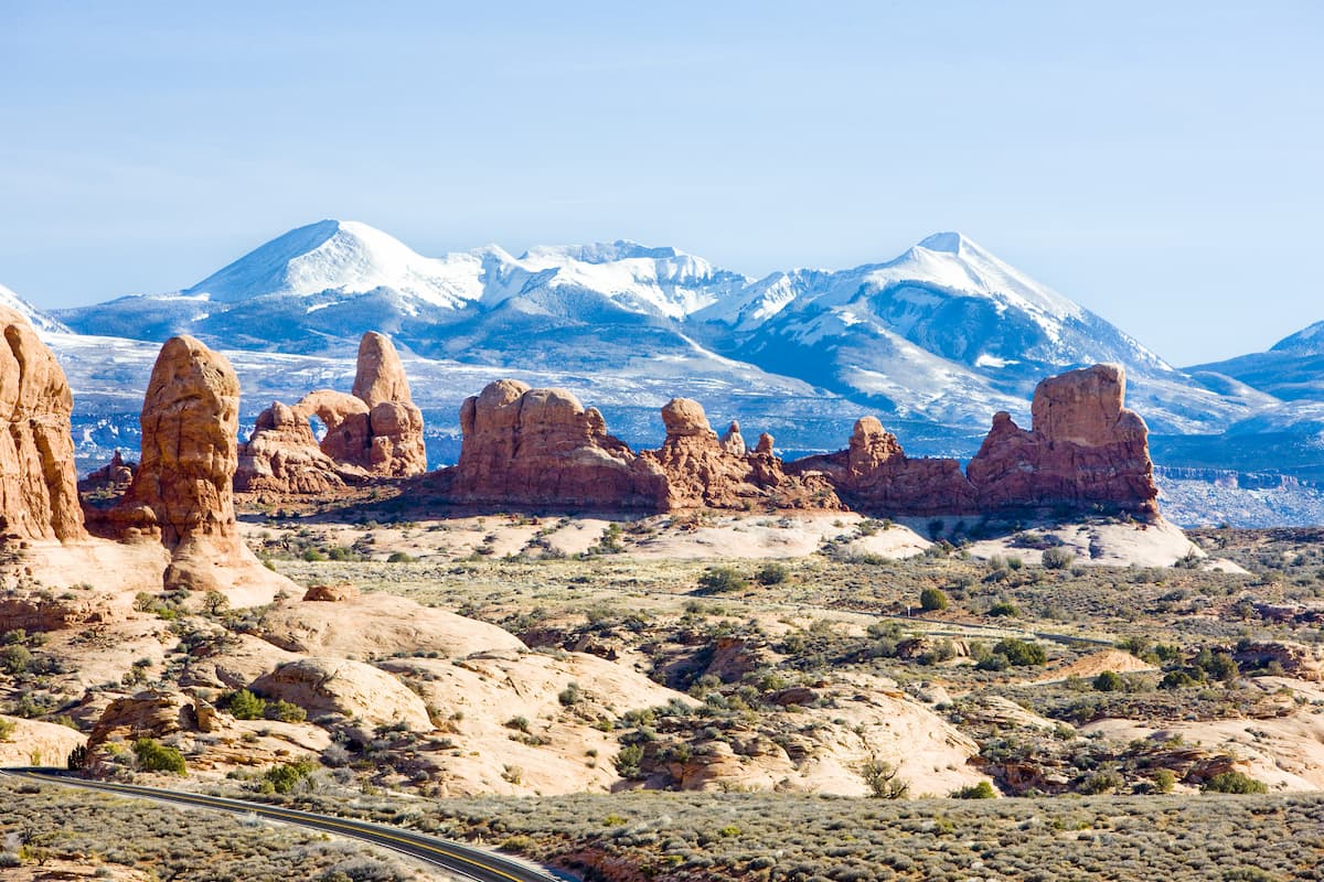
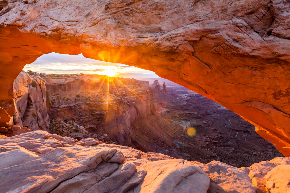
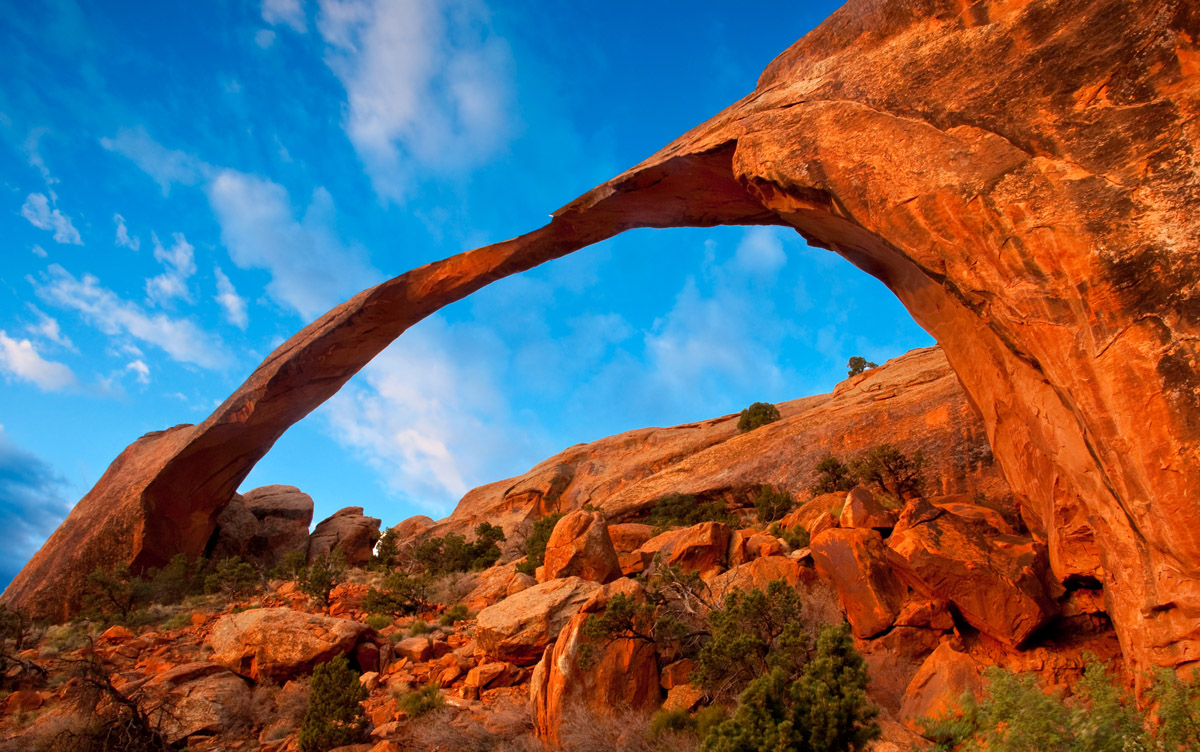
Located in the northern part of the Colorado Plateau in eastern Utah, the aptly-named Arches National Park contains more than 2,000 natural sandstone arches, which dot the desert landscape. Within the park, there are 7 named mountains, the highest and most prominent of which is Elephant Butte.
Like Zion National Park, Arches is a great place to visit if you enjoy day hiking. There are dozens of miles of maintained hiking trails in the park, including paths to Delicate Arch (perhaps the most iconic natural feature in Utah), Balanced Rock, the Windows, Devil’s Garden, and Landscape Arch. Moreover, visitors with adequate experience can hike off-trail to check out the beautiful Garden of Eden and the Fiery Furnace.
Despite the ruggedness and remoteness of much of the Colorado Plateau, there are quite a few large cities and towns in and around the region to visit. Here are some of the best places to check out:
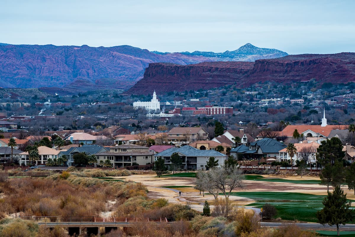
The city of St. George is situated in the southwestern corner of Utah, near the state’s border with Arizona and Nevada. It has about 90,000 residents, which makes it one of the largest cities in the region. Moreover, St. George is located close to both Zion and Bryce Canyon National Parks and it has a whole host of local hiking, climbing, and mountain biking opportunities for visitors to enjoy.
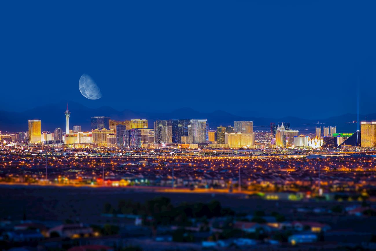
Although it’s technically located outside of the Colorado Plateau, the city of Las Vegas is a major metropolitan area with over 650,000 residents. The city has a bustling tourism industry and its great transportation links make it a great place to start your trip to the Colorado Plateau. In particular, Las Vegas is within driving distance of parks such as Grand Canyon, Zion, Bryce Canyon, Vermilion Cliffs, and Grand Staircase-Escalante.
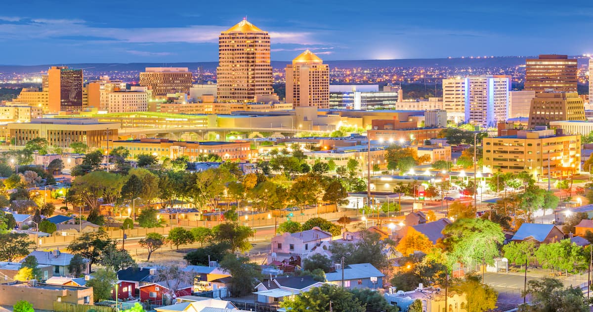
Albuquerque is the largest city in the state of New Mexico with some 560,000 residents. It is a major commercial and cultural hub for the region and it is known for its sunny blue skies. The city is also perfectly positioned for anyone looking to enjoy the great outdoor recreation opportunities in New Mexico, as it’s located close to major destinations both in the Colorado Plateau and in the Southern Rocky Mountains.
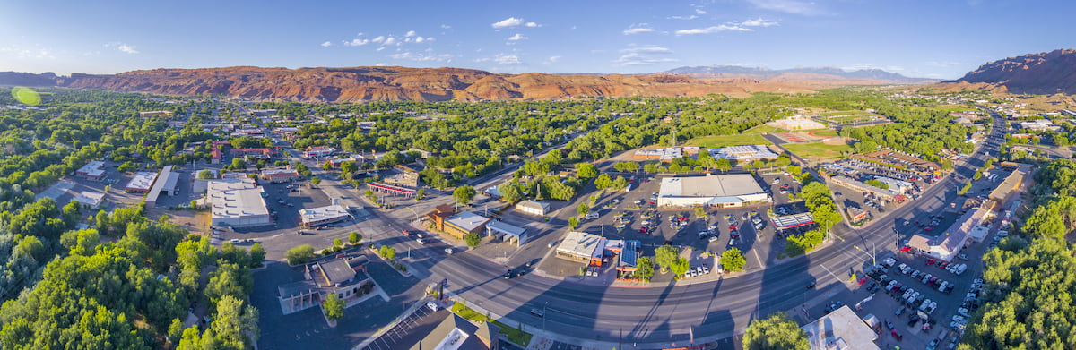
The town of Moab is located just outside of both Arches and Canyonlands National Parks in the east-central part of Utah. It is home to about 5,000 residents and it is a major outdoor recreation destination thanks to the great hiking, climbing, and mountain biking opportunities in the region. Moab is accessible by road from Salt Lake City, Utah and Grand Junction, Colorado and it even has a small airport with service to Denver.


ultra
arizona-10ers
las-vegas-mountaineers-classics
arizona-20-20-challenge
sierra-club-desert
fred-beckey-great-peaks
arizona-ultras
ultra
arizona-10ers
las-vegas-mountaineers-classics
arizona-20-20-challenge
sierra-club-desert
fred-beckey-great-peaks
arizona-ultras


