Scan the QR code and open PeakVisor on your phone
Located at the northern edge of the Grand Canyon in the US state of Arizona, Grand Canyon-Parashant National Monument protects 1,048,325 acres (424,242 ha) of rugged canyons, lava-capped strata, and spectacular escarpments. The monument includes 35 named mountains, the highest and most prominent of which is Mount Trumbull (8,015 ft/2,443 m).
The Grand Canyon-Parashant National Monument is located in Mohave County, Arizona, immediately to the north of Grand Canyon National Park and to the east of the state of Nevada.
Altogether, the monument encompasses 1,048,321 acres (424,240 ha) of land. Approximately 812,581 acres (328,840 ha) of the monument is administered by the Bureau of Land Management while 208,449 acres (84,356 ha) are managed by the National Park Service, 23,206 acres (93,91 ha) are Arizona state lands, and 4,085 acres (1,653 ha) are private lands.
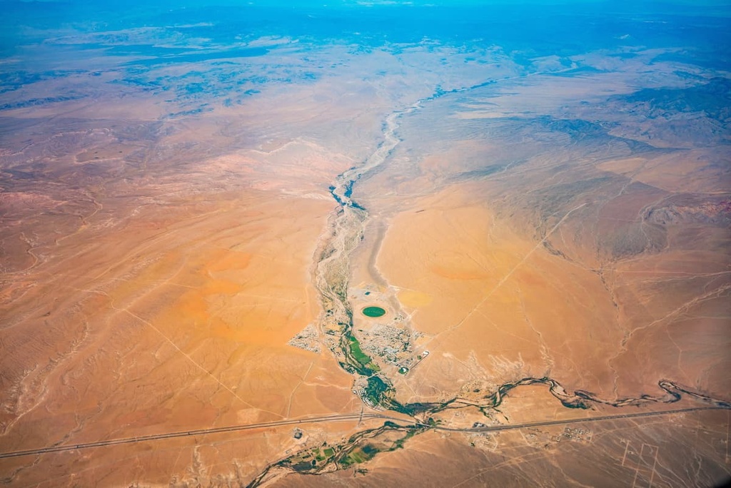
The monument contains a wide array of elevations. Its lowest point is around 1,200 feet (366 m) near Grand Wash Bay at Lake Mead while its highest is over 8,000 feet (2,438 m) at the summit of Mount Trumbull. It also encompasses the lower portion of the Shivwits Plateau, an important watershed for the Colorado River and the Grand Canyon.
The Grand Canyon-Parashant National Monument lies in an area known as the Arizona Strip, a vast, arid region that contains about 3 million acres (1.2 million ha) of northwest Arizona. From a geographic and cultural standpoint, the Arizona Strip is said to be more closely associated with southern Utah and Nevada than the rest of Arizona. This is largely due to it being isolated from the rest of the state by the Grand Canyon.
In addition to the Grand Canyon-Parashant National Monument, the Arizona Strip contains several wilderness areas and national monuments that are located just a short drive away from the Grand Canyon. These include:
The southern part of the Arizona Strip also includes the north rim of Grand Canyon National Park and the northern section of the Lake Mead National Recreation Area. The Mount Trumbull Wilderness, Mount Logan Wilderness, Grand Wash Cliffs Wilderness, and portions of the Paiute Wilderness all lie in the Grand Canyon-Parashant National Monument, too.
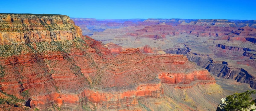
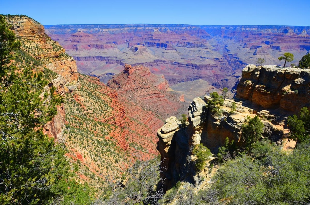
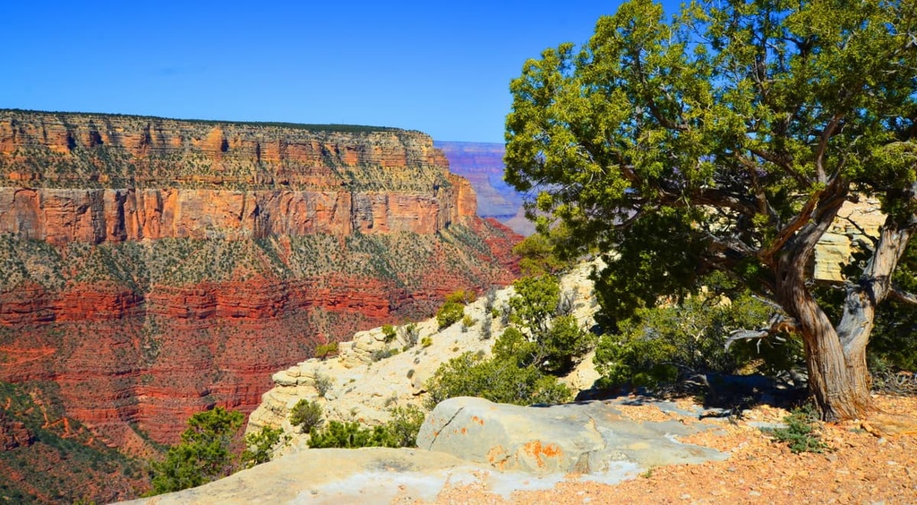
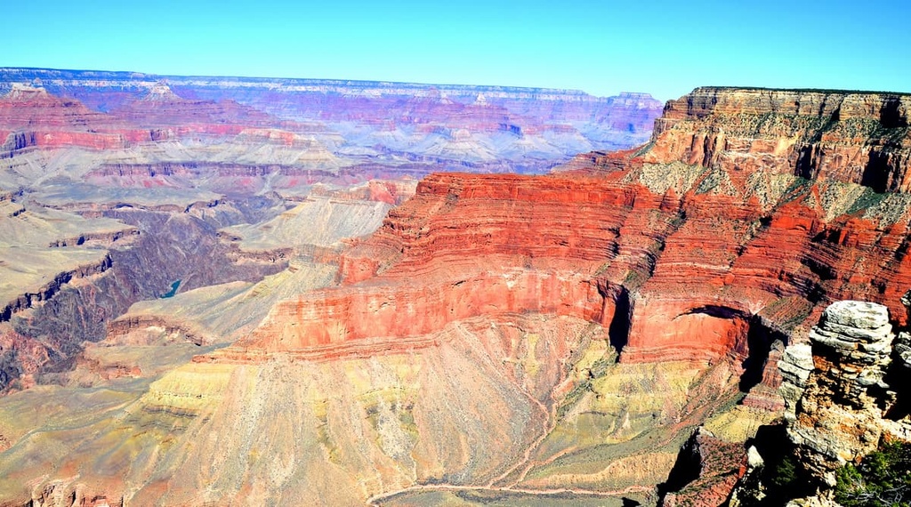
Exposed rock layers, karst features, and robust fossil records in the Grand Canyon-Parashant National Monument provide evidence of the region’s extensive geologic history. The monument’s variable landscape has been shaped over 2 billion years by volcanism, Basin and Range stretching, and uplift of the Colorado Plateau.
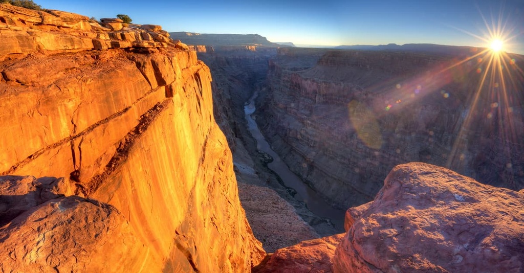
One of the most imposing geologic features in the monument, the Grand Wash Fault, represents a rather abrupt transition between two major geologic provinces—the Basin and Range province and the Colorado Plateau. The high-angle Grand Wash Fault trends from southwest Utah into west-central Arizona, through the monument.
Along the eastern edge of the fault is the Grand Wash Cliffs, a scarp ranging in elevation from 600- meters to about 1,700 meters.
The Grand Wash Cliffs extend south-southeast from the Grand Canyon-Parashant National Monument through the Grand Wash Cliffs Wilderness and into the Lake Mead National Recreation Area. This striking escarpment was shaped by upward movement along the fault.
To the east of the Grand Wash Cliffs lie the pinyon-juniper uplands of the Colorado Plateau, while to the west lies the familiar topography of the Basin and Range province, including the north-south trending Beaver Dam Mountains and the Virgin Mountains.
The Grand Canyon-Parashant National Monument also contains portions of several other geologic faults, including the Dellenbaugh fault and Toroweap fault. These are 6 to 7 million years old and 300,000 years old, respectively. Additionally, the region is home to the Hurricane fault, which shaped the Hurricane Cliffs.
Remarkably, Paleozoic and Mesozoic sedimentary rock layers remain relatively unobscured by vegetation in the monument. A variety of formations have been exposed by erosion of the Colorado River. Cambrian, Devonian, and Mississippian formations are visible at the southern end of the lower Grand Wash Cliffs.
Pennsylvanian and Permian formations are visible in the Parashant, Andrus, and Whitmore canyons. Finally Triassic Chinle and Moenkopi formations are exposed on the Shivwits Plateau and in Hells Hole.
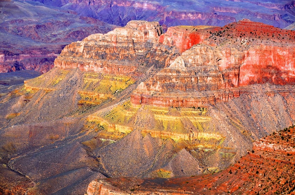
Evidence of the monument’s early volcanic eruptions can be seen in the black rock-capped mesas across the monument. The oldest volcanic activity in the monument is believed to have occurred in the Grand Wash Trough and Pakoon Basin, which is part of the Grand Wash Volcanic Field. Most of the volcanism still visible on the surface is from no later than the Pliocene, which began around 5.5 million years ago.
Capped by 3.6-million-year-old basalt lava flow, Mount Trumbull is also an excellent representation of the region’s volcanic past. Mount Trumbull is among the earliest known eruptions in the Uinkaret Volcanic Field. The Uinkaret Volcanic Field has since produced at least 213 eruptions, many of which repeatedly cascaded into the Grand Canyon and temporarily dammed the Colorado River.
Fossils are plentiful in the monument. Among these are invertebrate fossils tucked in the Calville limestone of the Grand Wash Cliffs as well as sponges in nodules and pectinoid pelecypods throughout the Kaibab formation of Parashant Canyon. There are also brochipods, pelecypods, fenestrate bryozoa, and crinoid ossicles in the Toroweap and Kaibab formations of Whitmore Canyon.
Since it is located where two geologic provinces converge, the Grand Canyon-Parashant National Monument spans several critical ecoregions. This includes the Sonoran Desert, the Mojave Desert, Great Basin, and Colorado Plateau. As such, this vast, undeveloped corner of northern Arizona supports a wide variety of plant and animal species.
High elevation areas of the monument offer plant and animal species refuge from the hot, arid, and hostile lowlands. Here, ponderosa pine forests with associated Gambel oak, New Mexico locust, and serviceberry, sustain populations of wild turkeys, mule deer, northern goshawks, and Kaibab squirrels, as well as elusive mountain lions and black bears.
The mid elevations in the monument feature scattered pinyon-juniper forests and sagebrush, which in turn sustain populations of pinyon jays, Great basin rattlesnakes, and mule deer. Mojave Desert vegetation, including creosote bush, barrel cacti, and Joshua trees, dominates lower elevations. As many as 25 bird species are known to nest in Joshua trees.
Many threatened and endangered species are protected within the Grand Canyon-Parashant National Monument, including the Mexican spotted owl, California condor, desert tortoise, and southwestern willow flycatcher.
The area now occupied by the Grand Canyon-Parashant National Monument has a rich history of human inhabitation that dates back some 12,000 years. Archeological evidence located in the monument suggests that some of the earliest residents of the area were hunter-gatherers that arrived during the Archaic Period (7000 BCE. to 300 BCE).
Pit houses, habitation rooms, agricultural features, and pueblo structures uncovered in the monument also show that the region was utilized by many Indigneous communities during the Ancestral Puebloan Period. The land is also the traditional territory of the Paiute, Navajo, Zuni, and Hopi, among others.
Though people of European descent traveled through parts of the southern Grand Canyon as early as 1540, the isolated northern edge of the canyon remained unvisited by Europeans until 1776, when the Domínguez–Escalante Expedition traveled near Mount Trumbull.
In the 1850s, Mormon settlers expanded into the area. Though many early colonizers considered the region too inhospitable for settlement, a handful of villages and ranches were established near vital water sources.
Mount Trumbull became the focal point for a large-scale timber operation during this time. Meanwhile, Pipe Spring, which is now the site of the Pipe Spring National Monument, was home to extensive cattle ranching operations.
Early Mormon settlement of the region was not without conflict. Clashes between Mormon colonizers and Indigenous peoples escalated as tribal nations were progressively displaced from their ancestral homelands and onto reservations in surrounding states.
Today, the Grand Canyon-Parashant National Monument and nearby Pipe Spring National Monument both contain preserved historic and prehistoric sites that provide insight into the region’s complicated human history.
The Grand Canyon-Parashant National Monument is largely expansive wilderness without designated trails or developed roadways. That said, visitors to the park can expect to enjoy the region’s natural beauty in relative solitude. Here are some of the more popular places to check out if you’re looking to visit the Grand Canyon-Parashant National Monument:
Located in the Mount Trumbull Wilderness, the 5.1-mile (8.2 km) Mount Trumbull trail provides exceptional views overlooking the Toroweap Valley, Grand Canyon, Kaibab Plateau, western Vermilion Cliffs, and Pine Valley Mountains.
The trail is well-traveled up to the rim but, due to a recent fire, it can be harder to navigate after entering a ponderosa forest. The summit is marked by a large rock cairn, an official US Geological Survey marker, and a trail register.
Located in the Mount Logan Wilderness, the short trek to the summit of Mount Logan features expansive views of the western Grand Canyon, Arizona Strip, Pine Valley Mountains, and Virgin Mountains. The end of the trail also offers a great vantage point into Hells Hole, a beautiful natural amphitheater.
Boasting one of the most scenic views in the monument, the 5.2-mile (8.4 km) Mount Dellenbaugh trail ascends 883 feet (270 m) through pinyon, juniper, and ponderosa woodlands. This extremely remote summit is an ancient shield volcano that is best-known for its role in Major John Wesley Powell’s dramatic passage through the Grand Canyon.
Located in the Grand Wash, between the Grand Wash Cliffs and Virgin Mountains, the 1-mile (1.6 km) Pakoon Springs Trail meanders through typical Mojave Desert terrain before crossing a clay floodplain and ascending a spring mound.
Generated from the Virgin and Black Rock Mountains, the Pakoon Springs is the most productive spring in the monument. The largest spring pool can be spotted on the south side of the mound.
Located in the Grand Wash Cliffs Wilderness, the Grand Wash Bench refers to a natural shelf tucked between the Grand Wash Cliffs. The 11-mile (18 km) Grand Wash Bench Trail navigates through the region’s scenic escarpments, canyons, and sandstone buttes. The trail can be accessed from the north or south end of the wilderness.
Parashant is a remote and isolated area with 1,200 miles (1,931 km) of dirt, gravel, and rocky roads. There is no developed infrastructure, no services, and very little cell reception in the monument. These are some of the closest places to stay near the Grand Canyon-Parashant National Monument:
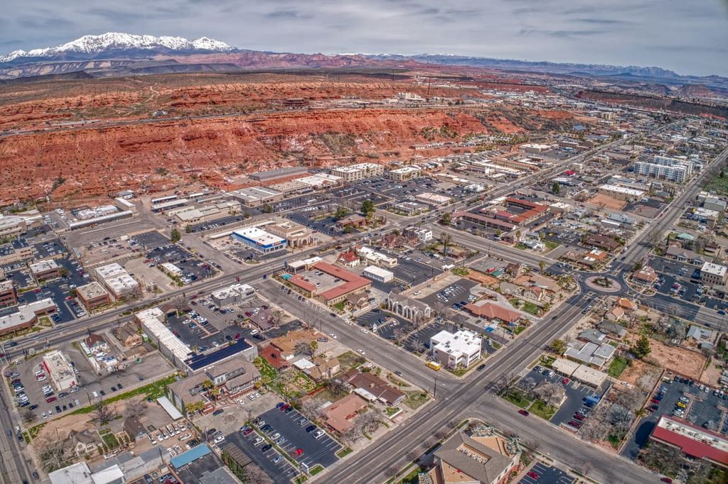
Best-known as the gateway Zion National Park, St. George is a community centered around outdoor recreation. St. George is one of Utah’s fastest-growing communities and it offers visitors plenty of amenities and lodgings to choose from.
Located about 80 miles (129 km) north of the Grand Canyon-Parashant National Monument, St. George is central to some of Utah’s most famous natural treasures, including Bryce Canyon, Grand Canyon, Great Basin, Capitol Reef, Lake Mead, and Gold Butte.
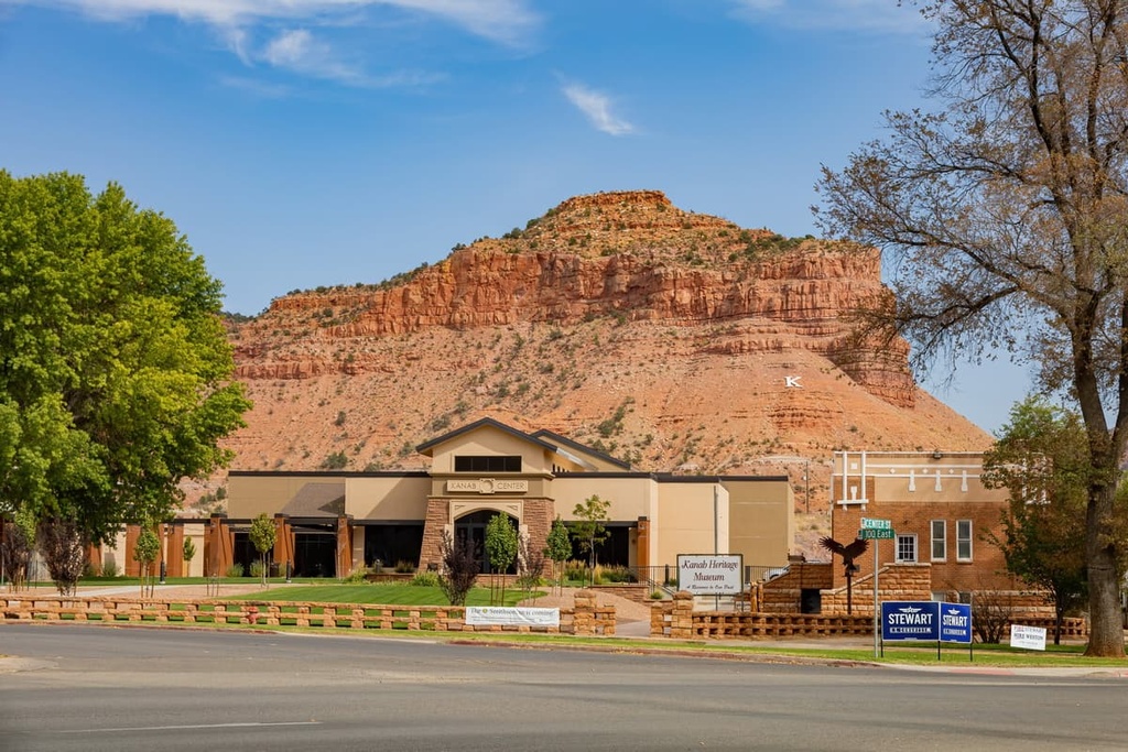
Located along the southern border of Utah, Kanab is a small community surrounded by red rock and sagebrush. The city has a population of around 5,000 people, and it is located near the Paria Canyon-Vermilion Cliffs Wilderness, the Grand Canyon, and Grand Staircase–Escalante National Monument.
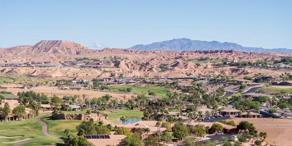
Situated just 10 miles (16 km) from the Nevada-Utah border, Mesquite isn’t a particularly large community. However, it’s one of the largest cities near the Grand Canyon-Parashant National Monument and offers visitors a good variety of lodging options and modern amenities.
Aside from the Grand Canyon-Parashant National Monument, Mesquite is also central to a number of other parks and monuments, including Cedar Breaks National Monument, Valley of Fire State Park, Cathedral Gorge, the Dixie National Forest, Great Basin National Park, and Bryce Canyon National Park.
Known as the gateway to the North Rim of the Grand Canyon, Fredonia is a small community located in Coconino County, Arizona.
Despite its modest population, Fredonia is central to some of southern Utah and northern Arizona’s most prized natural treasures, including the Grand Canyon-Parashant National Monument, Pipe Spring National Monument, Kaibab National Forest, Grand Staircase-Escalante National Monument, and Coral Pink Sand Dunes State Park.
Nestled to the northwest of Grand Canyon National Park and to the west of the Virgin River, Beaver Dam is one of only three Arizona communities located along Interstate 15.
This isolated Mohave County community is home to a handful of restaurants, bars, and hotels. Visitors exploring the northwest corner of Arizona often drop into Beaver Dam to replenish snacks and supplies for their trip to the North Rim of the Grand Canyon.