
Scan the QR code and open PeakVisor on your phone
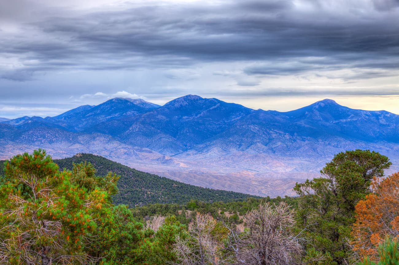
Known as the home of ancient bristlecone pines, Great Basin National Park is a federally-protected area in the eastern part of the US state of Nevada, near its border with Utah. It contains 10 named mountains, the highest and most prominent of which is Wheeler Peak (13,064ft/3,982m).
Great Basin National Park is situated just west of the border between Nevada and Utah within Nevada’s White Pine County. It contains some 120.6 square miles (312.3 sq. km) of land and is about 290 miles (470km) north of Nevada’s largest city of Las Vegas.
The park is near a number of different mountain ranges and wilderness areas. To the west of Great Basin National Park is the Mount Grafton Wilderness Area and the South Egan Range Wilderness Area.
Just north of the park is the High Schells Wilderness Area and the Mount Moriah Wilderness Area. Meanwhile, across the Utah border to the east, there is the Wah Wah Mountains Wilderness Study Area and the King Top Wilderness Study Area.
Finally, Great Basin National Park is bordered to the south by the Highland Ridge Wilderness. Combined, the two areas protect some 227 square miles (590 sq. km) of land in eastern Nevada.
Notable peaks in the park include Wheeler Peak, Jeff Davis Peak, Baker Peak, Pyramid Peak, and Mount Washington.
The mountains within Great Basin National Park are part of the Great Basin Ranges, which are within the Basin and Range physiographic province. This province extends around eastern California and eastern Oregon, throughout Nevada, and into western Utah and southern Idaho.
It consists mostly of thick layers of shale, sandstone, and limestone that formed during the height of the Cambrian, when North America was part of the continent of Laurentia. Since the formation of these rocks, the region has undergone a number of mountain building events, which have resulted in the metamorphism of much of the bedrock in the area, turning some of the bedrock into quartzite, slate, and marble.
However, the mountain features that we see today are much younger than the rocks that comprise them, having been formed during periods of extensive crustal stretching and thinning during the last 30 million years.
As a result of this process the Snake Range, a subrange of the Great Basin Ranges, was formed. The southern part of the Snake Range extends into Great Basin National Park where they form the peaks that we see today.
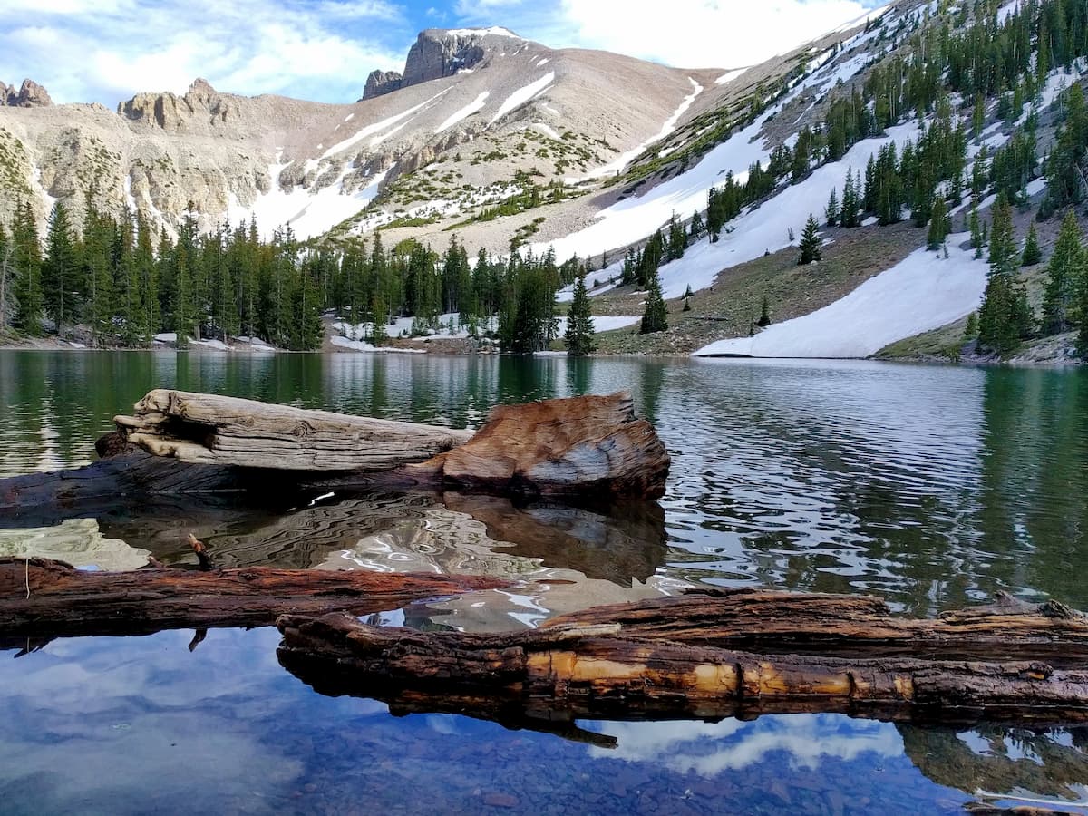
More recently, during the Pleistocene, the region was covered in a substantial amount of ice, which further carved out the mountain features that currently exist. These days, there is just one small remnant glacier within Great Basin National Park within the Lehman Cirque, though it barely resembles the massive ice sheet that once covered the landscape.
Another notable feature of Great Basin National Park is the Lehman Caves. These caves started to form some 550 million years ago during the Cambrian, before the region’s limestone had metamorphosed into marble. During this time, the limestone eroded quickly in the region’s slightly acidic groundwater, leaving behind the stunning caves and their features that exist today.
Great Basin National Park has what’s known as a Cold Semi-Arid Climate (Köppen: BSk), which brings with it cool winters and hot summers. However, the weather conditions in the park are known to change quickly, particularly at higher elevations.
While the Lehman Caves have a fairly constant 50ºF (10ºC) year-round temperature, above ground, the park ranges from an average high of 84.1ºF (28.9ºC) in the summer months to an average high of 38.6ºF (3.7ºC) in the winter.
The defining feature of the region, however, is not heat, but dryness. With an average annual precipitation of just 13.71” (348mm), Great Basin National Park does not get a lot of rain, nor snow, though most of the precipitation that does fall does so at higher elevations. Some parts of the park also have significantly salty soil, which further limits plantlife.
Within the park, there are eight species of coniferous trees, including sagebrush, single-leaf pinyon pine, Utah juniper, and saltbrush. In higher elevation regions, there are white fir, Engelmann spruce, and ponderosa pine, as well as some quaking aspen.
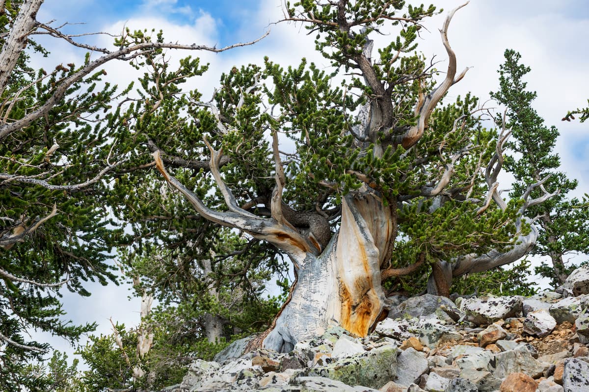
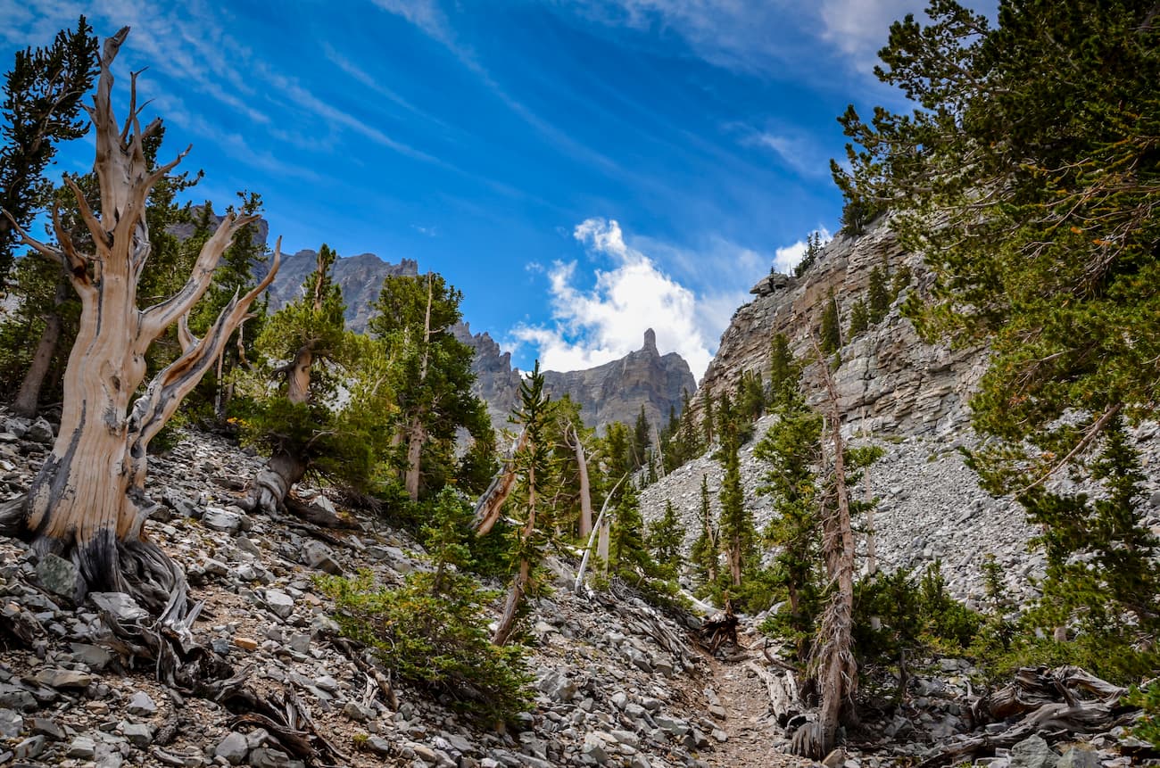
The most identifiable plantlife in the region is easily the Great Basin bristlecone pine. These trees can live to be thousands of years old, growing up to about 49ft (15m) tall with scaly orange-yellow bark.
In fact, one of the oldest of these trees, named “Prometheus” was located on the slopes of Wheeler Peak before it was cut down by scientists for research purposes. Estimated to be about 4860 years old, the scientists responsible for cutting the tree claimed that they did not know its true age before felling it, though the incident remains controversial to this day.
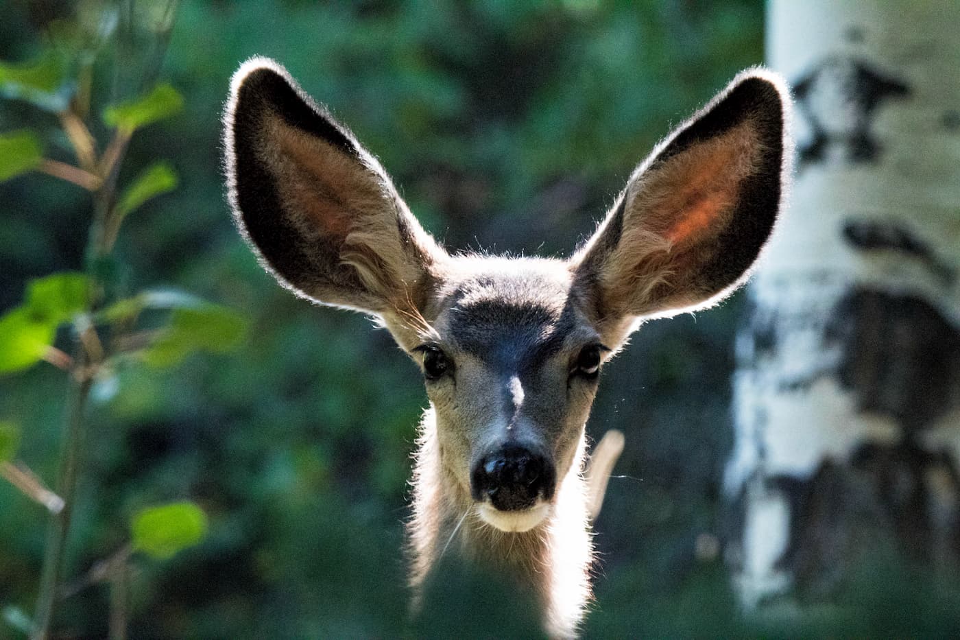
In addition to trees, Great Basin National Park is home to an assortment of wildlife. There are plenty of smaller mammals, including jackrabbits, badgers, kit foxes, and marmots, rock squirrels, and ringtail cats within the park. Larger mammals include bobcats, mountain sheep, pronghorns, coyotes, and mountain lions.
Interestingly, the only fish native to Great Basin National Park is the Bonneville cutthroat trout (Oncorhynchus clarkii utah). Other species that are currently located within the region, including rainbow, brown, brook and Lahontan trout, were stocked in the Snake Range’s lakes before the park was officially designated.
The region that is now Great Basin National Park was home to humans for thousands of years. Among the countless groups of people that called this area home, the Western Shoshone, Ute, Goshute, Washoe, and Paiute were the most dominant before their forced removal at the hands of European-American immigrants.
Some of the earliest Europeans and European-Americans to have traveled through the Great Basin include Jeddidiah Smith, a prominent fur trapper. Later, in the early 1800s, John C. Frémont led his three major expeditions, traveling across the United States and the Great Basin.
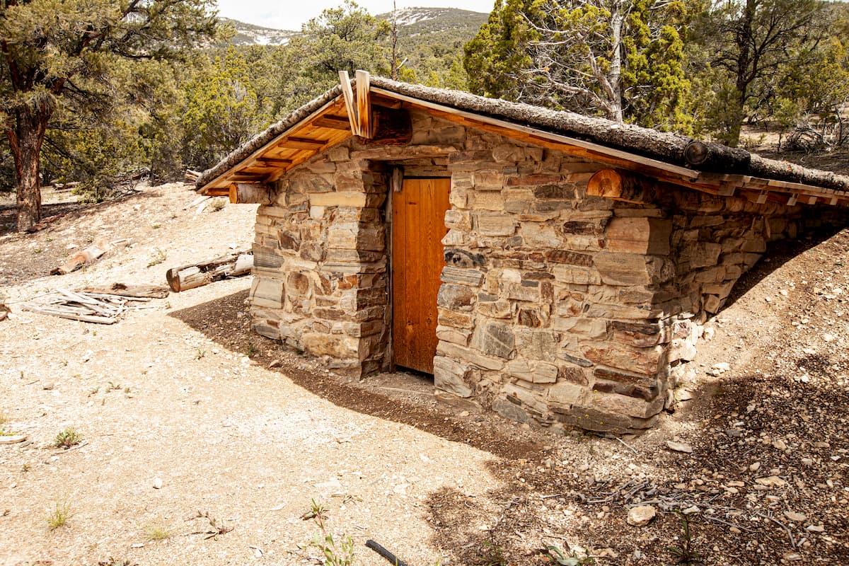
By the 1850s, a line of immigrants looking to make their way to California crossed the area on the California Trail. Some years later, European-Americans started to establish ranching sites within the current park boundaries. Subsequent discoveries of gold and silver deposits in the region also brought mining activity, though most of it, with the exception of the Johnson Lake Mine, was outside the modern-day park area.
Perhaps the best known of these early European-American settlers was Absalom Lehman, who traveled to California and later to Australia looking to make it rich off of gold. After these failed attempts, he arrived in Nevada’s Snake Valley and got into ranching during the late 1860s.
His ranching activities set the stage for a long history of ranching in the region that persists to this day. In fact, this culture of ranching created issues when the park was first established in 1986 by presidential proclamation at the hands of President Harding.
In an attempt to appease local ranchers, public land grazing permits were honored within the park, despite its protected status. Eventually, a local conservation fund managed to buy the permits off of the few local ranchers that still had them, ending most cattle grazing within the park itself. However, there are still some sheep grazing areas within the western part of the Snake Range.
Great Basin National Park is a comparatively small park. However, it offers a decent amount of on-trail hiking opportunities for visitors to enjoy. Here are some of the best options to check out:
The trail to Lexington Arch is officially 5.4 miles (8.6km) long (recent road washouts extend the hike by up to 2 miles/3.2km) and takes visitors to see a six-story high limestone arch. It is a steep and rugged trail, but it offers a unique chance to see this fantastic geological feature.
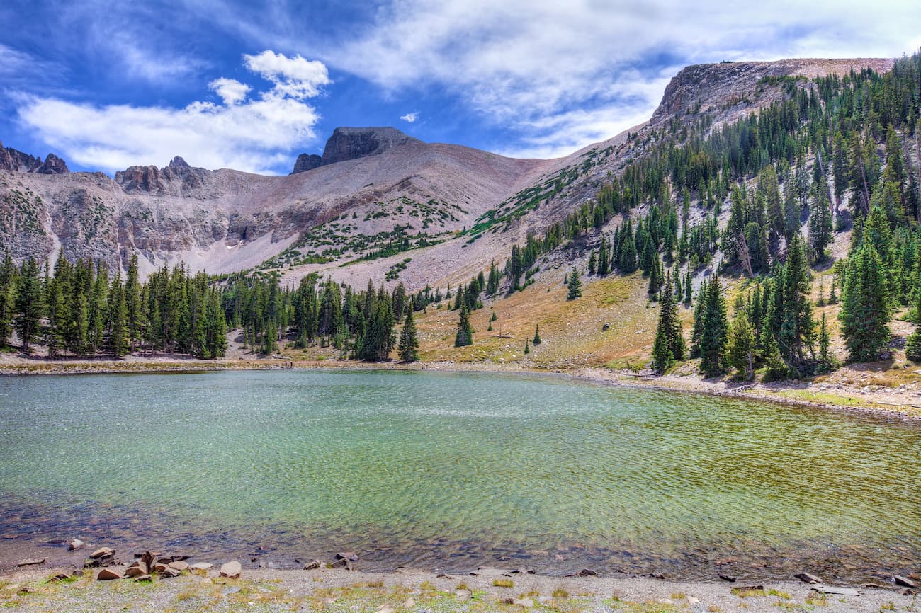
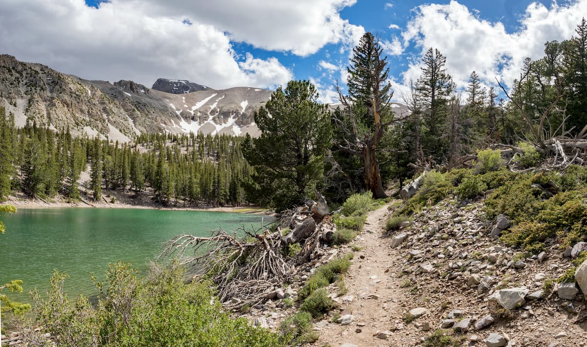
For great views of Wheeler Peak, the 2.7 mile (4.4 km) Alpine Lakes Loop is a must. This trail takes visitors to see two alpine lakes, Stella and Teresa, and offers panoramic vistas of the surrounding area.
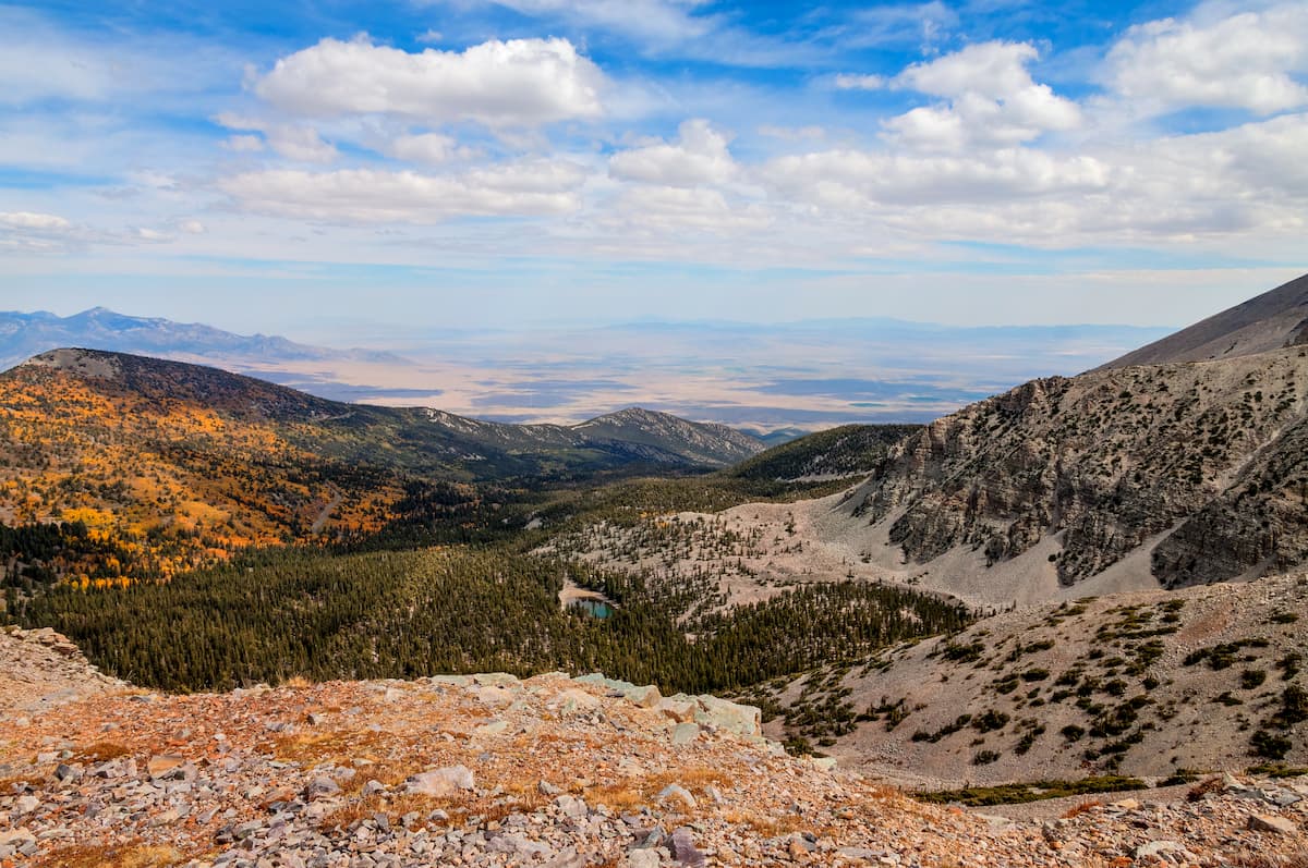
The Bristlecone and Glacier Trail is a 4.6 mile (7.4km) hike that journeys through groves of ancient bristlecone pines up to the base of the only remaining glacier in Nevada. It also provides nice views of Wheeler Peak.
For the more adventurous among us, the 8.6 mile (14km) long Wheeler Peak Summit Trail provides a nice day of hiking. It follows a ridge to the summit of the highest peak in the park, which also happens to be the second most prominent in Nevada. Park officials recommend that hikers start their journey early in the day to avoid the afternoon thunderstorms.
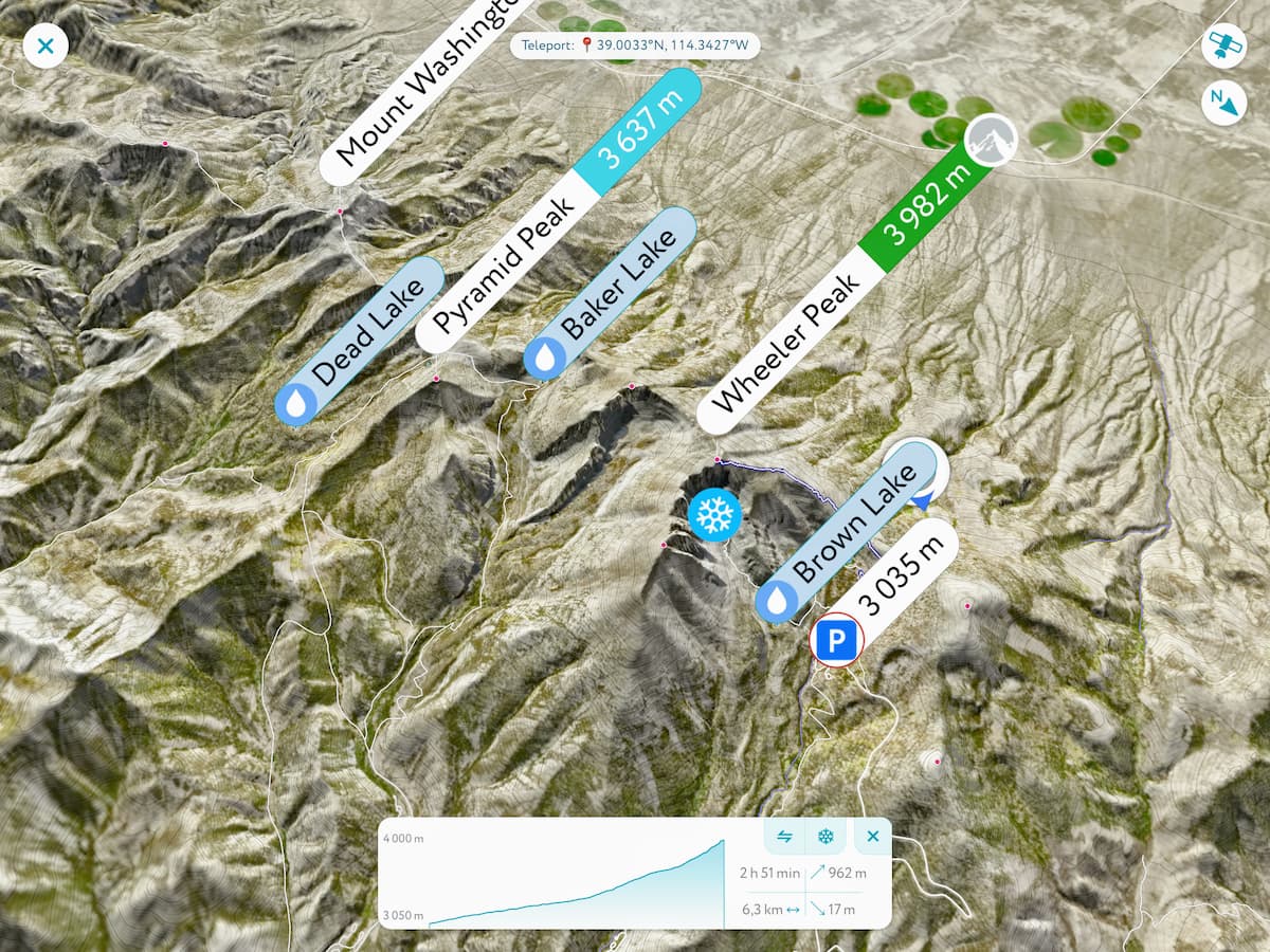
This 13.1 mile (21.1km) long hike offers a strenuous loop up and over the ridge that separates Johnson and Baker Lakes. It also provides excellent views of both Wheeler Peak and Baker Peak.
Great Basin National Park is located in a fairly remote section of Nevada. Here are some of the largest nearby towns and cities:
Ely is the largest city within Nevada’s White Pine County with around 4,200 residents. It started as a stagecoach station along the Pony Express and boomed during the mining and railroad eras. These days, travel to and from Ely is by road only, and there are a handful of US Routes that traverse the city.

Located some 3.5 hours to the northeast of Great Basin National Park, Salt Lake City is the capital and most populous city of Utah with over 200,000 inhabitants. It is a well-known destination for outdoor recreation. The city has a major international airport, as well as highway access along both I-15 and I-80, making it a great place to start your trip into Great Basin.


13er
ultra
nevada-11ers
nevada-peaks-club
las-vegas-mountaineers-classics
nevada-peaks-club-emblem
western-state-climbers
western-state-climbers-star
sierra-club-desert
great-basin
great-basin-star
nevada-ultras
nevada-11ers
nevada-peaks-club
las-vegas-mountaineers-classics
great-basin
nevada-11ers
nevada-peaks-club
las-vegas-mountaineers-classics
great-basin


