
Scan the QR code and open PeakVisor on your phone
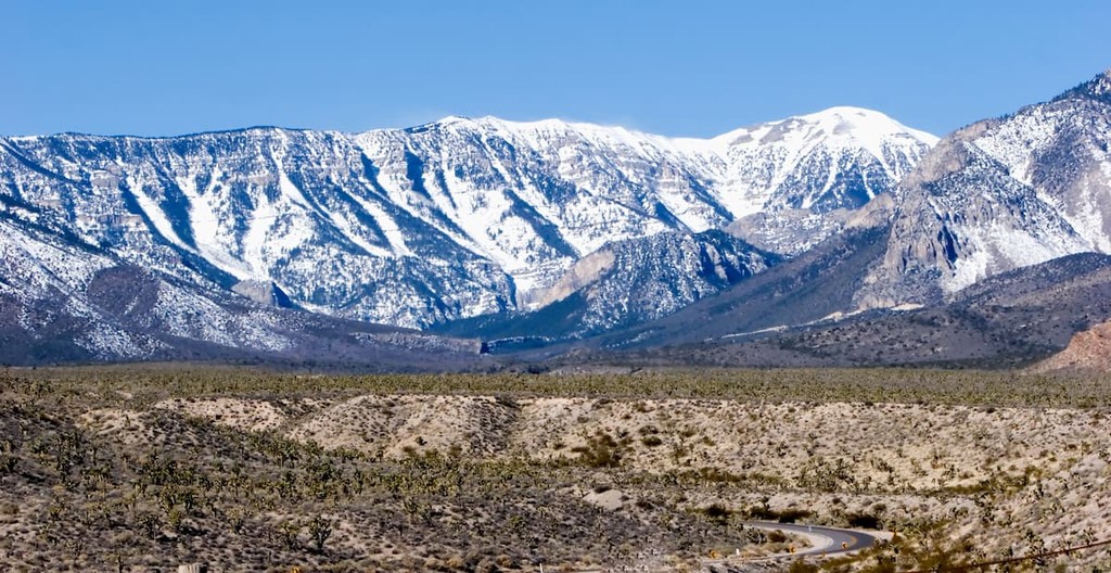
Boasting sprawling desert, snow-capped peaks, ancient bristlecone pine forests, and some world-famous casinos, Nevada is a US state located in the western part of the country. Although it’s less known for its mountainous landscape than its neighboring states, Nevada contains 2101 named mountains, the highest of which is Boundary Peak (13,130ft/3,998m), and the most prominent of which is Charleston Peak (11,916ft/3,632m).
The state of Nevada is located in the western region of the United States. With a total land area of 110,577 square miles (286.382 sq. km), Nevada is the seventh largest state in the union by area. However, with a population of just over 3 million, Nevada is only the 32nd most populous state, which makes it the 42nd most densely populous state in the country.
As a result of its unique shape, Nevada shares its borders with quite a few other states. This includes California to the west, Arizona to the southeast, Utah to the east, and both Idaho and Oregon to the north.
Interestingly, about 63% of Nevada is federally-owned land that is by the Bureau of Land Management. Another 16% or so of the state is managed by other federal agencies, including the US National Park Service and the US Forest Service, leaving just over 20% of the state in private hands and in state management.
As a result, Nevada is home to the highest percentage of federally-owned land of any state in the union, with 79.6% of the state owned by the US Government.
Nevada is officially broken up into 16 different counties and 1 independent city. However, the state can also be informally categorized by region, each of which has its own unique topography, economy, and culture.
The southern region of Nevada can be defined in many ways, but it generally refers to the southern half of the state. This includes Clark, Lincoln, Nye, and Esmeralda counties, so, ironically, Southern Nevada is home to both the largest (Clark) and the smallest (Esmeralda) counties by population.
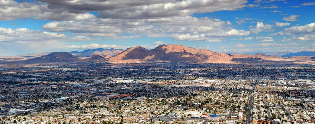
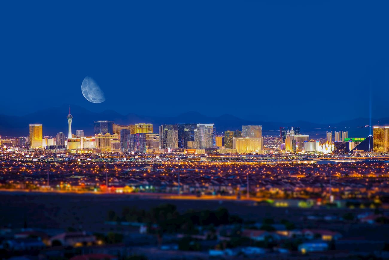
Due to the fact that Las Vegas is located in Clark County, the southern region of the state is easily the most populous part of Nevada. In fact, around 2.3 million people live in Clark County, alone. Moreover, southern Nevada is the state’s major tourism hub, thanks to the appeal of Las Vegas both domestically and internationally.
Nevertheless, southern Nevada is also home to an exceptional collection of mountain ranges and outdoor recreation areas.
The vast majority of southern Nevada is covered by the Great Basin Ranges, which includes the following subranges:
Meanwhile, a tiny sliver of extreme southeast Nevada is technically part of the Colorado Plateau, which includes:
Southern Nevada is a veritable treasure trove of outdoor recreation opportunities. Some of the many parks you can find in the region include:

Finally, southern Nevada contains a great collection of wilderness areas, as well as a number of wilderness study areas which are under consideration for official designation as wilderness areas, such as:
Encompassing Mineral, Washoe, Churchill, Storey, Lyon, and Douglas counties as well as Carson City, the Northern Sierra Nevada or Western Region of Nevada is a particularly popular destination for outdoor recreationalists.
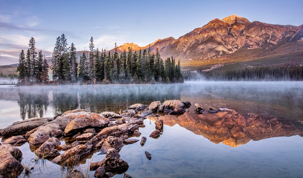
The region is well known among hikers and skiers, thanks to Lake Tahoe, which is located along its southern boundary. It also contains a great collection of parks and recreation areas in its own right as well as some beautiful mountain ranges.
Additionally, the Northern Sierra Region is home to the Pyramid Lake Paiute Tribe, who have a reservation that comprises a small section of their ancestral homelands in Washoe, Lyon, and Storey counties around Pyramid Lake.
The majority of the region is dominated by peaks of the Great Basin Ranges, including:
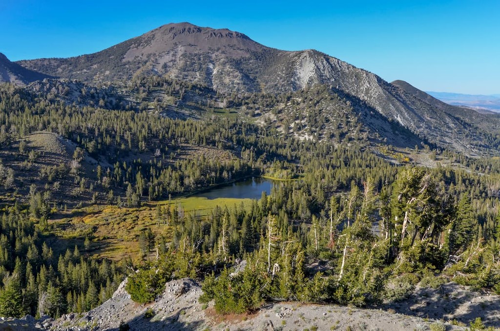
However, as the region’s name suggests, it is also home to a small sliver of the Sierra Nevada, namely in the Carson Range.
There are also quite a few areas of public land within the Northern Sierra Region, such as:
One of the most sparsely populated parts of the state, Nevada’s Northwestern Region includes Humboldt, Pershing, and Lander. With a combined population of around 30,000 people, these three counties are known for their vast areas of open land.
Pershing County, in particular, is best known for being the host of the annual Burning Man festival. The festival is usually hosted at a temporary city known as Black Rock City, which is established in the Black Rock Desert each year, about 100 miles (160km) to the northeast of the city of Reno.
The region is a mix of steppe, basins, and mountain ranges, though it is dominated by the peaks of the Great Basin Ranges, which include:

Within Northwestern Nevada, there are also quite a few excellent areas of public land, particularly if you’re interested in visiting the Black Rock Desert. These include:
The fourth and final region of Nevada, the Northeast Region includes Elko, Eureka, and White Pine counties in the northeastern part of the state. The third most populous region in the state, the Northeast Region is home to approximately 60,000 people, most of whom live in Elko County, which also happens to be the fourth-largest county in the contiguous United States.
Nevada’s Northeastern Region is particularly well known for its mining industry. It also contains the Duck Valley Reservation, which is home to some members of the Shoshone-Paiute Tribes, as well as the Goshute Reservation, wish is home to the Confederated Tribes of the Goshute Reservation.
Northeastern Nevada also contains a fantastic array of mountains that are part of the Great Basin Ranges. This includes:
Furthermore, the northeastern part of the state contains some of its most beautiful areas of public land, such as:

Nevada is a geologically unique state that’s home to parts of 3 major geomorphic provinces: the Great Basin, the Colorado Plateau, and the Sierra Nevada, each of which boasts its own geologic history.
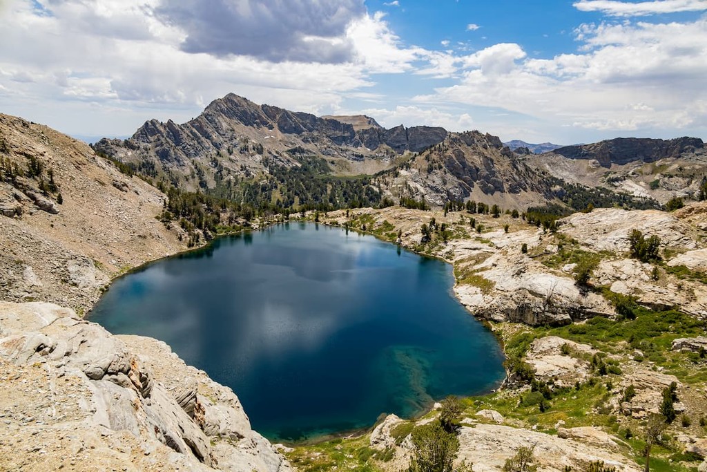
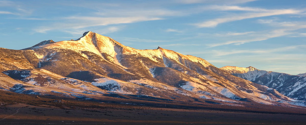
Encompassing nearly all of Nevada, the Great Basin Ranges are part of a massive geomorphic province that covers parts of Nevada, California, Oregon, Idaho, and Utah. The range includes some 3,689 named mountains, the highest of which is White Mountain Peak (in California), and the most prominent of which is Charleston Peak in Nevada.
Geologically, the history of the Great Basin Ranges are quite complex as it formed as a result of widespread tectonic expansion during the Miocene. However, it’s well known that the range is very rich in mineral resources, which is why Nevada has such a long tradition of mining.
Major peaks in Nevada’s Great Basin Ranges include Boundary Peak, Wheeler Peak, Mount Moriah, Charleston Peak, North Schell Peak, and Pilot Peak.
Covering a very small section of the southern tip of Nevada, the Colorado Plateau is another of the region’s major geomorphic provinces. It includes parts of Colorado, New Mexico, Utah, Arizona, and the southernmost tip of Nevada as well as 5,001 named mountains, the highest and most prominent of which is Mount Peale (of the La Sal Mountains in Utah).
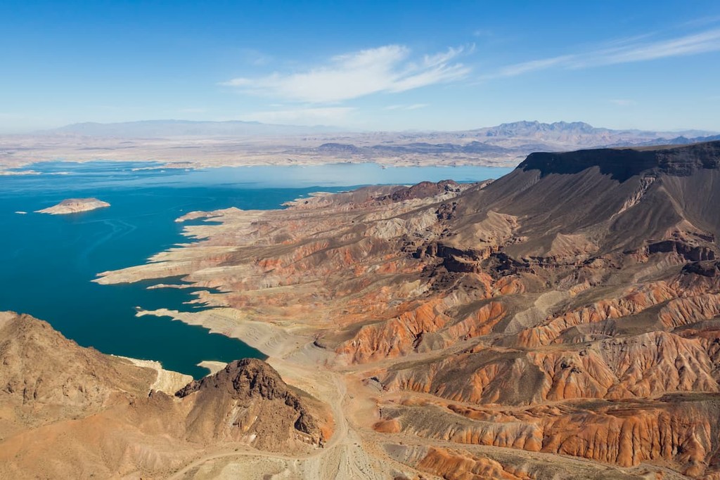
In Nevada, the Colorado Plateau is found around Lake Mead National Recreation Area and it includes the Virgin Mountains, South Virgin Mountains, Eldorado Mountains, and Newberry Mountains subranges.
Geologically, the plateau is part of a massive nearly intact province that is dominated by sedimentary rocks. The plateau was uplifted sometime around the Cenozoic, though it’s not completely clear what caused this uplift.
The final geologic province in the state of Nevada is that of the Sierra Nevada. Although the vast majority of the Sierra is located in California, a small section to the south of Reno is situated in Nevada, namely, the Carson Range.
Like the rest of the Sierra Nevada, the mostly igneous rocks within the Carson Range started to form about 155 to 87 million years ago as part of the Sierra Batholith. Later, as the Basin and Range started to tilt and uplift, the Sierra Nevada block to the west followed suit.
Major peaks within the Sierra Nevada region of Nevada include Mount Rose, Rifle Peak, Snowflower Mountain, and Slide Mountain.
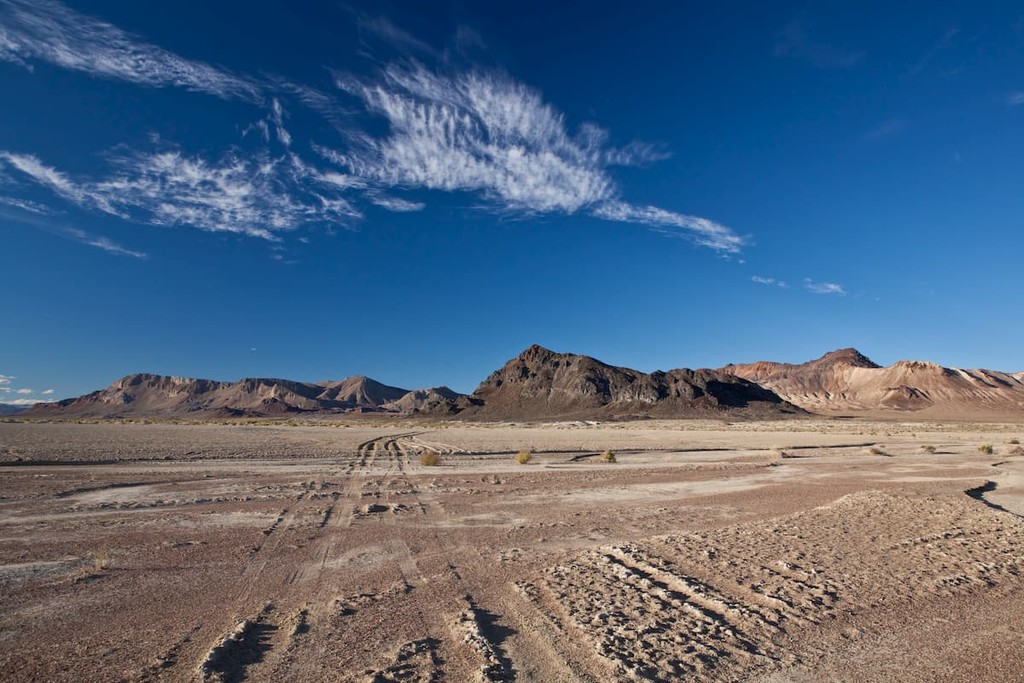
As one of the largest states in the union, it should come as no surprise that Nevada is home to a decent amount of biodiversity. Nevertheless, the state’s hot, arid climate limits the types of species that can survive in the region to only the heartiest of drought-tolerate flora and fauna.
Within Nevada, there are 3 primary ecoregions, all of which have their own unique mix of flora and fauna.
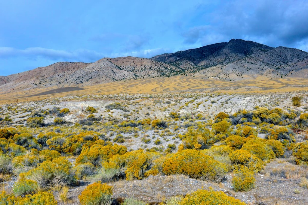
Also called the Great Basin Desert, the Central Basin and Range includes nearly all of central Nevada, as well as much of the land sandwiched between Utah’s Wasatch Range and California’s Sierra Nevada.
The ecoregion is known for being hot and dry in the summer, yet snowy in the winter. At lower elevations, it is home to salt deserts and sagebrush valleys which eventually give way to pinyon-juniper forests.
Moving up in elevation, the region actually has montane forests, which contain stands of Douglas fir, white fir, ponderosa pines, subalpine fir, Engelmann spruce, mountain mahogany, aspen, and even the ancient bristlecone pine. There are also some very small areas of alpine ecosystems atop the tallest peaks in the region.
Wildlife includes pronghorn, jackrabbits, elk, mule deer, and bighorn sheep, as well as a collection of birds and smaller mammals.
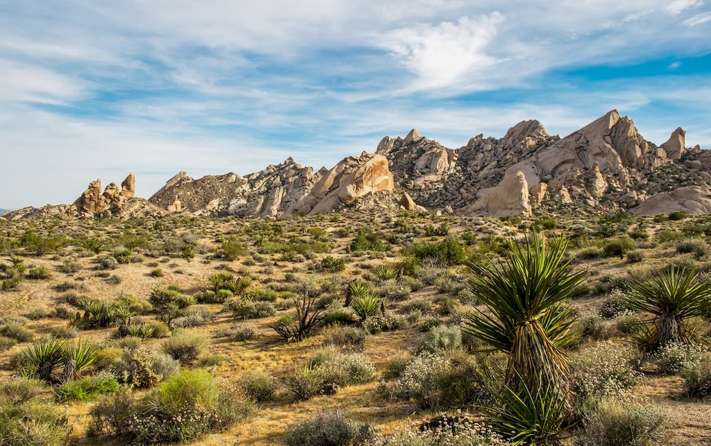
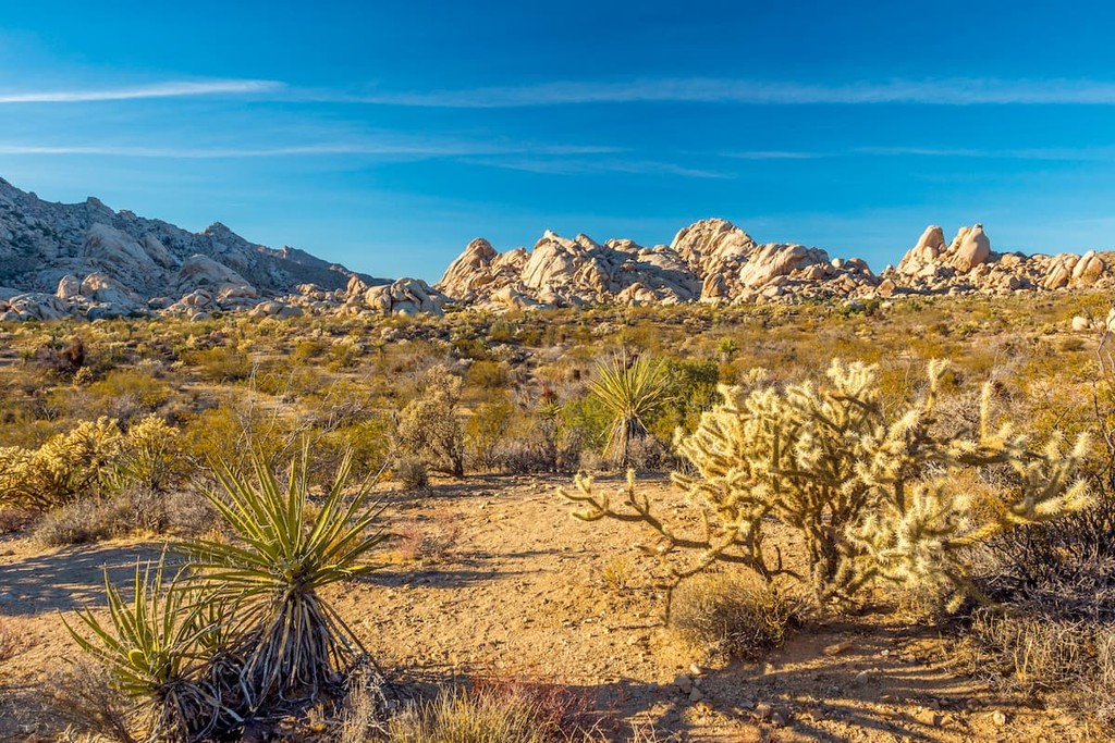
The Mojave Basin and Range, or, more colloquially, the Mojave Desert, is an arid region in California, southern Nevada, Arizona, and Utah. Known for being particularly dry, the Mojave is also home to its characteristic Joshua trees, which are found throughout the desert.
Although there are Joshua trees throughout the region, however, much of the desert is dominated by shrubs, creosote, and smaller cacti. It is also home to a surprising amount of wildlife, including coyotes, desert bighorn sheep, chuckwalla, bobcats, mountain lions, desert kit fox, desert tortoise, pronghorns, and mule deer.
The final major ecoregion in Nevada, the Northern Basin and Range encompases the northernmost parts of the state as wella s sections of Oregon, California, and Idaho to the south of the Snake River Plain.
Within the Northern Basin and Range, there are actually quite a few plant communities. The lowest elevations are generally home to sagebrush steppe that give way to juniper woodlands at higher elevations.
In the mountains, sagebrush, Douglas fir, aspen, and subalpine fir are most prevalent. However, there is quite a lot of livestock grazing in the region, so some natural plant cover has been removed.
The land that is now Nevada has a long and storied history of human inhabitation that dates back millennia.
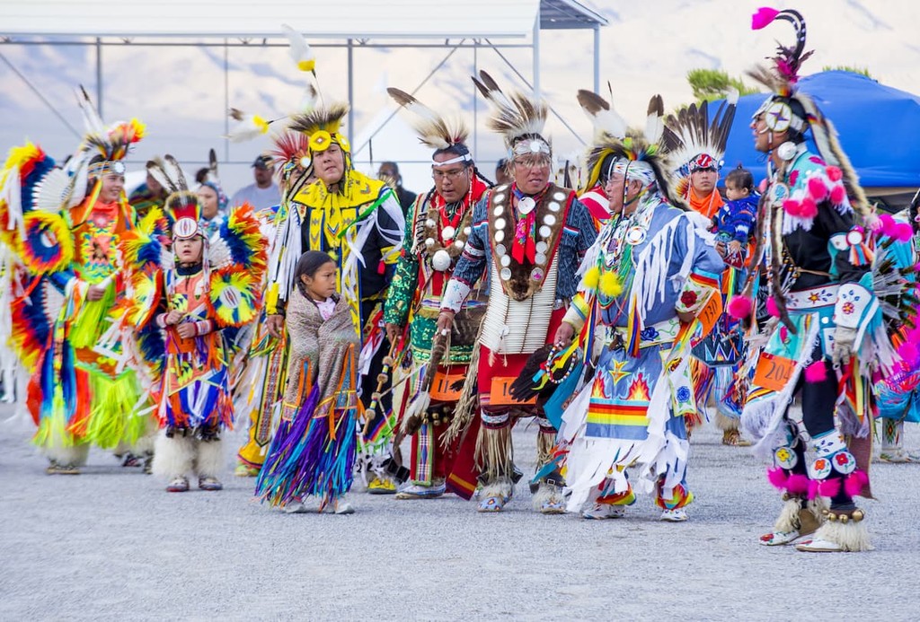
Indeed, the region is part of the ancestral homelands and traditional territory of many Indigenous peoples, including the Confederated Tribes of the Goshute Reservation, the Duckwater Shoshone Tribe, the Ely Shoshone Tribe, the Las Vegas Paiute Tribe, the Moapa Band of Paiutes, the Pyramid Lake Paiute Tribe, the Shoshone-Paiute Tribes, the Washoe Tribe of Nevada and California, and the Yomba Shoshone Tribe, among others.
The first Europeans to visit the land that is now Nevada were likely Spanish missionaries who came in the 1770s. It is believed that Francisco Garcés traveled through the region in the late 18th century after it was claimed by Spain as part of New Spain.
After the Californias were split in the early 19th century, what is now Nevada became part of Alta California. In the years after the Mexican War of Independence, the region then became a territory of Mexico, rather than a state.
Americans and Canadians of European descent are believed to have arrived for the first time in the region around the 1820s. During this time, Jedidah Smith made his way to the Las Vegas Valley while Peter Skene Ogden traveled down the Humboldt River.
With the conclusion of the Mexican-American War, Mexico ceded what is now Nevada to the United States in 1848. Then, during the California Gold Rush that soon followed, the Emigrant Trails through the region became immensely popular to the large groups of prospectors that sought to make it rich in California.
Although gold mining wasn’t as profitable in Nevada as it was in California, the discovery of the Comstock Lode in the Virginia Range was very important to the region’s economy. The Comstock lode, which was discovered in the 1850s, was one of the largest silver mines in the entire United States.
In 1864, Nevada officially became a state, even though it technically didn’t have the 60,000 residents that was normally required for statehood. Not long after, the University of Nevada was founded in 1874.
By the 1930s, it was clear that Nevada and the surrounding arid states needed a more reliable source of water from the Colorado River. So, they built the Hoover Dam in southern Nevada, which created Lake Mead and encouraged massive population growth in the Las Vegas area.
During the Great Depression, Nevada took an interesting political step and legalized gambling throughout the state, paving the way for its now-booming casino industry. The legalization of gambling also allowed Las Vegas to grow exponentially over the course of the 20th century.
Nevada also has a number of other laws that make it unique in the United States. In fact, it is the only state in the country where prostitution is legal, though the legalization of prostitution is a county-by-county decision.
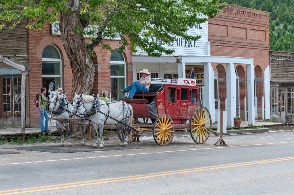
These days, Nevada’s two largest cities – Reno and Las Vegas – remain major tourist destinations, both throughout the United States and internationally. While much of the state is fairly remote, it is home to an exceptional amount of hiking and camping opportunities, so it’s a worthy destination for any outdoor enthusiast.
A lifetime’s worth of adventure awaits anyone who seeks it out in Nevada. With millions of square miles of publicly-owned land, hundreds of mountain ranges, and dozens of recreation areas, Nevada is a sure bet for any hiking trip. Here are some of the best places to check out during your visit to the state:
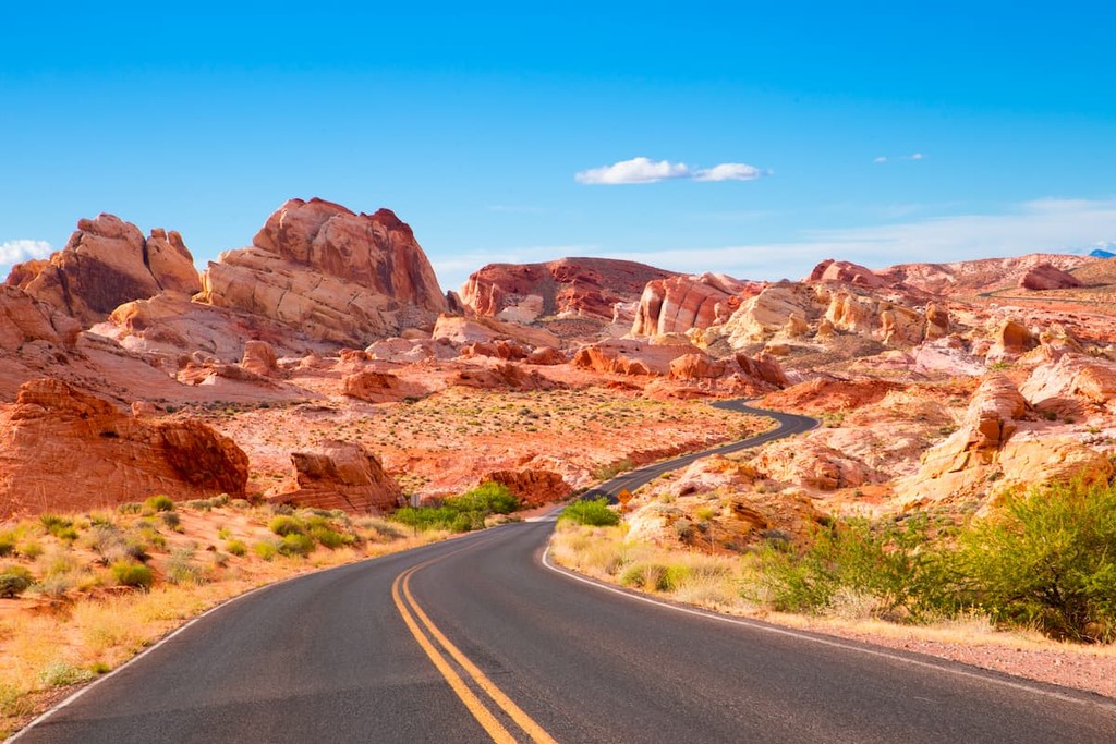
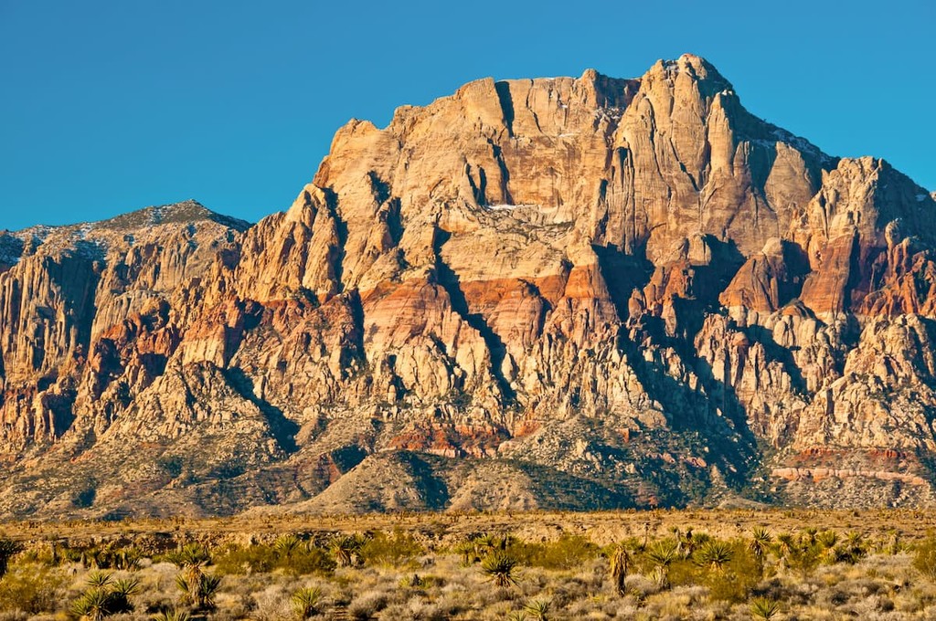
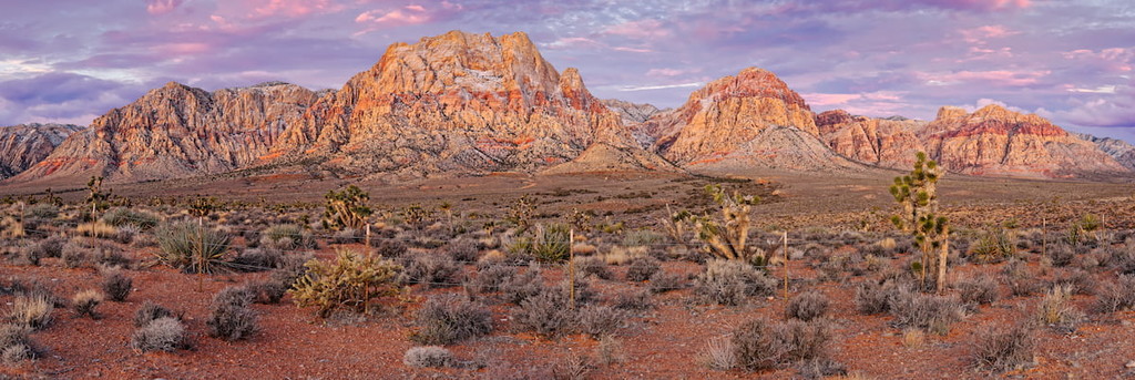
The Red Rock Canyon National Conservation Area is arguably one of the most popular hiking areas near Nevada’s largest city, Las Vegas. It contains 3 named mountains, the highest and most prominent of which is Calico Hills.
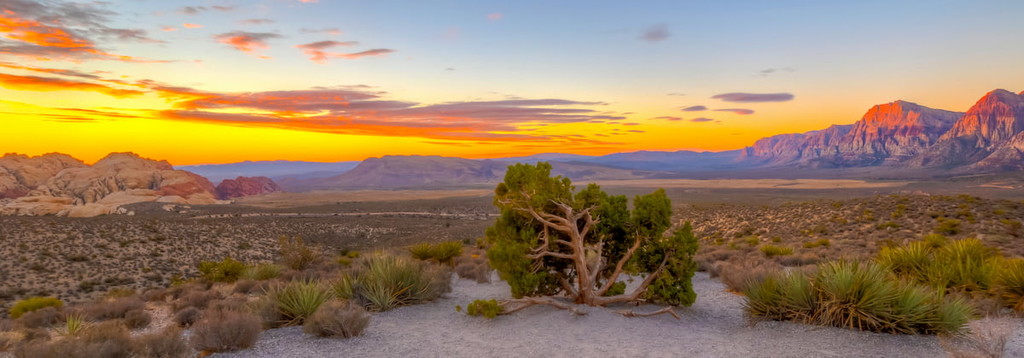
Stretching along the east-facing side of the Spring Mountains, Red Rock Canyon offers a variety of hiking trails and rock climbing opportunities. The Turtlehead Peak trail is one of the more popular trails in the area and consists of a challenging 4.6 mile (7.4km) trek past petroglyphs to the top of Turtlehead Peak.
Ice Box Canyon, an easier 3 mile (4.8km) hike, traverses high-walled canyons and ends in a seasonal waterfall. All hikes in the area depart from a 13 mile (20.9km) scenic loop drive that winds through the park.
At a remarkable 6.3 million acres (2.5 million ha), the combined Humboldt National Forest and Toiyabe National Forest are the largest national forests in the lower 48 states and an ideal place for hiking, backpacking, and camping.
Four National Scenic Trails are found within the forest: The Pacific Crest Trail, the Toiyabe Crest Trail, the Ruby Crest Trail, and the Mount Charleston Trail. The Humboldt-Toiyabe National Forest also contains 18 designated wilderness areas and over 1,000 hiking trails to explore.
Thirty-five miles northwest of Las Vegas, Mount Charleston is touted as an ideal, year-round getaway for experiencing a variety of outdoor recreation opportunities.
Part of the Spring Mountains, Mount Charleston ranges from 3,000-12,000 feet (914m to 3,650m) in elevation, making it the perfect place to escape the desert heat. Visitors can choose from a variety of hiking trails, some of which feature notable mountain peaks like Bonanza Peak.
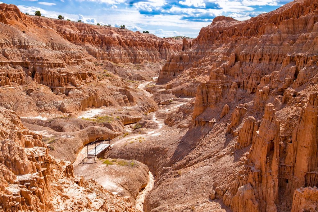
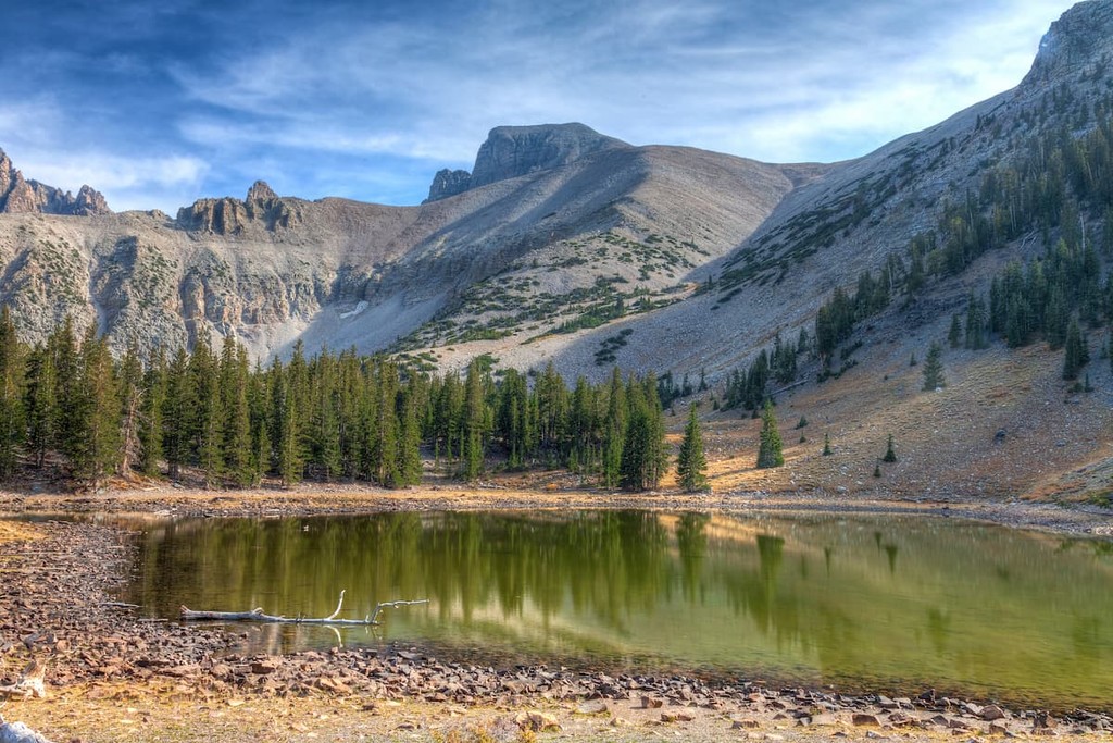
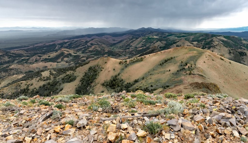
Great Basin National Park is Nevada’s only state park and it is located in the northeastern part of the state near the town of Ely. The park contains 10 named mountains, the highest and most prominent of which is the stunning Wheeler Peak.
Home to a diversity of different landscapes, Great Basin National Park encapsulates the sheer variety of topography that can be found in the Great Basin. From the high mountain peaks of the Snake Range to ancient bristlecone pine forests and even the subterranean Lehman Caves, there’s plenty to see and do in Great Basin National Park.

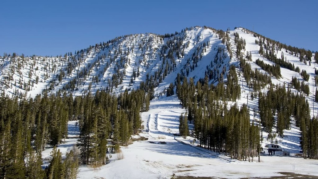
For skiing and snowboarding enthusiasts, there are more than 5 ski resorts in Nevada.
The largest is Heavenly Ski Resort with more than 90 km (56 mi) of slopes and more than 20 ski lifts, which is located on the western border of the state with California in the area of Tahoe Lake. There are also two other major areas for skiing in Nevada located just nearby: Diamond Peak Ski Resort and Mt. Rose Ski Tahoe. The main and only ski resort near Las Vegas is Lee Canyon.
Check the Nevada ski resorts map and the larger USA ski resorts map in the World Mountain Lifts section of the site. It includes information about open ski lifts / slopes in Nevada in real-time with opening dates and hours. There are also year-round cable cars, funiculars, cog railways, aerial tramways, and all other types of mountain lifts.
Looking for a place to stay in Nevada? Here are some of the best cities to check out in the state:
Las Vegas is an internationally renowned major resort city, known for its gambling, shopping, entertainment, and nightlife. However, a short distance from the bustling city lies some of Nevada’s top areas for outdoor recreation.
Red Rock Canyon National Conservation Area, Lake Mead National Recreation Area, Valley of Fire State Park, and Spring Mountains National Recreation Area are all within a short drive of Las Vegas and the snow-capped peak of Mt. Charleston can be seen from parts of the Las Vegas strip.
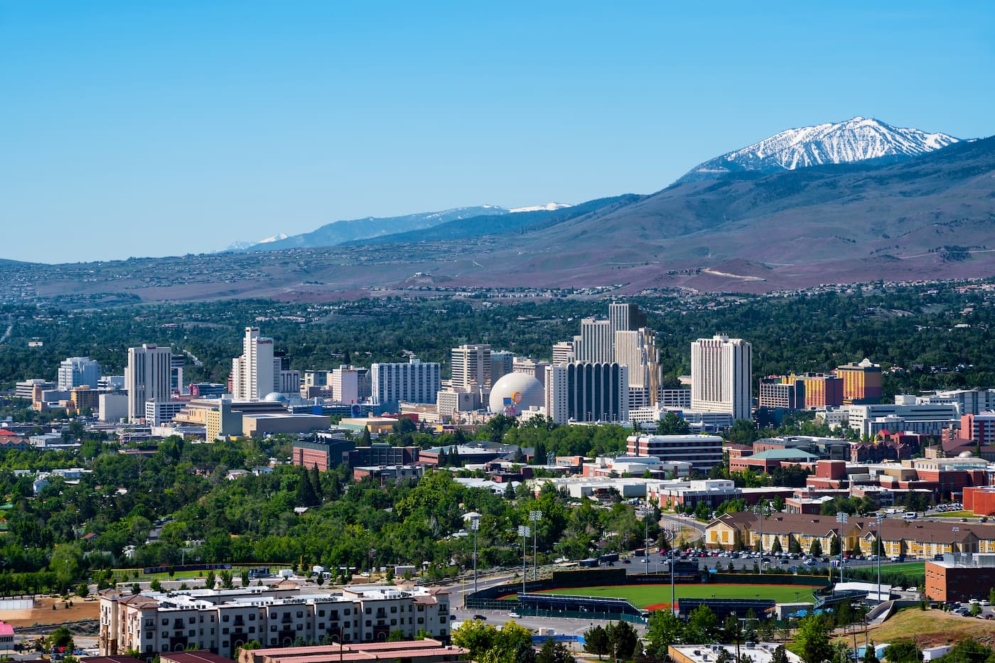
The second largest city in the state, Reno is located in the Western region of Nevada near the state’s border with California. Reno is well-known for its casino and tourism industries as well as its proximity to some of the region’s best outdoor recreation opportunities. It is also within driving distance of Lake Tahoe, so it offers unparalleled access to the Sierra Nevada.
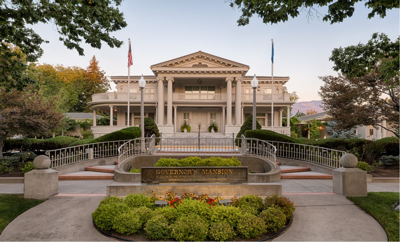
Named after the mountain man, Kit Carson and nestled on the banks of Lake Tahoe, Carson City, the capital of Nevada, is an ideal place to stay for visitors interested in outdoor exploration. Carson City is surrounded by the Sierra Nevada Mountains and offers a variety of outdoor, cultural and historical attractions to choose from.
Situated in northeastern Nevada, Elko is the largest city in Elko County with around 20,000 residents. As a hub for the greater Ruby Valley, Elko is a major center for tourism and commerce in the region. It is also located very close to the Ruby Mountains, which are considered to be one of the best backcountry ski destinations in all of Nevada.


nevada-11ers
nevada-peaks-club
las-vegas-mountaineers-classics
nevada-peaks-club-emblem
western-state-climbers
western-state-climbers-star
desert-summits-book
sierra-club-desert
great-basin
great-basin-star
13er
ultra
nevada-11ers
nevada-peaks-club
las-vegas-mountaineers-classics
nevada-peaks-club-emblem
western-state-climbers
western-state-climbers-star
sierra-club-desert
great-basin
great-basin-star
nevada-ultras
nevada-11ers
nevada-peaks-club
las-vegas-mountaineers-classics
great-basin
nevada-11ers
nevada-peaks-club
las-vegas-mountaineers-classics
western-state-climbers
western-state-climbers-star
great-basin
ultra
nevada-11ers
nevada-peaks-club
las-vegas-mountaineers-classics
nevada-peaks-club-emblem
western-state-climbers
western-state-climbers-star
sierra-club-desert
great-basin
nevada-ultras
nevada-11ers
nevada-peaks-club
las-vegas-mountaineers-classics
great-basin
ultra
nevada-11ers
nevada-peaks-club
las-vegas-mountaineers-classics
nevada-peaks-club-emblem
western-state-climbers
western-state-climbers-star
desert-summits-book
sierra-club-desert
desert-peaks-section-emblem
great-basin
great-basin-star
nevada-ultras
ultra
nevada-11ers
nevada-peaks-club
las-vegas-mountaineers-classics
western-state-climbers
western-state-climbers-star
great-basin
nevada-ultras
ultra
nevada-11ers
nevada-peaks-club
las-vegas-mountaineers-classics
nevada-peaks-club-emblem
western-state-climbers
western-state-climbers-star
desert-summits-book
sierra-club-desert
desert-peaks-section-emblem
great-basin
great-basin-star
nevada-ultras
13er
ultra
nevada-11ers
nevada-peaks-club
las-vegas-mountaineers-classics
nevada-peaks-club-emblem
western-state-climbers
western-state-climbers-star
sierra-club-desert
great-basin
great-basin-star
nevada-ultras
ultra
nevada-11ers
nevada-peaks-club
las-vegas-mountaineers-classics
nevada-peaks-club-emblem
western-state-climbers
western-state-climbers-star
sierra-club-desert
great-basin
nevada-ultras
ultra
nevada-11ers
nevada-peaks-club
las-vegas-mountaineers-classics
western-state-climbers
western-state-climbers-star
great-basin
nevada-ultras
ultra
nevada-peaks-club
las-vegas-mountaineers-classics
desert-summits-book
sierra-club-desert
great-basin
nevada-ultras
ultra
nevada-peaks-club
western-state-climbers
western-state-climbers-star
great-basin
nevada-ultras
ultra
nevada-11ers
nevada-peaks-club
las-vegas-mountaineers-classics
nevada-peaks-club-emblem
western-state-climbers
western-state-climbers-star
sierra-club-desert
great-basin
great-basin-star
nevada-ultras
nevada-11ers
nevada-peaks-club
las-vegas-mountaineers-classics
western-state-climbers
western-state-climbers-star
great-basin


