
Scan the QR code and open PeakVisor on your phone
Sheldon National Wildlife Refuge has 22 named peaks. The highest is Catnip Mountain at 2,223 m. Other notable peaks include Badger Mountain, Bald Mountain and Yellow Peak.
The Sheldon National Wildlife Refuge is a protected region located in the northwestern region of the US state of Nevada. This protected area marks the third largest animal refuge in the contiguous 48 states. The tallest and most prominent peak is Catnip Mountain at 7,293 feet (2,223 m) tall with 1,355 feet (413 m) of prominence.
The Sheldon National Wildlife Refuge is located in the northwestern section of the US state of Nevada with a small portion extending into southern Oregon. The national wildlife refuge encompasses 573,504 acres (232,089 ha) of land across Humboldt County and Washoe County.
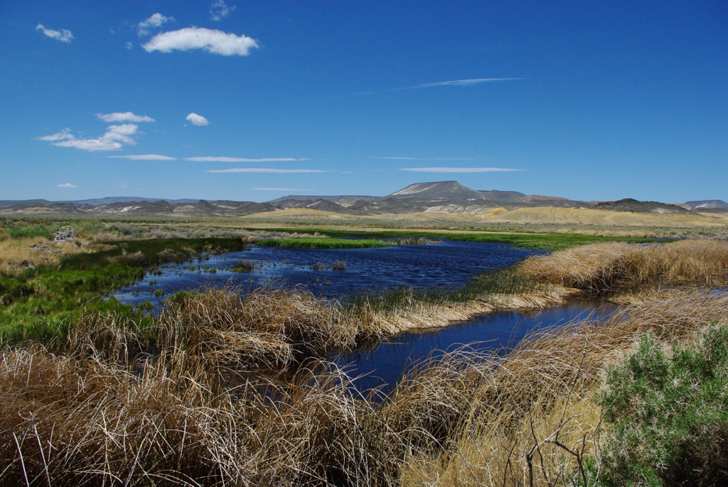
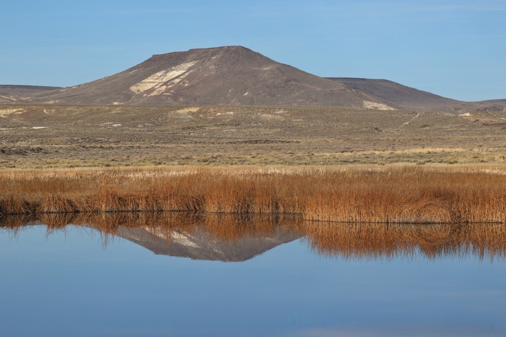
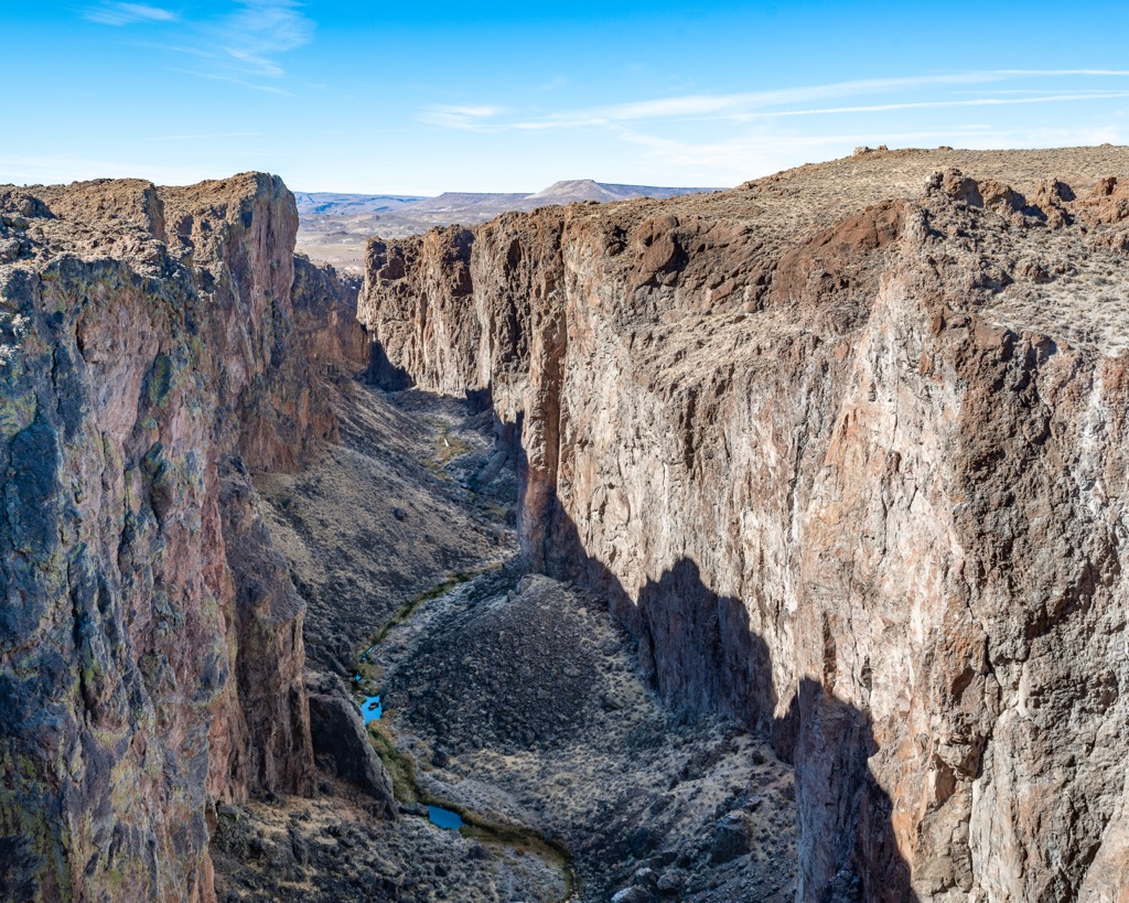
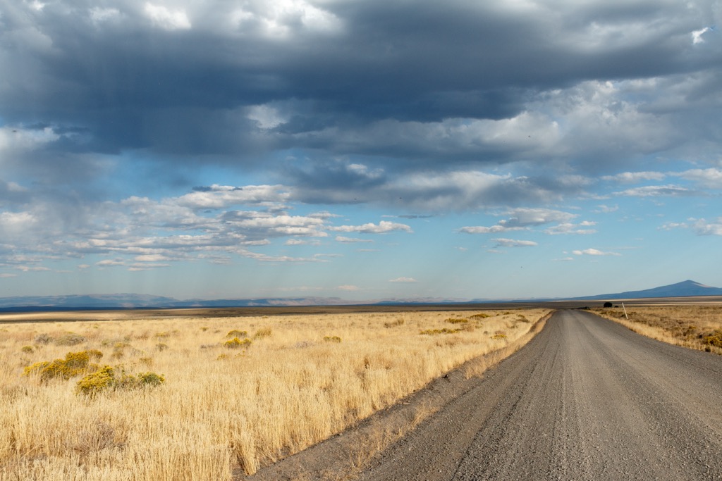
Terrain in this protected region is marked by high desert landscapes and sweeping vistas. Amidst the rolling hills and ridgelines lie numerous springs, lakes, and waterfalls. Canyons cut across the rugged landscape which is predominantly covered in sagebrush steppe.
This volcanic terrain creates a rather arid environment, only able to support sections of desert vegetation. Hikers will not spot vast sections of forest but rather rolling hillsides populated by grasses and low growing shrubs and small lakes.
Elevations in the refuge range from 4,100 feet (1,200 m) up to 7,200 feet (2,200 m). Small geothermal hot springs are found throughout the protected area, also supplying the warm water for the campground located within the refuge.
Amidst the rolling hills and basins lies the Virgin Opal Mining District which is still active to this day. The closest major river to the refuge is the Quinn River which runs southeast of the protected region. Prominent lakes in the refuge include Swan Lake Reservoir and Big Spring Reservoir.
The Sheldon National Wildlife Refuge is located near numerous other areas for outdoor recreation. Directly north lies the Hawk Mountain Wilderness Study Area and the Rincon Wilderness Study Area. To the south lies the Black Rock Desert-High Rock Canyon Emigrant Trails National Conservation Area. West of the refuge lies portions of both the Modoc National Forest in California and the Fremont-Winema National Forest in Oregon.
The Sheldon National Wildlife Refuge lies within the Great Basin Ranges, which encompass portions of the states of Nevada, Utah, Idaho, Oregon, and California.
This mountainous region began forming during the Early Miocene. Widespread tectonic extension occurred as the Pacific Ocean plate was subducted beneath the North American plate. As the Earth’s crust was folded and stretched, a series of mountain ranges began to form.
The landscape became marked by a series of alternating peaks and valleys, giving the region its Basin and Range name. This subduction has also led to numerous hot spots in the area, which today can be seen through the hot springs of the region.
The Great Basin region is also known for being the largest region of contiguous watersheds in North America that has no outlet. Cores of the peaks in the region are composed of both igneous and metamorphic rocks while the outer layers are primarily sedimentary rock.
This portion of land is known for being rich in minerals with opal mining having been active in the region since 1906. Common minerals found in the region include black opals, precious opal, hyalite opal, jasper, obsidian, carnelian, petrified wood, agates, and various semi precious gemstones.
Major peaks within the refuge include Catnip Mountain, Bald Mountain, Badger Mountain, and Big Mountain.
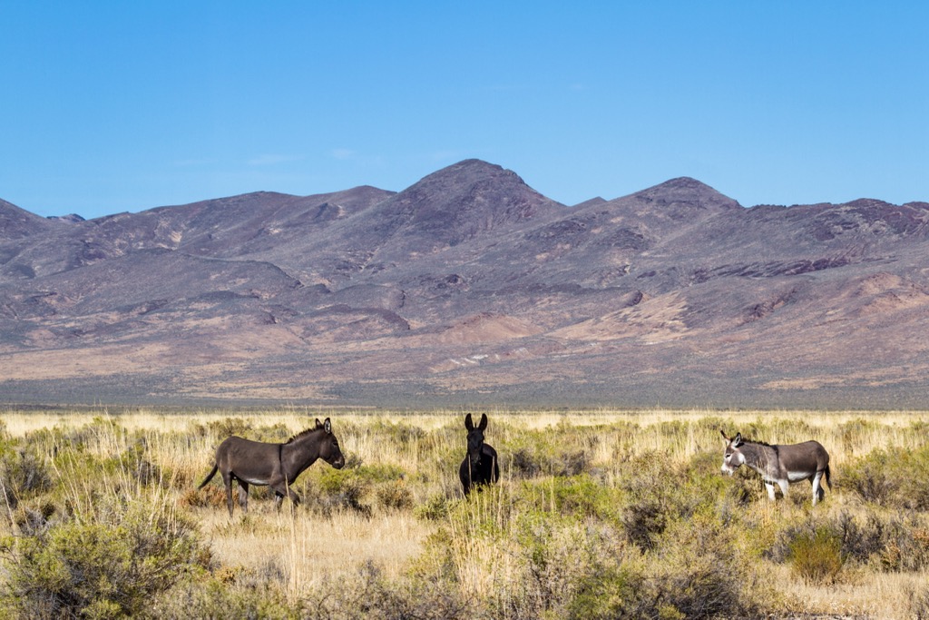
This arid volcanic zone marks one of the few intact sagebrush steppe ecosystems in the Great Basin region. Despite the rather harsh conditions, the refuge is home to a variety of both flora and fauna.
Common plant species found throughout the refuge include sagebrush, mountain mahogany and bitterbrush. Though there are no densely forested patches in the refuge, hikers are likely to spot stands of both juniper and aspen.
The refuge helps support various species of migratory birds along with sage grouse. Some of the ponds, lakes, and reservoirs contain populations of fish, including the endemic Alvord chub. This land was previously home to wild mustang though they were all removed by 2014.
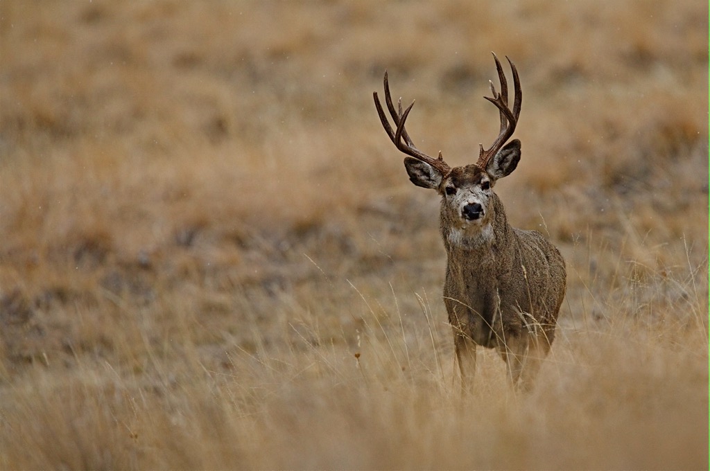
A population of pronghorn, the fastest land mammal in North America, live in the region along with mule deer, and bighorn sheep. The population of bighorn sheep continues to grow after the species was reintroduced in the 1930s. Hikers may also spot pygmy rabbits amidst the shrubs.
The land in and around the Sheldon National Wildlife Refuge has been home to humans for thousands of years. Long before European colonizers arrived, this region was home to numerous Indigenous Tribes.
This region marks part of the ancestral homelands of the Northern Paiute (Nüümü), and the Cayuse, Umatilla, and Walla Walla peoples. These people lived semi-nomadically, traditionally migrating with the changing of the seasons. Descendants of these tribes are part of the Summit Lake Indian Reservation, Pyramid Lake Indian Reservation, and the Confederated Tribes of the Umatilla Indian Reservation.
The 1820s marked the first recorded contact between the Indigenous peoples of the region and Europeans. Over the following decades, the population surrounding nearby Reno steadily began to rise.
An offshoot of the well-traveled California Trail, known as the Lassen-Applegate Trail, passed near the refuge during the 1850s. Wagon ruts of this historical route can be spotted in the nearby Black Rock Desert-High Rock Canyon Emigrant Trails National Conservation Area.
Increased population and people traveling through the region led to numerous disputes between the European-Americans and the Indigenous peoples of the area. Some of the most prominent battles in the surrounding area include the Pyramid Lake War, Owens Valley Indian War, Snake War, and Bannock War.
The arrival of Europeans also led to the spread of infectious diseases such as smallpox and measles. Indigenous populations were further decimated from these illnesses which they had no natural immunity to. Those who survived were forcibly removed from their native homelands and placed on reservations. Many young Indigenous children were forced to attend schools that were centered around assimilation and eradicating their traditional way of life and beliefs systems.
Mining prospects throughout Nevada brought more people to the region during the mid-19th to early 20th centuries. Lack of rainfall ultimately led many settlers to relocate to present-day California and Oregon.
Opal mining has been active in the region since 1906. The Virgin Valley Mining District is still active today with their mineral rights being grandfathered-in as the refuge was established in 1931.
Horses that lived in the refuge were descended from horses used by the US army. At the turn of the twentieth century, the horses were turned loose in the region. As the horses survived on grass, their grazing threatened the surrounding ecosystem, ultimately leading to their removal in 2014.
The Sheldon National Wildlife Refuge marks one of the most remote areas in the state of Nevada. Those visiting the region will often be over 100 miles (161 km) from the nearest gas station or food shop. There are no established hiking trails in the refuge. Here are a few hikes in the surrounding region:
This route is located near the eastern edge of the refuge near Continental Lake. This out and back route can be used for both hiking and off-roading with high clearance vehicles being able to drive right up to the hot springs. From the hot springs, hikers have views of the surrounding desert landscape and rolling foothills that lead into the refuge. This trail is 9.3 miles (15 km) round trip and features 91 feet (28 m) of elevation gain.
This out and back trail is situated northeast of the refuge in the Pueblo Mountains Wilderness Study Area. The route winds through the sagebrush landscape, roughly following along Cottonwood Creek. Rolling hills rise above on either side of the creek valley with minimal amounts of shade throughout. This hike is 3.5 miles (5.6 km) long and features 515 feet (157 m) of total elevation gain.
This short out and back trail lies southeast of the refuge in the Pine Forest Range Wilderness Area. True to its name, the trail begins by climbing steadily through the pine forest before reaching a series of lush blue lakes. Visitors can take in the views while steep terrain rises along the south side of the main lake. This out and back route is 1.3 miles (2 km) in length and features 288 feet (88 km) of total elevation gain.
Looking for a place to stay near the Sheldon National Wildlife Refuge? Here are some of the best cities and villages to check out in the region.
The town of Lakeview, Oregon lies northwest of the refuge and is home to under 2,500 residents. Situated at an elevation of 4,757 feet (1,450 m), Lakeview boasts the title of the “Tallest Town in Oregon”.
Despite its relatively small size, Lakeview is surrounded by a plethora of natural beauty. Situated in the Goose Lake Valley, the town lies at the foot of the Warner Mountains, located along the southern edge of Oregon’s high desert region.
Nearby attractions include Oregon’s Outback Scenic Highway which runs through the town, along with opportunities for outdoor recreation in Fremont-Winema National Forest and Modoc National Forest.
The city of Winnemucca lies southeast of the refuge, marking the closest city to the protected region. Home to roughly 8,000 residents, the city was named after Chief Winnemucca who led the Northern Paiute tribe to the region.
As the Pacific Railroad was being built, the city was established during the mid-1800s. Situated along the Humboldt River, Winnemucca lies roughly halfway between San Francisco, California and Salt Lake City, Utah.
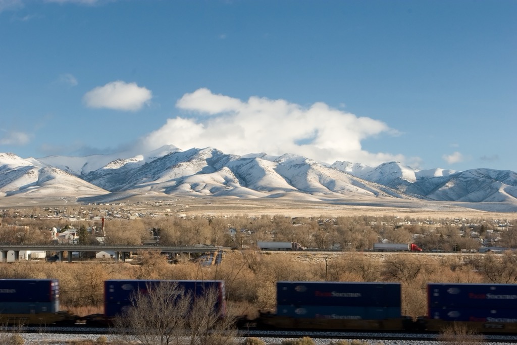
Surrounding ranges including the Santa Rosa Mountains, Humboldt Range, and Ruby Mountains provide visitors with access to some of Nevada’s most remote hiking trails. Similar to other cities in Nevada, Winnemucca features numerous casinos and opportunities for gambling.


The highest peak in Sheldon National Wildlife Refuge is Catnip Mountain, at 2,223 m.
Notable peaks in Sheldon National Wildlife Refuge include Catnip Mountain, Badger Mountain, Bald Mountain, Yellow Peak and Alkali Peak.


