
Scan the QR code and open PeakVisor on your phone
The Black Rock Desert-High Rock Canyon Emigrant Trails National Conservation Area, often referred to as Black Rock-High Rock NCA, is a protected region located in the northwestern region of the US state of Nevada. Within the NCA lie ten designated wilderness areas. The tallest and most prominent peak in the region is Division Peak at 7,257 feet (2,212 m) tall with 1,312 feet (400 m) of prominence.
The Black Rock-High Desert NCA covers a diverse section of landscape across the northwestern region of the US state of Nevada. The NCA encompasses just under 800,000 acres (323,749 ha) of land across Humboldt County and Pershing County.
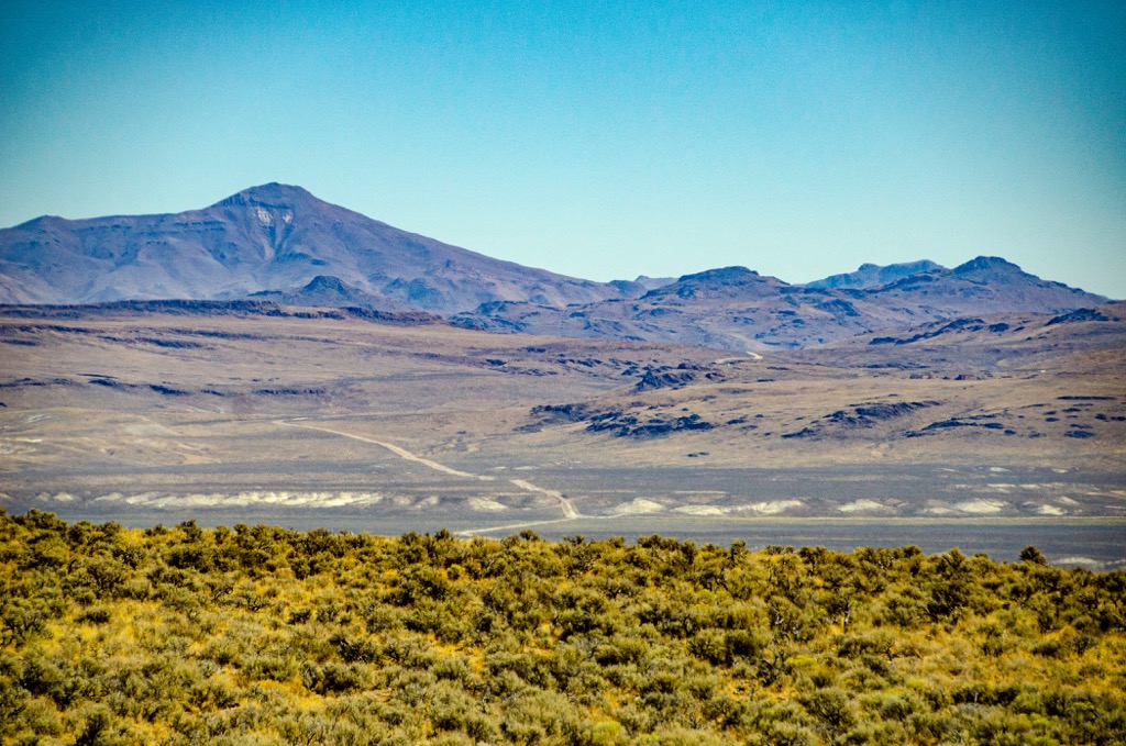
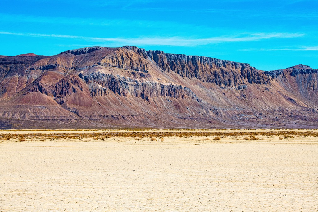
Hikers in the region have the opportunity to explore the Black Rock Desert, High Rock Canyon, historic trails, and various hot springs. The Black Rock Desert features lava beds, alkali flats, and playa. The main playa portion of the desert marks the now-dry bed of Lake Lahontan. This portion of the NCA spans roughly 44 miles (71 km) in length and 7 miles (11 km) in width.
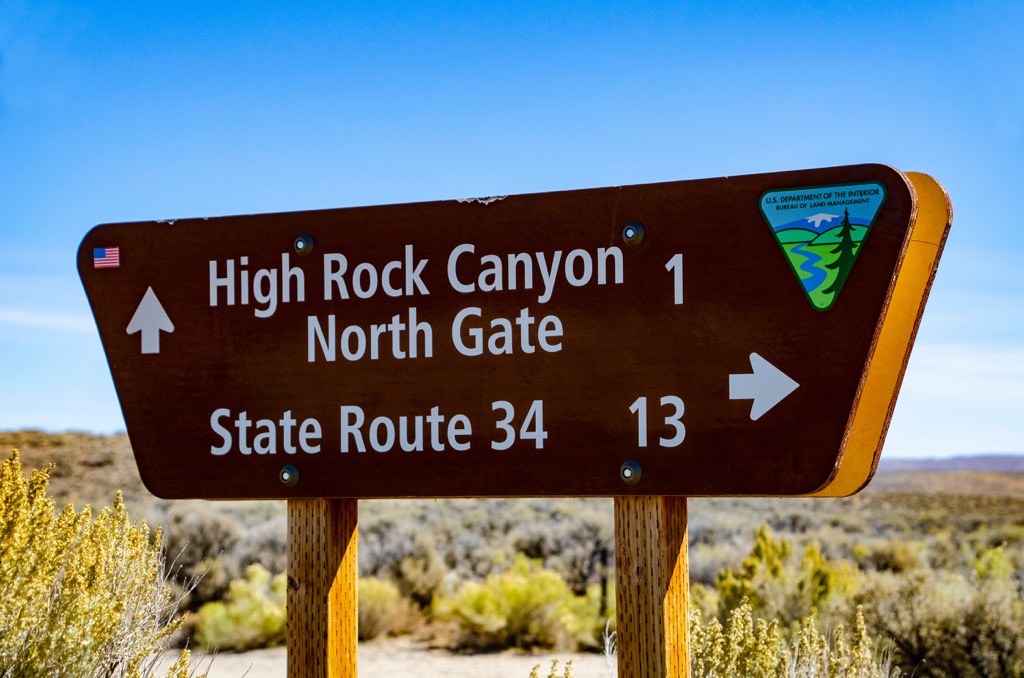
Other portions of the NCA are marked by steep and rugged canyons which cut across the terrain. The narrow gorge found in the High Rock Canyon is another notable spot within the protected region that features a hiking trail.
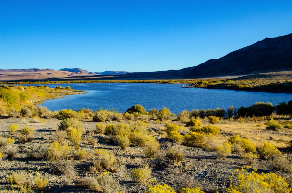
Major bodies of water in the region include the Quinn River, High Rock Lake and the Mud Meadow Reservoir. Below are the ten designated wilderness areas within the Black Rock-High Desert NCA:
Besides the wilderness areas it encompasses, the NCA is located near numerous other areas for outdoor recreation. Poodle Mountain, Twin Peaks, and Buffalo Hills Wilderness Study Areas are located southwest of the NCA while Modoc National Forest and the South Warner Wilderness are to the west. The Sheldon National Wildlife Refuge lies to the north with sections of the Humboldt-Toiyabe National Forest situated to the east.
The Black Rock-High Rock NCA lies within the Great Basin Ranges, which encompass portions of the states of Nevada, Utah, Idaho, Oregon, and California.
This expansive region began forming in the Early Miocene. During this time, widespread tectonic extension resulted in stretching and folding of the Earth’s crust. Over the course of millions of years, this process resulted in the alternating series of peaks and valleys which give this region its name.
The Great Basin region also marks the largest region of contiguous watersheds that have no outlet in all of North America. Outer layers of the mountains in the area are composed of sedimentary rock. Both metamorphic and igneous rocks make up the core of peaks in the region.
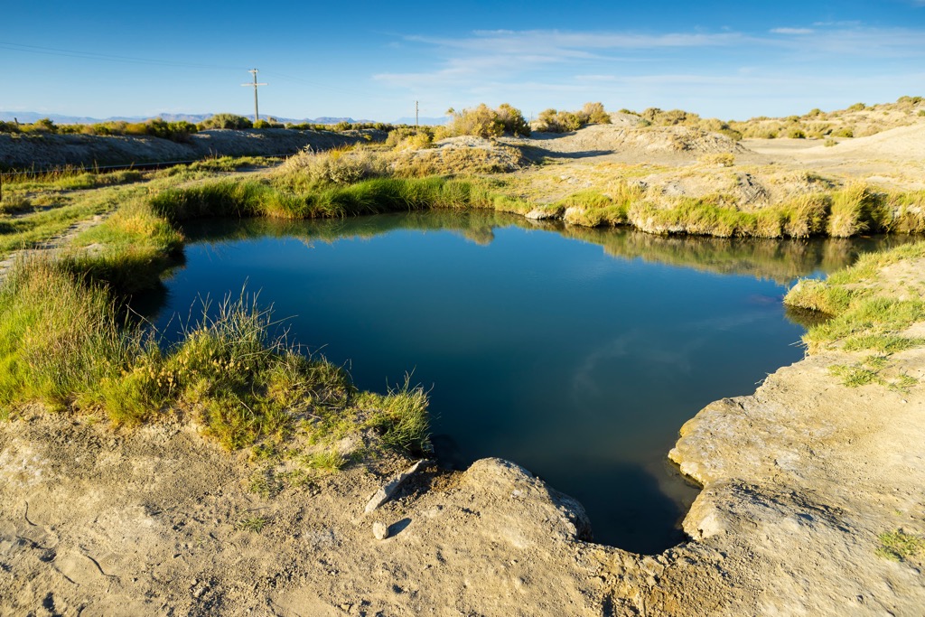
The Black Rock Desert portion of the NCA contains numerous volcanic and geothermal features. Geothermal activity can still be seen throughout the desert region that once marked the ancient Lake Lahontan.
Roughly 13,000 years ago, this lake covered 8,500 square miles (22,000 square km) across present-day Nevada. The lake eventually retreated during the end of the Pleistocene epoch, eventually leaving only a playa behind. Mammoth fossils have been found throughout the region along with various other fossils, many of which are now located at the Nevada State Museum.
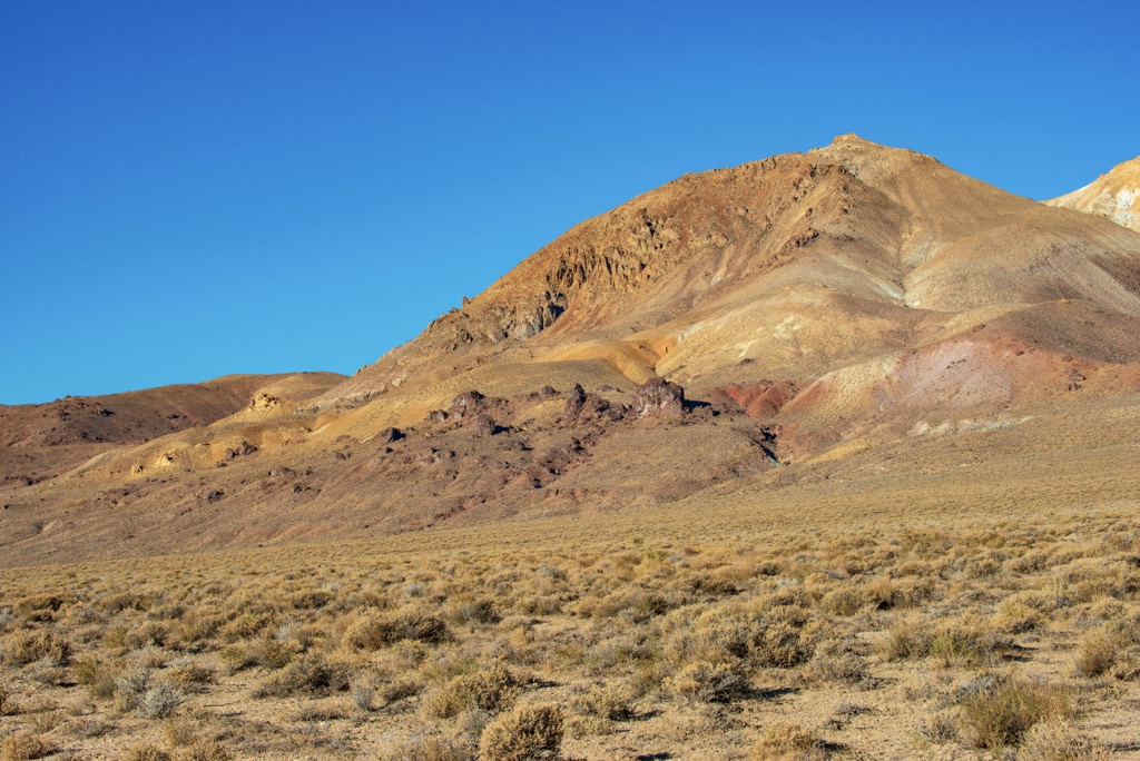
Major peaks within the NCA include Division Peak, Burnt Rock Peak, Ladden Cone, Black Rock Point, and Steamboat Mountain.
This semi-arid region features flora and fauna found throughout Great Basin shrub steppe eco-regions. The desert portion of the protected region features minimal amounts of flora.
Hikers are likely to spot various grasses, shrubs, algae, fungi, and lichen. During the spring months there are numerous species of wildflowers. A majority of the area is free of vegetation. Saltbrush and greasewood are common in the more mountainous areas.
Despite the extreme temperatures and minimal amounts of rainfall, a variety of animals inhabit the region. High Rock Canyon provides the ideal habitat for chukar, bighorn sheep, and quail. Birds of prey in the region include great-horned owls, prairie falcons, golden eagles, and red-tailed hawks.
Other animals in the mountainous region include mule deer, pronghorn antelope, sage grouse, coyote, pygmy rabbit, ground squirrels, kit foxes, badgers, rattlesnakes, and horned lizards.
The land in and around the Black Rock-High Rock NCA has been inhabited by humans for thousands of years. Long before the arrival of European colonizers, the region was home to numerous Indigenous Tribes.
This region marks part of the ancestral homelands of the Northern Paiute (Nüümü), and the Cayuse, Umatilla, and Walla Walla peoples. These tribes traditionally lived semi-nomadically, migrating with the changing seasons.
Descendants of these tribes are part of the Summit Lake Indian Reservation, Pyramid Lake Indian Reservation, and the Confederated Tribes of the Umatilla Indian Reservation.
The first recorded contact between the Indigenous peoples of the region and Europeans was during the 1820s. Populations near Reno, Nevada steadily began to rise over the following decades.
The Lassen-Applegate Trail, an offshoot of the more traveled California Trail, passed through the region during the 1850s. To this day, wagon ruts from this historical trail can be spotted throughout the NCA.
This increased population led to numerous disputes between the Indigenous peoples and the European-Americans. Some of the most prominent battles that took place included the Pyramid Lake War, Owens Valley Indian War, Snake War, and Bannock War.
This continual fighting, coupled with the arrival of infectious diseases that the Indigenous peoples had no natural immunity to, drastically reduced the Indigenous population. Those who were able to survive were eventually forced onto reservation by the US government. The Indigenous children were continually forced to assimilate with western culture, as the US government attempted to eradicate their traditional way of life.
Mining prospects occurred during the mid-19th century in the Black Rock region. Minimal amounts of rainfall in northwestern Nevada led many people to leave the region and travel west into present-day California.
The flat desert landscape has been used for land speed records and rocketry records throughout the late twentieth century and early twenty first century. Since 1986 the Black Rock Desert has been home to the annual Burning Man event. The Black Rock-High Rock NCA and the ten wilderness areas were established in 2000.
The Black Rock-High Rock NCA is a relatively remote area with minimal amounts of hiking trails. Those traveling through the region should note that the area is home to extreme temperatures and little to no amounts of shade. Here are a few hikes in the region:
This short trail is located at the southern edge of the NCA within the Black Rock Desert. The flat trail winds through the desert landscape from the parking lot with various shrubs and grasses on either side. Hikers may also spot wild horses in the surrounding region. The out and back trail is 0.8 miles (1.3 km) long and features 9 feet (3 m) of total elevation gain.
High Rock Canyon is located in the northwestern region of the NCA within the High Rock Canyon Wilderness Area. The route winds through the canyon, with steep rugged cliffs towering above on either side. The trail can be used for off-roading, hiking, backpacking, and mountain biking. The point to point route culminates at High Rock Lake, totaling 14.1 miles (23 km) and 941 feet (287 m) of total elevation gain.
This out and back trail is situated in the southwestern stretches of the NCA. Hualapai Playa is located just west of the hiking route. The trail climbs steadily through the desert landscape before reaching the summit of Steamboat Mountain. From the summit of the peak, hikers have sweeping views of the desert landscape. The out and back trail is 0.4 miles (0.6 km) long and features 170 feet (52 m) of elevation gain.
Looking for a place to stay near the Black Rock-High Rock NCA? Here are some of the best cities and villages to check out in the region.
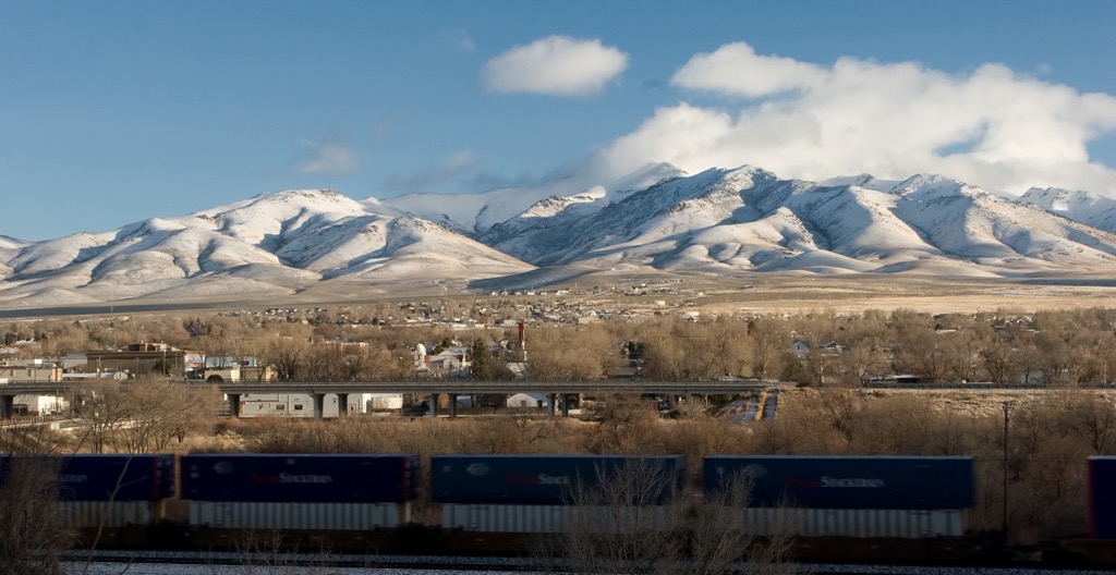
The headquarters for the NCA is located in Winnemucca, marking the closest city to the protected region. Named after Chief Winnemucca who led the Northern Paiute tribe to the region, the city is home to roughly 8,000 residents.
Established during the mid-1800s with the arrival of the Pacific Railroad, Winnemucca is situated along the Humboldt River. The city lies roughly halfway between San Francisco, California and Salt Lake City, Utah.
The surrounding Santa Rosa Mountains, Humboldt Range, and Ruby Mountains provide visitors with access to some of Nevada’s most remote hiking trails. Winnemucca is similar to other cities in Nevada and features numerous casinos and opportunities for gambling.
Reno lies roughly 100 miles (161 km) south of the NCA, marking the closest major city to the protected region. Known as the “The Biggest Little City in the World,” Reno is known for its casinos, gambling, and close proximity to outdoor recreation.

Home to around 425,000 residents, Reno marks the second largest city in Nevada. Besides casinos, the downtown region is home to the Nevada Museum of Art and the National Automobile Museum.
During the summer months, visitors in the region can enjoy rock climbing, hiking, and mountain biking. Lake Tahoe lies a short distance west of Reno, providing further opportunities for outdoor recreation. During the winter months, visitors can enjoy the multiple ski resorts along with terrain for both cross country skiing and snowmobiling.


