
Scan the QR code and open PeakVisor on your phone
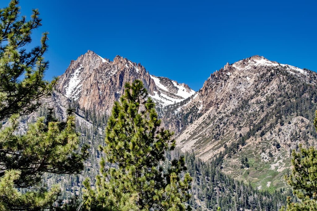
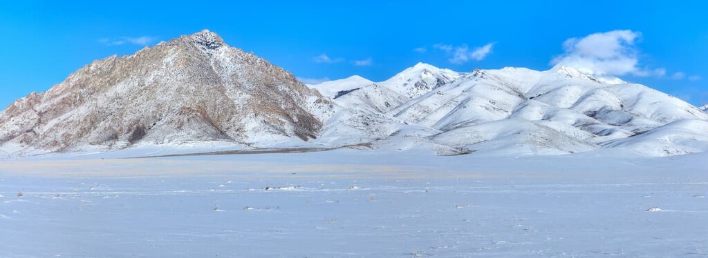
Alongside the Humboldt National Forest, the Toiyabe National Forest forms part of the largest national forest unit in the contiguous United States. The Toiyabe National Forest is located in numerous non-contiguous units that span throughout Nevada and eastern California. It contains 250 named mountains, the highest of which is Mount Jefferson's South Summit (11,932 ft/3,472 m) and the most prominent of which is Charleston Peak (11,916 ft/3,632 m).

Administratively combined with the Humboldt National Forest, the Toiyabe National Forest is part of a major complex of non-contiguous national forest lands that cover parts of Nevada and the Sierra Nevada in eastern California, including the Spring Mountains, Ruby Mountains, Toiyabe Range, Toquima Range, Santa Rosa Mountains, and Copper Mountains.
Located in central, western, and southern Nevada, and parts of eastern California, the Toiyabe National Forest protects more than half of the 6.3-million-acre (2,549,520 ha) Humboldt-Toiyabe National Forest.
The Toiyabe National Forest lies mostly within the Basin and Range province, an area that is generally defined as an expanse of 200 square miles from the Sierra Nevada Mountains (west) to the Wasatch Range (east), and Snake River Valley (north) to the Colorado River drainage system (south). However, the forest also lies partially in the Sierra Nevada Mountains, which rise abruptly from the Basin and Range region to the east.
Several scenic national forests and parks also border the Toiyabe National Forest, including the Stanislaus, Sierra, Tahoe, and Inyo National Forests and Yosemite, Kings Canyon, and Death Valley National Parks.
Historically, the Toiyabe National Forest was separated into three distinct units: the Sierra Nevada, central Nevada, and Mount Charleston units. However, today it’s generally referred to by its administrative units, or ranger districts, which include the Carson District, Bridgeport District, Austin-Tonopah district, and Spring Mountains National Recreation Area.
Together, the Humboldt-Toiyabe National Forest manages 23 designated wilderness areas that protect 1.2 million acres (485,623 ha) of Nevada and California. These wilderness areas, grouped by ranger district, include:
Boasting both spectacular alpine peaks and semi-arid Great Basin Desert, the Carson District extends along the eastern front of the Sierra Nevada Mountains, straddling the Nevada/California border.
The district spans seven counties and protects over 400,000 acres (161,874 ha) of California and Nevada wilderness. Elevations in the Carson District range from 4,800 feet (1,372 m) to over 11,400 feet (3,475 m) at the summit of Sonora Peak. Wilderness areas in the district include:
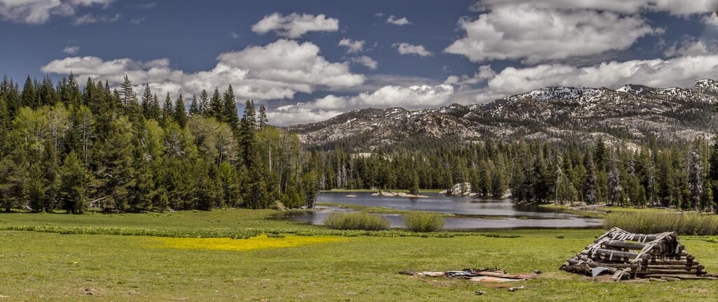
Rising from the Great Basin to the crest of the Sierra Nevada Mountains, just south of the Carson District, the Bridgeport District covers more than one million acres (404,000 ha) of Nevada and California. Elevations in the Carson District vary from 4,500 feet (1,372 m) at Wilson Canyon to over 12,300 feet (3,749 m) at the summit of Dunderberg Peak, tucked in the Hoover Wilderness.
The Carson and Bridgeport Districts contain several impressive Sierra Nevada subranges, including the Sweetwater Mountains, Carson Range, Wassuk Range, Excelsior Range, Pine Grove Hills, and Bodie Hills.
These two districts are understandably popular outdoor recreation areas due to their close proximity to Yosemite National Park, Lake Tahoe, and Sonora Pass. Wilderness areas in the district include:
Located off US Highway 95, between Reno and Las Vegas, the Austin-Tonopah Ranger District is the largest ranger district in the contiguous United States. The Austin and Tonopah districts were merged in 2015 to administer an impressive 2.1 million acres (849,000 ha) of the Humboldt-Toiyabe National Forest, including portions of the Toiyabe Range, Toquima Range, and Monitor Range.
The Austin-Tonopah Ranger District is characterized by a linear chain of mountains that stretch north-to-south across central Nevada. Elevations in the district range from roughly 5,000 feet (1,524 m) on the valley floor to over 11,900 feet (3,627 m) at Mount Jefferson’s south summit in the Alta Toquima Wilderness.
Popular landmarks in the Austin-Tonopah Ranger District also include Arc Dome, Table Mountain, and Hope Valley. Wilderness areas in the district include:
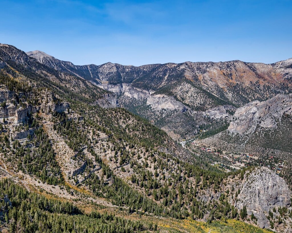
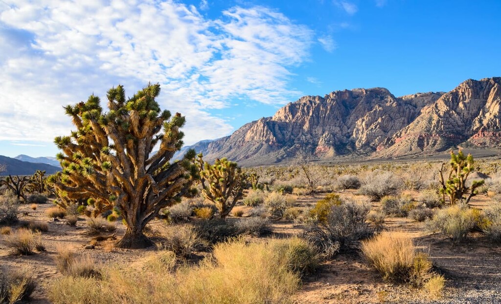
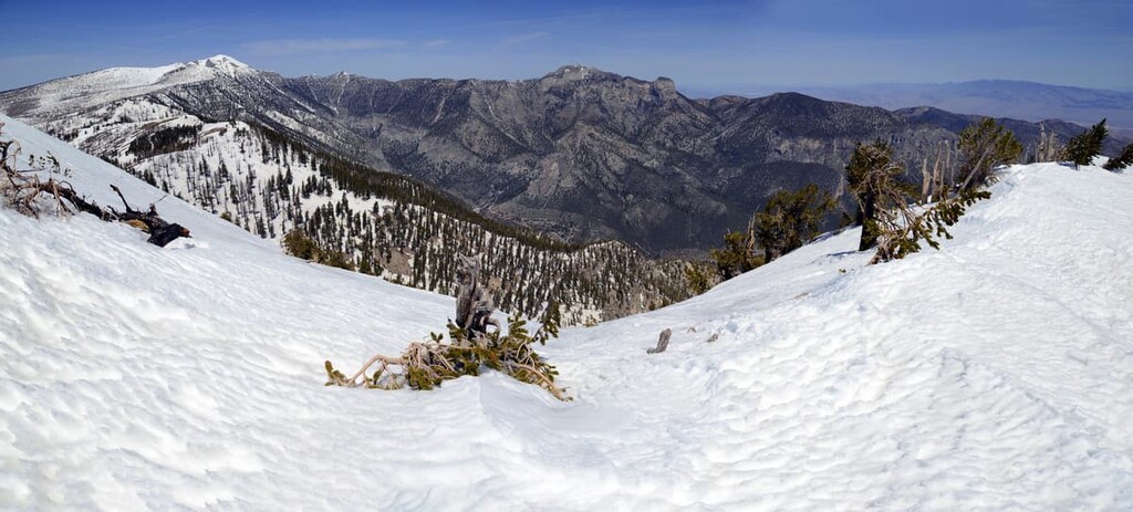
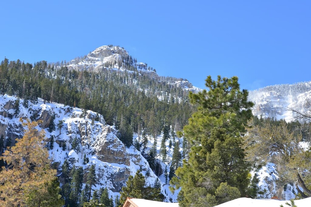
Home to Mount Charleston, Nevada’s premier destination for winter recreation, the Spring Mountains National Recreation Area lies just outside of downtown Las Vegas and encompasses more than 316,000 acres (127,881 ha) of rugged mountains, steep hillsides, and narrow canyons.
Elevations in the Spring Mountains National Recreation area range from about 3,000 feet (914 m) to over 11,900 feet (3,627 m) at the summit of Charleston Peak. The Spring Mountains National Recreation Area lies north of the Sloan Canyon Conservation Area and adjoins the Red Rock Canyon National Conservation Area. Wilderness areas in the recreation area include:
A number of ranger districts are also tucked within the Humboldt National Forest, to the east and northeast of the Toiyabe National Forest. These districts include the Ely district, which is home to some of Nevada’s tallest summits, including 12,064-foot (3,677 m) Mount Moriah. Wilderness areas in the district include:
Finally, the forest is home to the Mountain City-Ruby Mountains-Jarbidge District, which contains the Jarbidge, East Humboldt, and Ruby Mountain Ranges, and the Santa Rosa ranger districts, which protects the Santa Rosa Mountains and 9,747-foot (2,971 m) Granite Peak. Wilderness areas in the district include:
The Toiyabe National Forest lies mostly within the Basin and Range Physiographic Province, a region characterized by isolated mountain ranges and broad, flat basins. The Basin and Range province covers parts of Nevada, California, Oregon, Idaho, and Utah.
Several subranges of the Great Basin Ranges are tucked within the Humboldt-Toiyabe National Forest, including the Ruby Mountains, Carson Range, Toiyabe Range, Humboldt Range, Jarbidge Mountains, and Schell Creek Range.
Geologically, the Great Basin Ranges formed as a result of widespread and complex tectonic expansion during the Miocene. Volcanic intrusions have also left deposits of valuable minerals, including gold, silver, lead, and copper in the Great Basin.
Portions of the Toiyabe National Forest also extend into the Sierra Nevada Mountains, including the Carson Range and Hoover Wilderness. Located just east of Lake Tahoe, The Carson Range extends from Carson Pass in Alpine County, California, to the Truckee River in Washoe County, Nevada.
Home to prominent peaks, like Freel Peak and Mount Rose, the Carson Range contains mostly igneous rocks that formed roughly 155 to 87 million years ago as part of the Sierra Batholith, a massive collection of plutons that eventually uplifted during the Nevada Orogeny and Sevier Orogeny.
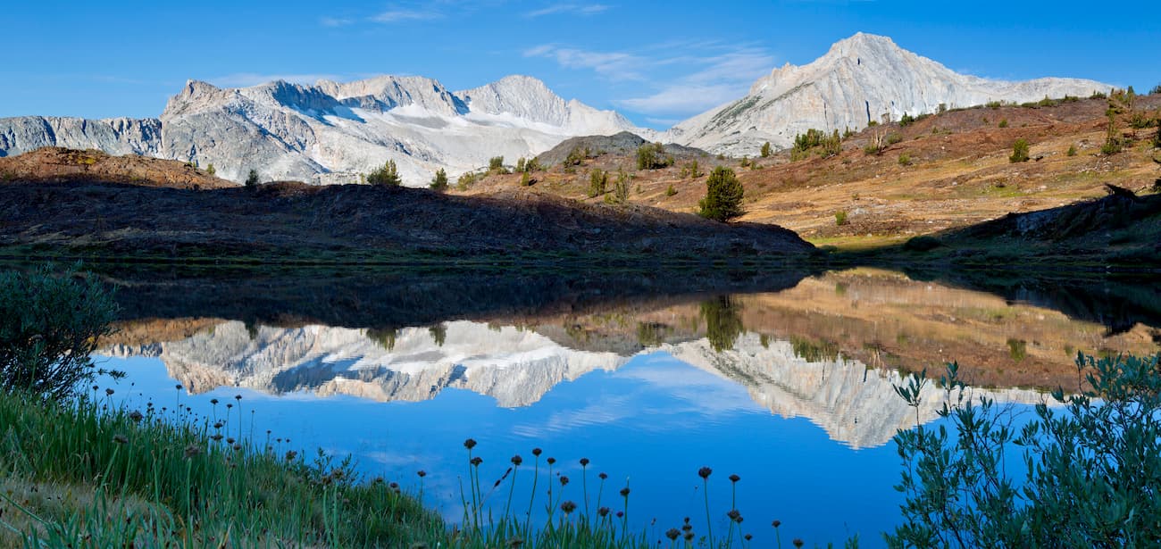
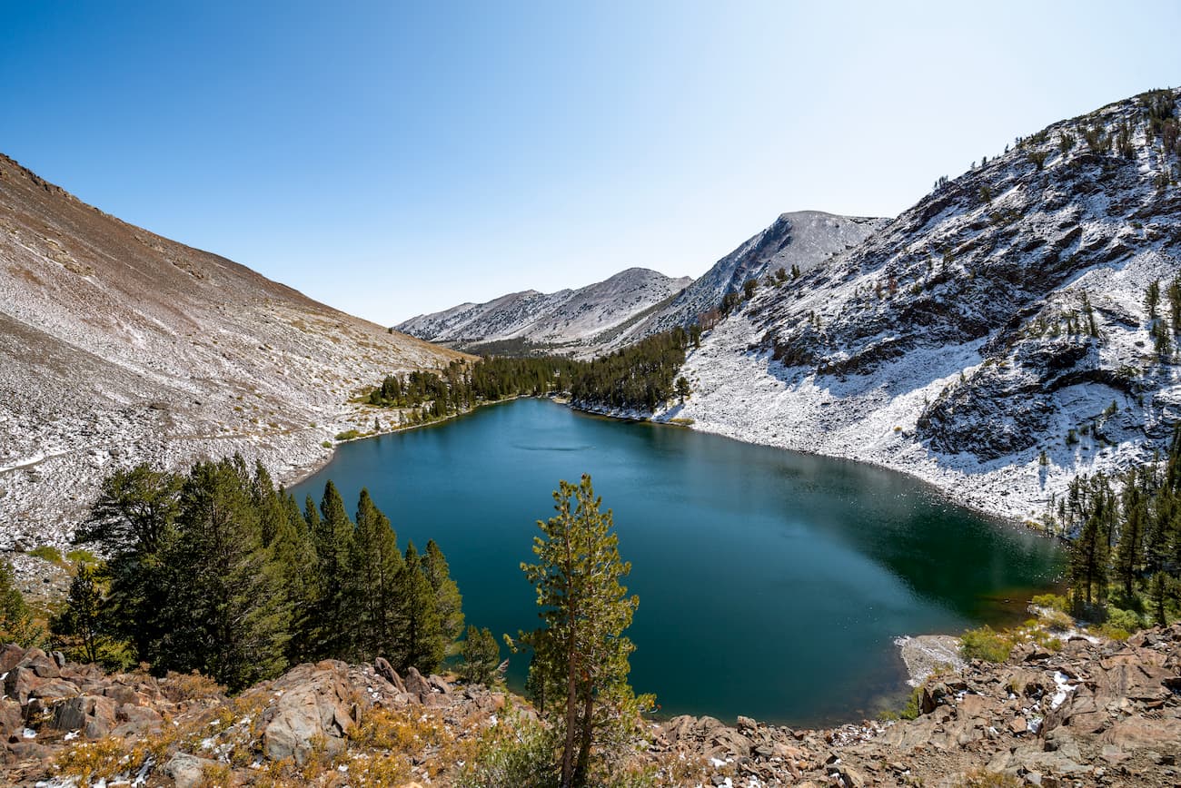
Jointly administered by the Inyo National Forest and Humboldt-Toiyabe National Forests, the Hoover Wilderness lies adjacent to Yosemite National Park and shares a similar geologic history as the Carson Range.
After the formation of the Sierra Batholith, movement along the Sierra fault uplifted the present-day Sierra Nevada. During the Pleistocene, extensive glaciation further shaped the impressive granitic summits tucked within the Hoover Wilderness, including Eagle Peak, Dunderberg Peak, Mount Conness, and Matterhorn Peak.
Due to its size and variable topography, the Humboldt-Toiyabe National Forest supports an extraordinary variety of plant and animal species.
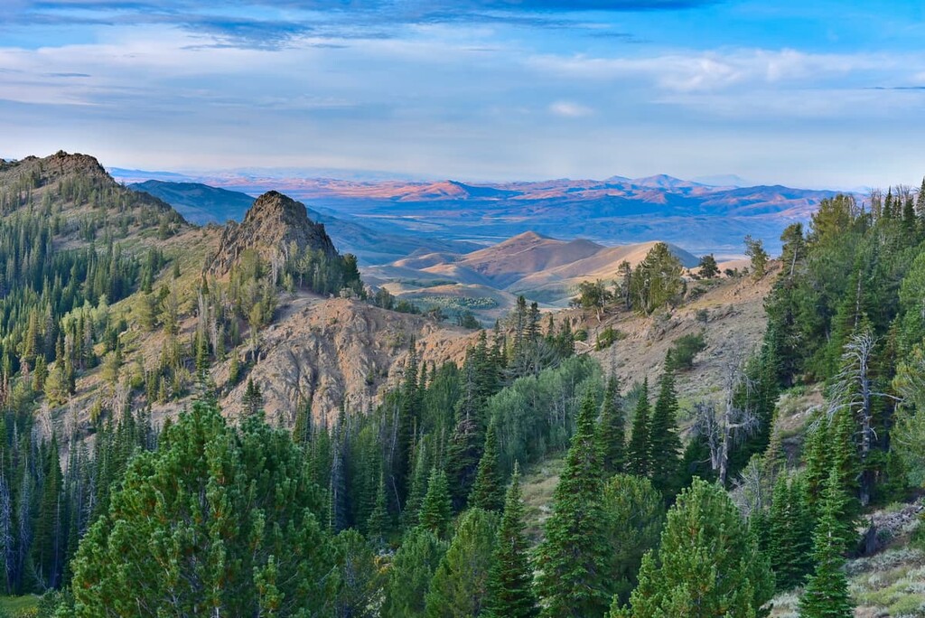
Aspen-dominated woodlands thrive in the Intermountain Region of the Humboldt-Toiyabe National Forest, between 5,200 and 10,500 feet (1,585 m and 3,200 m).
Though all districts in the forest boast stands of aspen, some of the largest stands can be found in the Table Mountain Wilderness in the Austin-Tonopah Ranger Districts, Hope Valley and Long Valley in the Carson Ranger District, Dunderberg Peak in the Bridgeport Ranger District, and the Schell Creek Range and Mount Moriah Wilderness in the Ely Ranger District.
Stands of bristlecone pine, whitebark, and limber pine can be found growing on the rocky slopes and ridges of high elevation peaks in the forest. Limber pine and whitebark both flourish in areas of the forest that are generally far too dry, windy, and rugged for other trees.
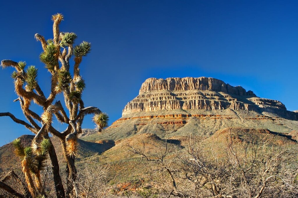
Bristlecone pines tend to grow in isolated groves around Charleston Peak, in the Spring Mountains National Recreation Area, on the slopes of Duckwater Mountain and Cave Mountain in the White Pine Range in the Ely Ranger District.
Mountain brush vegetation and pinyon-juniper woodland communities are extensive between 4,500 and 9,000 feet (1,372 m and 2,743 m). Mountain brush communities, including sagebrush, mountain mahogany, gambel oak, and bitter cherry, are considered the largest plant community in the Humboldt-Toiyabe National Forest.
Pinyon-juniper woodlands are dispersed along both gently rolling hills and steep mountain slopes, as well as in rocky canyons and along narrow ridges. Pinyon pine typically prospers at higher elevations, while juniper generally grows at lower elevations.
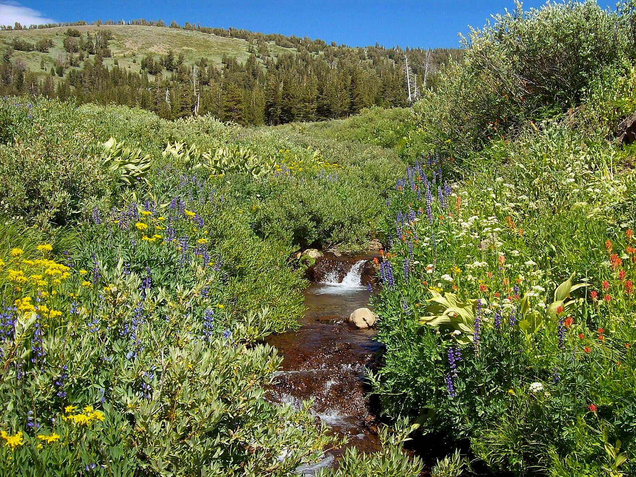
The Humboldt-Toiyabe National Forest is also home to a variety of wildflowers, including balsamroot, buckwheats, chokeberry, globemellows, lupines, monkey flowers, paintbrushes, rough angelica, and thistles. Wildflowers can be seen in early spring at lower elevations, and throughout the seasons in mid-elevation meadows, aspen groves, conifer forests, and riparian areas of the forest.
Currently, the Humboldt-Toiyabe National Forest protects over 100 threatened, endangered, and sensitive animal species.
Two species in the Toiyabe National Forest, the Lahontan cutthroat trout and Paiute cutthroat trout, are classified as threatened. The peregrine falcon and bald eagle, both federally classified as endangered, are also frequent visitors to the Toiyabe National Forest.
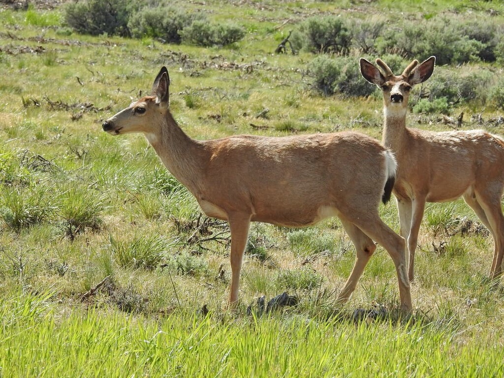
Common inhabitants of the Humboldt-Toiyabe National Forest include mule deer, desert bighorn sheep, elk, antelope, mountain lion, sage grouse, mountain quail, and blue grouse.
Pinyon-Juniper woodland communities in the forest serve as a particularly important food source for wildlife, including mule deer, elk, desert cottontail, pinyon jays, and Clark’s nutcrackers.
Ponderosa pine and mixed conifer forests in Humboldt-Toiyabe also sustain a wide variety of bird species, including finches, jays, white-throated sparrows, red-winged blackbirds, and mourning doves. Aspen stands in the forest provide a critical habitat to approximately 34 species of birds and 140 vertebrate species.
Archeological evidence suggests that the earliest inhabitants of the present-day Humboldt-Toiyabe National Forest arrived roughly 12,000 to 13,000 years ago.
A number of Indigenous communities have lived throughout what is now the Humboldt-Toiyabe National Forest, including the southern Paiute, Northern Paiute, Western Shoshone, Washoe, Chemehuevi, and Colorado River Yuman, among others, many of whom consider the region to be part of their ancestral homelands.
The first Europeans arrived in the Sierra Nevada and Great Basin as early as the seventeenth century. In 1827, Jedediah Smith crossed the Sierra Nevada and Great Basin. In 1833, Benjamin Bonneville, a fur trapper and American officer, established a route for Euro-American travelers along the Humboldt River across present-day Nevada, as well as a route over Walker Pass in the Sierra Nevada that would later become the California Trail.
In the 1840s, Mormon pioneers entering the Great Salt Lake Valley became the first permanent settlers of European descent in the Great Basin. Widespread settlement, however, was sparked by the nineteenth century California Gold Rush and American westward expansion. In 1848, immigrants from Europe and elsewhere crossed the Great Basin on the California Trail along Nevada’s Humboldt River to Carson Pass in the Sierra in search of gold.
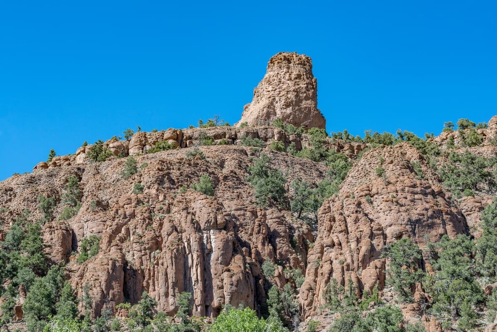
After gold resources were exhausted, miners and prospectors turned their attention toward mining other precious metals in the Great Basin region. Currently, it’s estimated that the Humboldt-Toiyabe National Forest contains over 80,000 archaeological and cultural sites, including historic mining towns and trails that remain accessible to visitors.
The Toiyabe National Forest Reserve was established in 1908, shortly after the creation of the Forest Reserve System. However, over the course of the last century, the forest has been restructured and administratively reorganized many times.
When it was first established, the Toiyabe National Forest Reserve encompassed the Toiyabe, Shoshone, and Paradise Ranges of Central Nevada. Between 1908 and 1915, however, the Toiyabe National Forest was expanded to include the Monitor, Toquima, and Moapa National Forests, as well as part of the Gabbs Valley Range in the Mono National Forest.
In 1945, the Mono and Toiyabe National Forests were administratively combined, and in 1957, the Mount Charleston Division of the Nevada National Forest was transferred back to the Toiyabe National Forest after being transferred to the Dixie National Forest in 1916.
More recently, in 1995, the Humboldt National Forest, which was formed from the defunct Ruby Mountain and Independence National Forests, was administratively combined with the Toiyabe National Forest to form the present-day Humboldt-Toiyabe National Forest.
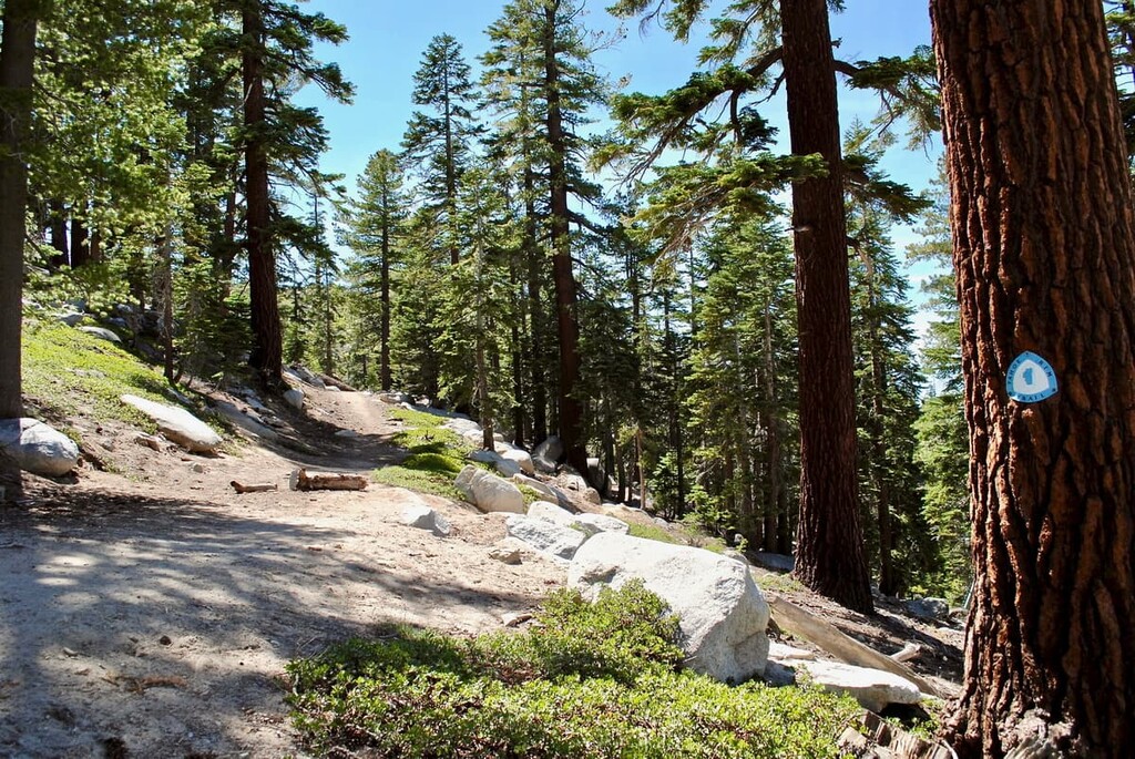
Together, the Humboldt and Toiyabe National Forests offer visitors over 1,000 miles (1,600 km) of hiking, backpacking, and horseback riding trails, as well as 18 spectacular wilderness areas to explore. Seven ranger districts are spread across Nevada and California, each offering their own unique outdoor recreation opportunities.
Located in central Nevada, the Austin-Tonopah Ranger District spans three Nevada Counties: Eureka, Lander, and Nye. The Austin-Tonopah Ranger District covers roughly 2.1 million acres (849,800 ha) of the Humboldt-Toiyabe National Forest, making it the largest ranger district in the contiguous United States.
District highlights include “The Loneliest Road in America,” a historic corridor that boasts incredible vistas of the Toiyabe Range and northern Toquima and Monitor Mountain Ranges, the Carson-Iceberg Wilderness, Alta Toquima Wilderness, Hope Valley, and Armstrong Pass.
Arguably the most popular district in the Humboldt-Toiyabe National Forest, the Bridgeport Ranger District spans four counties, including Douglas, Lyon, and Mineral in Nevada and Mono in California.
The Bridgeport Ranger District climbs from the western Great Basin to the crest of the Sierra Nevada Mountains, covering over a million acres of the Humboldt-Toiyabe National Forest. District highlights include the Hoover Wilderness, Matterhorn Peak, Twin Lakes, Buckeye Canyon, the Sweetwater Mountains, the Bodie Hills, and scenic Highway 395.
The Bridgeport Ranger District also borders Yosemite National Park and manages a winter recreation area near Sonora Pass.
Located along the eastern front of the Sierra Nevada Mountains, the Carson Ranger District encompasses roughly 400,000 acres (161,874 ha) from Dog Valley to north of Sonora Pass. The Carson District lies in seven counties, including Carson City, Douglas, andWashoe in Nevada and Alpine, Nevada, Lassen, and Sierra Counties in California.
Best-known for its proximity to Lake Tahoe, highlights of the Carson Ranger District include the Carson-Iceberg Wilderness, Mokelumne, and Mount Rose Wilderness areas, the Tahoe Rim and Flume trail, and portions of the Pacific Crest Trail.
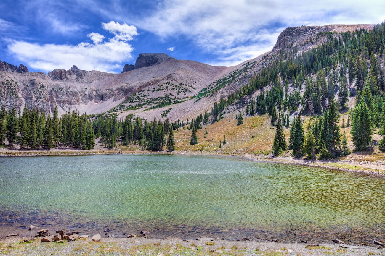
Located along the eastern edge of Nevada, the Ely Ranger District extends over three counties: Lincoln, Nye, and White Pine. The Ely Ranger District encompasses an impressive 1.1 million acres (445,154 ha) of the Humboldt-Toiyabe National Forest and is best-known for its rugged landscape, towering peaks, and 8 isolated wilderness areas.
District Highlights include the Mount Moriah Wilderness, Currant Wilderness, Grant Range Wilderness, High Schells Wilderness, Quinn Canyon Wilderness, Red Mountains Wilderness, Schellback Wilderness, and White Pine Wilderness. Cave Lake State Park and the Great Basin National Park also lie just outside of the Ely Ranger District.
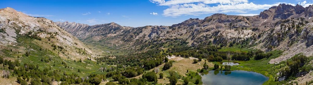
Located in northeastern Nevada, the Mountain City-Ruby Mountains-Jarbidge Ranger District contains over 1.1 million acres (445,154 ha) of the Humboldt-Toiyabe National Forest. The Mountain City-Ruby Mountains-Jarbidge Ranger District is incredibly diverse, spanning cirque basins, glacial lakes, narrow canyons, and incredible snow-capped summits.
District highlights include the East Humboldt, Jarbidge, and Ruby Mountains Wilderness areas. The Ruby Mountains Wilderness, the district’s most popular backcountry destination, contains ten peaks over 10,000 feet (3,048 m) and more than two dozen alpine lakes to explore.
Located in Humboldt County, Nevada, the Santa Rosa Ranger District is infrequently traveled by visitors to the Humboldt-Toiyabe National Forest. The Santa Rosa District contains over 280,000 acres (113,312 ha) of scenic mountains and plateaus, including impressive peaks like Santa Rosa Peak, Paradise Peak, and Singas Peak.
The main attraction in the Santa Rosa District is the Santa Rosa-Paradise Peak Wilderness, which contains the high ridge of the southern Santa Rosa Mountains, as well as Buffalo Canyon and Falls Canyon.
Located in Clark and Nye Counties, the Spring Mountains National Recreation Area covers over 300,000 acres (121,406 ha) of towering cliffs, narrow canyons, and wind-swept summits.
Also referred to as ‘Mount Charleston,’ the Spring Mountains National Recreation Areasits just outside of downtown Las Vegas, making it a particularly popular destination for local outdoor enthusiasts.
Highlights of the Spring Mountains National Recreation Area include the Mount Charleston, La Madre Mountain, and Rainbow Mountain Wilderness areas, as well as the Las Vegas Ski and Snowboard Resort.

Looking for a place to stay during your visit to the Toiyabe National Forest? Here are some of the nearby cities and towns to check out:
Nevada’s historic capital, Carson City, lies along the eastern boundary of the Carson Range, roughly 30 miles (50 km) south of Reno. Carson City is the perfect basecamp for exploring the Carson Ranger District in the Humboldt-Toiyabe National Forest, but it is also within close proximity to Snow Valley Peak, Lake Tahoe, and Washoe Lake State Park.
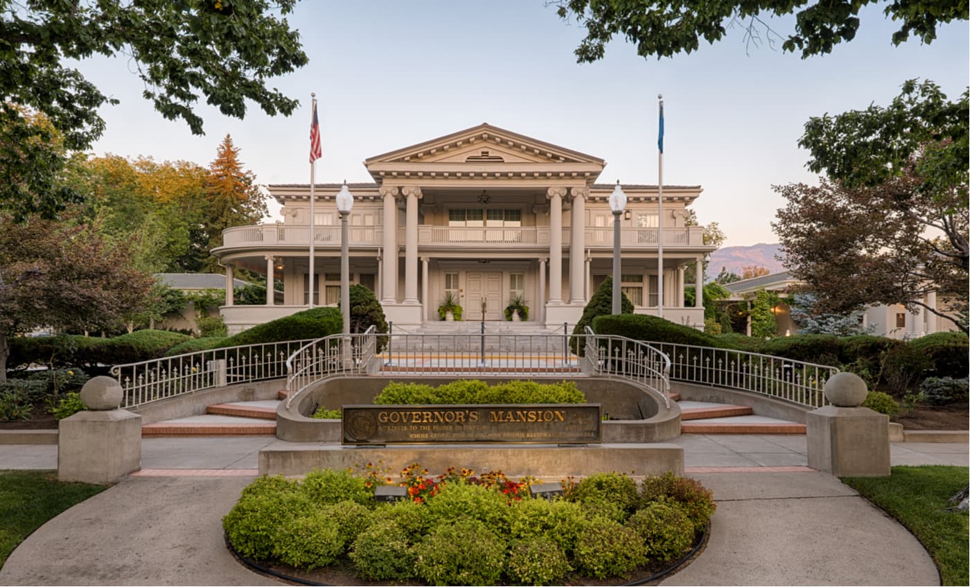
The city itself contains a number of historic landmarks, museums, and cultural exhibits, as well as a variety of services and lodging options.
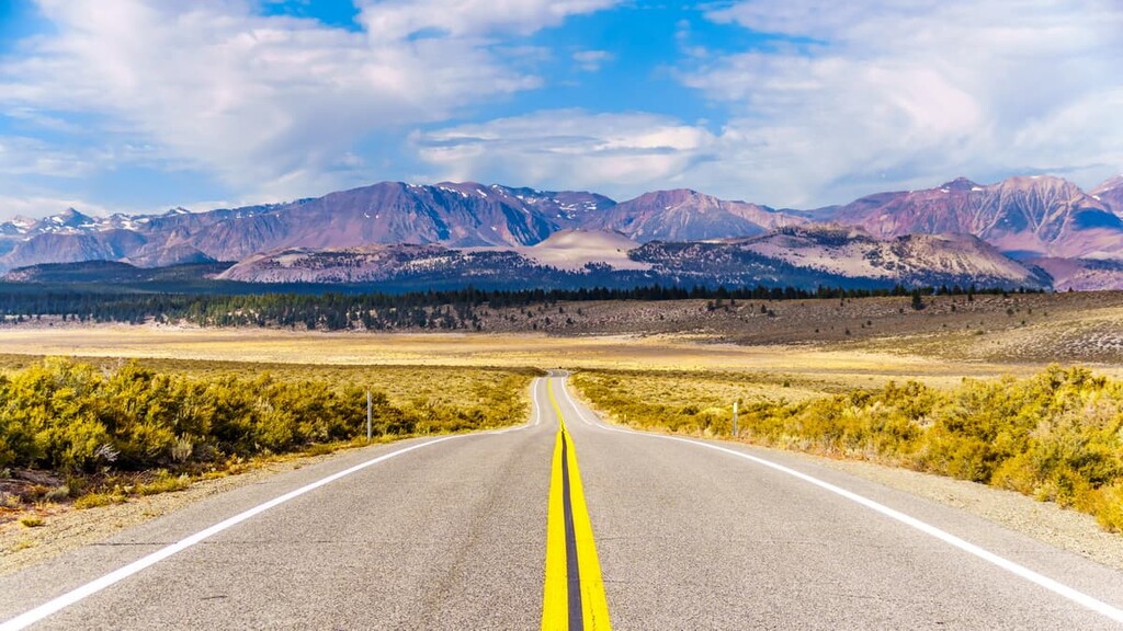
Affectionately referred to as ‘the gateway to the High Sierra,’ Bridgeport is a small community tucked in the Bridgeport Valley. Bridgeport is frequently visited by backcountry travelers and boasts over 500 miles of multi-use trails.
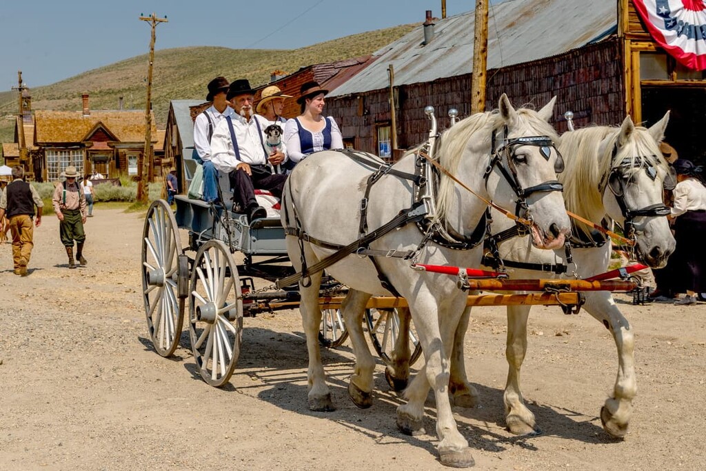
Visitors to Bridgeport can also explore Bodie, a well-preserved ghost town in the Bodie Hills, the Sweetwater Mountains, the Travertine Hot Springs, Virginia Lakes, and Summers Meadows.
Located roughly halfway between Las Vegas and Reno, Tonopah is a quirky community adorned with historic hotels and oddball attractions. Visitors travel to Tonopah to escape the city lights, explore the Tonopah Mining Park, and experience the 430-foot-deep Lunar Crater.
Tonopah isn’t a particularly large community, but it boasts a handful of hotels and breweries, as well as the Tonopah Ranger District office, making it a great place to stop in route to the Humboldt-Toiyabe National Forest.
Las Vegas is world-renowned for its lively nightlife and extravagant entertainment. However, this bustling city of lights is also centrally located to several scenic parks and recreation areas, including the Desert National Wildlife Refuge, Red Rock Canyon National Conservation Area, Lake Mead National Recreation Area, Valley of Fire State Park, and Spring Mountains National Recreation Area.
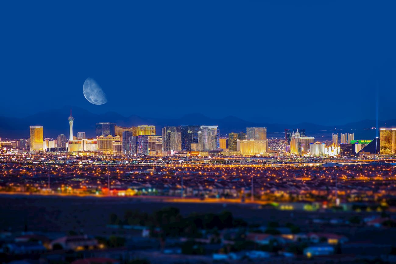
The abundance of amenities and lodging options in Las Vegas make it the perfect starting point for an adventure in southern Nevada.
Located along the California-Nevada border, Lake Tahoe is best-known for its crystalline alpine lake, jaw-dropping mountain vistas, and adrenaline inducing ski resorts. Generally, the lake and surrounding communities are divided into two areas—north Tahoe and south Tahoe.
The north shore of Lake Tahoe is made up of several small communities, including Incline Village, Sunnyside, Kings Beach, Crystal Bay, and Truckee. The general consensus is that the north side moves at a much slower pace than the south and sees far fewer visitors.
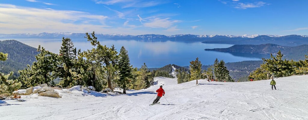
The south shore, on the other hand, is popular for its downtown area and vibrant nightlife. Communities tucked along the south shore include South Lake Tahoe, Stateline, Emerald Bay, and Zephyr Cove. South Tahoe is best-known for its lavish hotels and resorts, restaurants, casinos, and pedestrian-friendly amenities.
Overall, Lake Tahoe offers some of the best winter recreation in North America, hundreds of scenic hiking trails, plenty of amenities, and is an excellent basecamp for exploring the Sierra Nevada Mountains.
The capital city of California, Sacramento lies at the confluence of the Sacramento and American Rivers in the Sacramento Valley. Sacramento is infamous for its farm-fresh restaurants, home-grown breweries, Gold Rush-era attractions, and colorful street murals.
Sacramento lies just outside of the Sierra Nevada and is home to an international airport, making it an excellent starting point for adventures to Lake Tahoe, Yosemite National Park, or the Humboldt-Toiyabe National Forest.

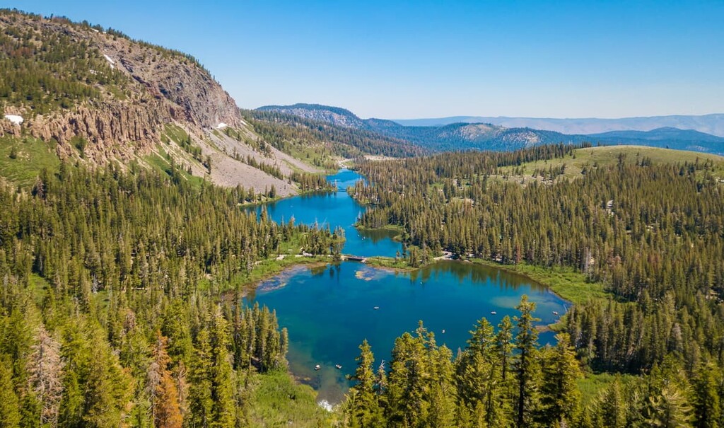
Located just south of the Hoover Wilderness, the town of Mammoth Lakes is a beloved mountain community that features dozens of crystal-clear alpine lakes, towering peaks, cascading waterfalls, and sweeping valleys. Outdoor recreation is plentiful in and around its namesake Mammoth Lakes.
The community offers a range of lodging, shopping, and amenities options, and is home to one of California’s best ski resorts: Mammoth Mountain.


ultra
nevada-11ers
nevada-peaks-club
las-vegas-mountaineers-classics
nevada-peaks-club-emblem
western-state-climbers
western-state-climbers-star
sierra-club-desert
great-basin
nevada-ultras
ultra
nevada-11ers
nevada-peaks-club
las-vegas-mountaineers-classics
nevada-peaks-club-emblem
western-state-climbers
western-state-climbers-star
desert-summits-book
sierra-club-desert
desert-peaks-section-emblem
great-basin
great-basin-star
nevada-ultras
ultra
nevada-11ers
nevada-peaks-club
las-vegas-mountaineers-classics
nevada-peaks-club-emblem
western-state-climbers
western-state-climbers-star
sierra-club-desert
great-basin
great-basin-star
nevada-ultras
western-state-climbers
western-state-climbers-star
desert-summits-book
sierra-club-desert
tahoe-ogul
great-basin
western-state-climbers
western-state-climbers-star
desert-summits-book
tahoe-ogul
western-state-climbers
western-state-climbers-emblem
sierra-club-sierra-peaks-section
sierra-sampler
vagmarken-sierra-crest
nevada-11ers
nevada-peaks-club
las-vegas-mountaineers-classics
desert-summits-book
sierra-club-desert
great-basin
ultra
nevada-11ers
nevada-peaks-club
las-vegas-mountaineers-classics
nevada-peaks-club-emblem
western-state-climbers
western-state-climbers-star
desert-summits-book
sierra-club-desert
desert-peaks-section-emblem
great-basin
great-basin-star
nevada-ultras
ultra
nevada-11ers
nevada-peaks-club
las-vegas-mountaineers-classics
nevada-peaks-club-emblem
western-state-climbers
western-state-climbers-star
sierra-club-desert
great-basin
nevada-ultras
ultra
nevada-11ers
nevada-peaks-club
las-vegas-mountaineers-classics
nevada-peaks-club-emblem
western-state-climbers
western-state-climbers-star
sierra-club-desert
great-basin
great-basin-star
nevada-ultras
western-state-climbers
western-state-climbers-star
desert-summits-book
sierra-club-desert
tahoe-ogul
great-basin
nevada-peaks-club
western-state-climbers
western-state-climbers-star
sierra-club-sierra-peaks-section
sierra-sampler
tahoe-ogul
great-basin
great-basin-star
western-state-climbers
western-state-climbers-star
sierra-club-sierra-peaks-section
sierra-sampler
tahoe-ogul


