Scan the QR code and open PeakVisor on your phone
The East Humboldt Wilderness is a remote protected area situated in the northeastern region of the US state of Nevada. The high desert landscape in the wilderness features craggy peaks and incredible views. There are 4 named mountains within the wilderness, the tallest and most prominent of which is Hole in the Mountain Peak (11,296 ft/3,443 m).
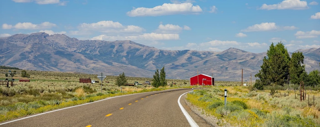
The East Humboldt Wilderness Area lies within the Humboldt National Forest, just to the north of the Ruby Mountains Wilderness Area. It is situated in northeastern Nevada, and it encompasses 36,900 acres (14,900 ha) of terrain.
The wilderness protects a sizable swath of land in the East Humboldt Range. Its northern boundary is the Humboldt River, but within the wilderness area, you can find sagebrush flats and foothills that rise steeply into desert islands.
These figurative islands feature a plethora of flora and fauna when compared to the surrounding landscape, which is otherwise dry, desert, and somewhat barren. This is primarily due to the relatively high amounts of rainfall that the East Humboldt Range gets when compared to the rest of northeastern Nevada.
High amounts of rainfall also support the seasonal creeks that flow throughout the wilderness. Alpine scenery and lake basins lie below the rugged ridgelines of the East Humboldt Range. There are also sizable areas of alpine meadows and forests in the wilderness area.
The vast majority of roads in the wilderness are dirt with the exception of Angel Lake Road, which is paved. Hikers can also explore the nearly 90 miles (145 km) of trails found throughout the wilderness.
The East Humboldt Wilderness Area is also situated near numerous other areas for outdoor recreation. The Ruby Mountains Wilderness Area is located to the southwest of East Humboldt while the Jarbidge Wilderness Area lies to the north. The South Pequop Wilderness Study Area and Bluebell Wilderness Study Area are both situated to the east of the wilderness area while the Goshute Canyon Wilderness Area is nestled to the south.
The peaks within the wilderness area are part of the Great Basin Ranges, which can be found throughout much of Nevada, Utah, Idaho, Oregon, and California.
All of the peaks in the wilderness area are part of the East Humboldt Mountains. These peaks formed as a result of a tilted fault-block process. In particular, widespread tectonic extension stretched and folded the Earth's crust in the region, creating the series of peaks and valleys that the Great Basin is named after.
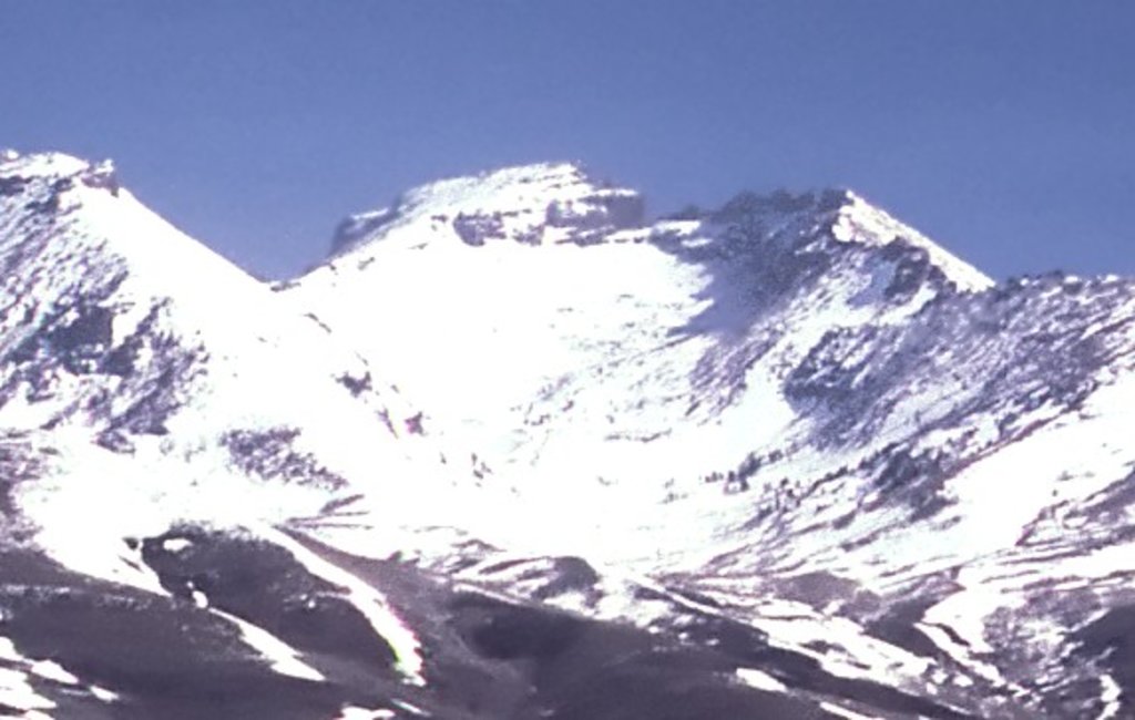
The western side of the East Humboldt Mountains is marked by gradual slopes and valleys while the eastern foothills feature a steep escarpment. Glaciation further carved out the landscape in what is now the wilderness area during the last glacial maximum. Granite cliffs, cirques, U-shaped canyons, and moraines all showcase the glacial history of the region.
The core of the range primarily consists of igneous and metamorphic rocks while the outer layers of rock in the region are often sedimentary. Various glacial tarns can still be found throughout the wilderness, including in Angel Lake, Greys Lake, and Smith Lake.
Some of the major peaks in the East Humboldt Wilderness Area include Hole in the Mountain Peak, Humboldt Peak, Greys Peak, and Chimney Rock.
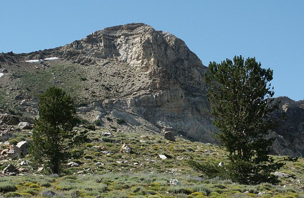
Lower elevations in the wilderness are often populated by widespread sagebrush. As the elevation increases in the region, hikers may spot stands of aspen and conifer trees along with low-growing grasses and seasonal wildflowers.
Higher than average amounts of rainfall transform the hillsides of the East Humboldt Range into green meadows and fields. These meadows stand in sharp contrast to the surrounding desert landscape, allowing for a variety of fauna to thrive.
The remote landscape of the region provides the ideal habitat for populations of mule deer, mountain goats, coyotes, bighorn sheep, and mountain lions to thrive. The various lakes and streams in the area also provide a suitable habitat for brook and rainbow trout. The threatened Lahontan cutthroat trout also live in the wilderness area’s waterways.
Present-day northern Nevada, including what is now the East Humboldt Wilderness, has a long and rich history of human habitation. Humans have inhabited the region for thousands of years, long before the arrival of European settlers.
Since time immemorial, northern Nevada has been home to many Indigenous peoples. The land within and surrounding the contemporary East Humboldt Wilderness is part of the ancestral homelands of the Western Shoshone.
Traditionally, the Western Shoshone had a relatively harmonious relationship with the Northern Paiute, who also migrated throughout the surrounding region. In the 1820s, people of European descent started settling throughout the region, too.
By the 1840s, populations of settlers began to rapidly grow in the area around the East Humboldt Mountains. As the settler population continued to increase, numerous battles broke out between the Indigenous peoples who lived in the area and the US military. Major battles in the area include the Pyramid Lake War, Owens Valley Indian War, Snake War, and the Bannock War.
The arrival of infectious diseases, such as smallpox and measles, further decimated the Indigenous tribes in the region as they had no natural immunity to these illnesses. Many of the remaining Indigenous people in the region were subsequently forcibly removed from their homelands and relocated to reservations.
In the nineteenth century, the California Gold Rush brought more people to the region. The California Trail traveled just to the north of the wilderness and it followed along the banks of the Humboldt River.
The Ruby Mountain Forest Reserve was established in 1906, and it later became part of the Humboldt National Forest in 1908. The East Humboldt Wilderness was established in 1989 following the passage of the Nevada Wilderness Protection Act of 1989.
The East Humboldt Wilderness Area is home to around 90 miles (145 km) of trails. Here are some of the most popular trails in the region to check out during your next trip to the wilderness area.
The Winchell Lake Trail lies along the eastern edge of the wilderness. This route climbs through sagebrush before heading through stands of aspen trees and wildflower meadows. After a period of gradual climbing, the route eventually reaches the shores of Winchell Lake.
Rocky buttes and ridgelines tower above the small Winchell Lake, which is surrounded by low-growing grasses. This out-and-back trail is 6.8 miles (11 km) in length and it has 1,535 feet (468 m) of elevation gain.
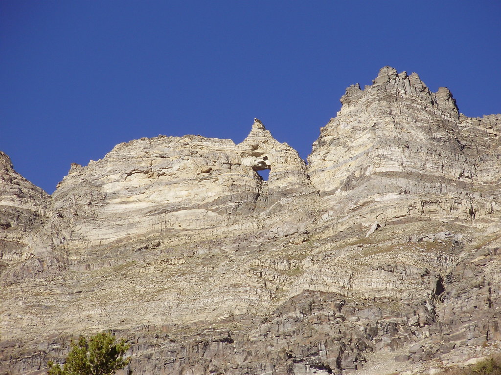
Hole in the Mountain Peak is the tallest peak within both the wilderness area and the East Humboldt Range as a whole. The peak gets its name from the natural arch that’s located at its summit.
Do note, however, that this strenuous hike features class 2+ scrambling near the summit, so it is only suitable for experienced hikers. It is recommended that hikers wear pants to protect their legs when scrambling on the mountain, too.
From the summit, hikers can enjoy panoramic views of the surrounding wilderness. This out-and-back trail is 6.2 miles (10 km) in length and it has 4,475 feet (1,364 m) of elevation gain.
The Secret Starr Trail lies along the western edge of the East Humboldt Wilderness. This trail climbs gradually through sagebrush before transitioning into rolling alpine meadows.
During the spring and early summer months, hikers on this trail can also witness fields of wildflowers. This out-and-back route is 5.2 miles (8.4 km) in length and has 1,207 feet (368 m) of elevation gain.
Looking for a place to stay near the East Humboldt Wilderness Area? Here are some of the best cities and villages to check out in the region.
Elko is a small city that lies just to the northwest of the East Humboldt Wilderness Area. The city is home to 21,000 residents and it acts as an economic hub for the greater Ruby Mountain region. The Humboldt River runs through the city while the Lamoille Canyon and Ruby Mountains are both located nearby.
The East Humboldt Wilderness Area and Ruby Mountain Wilderness provide locals and visitors alike with year-round outdoor recreation opportunities. Hiking, trail running, skiing, biking, and hunting are all common activities in the region. Each year, the city also hosts the National Cowboy Poetry Gathering and the National Basque Festival.
Elko is home to Great Basin College and is surrounded by numerous hot springs for visitors to enjoy. Visitors to Elko can also consider checking out the Western Folklife Center, which is a non-profit cultural center in the city.
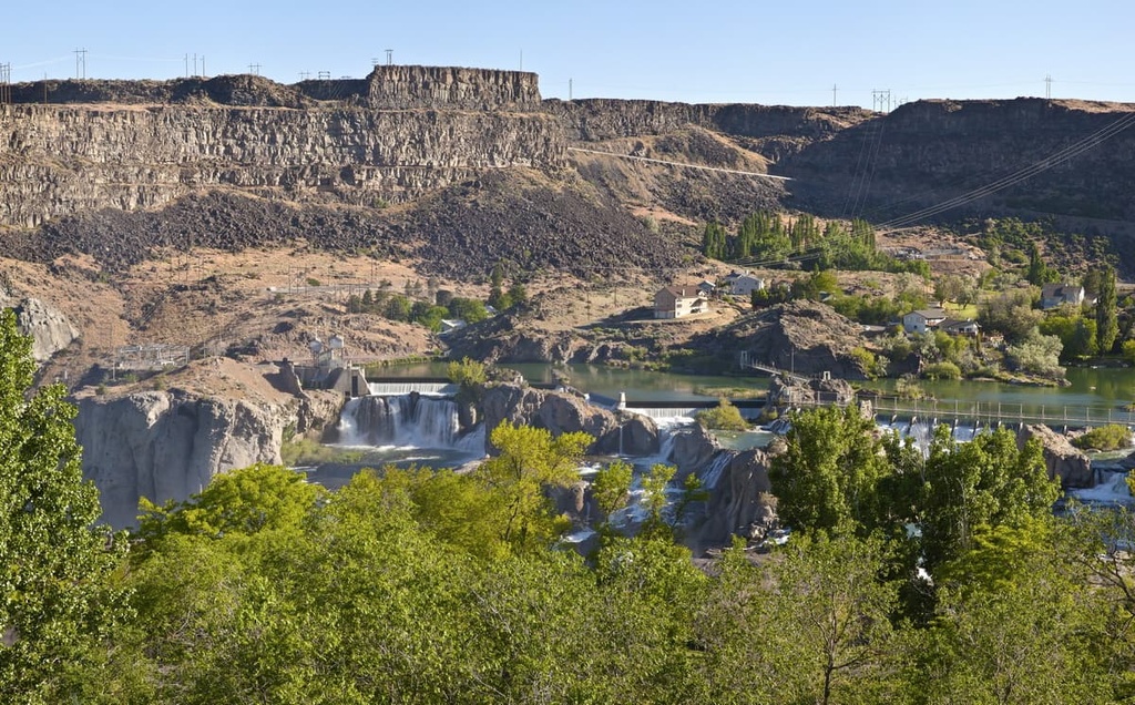
Twin Falls lies just a 2-hour drive to the north of the wilderness, making it the closest major city to the region. The city is home to around 50,000 residents and lies along the Snake River. As it is the most populous city in Twin Falls County, the city of Twin Falls serves as an economic and cultural hub for the region.
In 1974, the city was even the site of Evel Knievel’s attempt to cross the Snake River by shooting himself out of a canyon. Other popular spots to visit in the region include Magic Mountain Ski Resort and the famous Shoshone Falls, which are located along the Snake River.


_6.1_miles_north_of_the_southern_terminus_in_Clover_Valley,_Nevada-cropped.jpg)