
Scan the QR code and open PeakVisor on your phone
Ruby Mountains Wilderness Area has 18 named peaks. The highest is Mount Silliman at 3,432 m. Other notable peaks include Mount Fitzgerald, Snow Lake Peak and Mount Gilbert.
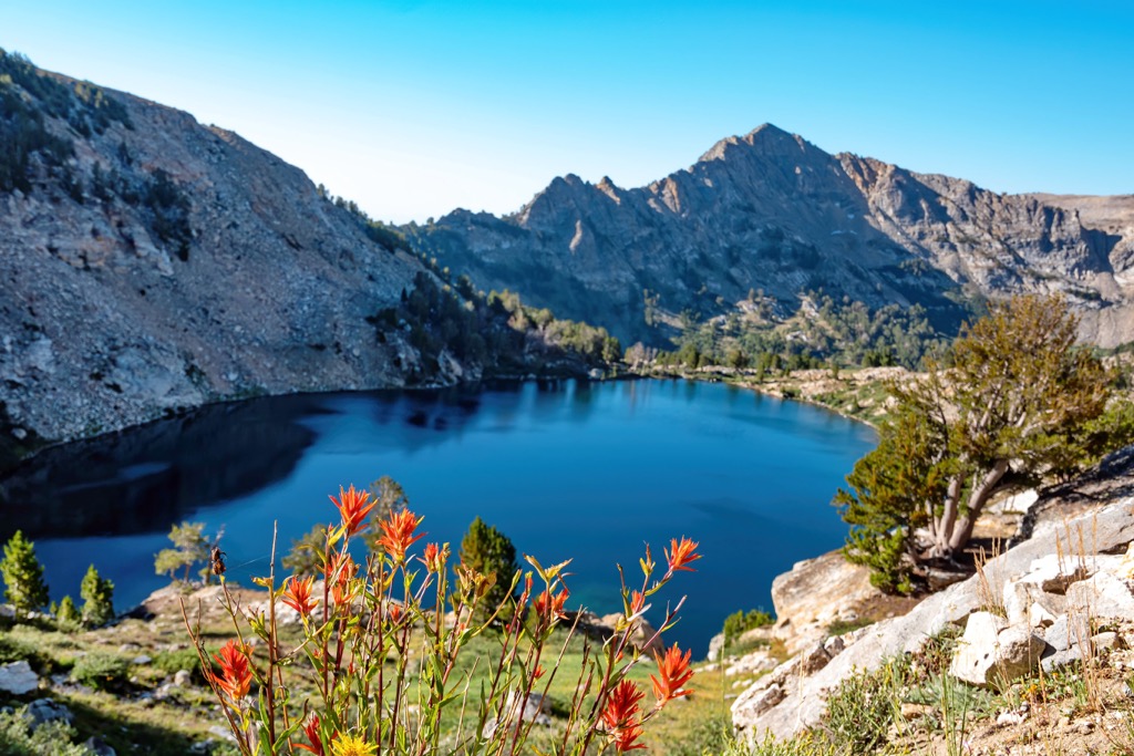
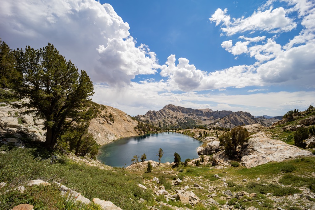
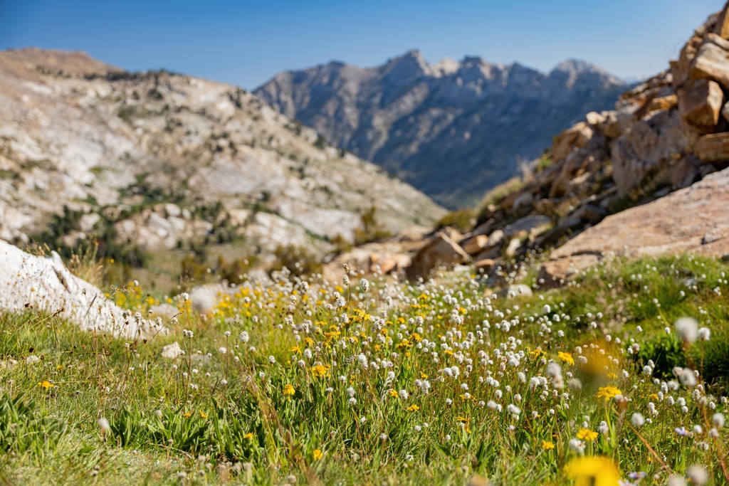
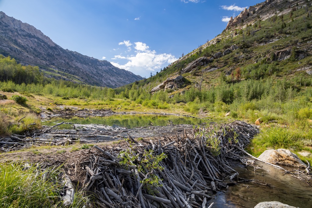
With its tall peaks, hanging valleys, and alpine lakes, the Ruby Mountains Wilderness Area is a spectacular stretch of wilderness in northeastern Nevada, USA. Covering more than 90,000 acres (36,420 ha), the wilderness lies along part of the Ruby Mountains ridge within Humboldt-Toiyabe National Forest. There are 18 named mountains in the wilderness. Mount Silliman is the highest at 11,260 ft (3,432 m) and King Peak (11,030 ft/3,362 m) is the most prominent, rising 1,325 ft (404 m) from its surroundings to its summit.
Located in Humboldt-Toiyabe National Forest in northeastern Nevada, the Ruby Mountains Wilderness Area covers 93,030 acres (37,648 ha) of the Ruby Mountains. It was designated a wilderness space in 1989 and is part of the Mountain City-Ruby Mountains-Jarbidge Ranger District.
The wilderness offers an exciting escape into an alpine landscape with its snow-fed streams, glacier-carved valleys, and soaring peaks. The wilderness’ northernmost point is Secret Pass and it extends about 90 mi (144 km) south into the Ruby Mountain Range.
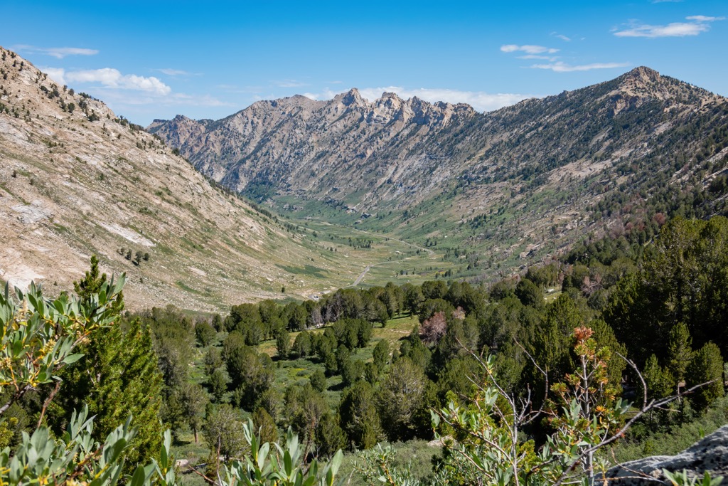
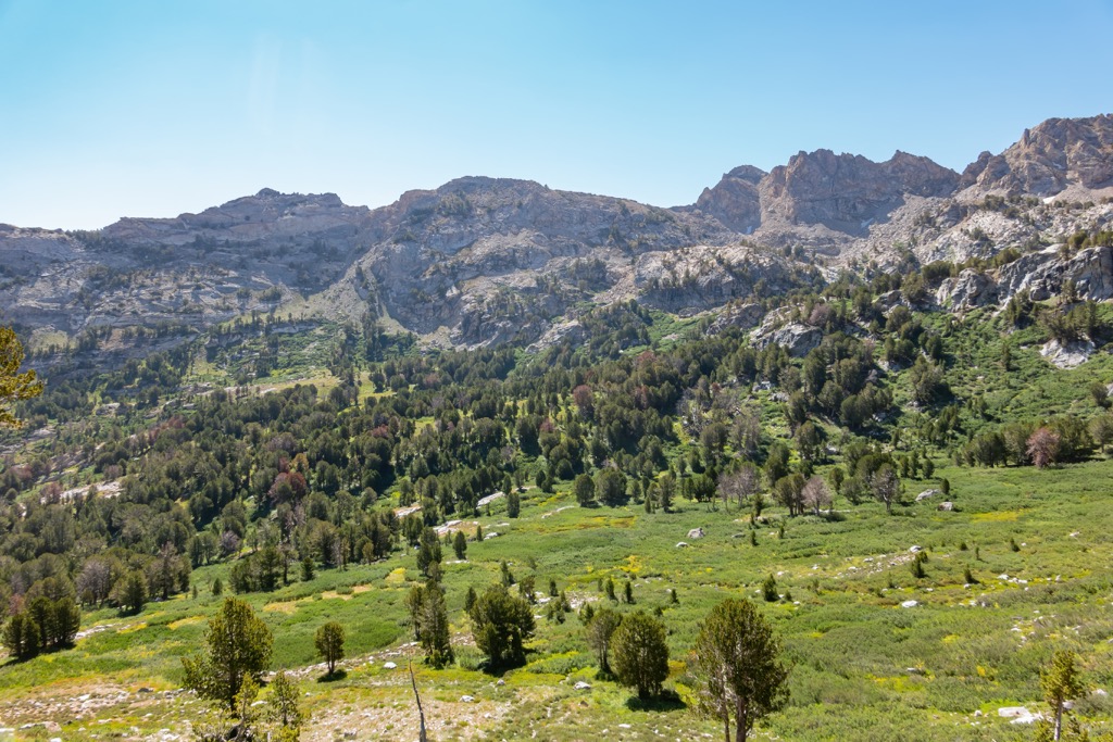
The Ruby Mountain Range, not exclusively the wilderness, has ten peaks over 10,000 ft (3,048 m) and a number of alpine lakes. Lamoille Canyon is sometimes called “Nevada’s Yosemite” and is a popular spot for hiking and rock climbing. South of the canyon lie lake basins and meadows, which turn into a grassy ridge running south to the Overland Lake Basin.
The Ruby Mountains Wilderness has six peaks over 11,000 ft (3,353 m) – Mount Silliman (11,260 ft/3,432 m), Mount Fitzgerald (11,214 ft/3,418 m), Snow Lake Peak (11,155 ft/3,400 m), Mount Gilbert (11,086 ft/3,379 m), Verdi Peak (11,073 ft/3,375 m), and King Peak (11,030 ft/3,362 m).
The Ruby Mountains Wilderness Area falls within the Basin and Range Province. This Province extends from Nevada to northern Mexico. The geologic region formed as a result of crustal extension. As the Earth’s crust and upper mantle stretched, parts of the crust thinned. The thinning crust cracked, thus creating large faults. Mountains pushed up along the faults and valleys formed below.
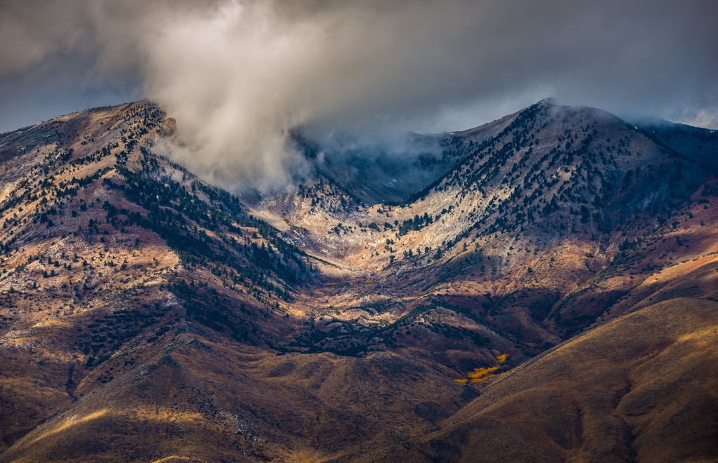
The Ruby Mountains are composed of a metamorphic core complex, created during the mid-Tertiary. The region also experienced phases of magmatism, crustal shortening, and metamorphism. During the last ice age, glaciers carved out valleys and alpine lakes in the the northern portion of the Ruby Mountains.
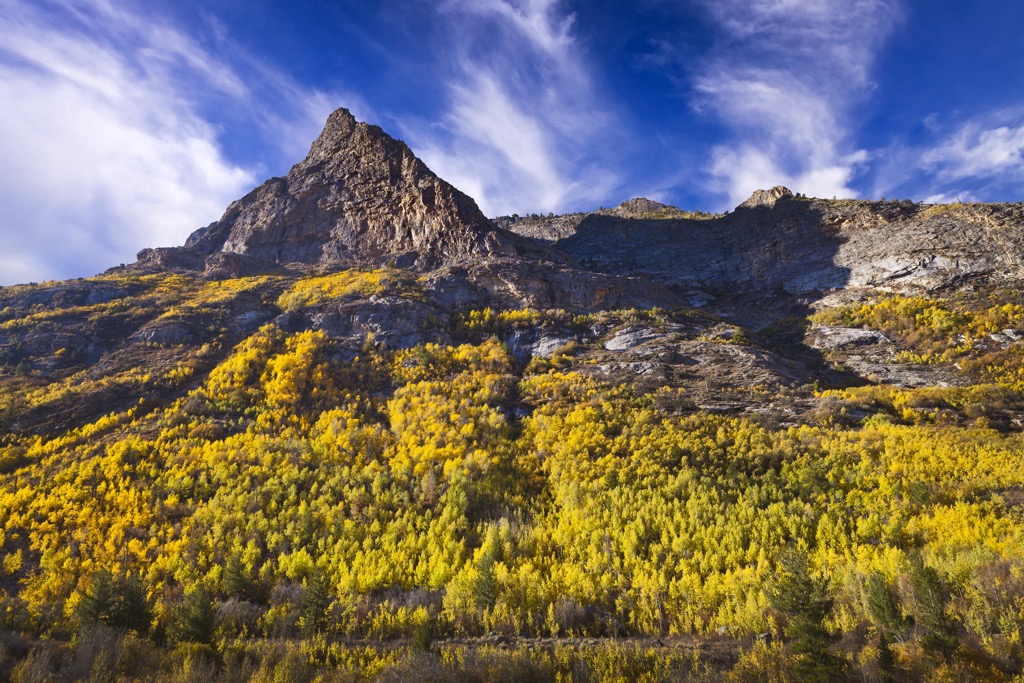
The high peaks and hanging valleys of the Ruby Mountain Wilderness are covered by sagebrush, aspen, mountain mahogany and high altitude conifers. The wilderness and surrounding area is home to one of Nevada’s largest mule deer populations.
In addition to mule deer, the wilderness provides habitat for mountain goats, bighorn sheep, mountain lions, pika, marmots, and beavers. Brook trout, rainbow trout, and the threatened Lahontan cutthroat trout live in the streams and lakes.
While numerous birds live in the forests, the most unique is the Himalayan snowcock, a type of grouse native to southern Asia. They were first introduced into the Ruby Mountains in 1963 and it is the only spot they can be found in the United States.
The reliable water sources that form the marshes in Clover and Ruby Valleys allowed for prehistoric groups and Native Americans to live an almost sedentary lifestyle. Archaeologists have discovered evidence of prehistoric human habitation in caves, campsites, and lithic scatters. Spread across the summits of East Humboldt Range and the Ruby Mountains are sites indicating prehistoric bighorn sheep hunting.
The land is the traditional territory of the Western Shoshone. Neighboring the Ruby Mountain Ranger District are the Ruby Valley Indian Reservation, established in 1910, and Te-Moak Indian Reservation, established in 1941.
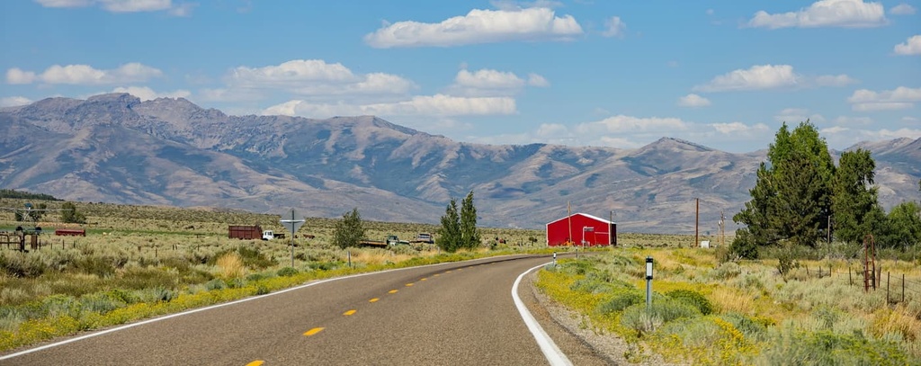
The Humboldt River served as a significant travel corridor in Nevada beginning in the 1840s for first wagons and later railroads and highways. The area around the Ruby Mountains was one of the first parts of northeastern Nevada to receive an influx of trappers, explorers, settlers, and military members. In the present day, ranching is common in the surrounding area.
The Ruby Mountain Forest Reserve was first set aside in 1904 and officially established in 1906. The wilderness received its official designation in 1989.
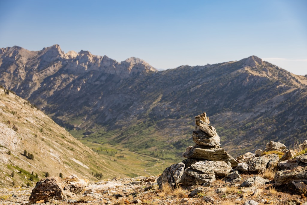
The Ruby Mountain Wilderness has about 300 mi (480 km) of trails. The main trailheads are Roads End in Lamoille Canyon, Harrison Pass, Soldier Canyon, and Overland Lake. Except for Lamoille Canyon which has a paved road, access roads are typically on maintained dirt roads. Maps and trail information can be picked up from the Ruby Mountain Ranger Station and Mountain City Ranger Station.
The Ruby Crest National Recreation Trail measures around 40 mi (64 km), depending on where one begins, and follows the Ruby Mountain Ridge. Elevations range between 7,200 ft (2,195 m) and nearly 10,900 ft (3,322 m). It is commonly completed going south to north from Harrison Pass to Lamoille Canyon. The first few miles run along a Forest Service Road from Harrison Pass. This road is rough and most find it more convenient to walk this relatively level road to reach the actual trail.
The Thomas Creek Trail measures 4.4 mi with about 1,275 ft (390 m) of elevation gain. It’s a good workout with a fairly consistent incline, and the waterfalls, wildflowers, and beautiful canyon make it a popular route.
This trail is 9.7 mi out and back and with 2,350 ft (716 m) elevation gain. It is considered challenging and is great for backpacking. Not many people take this trail, making it perfect for those looking for more solitude while hiking.
The trail crosses streams several times and there may be mud or snow depending on the season. Some parts of the trail may be overgrown and a few spots have rocky outcroppings to get around. That being said, the great views, waterfalls, and goat lake make this hike worth the effort.
A number of campgrounds can be found in Humboldt-Toiyabe National Forest and most are open from May/June through September/October.
Less than an hour’s drive to the northwest, Elko has a population of 20,000 and offers a lot both by way of outdoor recreation and western culture. It is a great spot for birdwatching with over 35,000 acres (14,165 ha) of marshes, ponds, and wet meadows in its backyard. There’s plenty to explore for for rock and mineral enthusiasts, lots of fishing opportunities for bass and trout, and it’s only a short trip to get to Lamoille Canyon for hiking, biking, and rock climbing.
The city itself is steeped in western culture – hosting rodeos, the National Cowboy Poetry Gathering, as well as a number of music festivals. You’ll find old time saloons and classic burger or steak joints, but also more diverse offerings like vegetarian and Japanese restaurants. The city has a range of lodging options including hotels, motels, RV parks, and campgrounds.
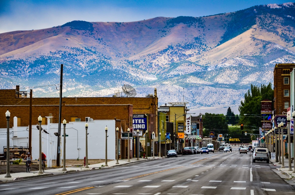
A little over 3 hours away by car to the south, the small town of Ely has a population of 4,000. Ely is rich in history, outdoor experiences, and the arts. It was a stagecoach stop in the 1870s and later in the heart of a major copper mining region. The Nevada Northern Railway reached Ely in 1906.
Murals and art galleries are dotted around the downtown. It’s near Great Basin National Park, Cave Lake State Park, Ward Charcoal Ovens State Park, and Ward Mountain Recreation Area. If you’re looking for a deeper dive into history, there are a number of ghost towns to visit around Ely.

The town has a small selection of cafes, fast food joints, pubs, Mexican restaurants, and grills. If you’re looking to stay over here, you'll have a choice of B&Bs, motels, hotels, hotel casinos, RV parks, and campgrounds.
A four hour drive to the east, Salt Lake City in Utah has a population of 200,000. A popular site to visit while in the city is, naturally, the Great Salt Lake – the largest salt lake in the western hemisphere. One can hike or bike along the Bonneville Shoreline Trail or get out onto the water in a kayak or boat. Swimming at Antelope Island State Park is quite popular in summer.
While around the city, check out the Olympic venues from the 2002 Winter Olympics. There are also a number of historic sites from early pioneers in the region, museums, zoos, and an aquarium to visit.
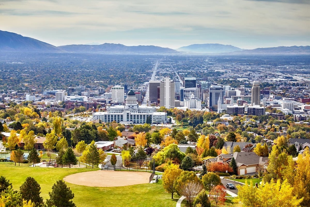
The city offers a wide range of restaurants, fun cafes, bars, vegetarian joints, fine dining, and spots to grab a quick bite. There’s a selection of accommodations available for all experiences, including mountain resorts, vacation homes, hotels, motels, and cozy inns.


nevada-11ers
nevada-peaks-club
western-state-climbers
western-state-climbers-emblem
nevada-11ers
nevada-peaks-club
western-state-climbers
western-state-climbers-emblem
The highest peak in Ruby Mountains Wilderness Area is Mount Silliman, at 3,432 m.
Notable peaks in Ruby Mountains Wilderness Area include Mount Silliman, Mount Fitzgerald, Snow Lake Peak, Mount Gilbert and Verdi Peak.


