
Scan the QR code and open PeakVisor on your phone
Idaho is home to 3,346 named mountains. The highest is Borah Peak at 3,859 m.
While it’s best known for its famous potatoes, the US state of Idaho is home to a spectacular array of mountain ranges and stunning landscapes that are sure to excite any outdoor enthusiast. The Gem State contains 3346 named mountains, the highest and most prominent of which is the rugged Borah Peak (12,654ft/3,857m).
The state of Idaho is situated in the northern part of the western United States. It shares a border with 6 other US states - Washington, Oregon, Nevada, Utah, Wyoming, and Montana - and with the province of British Columbia in Canada.

Depending on who you ask, Idaho is included within either or both the Pacific Northwest region and the Mountain West region.
Traditionally, the Pacific Northwest includes British Columbia, Washington, and Oregon, though contemporary definitions sometimes stretch to include Idaho and even parts of northern California. Alternatively, the Mountain West historically includes Idaho, Montana, Wyoming, Utah, Colorado, and Nevada, but the definition can expand to include Arizona and New Mexico.
Regardless of how Idaho is categorized, though, it contains geological, ecological, historical, and cultural ties to both the Pacific Northwest and Mountain West regions.
That being said, with a total land area of 83,569 square miles (216,44 sq. km) and a water area of 926 square miles (2,398 sq. km), Idaho is among the driest states in the country. Moreover, despite ranking 14th in land area, Idaho is the 39th most populous state and the 44th most densely populated state, trailing only behind Alaska, Wyoming, Montana, North Dakota, South Dakota, and New Mexico in terms of population density.
Due to its size and diversity of topography, the state of Idaho is home to a number of different regions. Although there are some slight differences in exact boundaries and naming conventions, many agree that there are 7 major regions within the state, namely: the Panhandle, Clearwater, Southwest, Salmon, Upper Nake, Magic Valley, and the Southeast.
Each of these regions contains its own fantastic array of mountain ranges and outdoor recreation destinations to check out.
The Idaho Panhandle Region generally refers to the northernmost part of Idaho, which is situated between northwestern Montana and northeastern Washington. While the exact borders vary, it’s generally considered to contain the counties of Boundary, Bonner, Kootenai, Benewah, and Shoshone. If one doesn’t consider the Clearwater Region to be geographically distinct, the Panhandle may also include Latah, Clearwater, Nez Perce, Lewis, and Idaho counties.
Within the Panhandle, there are 3 primary mountain systems, the Columbia Mountains, the Columbia Plateau, and the Idaho-Bitterroot Rocky Mountains. This region of Idaho includes a number of smaller subranges, such as:

Moreover, the Panhandle includes 2 major national forests, the Idaho Panhandle National Forests and the Kootenai National Forest.
The Clearwater Region of Idaho is situated to the south of the Panhandle and is also bordered by Montana and Washington. Although it is sometimes considered to be a part of the Panhandle, when considered as a separate region, the Clearwater Region generally contains Latah, Clearwater, Nez Perce, Lewis, and most of Idaho county.

Here, one can find 2 major mountain systems, the Columbia Plateau and the Idaho Bitterroot-Rocky Mountains, as well as the headwaters of the Clearwater River, which drains into the Snake River.
There are a number of smaller mountain ranges in the Clearwater Region, including:
Major outdoor recreation destinations in the region include:
As the name suggests, the Southwest Region is located in southwestern Idaho. This region typically includes the southwestern part of Idaho County as well as Adams, Valley, Washington, Payette, Gem, Boise, Elmore, Ada, Canyon, and Owyhee counties.

Here, the landscape is particularly varied, with peaks of the Idaho-Bitterroot Rocky Mountains dominating in the northeast and the Columbia Plateau and Great Basin Ranges occupying much of the southern parts of the region.
Major subranges in the Southwest Region of Idaho include:
There are also quite a few major protected areas within Idaho’s Southeastern Region, such as:

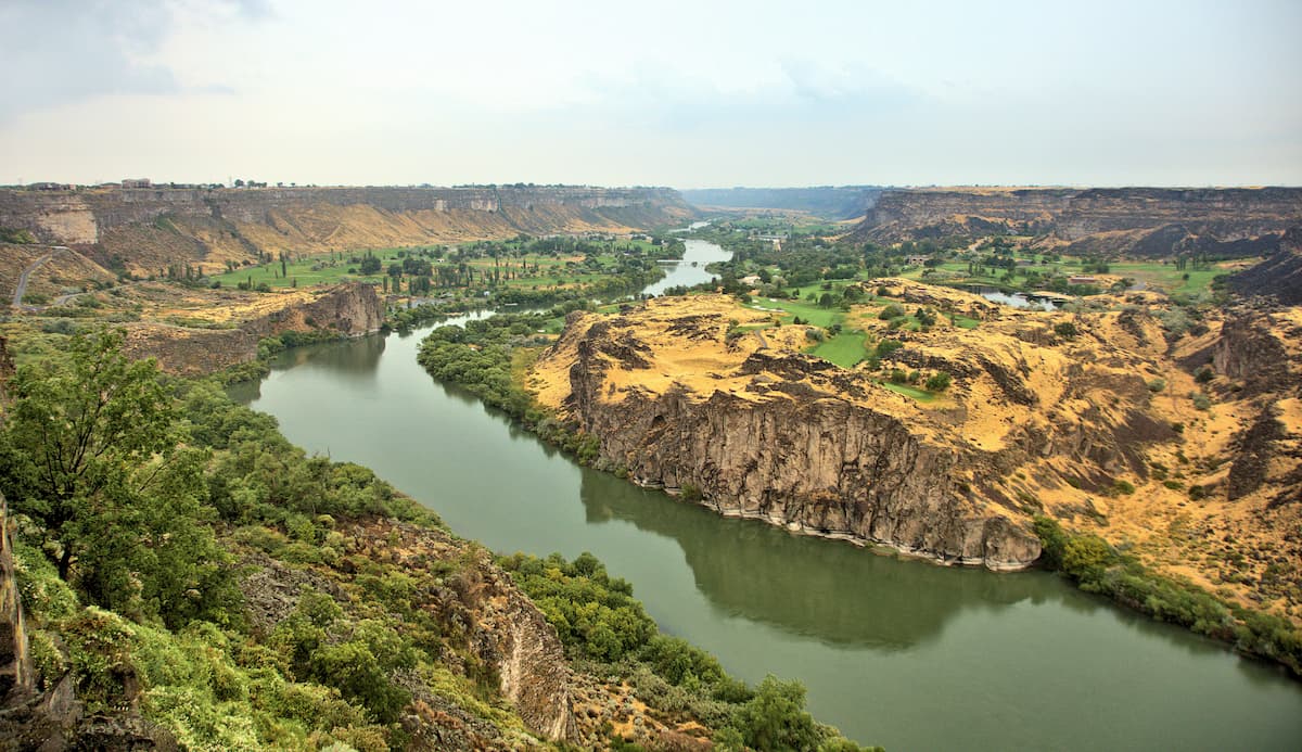
Idaho’s Magic Valley Region is situated in the south-central part of the state, predominantly within the Snake River Plain. It contains a handful of counties, including Blaine, Cassia, Jerome, Minidoka, Twin Falls, Gooding, Camas, and Lincoln.
This portion of Idaho is not nearly as mountainous as the regions that surround it, though it does include some high points from within the Idaho-Bitterroot Rocky Mountains and the Great Basin Ranges. Some smaller ranges within the Magic Valley Region include:

Some major protected areas in the region include Craters of the Moon National Monument and Sawtooth National Forest.
Idaho’s southeastern region generally refers to the southern part of the corner of the state that borders both Wyoming and Utah. While this region is known more for the Snake River Plain that dominates it, it is home to quite a few high points within Bannock, Caribou, Bear Lake, Franklin, Oneida, Power, Twin Falls, and southern Bingham and Bonneville counties.
Most of these peaks are within the Western Rocky Mountains system, including within the Wasatch Range, the Portneuf Range, and the Caribou Range. While much of this region is either publicly owned or BLM land, some portions are within the Caribou-Targhee National Forest.
The Upper Snake Region of Idaho encompasses the northeastern corner of the state from about Idaho Falls up north to the Montana border, including Fremont, Teton, Madison, Clark, and the northern parts of Bingham and Bonneville counties.
Here, the mountains are mostly part of the Greater Yellowstone Rocky Mountains, which includes the subranges of the Elkhorn Mountains and the Henryslake Mountains in the Caribou-Targhee National Forest.
While much of the Upper Snake Region is fairly low-lying, the region does border Wyoming's Yellowstone National Park and Grand Teton National Park, both of which are particularly mountainous.
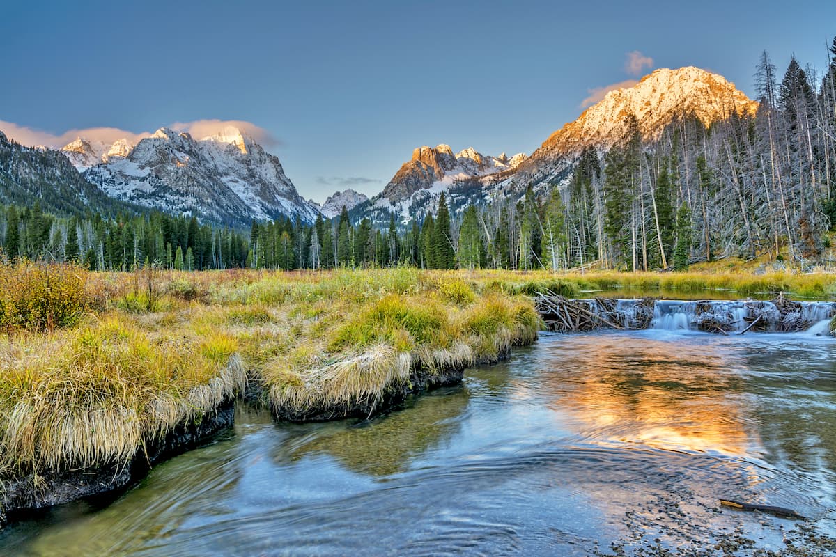
Idaho’s Salmon Region is one of the most mountainous, as it’s home to a number of different subranges within the Idaho-Bitterroot Rocky Mountains. This region includes Lemhi, Custer, Butte, and parts of Clark counties as well as the state’s highest mountain, Borah Peak.

In this region, there are a number of subranges, including:

Moreover, the Salmon Region of Idaho contains a fantastic mix of different public land areas, such as:

Idaho is home to a complex mix of different physiographic regions, each of which has its own unique geologic history. These regions include the Rocky Mountains (Idaho-Bitterroot Rocky Mountains, the Greater Yellowstone Rocky Mountains, and the Western Rocky Mountains), the Columbia Mountains, the Columbia Plateau, and the Great Basin Ranges, as well as the vast Snake River Plain which cuts across the central part of the state.
The vast majority of central Idaho and the southern part of the Panhandle is home to mountains within the Rocky Mountains system. Technically speaking, there are quite a few sub-systems in this area, including the Idaho-Bitterroot Rocky Mountains, the Greater Yellowstone Rocky Mountains, and the Western Rocky Mountains.
While these regions are underlaid by various bedrocks, including the Idaho Batholith, they, for the most part, share a similar geologic past. Most of the mountains in this area started to uplift during the Laramide orogeny some 80 to 55 million years ago and most of them were later covered with glaciers during the Pleistocene, which helped to carve out their current landscape.
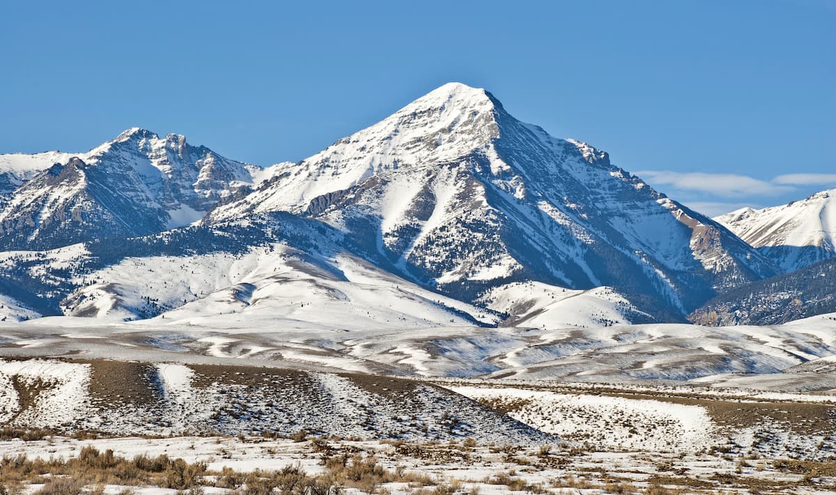
Nearly all of Idaho’s major peaks are found in the Rocky Mountains region, including Borah Peak, Diamond Peak, Leatherman Peak, Hyndman Peak, Scotchman Peak, and Black Pine Peak.
Encompassing a small section of western Idaho, the Columbia Plateau is a massive physiographic province that also includes parts of eastern Oregon and Washington.
This part of Idaho began to form about 17 to 6 million years ago when the region underwent a long period of volcanism. As basaltic lava started to flow throughout the region, it cooled and created most of the columnar cliffs that can now be found in the Columbia Plateau.
After this volcanic bedrock formed, a period of subduction then helped to create many of the mountains in the region.
Some of the easternmost parts of the Columbia Plateau, which are located in Idaho, such as the Hells Canyon National Recreation Area and the Seven Devils Mountains aso experienced widespread erosion at the hands of the Snake River and the overflow of ancient Lake Bonneville some 15,000 years ago. This helped to create Hells Canyon, which is one of the deepest canyons in the world.

Major peaks in this part of Idaho include She Devil, Monument Peak, and Jackley Mountain.
The Columbia Mountains cover just a small section of Idaho’s Panhandle, though they extend much further to the north into British Columbia and to the west and east, where they can be found in Montana and Washington.
Although the subranges of the Columbia Mountains all formed slightly differently, they are, for the most part, have a base of ancient sedimentary rock and some meta sedimentary layers which started to uplift about 185 million years ago during a mountain-building process that lasted until about 55 million years ago.
Despite being home to ancient rock and fairly old peaks, however, the Columbia Mountains have experienced massive amounts of shaping and sculpting in recent years, as a result of the extensive glaciation that took place in the region during the Pleistocene.
Covering just a small portion of southern Idaho, the Great Basin Ranges are a unique landscape that resulted from widespread crustal expansion during the Miocene. While most of the Great Basin Ranges are found in Nevada, California, and Utah, these ranges are also found in southern Idaho, including in the Owyhee Mountains.

This region has a fascinating geologic history as the Owyhee Mountains have also experienced a significant amount of volcanism over the past millions of years. In particular, Mahogany Mountain is the remains of a caldera which some geologists believed erupted about 15.5 million years ago.
Major peaks in this part of Idaho include Hayden Peak, Mahogany Mountain, Juniper Mountain, and Rough Mountain.
In a state as topographically diverse as Idaho, there’s a veritable treasure trove of flora and fauna to be found. Although the state is often seen as dry and arid, there’s much more than meets the eye based on where you are within the state of Idaho.
The southeasternmost part of Idaho is hot and dry, and is home to a landscape typical of the Basin and Range Ecoregion. This area contains mostly grases and sagebrush, though you can find plenty of drought-tolerant wildlife, such as pronghorns, bighorn sheep, mule deer, and even mountain lions, roaming around.
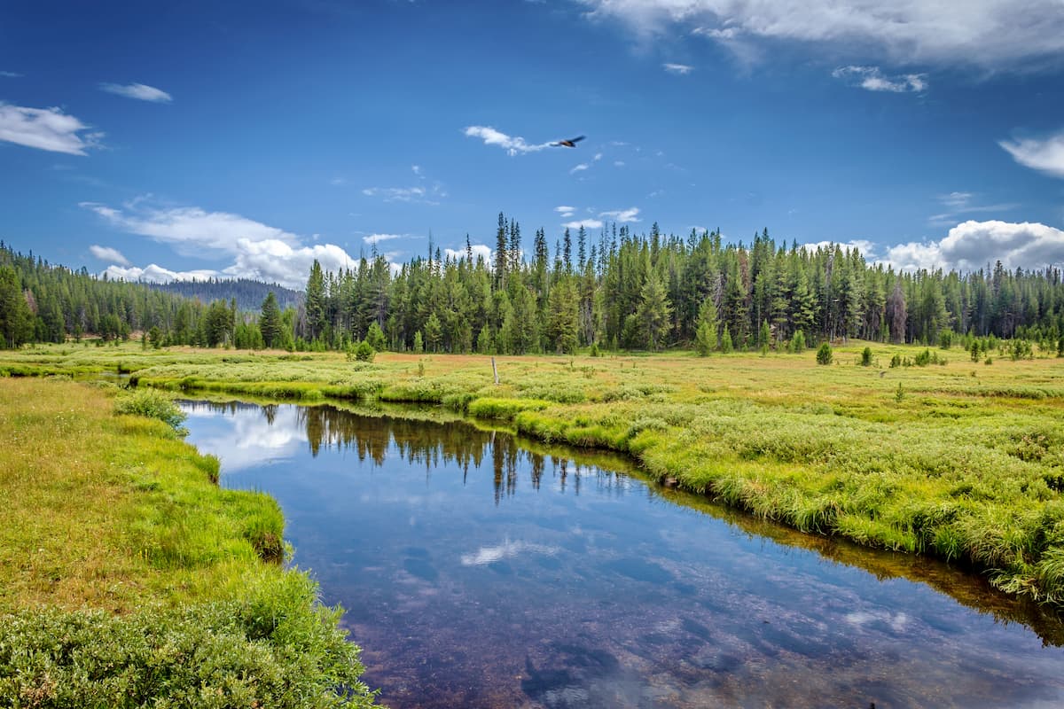
Meanwhile, the more northerly and central parts of the state are part of the Idaho Batholith and Rocky Mountains ecoregions which are home to dense forests of Douglas fir, lodgepole pines, ponderosa pines, whitebark pines, subalpine firs, and Engelmann spruce at mid-elevations. Wildlife in this part of the state is also typical of the Rockies, with everything from black bears and mountain lions to elk, moose, marmots, and coyotes.

The last major ecoregion in Idaho is the Snake River Plain Ecoregion, though, for the most part, this is a relatively low-lying area. It is characterized by rolling hills and plains which are fairly good for agricultural purposes.
Indeed, much of this ecoregion, which cuts a wide swath across the south-central part of Idaho, is used for livestock grazing and the growth of alfalfa, sugar beets, grains, and, yes, Idaho’s famous potatoes.
As the Snake River Plain is the most populous part of Idaho, much of the land no longer retains its natural flora. However, prior to European settlement, this region was mostly sagebrush steppe.
Idaho has a rich history of human inhabitation that dates back at least 14,000 years. Many Indigenous peoples consider the state to be their ancestral homelands, including the Ktunaxa, Coeur d’Alene, Nimiipuu (Nez Perce), Lemhi, Shoshone-Bannock, Northern Paiute, and the Eastern Shoshone, among others.
Some of the earliest Europeans to visit the region were likely French and French-Canadian fur trappers, many of whom came to what is now the state of Idaho well before the Lewis and Clark expedition.
The Lewis and Clark expedition was perhaps the most famous of the early non-Indigenous visitors to the area, having crossed into the modern day state boundaries in 1805 at Lemhi Pass.
After the expedition, fur trading remained a significant source of economic activity for Europeans in the region, bringing multiple large trading companies, such as the Hudson’s Bay Company and the North West Company into the Idaho mountains in search of furs.
The mid-1800s also saw an increase in missionary sojurns into the region. One of these early missions was established by Henry Harmon Spalding, who also planted the first potatoes in the state.

During this time, there was also a flurry of other immigrant activity as thousands of migrants traveled through Idaho to take part in the California Gold Rush. Eventually, prospectors also found gold within Idaho.
The latter half of the 19th century saw the creation of the Idaho Territory and the establishment of Boise as the capital. In 1890, Idaho also became the 43rd state in the US after Benjamin Harrison signed the statehood bill into law.
After statehood, mining and agriculture became major industries in Idaho. However, by the 1980s, mining prospects started to fade in the state, though agriculture still holds a significant portion of the state economy. Technology and science have also become major economic players, particularly around Boise.
In more recent years, outdoor recreation has become a major player in Idaho, as more people flock to the state’s excellent national forests and ski areas, particularly in the central Rocky Mountain Region.
Idaho is home to a lifetime of outdoor recreation opportunities. Here are some of the best hiking, climbing, and skiing areas to check out:
The Sawtooth National Recreation Area is one of the largest national recreation areas in the United States and it is considered to be one of Idaho’s crown-jewels of outdoor recreation.

Four mountain ranges - the Sawtooths, Boulders, White Clouds, and Smokies - are located in or around the recreation area, providing miles of popular hiking trails and endless scenic vistas. In the winter, the Sawtooth National Recreation Area maintains about 150 miles (240km) of snowmobile trails and 70 miles (113km) of cross-country ski trails.
Boise National Forest is another popular area for outdoor recreation and offers a variety of options for those interested in hiking, backpacking, or camping.
The Red Mountain Trail is a popular trail up to Red Mountain and Blue Lake is considered one of Idaho’s best kept secrets. Located just outside of the town of Cascade, Blue Lake also offers great views of nearby Snowbank Mountain and Granite Peak.
Nestled in the heart of the Lost River Range, Mt. Borah is a must-do for mountaineers and experienced hikers interested in tackling Idaho’s tallest mountain. The most popular route is a 9 mile (14.5km) trek along the Southwest Ridge, though the ascent is technically and physically demanding.
Hells Canyon, the deepest river gorge in North America, offers a variety of accessible hiking trails and scenic viewpoints for travelers. The Snake River Trail is a particularly popular 28 mile (45km) hike that winds its way along the Snake River and provides optimal views of the towering canyon.

For skiing and snowboarding enthusiasts, there are more than 20 ski resorts in Idaho, which are located mostly in the southwestern part of the state.
The two largest are Schweitzer Mountain Resort and Bald Mountain-Sun Valley with more than 90 km (56 mi) of slopes and more than 10 ski lifts each. In descending order of size, other major areas for skiing in Idaho include Bogus Basin—the main ski resort near Boise, Tamarack Resort, Lookout Pass, Brundage Mountain, Silver Mountain, Soldier Mountain, and others.
Check the Idaho ski resorts map and the larger USA ski resorts map in the World Mountain Lifts section of the site. It includes information about open ski lifts / slopes in Idaho in real-time with opening dates and hours. There are also year-round cable cars, funiculars, cog railways, aerial tramways, and all other types of mountain lifts.

Here are some of the best places to stay if you’re visiting the great state of Idaho:
The capital and largest city in Idaho, Boise is a lively metropolis that’s home to some 228,000 people. It is the cultural and commercial center of the state as well as an excellent place to start your adventures, as it’s the location of Idaho’s largest airport.

Sun Valley is a resort city located just outside the city of Ketchum. It is a popular destination for alpine skiers, hikers, and outdoor enthusiasts looking to experience the Sawtooth National Forest.
There are several popular resorts in Sun Valley, including Sun Valley Resort, River Run Lodge, Warm Springs Lodge, Carol’s Dollar Mountain Lodge, and Seattle Ridge Lodge. Additionally, the valley has a wide variety of visitor-friendly amenities including gondolas, chair lifts, bike trails, hiking trails, shops, and restaurants.

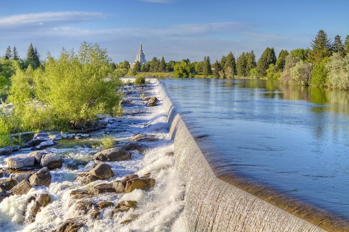
Idaho Falls is one of the largest cities in Idaho outside of the greater Boise region. It is situated in the eastern part of the state in the Snake River Plain and it is home to about 56,000 residents. The city is a hub for commerce and transport in eastern Idaho and western Wyoming and it has a busy regional airport that offers good connections around the Mountain West.


Yes. Idaho has 3,346 named mountains. The highest is Borah Peak at 3,859 m.
The highest mountain in Idaho is Borah Peak, at 3,859 m.
Idaho has 3,346 named mountains.


