Scan the QR code and open PeakVisor on your phone
The Wallowa-Whitman National Forest is located in Oregon and Idaho in the United States. The forest was created in 1954 when the Wallowa and Whitman forests were merged into one. The term Wallowa was used to name the forest for the Wallowa band of Nez Perce people. There are 200 named mountains in Wallowa-Whitman National Forest. The highest and the most prominent mountain is Sacajawea Peak at 9,820 feet.
The forest covers over 2.3 million acres which includes 600,000 acres of designated wilderness. Located in the Oregon section of the forest lies the Wallowa Mountains, a rugged stretch of mountain that reaches some of the tallest peaks in the region. The Wallowa-Whitman National Forest encompasses four separate wilderness areas; Eagle Cap Wilderness, Hells Canyon Wilderness, Monument Rock Wilderness, and North Fork John Day Wilderness. Part of the Wallowa-Whitman National Forest encompasses the Elkhorn Mountains, a subrange of the Blue Mountains. This region of the forest borders the Malheur National Forest and the Umatilla National Forest. The historic gold mining city Sumpter is surrounded by the Wallowa-Whitman National Forest.
The Wallowa-Whitman National Forest is home to a plethora of wildlife with over 1,500 plant species. There are an estimated 173,000 acres of old growth forest within this national forest. Commonly found large mammals include moose, elk, bighorn sheep, deer, coyote, black bear, timber wolf, cougar, as well as bobcat. Wolverine sightings are extremely rare in the United States but there have been several recording sightings within the forest.
Back in 1905, President Theodore Roosevelt established the Wallowa Forest Reserve and Chesnimnus Reserve. The name was changed in 1908 to the Wallowa National Forest on the same day that the Whitman National Forest was established. Today the government works with the Nez Perce Tribe of Idaho and the Confederated Tribes of the Umatilla Indian Reservation on both cultural and natural resources issues.
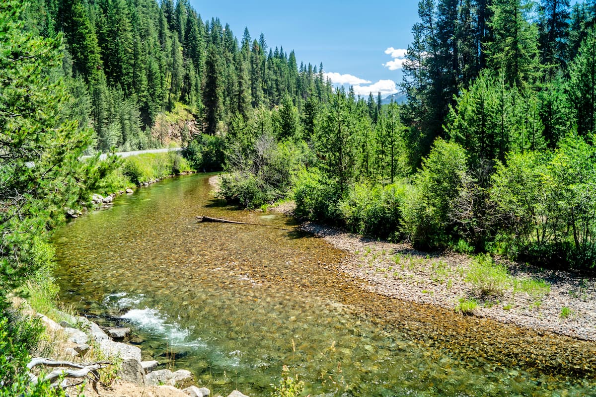
Overall the forest is used for hiking, camping, fishing, kayaking, rafting, and skiing as Anthony Lakes Ski Area is located within the forest. Within the forest there are 66 designated and maintained hiking trails. In winter months the forest is used for skiing, snowshoeing, and snowmobiling.
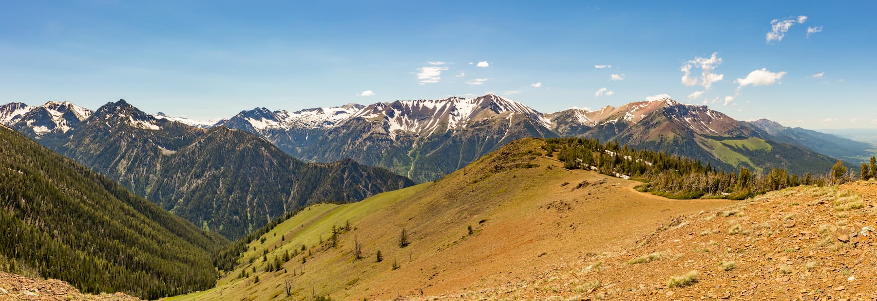
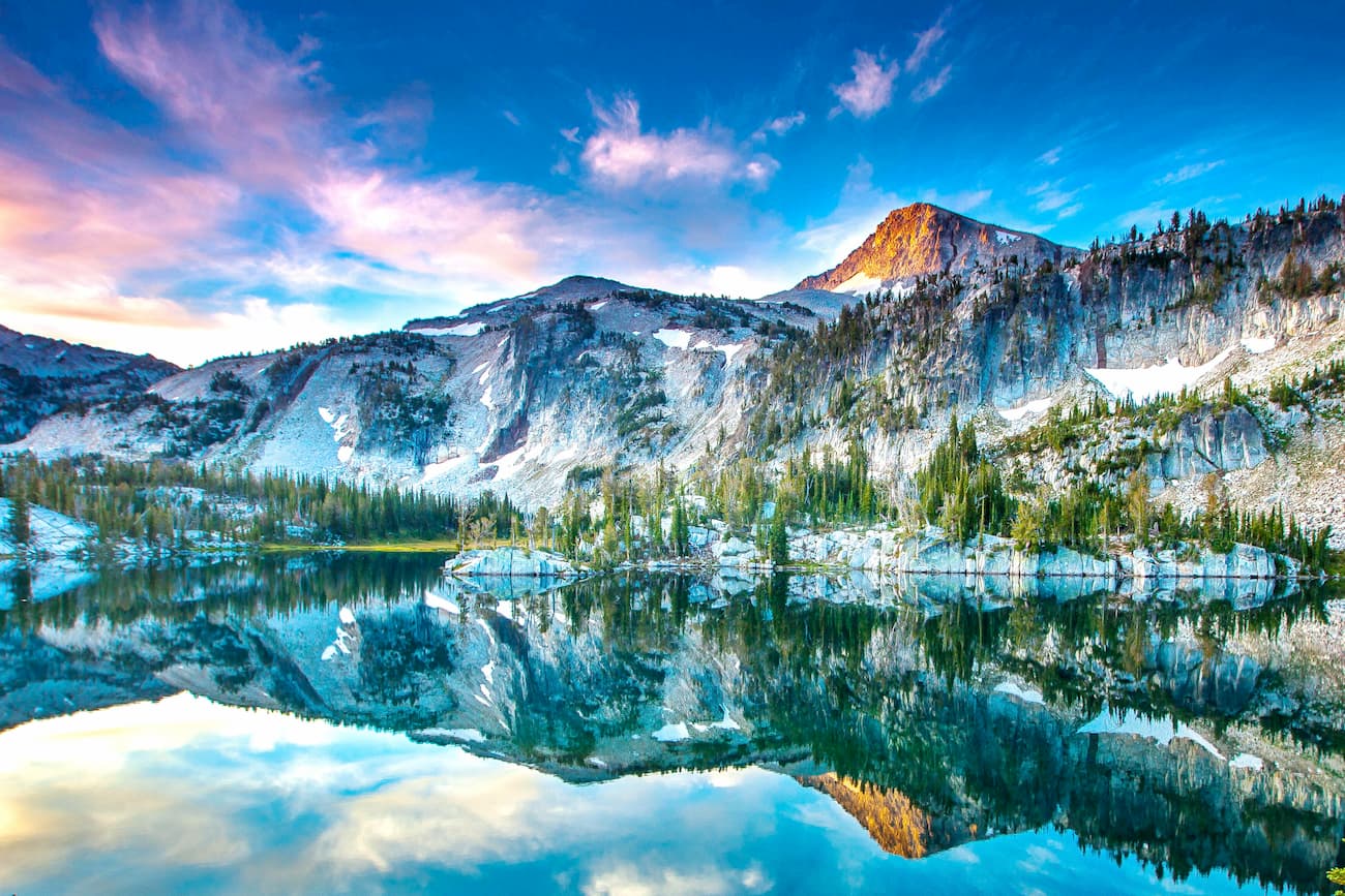
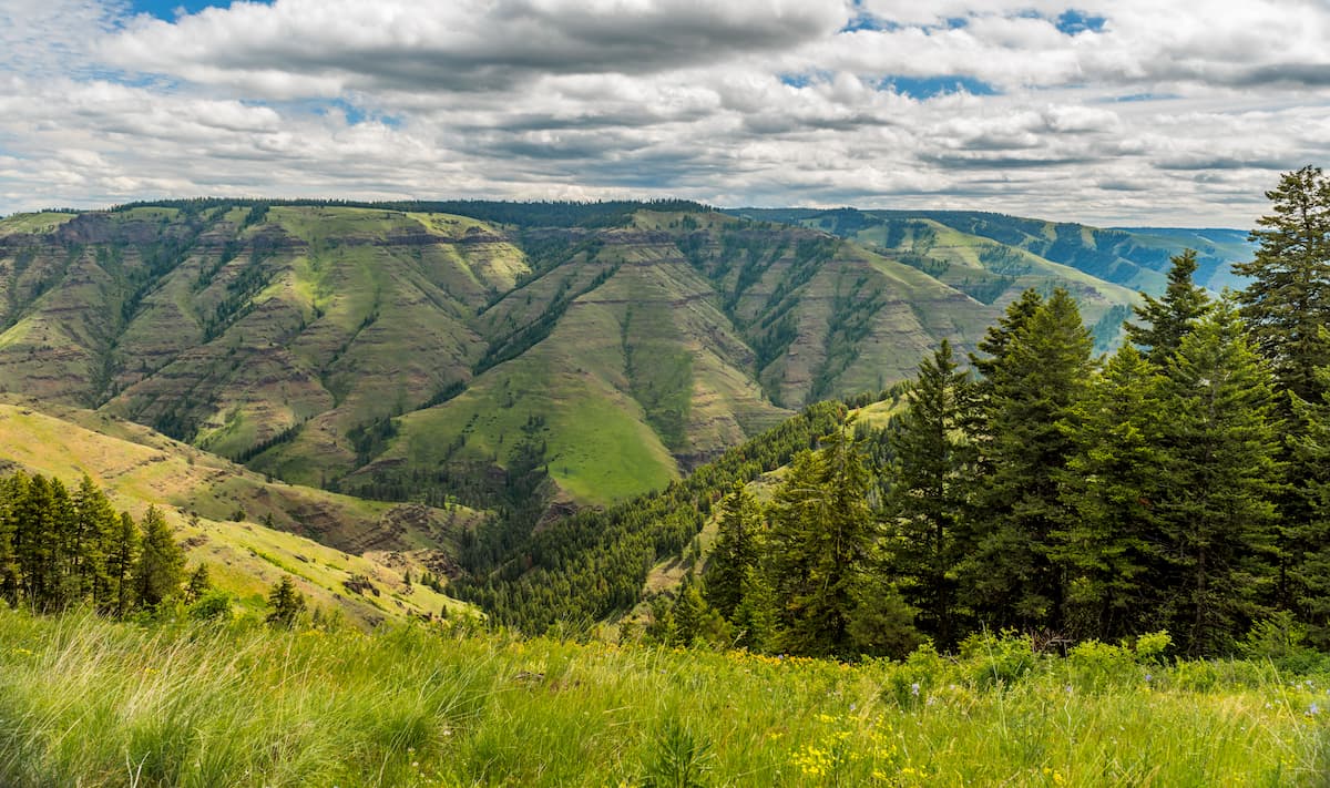
This wilderness spans 361,446 acres making it Oregon’s largest wilderness area. The region covers the Wallowa Mountains and is characterized by its over 30 summits that reach over 8,000 feet. The Eagle Cap Wilderness is also characterized by high alpine lakes with 12 named lakes sitting above 8,000 feet. There are approximately 534 miles of trails within the wilderness.
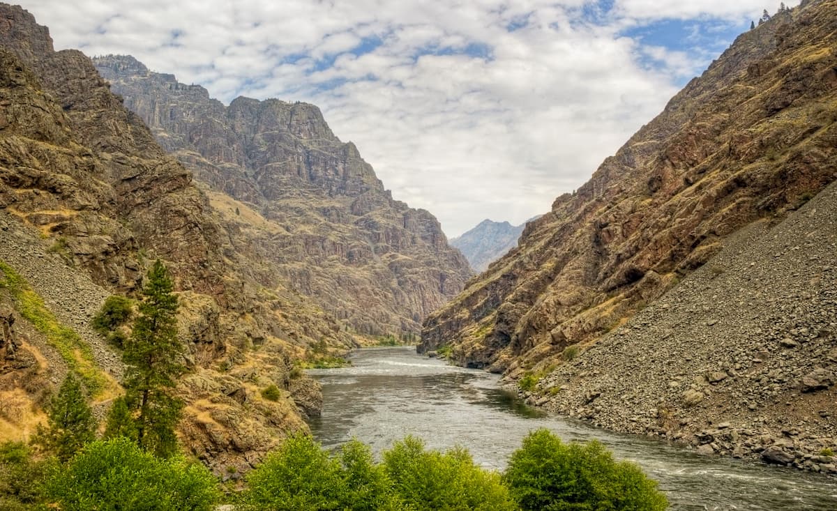
Hells Canyon is the deepest river gorge in North America and it was established back in 1975. The wilderness covers 217,927 acres. There are 39 named mountains in Hells Canyon Wilderness. There are over 360 miles of trails within the wilderness.
The North Fork John Day Wilderness covers 121,352 acers. Within this wilderness also lies Vinegar Hill-Indian Rock Scenic Area. The region has 133 miles of hiking trails and is also known for rock climbing on the granite cliffs of the Elkhorn Mountains.
The Monument Rock Wilderness comprises 19,650 acres located in the Blue Mountains of Oregon. The tallest peak in the region is Table Rock at 7,815 feet. This wilderness region is not as accessible as some of the others in the Wallowa-Whitman National Forest with just 15 miles of maintained trails.
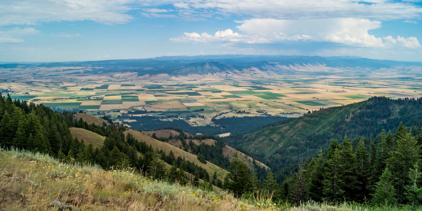
While there are not any major cities in much of eastern Oregon, La Grande sits at the foothills of the Wallowa Mountains. The city is located in the Grande Ronde Valley and has a population just under 15,000. It sits east of the Blue Mountains and west of the Wallowa Mountains. Mount Emily sits north of the town, towering over its streets. The small town is a great place to stop on your way to the Eagle Cap Wilderness, grab a bite to eat or check out the many local shops.
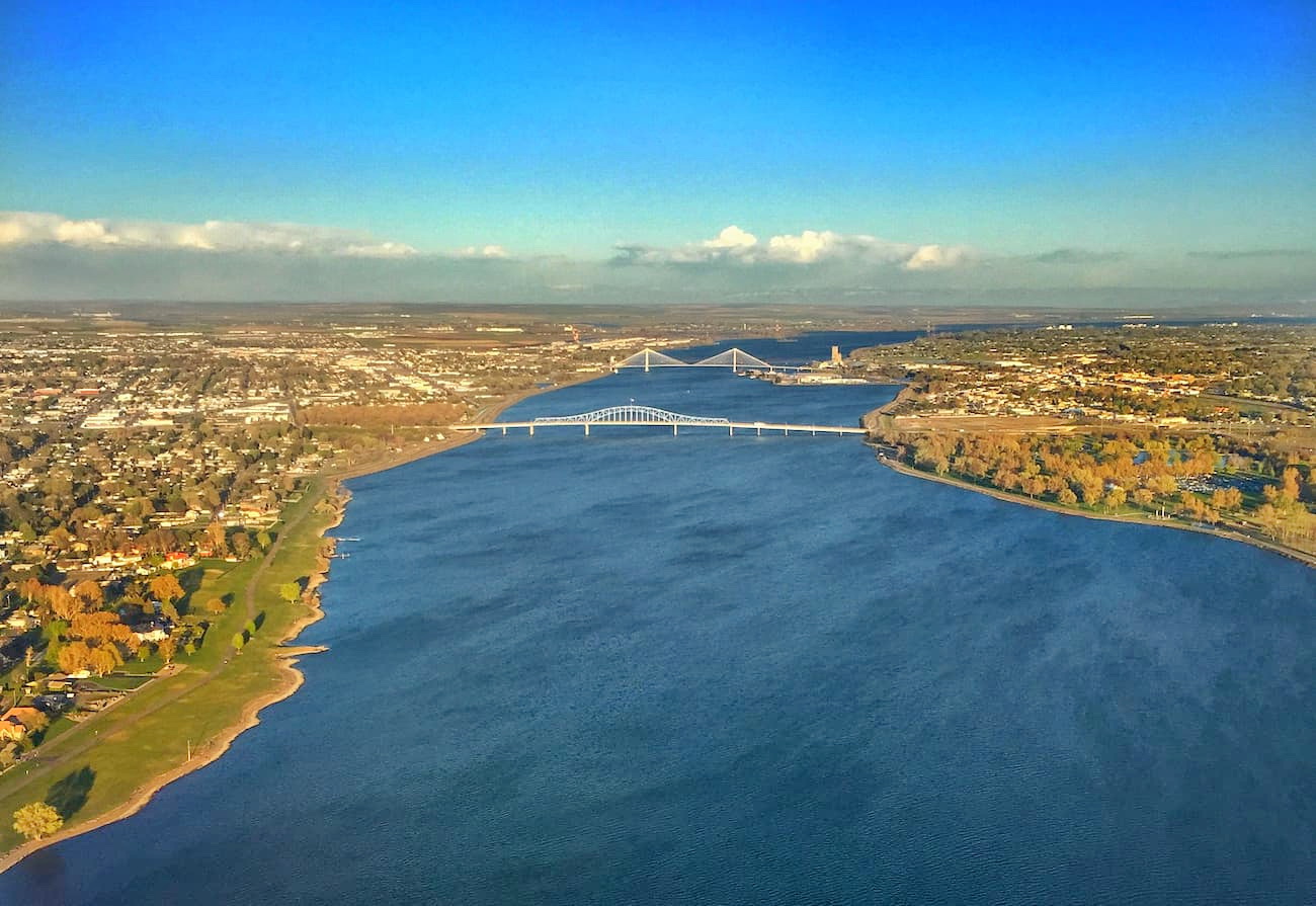
The Tri-Cities, includes three closely linked cities; Kennewick, Pasco, and Richland. The cities are situated where the Yakima, Snake, and Columbia rivers meet. Situated about an hour west of the Umatilla National Forest, the area has been historically based on farming and the Hanford Nuclear Reservation. Farming has been popular due to the irrigation from the three conjoining rivers. The area is home to seven river-front parks that are popular among locals and tourists alike.
Four hours east of the Malheur National Forest sits Boise. The city of Boise is the capital of the state of Idaho and the most populous city in the state. Situated on the Boise River, the city is 41 miles east of the Oregon border and 110 miles north of the Nevada border. The Boise metropolitan area contains the state’s three most populous cities; Boise, Nampa, and Meridian with a total population of 710,000. The city is known as “The City of Trees” and the downtown area is full of shops and local dining options. The town is home to numerous recreational opportunities which include hiking and biking. Boise is also home to the Boise River Greenbelt which is an extensive urban trail system along the Boise River.

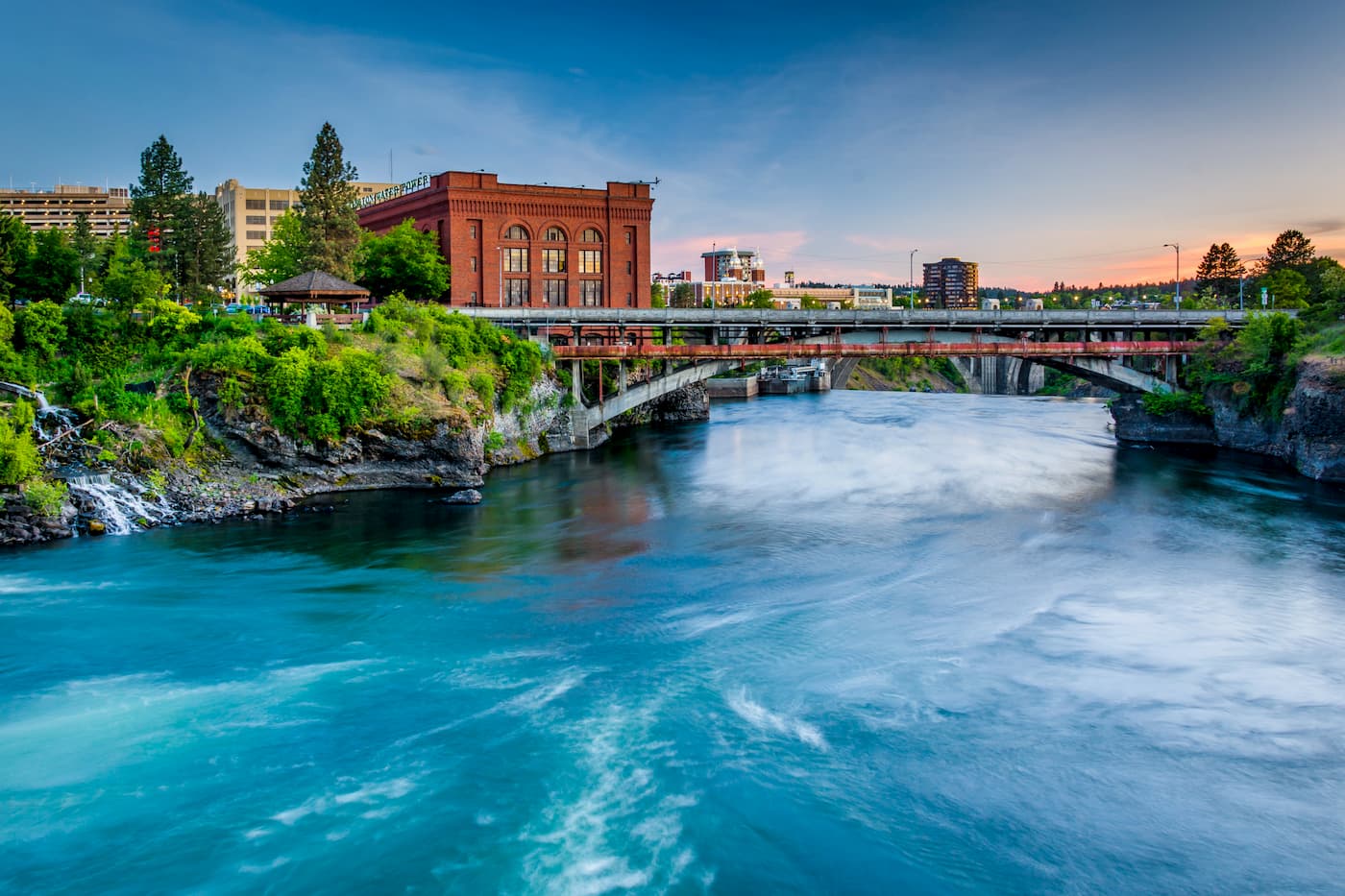
Located two hours north of the Umatilla National Forest, Spokane is the most populous city in eastern Washington. The Spokane river runs through the city while it sits 92 miles south of the Canada-U.S. border. With a population of 222,000, Spokane is the second largest city within the state of Washington. While most of the state’s population lives on the western side of the Cascade Mountain Range, Spokane is a hidden gem for any outdoor enthusiast. There are four ski resorts within two hours of downtown, while rock climbing, hiking, running, rafting, canoeing, and fishing are all accessible within minutes.