
Scan the QR code and open PeakVisor on your phone
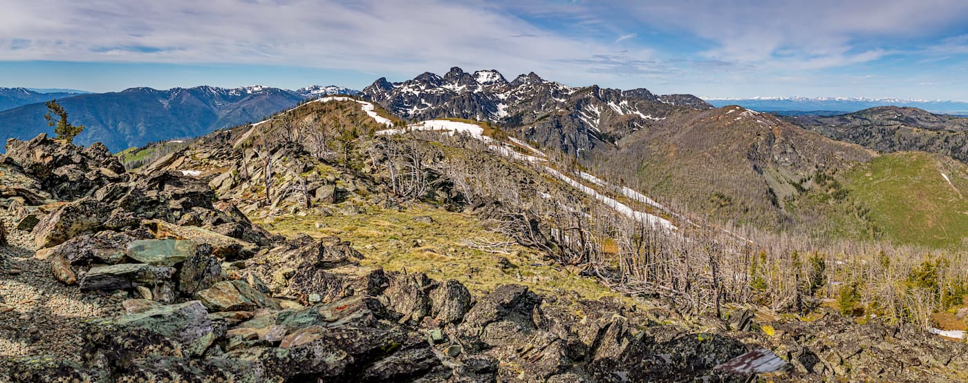
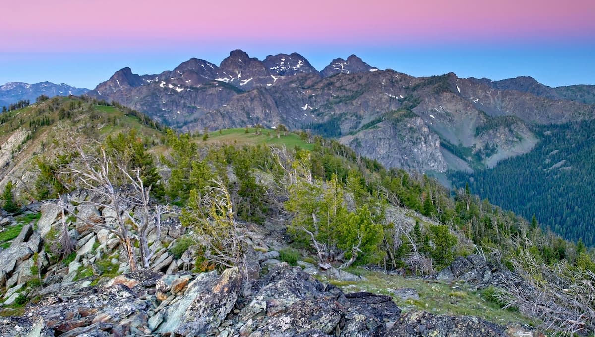
Hells Canyon Wilderness has 48 named peaks. The highest is He Devil at 2,872 m. Other notable peaks include She Devil, Devils Throne and The Ogre.
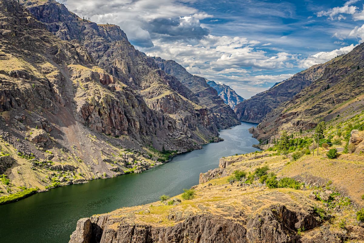
Hells Canyon Wilderness is a wilderness area within the Hells Canyon National Recreation Area within the Wallowa-Whitman National Forest. Hells Canyon is the deepest river gorge in North America and it was established back in 1975. The wilderness covers 217,927 acres. There are 39 named mountains in Hells Canyon Wilderness. The highest and the most prominent mountain is She Devil at 9,406 feet.
There are over 360 miles of trails within the wilderness. Some trails follow old roads while others climb ridges and traverse the slopes. Because the region is a designated wilderness area, no motorized or mechanized vehicles are allowed.
Despite the wilderness existing primarily in Oregon, the vegetation varies from the western part of the state. Hells Canyon Wilderness is characterized by sagebrush, prickly pear cactus and bunchgrass. Wildlife is similar to other parts of the state, including black bear, cougar, elk, deer, mountain goat, and recent sighting of wolverines.
There are three National Wild and Scenic Rivers that run through the wilderness; the Snake, Imnaha, and Rapid Rivers. The Snake river runs through the wilderness for 67 miles with sections known for white water rafting. The Imnaha River has 77 miles within the wilderness while the Rapid River has 26.8 miles. The Rapid River is home to chinook salmon, steelhead, and bull trout.
As one of the most popular hikes in the wilderness, this route is 1.6 miles out and back with 885 feet of elevation gain. The route starts at the Seven Devils Campground and climbs steadily through the forest and rock cliffs before arriving at the lake.
The hike to the top of Cuddy Mountain is 7.5-miles out and back with 2,864 feet of elevation gain. The steep climb takes you through sections of forests and open viewpoints. From the top of Cuddy Mountain are views of both western Idaho and eastern Oregon with the Blue Mountains in the distance and She Devil.
As the tallest peak in the wilderness, the summit of She Devil offers expansive panoramic views of the Hells Canyon Wilderness. There are multiple trails leading to the summit though the most common approach to the peak is from Sheep Lake. Much of the trail from the lake requires scrambling over loose rocks.
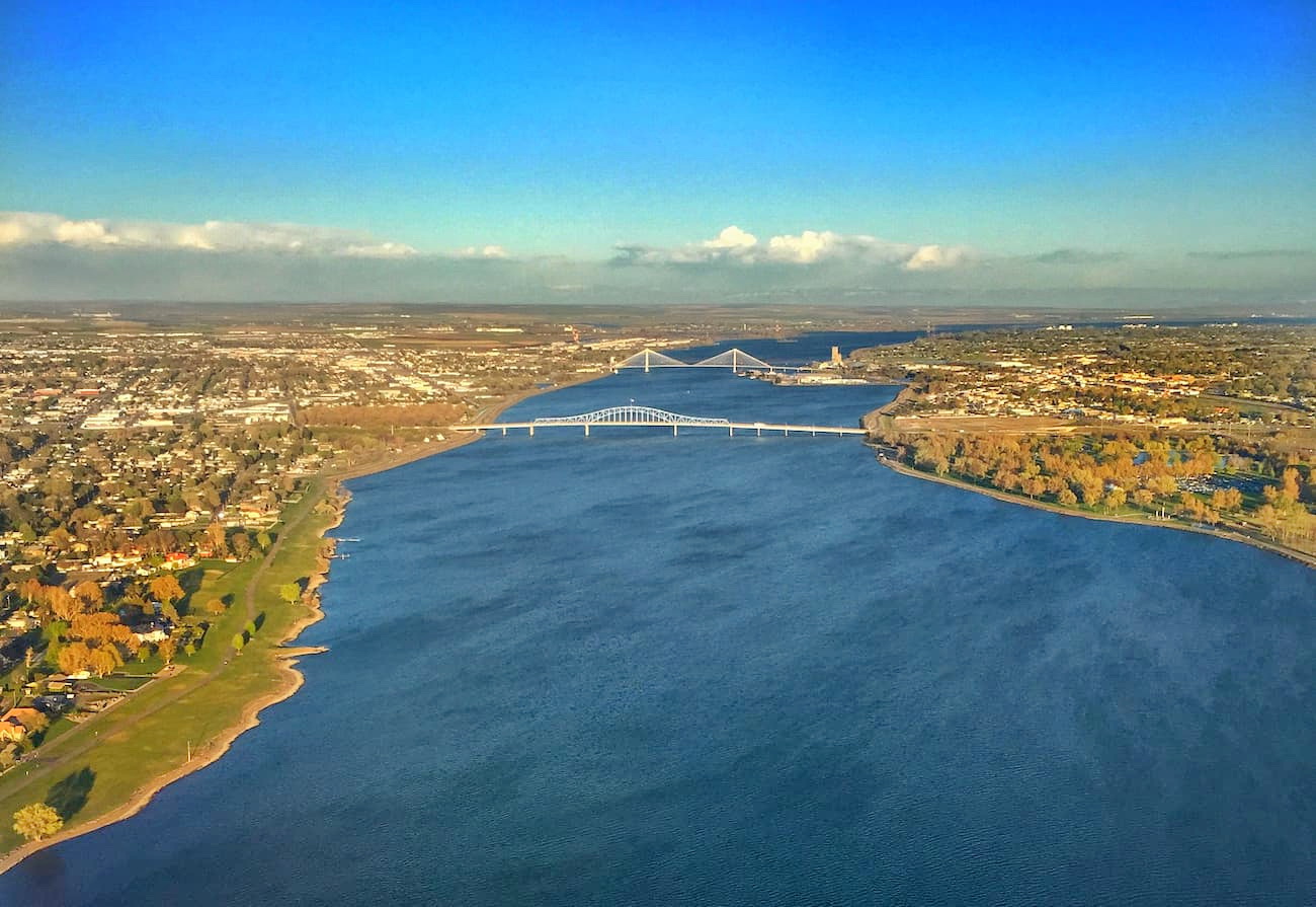
The Tri-Cities, includes three closely linked cities; Kennewick, Pasco, and Richland. The cities are situated where the Yakima, Snake, and Columbia rivers meet. Situated about two hours northwest of the Eagle Cap Wilderness, the area has been historically based on farming and the Hanford Nuclear Reservation. Farming has been popular due to the irrigation from the three conjoining rivers. The area is home to seven river-front parks that are popular among locals and tourists alike.
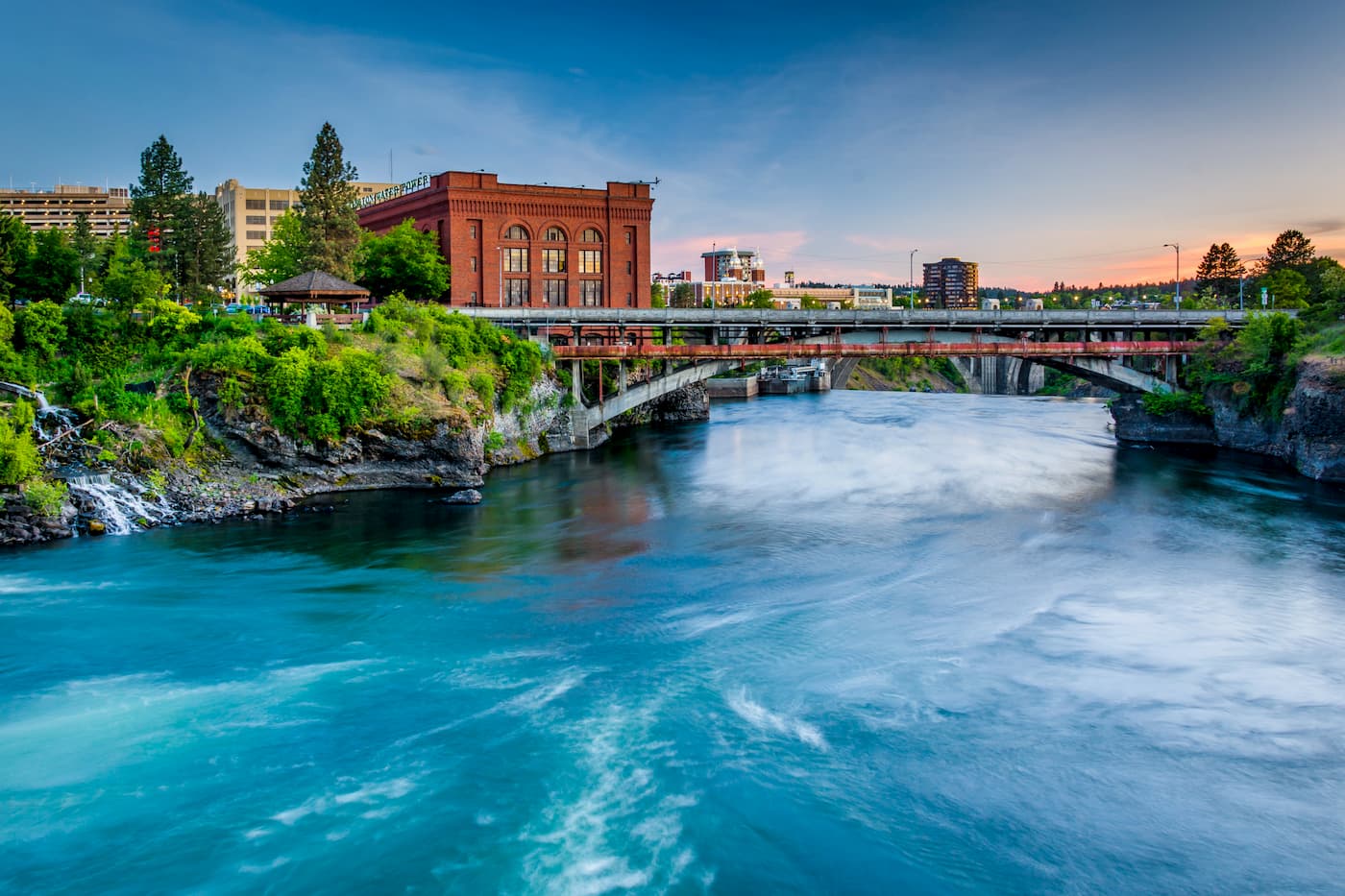
Located four hours north of the Hells Canyon Wilderness, Spokane is the most populous city in eastern Washington. The Spokane river runs through the city while it sits 92 miles south of the Canada-U.S. border. With a population of 222,000, Spokane is the second largest city within the state of Washington. While most of the state’s population lives on the western side of the Cascade Mountain Range, Spokane is a hidden gem for any outdoor enthusiast. There are four ski resorts within two hours of downtown, while rock climbing, hiking, running, rafting, canoeing, and fishing are all accessible within minutes.
Four hours east of the Malheur National Forest sits Boise. The city of Boise is the capital of the state of Idaho and the most populous city in the state. Situated on the Boise River, the city is 41 miles east of the Oregon border and 110 miles north of the Nevada border. The Boise metropolitan area contains the state’s three most populous cities; Boise, Nampa, and Meridian with a total population of 710,000. The city is known as “The City of Trees” and the downtown area is full of shops and local dining options. The town is home to numerous recreational opportunities which include hiking and biking. Boise is also home to the Boise River Greenbelt which is an extensive urban trail system along the Boise River.


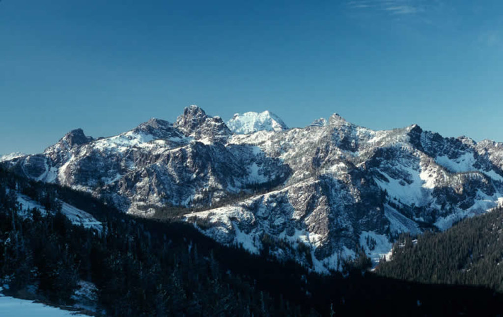
The highest peak in Hells Canyon Wilderness is He Devil, at 2,872 m.
Notable peaks in Hells Canyon Wilderness include He Devil, She Devil, Devils Throne, The Ogre and Tower of Babel.


