
Scan the QR code and open PeakVisor on your phone
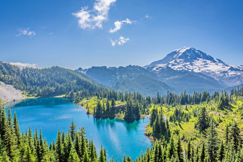
Washington is home to 3,709 named mountains, including 2 fourteeners. The highest is Mount Rainier at 4,392 m.
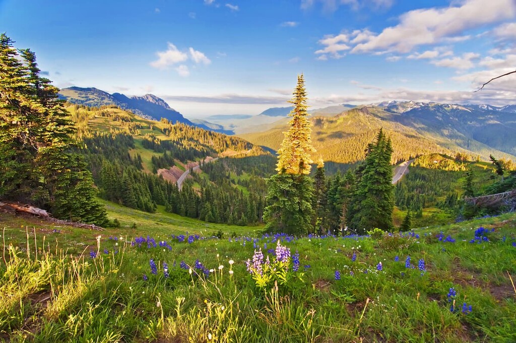
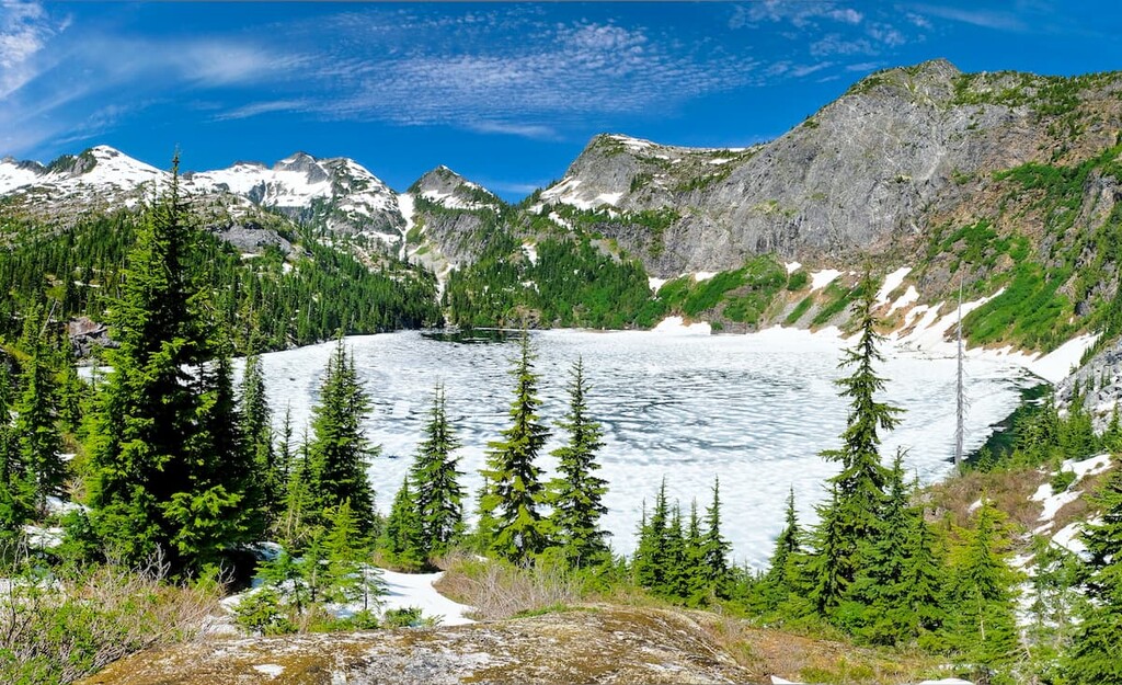
Rugged mountains, sprawling glaciers, and dense forests. These are just some of the many natural delights that you can find in the great US state of Washington. One of the most mountainous states in the country, Washington is home to 3709 named mountains, the highest and most prominent of which is the famous Mount Rainier (14,409ft/4,392m).
The state of Washington (not to be confused with Washington, D.C.) is located in the northwestern region of the United States. With a total area of some 71,362 square miles (184,827 sq. km), Washington is the 18th largest state in the union.
Nevertheless, despite having the country’s 13th largest population as of 2021, Washington is only the 25th most densely populated state in the country. That being said, Washington does have the 12th longest ocean coastline in the United States.
Washington is located in the United States’ Pacific Northwest Region along the Pacific Ocean. It shares its borders with Idaho to the east and Oregon to the south. Furthermore, Washington has an international border with Canada to the north, where it borders the province of British Columbia.
Washington is officially divided up into 39 counties of various shapes and sizes. However, the state can also be unofficially divided up into geographic regions, each of which has its own unique topographical features.
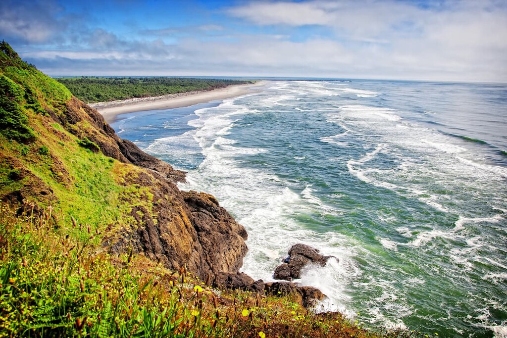
Aptly named, the Peninsulas & Coast Region of Washington includes the entirety of the Olympic Peninsula and the state’s southern coastline.
It includes Clallam, Jefferson, Grays Harbor, Mason, Kitsap, Pacific, and Wahkiakum counties, as well as the reservations of the Makah Tribe, Lower Elwha Klallam Tribe, Jamestown S’Klallam Indian Tribe, Port Gamble S’Klallam Tribe, Hoh Tribe, Quinault Indian Nation, Skokomish Indian Tribe, Squaxin Island Tribe, and Shoalwater Bay Tribe.
Much of the Peninsulas & Coast region is dominated by the Olympic Mountains, though a small portion of the northern section of the region is part of the Northwest U.S. Coast Ranges.
There are a whole host of great parks and forests in the region, including:
Furthermore, the Peninsulas & Coast region includes parts of 7 federally-designated wildernesses.
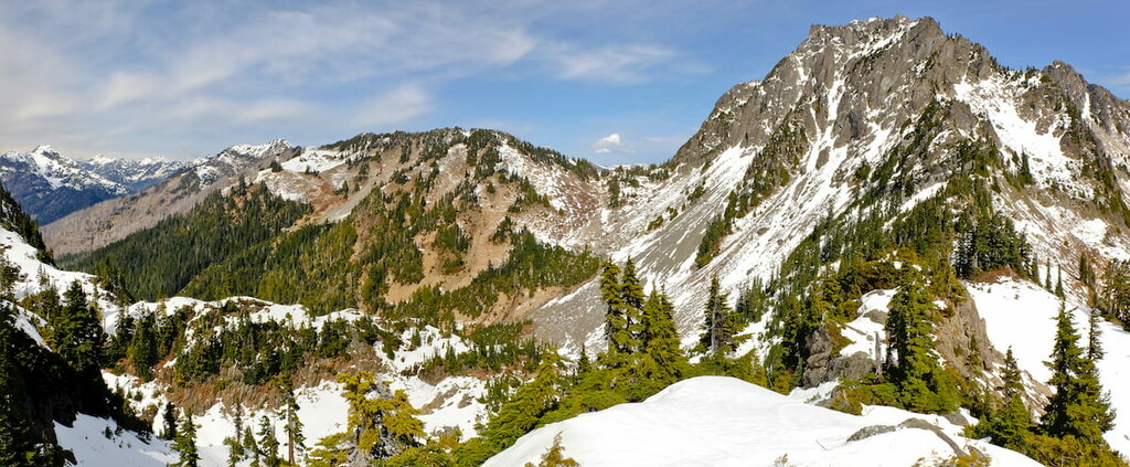
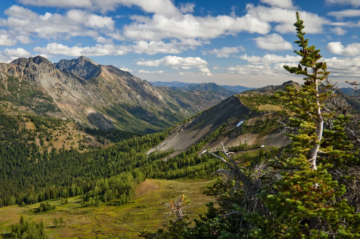
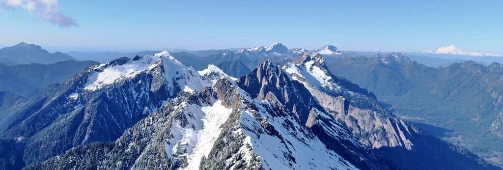
Located in northwestern Washington, the North Cascades region encompasses some of the most rugged terrain in the state.
This region includes Whatcom, Skagit, San Juan, Island, and Snohomish counties as well as the reservations of the Nooksack Indian Tribe, Lummi Nation, Samish Indian Nation, Upper Skagit Tribe, Swinomish Tribe, Sauk-Suiattle Indian Tribe, Stillaguamish Tribe.
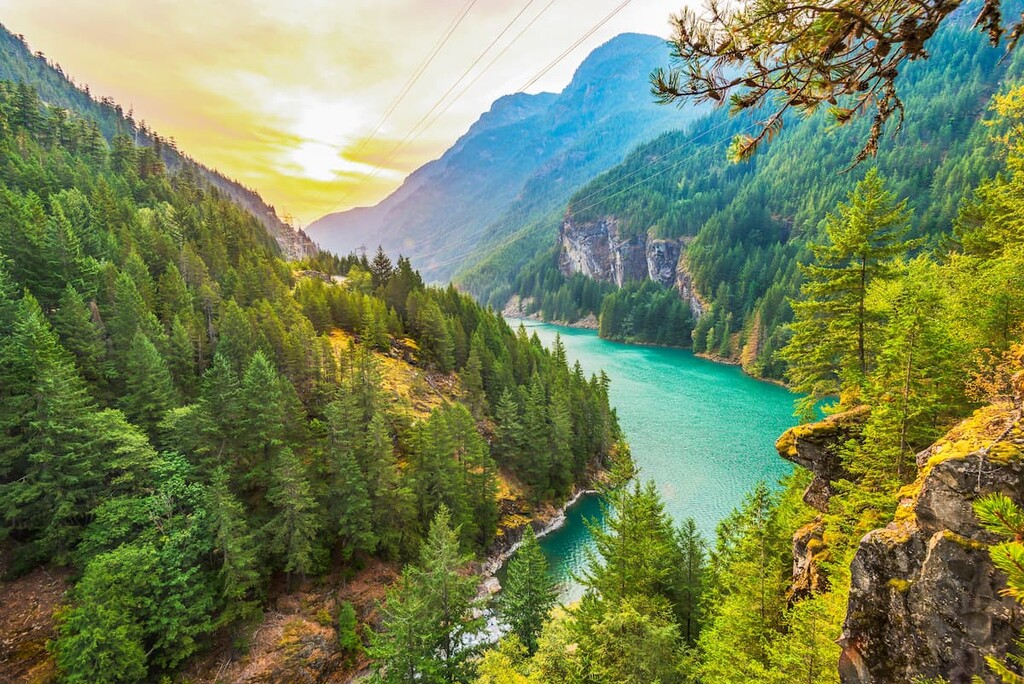
Furthermore, this region is dominated by the peaks of the Cascade Range, including the Skagit Range subrange. Major parks, forests, wildernesses, and wildlife refuges in the region include:
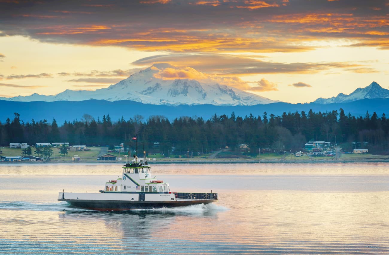
As the name suggests, the Greater Seattle region includes much of the land in and around the city of Seattle, as well as the city of Olympia. It incorporates parts of Snohomish, King, Pierce, and Thurston counties, as well as the reservations of the Tulalip Tribes, Suquamish Tribe, Snoqualmie Tribe, Muckleshoot Tribe, Puyallup Tribe, Nisqually Tribe, Confederated Tribes of the Chehalis Reservation.
While this region is home to Washington’s biggest metro area, it also contains parts of the Cascade Range and the Northwest U.S. Coast Ranges. There are a number of major forests and wilderness areas in the region, including:

The Volcanoes region is located just to the south of Greater Seattle and to the east of the Peninsulas & Coast. It includes Pierce, Lewis, and Cowlitz counties as well as the reservation of the Cowlitz Tribe.
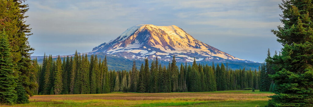
As you can gather from the name, the region is home to a handful of volcanoes of the Cascade Range, the most notable of which is Mount Rainier. Within the region, there are quite a few parks and forests, such as:
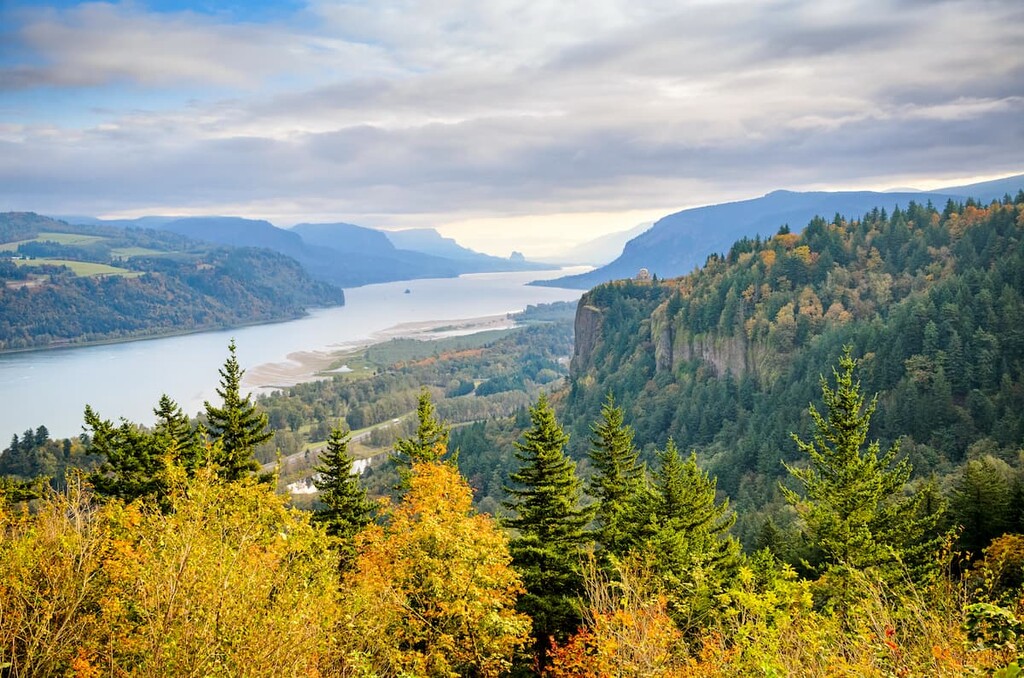
Situated around the Columbia River in southern Washington, the Gorge region includes parts of Clark, Skamania, and Klickitat counties as well as the reservation of the Confederated Tribes of the Yakama Indian Reservation.
This region is dominated by the Gifford Pinchot National Forest and the Columbia River Gorge National Scenic Area. It also contains a handful of wilderness areas and wildlife refuges, such as:
Covering much of the central part of the state, the North Central Region includes the bulk of Okanogan, Chelan, Douglas, Grant, and Kittitas counties as well as the reservation of the Colville Confederated Tribes.
This region contains much of the eastern portions of the Cascade Range and its associated foothills, much of which is found in the Okanogan-Wenatchee National Forest. There are also a few wildernesses and wildlife refuges in the region, such as:
Washington’s premier wine-growing region, Wine County is located in south-central Washington and it includes Yakima, Benton, Franklin, and Walla Walla counties. It is also home to part of the reservation of the Confederated Tribes of the Yakama Indian Reservation.
Much of this region is dominated by the hills of the Columbia Plateau, including the Blue Mountains, though a small portion of it is also within the Cascade Range.
In addition to being an agricultural region, Wine Country contains a handful of great outdoor recreation destinations, such as:

One of the largest regions in Washington, the Northeast Region includes the majority of the state’s northeastern corner. This includes Ferry, Stevens, Pend Oreille, Spokane, and Lincoln counties as well as the reservations of the Colville Confederated Tribes, Spokane Tribe, Kalispel Tribe.
Here, the peaks are mostly part of the Columbia Mountains, including the Monashee Mountains and Selkirk Mountains subranges. There are 3 national forests in the region as well as some wilderness areas and national wildlife refuges, such as:
Last but not least, the final region of Washington is the southeast region, which includes parts of Adams, Whitman, Columbia, Garfield, and Asotin counties.
The land here is mostly part of the Columbia Plateau, including the Blue Mountains subrange, though much of it is agricultural. There are a handful of areas of public land in the region, as well as access to some of the best outdoor recreation areas in nearby Idaho and Oregon. Some popular destinations in the region include:
The geology of the state of Washington is complex and varied. Indeed, the state’s current topography and its many geologic structures are the result of innumerable geological processes over the past few hundred million years.
One of the major mountain ranges in the United States, the Cascade Range stretches from northern California, through Oregon, and into Washington before briefly crossing the border into British Columbia.
The range has a complex geologic history that dates back some 400 million years. It is the result of various accreted terranes, faults, and volcanic activity. However, the subduction of the Juan de Fuca Plate (and its ancestor, the Farallon Plate) under the North American Plate over about 40 million years has resulted in the formation of the Cascade Volcanic Arc.
Over the last 5 to 7 million years, the region became particularly volcanically active, evidence of which is still seen today in the range’s many active volcanoes.
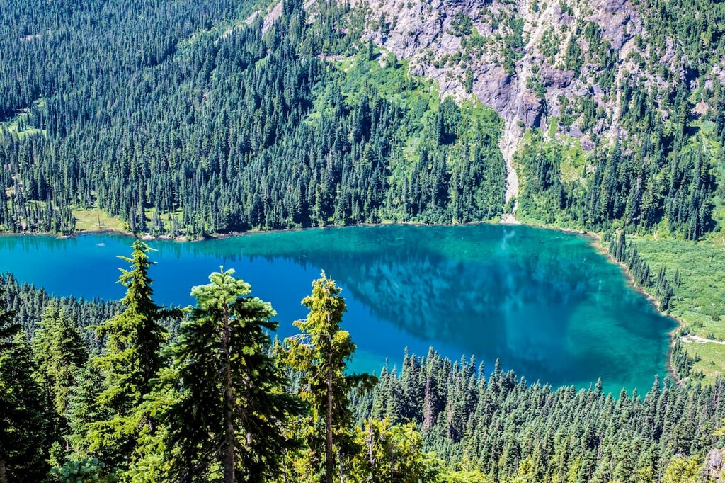
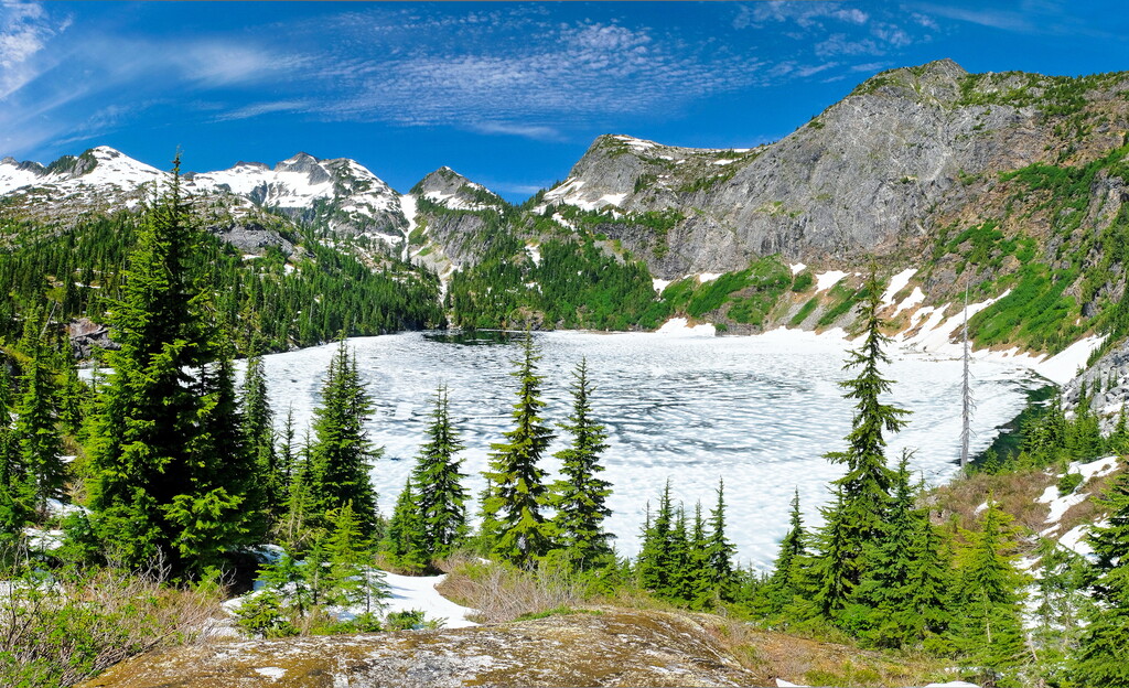
Furthermore, the range is extensively glaciated. These glaciers have carved out many of the topographical features that we see in the region today, such as high mountain cirques, deep valleys, and tarn lakes.
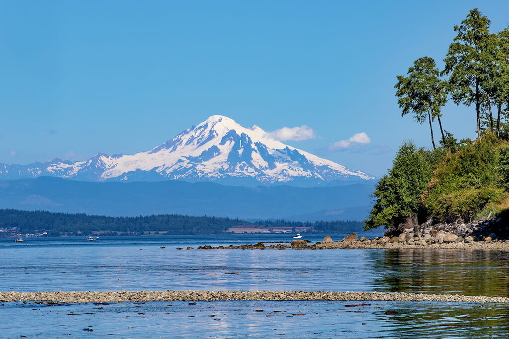
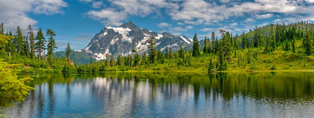
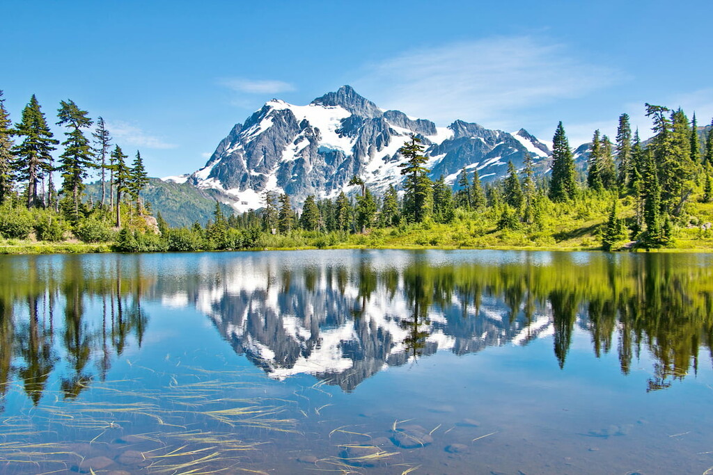
Major peaks in the range include Mount Rainier, Mount Baker, Glacier Peak, Mount Adams, Bonanza Peak, and Mount Stuart.
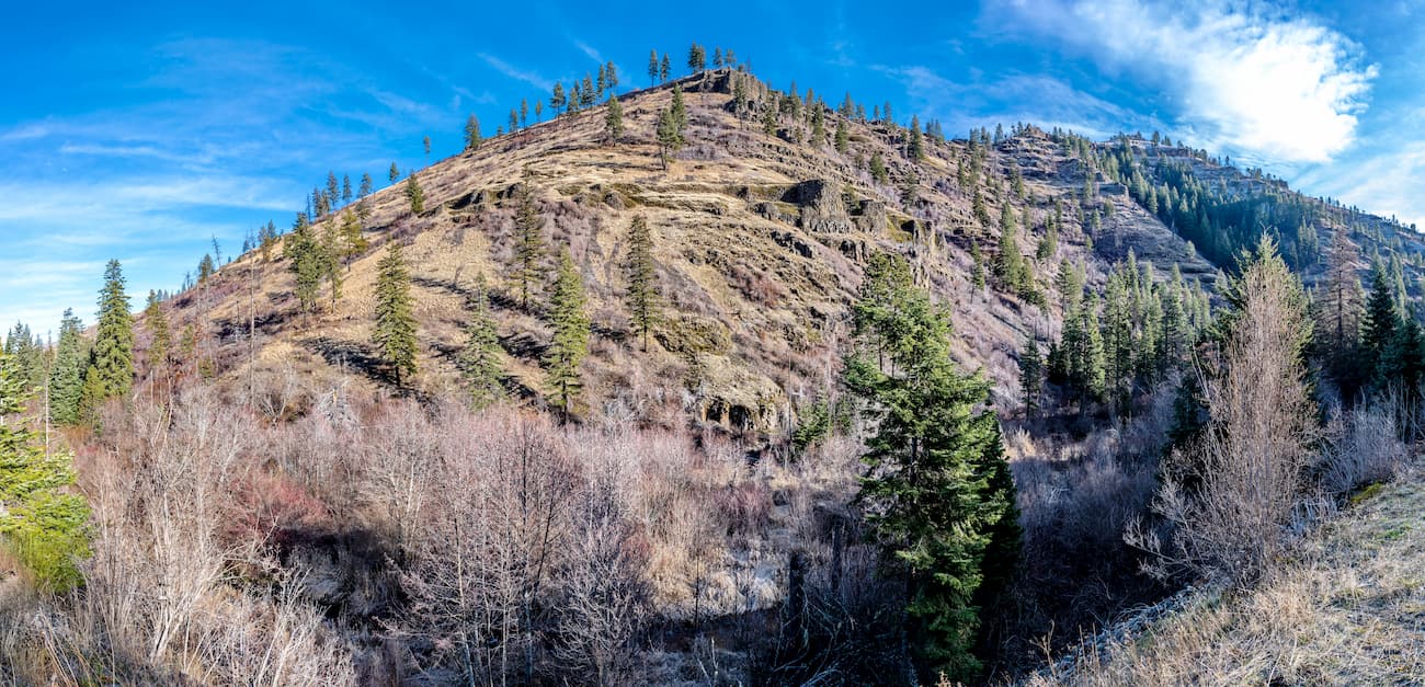
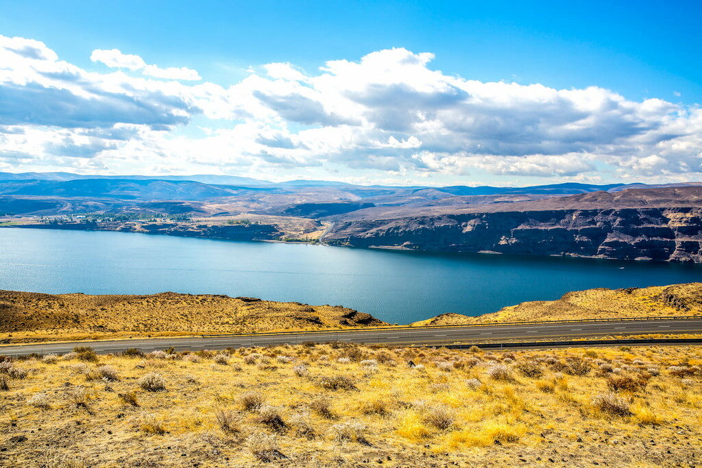
One of the region’s major geophysical provinces, the Columbia Plateau stretches across parts of Washington, Idaho, and Oregon. Although it only covers a portion of southeastern Washington, it is the result of an interesting geologic past.
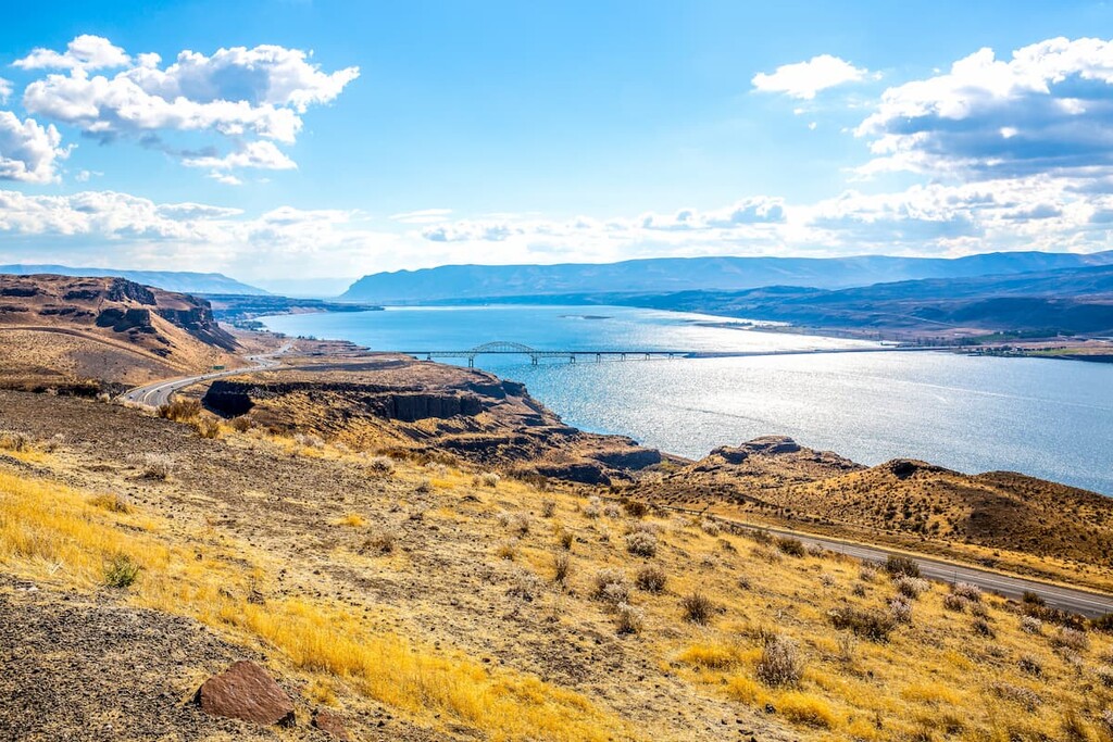
The plateau started to form about 6 to 17 million years ago when the region experienced widespread volcanism. This volcanism created a number of major lava flows, which cooled to create massive outcroppings of basalts.
Not long afterward, the region experienced widespread uplifting which helped to bring the plateau to its current elevated position. However, while both the Columbia Plateau and the Cascade Range are the result of volcanism, both regions formed independently of each other and are not geologically linked.
Major high points in the region include Oregon Butte, Black Mountain, Black Butte, Jumpoff Joe Peak, and Tower Mountain.
Covering a small section of northeastern Washington, the Columbia Mountains can sometimes be considered a part of the Rocky Mountains, though this depends on who you ask.
Geologically, the range is comprised mostly of ancient sedimentary rocks, such as gritstone, shales, and sandstones, which were deposited when the region was located under a shallow sea. About 185 million years ago, the region then experienced a widespread mountain building event, which caused the uplift of the Columbia Mountains.
Around 60 million years ago, however, a transcurrent fault started to form near the range. This eventually led to the formation of the Rocky Mountain Trench which separates the Columbia Mountains from the Canadian Rockies to the east.

Major peaks in the range include Abercrombie Mountain, Copper Butte, Calispell Peak, and Gillette Mountain.
Washington is home to a spectacular amount of biodiversity, thanks to its many ecoregions. Here are some of the primary ecoregions that you can find in the Evergreen State:
Running down the west coast of Washington, the Coast Range ecoregion is home to a very biodiverse coniferous temperate rainforest. Here, rainfall totals can be quite high and lush forests of both sitka spruce and coastal redwoods are the norm.
Other major tree species in the region include western red cedar, Douglas-fir, and wetern hemlock. However, some areas of the Coast Range were fairly heavily logged in years past, though much of the region is now protected.

A relatively small ecoregion that includes much of the eastern shore of the Puget Sound, the Puget Lowlands are home to rolling terrain and a mild maritime climate. The region contains quite a few outwash plains, peninsulas, and islands.
Although much of the region is now developed and urbanized, it was traditionally home to large stands of coniferous forest. Nevertheless, the region is in the rain shadow of the Olympic Mountains so it is less ecologically rich than its western neighbor.
The Willamette Valley ecoregion is mostly in the state of Oregon, though it covers a small section of southwestern Washington. Within the Willamette Valley, the topography is mostly rolling prairie.
Prior to European settlement, the region was home to a pathwork of mixed forests and large wetlands. However, it is now one of the most agricultural areas in the region, so much of the land has been converted for agricultural use.
Encompassing the majority of the southern and central Cascade Range, the Cascade ecoregion is a highly mountainous area with deep valleys and steep ridges. At the highest biologically productive elevations, it is home to alpine ecosystems where only the hardiest shrubs and grasses survive.
Meanwhile, at lower elevations, the landscape is heavily forested, with coniferous forests being the most dominant. Some of the most common tree species include western red cedar, subalpine fir, grand fir, Douglas fir, and mountain hemlock. Meanwhile, animal species include mountain lions, bobcats, deer, coyotes, elk, and black bears.
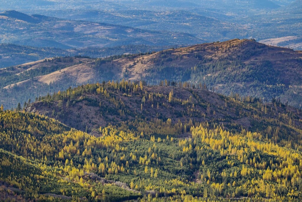
Bordering the Cascade ecoregion to the east, the Eastern Cascades Slopes and Foothills is a large ecoregion that occupies most of the immediate rainshadow of the Cascade Range. Here, the relatively lack of rainfall leads to vastly different forest composition.
For example, the tree species that dominate here include lodgepole and ponderosa pine, which differs substantially from the spruce-fir forests that are more common within the mountains themselves.
Covering much of central and southeastern Washington, the Columbia Plateau ecoregion is very arid when compared to the Cascade Range. The plateau is dominated by sagebrush steppe and grasslands, which are, interestingly enough, surrounded on all sides by much more mountainous terrain.
Nevertheless, this region is also a reasonably good place for agriculture, so much of the original landscape has since been converted for agricultural purposes, particularly for wheat production.
The northernmost extent of the Cascade Range, the North Cascades ecoregion is a rugged, high-elevation place that’s dominated by glaciers and permanent snowfields on the highest slopes.
Despite the ruggedness of the terrain, however, the region is quite biodiverse. Some of the major tree species in the region’s forests include western hemlock, mountain hemlock, subalpine fir, Douglas fir, grand fir, and Pacific silver fir. Furthermore, animal species in the region include grizzly bears, black bears, mountain lions, wolves, and bald eagles.
Although Washington isn’t normally considered to be a Rocky Mountain state, a small section of the northeastern part of Washington is part of the Northern Rockies ecoregion. This ecoregion, which extends off the northern edge of the Idaho-Bitterroot Rocky Mountains and the Columbia Mountains, is heavily forested.
Major tree species within the region include everything from western white pine and western red cedar to grand fir. However, the region has experienced a decent amount of logging in the past and it is now home to a mosaic of plant communities.
The human history of the area that is now Washington dates back tens of thousands of years. Indeed, the region has been home to humans since time immemorial, and countless peoples, including the 29 federally-recognized tribes of Washington, consider the area to be part of their ancestral homelands and traditional territory.
It’s believed that the first people of European descent to have traveled through the region that is now the state of Washington were part of Spaniard Juan Pérez’s voyages in the 1770s. Another Spaniard, Don Bruna de Heceta, is also believed to have traveled around the coast of Washington in the 1770s, making landfall near the Quinault River.
During the latter part of the 1770s, Captain James Cook of Britain saw Cape Flattery, through the first European to sail the Strait of Juan de Fuca was Charles William Barkley a decade later.
In the 1790s, Captain George Vancouver of Britain also made his famous voyages through the Pacific Northwest, having traveled around what is now called the Puget Sound. Captain Robert Gray of the newly-formed United States is also noted for having established a fur trade at the mouth of the Columbia River in the southern part of what is now Washington in the late 18th century.
Perhaps the most famous US-sponsored expedition to the region was that of Lewis and Clark who arrived in 1805. However, although their expedition was called the “Corps of Discovery,” they were not discovering land, but rather, traveling through a region that has been continuously inhabited by Indigenous peoples for tens of thousands of years.
After the Lewis and Clark Expedition, a number of people of European descent started settlements in what is now Wahsington, mostly for fur trading purposes. Eventually, during the early part of the 19th century, the United States and Britain were embroiled in a territorial dispute over who had control over the region.
In the aftermath of the War of 1812 and the Treaty of 1818, Great Britain claimed all the land to the north of the 49th parallel to the west of the Continental Divide while the United States claimed the land to the south. This decision has led to some interesting American exclaves in what is now Canada, including Point Roberts, Washington, which is south of the 49th Parallel but is accessible by road only through British Columbia.
The Washington Territory was eventually formed out of the Oregon Territory in 1853. This led to an increase in US settlement of the region, as well as an increase in violence against the many tribes and nations who call the region home.
In 1889, Washington became the 42nd state in the union. Throughout its early years of statehood, Washington was a hub for mining, agriculture, logging, and maritime trade. During the 20th century, the state also became a hub for aerospace manufacturing and engineering, thanks to the establishment of the Boeing Company.
Due to Washington’s exceptional collection of mountain ranges and glaciated peaks, it has long been popular among climbers and hikers. Mount Rainier National Park was one of the earliest to be established in the country, having been designated in 1899. A few decades later, Olympic National Park was established in 1938 while North Cascades National Park was established in 1968.
The state of Washington and its many outdoor recreation opportunities have drawn an influx of climbers, skiers, and hikers to the region each year. In addition to being home to a great assortment of outdoor recreation areas, many major outdoor gear manufacturers and retailers, such as REI, Feathered Friends, and Cascade Designs, all have headquarters in the state.

As a result, Washington is one of the United States’ premier outdoor recreation destinations. Thousands of hikers and climbers flock to the state each year to test their mettle against Mount Rainier, Mount Baker, and many of the state’s other prominent mountains.
Washington is a true outdoor recreationalist’s paradise, so there’s no shortage of excellent hiking areas to check out. Here are some of the best places to visit during your time in the Evergreen State.
Washington’s easternmost national park, Olympic National Park necompasses some 922,650 acres (373,383 ha) of land on the Olympic Peninsula. It contains 128 named mountains, the highest and most prominent of which is Mount Olympus.
Olympic National Park is a varied and exciting place with everything from the glacier-capped peaks of the Olympic Mountains to rugged coastline and temperate rainforests. Mountaineering and backpacking opportunities abound in the park and there are plenty of maintained trails for hikers to enjoy.

Additionally, it’s worth making the trip to see the Hoh Rainforest, which contains some of the most ecologically diverse terrain in all of the Pacific Northwest.
North Cascades National Park is a particularly popular location for hiking, backpacking, camping, and climbing. It contains 103 named mountains, the highest of which is Goode Mountain, and the most prominent of which is Mount Spickard.
Within the North Cascades, you’ll find over 2.5 million acres (1 million ha) of pristine wilderness. Some of the more popular hiking routes include Hannegan Peak, a 5.2-mile (8.4km) trail with views of the Cascade Range, including Mount Baker and Bandera Mountain. There is also a 3.5-mile (5.6km) trail that climbs to the top of Bandera Mountain with sweeping views of alpine meadows and lakes.
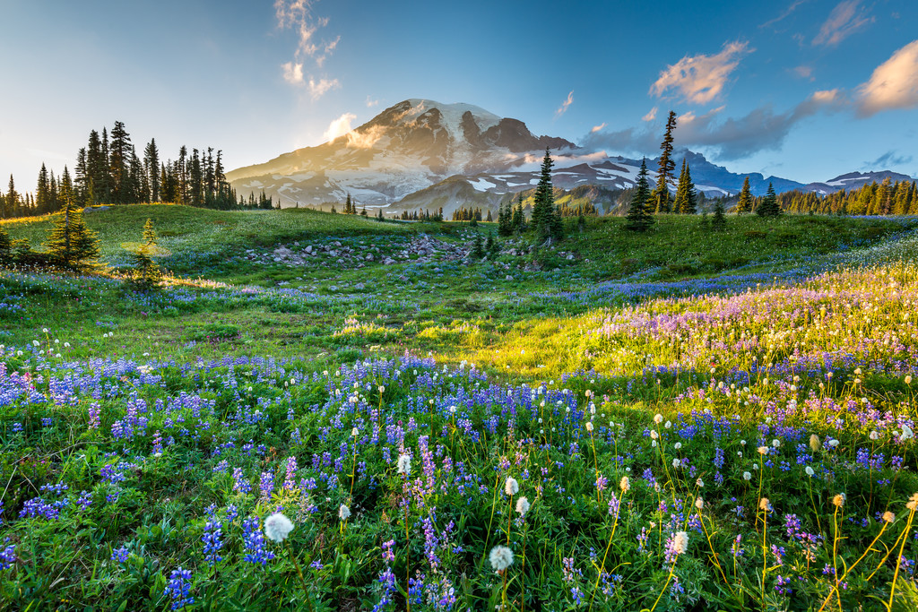
Home to Washington’s highest peak, Mount Rainier National Park is one of the state’s premier climbing destinations. It contains 140 named mountains, the highest and most prominent of which is Mount Rainier.
In addition to Mount Rainier, the park also contains over 260 miles (418km) of maintained hiking trails for backpackers to enjoy. One of the most popular treks in the park is the Wonderland Trail, which is a 93 mile (150km) long path that wraps around the base of Rainier itself. However, permits are necessary if you want to backpack the trail, so be sure to reserve yours in advance!
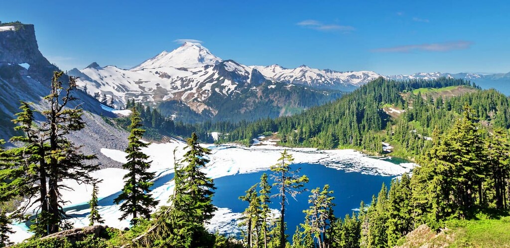
Covering much of the Northern Cascades, the Mount Baker-Snoqualmie National Forest includes some 1.7 million acres (687,000 ha) of some of the most stunning and rugged terrain in Washington. It has 417 named peaks within its borders, the highest and most prominent of which is Mount Baker.
The Mount Baker-Snoqualmie National Forest contains thousands of miles of trails and informal paths, many of which lead deep into the wilderness. There are also more than 200 glaciers within the forest, alone, which makes it a popular destination for mountaineering.
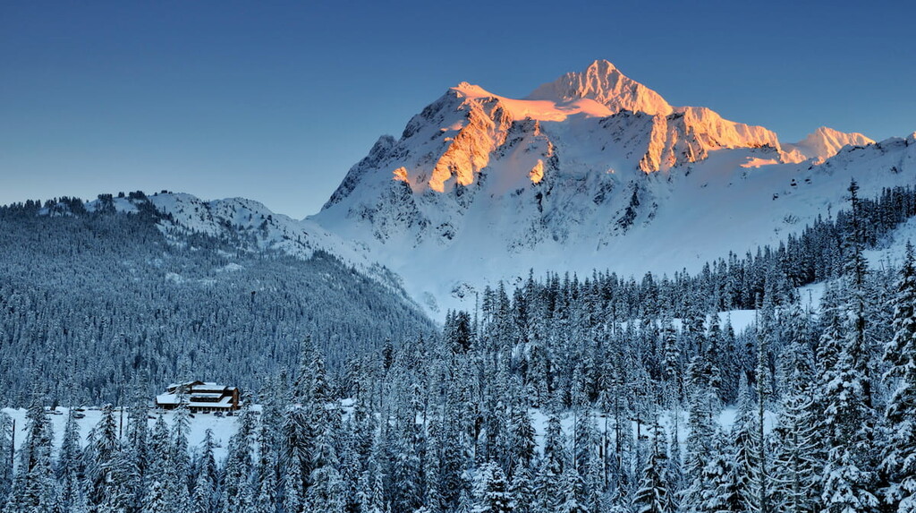
Within Mount Baker-Snoqualmie, there are parts of 10 different wilderness areas, so be sure to check any permit requirements in the region before planning an overnight trip. Furthermore, the forest is home to two major stratovolcanoes—Mount Baker and Glacier Peak—both of which make for excellent mountaineering objectives.
As the holder of the world snowfall record (slightly less than 95ft/29m of snow in a year), Washington is a winter-sports paradise. Plus, with so many ski resorts located within a few hour’s drive of Seattle, a world of snowsports adventure awaits in the Evergreen State. Here are some of the best resorts to check out in the region:
Check the Washington ski resorts map and the larger USA ski resorts map in the World Mountain Lifts section of the site. It includes information about open ski lifts / slopes in Washington in real-time with opening dates and hours. There are also year-round cable cars, funiculars, cog railways, aerial tramways, and all other types of mountain lifts.
Looking for a place to stay in Washington state? Here are some of the best cities to check out:
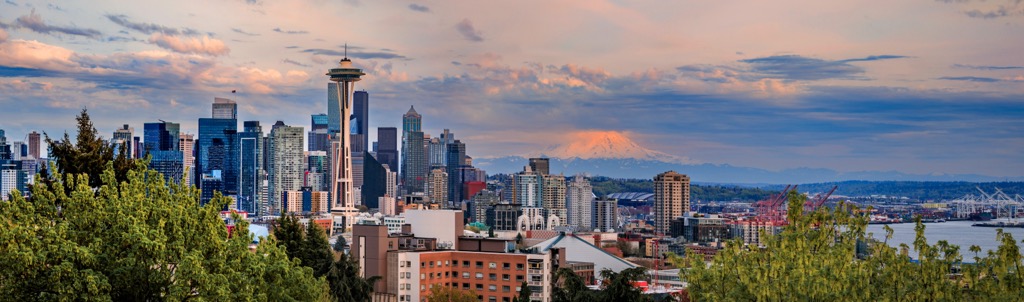
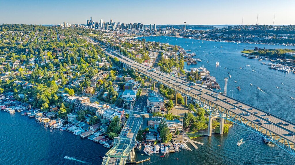
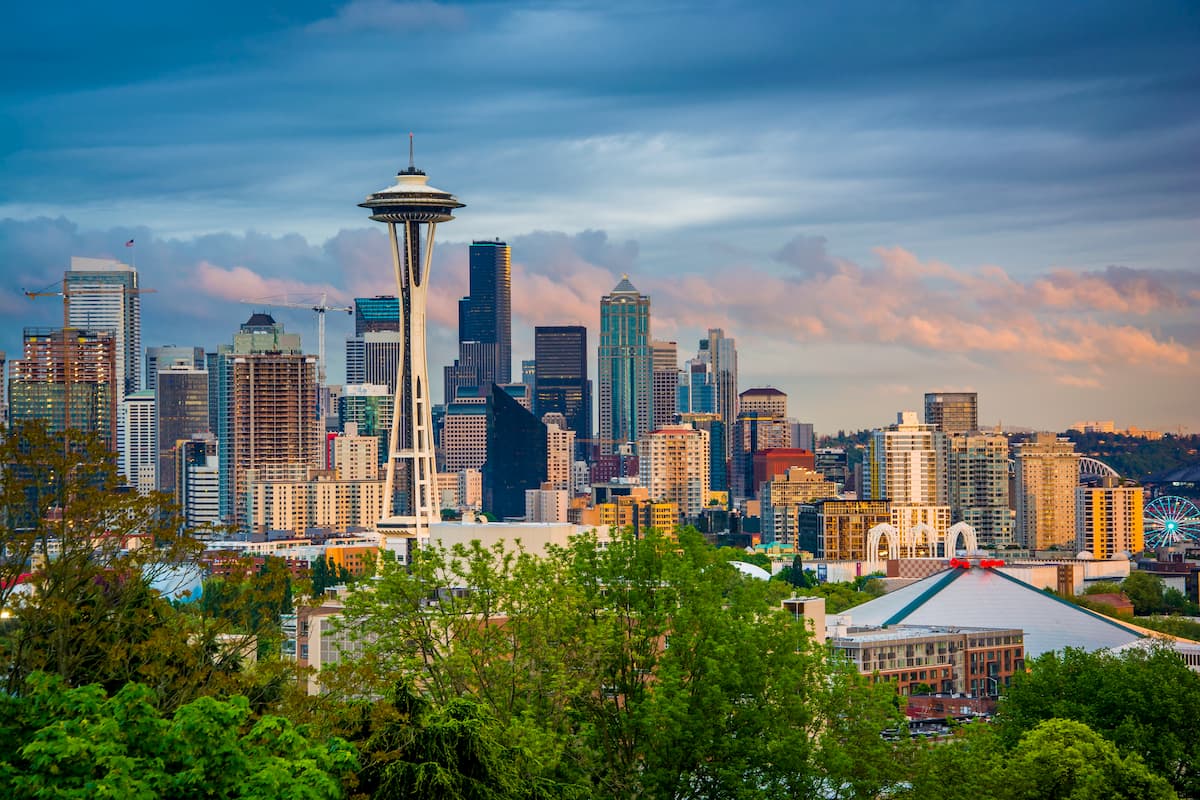
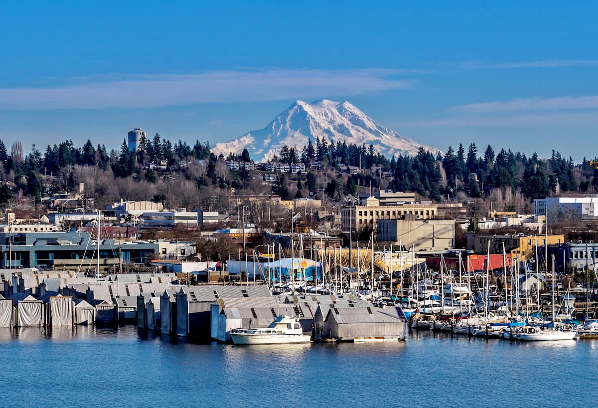
The largest city in the state of Washington, Seattle is home to some 750,000 residents, though about 4 million people live in its metro area. Seattle is a major seaport for the region, as well as a hub for culture and commerce in the Pacific Northwest.
In addition to having a bustling downtown and metropolitan area, Seattle is also located within driving distance of some of Washington state’s best outdoor recreation destinations. On a sunny day, one can even see Mount Rainier from downtown Seattle.
Located in the northwestern region of Washington, the city of Bellingham is home to about 90,000 people who live just a short drive from the Canadian border. Bellingham is a popular tourist destination thanks to its location near both the San Juan Islands and the Cascade Range.
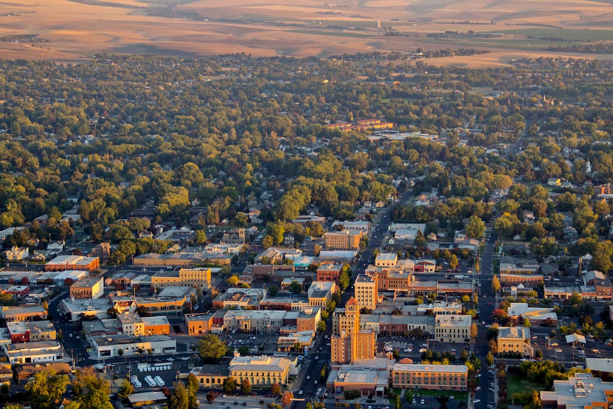
Situated in southeastern Washington, Walla Walla is a city of some 32,000 people. The city is home to Whitman College and it is considered a commercial hub for southeastern Washington’s agricultural region. Furthermore, it is one of the largest cities in Washington’s Wine Country, so it’s becoming a popular destination for tourism outside the North Cascades.
The capital of the state of Washington, the city of Olympia is located about 60 miles (100km) to the southwest of Seattle and is home to about 50,000 people. It is a commercial center for the southern Puget Sound region and it contains a great collection of public parks and other recreation areas.
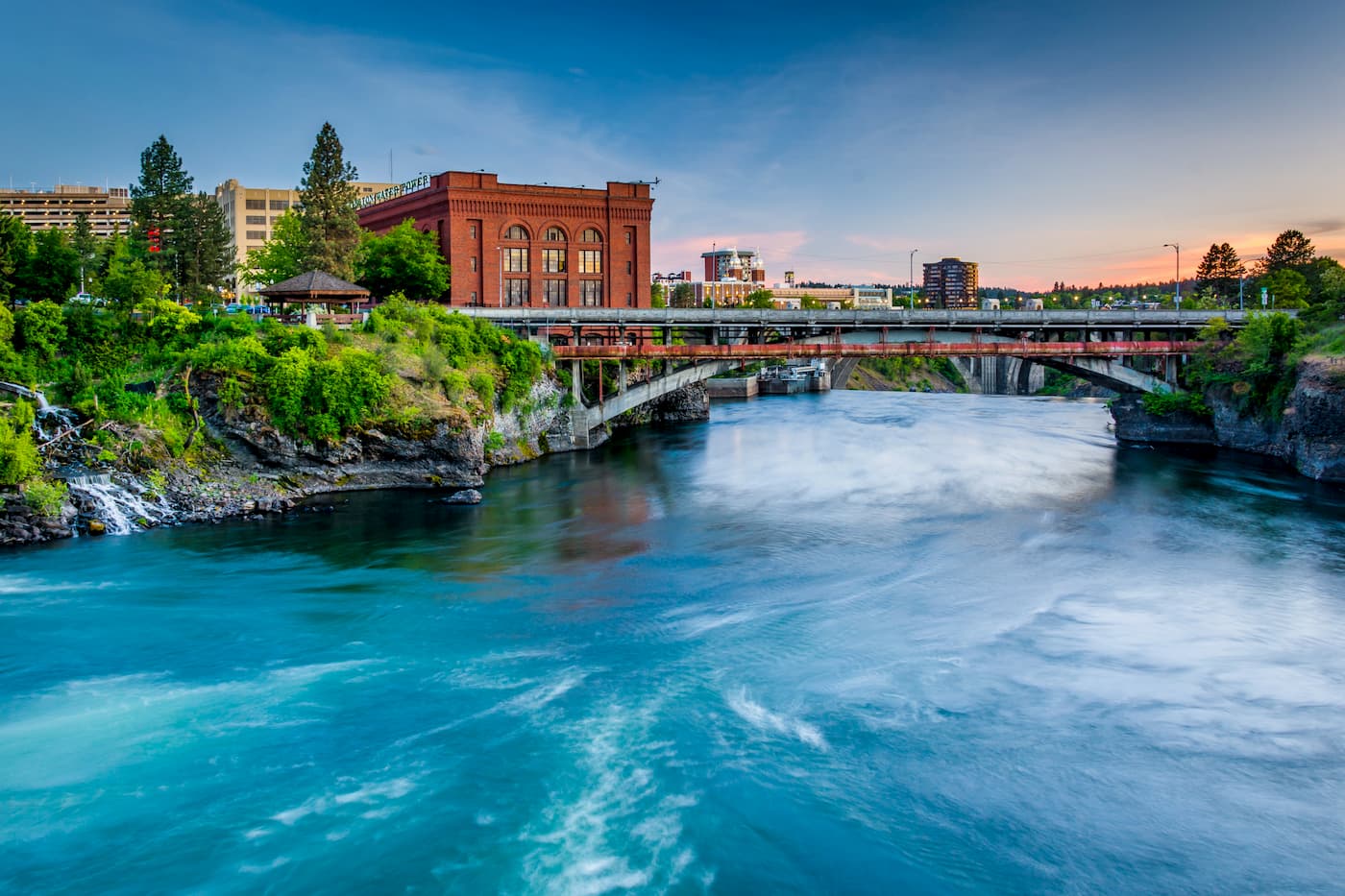
Home to around 220,000 people, Spokane is a major city in the northeastern Washington/northern Idaho region. In fact, it is Washington’s second largest city, despite being on the complete opposite side of the state from Seattle.
Within the city, there are dozens of miles of walking trails for visitors to check out. Furthermore, Spokane has a bustling arts scene, particularly when it comes to the performing arts, and it has a number of excellent museums that are well worth a visit.


14er
ultra
glacier
volcano
cascade-range-9000ers
washington-bulger
smoots-100
chemeketan-18-nw
mountaineers-6-peak-pin
mountaineers-5-peak-pin
cascade-volcanoes-pin
mazamas-16-nw-award
fred-beckey-great-peaks
washington-ultras
14er
ultra
glacier
volcano
cascade-range-9000ers
washington-bulger
smoots-100
chemeketan-18-nw
mountaineers-6-peak-pin
mountaineers-5-peak-pin
cascade-volcanoes-pin
mazamas-16-nw-award
fred-beckey-great-peaks
washington-ultras
ultra
glacier
volcano
cascade-range-9000ers
washington-bulger
smoots-100
chemeketan-18-nw
mountaineers-6-peak-pin
mountaineers-5-peak-pin
mountaineers-bakers-dozen
cascade-volcanoes-pin
mazamas-16-nw-award
washington-ultras
ultra
glacier
volcano
cascade-range-9000ers
washington-bulger
washington-fire-lookouts
smoots-100
chemeketan-18-nw
mountaineers-6-peak-pin
mountaineers-5-peak-pin
cascade-volcanoes-pin
mazamas-guardian-award
mazamas-16-nw-award
washington-ultras
ultra
glacier
olympic-6500ers
olympic-mountains-rain-forest-court
smoots-100
olympic-mountain-project
chemeketan-18-nw
mountaineers-6-peak-pin
mountaineers-5-peak-pin
mazamas-16-nw-award
washington-ultras
ultra
glacier
volcano
cascade-range-9000ers
washington-bulger
smoots-100
chemeketan-18-nw
mountaineers-6-peak-pin
mountaineers-5-peak-pin
cascade-volcanoes-pin
mazamas-16-nw-award
washington-ultras
ultra
mid-state-milers
cascade-range-9000ers
washington-bulger
smoots-100
chemeketan-18-nw
mountaineers-cascade-classic
mazamas-16-nw-award
washington-ultras
Yes. Washington has 3,709 named mountains. The highest is Mount Rainier at 4,392 m.
The highest mountain in Washington is Mount Rainier, at 4,392 m.
Washington has 3,709 named mountains.
Washington has 2 fourteeners — peaks above 14,000 ft (4,267 m).


