
Scan the QR code and open PeakVisor on your phone
Jefferson County is home to 113 named mountains. The highest is Mount Olympus at 2,431 m.
Jefferson County is a county located along the Olympic Peninsula in Washington state. The county spans 2,183 square miles across the peninsula and has an estimated population of around 32,000. Jefferson County covers land from the Pacific Coast to the Puget Sound. The county is connected to Kitsap County via the Hood Canal Bridge and to Island County via the ferry system within the Puget Sound. The most iconic features of Jefferson County are the Olympic Mountains that lie within the Olympic National Forest. Clallam County sits to the north of Jefferson County and encompasses the northernmost portion of the Olympic Peninsula along the Strait of Juan de Fuca.
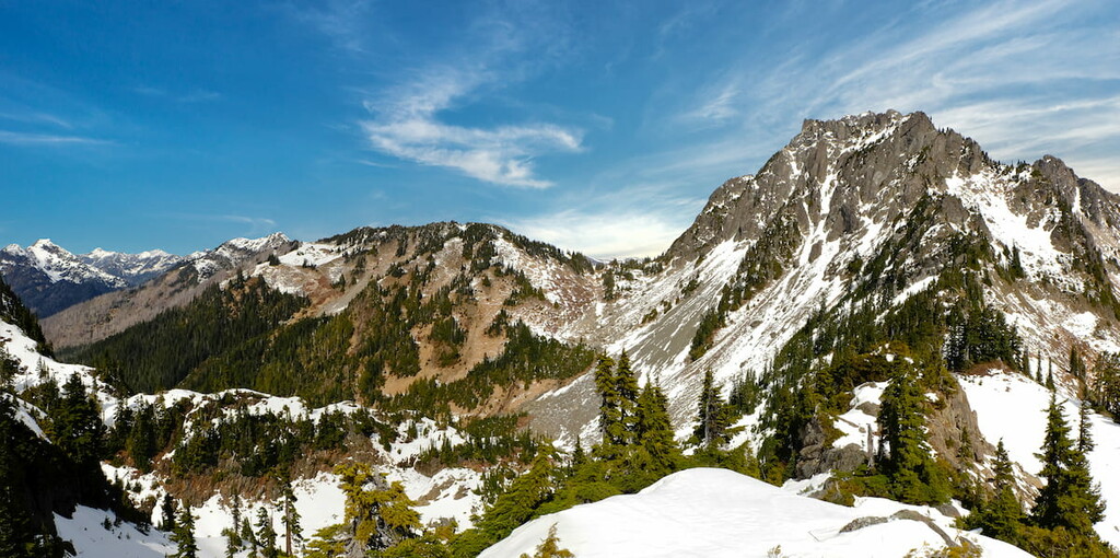
There are 106 named mountains in Jefferson County. The highest and the most prominent mountain is Mount Olympus standing at 7,976 feet with 7,841 feet of prominence. Seventeen percent of the county consists of water, mainly along the eastern region. Jefferson county is divided into three major regions. The eastern portion is the least mountainous, and sits along the Strait of Juan de Fuca, the Puget Sound, and the Hood Canal. Here lies the majority of the county’s population and the main access to the rest of the state. The central region of Jefferson County makes up most of the county and is characterized by the Olympic Mountains, Olympic National Park, and the Olympic National Forest. The western region of the county lies along the Pacific Ocean along the west coast of Washington. There is not a direct road through the Olympic Mountains, thus in order to travel from one side of the county to the other, travelers must drive north through Clallam County along US Route 101.
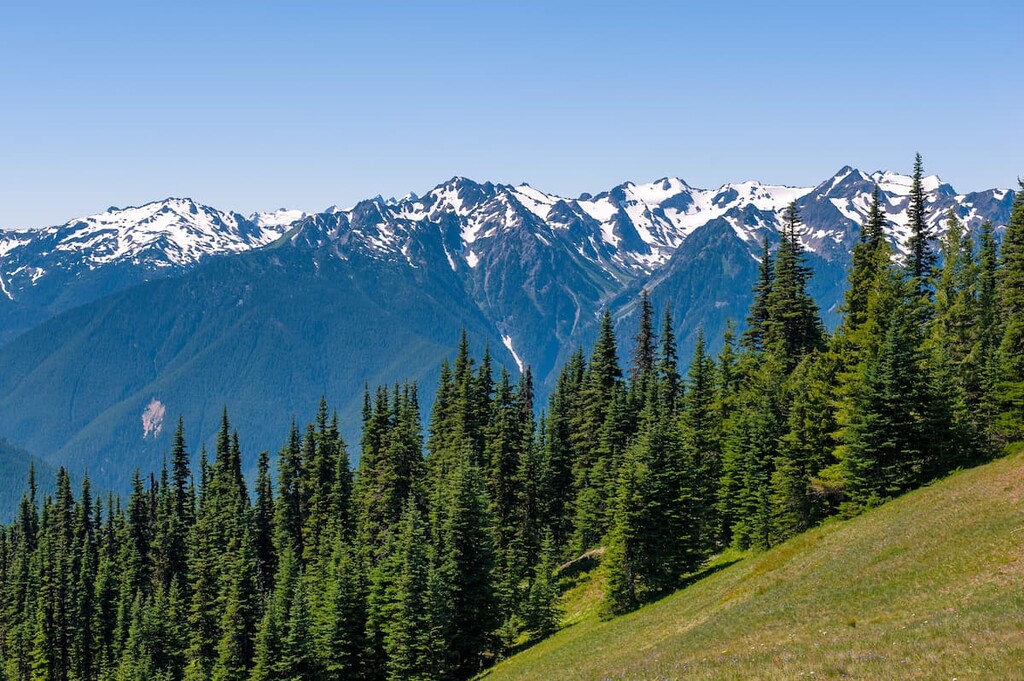
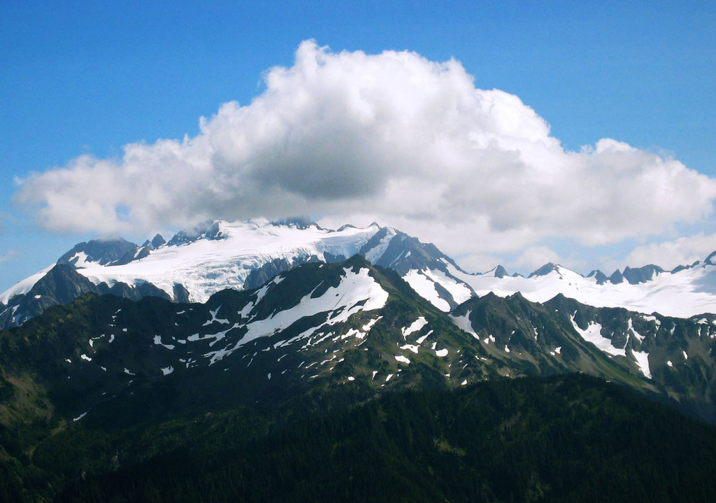
The Olympic Mountains are the key feature of Jefferson County. The rugged and remote peaks define the region and are relatively uninhabited. The western slopes of the Olympic Mountains receive the most rainfall of anywhere in the 48 contiguous states. The mountain range is surrounded by water on three sides from the Pacific Ocean, Strait of Juan de Fuca, and the Puget South. A wide coastal plain surrounds the mountains for approximately 10-25 miles on each side. The coastal plain then turns into densely forested slopes.
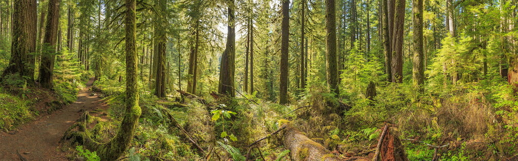
The Hoh Rainforest of the region is one of the largest temperate rainforests in the United States, and the largest in the contiguous 48 states. The forest is made up almost entirely by conifers rather than hardwoods, which are common throughout the rest of the state. The conifers, mixed with the immense amount of rainfall, creates an extremely moist and mossy forest. At slightly higher elevations, the forests are dominated by western hemlock and Douglas-fir trees. At the highest elevations in the county, subalpine fir grows amongst yellow cedars and fields full of thimbleberry.
Throughout the mountainous region of Jefferson County, live a variety of wildlife. American black bears and cougars are abundant in the Olympic Mountains though bear sightings are much more common than cougars. Mountain goats were introduced to the region during the 1920s and in recent decades they have been known to be aggressive towards visitors of the region. Elk and mule deer are seen throughout the region with the blacktail deer primarily living in the drier areas of the county. Other common animals found in the Olympic Mountains include the mountain beaver, northern spotted owl, osprey, bald eagle, and various types of salmon.
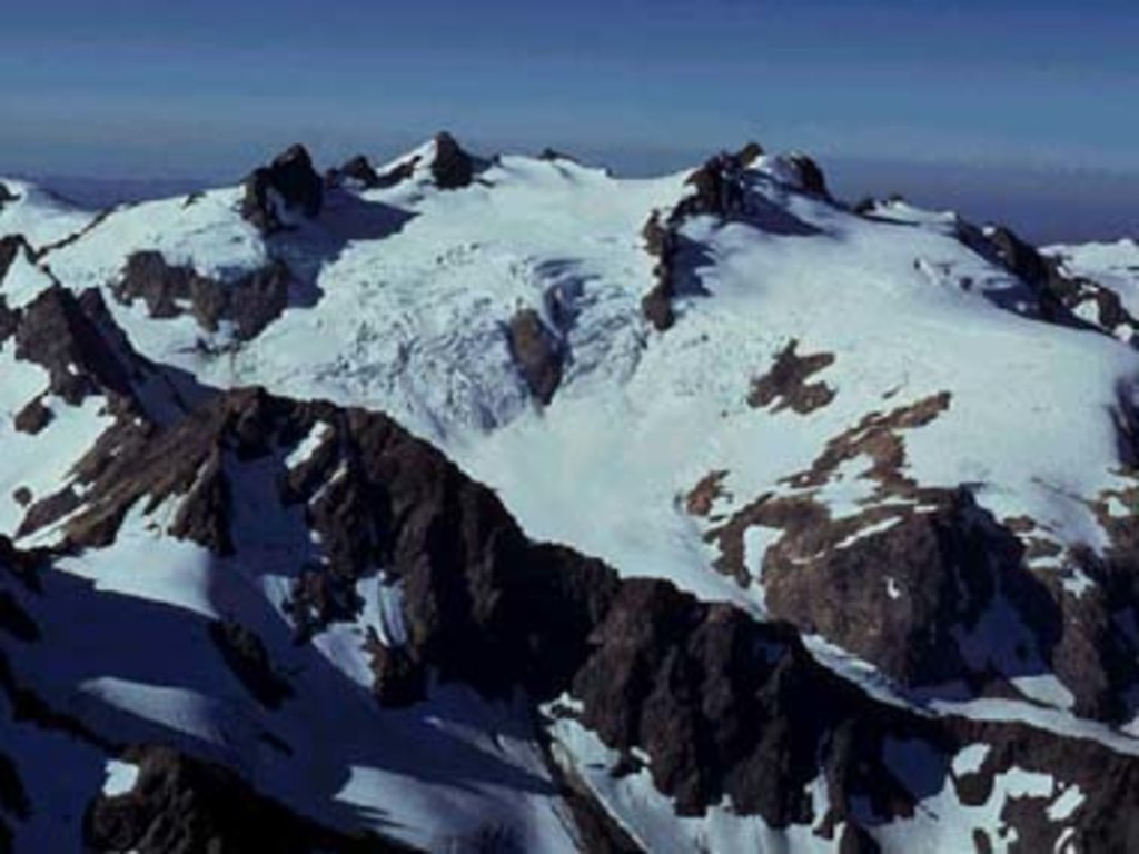
Olympic National Park: The Olympic National Parks protects the central region of the Olympic Mountains with the Olympic National Forest surrounding it. The park is divided into four regions spanning from the Pacific coast, to the alpine regions, the western rain forest, and the slightly drier eastern slopes. Jefferson park makes up most of the park which stretches over 922,000 acres. Within the alpine region lies Mount Olympus which receives an immense amount of snowfall during the winter months. Excluding mountains in the North Cascades of Washington, Mount Olympus has the largest amount of glaciation of any non-volcanic peak in the United States, excluding Alaska. The Hoh Rainforest that lies within the park receives 150 inches of annual rainfall per year making for some of the lushest hiking spots in the entire nation. Popular hikes include High Divide Seven Lakes Basin Loop, Staircase Rapids Loop, and the Hoh River Trail.
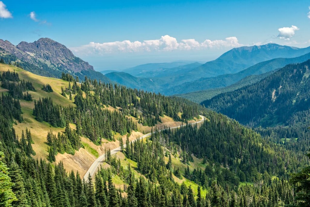
Olympic National Forest: The Olympic National Forest spans 628,115 acres across the Olympic Peninsula with its sections being connected by the Olympic National Park. The forest primarily makes up the lower elevation regions of the peninsula with the interior of the Olympic Mountains lying within the national park. Popular trails include Mount Ellinor, Lower Lena Lake, and Mount Townsend.
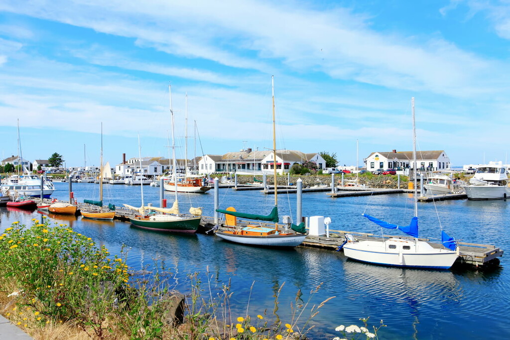
The largest city within Jefferson County lies along the eastern edge in the Puget Sound. Port Townsend has a population of around 10,000 people and is known for its various Victorian style buildings throughout. The city doesn’t have an immense amount of industry and is primarily known for its cultural events, art galleries, and independent boat building. The city receives less rainfall than other cities in the Puget Sound due to the rainshadow provided by the Olympic Mountains; receiving just 20 inches of rainfall per year.
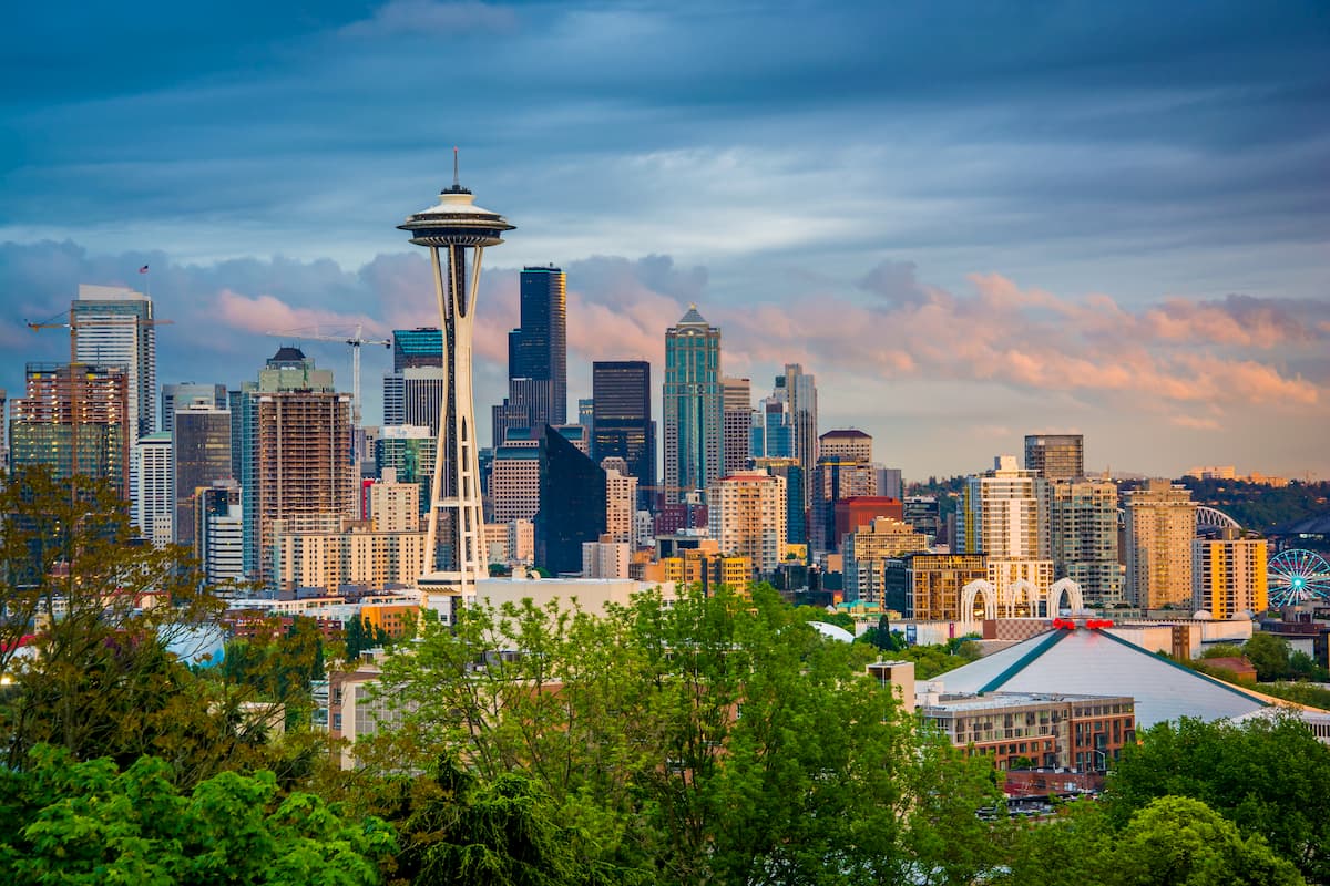
The most iconic and populated city in the state of Washington is Seattle, in the heart of King County. While Seattle is known for being a rainy city, don’t let that deter you. Surrounded by lush forest, the Puget Sound, and views of Mount Rainier, Seattle has something to offer all of its visitors. Take a trip to Pike Place Market, stop by the original Starbucks location, visit the Space Needle, or swing by one of the city’s 174 breweries. Staying in Central Seattle, just east of I-5, will ensure that you’ll have quick access to the state’s major highways and nearby parks.


ultra
glacier
olympic-6500ers
olympic-mountains-rain-forest-court
smoots-100
olympic-mountain-project
chemeketan-18-nw
mountaineers-6-peak-pin
mountaineers-5-peak-pin
mazamas-16-nw-award
washington-ultras
olympic-6500ers
olympic-mountains-rain-shadow-court
smoots-100
olympic-mountain-project
mountaineers-olympia
olympic-6500ers
olympic-mountains-rain-shadow-court
smoots-100
olympic-mountain-project
paul-wiseman-memorial-bench
ultra
glacier
olympic-6500ers
olympic-mountains-rain-forest-court
smoots-100
olympic-mountain-project
chemeketan-18-nw
mountaineers-6-peak-pin
mountaineers-5-peak-pin
mazamas-16-nw-award
washington-ultras
olympic-6500ers
olympic-mountains-rain-shadow-court
smoots-100
olympic-mountain-project
mountaineers-olympia
olympic-6500ers
olympic-mountains-rain-shadow-court
smoots-100
olympic-mountain-project
mountaineers-olympia-scramble
olympic-6500ers
olympic-mountains-rain-shadow-court
olympic-mountain-project
mountaineers-olympia
olympic-6500ers
olympic-mountains-rain-shadow-court
smoots-100
olympic-mountain-project
paul-wiseman-memorial-bench
Yes. Jefferson County has 113 named mountains. The highest is Mount Olympus at 2,431 m.
The highest mountain in Jefferson County is Mount Olympus, at 2,431 m.
Jefferson County has 113 named mountains.


