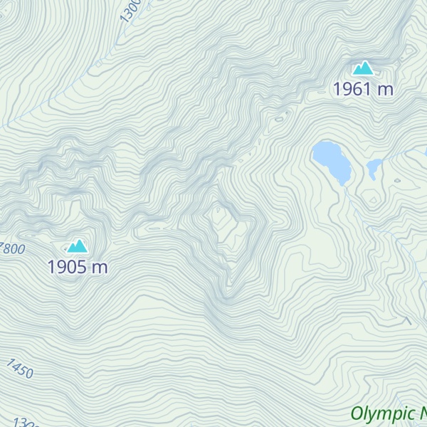
Mount Elk Lick is a 6,517-foot-elevation (1,986 meter) mountain summit located in the Olympic Mountains, in Jefferson County of Washington state. It is situated within Olympic National Park, and is set within the Daniel J. Evans Wilderness at the head of Elk Lick Creek. The nearest neighbor is Mount La Crosse, 2.54 mi (4.09 km) to the west, and the nearest higher neighbor is Diamond Mountain, 3.73 mi (6.00 km) to the north-northwest. Precipitation runoff from the mountain drains south into the Duckabush River, and north into the Dosewallips River. Topographic relief is significant as the south aspect rises over 4,300 feet (1,310 m) above the Duckabush valley in approximately one mile. The mountain is remote and an ascent can take four days and involves 46 miles of hiking.
By elevation Mount Elk Lick is
# 40 out of 113 in Jefferson County # 43 out of 144 in Olympic National Park # 47 out of 284 in the Olympic Mountains
By prominence Mount Elk Lick is
# 56 out of 3574 in the Northwest U.S. Coast Ranges # 7 out of 113 in Jefferson County # 6 out of 144 in Olympic National Park # 10 out of 284 in the Olympic Mountains
We use GPS information embedded into the photo when it is available.
3D mountains overlay
Adjust mountain panorama to perfectly match your photos because recorded by camera photo position might be imprecise.
Move tool
Rotate tool
Zoom
More customization
Choose which peak labels should make into the final photo and what photo title should be.
Next
Photo Location
Satellitte
Flat map
Relief map
Latitude
Longitude
Altitude
OR
Latitude
°'''
Longitude
°'''
Apply
Register Peak
Peak Name
Latitude
Longitude
Altitude
Register
Teleport
PeakVisor
This 3D model of Sagarmatha National Park in Nepal was made using the PeakVisor app topographic data. The mobile app features higher precision models worldwide, more topographic details, and works offline. Download PeakVisor maps today.
Download OBJ model
PeakVisor
The download should start shortly. If you find it useful please consider supporting the PeakVisor app.
PeakVisor for iOS and Android
Be a superhero of outdoor navigation with state-of-the-art 3D maps and mountain identification in the palm of your hand!