
Scan the QR code and open PeakVisor on your phone
The Idaho Panhandle National Forests consists of three national forests located in the state of Idaho. Back in 1973 the Kaniksu, Coeur d’Alene, and St. Joe National Forest were combined to form and be managed as the Idaho Panhandle National Forests. This forest covers 2.5 million acres, predominately in Idaho, but small sections located in eastern Washington and western Montana. The elevation in the forest ranges from 2,100 feet up to 7,600 feet. There are 514 named mountains in Idaho Panhandle National Forests. Northwest Peak is the highest point. The most prominent mountain is Scotchman Peak.
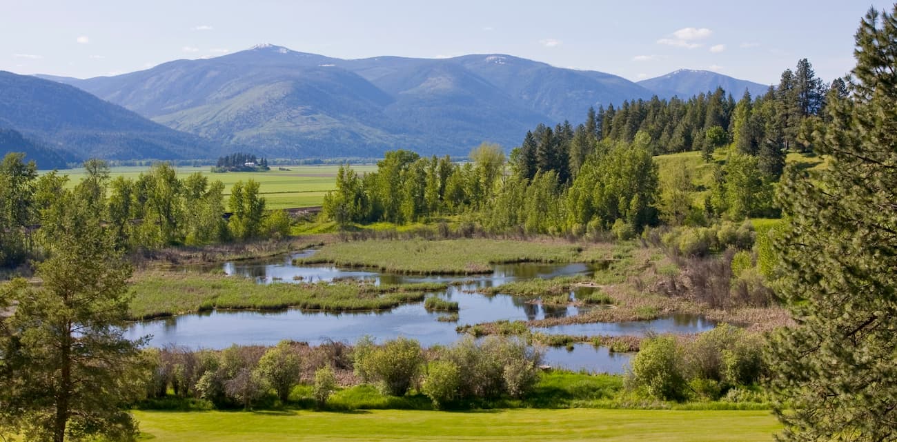
The Idaho Panhandle National Forests is home to numerous mountain ranges including the Selkirk Mountains, Purcell Mountains, Coeur d’Alene Range, Cabinet Mountains, and the Bitterroot Range. With such a diverse and expansive landscape, the forest is home to deer, elk, grizzly bear, moose, black bear, coyotes, beavers, cougars, wolverines, and various other species. The region is also known for its many lakes and rivers, often revered as some of the best fishing in the entire world.
Within the Idaho Panhandle National Forests lies the Salmo-Priest Wilderness area. There are also four roadless regions that are currently being proposed for future wilderness areas. The forest is home to an extensive network of trails totaling over 1,400 miles for hiking, snowmobiling and cross country skiing. Many of the trails can be accessed throughout the year for varying types of activities.
Located next to Coeur d’Alene, Idaho, this hike is one of the most popular in the entire forest. At 2.5-miles with just 650 feet of elevation gain, this route is accessible for most individuals. The trail looks west over Lake Coeur d’Alene with viewpoints and educational milestones along the way.
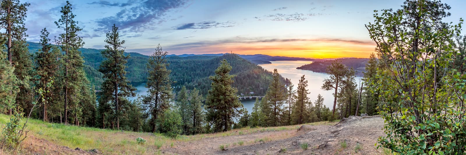
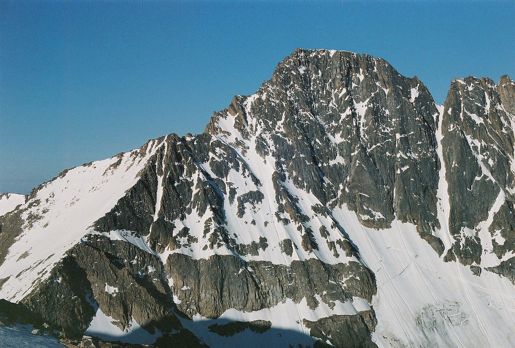
As the most prominent peak in the region, the Scotchman Peak is a well-known hike. The route totals 7.6-miles out and back with 3,600 feet of elevation gain. The trail climbs through the forest before thinning out to offer views of the surrounding mountains and lakes. In the distance, hikers can see Lake Pend Oreille, the largest lake in Idaho and the 5th deepest lake in the entire nation. Because the trail is exposed in the later sections, it is recommended to start the route early to avoid the heat.
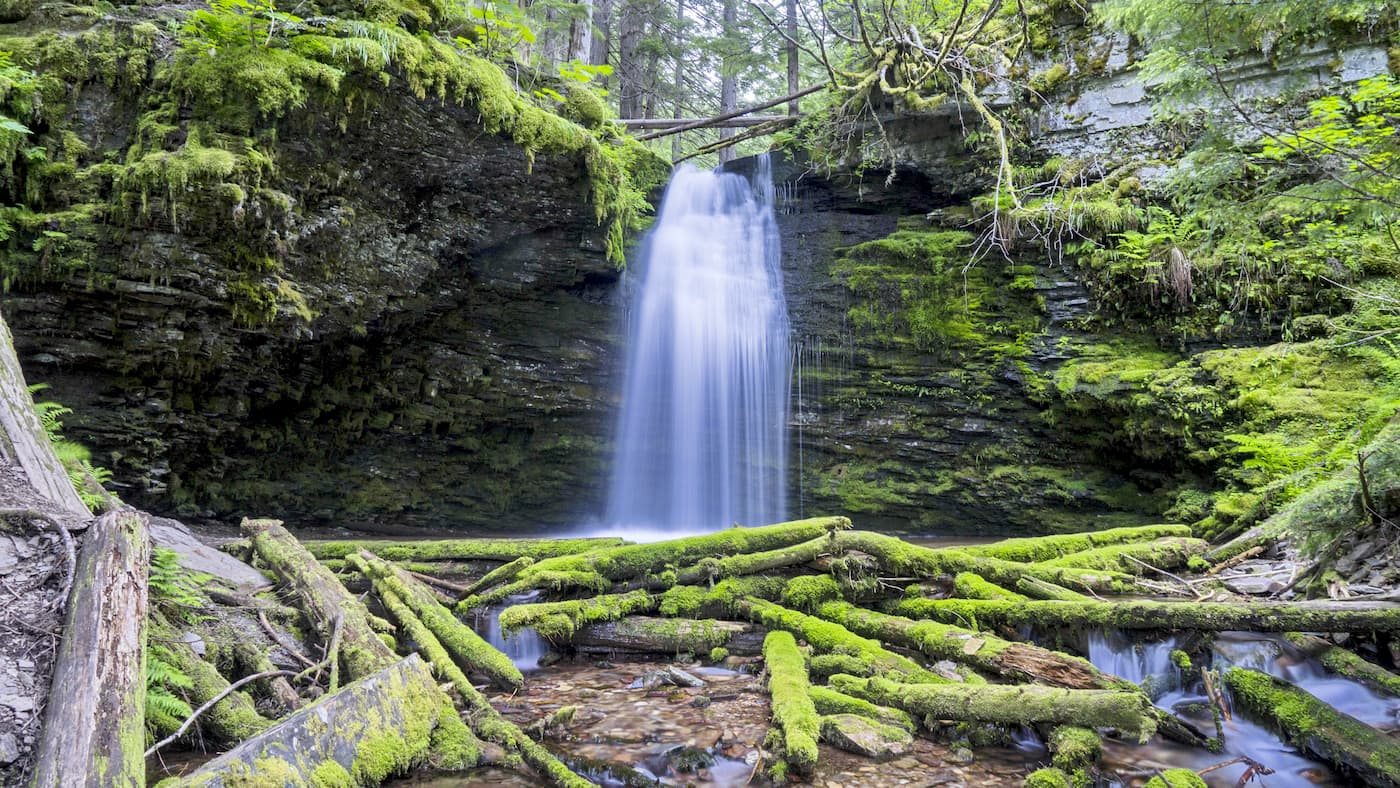
This trail totals 5-miles with 1,824 feet of elevation gain. The trial climbs through the forest and includes sections of traversing over rock slides before reaching Stevens Lake. This small lake is quaint in comparison to some of the region's larger and more prominent lakes. Swim at the lake or simply take in the views of the clear waters and surrounding peaks.
The Pulaski Tunnel trail is 4-miles out and back with 741 feet of elevation gain. The trail traces part of the route that Edward Pulaski’s crew followed to escape from the 1910 fires and leads to an overlook across from the Nicholson mine entrance. It was in this mine that Pulaski led his firefighting crew after they got stuck in the middle of a forest fire back in 1910, ultimately leading to the crew’s survival.
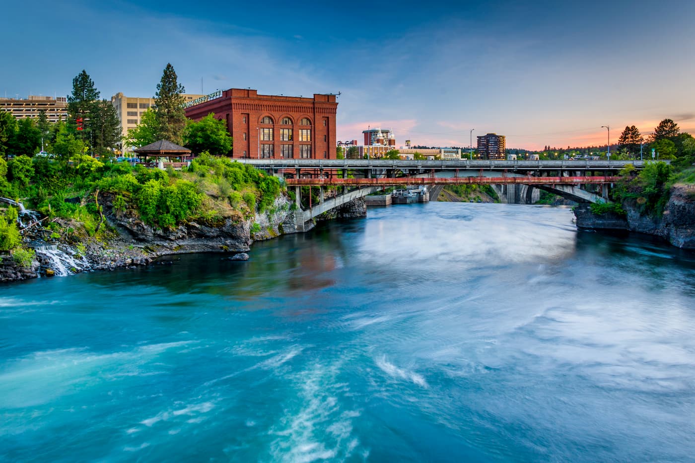
Though located in Wasington state, Spokane is the largest nearby city to the Idaho Panhandle National Forests. Located just southeast of the Okanogan Highlands, Spokane is the most populous city in eastern Washington. The Spokane river runs through the city while it sits 92 miles south of the Canada-U.S. border. With a population of 222,000, Spokane is the second largest city within the state of Washington. While most of the state’s population lives on the western side of the Cascade Mountain Range, Spokane is a hidden gem for any outdoor enthusiast. There are four ski resorts within two hours of downtown, while rock climbing, hiking, running, rafting, canoeing, and fishing are all accessible within minutes.
Just east of the Idaho Panhandle National Forests is the city of Missoula, Montana. Located in western Montana, this city sits at the convergence of five mountain ranges and is known as the “hub of five valleys”. The population is approximately 75,000 and is the second largest city within the state. Due to the proximity to mountains, rivers, and public lands, the city is known for ites outdoor spaces. Within the city lie 22 miles of trails and 5,000 acres of conserved open space. Sitting at the confluence of the Clark Fork, Bitterroot, and Blackfoot rivers makes the city a popular white water rafting destination. During the winter months, snow sports take center stage in the surrounding mountains, cross country skiing trails, and snowmobile routes.

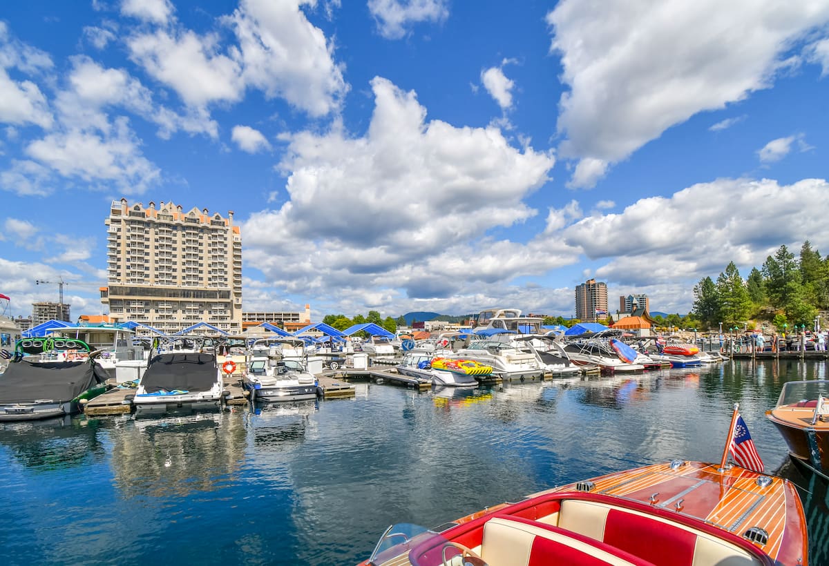
Located in northwestern Idaho, the city of Coeur d’Alene is located on Lake Coeur d’Alene. The city has a population of 50,000 which surges during the summer months due to the popularity of the large lake. The city is home to local restaurants, shops and is known for the water based activities and the trail systems in nearby Canfield Mountain Natural Area.


_3D_version_1.jpg)


