
Scan the QR code and open PeakVisor on your phone
Yakima County is home to 171 named mountains. The highest is Pahto at 3,743 m.
Yakima County is a county located in southern central Washington in the United States. The region is home to a diverse landscape with the western region encompassing parts of the Cascade Range and the eastern region stretching into the rolling plains of western Washington. The county covers 4,311 acres of land across the state with an estimated population of 250,000. Yakima County was established back in 1865 and is named after the Yakama tribe of Native Americans. What is now Yakima County, was once part of the large Oregon County, shared by both Canadians and Americans. The land was used for agriculture, fur trading, and mineral extraction. In 1855 the Yakima Indian Reservation was established. Today the reservation is the 15th largest in the nation and it comprises 36% of the land within the county.
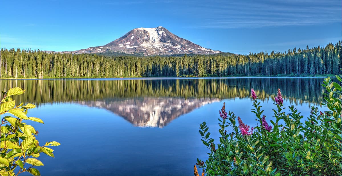
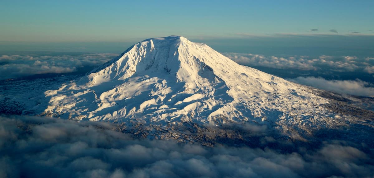
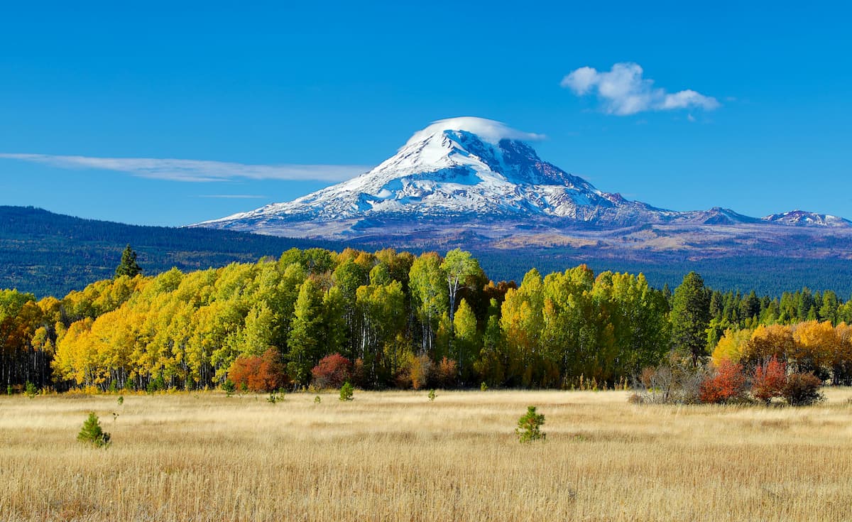
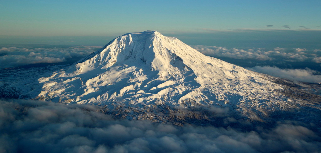
There are 132 named mountains in Yakima County. The highest and the most prominent mountain is Mount Adams at 12,280 feet. Mount Adams is the second tallest peak in Washington and the third tallest peak within the entire Cascade Range. Other notable peaks within the county include Gilbert Peak, Mount Aix, and Tieton Peak. The major rivers that run through the county are the Yakima, Columbia, and Naches rivers. By land area, Yakima County is the second largest within the state of Washington. The total area of the county is larger than that of Delaware and Rhode Island combined. Besides its abundance of national protected land, Yakima County is also known for its production of wine. The county is responsible for 40% of the state’s wine, with 665,000 acres of dedicated land.
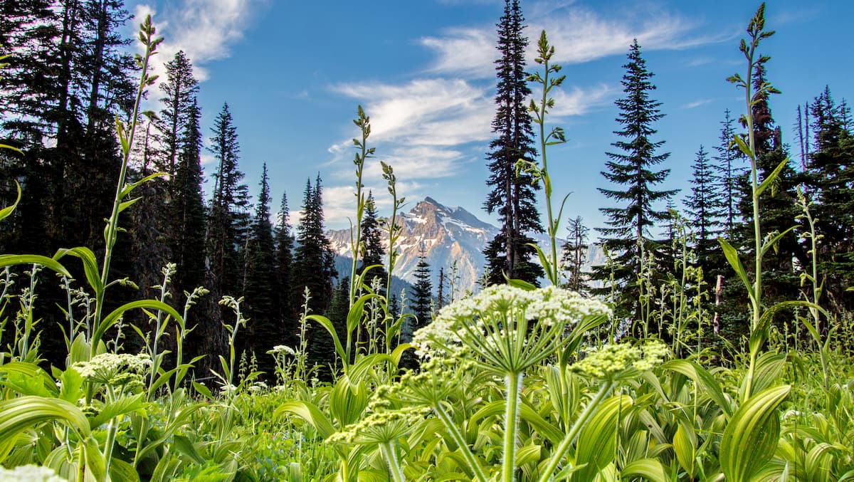
Goat Rock Wilderness: The Goat Rock Wilderness protects 108,096 acres of land within the Okanogan-Wenatchee National Forest and the Gifford Pinchot National Forest. The wilderness is named after the rugged Goat Rocks and the plethora of mountain goats that live in the region. What was once an active volcano, some two million years ago, now remains the rugged Goat Rocks. Today peaks within the region have an average elevation of 7,000 feet with the highest being Gilbert Peak. The Pacific Crest Trail passes through this wilderness before heading north towards Mount Rainier National Park. Other popular trails within the wilderness include Old Snowy Mountain, Bear Creek Mountain, and the 69-mile Goat Rocks Three Loop trail.
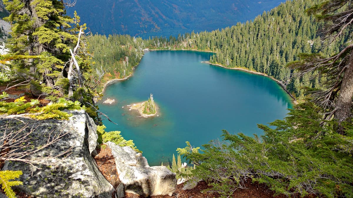
Okanogan-Wenatchee National Forest: The southern region of the Okanogan-Wenatchee National Forest lies within Yakima County. In total the forest encompasses more than 4 million acres along the eastern side of the Cascade Mountains. The southern portion of the forest shares a border with the Goat Rock Wilderness and the two regions have similar geographic features. Rugged peaks dominate the landscape, mixed with lush forests, alpine lakes, and wild meadows. The western section of the forest, along the Cascade Crest receives more than 70 inches of rainfall, making for the lush landscape associated with the state of Washington. However, the eastern edge of the forest receives less than 10 inches of rain.
Mount Adams Wilderness: The Mount Adams Wilderness encompasses the tallest peak within Yakima County, Mount Adams. The wilderness spans 47,708 acres and was established back in 1964. The eastern side of Mount Adams is part of the Yakama Nation with the other portions of the mountain lying within Mount Adams Wilderness and Mount Adams Recreation Area. Every year hundreds of people attempt to climb the mountain, though proper mountaineering gear is often required. There are over 20 routes for reaching the summit of Mount Adams. Throughout the wilderness, are also a multitude of hiking and backpacking trails. The Round the Mountain Trail takes hikers along much of the southern side of the mountain.
Other major hiking areas include Snoqualmie National Forest, Gifford Pinchot National Forest, Norse Peak Wilderness, William O. Douglas Wilderness, and the Toppenish National Wildlife Refuge.
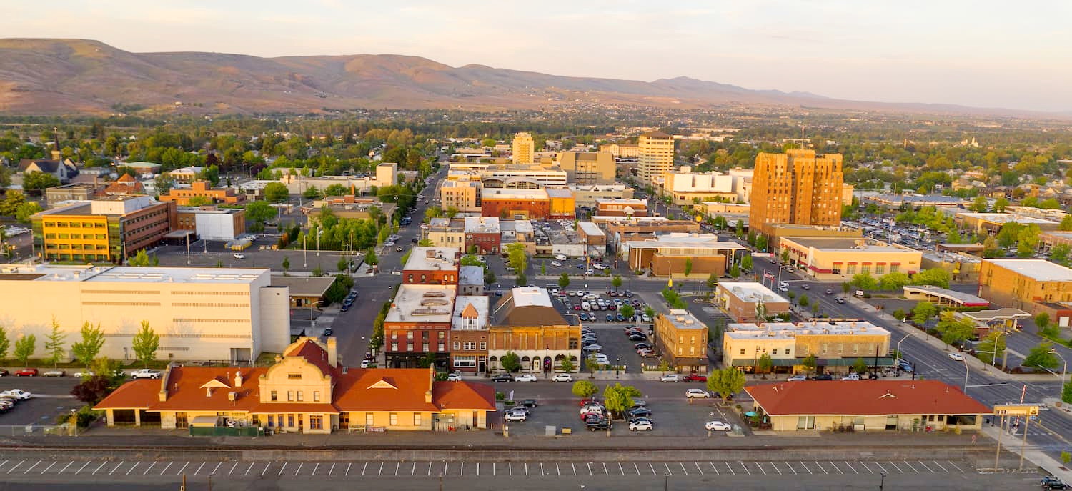
Located in the fertile Yakima Valley of central Washington, the city of Yakima is known for its wineries and apple orchards. At about 55 minutes east from the William O. Douglas Wilderness, the city is a great place to stay or stop by when you are in the area. The Yakima Valley produces over 75% of all hops grown in the United States. The name Yakima comes from the Yakama Nation Native American tribe, with their reservation located just south of the city. The Yakima River runs through the city and offers a 10-mile trail along the edge for running, hiking, or biking.
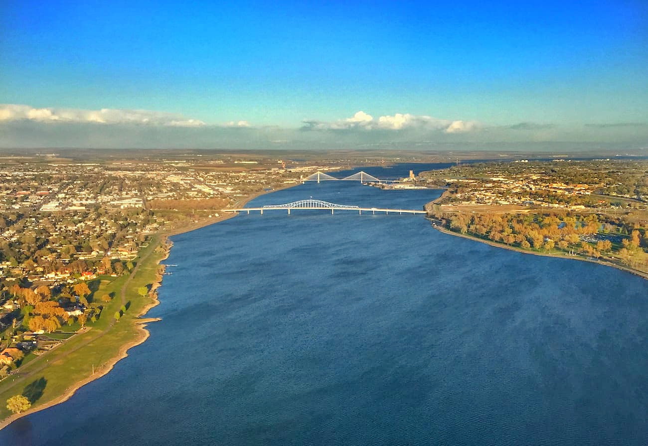
The Tri-Cities includes three closely linked cities; Kennewick, Pasco, and Richland, located an hour east of Yakima. The cities are situated where the Yakima, Snake, and Columbia rivers meet. Situated about one hour southeast from the Hanford Reach National Monument, the area has been historically based on farming and the Hanford Nuclear Reservation. Farming has been popular due to the irrigation from the three conjoining rivers. The area is home to seven river-front parks that are popular among locals and tourists alike.


ultra
glacier
volcano
cascade-range-9000ers
washington-bulger
washington-fire-lookouts
smoots-100
chemeketan-18-nw
mountaineers-6-peak-pin
mountaineers-5-peak-pin
cascade-volcanoes-pin
mazamas-guardian-award
mazamas-16-nw-award
washington-ultras
ultra
glacier
volcano
cascade-range-9000ers
washington-bulger
washington-fire-lookouts
smoots-100
chemeketan-18-nw
mountaineers-6-peak-pin
mountaineers-5-peak-pin
cascade-volcanoes-pin
mazamas-guardian-award
mazamas-16-nw-award
washington-ultras
Yes. Yakima County has 171 named mountains. The highest is Pahto at 3,743 m.
The highest mountain in Yakima County is Pahto, at 3,743 m.
Yakima County has 171 named mountains.


