
Scan the QR code and open PeakVisor on your phone
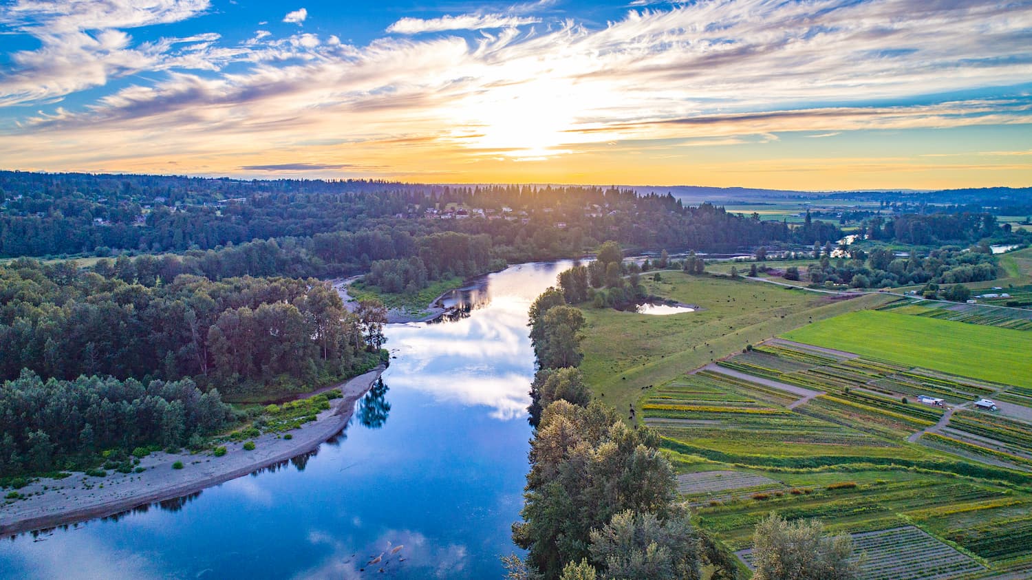
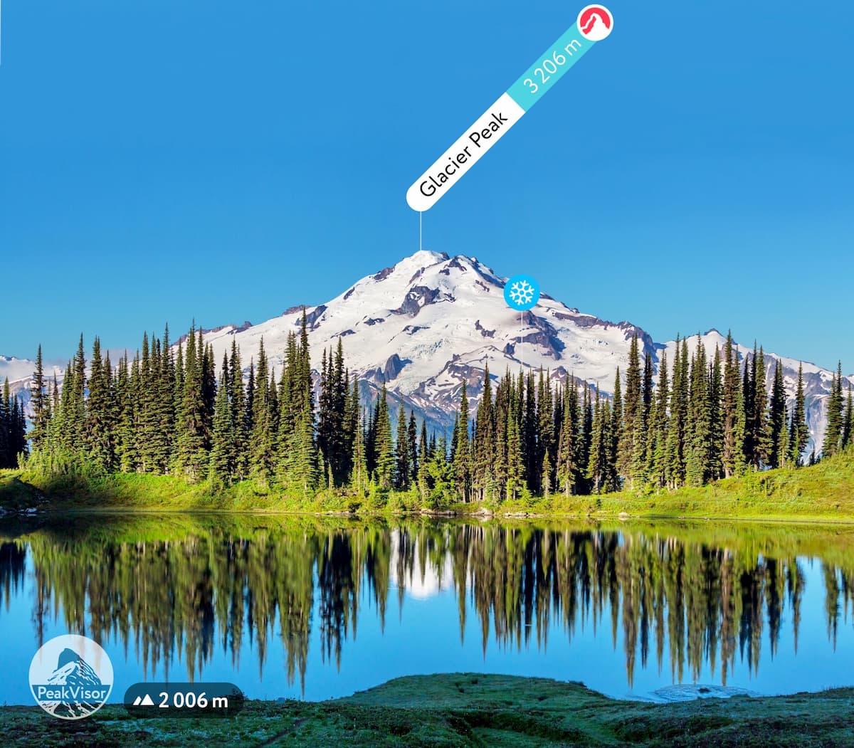
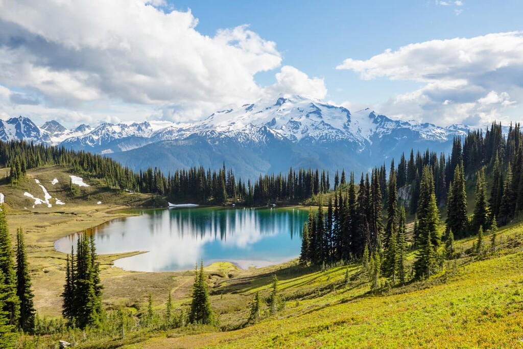
Snohomish County is a county located in western Washington, just north of Seattle. The county is named for the Snohomish people, a Coast Salish tribe. The population of the county is just shy of 1 million residents, making it the third most populous county in the state. The western side of the county borders the water on the Puget Sound while the eastern side of the county runs through the Cascade Mountain Range. There are 145 named mountains in Snohomish County. The highest and the most prominent mountain is Glacier Peak standing at 10,541 feet. Glacier Peak is the fourth tallest peak within the state of Washington. The entire county covers 2,198 square miles. Much of the eastern part of the county is protected by Mount Baker National Forest and Snoqualmie National Forest. The mountains within the county provide water for the Snohomish, Skykomish, Snoqualmie, and Stillaguamish rivers.
The Darrington Ranger District is one of the largest districts located within the Mt. Baker-Snoqualmie National Forest. Within this district alone there are 328 miles of hiking trails ranging from all levels of difficulty. Snohomish County sits right next to Seattle making the ample network of trails a popular destination for all in the area.
Bridal Veil Falls is one of the most iconic waterfalls within the entire county. This 4-mile out and back trail has just 1,000 feet of elevation, making it the perfect hike for multiple skill levels. The falls flow out of Lake Serene and down the east wall of Mount Index. The falls drop over 100 feet with a set of stairs paralleling them for a variety of different views. The misty water flows over the rock so effortlessly that it appears to look similar to a veil, hence the name of the falls. Note that this is a very popular hike within the county so be prepared to arrive early or visit on a weekday.

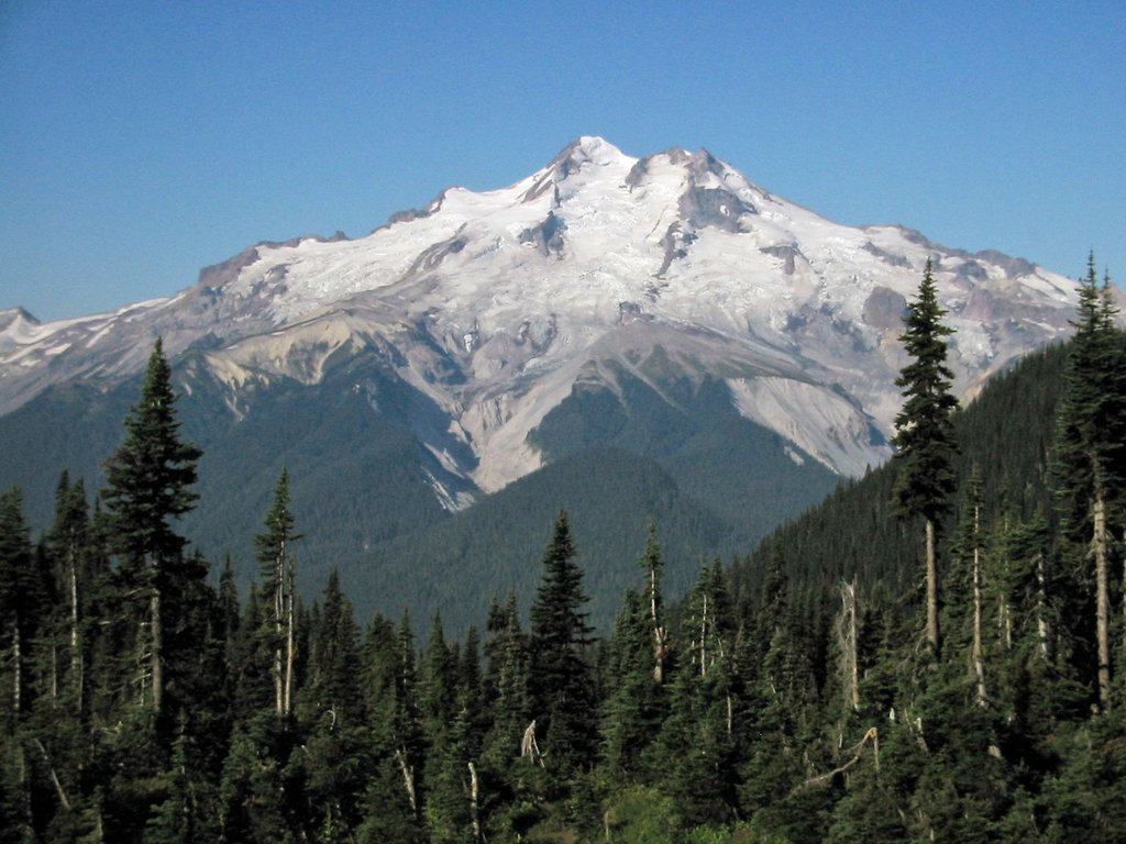
Glacier Peak is one of the five volcanoes within the state of Washington. The peak is classified as a stratovolcano, with no major activity over the last 300 years. It is a lesser known peak due to it being far from a major town and many of the major roads having been washed out. There are multiple routes to summiting the mountain but the most common is known as the Standard Route, approaching from White Pass and ascending through Disappointment Peak Cleaver. After 10 miles of trails, hikers reach the basecamp. This route totals about 33-miles with over 10,000 feet of elevation gain. Many hikers complete this ascent over the course of 2-3 days. Mountaineering experience is required for this summit and always be sure to travel in a group.
Lord Hill Regional Park is the largest county park within Snohomish County, spanning 1,400 acres. This popular hike takes you past Beaver Lake, Temple Pond and around Lord Hill, the namesake for the park. This 3.7-mile loop is great for beginner hikers as the whole trail has just 200 feet of elevation gain. Temple Pond is the largest body of water within the park and features a surrounding wetland full of a variety of animal life.
The Centennial Trail stretches 31 miles across the county, starting in Snohomish and ending in Arlington. This paved trail also has a dirt horse path parallel to it that is perfect for trail running and off-road biking. The trail passes through farm land, fields of wildflowers and crosses multiple creeks and rivers. There are many parking lots throughout the trail and offshoots to other trails for more serious hiking/ trail running.
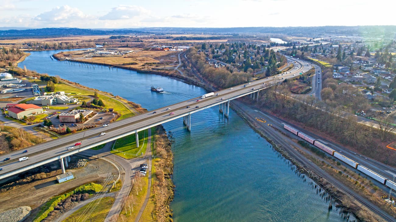
Everett is the largest and most populous city within Snohomish County. The city is situated at the mouth of the Snohomish River that leads into Port Gardner Bay, part of the Puget Sound. Boeing has a production facility within Everett which is the largest employer in the region. The city is also home to the Naval Station Everett, which opened in 1994.
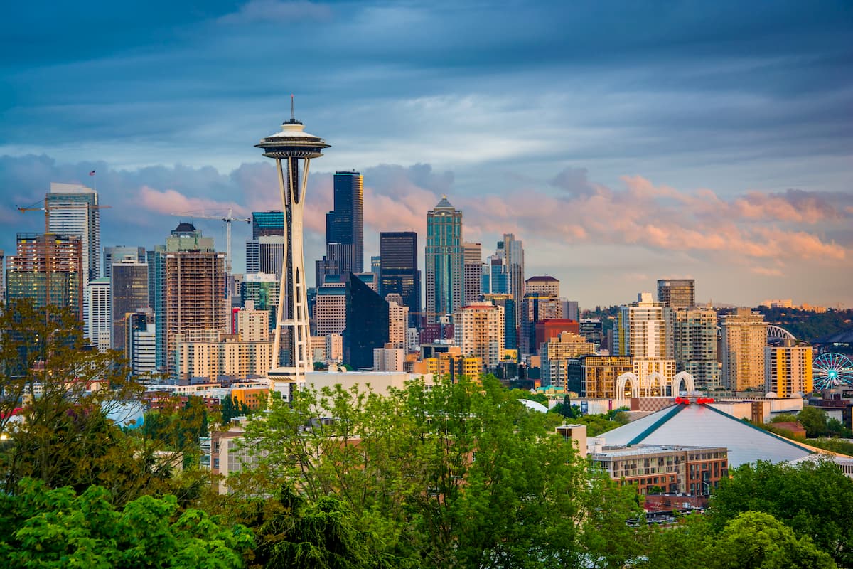
The most iconic and populated city in the state of Washington, Seattle is located 25 miles south of Snohomish County. While Seattle is known for being a rainy city, don’t let that deter you. Surrounded by lush forest, the Puget Sound, and views of Mount Rainier, Seattle has something to offer all of its visitors. Take a trip to Pike Place Market, stop by the original Starbucks location, visit the Space Needle, or swing by one of the city’s 174 breweries. Staying in Central Seattle, just east of I-5, will ensure that you’ll have quick access to the state’s major highways.


ultra
glacier
volcano
cascade-range-9000ers
washington-bulger
smoots-100
chemeketan-18-nw
mountaineers-6-peak-pin
mountaineers-5-peak-pin
cascade-volcanoes-pin
mazamas-16-nw-award
washington-ultras
ultra
glacier
volcano
cascade-range-9000ers
washington-bulger
smoots-100
chemeketan-18-nw
mountaineers-6-peak-pin
mountaineers-5-peak-pin
cascade-volcanoes-pin
mazamas-16-nw-award
washington-ultras


