
Scan the QR code and open PeakVisor on your phone
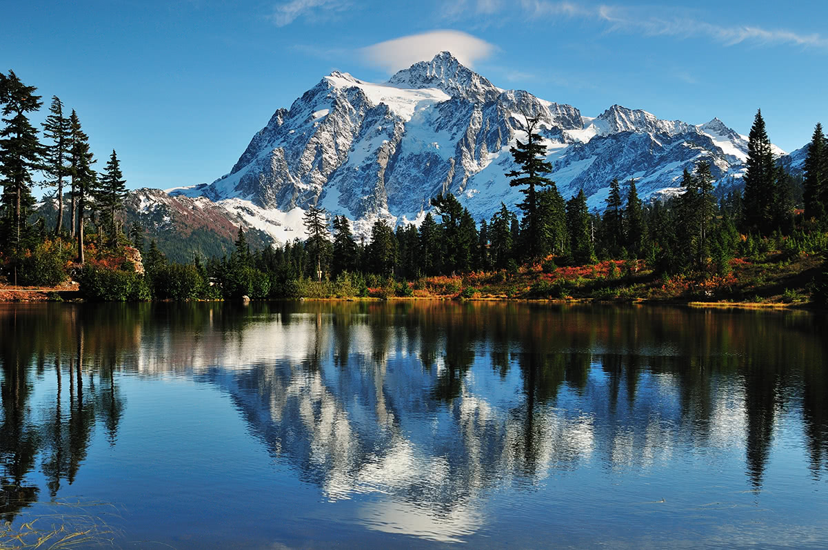
Located on the western slopes of the Cascade Mountains, The Mt. Baker-Snoqualmie National Forest spans over 140 miles between Seattle, Washington, and Vancouver, British Columbia. Baker-Snoqualmie is one of the most visited forests in the country for a few reasons. This region is not only known to contain some of the most incredible glacier-covered peaks in Washington, like Mount Baker, Glacier Peak, and Mount Shuksan, but it’s also easily accessible via several major highways.
The Mount Baker-Snoqualmie National Forest covers a total area of over 1.5 million acres and reaches through portions of Snohomish, Whatcom, Skagit, King, Pierce, and Kittitas Counties. In fact, over half of the state’s population lives within a 70-mile drive of the forest.
The Mount Baker-Snoqualmie National Forest also happens to house more glaciers and snowfields than any other national forest in the lower 48. The largest glaciers are found on Mount Baker, Sentinel Peak, and Glacier Peak and include Coleman Glacier, Easton Glacier, and Boulder Glacier.
Interestingly, in 1968, a remote section of this precious, protected forest was transferred to nearby North Cascades National Park. Also, over the years over 800,000 acres of the forest have been designated as wilderness areas. Today, there is a total of eight Wilderness areas to explore – Alpine Lakes Wilderness, Boulder River Wilderness, Clearwater Wilderness, Glacier Peak Wilderness, Henry M. Jackson Wilderness, Mount Baker Wilderness, Noisy-Diobsud Wilderness, Norse Peak Wilderness, and Wild Sky Wilderness. Together, these Wilderness areas provide permanent protection to vast spans of old-growth forest and safeguard iconic Washington summits like Mount Baker, Sloan Peak, Glacier Peak, Mount Pugh, Twin Sisters, Hannegan Peak, and Mount Larrabee.
It goes without saying, but recreation opportunities are endless in Baker-Snoqualmie. Containing over 800 alpine lakes and 1,500 miles of hiking trails, the Forest is an adventure hub for hunters, fishers, bikers, hikers, snowmobilers, skiers, and general sightseers.
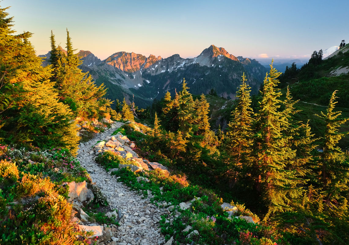
The Alpine Lakes Wilderness, which covers over 400,000 acres, is a beloved wilderness area that spans the Central Cascades near Puget Sound. This region features some of the most rugged Cascade peaks and ridges, including Mount Stuart and Mount Daniel, and protects over 700 glacial lakes. The western portion of the Alpine Lakes Wilderness is managed by the Mt. Baker-Snoqualmie National Forest and is one of the most popular outdoor recreation areas in western Washington, due in part to its proximity to densely populated areas.
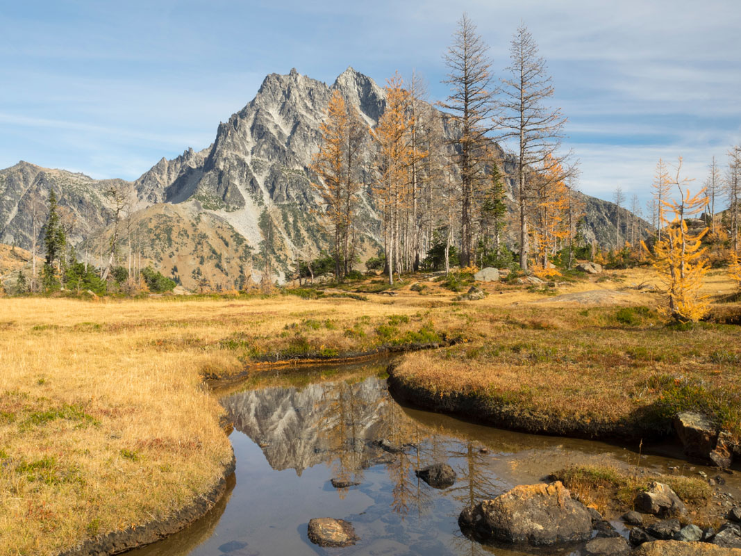
The Alpine Lakes Wilderness is accessed via 47 trailheads and over 600 miles of trails, and even includes a portion of the Pacific Crest National Scenic Trail. Some of the most popular trails and attractions in the Alpine Lakes Wilderness include: The Enchantments, Snoqualmie Lake, Mount Defiance, Granite Mountain Lookout, Colchuck Lake, Lake Stuart, Nada Lake, and Snow Lakes.
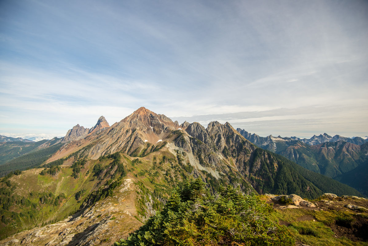
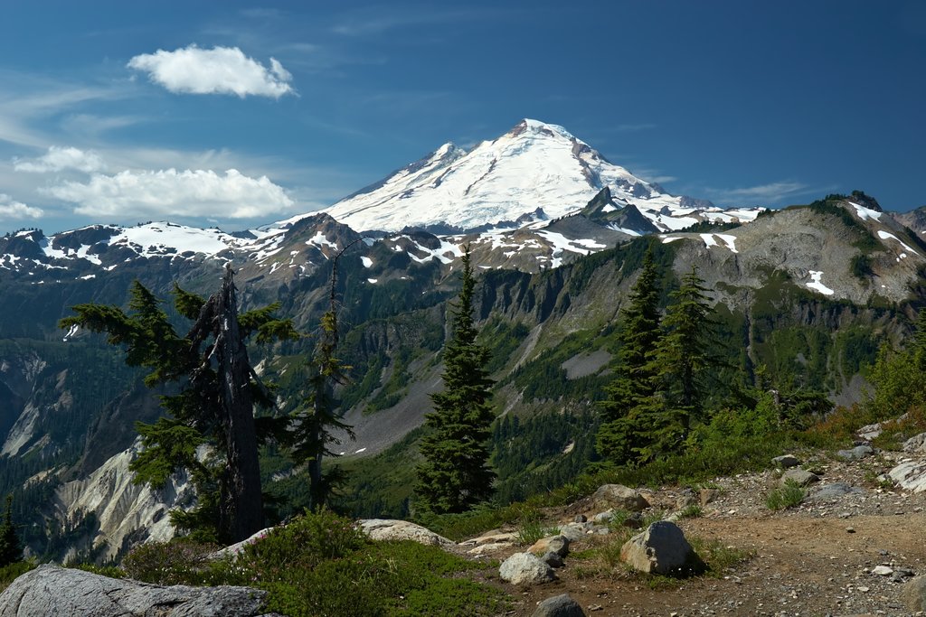
The Mount Baker Wilderness area is another incredibly popular region for outdoor recreation within Mt. Baker-Snoqualmie National Forest. Mount Baker, the crown-jewel of this region, is an active glacier-covered volcano and the fourth highest peak in Washington. This wilderness area contains over 100,000 acres of the western Cascade Range in northern Washington and features some of the state’s most stunning, high-altitude summits like Mount Shuksan, Ruth Mountain, the Sister Range, and Tomyhoi Peak. Needless to say, there’s never a shortage of spectacular views that both novice and expert hikers and explorers can appreciate.
Some of the most popular hikes and attractions in the Mt. Baker Wilderness include Artist Point, Picture Lake, Table Mountain, Winchester Mountain, Chain Lakes Loop, Hannegan Peak, Lake Ann, and Ptarmigan Ridge.
Snoqualmie Pass is more than just a major mountain pass that travels through the Cascade Range. This region serves as an all-seasons gathering place for outdoor enthusiasts. Snoqualmie Pass offers over seven designated areas for climbing, eight major biking trails, over 100 miles of trails, and 1,981 acres of skiable terrain. Snoqualmie Pass is also home to the Summit at Snoqualmie, a group of four alpine ski areas – Alpental, Summit West, Summit Central, and Summit East – that serve as the closest ski area to Metropolitan Seattle.
Popular hikes and attractions in the Snoqualmie Pass region include: Franklin Falls, Snoqualmie Mountain, Snoqualmie Falls, Snow Lake, Granite Mountain, Annette Lake, and Lillian Lake.

Wild Sky is the youngest Wilderness area on this list and the first new federally designated wilderness in Washington since 1984. This 106, 577-acre wilderness area sits just north of Index and Skokomish in the central Cascades - its highest point reaches over 6,000 feet at the top of Gunn Peak. Only five peaks in the Wild Sky Wilderness have officially designated trails – Evergreen Mountain, Beckler Peak, Sunrise Mountain, Scorpion Mountain, and West Cady Ridge. However, several other hiking trails, old logging roads, and hunting trails exist within this area.
Popular trails and attractions in the Wild Sky Wilderness include: Blanca Lake, Baring Mountain, Evergreen Mountain, Beckler Peak, and Johnson Ridge.
The Mountain Loop Highway is a scenic roadway that connects the towns of Granite Falls and Darrington. Located in Snohomish County, the road traverses the western section of the Cascade Range for nearly 56 miles (43 paved and 13 unpaved), passing several U.S. Forest Service Roads, trailheads, and campgrounds along the way. Rugged alpine peaks like Three Fingers, Whitehorse Mountain and Mount Dickerman, draw thousands of adventurous hikers and travelers to this region every summer.

Popular hikes and attractions along the Mountain Loop Highway include: Lake 22, Mount Pilchuk, Big Four Ice Caves, Goat Lake, Glacier Basin, and Mount Pugh.
The Mt. Baker Ski Area sits in Whatcom County at the end of Mt. Baker Highway in what is considered one of the most beautiful alpine areas in North America. In addition to being in the heart of the Mt. Baker Wilderness, the Mt. Baker Ski Area averages over 600 inches of snow each year and is home to 34 runs and 1,000 acres of skiable terrain. This area is also known for its challenging routes and backcountry accessibility.
The Mount Baker Lodge is within walking distance of the ski area and provides accommodations for travelers looking to explore the stunning mountain summits and valleys of Mt. Baker-Snoqualmie National Forest.

Washington’s largest city, Seattle, sits just outside of the Mt. Baker-Snoqualmie National Forest, and several of the major recreation areas listed above are just an hour or less from city-center (without traffic, of course). In terms of an outdoor recreation basecamp, it’s hard to beat Seattle. The largest city Pacific Northwest region of North America, the city sits has an international airport, Seattle-Tacoma International, and a variety of hotel accommodations and amenities.
Located on the crest of Stevens Pass in the Cascade Range, Stevens Pass Ski Resort averages 460 inches of snowfall a year and offers 1,125 acres of skiable terrain, and 52 major runs. Stevens Pass spans both Mt. Baker-Snoqualmie and Wenatchee National Forest, making it a perfect resort to explore the Cascades. There are also a variety of accommodations, lodging, restaurants, shopping, and facilities available for visitors to Stevens Pass.


ultra
glacier
volcano
cascade-range-9000ers
washington-bulger
smoots-100
chemeketan-18-nw
mountaineers-6-peak-pin
mountaineers-5-peak-pin
mountaineers-bakers-dozen
cascade-volcanoes-pin
mazamas-16-nw-award
washington-ultras
ultra
glacier
volcano
cascade-range-9000ers
washington-bulger
smoots-100
chemeketan-18-nw
mountaineers-6-peak-pin
mountaineers-5-peak-pin
cascade-volcanoes-pin
mazamas-16-nw-award
washington-ultras
ultra
glacier
volcano
cascade-range-9000ers
washington-bulger
smoots-100
chemeketan-18-nw
mountaineers-6-peak-pin
mountaineers-5-peak-pin
mountaineers-bakers-dozen
cascade-volcanoes-pin
mazamas-16-nw-award
washington-ultras
ultra
glacier
volcano
cascade-range-9000ers
washington-bulger
smoots-100
chemeketan-18-nw
mountaineers-6-peak-pin
mountaineers-5-peak-pin
cascade-volcanoes-pin
mazamas-16-nw-award
washington-ultras
glacier
washington-bulger
mountaineers-cascade-classic
mountaineers-everett-classic-8


