
Scan the QR code and open PeakVisor on your phone
The Glacier Peak is a 566,057-acre wilderness in the Cascade Range that shares a border with North Cascades National Park, Stephen Mather Wilderness, and the Henry M. Jackson Wilderness.
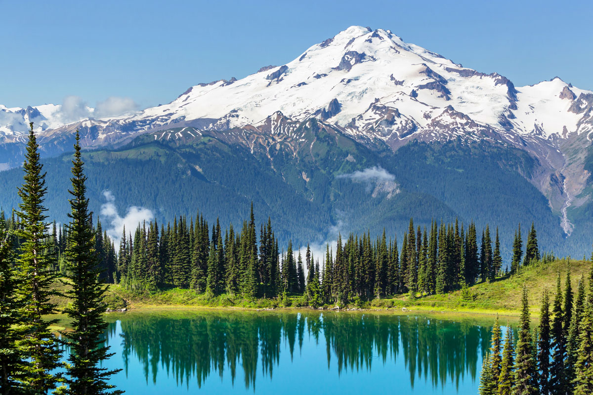
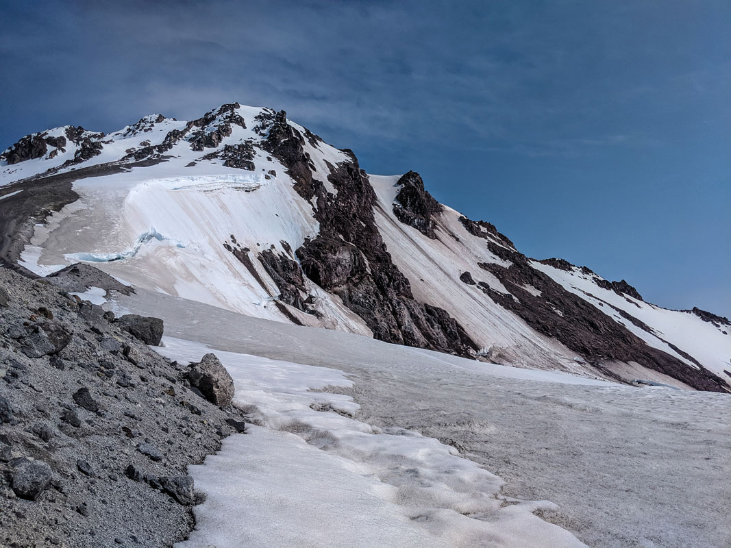
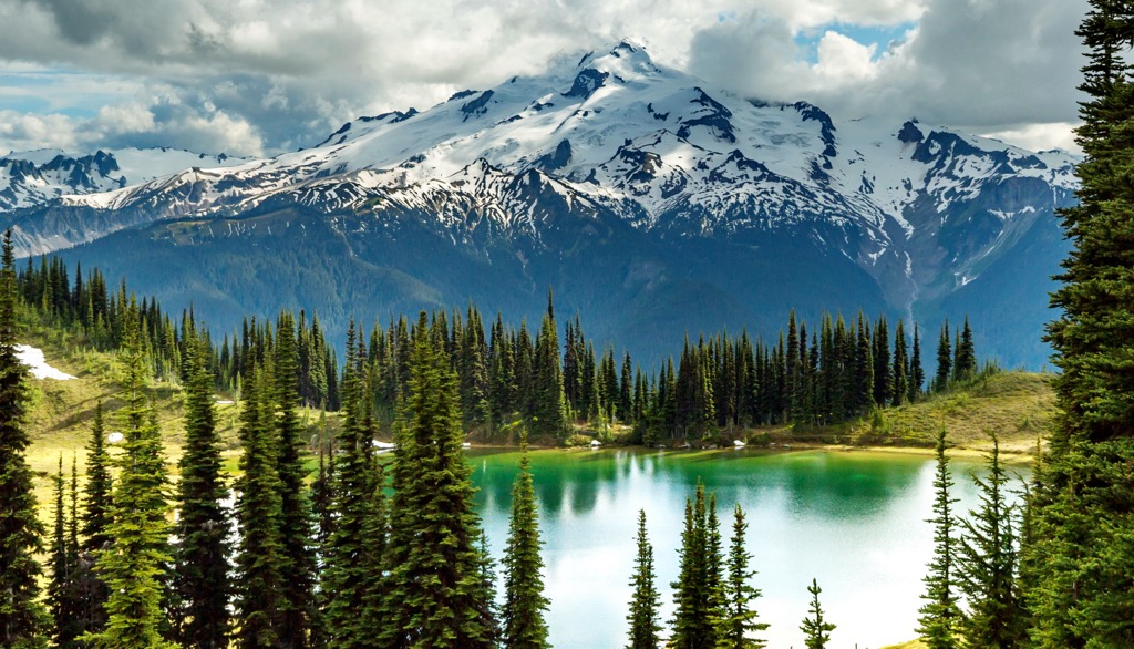
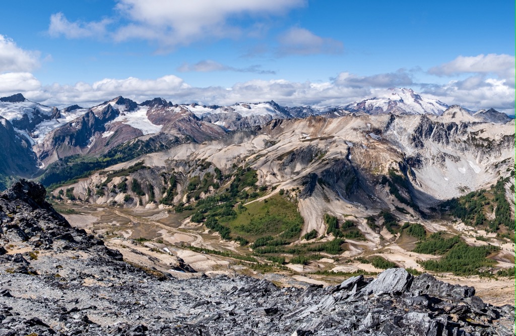
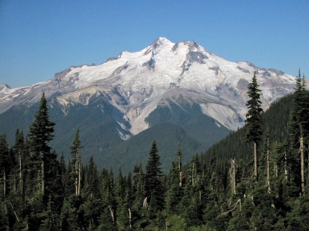
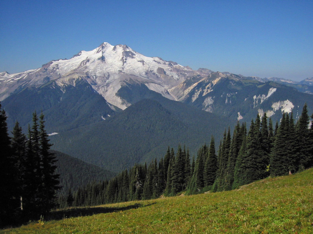
The Glacier Peak region is known for its rugged and remote topography, particularly its weathered glaciated peaks and steep-sided valleys. Unlike other famed Washington volcanoes, like Mount Baker and Mount Rainier, the volcanoes in the Glacier Peaks region are tucked deep in the North Cascades. Glacier Peak, for example, is the highest summit in this area. This peak sits at 10,538 feet and has more active glaciers than any other place in the lower 48, but it cannot be seen from major highways or scenic overlooks, and it takes hours of hiking to reach it.
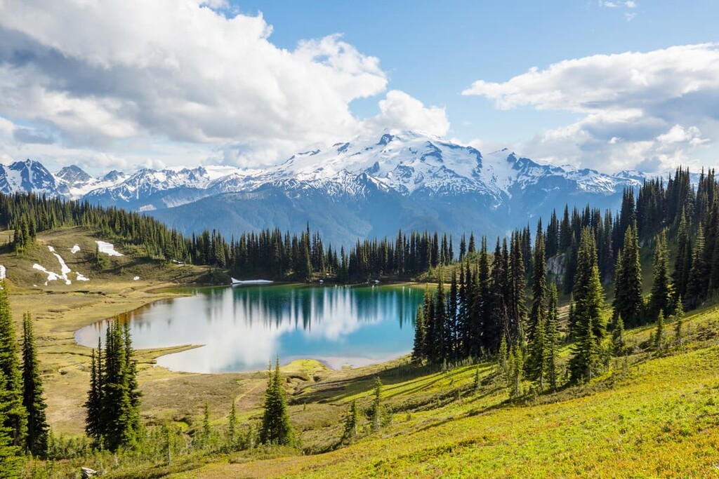
Above the treeline, travelers will appreciate lovely meadows and deep U-shaped valleys. Glacier Peak also houses over 200 lakes, an abundance of wildlife, and large spans of densely forested terrain. There are approximately 450 miles of trail stretched out over 100 footpaths in Glacier Peak, allowing for both modest strolls in the woods and strenuous adventures into the backcountry. Climbers have also put up routes on over 100 peaks and faces in this region, making this area a notoriously popular destination for experienced rock climbers.
Washington locals have long believed that Glacier Peaks, Alpine Lakes, and North Cascades offer some of the very best mountainous terrain in the lower 48. Cascade icons like Bonanza Peak, Mount Fernow, Seven Fingered Jack, and Mount Maude are tucked within this rugged and remote wilderness, waiting to be appreciated by adventurous travelers.
There are several ways to access Glacier Peaks Wilderness. Most visitors will hop on the Mountain Loop Highway to reach the park’s most prized icon, Glacier Peak. However, Highway 20/Cascade Pass, Lake Chelan and Holden Village, and the Trinity/Phelps Creek Trailhead all offer access to various points of the region.
The North Fork Sauk Trail is where hikers and climbers go to experience the high country of the Glacier Peak Wilderness. The trail begins by weaving through incredible old-growth forest, following the North Fork Sauk River. Over the first few miles, the trail climbs relentlessly for over 3,000 feet. But after grinding through a few miles of seemingly vertical switchbacks, the grade eventually lessens, and impressive views of Monte Cristo and Sloan Peaks come into view. Continue on to the pass, where ice-capped volcanoes decorate the horizon.
Sitting on the east side of Stevens Pass, two pristine lakes rest in a lush basin lined with trees. The long-distance trek to Twin Lakes is considered one of the best trails in Glacier Peak. Deep river valleys, lush old-growth forest, and sweeping panoramic views are just a few things you can expect along this trek. The trail begins by climbing along the banks of the South Sauk River before reaching a turn-of-the-century mining town, Monte Cristo. From Monte Cristo, the trail continues to climb toward Poodle Dog Pass and Silver Lake. This part of the trail will be challenging, but those willing to tackle the ascent will be greeted with 360-degree views 3,000 feet above Monte Cristo. Before long, the trail makes its way to two gorgeous lakes tucked within Heather Meadows and flanked by the vertical granite wall of Columbia Peak.
Green Mountain is a challenging trek in Glacier Peak, but for those willing to make the effort, the trail offers a stroll through incredible emerald forest, fern meadows, and a historic lookout complete with panoramic Cascade views. For the first mile, this trail climbs through lush old-growth forest before reaching a large, open meadow. During the summer, this is where hikers and photographers will go to check out an incredible display of wildflowers. After 2.5 miles, the trail will descent to a pair of small tarns before reaching the lookout, which sits 6,500 feet above sea level.
Darrington sits nestled among the forested foothills and snow-capped summits of the North Cascades. Albeit a small town, Darrington is packed with world-class recreational opportunities and offers access to some of the most wild and remote regions of the Cascades. The Darrington area is known for its vast network of public lands, including the Glacier Peak Wilderness. Visitors to Darrington can partake in a variety of outdoor activities like hiking, camping, rock climbing, snowmobiling, and fishing. The town also offers plenty of lodging, including quaint cabins and cottages, and a number of low-key dining options like the Lonesome Bear Café and River Time Brewing.
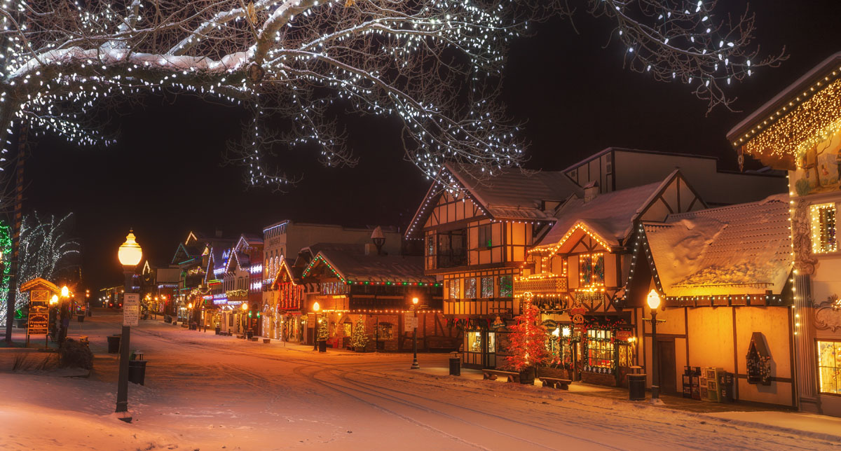
Tucked within the Cascade Mountains, Leavenworth is a unique, Bavarian-style mountain town with an interesting history. In the late 1800s, settlers that were hungry for gold and timber turned Leavenworth into a bustling mountain town. Since then, Leavenworth has transformed into an outdoor recreation hub and a quirky destination for travelers to drink German beer, grab a bite to eat, and hit the nearby ski slopes or mountain trails.


ultra
glacier
volcano
cascade-range-9000ers
washington-bulger
smoots-100
chemeketan-18-nw
mountaineers-6-peak-pin
mountaineers-5-peak-pin
cascade-volcanoes-pin
mazamas-16-nw-award
washington-ultras
cascade-range-9000ers
washington-bulger
smoots-100
mountaineers-cascade-classic
mountaineers-everett-classic-8
cascade-range-9000ers
washington-bulger
smoots-100
mountaineers-cascade-classic
glacier
cascade-range-9000ers
washington-bulger
smoots-100
mountaineers-cascade-classic
glacier
washington-bulger
mountaineers-cascade-classic
mountaineers-everett-classic-8
ultra
glacier
volcano
cascade-range-9000ers
washington-bulger
smoots-100
chemeketan-18-nw
mountaineers-6-peak-pin
mountaineers-5-peak-pin
cascade-volcanoes-pin
mazamas-16-nw-award
washington-ultras
cascade-range-9000ers
washington-bulger
smoots-100
mountaineers-cascade-classic
mountaineers-everett-classic-8
glacier
washington-bulger
mountaineers-cascade-classic
mountaineers-everett-classic-8
cascade-range-9000ers
washington-bulger
smoots-100
mountaineers-cascade-classic


