Scan the QR code and open PeakVisor on your phone
Nestled between Mount Rainier and Mount Adams, Goat Rocks Wilderness is a 108,096-acre wilderness area that contains the remnants of an extinct two-million-year-old Stratovolcano that once reached an impressive 12,000 feet in elevation.
Together, with Mount Adams, Mount Rainier, and Mount St. Helens, the Goat Rocks volcano forms a triangular arrangement of volcanoes not found anywhere else in the Cascades. Eruptions are ceased over .5 million years ago, and extensive glaciation and erosion have since worn away at the terrain, forming a series of impressive summits and ridges.
In 1931, the first 44,500 acres of the wilderness were designated as the Goat Rocks Primitive Area and named after the native goats in the region. By 1940, the wilderness had nearly doubled in size and was renamed the Goat Rocks Wild Area. In 1964, Goat Rocks Wild Area became a designated wilderness, and, in 1984, additional land was added to preserve the wild character of the landscape.
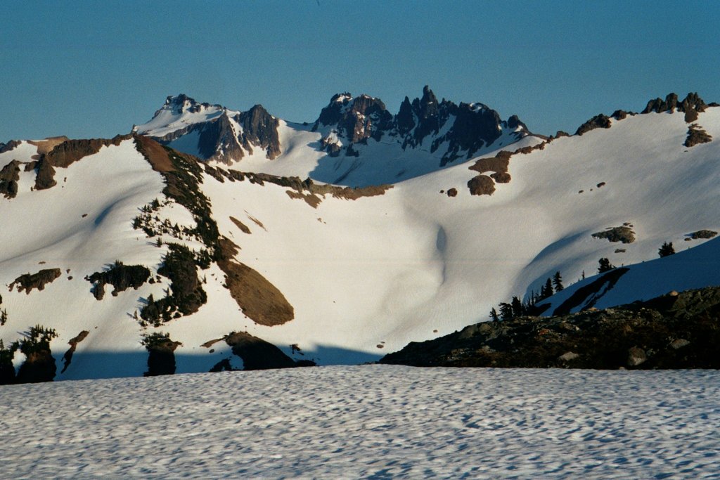
Goat Rocks sits on the crest of the Cascade Range, encompassing land in both Okanogan-Wenatchee National Forest and Gifford Pinchot National Forest. There are 23 named mountains in the wilderness. The highest summit, Gilbert Peak, reaches over 8,000 feet in elevation and nearby mountains, including Goat Citadel, Big Horn, Ives Peak, Tieton Peak, and Old Snowy Mountain, extend to over 7,500 feet in elevations. On the shaded northern slopes of these major peaks are several noteworthy glaciers including Packwood Glacier, Meade Glacier, and Conrad Glacier.
The variable climate found in the Goat Rocks Wilderness supports a host of wildlife, including black-tailed deer, Roosevelt elk, Rocky Mountain elk, marmots, and pikas.
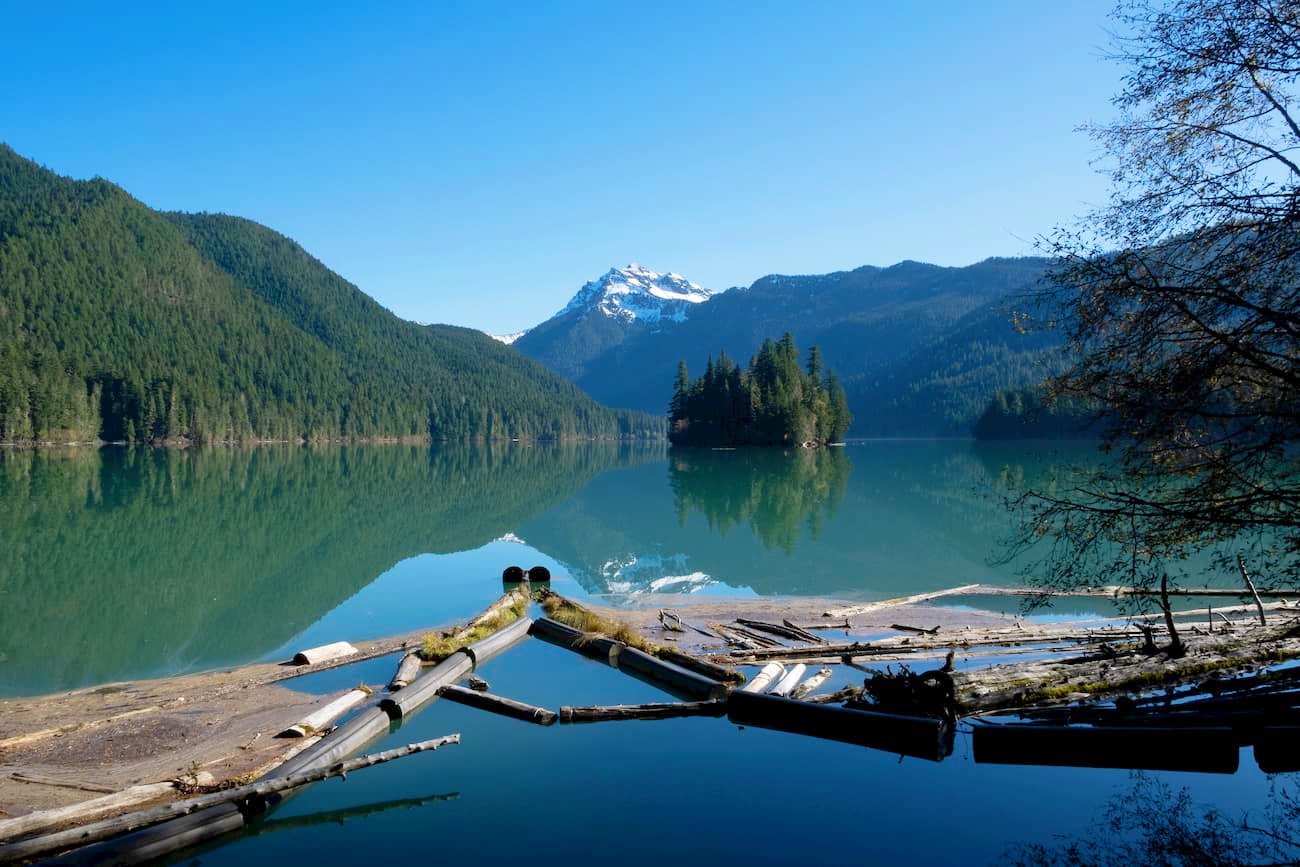
Goat Rock’s craggy summits and dazzling alpine lakes make it a popular destination for backpacking and hiking. In total, the wilderness contains over 120 miles of trails, including 31 miles of the infamous Pacific Crest Trail. Many consider Goat Rocks to be one of the most scenic stretches of the Pacific Crest Trail and over a dozen trails grant visitors access to this beloved footpath.
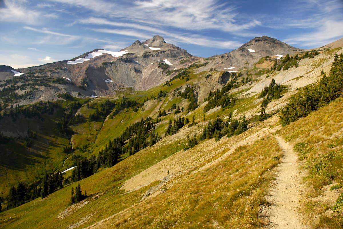
The 7-mile footpath to the summit of Bear Creek Mountain begins with a climb through alpine forest and stunning flower-clad meadows. Along the way, hikers will be greeted by sweeping vistas of several Cascade icons, including Old Snowy, Tieton Peak, Gilbert Peak, and the McCall Glacier. The final push to the summit isn’t for the faint of heart, but those willing to endure the ascent will climb to over 7,300 feet and reach the third highest hiker-accessible point in the Goat Rocks Wilderness.
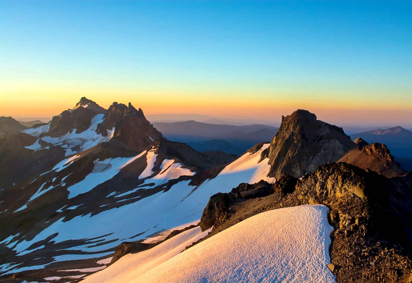
Sitting at an impressive 7,900 feet, the summit of Old Snowy features picturesque views of three volcanoes – Mount Rainier, Mount Adams, and Mt. St. Helens, as well as several Goat Rock icons, including Hawkeye Peak, Johnson Peak, Ives Peak, Big Horn, and Gilbert Peak. Despite being one of the tallest peaks in the wilderness, Old Snowy isn’t a particularly technical trek. It’s accessibility makes it a popular destination for local peak-baggers and novice mountaineers.
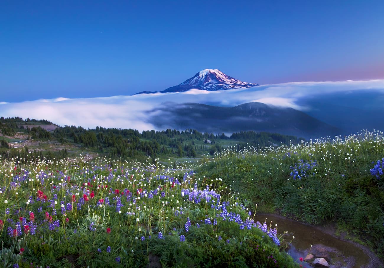
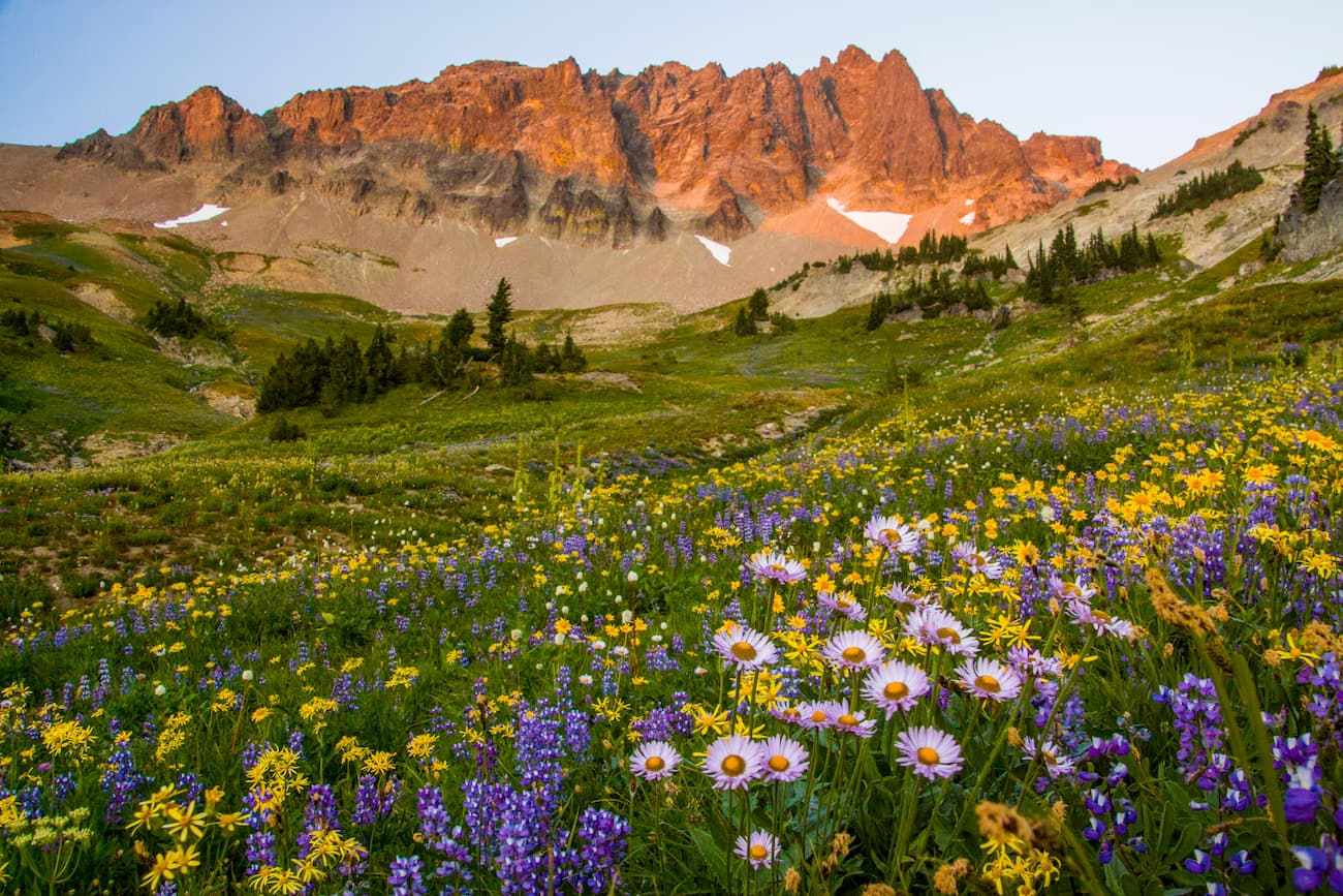
A favorite amongst wildflower enthusiasts, the Snowgrass Flats and Goat Lake Basin loop is a scenic trail that boasts incredible views of Old Snowy Mountain and Mount Adams. Arguably one of the most scenic passes in the area, this trek is one of the most popular destinations in the Goat Lakes Wilderness.
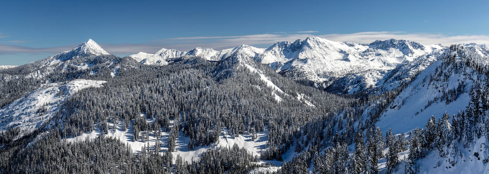
The White Pass Ski Resort sits in the Cascade Range, just 30 miles from Mount Adams and 20 miles from Mount Rainier. With a base elevation of 4,500 feet and summit elevation of 6,500 feet, White Pass has earned a reputation for being an ideal destination for high-alpine skiing and snowboarding. The resort features 1,400 acres of skiable terrain, a terrain park, a Nordic center, a day lodge, and even offers snowshoe tours.
Located at the heart of ‘Volcano Country,’ Packwood is a small, charming town known for its scenic beauty and ample recreational opportunities. The city sits just outside of the entrance to Mt. Rainier and is the closest major town to the Goat Rocks Wilderness. Packwood hosts several seasonal events, including a snowmobile hill climb and winter festival, and boasts a variety of dining options and accommodations.