Scan the QR code and open PeakVisor on your phone
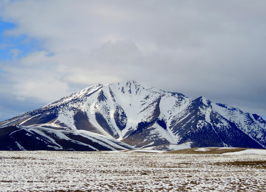
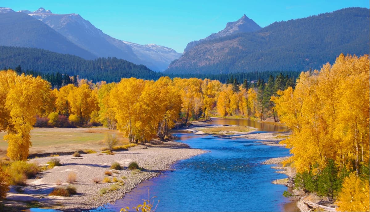
There are 2600 named mountains in the Idaho-Bitterroot Rocky Mountains, the most significant portion of the Bitterroot Range. The Idaho-Bitterroot mountains encompass an area of approximately 4,862 square miles. These iconic peaks also combine parts of Coeur d’Alene and Clearwater Mountains to form a long narrow grouping of peaks that stretch south from Lake Pend Oreille to Lost Trail Pass north of Salmon, Idaho.
Like the rest of the Rockies, the Bitterroots were formed by a combination of geologic forces including shifting plate tectonics, glaciation, and volcanic activity. Molten magma intrusions pushed their way toward the surface more than 50 million years ago, forcing their way into older rocks and crystallizing more than ten miles below the surface. Magma rose up through the crust of the earth, resulting in the eruption of large volumes of volcanic rock in the southern Bitterroot Range. Glaciers then capped the Bitterroot Range and carved out dramatic U-shaped valleys.
Despite being known as the Idaho-Bitterroot Rocky Mountains, these peaks not only span the panhandle of Idaho but also stretch into the westernmost portion of Montana and form the Idaho-Montana border. In fact, this range is referred to as Montana’s largest range and it’s not uncommon to hear them referred to as just the Bitterroot Mountains.
Some of the most rugged Bitterroot peaks are referred to as the Montana Alps and sit between the Lolo and Lost Trail Passes. This section of summits is so iconic that most people mistakenly believe that these peaks make up the entire Bitterroot Range. These peaks, which include Trapper Peak, El Capitan, and Boulder Peak, are also infamous for being an unexpected, daunting obstacle to Lewis and Clark during their expedition westward in 1805.
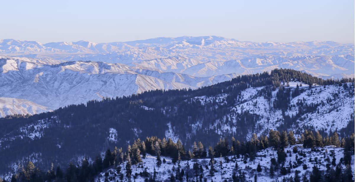
South of Lolo Pass, on the Idaho-Montana border, the 200-mile-long Idaho Batholith lies exposed on the Bitterroot Divide. This series of rugged peaks and steep canyons were carved out by alpine glaciers during the last ice age. Within the heart of this landscape lies the largest wilderness area in the continental U.S., Selway-Bitterroot Wilderness, which protects 1.3 million acres of incredible terrain.
Notable peaks in this region include St. Mary Peak, Trapper Peak, West Goat Peak, Mt. Mcguire, Boulder Peak, Allan Mountain, and St. Joseph Peak. Additional noteworthy Bitterroot mountain summits include Leatherman Peak and Diamond Peak. Not to mention, Borah Peak, the tallest mountain in Idaho and the Idaho-Bitterroot Mountains, is also one of the most prominent in the contiguous united states.
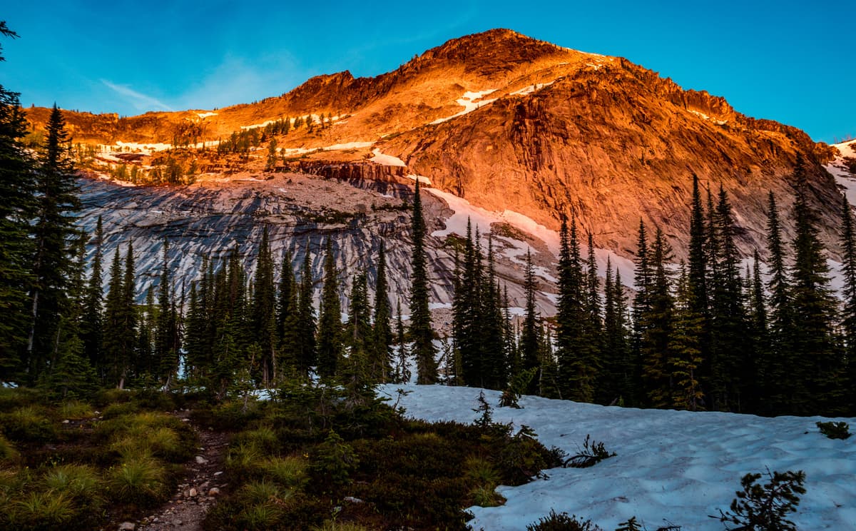
The Bitterroot Mountains can be enjoyed year-round and offer a plethora of outdoor recreation potential. They are a popular destination for camping, fishing, hiking, horseback riding, as well as skiing, cross-country skiing, and snowshoeing.
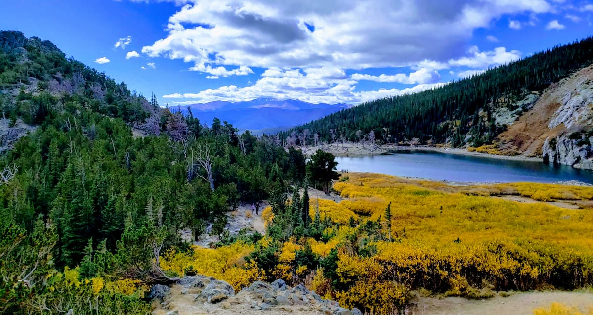
Spanning over 1.3 million acres, the Selway-Bitterroot Wilderness is the third largest wilderness area in the contiguous United States. Selway-Bitterroot runs along both sides of the Bitterroot range, stretching along the Montana-Idaho border. Idaho contains nearly 1.1 million acres and Montana contains just 254, 790 acres of the wilderness area. This region is one of the wildest, most rugged mountainous areas in the states, making it ideal for backcountry travelers, climbers, and mountaineers. Only the 600-foot-wide Nez Perce Trail, an unimproved dirt road, separates the Selway-Bitterroot from the Frank Church-River of No Return Wilderness. Few humans traverse the huge trailless spans of this region. However, nearly 1,800 miles of trails wind through the area and provide access to both the Montana and Idaho sides of the mountains. Popular trails include Bass Lake, St. Mary Peak, Blodgett Overlook Trail, Bear Creek Trail, Lake Como, and the Warm Springs Trail.

In 1968, Congress passed the National Trails System Act to establish a framework for a nationwide system of scenic, recreational, and historic trails. The Nez Perce National Historic Trail stretches from Wallowa Lake, Oregon, to the Bear Paw Battlefield in Chinook, Montana. Along the way, it heads northeast and crosses the Snake River before entering Idaho at Lewiston. Eventually, it makes its way into Montana near Lolo Pass and travels through the Bitterroot Valley, re-entering Idaho at Bannock Pass. At that point, it travels east back into Montana at Targhee Pass to cross the Continental Divide. Although not many travelers will attempt the entire trail, sections of the trail can be used for day hikes or long-distance backpacking.
Located in Kellogg, Idaho, Silver Mountain is a year-round resort that offers skiing, snowboarding, lift-served snow tubing and snowshoeing during the winter months. During summer months, the resort is the perfect place to hit the trail, either on foot or mountain bike. There is also a scenic gondola, live music, and a delicious mountain house grill. Silver Mountain also offers access to Idaho’s largest indoor waterpark, Silver Rapids Waterpark.
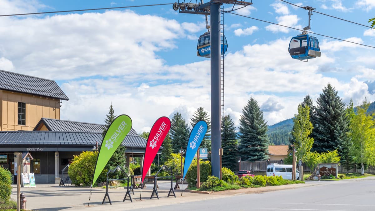
There are two popular trails that can be accessed directly from the resort, Kellogg Peak and the East Ridge Nature Trail. Not to mention, once you’ve worked up an appetite, there are a variety of dining options available. At the heart of Silver Mountain’s Gondola Village is the Morning Star Lodge, one of the area’s premier vacation rentals.
Enjoy the uncrowded slopes of the Rocky Mountains by visiting Lost Trail, a family-owned facility that offers an 1,800-foot vertical drop, 5 lifts, and 60+ marked trails that cover 1,800 acres. Lost Trail receives an average of 325 inches of snow each year and also has two terrain parks with epic powder lines, log grinds, and rock drops. Nearby accommodations include the Ridge Line Yurt, Lost Trail Hot Springs, The Bitterroot River Ranch, and the Darby Bed and Breakfast. However, there are plenty of other Inns, lodges, and resorts to choose from.
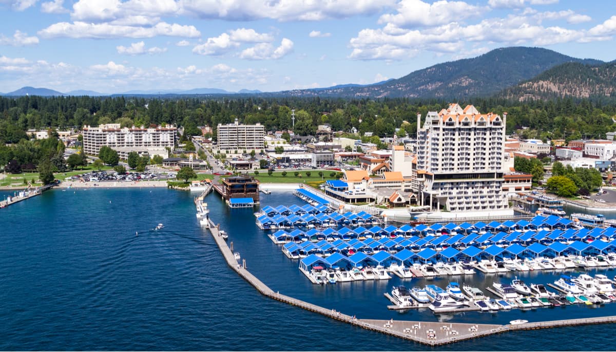
Coeur d’Alene (pronounced core-da-lane) sits on the shores of the magnificent 30-mile Lake Coeur d’Alene and offers a variety of recreational opportunities. Coeur D’Alene is known for its five-star amenities and all-seasons attractions. In addition to hanging out at Lake Coeur d’Alene, visitors can make a quick trip to Silver Mountain Resort, take a guided tour at Red Horse Mountain Ranch, or take a hike along the Mineral Ridge National Recreation Trail, along the Canfield Mountain Trail System, or the Trail of the Coeur d’Alenes. There are plenty of hotels, campgrounds, and cabins to choose from including the Coeur d’Alene Resort, Wolf Lodge Campground, and Abbotswood House.