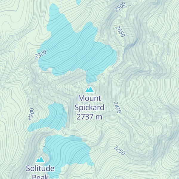
Mount Spickard (pronounced SPICK' erd) is a 8,980-foot (2,740 m) mountain peak in the North Cascades, a mountain range in the U.S. state of Washington. Located 2 miles (3.2 km) south of the Canada–US border, it is part of the Chilliwack Group, a subrange of the Skagit Range which is part of the North Cascades. It is composed mainly of gneiss and is part of two major drainage basins: that of the Skagit River and Fraser River.
With a topographic prominence of over 4,700 feet (1,400 m), Mount Spickard is one of the most prominent peaks in the state, and has two minor summits. It was named for a climber who fell to his death while ascending another nearby mountain peak. The first to ascend it was Walter B. Reaburn, in 1904.
By elevation Mount Spickard is
# 80 out of 4345 in the Cascade Range # 9 out of 227 in Whatcom County # 55 out of 3673 in Washington # 6 out of 123 in North Cascades National Park # 8 out of 269 in the Skagit Range
By prominence Mount Spickard is
# 13 out of 4345 in the Cascade Range # 2 out of 227 in Whatcom County # 9 out of 3673 in Washington # 1 out of 123 in North Cascades National Park # 3 out of 269 in the Skagit Range
We use GPS information embedded into the photo when it is available.
3D mountains overlay
Adjust mountain panorama to perfectly match your photos because recorded by camera photo position might be imprecise.
Move tool
Rotate tool
Zoom
More customization
Choose which peak labels should make into the final photo and what photo title should be.
Next
Photo Location
Satellitte
Flat map
Relief map
Latitude
Longitude
Altitude
OR
Latitude
°'''
Longitude
°'''
Apply
Register Peak
Peak Name
Latitude
Longitude
Altitude
Register
Teleport
PeakVisor
This 3D model of Sagarmatha National Park in Nepal was made using the PeakVisor app topographic data. The mobile app features higher precision models worldwide, more topographic details, and works offline. Download PeakVisor maps today.
Download OBJ model
PeakVisor
The download should start shortly. If you find it useful please consider supporting the PeakVisor app.
PeakVisor for iOS and Android
Be a superhero of outdoor navigation with state-of-the-art 3D maps and mountain identification in the palm of your hand!