
Scan the QR code and open PeakVisor on your phone
The Skagit Range include 263 named peaks. The highest is Mount Baker at 3,287 m. Other notable peaks include Grant Peak, Lahar Lookout and Sherman Peak.
The Skagit Range is a subrange of the much larger Cascade Range and spans from southwestern British Columbia, Canada, to northwestern Washington, in the United States. Although there are three significant subranges in the Canadian Cascades – the Skagit, Hozameen, and Okanogan ranges – the Skagit Range is the most mountainous. In fact, several of the Skagit Range summits are characteristically craggy and rugged both geographically and topographically.
The most popular areas for outdoor recreation in the Skagit Range include portions of North Cascades National Park and Mt. Baker National Forest in Washington state, as well as Skagit Valley Provincial Park in Canada. There are 240 named mountains in the Skagit Range including iconic cascade peaks like Mount Baker, Grant Peak, Sherman Peak, and Mount Shuksan.
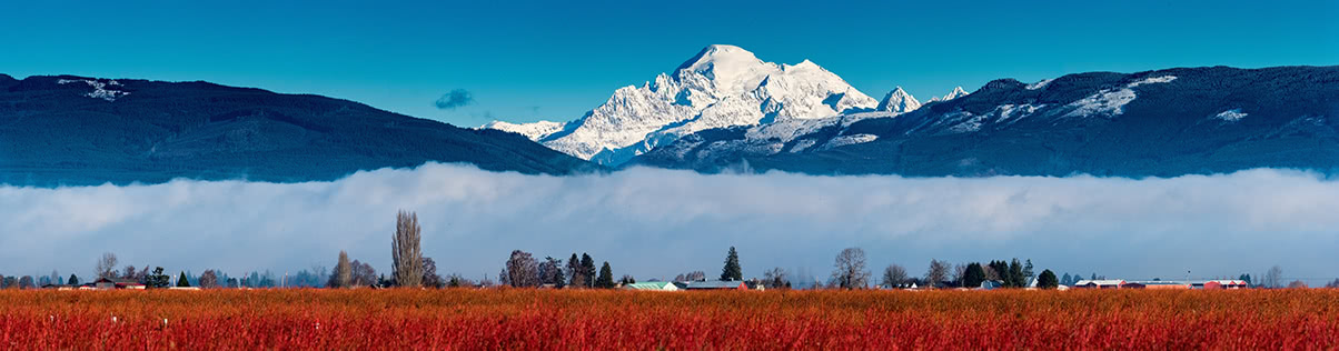
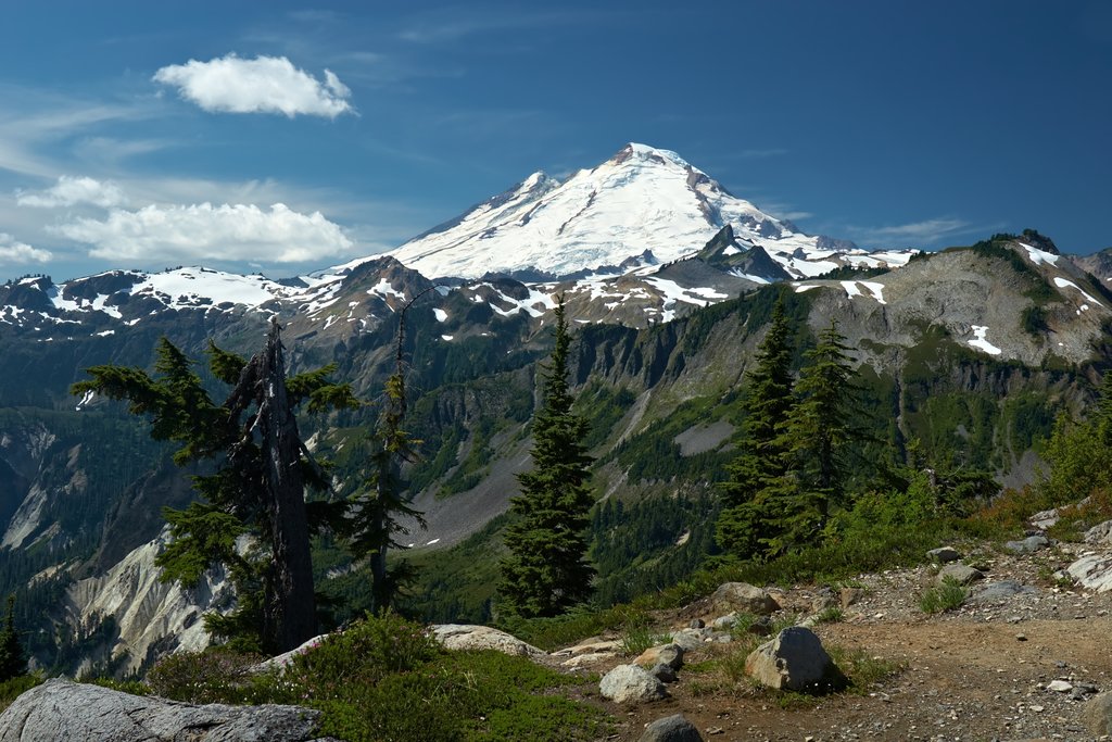
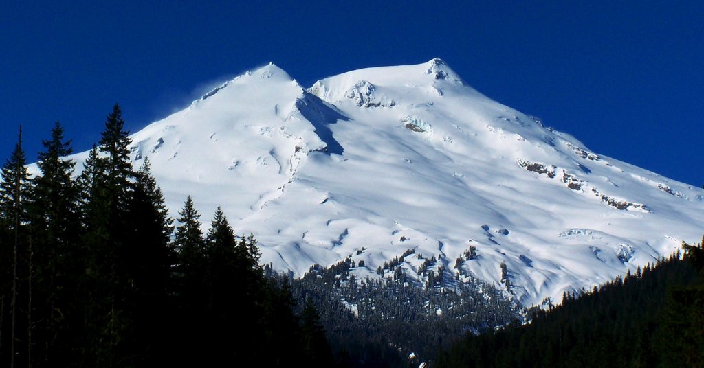
Mount Baker, the tallest peak in the Skagit Range, is an impressive and active, glacier-covered volcano that sits at 10,781 feet in elevation. Not only is Mount Baker the youngest volcano in the Mt. Baker Volcanic field, it’s also the second most heavily glaciated in the Cascade Range volcanoes.
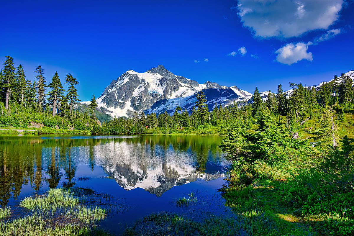
Mount Shuksan, another glaciated Skagit Range massif, sits just east of Mount Baker in North Cascades National Park. Mount Shuksan is one of the most photographed mountains in the Skagit Range and is home to one of the tallest North American waterfalls, Sulphide Creek Falls.
A view of Mount Larrabee and the Pleiades from Winchester Mountain
Additional noteworthy summits in the Skagit Range include the American Border Peak, which, as its name implies, sits just south of the Canada-United States border and Its northerly neighboring peak, Canadian Border Peak. Both of these peaks are highly visible and recognizable from the Mt. Baker region. Together, with Mount Larrabee and the Pleiades, the border peaks form a high ridge of spectacular alpine summits that are known to be a punishing mountaineering challenge.

Mount Larrabee and Tomyhoi Peak
Opinions on the precise location of the Skagit Range tend to vary depending on who you talk to. While typically the range has been said to reach from the Skagit River northwest to the Fraser River, some Canadian maps show the Skagit Range reaching from the Sumallo-Nicolum valley and north along the east side of the Coquihalla River.
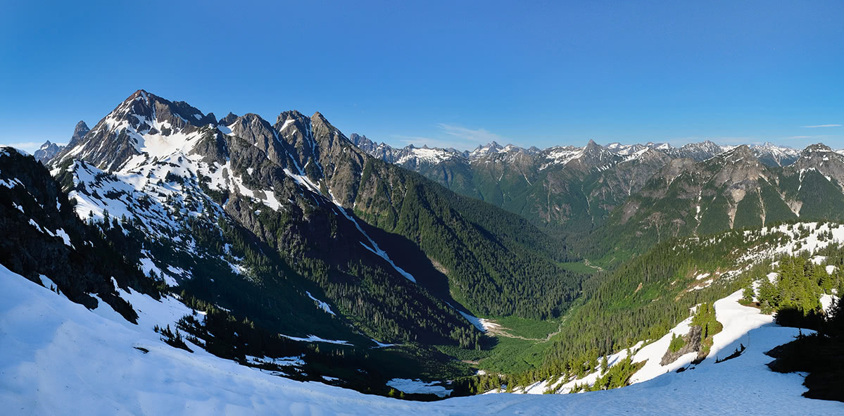
Often referred to as the North American Alps, North Cascades National Park highlights some of the most iconic, craggy peaks in the North Cascade range. Established in 1968, North Cascades preserves some of the most incredible, alpine scenery, snowfields, glaciers, meadows, and summits in the states. Surprisingly, this park is one of the least visited national parks in America, so if you’re looking for a peaceful trek in the woods, this is where you’ll find it. Several popular trails including Sourdough Mountain, The Cascade Pass Trail, Maple Pass Loop, and Hidden Lake offer sweeping views of notable Cascade and Skagit mountain summits including Hozomeen Mountain, Mount Triumph, Mixup Peak, Magic Mountain, Forbidden Peak, and Mount Shuksan.
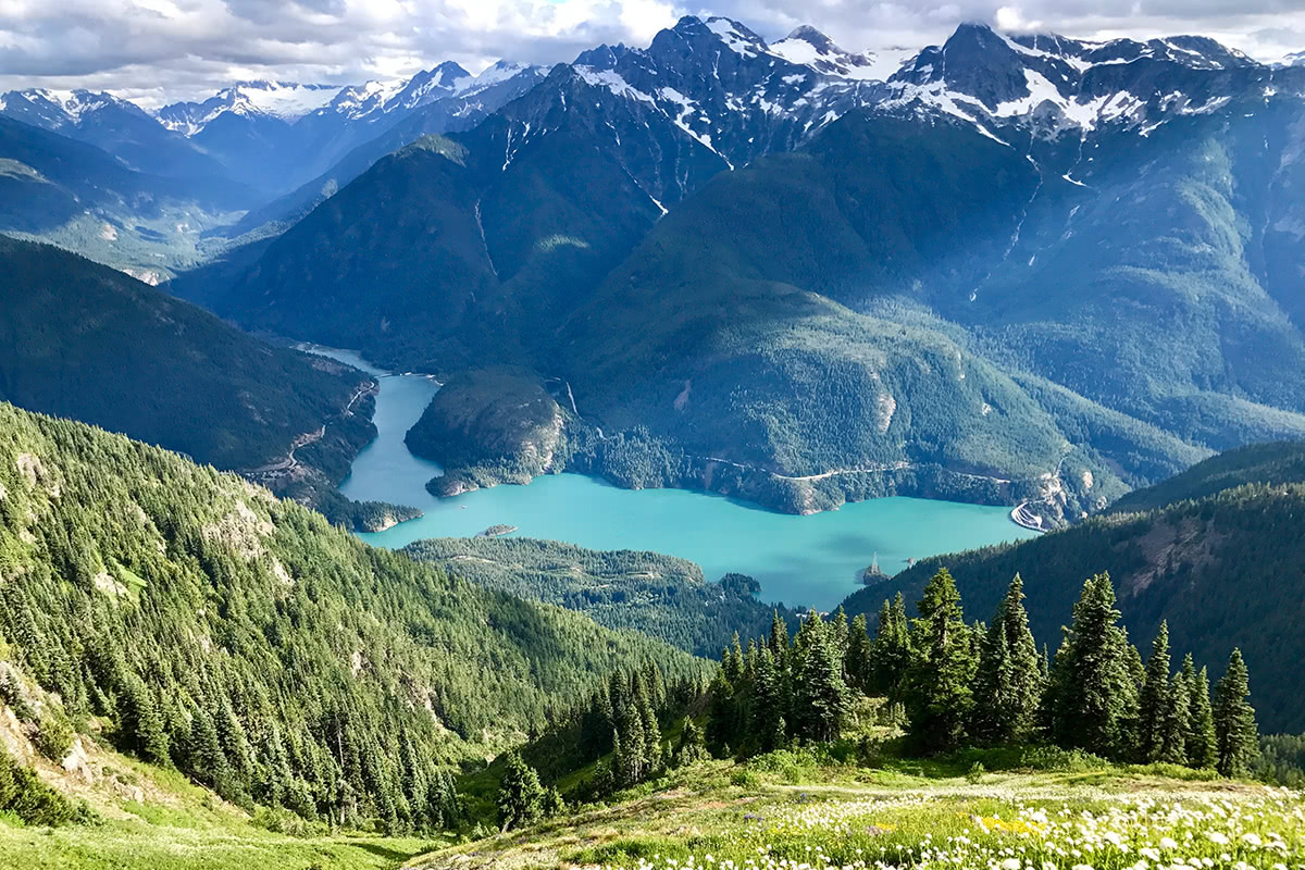
Sourdough Mountain trail near Diablo Lake
A vast expanse of undeveloped wilderness, Skagit Valley Provincial Park is a 32,577 hectare park that extends 14 miles north of the Canada/US border. This rugged mountain landscape was carved out by retreating glaciers and offers a plethora of jaw-dropping mountain scenery. The valley offers more than 31 miles of hiking trails, front and backcountry camping, as well as plenty of fishing potential. This area is known to be rugged and remote, but epic hiking trails like Skyline II Trail and Centennial Trail offer unparalleled views of the infamous Red Mountain, nearby Mount Hozomeen, and incredible alpine meadows.
One of the most visited national forests in the U.S., Mount Baker-Snoqualmie National Forest sits on the west side of the Cascades between the Canadian border and Mount Rainier National Park, spanning more than 140 miles. Needless to say, there’s more than enough to do in terms of outdoor exploration. Here, you’ll find hundreds of miles of trails that traverse world-class mountain scenery, alpine meadows, pristine lakes, and vast old-growth forests. Whether you opt to venture out on an easy or strenuous trek, chances are the illustrious Mount Baker can be found on the skyline. Some of the most popular trails in this area include Table Mountain, Winchester Mountain, and Skyline Divide.
Bellingham, which sits between two major metropolitan areas - Vancouver and Seattle - is known for its year-round hiking, biking, and exploring potential, as well as its proximity to epic outdoor recreation opportunities. In addition to Bellingham’s extensive system of hiking trails and pristine parks, visitors can trek hundreds of miles of trails in the Mount Baker-Snoqualmie National Forest and nearby North Cascades National Park. Not to mention, there are ample accommodations, restaurants, and facilities are available in this quaint coastal town including Hotel Bellwether, a luxurious Bellingham hotel that offers incredibly views of Mount Baker and access to the world-famous San Juan islands.
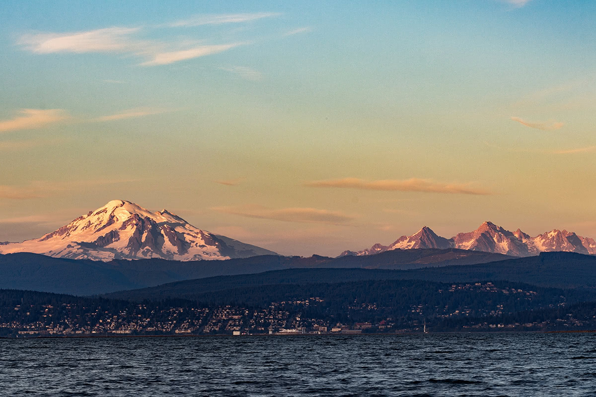
Mount Baker towers over Bellingham
Home to the world’s greatest record snowfall in a single season, Mount Baker ski area and resort is the perfect place to spend a winter getaway in the mountains. Located in Whatcom County, the Mount Baker ski area and accompanying resort averages a whopping 682 inches of snow on average each season and offers 1,000 skiable acres. Home to a 1,500-foot vertical rise, Mt. Baker is the main winter recreation attraction in the Skagit Range. There are a ton of private cabins, guest suites, and private rooms available near Mount Baker, so accommodations shouldn’t be too hard to come by.


ultra
glacier
volcano
cascade-range-9000ers
washington-bulger
smoots-100
chemeketan-18-nw
mountaineers-6-peak-pin
mountaineers-5-peak-pin
mountaineers-bakers-dozen
cascade-volcanoes-pin
mazamas-16-nw-award
washington-ultras
glacier
cascade-range-9000ers
washington-bulger
smoots-100
chemeketan-18-nw
mountaineers-cascade-classic
mountaineers-bakers-dozen
mazamas-16-nw-award
fred-beckey-great-peaks
glacier
washington-bulger
mountaineers-cascade-classic
mountaineers-everett-classic-8
ultra
glacier
volcano
cascade-range-9000ers
washington-bulger
smoots-100
chemeketan-18-nw
mountaineers-6-peak-pin
mountaineers-5-peak-pin
mountaineers-bakers-dozen
cascade-volcanoes-pin
mazamas-16-nw-award
washington-ultras
glacier
cascade-range-9000ers
washington-bulger
smoots-100
chemeketan-18-nw
mountaineers-cascade-classic
mountaineers-bakers-dozen
mazamas-16-nw-award
fred-beckey-great-peaks
The highest peak in the Skagit Range is Mount Baker, at 3,287 m.
The Skagit Range have 263 named peaks.


