
Scan the QR code and open PeakVisor on your phone
British Columbia is home to 7,996 named mountains, including 1 fourteener. The highest is Mount Fairweather at 4,671 m.
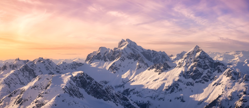
British Columbia, colloquially known as BC, is Canada's westernmost and third-largest province, from the Pacific Ocean to the Rocky Mountains. The province has nearly 7996 named peaks spread across several major mountain ranges, of which Fairweather Mountain (4,671 m/15,325 ft) is the tallest and most prominent.
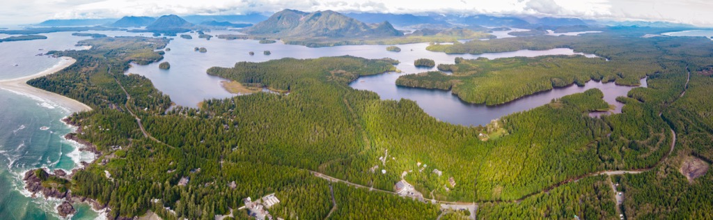
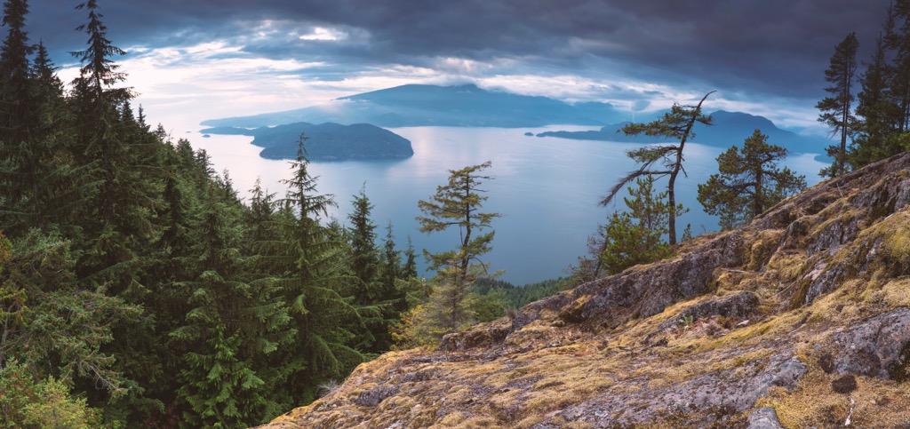
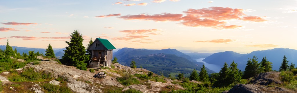
British Columbia (BC) encompasses 944,735 square kilometers (364,800 square miles) of land, which includes nearly 8,000 named mountain peaks, over 27,000 km (17,000 mi) of coastline, around 6,000 islands, over 5,000 glaciers, deep fjords, dense forests, thousands of crystal-clear rivers and lakes, and so much more. BC’s marketing tagline is “Super, Natural,” and it does not disappoint.
BC is the only Canadian province that borders the Pacific Ocean. I know you’re thinking, “Oh, it’s like the Canadian California,” but you’re wrong - it’s actually way better.
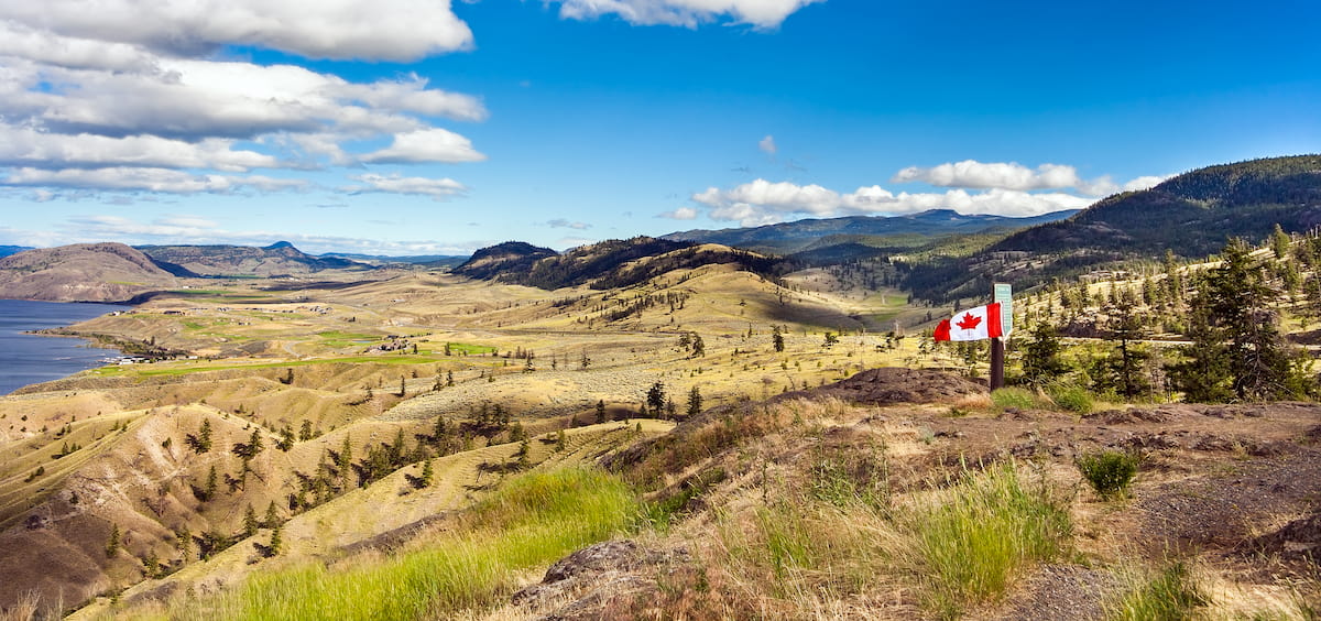
Alberta borders BC on its east side, while the Yukon and Northwest Territories extend to the north. The US state of Alaska touches the northwest corner of BC, and Washington, Idaho, and Montana are just south of the Canada - US border.
After establishing Rocky Mountain Park (Banff National Park), the federal government moved quickly to designate more national parks throughout the Rocky Mountains. They subsequently established Glacier and Yoho National Parks in 1886. With the popularity of municipal parks in BC, the provincial government adopted the Provincial Parks Act in 1908.
There are seven national parks across BC, all within the Rocky Mountains and along the Pacific Coast:

Strathcona Park was the first provincial park established under the new Provincial Parks Act. Strathcona Park protected 250,000 ha (620,000 acres) of the Vancouver Island Ranges from development and settlement. Over 1,000 parks, conservation sites, and historic properties currently reside in the BC Parks portfolio. Some of the noteworthy BC provincial parks are as follows:
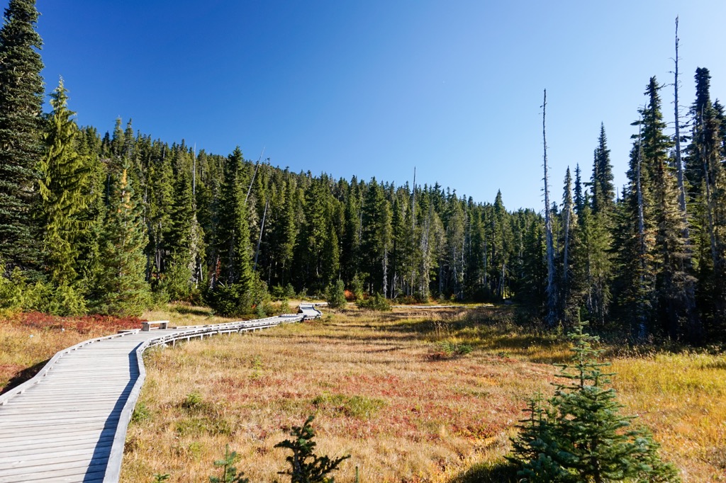
There are too many parks in the BC Parks portfolio to mention all the beautiful places the province has set aside for conservation and recreation. World-class climbing, bouldering, paddling, swimming, mountaineering, snowshoeing, cycling, hiking, backpacking, and horseback riding are only a small assortment of activities in the wilderness of BC.
Nearly all rocks within the Canadian Cordillera in BC are between 10,000 and 400 million years old. However, some areas of the BC mountains contain rocks over 2 billion years old.
The types of rocks found across the mountains of BC range from Paleozoic-era limestone and Cretaceous-era slate and sandstone to the volcanic igneous rocks that erupted during the Pleistocene and even the current Holocene.
The geological mosaic of BC is composed of several terranes that accreted, or joined, to the west coast of Canada starting about 180 million years ago. As the continent moved west after the break-up of Pangea, it over-rode the oceanic tectonic plates. While the oceanic plates subducted beneath North America, their buoyant land masses collided with the west coast.
The crustal fragments and island arcs generally formed in the Pacific Ocean between 380 and 360 million years ago. The collisions of the exotic terranes started thrust faulting, folding, and crumpling the sedimentary rocks along the continental margin in what is known as the Sevier orogeny.
The Sevier orogeny is the formation event responsible for most BC mountain ranges west of the Rockies. The primary cause of the Sevier orogeny was the subduction of the Farallon and Kula plates beneath the west coast. As their terranes propelled into the continent, they pushed the pre-existing sedimentary layers out of the way.
The collision of these exotic terranes with the west coast created immense pressure, heating the rock layers and allowing them to be malleable and folded. The further compression of the sedimentary layers caused buckling and shearing as older rock layers pushed upon the younger rock to the east.
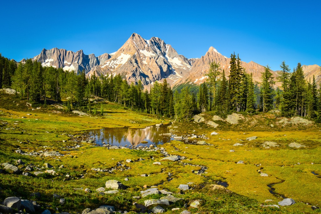
The rough timeline of mountain building in BC starts with the formation of the Columbia Mountains, which include the Purcell, Cariboo, and Monashee Mountain subranges. The Columbia Mountains comprise Precambrian metasedimentary, Paleozoic and Mesozoic sedimentary, and volcanic rock intruded by significant granite batholiths.
Some of the incredible granite batholiths of the Columbias are in Bugaboo Provincial Park, in the Purcell Mountains. The granite spires of the park formed when magma intruded the sedimentary crust and slowly cooled underground. Over millions of years, the overlying rocks eroded to expose the incredible spires of the park.
Around the same time as the formation of the Columbia Mountains, the Omineca Mountains formed in the north end of the province. Like the Columbia Mountains, the Ominecas have a granitic core called the Omineca Intrusions. The base of the Omineca Mountains comprises Proterozoic through Jurassic-era sedimentary, metamorphic, and volcanic rocks.
As the exotic terrane approached the subduction zone near the end of the Jurassic, magma intruded the core of the terrane. The tectonic collision caused the rock's bending, buckling, and stacking, which were then at the mercy of erosive forces for millions of years. Wind, water, and glacial ice ground away the softer and weaker rocks and left parts of the granite core exposed.
As the Columbia and Omineca Mountains were forming, the Intermontane Belt was accreting to the coast of BC. The Intermontane Belt fills the interior of BC between the Columbia and Coast Mountains. BC’s Interior Mountains are not as dramatic as their neighboring ranges, and massive plateaus cover many regions of the interior.
The Cassiar Mountains, Stikine Ranges, and Skeena Mountains are the northern mountains of the interior. The Stikine Plateau is northwest of the Stikine Ranges. South of the Skeena Mountains, the Nechako, Fraser, and Thompson Plateaus dominate the topography.
The underlying terrane that composed the Interior Plateau is over 400 million years old; however, recent geological events created the region’s topography. During the Tertiary era, tectonic forces lifted the interior and subjected it to erosive forces that rounded peaks and filled valleys with sediment deposits.
Furthermore, volcanic forces filled valleys and depressions with lava flow. Volcanoes were active during the Eocene on the Thompson Plateau and the Miocene and Pliocene on the Fraser Plateau. In the north, volcanoes are still active, and eruptions have occurred in the past 10,000 years to form the Nazko Cone.
The Canadian Coast Mountains dominate the coast of BC. They are divided into the Boundary Ranges in the north, the Kitimat Ranges in central BC, and the Pacific Ranges along the southern coast. The terrane accreted to form the Coast Mountains formed over 180 million years ago in the Pacific Ocean. The Coast Mountains formed following BC’s Interior Mountains.
Significant volcanic activity subjected the sedimentary and volcanic rocks of the Coast Belt during its accretion, creating many batholiths. The Coast Intrusions are significant batholiths of granodiorite and quartz diorite that form the backbone of the Coast Mountains.
The final addition to the west coast came as Kula Plate was subducted beneath the continent, and the Insular belt accreted to the coast. The Insular belt consists of two significant terranes, Wrangellia and Alexander, and the smaller Pacific Rim and Crescent terranes.
The significant ranges of the Insular belt include the St. Elias Range in northern BC and the Insular Mountains (Haida Gwaii and the Vancouver Island Ranges). The tallest peak in BC, Fairweather Mountain, is in the St. Elias Mountains, along the border with Alaska.
The folding and crumpling of the Insular belt created a mountain range west of the Canadian Coast Mountains; however, most of the range is underwater. Vancouver Island is among the largest exposed areas of the Insular Mountains. The 6 km (3.6 mi) layer of basalt lava that comprises most of the Wrangellia terrane is visible across the island.
The accretion of the Insular belt was a significant factor in the Laramide orogeny, which is responsible for the formation of the Canadian Rockies. Until the Insular belt collided with the west coast, the mountain building extended west, starting with the Columbia Mountains, then the Interior Mountains and plateaus, then the Coast Mountains, and finally the Insular Mountains.
About 75 million years ago, as the Insular belt pressed against the already broken and compressed terrane, the stress from the collision was transferred inland. The force of the tectonic collision compressed, folded, buckled, and uplifted the Paleozoic limestone along the ancient continental margin to form the Rockies.
The older and deeper layers of marine sedimentary rocks were pushed up and east upon the younger Cretaceous-era sandstone and shale through thrust faulting. As the Rockies lifted, they became the tallest mountains in the Cordillera and the new continental divide.
Near the end of the Laramide orogeny, the colliding tectonic plate shifted direction and stopped the eastward compression of the continent. This reversal of movement caused the Columbia Mountains to pull away from the new Rockies. Subsequently, the land between the ranges dropped to form the Rocky Mountain Trench along the fault line.
Following the mountain-building events of BC, the world cooled off during the Pleistocene, setting off a series of glacial events across the province. As the climate cooled, the mountainous precipitation would fall as snow and accumulate from year to year.
The accumulating snow would consolidate and compress the older layers, slowly turning them into ice. Eventually, with enough mass and pressure, ice began to flow downward. Across BC, glaciers formed at upper elevations, cutting away rocks through their immense erosive powers. Glaciers would grind out valleys, rip away mountain peaks, and smooth anything in their path like gigantic, slow-moving rivers.
Glaciers created most of the province's topography as we know it today. Glaciers formed the mountain valleys, cirques, and peaks. As the glaciers flowed out of the upper elevations, they created steep-sided U-shaped valleys. Following the Pleistocene, the water level rose, and the glacier-created valleys along the coast filled with water to create rugged fjords.
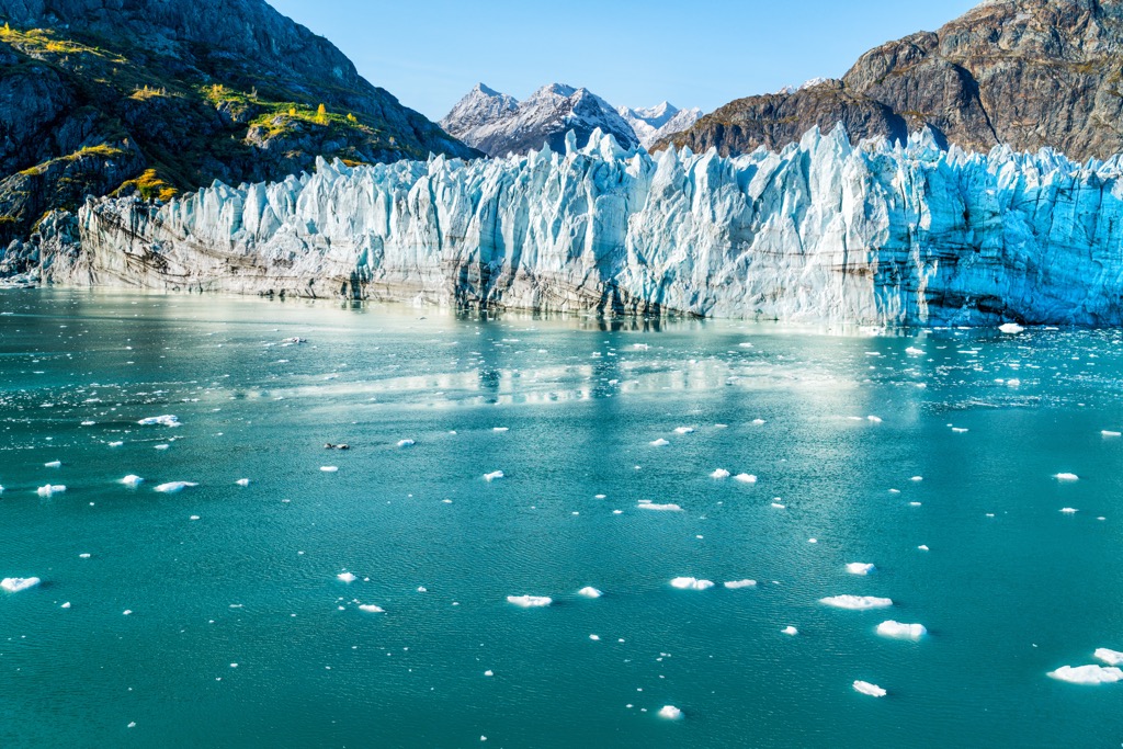
At the height of glaciation during the Pleistocene, the glaciers across the province merged to form a massive ice sheet. Known as the Cordilleran ice sheet, it covered BC and western Alberta in as much as 2 km (1.2 mi) of ice. Over about 4,000 years, the Cordilleran ice sheet melted, leaving behind formations of glacial debris.
Often, glacial debris would deposit sediment in low-lying areas or push it around, creating large piles. Moraines, kames, drumlins, and eskers are all some of the glacial formations created across BC. Most major valleys, such as the Rocky Mountain Trench, are shaped from glacial deposits.
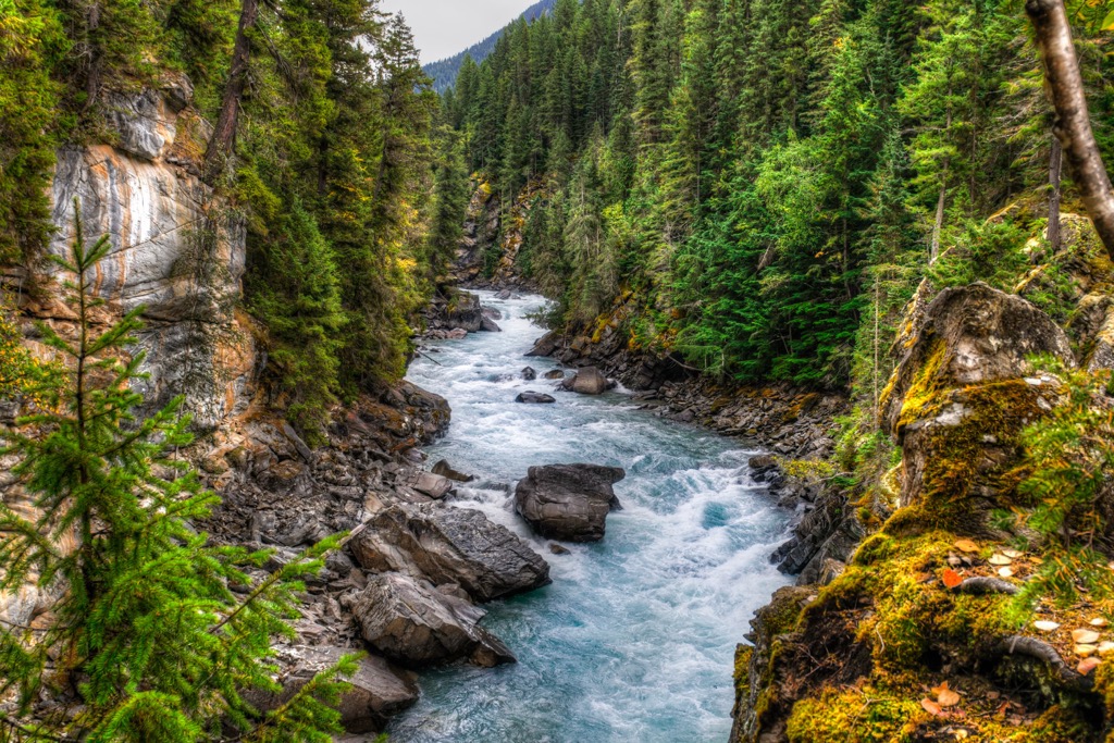
Following the Pleistocene, water, in the form of creeks and rivers, further sculpted the topography. The glacial runoff created large incisions across the interior plateaus, and rivers continue to erode the channels even deeper.
The creeks and rivers cut particularly deep in the Coast Mountains, where the elevation rapidly drops to the Pacific. Compared to the gentler decline in the eastern mountains, the sharp decline creates fast-flowing waterways with great erosive power. As such, steep gorges are more prevalent in the mountains along the coast.
Due to the varied topography and climates across BC, many distinct ecosystems exist. The province generally experiences a westward flow of cool, moisture-laden air from the Pacific Ocean. The topography then affects the airflow, creating many distinct, localized climates and ecosystems.
Temperate rainforests dominate western BC, where the cooling of oceanic air causes massive annual precipitation as it’s pushed over the Coast Mountains. Douglas fir, western redcedar, western hemlock, Sitka spruce, amabilis fir, and yellow-cedar are the primary tree species along the coast.
BC’s rainforests are some of the densest coniferous forests and are home to some of the world's largest trees. Cathedral Grove and Carmanah Walbran Provincial Park are just two preserved lands featuring ancient giants and old-growth forests. Western red cedars can grow upwards of 60 m (200 ft), and Sitka spruce upwards of 70 m (230 ft) and 2 m (7 ft) in diameter. Unfortunately, the vast majority (over 99%) of these old-growth forests have been lost to the logging industry over the last century and a half. Only small parcels of genuine old-growth forest remain in the province’s remote corners.
Pacific Rim National Park Reserve is home to the Cheewhat Giant, the largest living western red cedar and known tree in Canada, and one of the largest trees in the world. It is over 56 m (183 ft) tall and 6 m (20 ft) wide.
The rainforests of the valleys and slopes throughout the coastal mountains transition through a narrow subalpine belt of forests of mountain hemlock and amabilis fir. The alpine is rugged and moist along the coast, where glaciers still dominate much of the high Pacific and Boundary ranges.
The interior is in the rain shadow of the Coast Mountains and is relatively arid. The southern interior is also warm; steppe vegetation dominates the valleys and basins. Sagebrush, ponderosa pine, or Douglas-fir are common. The thick bark of the ponderosa pine and Douglas fir allow them to resist the grass fires that can rage across the plateaus.
The low valleys are incredibly hot in the interior and are dominated by sagebrush and Ponderosa pine. However, the cooler upper slopes and plateaus feature vast forests of Douglas-fir, lodgepole pine, Engelmann spruce, and subalpine fir.
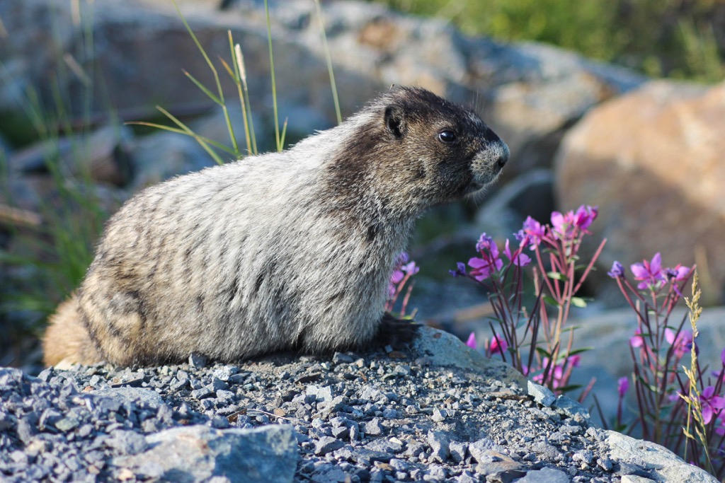
The uppermost elevations are home to alpine flora, where rocky outcrops and relict glaciers dominate the landscape. Mountain goats, pika, and Columbia ground squirrels inhabit the alpine. Hoary marmots thrive across the mainland alpine, while Vancouver Island marmots are endemic to the Vancouver Island Ranges.
In the province's north end, the sub-boreal spruce-pine forests are composed of lodgepole pine and white spruce. As the sub-boreal forests transition to the true boreal forests of the upper latitudes, subalpine fir, black spruce, tamarack, trembling aspen, and shrublands of willow and birch are added to the mix. Grasslands dominate the rounded summits of northern BC.
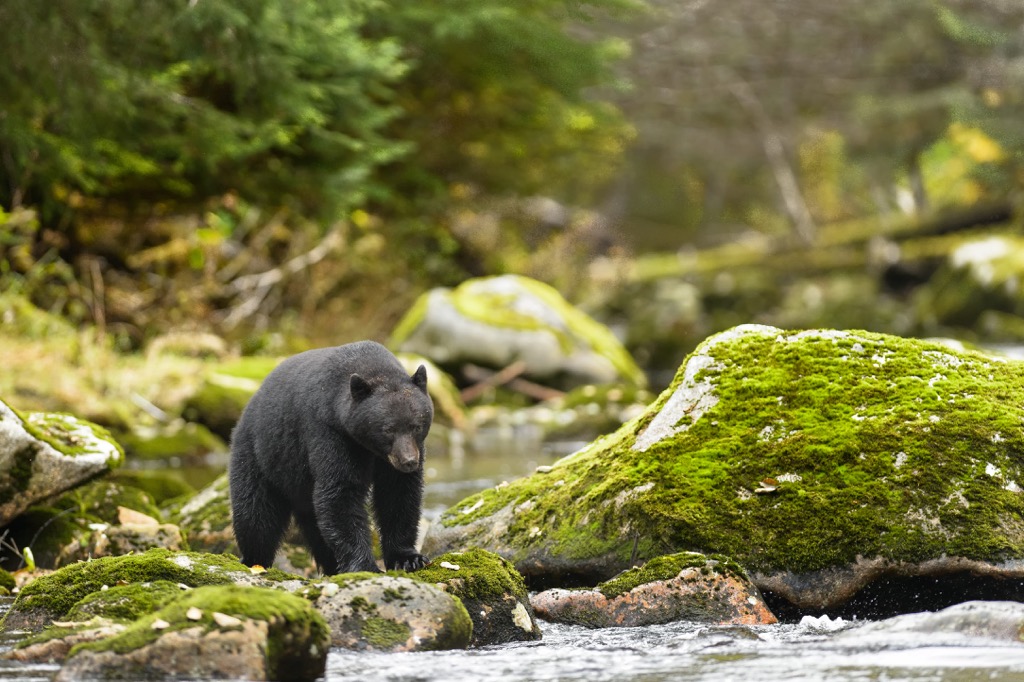
Muskegs are common in the boreal lowlands, where the land drain slowly. Biologists estimate that 90% of the world’s population of stone sheep live in northern BC. Black bears, mountain goats, Columbian ground squirrels, cougars, moose, mule deer, whitetail deer, grizzly bears, and caribou inhabit most of BC. However, unique ecosystems also have endemic and/or distinct wildlife.
For example, the isolation of Vancouver Island has created a rare ecosystem. The island has a large population of black bears; however, there are no resident grizzly bear populations. Columbia blacktail deer are all over the island but are only found in the southwest corner of the mainland and further south in the US. In addition to grizzly bears, mountain goats, and wild sheep, such as Rocky Mountain bighorn, California bighorn, Dall’s sheep, and stone sheep are absent from the island.
Hoary marmots are ubiquitous across most of British Columbia, including Whistler Mountain, named for the sound of the marmots’ whistle.
The northwest coast of BC is known to have a significant population of grizzly bears; the Khutzeymateen Provincial Park exists as a grizzly bear sanctuary.
The Cordilleran ice sheet blanketing British Columbia was one of the main impediments to the habitation of the province. As the ice sheet melted and the province’s ecology reestablished, the first inhabitants arrived in BC between 12,000 and 14,000 years ago. The original inhabitants were migratory families of hunter-gatherers who tracked megafauna like woolly mammoths.
The first inhabitants came from the north and likely migrated down the west coast, taking advantage of the ice-free terrain along the coast to hunt and forage. The Kootenay area in southeast BC was ice-free as early as 15,000 years ago and shows evidence of habitation dating back 11,000 years.
The Ktunaxa are the First Nation (indigenous) peoples currently inhabiting the Kootenay area and are possibly the descendants of those that arrived 11,000 years ago. Archeological evidence from the region suggests that all their technologies were developed locally, without evidence of displacement or emigration of the people.
The Ktunaxa had a vast territory extending from the valleys of the Columbia and Kootenay Rivers to the eastern slopes of the Rockies. The Kananaskis passes between Height of the Rockies Provincial Park in BC and Peter Lougheed Provincial Park in Alberta was one of many passes the Ktunaxa used to travel to and from the plains to hunt buffalo.
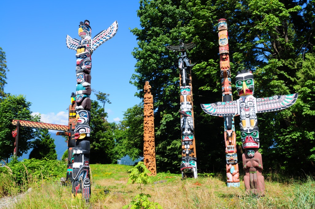
While the Ktunaxa established themselves inland, many cultures developed along the coast. The Tlingit, Haida, and Coastal Salish cultures are some of the most prominent.
The Tlingit culture is present along the north coast of BC and parts of Alaska; their origin as a specific culture occurred about 10,000 years ago near the mouths of the Skeena and Nass Rivers.
The Haida are another ancient culture, and they primarily inhabit the island of Haida Gwaii and the adjacent archipelago. Their stories and archeological evidence corroborate that the Haida ancestors lived alongside glaciers, with people arriving at least 12,000 years ago.
Because they arrived at the tail end of an ice age, Haida Gwaii likely resembled a tundra for its first 5,000 years of colonization. Oral traditions of the Haida share that they were present when the first tree, a lodgepole pine, started growing on their island. Around 7,500 years ago, red cedars began to dominate the west coast, transforming their culture to center around the coastal “tree of life.” The Haida are highly regarded for their craftsmanship in making totem poles and other carvings.
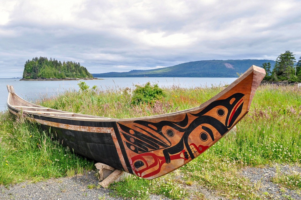
In the southwest corner of British Columbia is evidence that the Coastal Salish culture existed at least 5,000 years ago. Around this time, most coastal cultures also transitioned from a nomadic lifestyle to a semi-sedentary one. The abundant resources along the coast allowed for complex hierarchies to develop, creating an organized society.
It was common for families to congregate in winter in cedar-plank houses along the coast. During the summer, the people would fan out through their territory, following a seasonal round of hunting and gathering where the land provided seasonal resources.
The Interior Salish likely migrated inland from the west coast to inhabit most of the southern interior plateaus. Other cultures inhabited the interior before the arrival of the Interior Salish about 4,000 years ago; however, those other groups were displaced and possibly disappeared completely. One of the theories on why the Salish culture thrived inland while the others did not was the Salish fishing knowledge. Fishing allowed the Interior Salish culture to thrive, while a changing climate made hunting for big game more challenging, ultimately leading to the downfall of other cultures.
Indigenous trade routes crossed the province, trading obsidian, chert, and other local resources. Eulachon (candlefish), a small, greasy fish harvested along the coast, was traded in abundance across the province.
It wasn’t until the eighteenth century that Europeans became established across the province. Russians were among the first to interact with the First Nations of BC while sailing along the coast hunting otters and other fur-bearing sea animals. Spanish and British soon followed, sending fleets to explore and claim the west coast.
The fur traders also came from the East, across land, during the early nineteenth century, employing locals to hunt, trap, and expand the acquisition of North American furs for export. The Hudson’s Bay and North West Companies established trading posts, effectively establishing a permanent British presence in BC.
The fur trade ushered in an era of utter destruction for the indigenous population. Smallpox and measles were some diseases that ripped through the uninoculated indigenous communities, often killing whole villages and 90% of entire cultural groups.
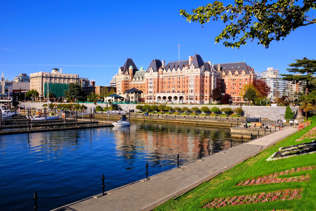
The colonial history of British Columbia is especially present in the architecture of the historic buildings in the provincial capital of Victoria. Victoria started in 1843 as one of the many trading posts and grew to become the capital of the colony of Vancouver Island. Vancouver Island coalesced with the territory of British Columbia in 1866. While Canada was established in 1867, it wasn’t until 1871 that British Columbia joined the federation as a province.
The railway played a significant role in the settlement of BC, as it was a national goal to create a railway that linked Canada’s East to its West. Essentially, the completion of the Canadian Pacific Railway halted the northward expansion of the US and unified Canada as a country.
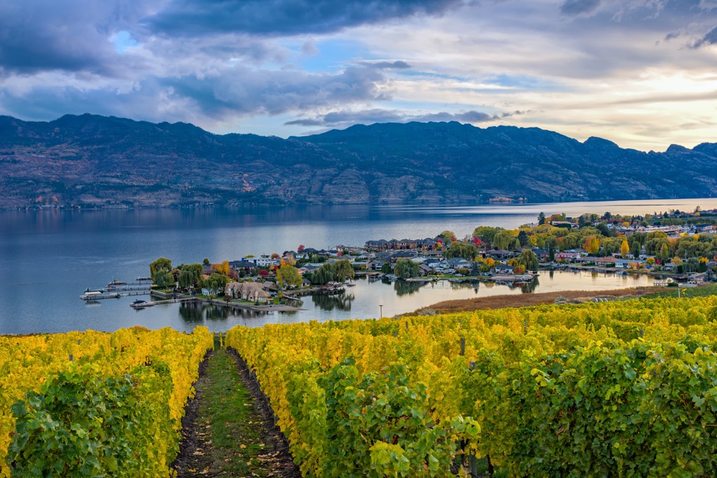
Agriculture, mining, forestry, and fishing have historically been the primary industries in BC. The province was home to several gold rushes in the nineteenth century in the Fraser Canyon and the Cariboo, Omineca, and Cassiar Mountains. The gold rushes attracted settlers to the areas, who began to graze cattle and grow fruit. The orchards and vineyards of the Okanagan are known across the country and the world.
While most of its industry relies on the extraction of natural resources, the province of British Columbia is protective of its natural areas. There are over 1,000 parks, conservancies, ecological reserves, and historic sites within the BC Parks portfolio that protect and conserve the natural resources of BC.
The mild climates along the coast and Okanagan have fostered tourism for over 100 years. The industry continues to grow and includes hundreds of ways to experience the province’s supernatural beauty.
British Columbia has incredible natural beauty. You can kayak between the coastal islands amongst the whales, ski the backcountry or the resorts, or hike the craggy mountains and gaze at the spectacular landscape. The following are some of the popular attractions and trails in BC.
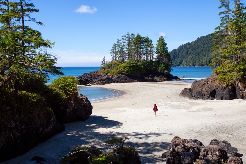
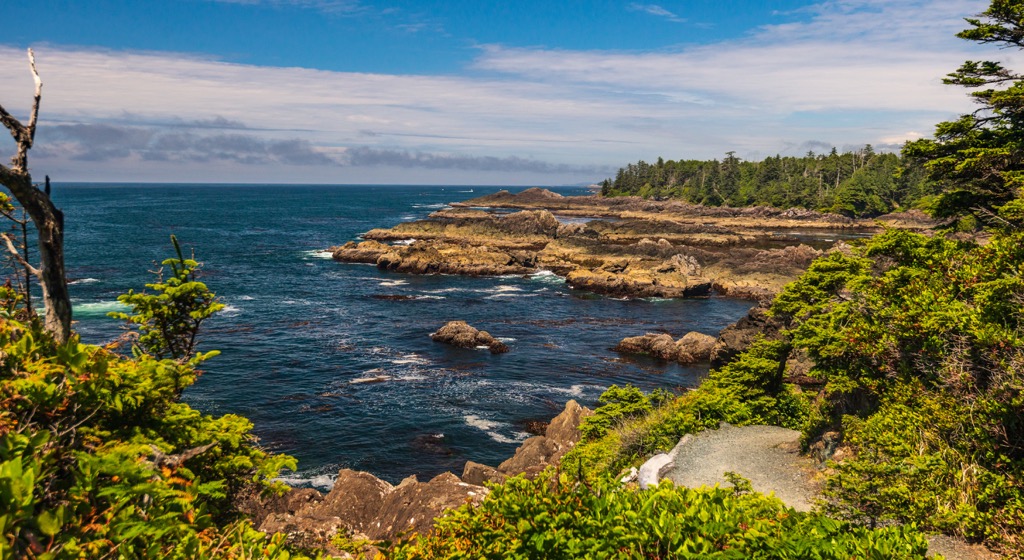
I don’t think any trail is as synonymous with BC hiking as the West Coast Trail on Vancouver Island. The West Coast Trail is part of the Pacific Rim National Park Reserve, Long Beach, and the Broken Group Islands.
The trail, part of many bucket lists, is 75 km (45 mi) between the communities of Bamfield and Port Renfrew. It features sandy beaches, rocky shores, river crossings, and dense cedar-hemlock temperate rainforest. There are bridges, ladders, and cable cars to help hikers traverse the rugged terrain.
The trail can take up to seven days; however, there are many opportunities for shorter excursions or day hikes along the route. Hikers will witness the powerful tides and ocean swells, the uncertain west coast weather, two lighthouses, and over 20 shipwrecks.
The trail originated in the early 1900s after the sinking of the Valencia along the west coast. The Dominion Life Saving Trail helped shipwrecked passengers and sailors escape the brutal west coast of Vancouver Island and bring them to safety. The trail was later incorporated into Pacific Rim National Park Reserve.
The 180 km (108 mi) route along the central coast is Canada’s longest hut-to-hut hiking trail. The trail originated in 1992 from local groups hoping to connect the remaining stands of old-growth forest along the mainland coast near Powell River.
The trail traverses old-growth forest, coastal shorelines, rivers, creeks, and panoramic mountain tops. With over a dozen unguarded cabins along the way, the Sunshine Coast Trail is a breathtaking journey through BC’s backcountry.
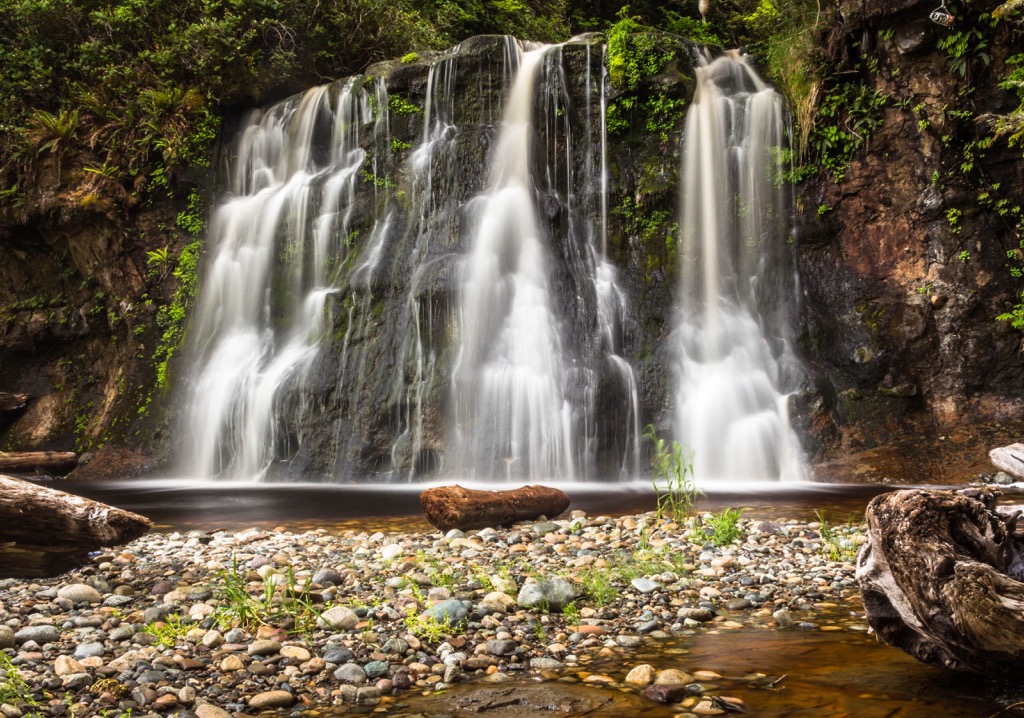
Icy mountain streams, steamy hot springs, towering mountain peaks, serene forests, meadows, crystal clear lakes and rivers, precipitous glaciers, deep canyons, craggy cliffs, and tumbling waterfalls are all part of the experience of Kootenay National Park.
The national park is in southeast British Columbia and is accessible mainly from Highway 93. The park has front country camping and interpretation facilities and over 1,400 square kilometers (540 square miles) of backcountry to explore. Some of the popular hiking trails include the routes to Cobb Lake, Dog Lake, and Floe Lake. The trek to the Stanley Glacier is only about 8 km (5 mi) roundtrip.
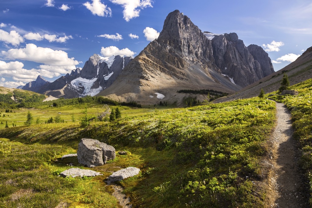
The park is home to the iconic Rockwall hike, which takes you past a towering limestone cliff aptly called ‘the Rockwall.’ The multi-day excursion hikes through the alpine meadows and passes by Floe Lake. If the Rockwall is too intense or time is limited, a short hike crosses a bridge over the beautiful Vermillion River to the Paint Pots, where you can view the iron-rich ochre beds.
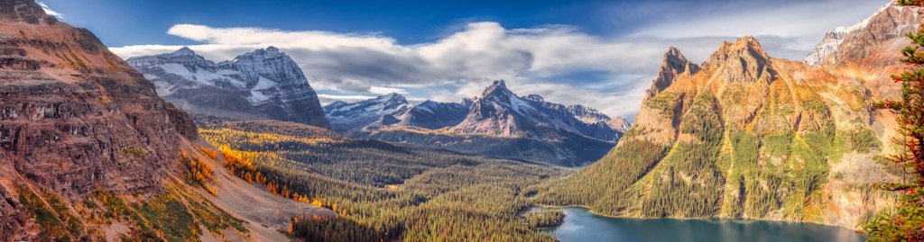
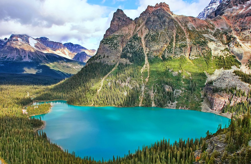
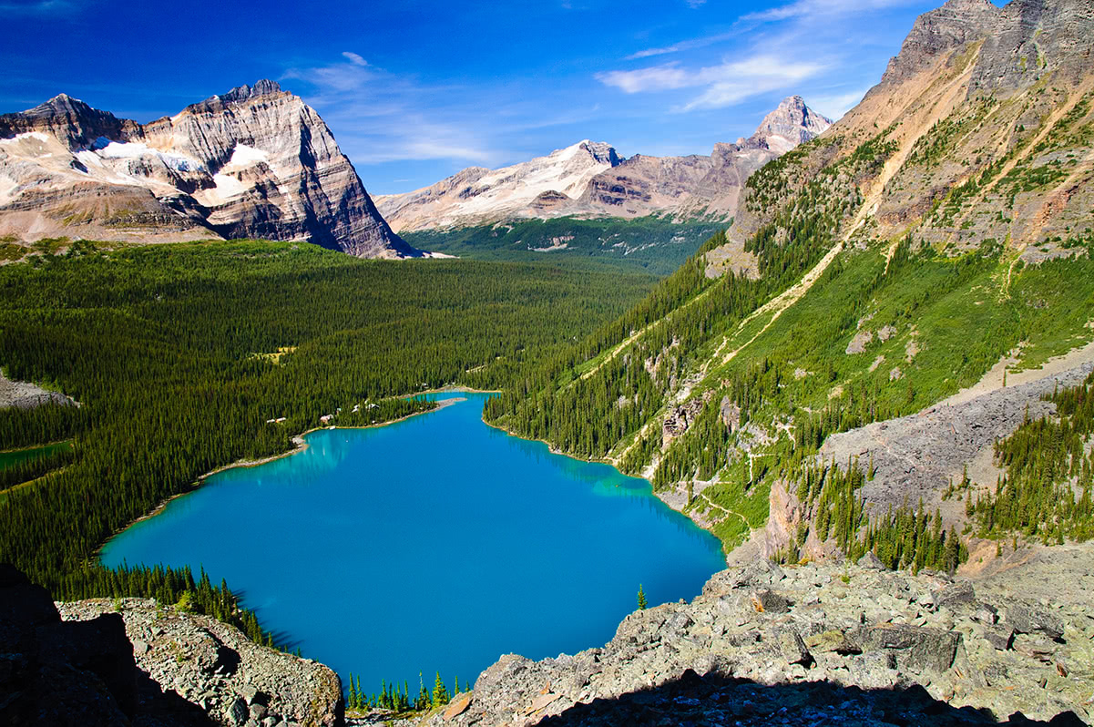
Yoho National Park is in southeastern British Columbia in the Canadian Rocky Mountains. The park is adjacent to Banff National Park in Alberta and Kootenay National Park to the south.
Accessible from the Trans-Canada Highway, Yoho National Park has exceptional sightseeing and hiking opportunities. The park is home to the incredible Takakkaw Falls and the pristine Lake O’Hara.
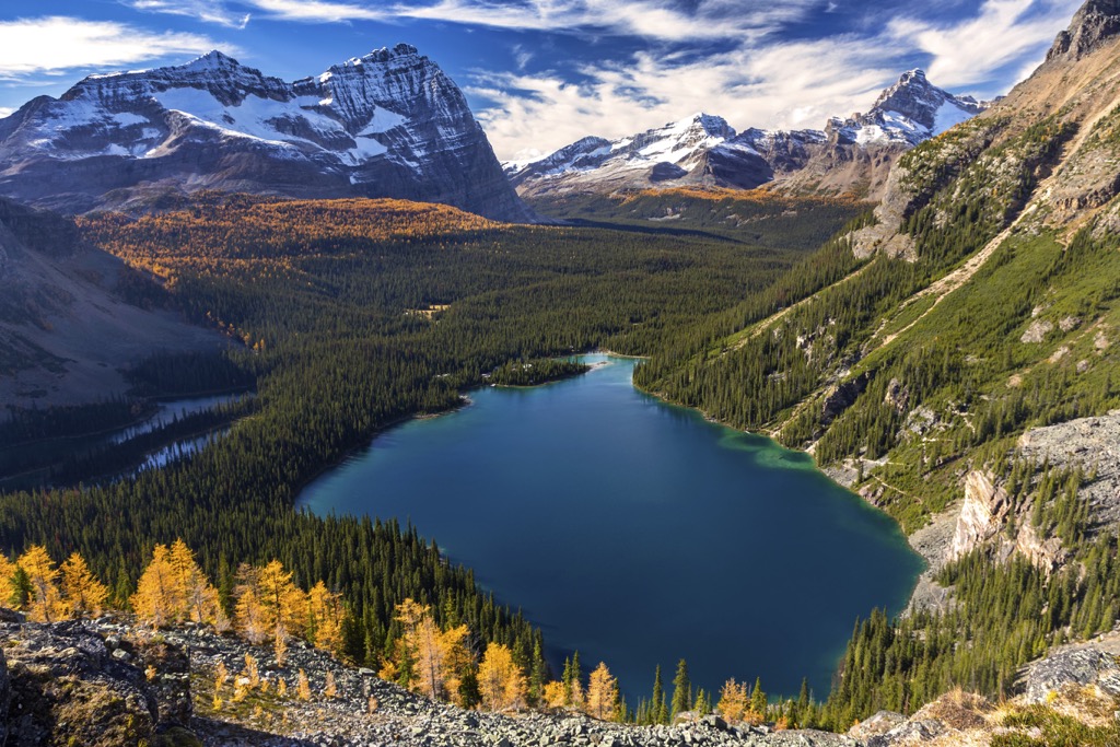
Some popular hiking trails are the Yoho Pass, Twin Falls, Goodsir Pass, and Ottertail Valley. Adventurers can hike from Yoho National Park over the Goodsir Pass and connect with the Rockwall Trail in Kootenay National Park.
Yoho National Park is also home to the Burgess Shale, adjacent to the community of Field, BC. Guided tours are available to take visitors to the quarry site, where you view and find fossils from the middle Cambrian, about 508 million years ago. The fossils at the Burgess Shale sites are exceptional for their incredible preservation of the soft parts of flora and fauna.
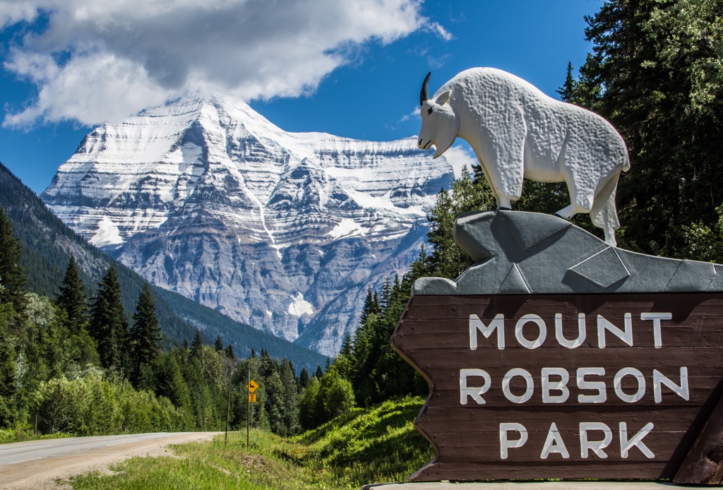
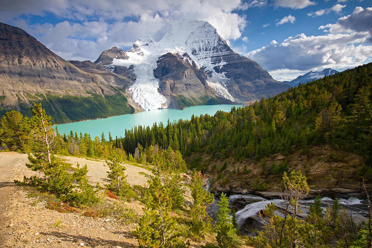
Named for the iconic Mount Robson, the tallest peak in the Canadian Rockies, Mount Robson Provincial Park is located along the western slopes of the Canadian Rockies. The park is adjacent to Jasper National Park and is near Willmore Wilderness Park, Wells Gray, and Bowron Lakes Provincial Parks.
Mount Robson is a behemoth of a mountain covered in cascading glaciers and impenetrable cliffs. The first recorded climb of the peak was a 1913 ascent by a team led by Conrad Kain.
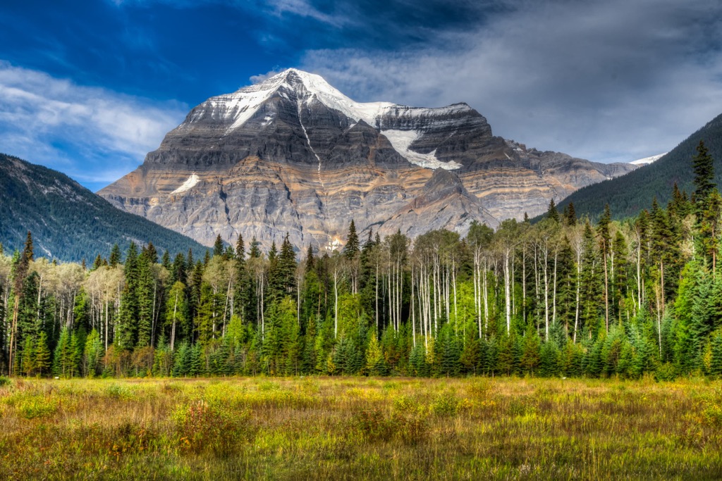
The park has front-country, vehicle-accessible camping, and seldom-trodden backcountry areas. There are numerous opportunities for paddling, hiking, caving, climbing, mountaineering, cycling, fishing, and winter recreation.
Some popular hikes are the Berg Lake Trail, the Yellowhead Mountain Trail, and the Moose River route. Many scenic waterfalls, salmon-filled rivers, and diverse flora and fauna exist.
Located on Vancouver Island at the height of the Vancouver Island Ranges, Strathcona Provincial Park was the first provincial park established in BC. The park is filled with snow-covered peaks, lakes and alpine tarns, crystal clear rivers, creeks, streams, and cedar-hemlock forests.
While Buttle Lake and the Forbidden Plateau offer easy access, hiking into the backcountry is the best way to experience most of the park’s splendor. Some gems include the Golden Hinde, the tallest peak on the island, and Della Falls, which descends 440 m (1,440 ft) over three cascades, making it one of the highest waterfalls in Canada.
The park is home to Strathcona Park Lodge and Outdoor Education Centre, which offers wilderness skills training. Other activities include climbing the more than 150 routes and Crest Creek Crags, fishing and paddling on Buttle Lake, or hiking the many trails. A wide variety of trails range from short ambles, like Lady Falls and Auger Point, to multi-day treks to the remote corners of the park.
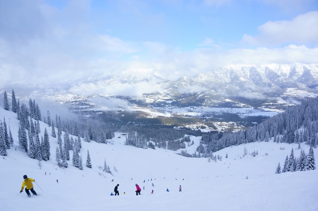
For skiing and snowboarding enthusiasts, there are more than 80 ski resorts in British Columbia, mainly in the region's southeast. It is the primary destination for skiing in Canada.
The largest ski resort in British Columbia and all of Canada is Whistler Blackcomb, with more than 200 km (124 mi) of slopes and more than 20 ski lifts.
Other areas for skiing in British Columbia, with more than 50 km (31 mi) of slopes and three ski lifts, include the following:
British Columbia covers a vast area with many types of terrain, including coastal lowlands, granite spires, jagged limestone peaks, alpine meadows, expansive highlands and plateaus, steep river canyons, rugged coastal fjords, and so much more. There are so many incredible places to visit in BC; the following are some of the province’s major cities where one of your adventures may begin.
Located on the Saanich Peninsula of southern Vancouver Island, Victoria is the capital city of BC. The settlement started as a trading post for the Hudson’s Bay Company, drawing settlers from far and wide. The city has a deep colonial history, visible within the architecture of many old government buildings and hotels along the harbor.
Victoria is close to many incredible natural and wilderness areas. Some of my favorite places for nature walks while I’m in Victoria are the Swan Lake Christmas Hill Nature Sanctuary and John Dean Provincial Park.
Other nearby places I enjoy hiking are Gowlland Tod Provincial Park, which has fantastic views across the Saanich Inlet, and Goldstream Provincial Park, featuring several waterfalls at the end of some short hikes.
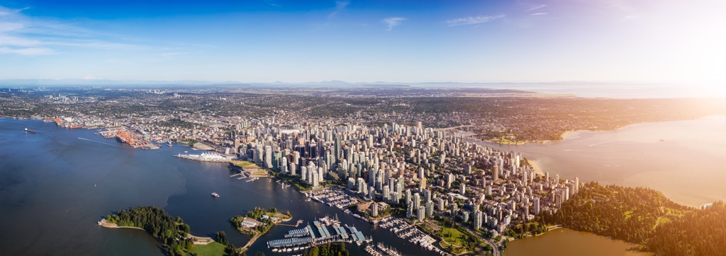
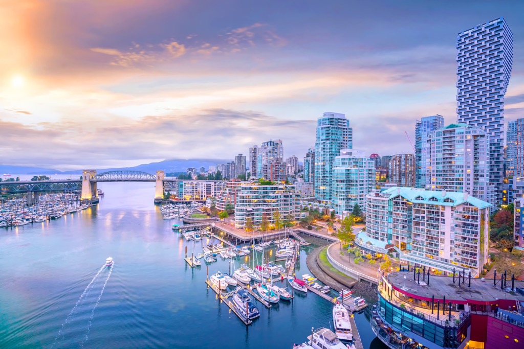
Many people mistakenly assume that Vancouver is the capital because it is the largest city in British Columbia. However, Vancouver is one of the province's youngest cities, owing its growth to its prominence as a major port during the latter nineteenth century. People also assume Vancouver is on Vancouver Island when it is actually on BC’s mainland.
The city has many cultural attractions, such as museums, performing arts, art galleries, and a vibrant nightlife. The city also has annual festivals, such as the Pacific National Exhibition. Vancouver is a fit, outdoors-oriented city (especially during the summer, when the weather is ideal), and walking paths, such as those in Stanley Park, are abundant. Other trails near the city include St. Marks Summit, Quarry Rock, Norvan Falls, and the Grouse Grind.
Adjacent to the Vancouver Metropolitan Area, locally known as the Lower Mainland, many stunning wilderness areas are large enough for multi-day excursions. Some nearby parks include Garibaldi Provincial Park, Pinecone Burke Provincial Park, Golden Ears Provincial Park, and Mount Seymour Provincial Park.
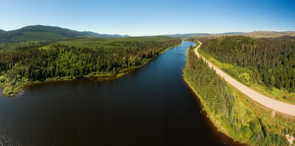
Prince George is the capital and commercial and service center for northern BC. Located in the Regional District of Fraser – Fort George, most northern excursions in the province pass through Prince George. The city has some great trails for local hiking, such as the Greenway Trail, the McMillan Creek Loop, and Troll Lake. You can find Sugarbowl-Grizzly Den and Stuart River Provincial Parks for local wilderness and wildlife viewing a little way from the city.
Some of the province’s most spectacular and pristine parks and wilderness areas are north of Prince George. You can visit Monkman, Pine Lemoray, Gwillim Lake, Northern Rocky Mountains, and Stone Mountain Provincial Parks in the Far Northern Rockies.
Northwest of Prince George are Mount Edziza Provincial Park, Spatsizi Plateau Wilderness Provincial Park, Stikine River Provincial Park, and Babine Mountains Provincial Park.
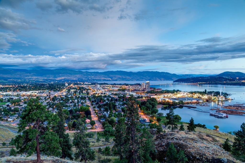
Located on the plateaus of southern BC, Kelowna has a warm and inviting climate that has encouraged tourists to flock to the region every summer for generations. The city is divided by Okanagan Lake, home to the fabled Ogopogo, with Kelowna proper on the east side and West Kelowna on the western shore.
The population of the city and surrounding lakeside communities swells during the summer as visitors flock to the sandy beaches along the lake. Water sports and visits to orchards and the local vineyards are especially popular.
The dry and hot climate is home to meadows filled with sagebrush and forests of Douglas fir and ponderosa pine, which are resistant to frequent wildfires. Some hiking areas near Kelowna are the historic Fintry Provincial Park, Okanagan Mountain Provincial Park, Myra-Bellevue Provincial Park, and Wrinkly Face Provincial Park.


14er
ultra
4000ers-canada
11ers-bc
alaska-13ers
canada-sampler
british-columbia-ultras
alaska-ultras
ultra
glacier
4000ers-canada
11ers-bc
fred-beckey-great-peaks
canada-sampler
british-columbia-ultras
ultra
11ers-bc
11ers-ca-rockies
fred-beckey-great-peaks
canada-sampler
british-columbia-ultras
ultra
glacier
11ers-bc
11ers-ca-rockies
canada-sampler
british-columbia-ultras
alberta-ultras
14er
ultra
4000ers-canada
11ers-bc
alaska-13ers
canada-sampler
british-columbia-ultras
alaska-ultras
ultra
glacier
4000ers-canada
11ers-bc
fred-beckey-great-peaks
canada-sampler
british-columbia-ultras
ultra
11ers-bc
11ers-ca-rockies
fred-beckey-great-peaks
canada-sampler
british-columbia-ultras
ultra
11ers-bc
canada-sampler
british-columbia-ultras
ultra
11ers-bc
canada-sampler
british-columbia-ultras
Yes. British Columbia has 7,996 named mountains. The highest is Mount Fairweather at 4,671 m.
The highest mountain in British Columbia is Mount Fairweather, at 4,671 m.
British Columbia has 7,996 named mountains.
British Columbia has 1 fourteener — peaks above 14,000 ft (4,267 m).


