
Scan the QR code and open PeakVisor on your phone
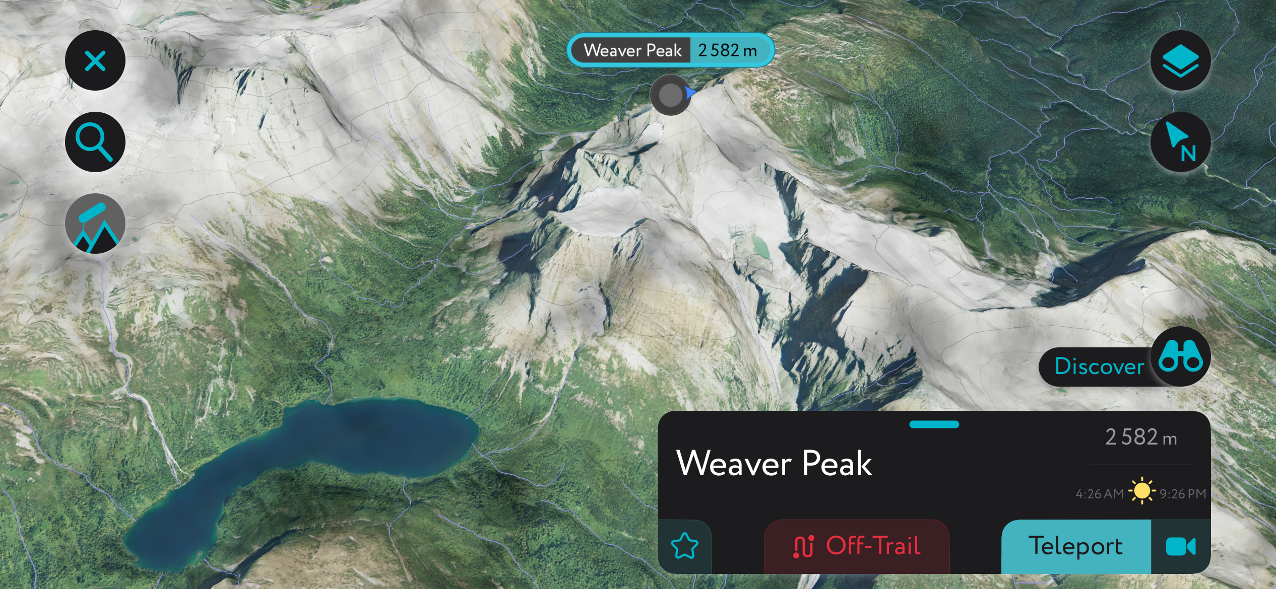
Monkman Provincial Park has 13 named peaks. The highest is Weaver Peak at 2,580 m. Other notable peaks include Mount Bulley, Mount Vreeland and Mount Barton.
Monkman Provincial Park is one of Canada’s most overlooked yet spectacular wilderness areas, located in northeastern British Columbia. The park features several peaks that are part of the Far Northern Rockies, as well as boreal forests, critical wetlands, and several rivers and waterfalls. There are 13 named peaks in Monkman Provincial Park, of which Weaver Peak is the tallest and most prominent, with 2,580 m (8,465 ft) of elevation and 1,281 m (4,203 ft) of prominence.
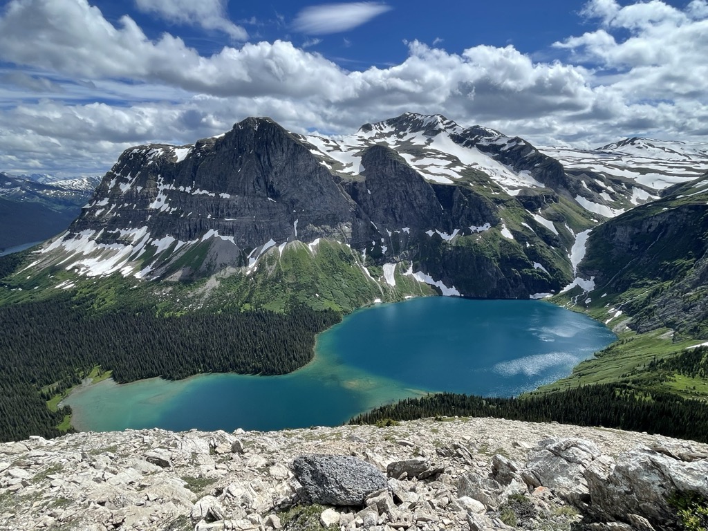
Located in northeastern British Columbia, Canada, Monkman Provincial Park covers 62,867 ha (155,344 acres) of the Hart Ranges of the Far Northern Rockies. Elevations range from about 850 m in the valley floors to more than 2,200 m along the mountain ridges.
The park includes the headwaters of the Murray River, as well as the Pioneer Range, and south to the Limestone Lakes. It is located partly in the Peace River Regional District and in the Regional District of Fraser-Fort George.
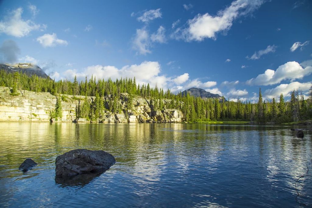
Access to the park is via the community of Tumbler Ridge off of Highway 52. South of Tumbler Ridge, the Murray Forestry Service Road follows the Murray River into Monkman Provincial Park, where there is a vehicle-accessible campground as well as trailheads that lead into the backcountry. Within its boundaries, Monkman encompasses alpine lakes, old-growth spruce forests, and karst formations (eroded limestone forming caves and other features), all typical of the northern Rockies but less disturbed than in southern parks.
Some of the other provincial parks in the region are Arctic Pacific Lakes Provincial Park, Wapiti Lake Provincial Park, and Kakwa Provincial Park.
As part of the Rocky Mountains, the Hart Ranges, which are partly located within Monkman Provincial Park, began forming approximately 75 million years ago when tectonic plates beneath the Pacific Ocean subducted beneath the North American Plate.
The Rockies formed over approximately 35 million years, during which time massive layers of Paleozoic limestone were thrust up and over the younger Cretaceous layers to the northeast.
As such, most of the Rockies are made of layers of limestone; however, Monkman Provincial Park also contains part of the Misinchinka Ranges, which has a unique geological composition. The Misinchinka Ranges are a subrange of the Hart Ranges. They feature a slightly different geological make-up that includes large amounts of Misinchinka schist.
Due to the nature of the schists, the Misinchinka Ranges’ mountains are less rugged than those of the southern Rockies. The limestone of the southern Rockies is less susceptible to erosion. Therefore, it is better able to support precipitous cliffs and jagged peaks. Meanwhile, schists are more prone to erosion and tend to crumble, forming a gentler landscape.
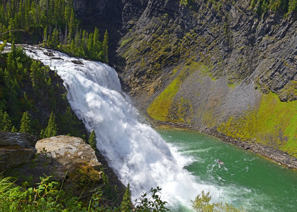
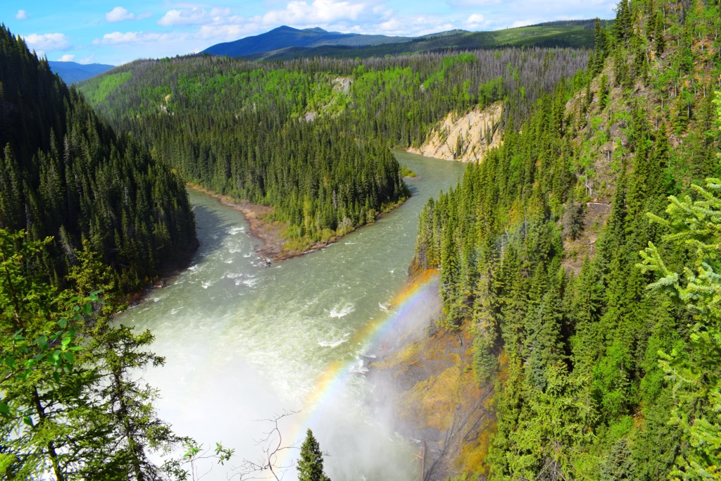
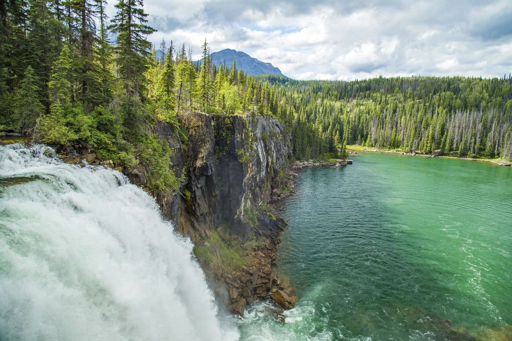
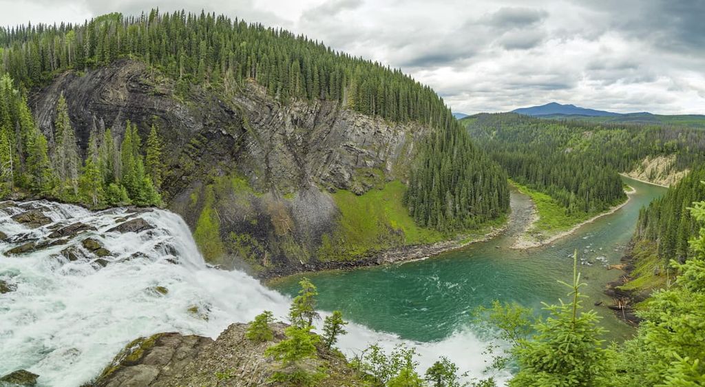
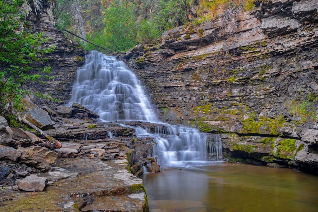
An interesting geological feature of Monkman Provincial Park is that the Murray River tumbles 60 m (197 ft) over a geological fault, creating the magnificent Kinuseo Falls. Kinuseo Falls are slightly taller than Niagara Falls; however, Niagara Falls has a significantly larger volume of water.

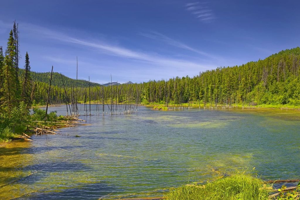
Monkman Provincial Park boasts a diverse and rich array of ecosystems and habitats. From the banks along the Murray River and the shores of the many lakes in the park, up through the valleys and forested slopes, to the barren and rocky alpine peaks, a variety of plant and animal species call the area home.
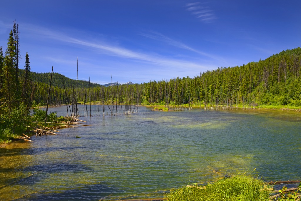
The entrance to Monkman Provincial Park is through the Murray River Valley. The valley is part of the Sub-Boreal Spruce Zone, characterized by forests of subalpine fir, hybrid white spruce, lodgepole pine, and the occasional black spruce.
The combination of trees in this region creates a highly productive forest with a distinctive understory, which includes lilies, ferns, blueberries, and Devil’s club. Trembling aspen, birch, and black cottonwood usually appear around creeks and rivers (the “riparian” zone).
The mountain peaks in the park are part of the Boreal Altai Fescue Alpine zone. Here, the ground is typically barren with small communities of grasses, usually Altai fescue or small-awned sedge. As you descend from the alpine, the trees transition from scattered stands to a dense forest at lower elevations.
Aside from the small areas of sub-boreal forest and alpine found in the region, most of Monkman Provincial Park is part of the Engelmann Spruce – Subalpine Fir Zone. This is the typical subalpine ecology at the high elevations across British Columbia. The mountains’ long, cold winters dictate that only hardy trees and other vegetation can survive the winter in this zone. The subalpine forests are full of Engelmann spruce, subalpine fir, and lodgepole pine. White bark pine, limber pine, and alpine larch also grow in this region.
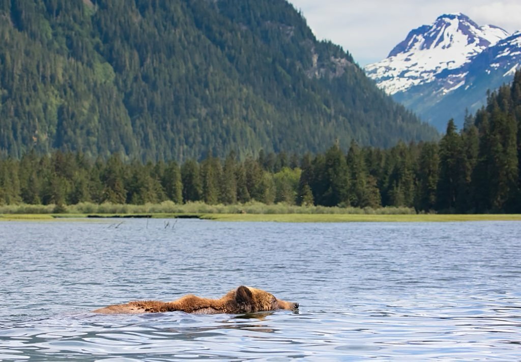
From the alpine to the forests and river valleys, the park has a large variety of wildlife. Mountain goats inhabit the alpine as do marmots and Columbian ground squirrels. Black and grizzly bears are some of the park’s most notable residents, inhabiting all elevations below the alpine. Other species include bighorn sheep, Rocky Mountain elk, white-tail deer, and stone sheep; however, these animals tend to migrate to lower elevations to escape the deep snowpack during the winter.
Mountain goats, moose, and caribou have adapted to spend the winters among the deep snow that is common in the Engelmann Spruce – Subalpine Fir Zone of Monkman Provincial Park. Marten, fisher, and wolverine also inhabit the conifer forests year-round.
Bird species include the gray jay, red crossbill, pine siskin, and Clark’s nutcracker. Golden eagles make their nests on south-facing cliffs, the perfect perch from which to hunt marmots and ground squirrels. The park’s rivers and lakes support bull trout and Arctic grayling, and intact aquatic ecosystems provide critical spawning habitat.
Monkman Provincial Park is situated within the traditional territories of the Métis Nation of British Columbia and the Carrier and Denéth First Nations. Oral history has passed on information regarding the area, including plants known by elders to have medicinal properties. There are burial sites, vision quest sites, as well as a notable historic trading route that would later be named Monkman Pass.
The first written reference to the area and some of its major features wasn’t made until Robert W. Jones compiled a map of the region in 1906 for the Grand Trunk Pacific Railway. The map noted the 60 m (197 ft) falls that disrupt the Murray River at the north end of the park. It wasn’t until 1915 that Kinuseo Falls was formally proposed as a name, which means “fish” in a Cree language.
In 1922, Alex Monkman, a member of the Métis Nation, was exploring the Rocky Mountains in search of tungsten. While prospecting, Monkman discovered a pass that would later be named in his honor. While the pass was already well-known to the First Nations and Métis of the area, Monkman established it as a trade route from northern Alberta and British Columbia to the Pacific Ocean.
Monkman’s route would have taken 1,600 km (1,000 mi) off the total distance traveled at the time through Peace River, Edmonton, or Calgary. However, the Yellowhead Pass was chosen for the route despite claims from engineers that the Monkman Pass would be easier to traverse.
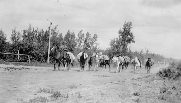
By 1936, transportation costs were rising for farmers, so Monkman suggested they build a highway themselves through Monkman Pass to reduce their costs. The locals held fundraisers and volunteers toiled for the next three years, crossing the Alberta-British Columbia border and reaching Kinuseo Falls, where a fishing lodge was built.
Despite their efforts, the start of the Second World War brought an end to Monkman’s highway-building ambitions, and he died in 1941. The highway never saw completion; however, the Monkman Pass Memorial Trail commemorates the efforts of Alex Monkman and follows the old road and trail through Monkman Pass.
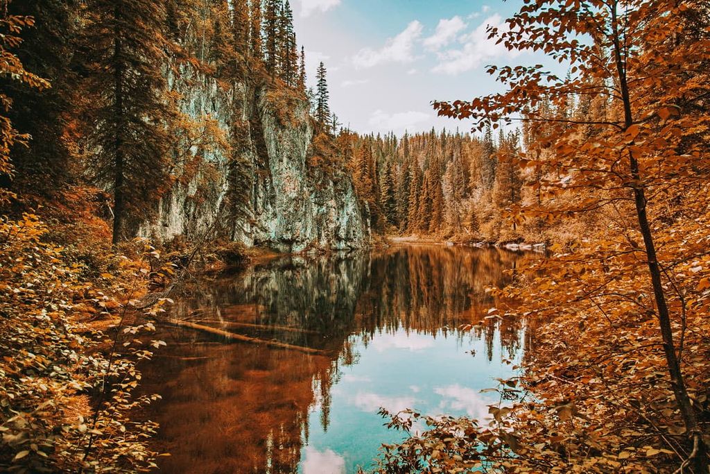
Monkman Provincial Park boasts stunning natural beauty, featuring special attractions such as Kinuseo Falls, the Stone Corral, and a rock wall embedded with an abundance of marine fossils. While there are only a few trails in the park, there is a lot to see. The following are the major trails and attractions of Monkman Provincial Park.
Kinuseo Falls is the top attraction in Monkman Provincial Park. There are walking trails leading to the falls, varying in length from 0.5 km (0.3 mi) to 4 km (2.4 mi).
You can choose the shortest hike to see the stunning 60 m (197 ft) Kinuseo Falls, or you can continue along and follow that trail across the top of the ridge for an even better view of the falls. Interpretive signs are available along the way, and a brochure is provided for visitors to learn more about the falls and the surrounding area.
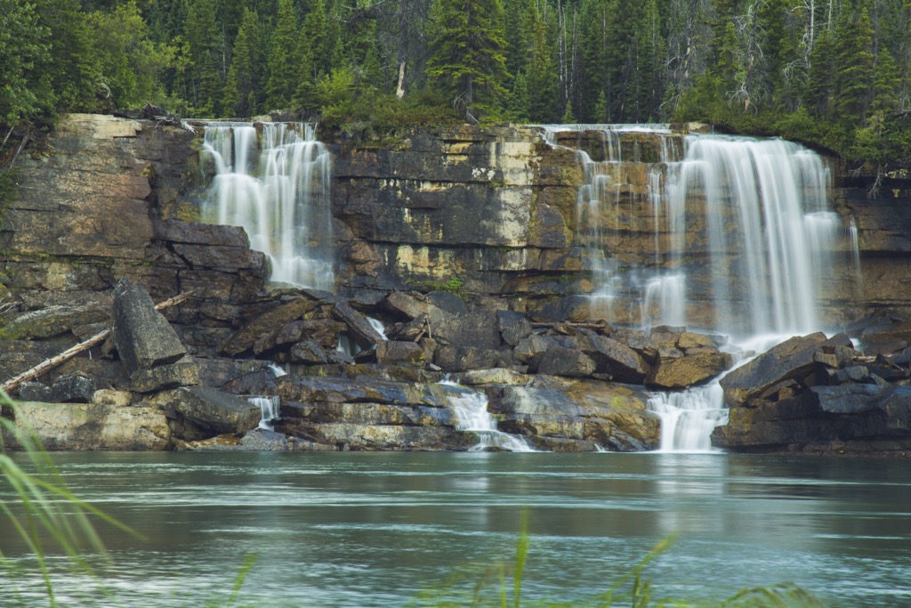
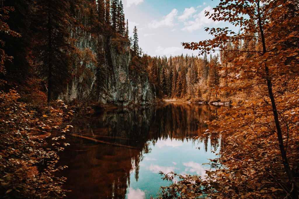
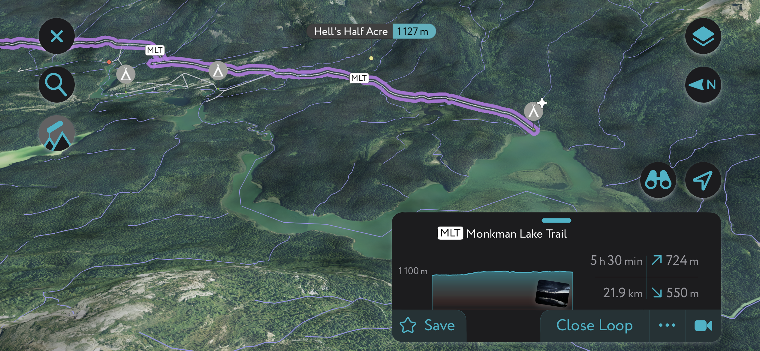
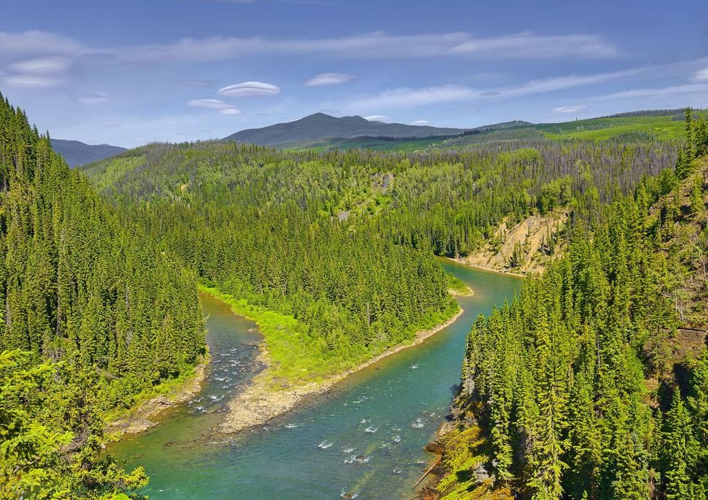
The Monkman Cascades are a series of 10 waterfalls along the Murray River downstream from Monkman Lake. The falls are all stunningly beautiful. The trail to the falls begins off the Monkman Lake Trail, and the trek is about 50 km (30 mi) round-trip. It generally takes 3–4 days to make the hike and explore the falls.
There are several backcountry campsites along the trail, such as Devil’s Creek Camp and Cascades Camp, which are near the cascades. There is also the Monkman Lake Camp at the end of the maintained trail. The hike is considered difficult; however, the quantity and size of the cascades in the region make it a worthwhile adventure.
The hike to the Stone Corral features a crystal-clear cenote surrounded by 100-meter (328-foot) vertical limestone cliffs.
This 4 km (2.4 mi) interpretive trail includes ponds, falls, and caves with stalactites, moonmilk, and other limestone formations. The trail takes about two hours to hike, but note that you may want to take flashlights to explore the caves.
The Monkman Pass Memorial Trail is an extension of the Monkman Lake Trail, which opened in 2008. The trail follows the highway Monkman attempted to build as his route through Monkman Pass. The trail commemorates the work of Monkman, who dedicated his life’s work to helping his community and region.
The hike is a difficult 63 km (38 mi) one-way trail that takes 5 to 6 days to complete. The trail generally follows the original route to the pass; however, there are some deviations that lead into subalpine meadows with a series of tarns.
The trail terminus is Hobi’s Cabin, which is located at the confluence of Fontiniko and Herrick Creeks and is only accessible by boat.
At PeakVisor, we love information. That’s why we write articles like this one.
Once upon a time, it was challenging to obtain accurate maps in remote locations, such as Monkman Provincial Park. No longer. Welcome to PeakVisor’s 3D Maps with real satellite imagery. PeakVisor has all the public trails at your fingertips—we still encourage supporting the locals by hiring a guide, though!
Check out the PeakVisor app for even more information on thousands of additional hikes, ski tours, and ski resorts across the world. In fact, we’ve compiled information on all publicly maintained walking tracks worldwide, formatted onto our 3D maps.
PeakVisor started as a peak identification tool, but we’ve evolved into purveyors of the finest 3D maps available. We continue to expand our offerings. You can track your hikes directly on the app, upload pictures for other users, and keep a diary of all your outdoor adventures.
Most recently, the PeakVisor App has included up-to-date weather reports, including snow depths, at any destination. We've also been hard at work adding the details of hundreds of mountain huts, including information on overnight accommodation, dining options, and opening hours. You can also use our Hiking Map on your desktop to create .GPX files for routes to follow later on the app.
Monkman Provincial Park is a remote wilderness park that features beautiful wilderness trails as well as incredible natural features such as the Stone Corral, Kinuseo Falls, and the Monkman Cascades. The remoteness ensures that tourism remains light, and visitors must come prepared, logistically and mentally, for a genuine wilderness experience.
However, while traveling to and from the park, there are a few places to obtain needed supplies or rest in a comfortable hotel before or after your adventure.
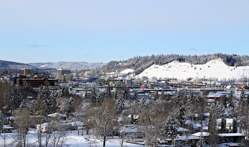
Located at the junction of Highways 16 and 97, Prince George is considered the capital of northern British Columbia. Simon Fraser originally established it in 1807 as a North West Company trading post. It’s located about 500 km (300 mi) to the southwest of Monkman Provincial Park.
Prince George is situated at the confluence of the Nechako and Fraser Rivers. Since its founding, it has evolved into a transportation and service hub for northern British Columbia, offering all the amenities of a modern city. It features fine dining restaurants, cinemas, museums, a range of accommodations, and an international airport.
Off-roading is a popular pastime of locals, with several well-established clubs and areas to practice motocross and drive OHVs. The area also has vast wilderness areas that local hiking groups flock to, as well as opportunities for fishing and other outdoor recreation.
Some of the most popular hikes around the city are Cottonwoods Island Loop, the Greenway Trail to Shane Lake Loop, McMillan Creek Loop, Troll Lake, Kakwa Lake Trail, and Forests for the World Lookout.
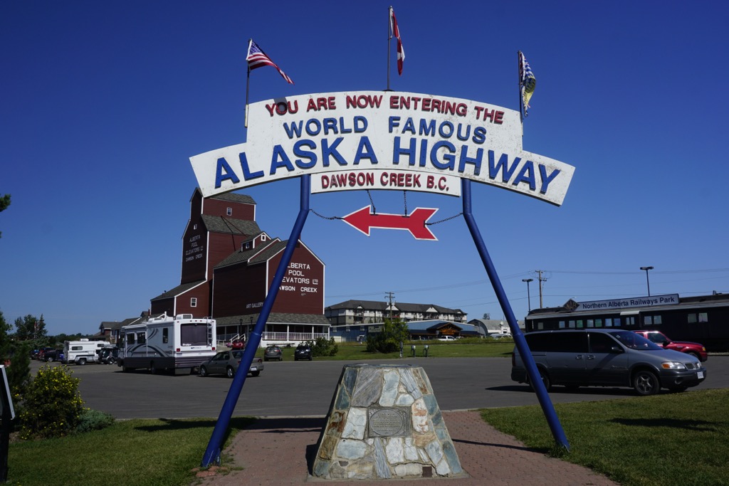
Located about 200 km (120 mi) to the northeast of Monkman Provincial Park, Dawson Creek was founded in the early twentieth century. It is considered to be a gateway city to Alaska and the northern wilderness of Canada. Settlers of European descent originally came to the region to claim homestead grants offered by the Canadian government.
As railways were built through the town, it grew and attracted more businesses and settlers. During the twentieth century, Dawson Creek saw some excitement, as the United States used the city as a terminus for the Alaska Highway, making Dawson Creek Mile 0.
The area surrounding Dawson Creek has beautiful wilderness areas that are great for hiking, skiing, and OHV use. In addition to wilderness access, the city has an art gallery, a historical village, a museum, as well as annual fall fairs and a rodeo.
Some of the popular hikes around the city of Dawson Creek are the casual 1.8 km (1 mi) Leoppky Park Trail and the 9.7 km (5.8 mi) Dawson Creek Trail. There is also a moderate 7.4 km (4.4 mi) hike along the Rim Rocks Trail.
Situated about 250 km (180 mi) northwest of Monkman Provincial Park, Mackenzie is located on the west side of the Hart Ranges off Highway 39, along the shore of Williston Lake. The municipality of Mackenzie is an excellent destination for winter-loving outdoor enthusiasts, hosting dog sledding, cross-country skiing, and snowmobiling competitions.
The community maintains 32 km (19 mi) of groomed cross-country ski trails throughout the winter. Additionally, there are many trails nearby that are worth hiking if you’re in the area. Some of the recommended trails are the Morfee Lake Trails, Cut Thumb Falls, and the Kimta Creek Trail.


The highest peak in Monkman Provincial Park is Weaver Peak, at 2,580 m.
Notable peaks in Monkman Provincial Park include Weaver Peak, Mount Bulley, Mount Vreeland, Mount Barton and The Shark's Fin.


.jpg)
![Carlisle family fonds image 0399.09.01[1]](https://commons.wikimedia.org/wiki/File:Pack_Horse_Train_Leaving_Hazelmere_for_Monkman_Pass_1941.jpg)