
Scan the QR code and open PeakVisor on your phone
The Hart Ranges include 123 named peaks. The highest is Mount Sir Alexander at 3,275 m. Other notable peaks include Mount Ida, Nilah Peak and Mount Ovington.
The Hart Ranges are a collection of peaks located in the central part of the Canadian province of British Columbia, along the province’s eastern border with Alberta. The range has 123 named mountains of which Mount Sir Alexander is the tallest and most prominent with 3,275 m (10,745 ft) of elevation and 1,743 m (5,719 ft) of prominence. The Hart Ranges are also home to the ultra-prominent Mount Ovington and Mount Crysdale, with respective prominences of 1,594 m (5,230 ft) and 1,548 m (5,079 ft).
The Hart Ranges are located at the southern end of the northern Canadian Rockies. They run northwest from the Alberta–British Columbia border, where the border no longer follows the continental divide. There are two main divisions in the Hart Ranges with several subranges.
The western part of the Hart Ranges are known as the Misinchinka Ranges while the eastern part is simply called the Hart Ranges. The ranges were named for former BC Premier John Hart. There are several subranges, which are the Dezaiko Range, Murray Range, Pioneer Range, and the Solitude Range.
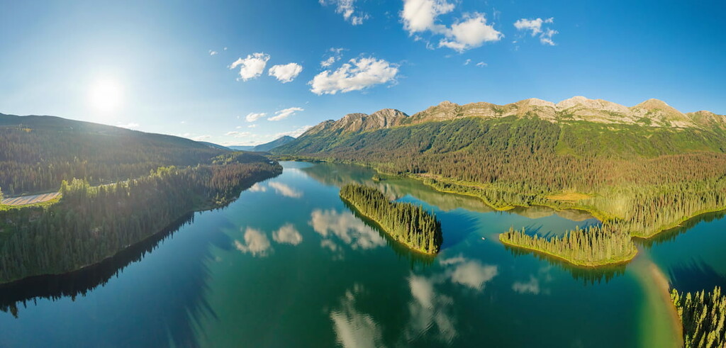
The Rocky Mountain Trench and the McGregor Plateau are located west and southwest of the Hart Ranges. The Peace Arm of the Williston Reservoir is at the northern end of the ranges while Jarvis Creek is located at the southern border of the Hart Ranges. The Rocky Mountain Foothills are the eastern border of the Hart Ranges.
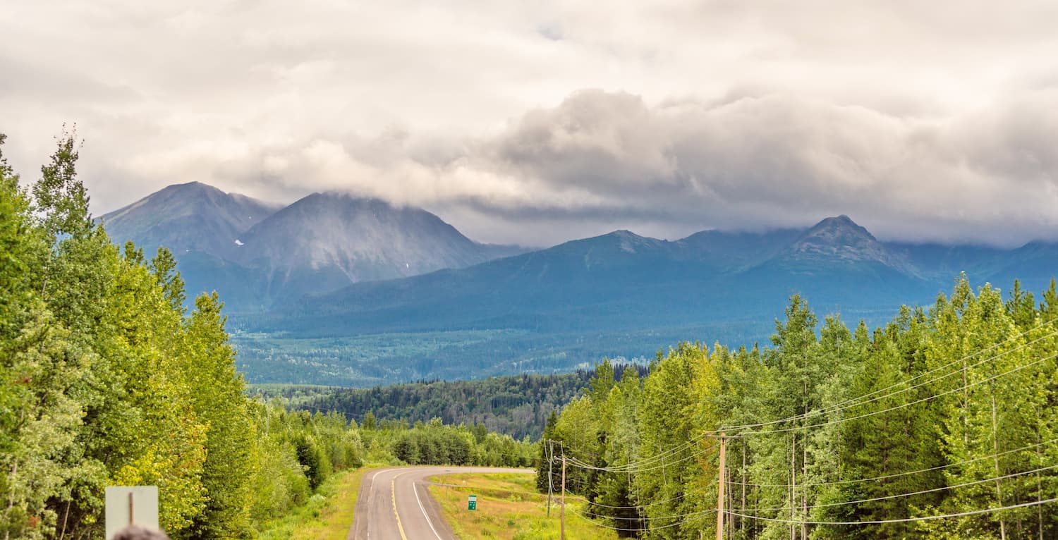
The main road access to the ranges is Highway 97 which runs north of Prince George and crosses the Hart Ranges to lead to Dawson Creek. Alternatively, Highway 16, the Yellowhead Highway, runs along the southern end of the ranges.
There are several provincial parks that are located in the Hart Ranges. Pine Le Moray, Monkman, Wapiti Lake, and Kakwa provincial parks are all found in the British Columbia portion of the ranges. Kakwa Wildland Provincial Park is located at the southeastern end of the Hart Ranges, in Alberta.
The Hart Ranges are part of the northern Canadian Rockies and were formed in a mountain building event called the Laramide orogeny that started about 75 million years ago. The cause of the orogeny that formed the Rocky Mountains was the movement of tectonic plates from under the Pacific Ocean. This movement caused the plates to collide with and slide under the North American continent.
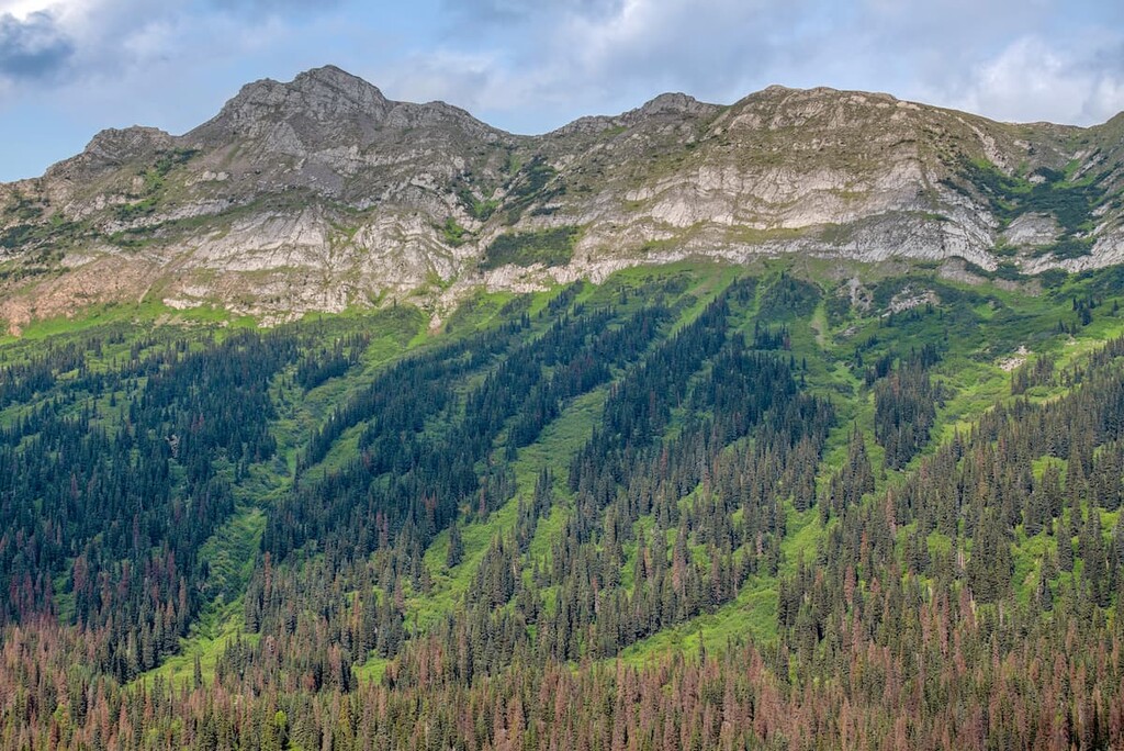
The Rockies are formed from layers of limestone, sandstone, and shale that were thrust up and stacked upon each other in a process called thrust-faulting. However, the Hart Ranges differ slightly from the Continental Ranges to the south and the Muskwa Ranges to the north. The Hart Ranges are considerably lower and constitute a central belt of lower elevation in the Rocky Mountains.
The differences come from variations to the layers of rocks as well as less uplift during the Paleogene, resulting in the lower mountains. While the eastern ranges are characteristically the same as the front ranges further to the south, with thick quartz and limestone formations, those formations thin towards the west.
In the Misinchinka Ranges, on the west side of the Hart Ranges, the quartz and limestone are gradually replaced with layers of schist. The Misinchinka schist cannot support the precipices and slopes like the limestone to the southeast and therefore the characteristics of the range have changed.
The mountains in the Misinchinka Ranges are lower in elevation, generally only 1,981 m (6,500 ft) tall with rounded, woody peaks. The lower elevations of the Misinchinka Ranges were also affected differently by the Pleistocene glaciers, than the rest of the Rocky Mountains and the eastern part of the Hart Ranges.
The glaciers of the Pleistocene stood between 1,830 m (6,000 ft) and 2,134 m (7,000 ft) in the Hart Ranges. The front ranges of the Rockies and the Hart Ranges have noticeable glacial topography. There are significant cirques with steep headwalls and basins with tarn lakes in the limestone dominant front ranges.
While the mountains of the Misinchinka Ranges were also covered by glaciers, the combination of lower elevation and relief, schists as opposed to limestone, and reduced alpine and valley glaciation affected the final topography of the ranges. The Misinchinka Ranges have a significantly subdued alpine topography when compared with the rugged nature of the rest of the Rocky Mountains.
The ecology of the Hart Range has three prominent zones. The highest elevations are the relatively barren alpine tundra, which with its cold winters and short growing season, make it difficult for any woody plants to grow, except in dwarf form. The alpine is dominated by dwarf shrubs, mosses, lichen, herbs, and mosses. However, there is a parkland mosaic of small stands of trees and alpine meadows.
Down the slopes, the parkland transitions into densely wooded forests of Engelmann spruce and subalpine fir. Lodgepole pine is also common in the subalpine areas, especially in areas recently affected by forest fires.
Finally, the forests flow off of the mountains and into the sub-boreal valleys and rolling plateaus. While the winters are cold and long, the sub-boreal forests have a longer growing season than the boreal forests further to the north. Hybrid Engelmann-white spruce and subalpine fir forests continue from the slopes, and lodgepole pine is especially abundant in dryer areas of the zone.
There is a wide variety of animal species that inhabit the Hart Ranges. Elk and deer forage in the alpine meadows during the summer; however, they move to lower elevations during the winter. Mountain sheep are the only large mammals that tend to remain in the alpine during the winter, as they move to steep slopes that resist the accumulation of snow.
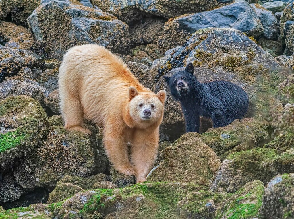
Caribou, mountain goats, grizzly bears, and moose also inhabit the Hart Ranges. All of the animals will forage or hunt across the range during the warmer months. During the winter, the bears hibernate and the ungulates go down into the valleys and areas with less snow, except for caribou. Caribou often stay in the higher elevations with deeper snow, pawing through the snow to access the lichen on which they feed.
Golden eagles can be seen soaring over the mountains and white-tailed ptarmigan may be spotted with a keen eye. Gray jays, ravens, and other robust birds are found throughout the range. The seeds of the mature coniferous forests provide food for pine siskins, pine grosbeaks, and golden-crowned kinglets. There are many migratory birds that come to the range during their season, while only a few, such as the pine grosbeak, red crossbill, great gray owl, and great horned owl remain all year.
Humans likely began to inhabit the Hart Ranges as far back as 9,000 years ago. The ranges are part of the traditional territory of the Beaver, Denédah, Takla, Métis, Tse’khene, Lheidi, T’enneh, and Secwépemc First Nations.
In the early eighteenth century, European fur traders were moving west and came to the Rocky Mountains. The end of the eighteenth century saw the travels of Alexander Mackenzie as he ventured into the region in 1793. In 1808, Simon Fraser established a camp near the range to travel the Fraser River to its outlet at the Pacific Ocean.
While the North West Company and Hudson’s Bay Company competed in the region for furs and resources, the First Nations had a time of relative prosperity. The fur traders were dependent upon the Indigenous peoples for labor and food.
Many of the Métis that settled in the area at the beginning of the twentieth century are descendants of Scottish and French traders as well as Iroquois, Beaver, Chippewa, and Sekani First Nations. Some Métis originally settled in the Athabasca Valley; however, they moved north near Grande Cache, at the southeastern end of the Hart Range during the Jasper Exodus, which caused the eviction of settlers in what is now Jasper National Park.
While the fur trade brought some time of relative prosperity to some of the First Nations, the traders also brought smallpox and measles. There were many pandemics throughout the nineteenth century that killed large numbers of people, often wiping out entire villages.
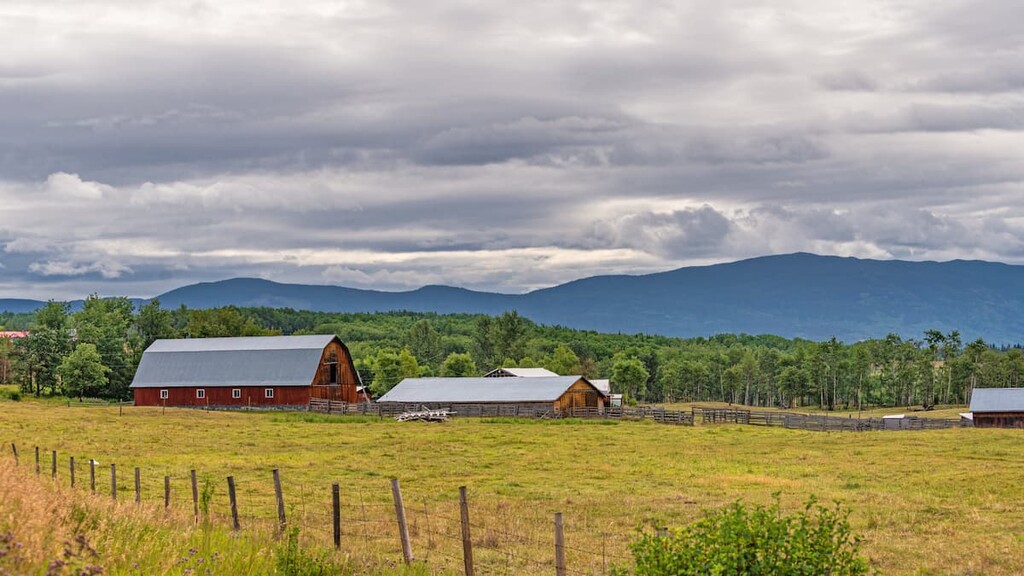
The cities and towns that now surround the Hart Ranges grew from settlements that were focused on resource extraction. There are coal mines, as well as prime lumber crops in the Hart Ranges. Additionally, there are oil and gas reserves that were discovered in the regions which led to increased settlement, especially to the east of the Hart Ranges.
The Hart Ranges are a beautiful and remote range of mountains in central British Columbia. There are several areas in the ranges that have been preserved as provincial parks and are worth visiting.
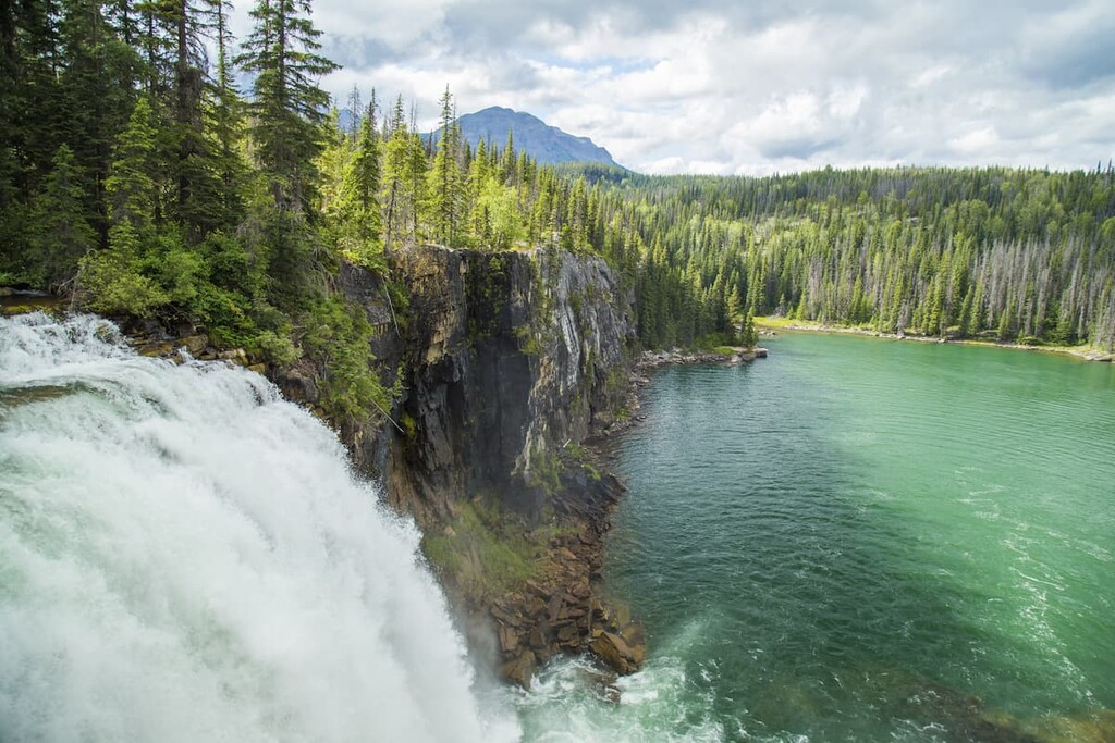
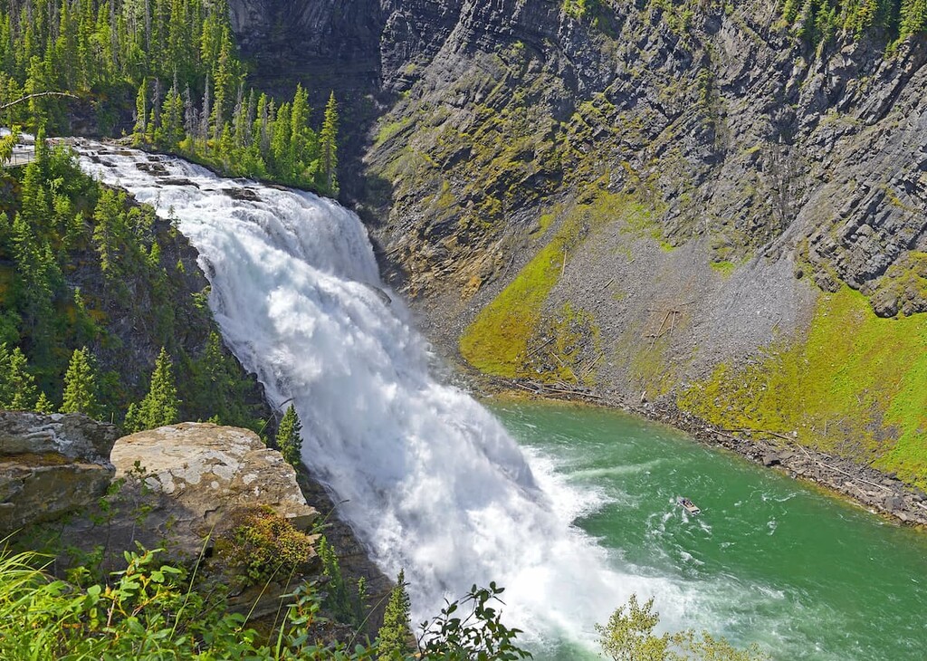
Established in 1981, Monkman Provincial Park encompasses vast alpine meadows, jagged limestone peaks, dense forested wilderness, clear and aquamarine alpine lakes, and rivers with thundering waterfalls and cascades.
The park is popular for day hiking, picnicking, wildlife viewing, caving, backpacking, and fishing. Some of the adventures in the park include spelunking along the Stone Corral Trail, where small caves can be found in the limestone outcrops. Beneath the steepest cliffs, at the end of the Stone Corral lies the entrance to the Corral Cave. While only 20 m (65 ft) deep, there are many fascinating features to enjoy in the area.
While there are many day hikes in Monkman Provincial Park, such as routes to views of Kinuseo Falls and the Murray River, the major trail is the historic 63 km (40 mi) Monkman Lake Trail. The Monkman Lake Trail winds through the park, allowing visitors to enjoy the unspoiled wilderness and the tranquility of deep backcountry.
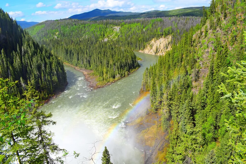
Wapiti Lake Provincial Park is in the Hart Ranges of the Canadian Rockies, with clear lakes, fast rivers, and stunning mountain scenery. The park offers opportunities for canoeing, kayaking, fishing, wildlife viewing, and hiking or cross-country skiing the Wapiti Onion Trail.
The 36 km (22 mi) out-and-back Wapiti Onion Trail is the main trail in Wapiti Lake Provincial Park. The trail follows the incredibly scenic Wapiti River to the cabin at Wapiti Lake. The trail is scenic and provides an incredible wilderness experience. Further adventures can be found in the valleys surrounding Wapiti Lake among the slopes of Wapitik Mountain, Bertram Peak, and Mount Becker.
Kakwa Provincial Park is part of the first interprovincial park with Alberta, combining with Kakwa Wildland Provincial Park and the Willmore Wilderness Park in Alberta to form the Kakwa-Willmore Interprovincial Park. The park is located along the Continental Divide and it features glaciated mountain peaks, extensive alpine meadows, and numerous rivers and lakes.
There is one main trail that leads into Kakwa Provincial Park and ends at a public cabin on the shores of Kakwa Lake. There are dozens of named peaks in the park, such as the massive Mount Sir Alexander and Mount Ida. There are many unofficial and unmaintained trails through that park that lead through the beautiful wilderness. Additionally, there are many opportunities for climbing and mountaineering in the park; however, there are no officially marked routes.
The Hart Ranges are northwest from the Continental Divide that separates British Columbia and Alberta. There are several cities on either side of the border that are access points to the activities and parks within the ranges.
The city of Prince George is considered the capital of northern British Columbia and its recent history can be traced back to the founding of Fort George, a North West Company trading post established by Simon Fraser in 1807. The city is southwest of the Hart Ranges at the junction of Highways 16 and 97.

The city has grown at the confluence of the Nechako and Fraser Rivers to become an important transportation and service hub to the north of British Columbia with all the amenities of a modern city, including fine dining restaurants, cinemas, museums, a range of accommodations, and an international airport.
Off-roading is a popular pastime of locals and there are well established clubs and areas to practice motocross and drive OHVs. The area also has vast wilderness areas that local hiking groups flock to as well as incredible opportunities for fish and other outdoor recreation.
There are also many annual fairs and festivals that draw in crowds from across the region and the province. The British Columbia Northern Exhibition started in 1912 and is the city’s largest summer event. Other summer events include the Canada North Resource Expo and the Downtown Summerfest.
Winter festivals include the Prince George Coldsnap Festival which is a national folk music festival held at venues across town as well as Snow Daze Winter Festival held every February. There is also the Prince George Iceman Multi-sport race that involves skiing, running, skating, and swimming, every February.
The city of Dawson Creek is named after the watercourse of the same name, which was named after George Mercer Dawson, who led a surveying team through the region in 1879. One of the surveying crew labelled the creek with Dawson’s name. The city is located northeast of the Hart Ranges and was established in the early twentieth century.
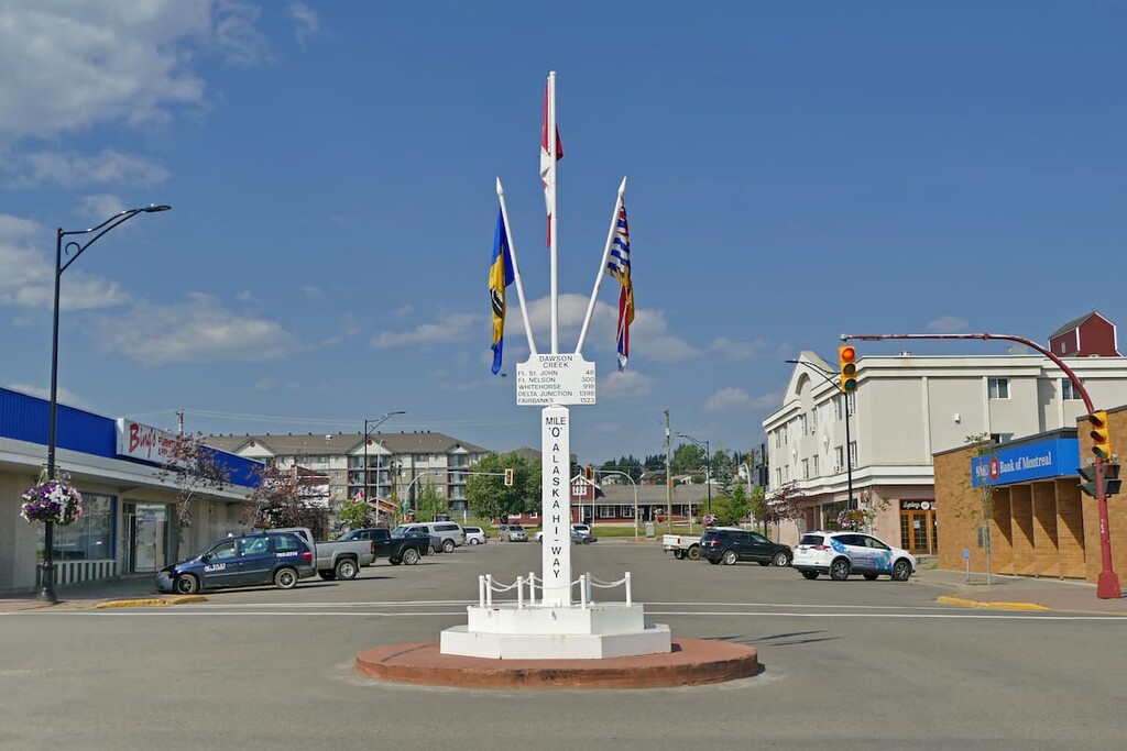
Settlers came to the region for the homestead grants that were being offered by the government of Canada. As railways were built through the town, it grew and attracted more businesses and settlers. During the twentieth century Dawson Creek saw some excitement as the United States used the city as a terminus for the Alaska Highway, of which Dawson Creek is at Mile 0.
However, growth slowed in the 1960s as industrial development was going to nearby Fort St. John and Grande Prairie, Alberta was becoming a commercial hub. The area surrounding Dawson Creek has beautiful wilderness areas that are great for hiking, skiing, and OHV use. In addition to wilderness access, the city has an art gallery, a historical village, a museum, as well as annual fall fairs and a rodeo.


The highest peak in the Hart Ranges is Mount Sir Alexander, at 3,275 m.
The Hart Ranges have 123 named peaks.


