
Scan the QR code and open PeakVisor on your phone
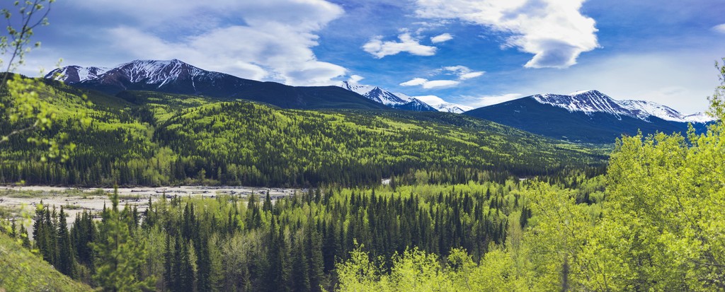
The stunning wilderness of Kakwa Wildland Provincial Park is a protected area located in central Alberta, Canada along the province’s border with British Columbia. The park covers 7,650 square kilometers (2,953 square miles) and includes forested valleys, beautiful lakes, and 8 named peaks. The tallest of the park’s mountains is Mount May (2,450 m/8,038 ft) and the most prominent is Sulfur Ridge (2,282 m/7,487 ft).
Located in central Alberta, Canada near the city of Grande Cache, Kakwa Wildland Provincial Park is a protected area that encompasses parts of the Hart Ranges and the far northern Front Ranges of the Canadian Rockies. The main highway that runs near the park is Highway 40; however, the main access to the wildland area is from the north through Two Lakes Provincial Park.
The park has eight major peaks that overlook the region’s stunning forested valleys, creeks, lakes, and waterfalls. Mount May is the tallest mountain in the park at 2,450 m (8,035 ft) in elevation while Sulfur Ridge is the most prominent peak with 796 m (2,612 ft) of prominence.
Kakwa Wildland Provincial Park is part of the Kakwa-Willmore Interprovincial Park, which includes wilderness areas in British Columbia and Alberta. The three sections of the interprovincial park are Kakwa Wildland Provincial Park and Willmore Wilderness Provincial Park in Alberta, and Kakwa Provincial Park in British Columbia.
Other parks and protected areas located near Kakwa Wildland Provincial Park include:
The mountains and foothills of Kakwa Wildland Provincial Park are part of the northern Canadian Rockies, which formed in a mountain building event called the Laramide orogeny. The Laramide orogeny started about 75 million years ago as the Pacific tectonic plates collided with North America.
The tectonic collision heated, folded, broke, and deformed the layers of rock that eventually created the Rockies. Layers of limestone, sandstone, and shale were thrust up and stacked upon each other in a process called thrust-faulting. These thrust faults occur in a general southwest to northeast direction, with the youngest mountains rising to the northeast of the Rockies.
Toward the end of the Laramide orogeny, the force of the tectonic collision was no longer sufficient to continue lifting the deep layers of Paleozoic limestone. However, the force was large enough to continue the minor uplifting of the region’s upper layer of Cretaceous sandstone and shale. This uplifting eventually created the foothills that are located along the eastern edge of the Rockies.
The peaks of Kakwa Wildland Provincial Park are typically lower than the peaks of nearby ranges. The differences are a result of variations in the layers of rock as well the fact that the region experienced less uplifting during the Paleogene, which resulted in the formation of lower elevation mountains.
While the eastern ranges are characteristically the same as the front ranges further to the south with thick quartz and limestone formations, these formations generally thin out as you move toward the west.
The glaciers of the Pleistocene existed up to elevations of roughly between 1,830 m (6,000 ft) and 2,134 m (7,000 ft) across the park, and they heavily eroded anything that was covered under the ice. The front ranges of the Rockies and the Hart Ranges in Kakwa Wildland Provincial Park have noticeable glacial topography. There are significant cirques with steep headwalls and basins with tarn lakes found in these limestone-dominant front ranges.
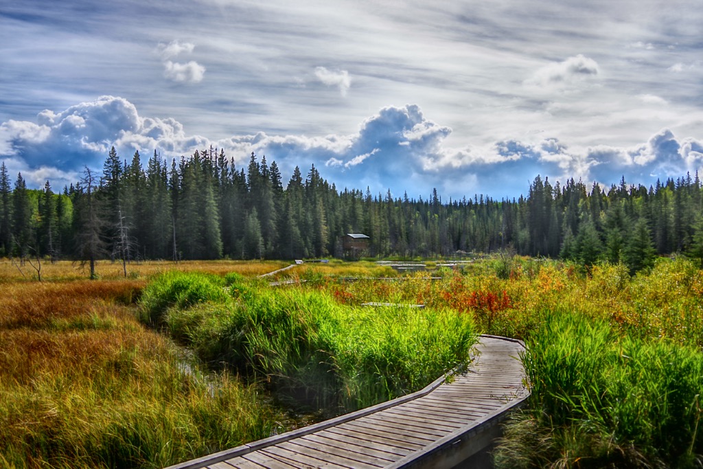
The wilderness of Kakwa Wildland Provincial Park is home to a variety of habitats and ecosystems. The park is representative of the alpine and subalpine subregions of the Rocky Mountain Natural Region. It also includes parts of the Foothills Natural Region, which encompasses the alpine, subalpine, and montane subregions.
The highest elevations in the park are covered in glaciers and rocks that gently transition to heath meadows. The cold winters and short growing season make it difficult for any woody plants to grow in the area except in dwarf form. The alpine is dominated by dwarf shrubs, mosses, lichen, herbs, and mosses.
In the park, alpine meadows gradually transition to a parkland mosaic of small stands of trees and alpine grass and heath until the treeline, which divides the alpine from the subalpine. The parkland transitions into densely wooded forests of Engelmann spruce and subalpine fir. Lodgepole pine is also common in the subalpine areas, especially in areas recently affected by forest fires.
At the base of the slopes in the park, the sub-boreal valleys and rolling plateaus extend toward the foothills and prairies. While the winters are cold and long, the sub-boreal forests have a longer growing season than the boreal forests further to the north. Hybrid Engelmann-white spruce and subalpine fir forests continue from the slopes, and lodgepole pine is especially abundant in dryer areas of the zone.
There is a wide variety of animal species that inhabit wildland provincial park. Elk and deer forage in the alpine meadows during the summer; however, they move to lower elevations during the winter. Mountain sheep are the only large mammals that tend to remain in the alpine throughout the winter, as they move to steep slopes that resist the accumulation of snow.
Caribou, mountain goats, grizzly bears, and moose also inhabit Kakwa Wildland Provincial Park. All the animals will forage or hunt across the range during the warmer months. During the winter, the bears hibernate, and the ungulates go down into the valleys and areas with less snow, except for caribou. Caribou often stay in the higher elevations where they can find deeper snow to paw through in order to access the lichen on which they feed.
Golden eagles can be seen soaring over the mountains and white-tailed ptarmigan may be spotted with a keen eye in the park, too. Gray jays, ravens, and other robust birds are some of the many avian species found throughout the park.
The seeds of the mature coniferous forests in the park provide food for pine siskins, pine grosbeaks, and golden-crowned kinglets. There are many migratory birds that come to the park during their season, while only a few, such as the pine grosbeak, red crossbill, great gray owl, and great horned owl remain all year long.
Humans likely began to inhabit the forests and valleys of Kakwa Wildland Provincial Park as far back as 9,000 years ago. The eastern slopes of the Rockies that the park encompasses are part of an ice-free corridor that was once an ancient migration and settlement route.
The ranges are part of the traditional territory of the Cree, Tsuu T’ina, and Secwépemc First Nations as well as the Métis Nations of British Columbia and Alberta. During the early eighteenth century, European fur traders started moving west and they eventually came to the Rocky Mountains where they made contact with many First Nations.
While the North West Company and Hudson’s Bay Company competed in the region for furs and resources, many of the First Nations in the area enjoyed a time of relative prosperity as the fur traders were dependent on First Nations for both labor and food.
Many of the Métis that settled in the area at the beginning of the twentieth century are descendants of Scottish and French traders as well as Iroquois, Beaver, Chippewa, and Sekani First Nations.
Some Métis originally settled in the Athabasca Valley; however, many moved north to near what is now Grande Cache at the southeastern end of the Hart Range during the Jasper Exodus, which caused the eviction of settlers in what is now Jasper National Park.
While the fur trade brought some time of relative prosperity to some of the First Nations, the traders also brought smallpox and measles. There were many pandemics throughout the nineteenth century that killed large numbers of people, often wiping out entire villages.
The cities and towns near Kakwa Wildland Provincial Park are generally grown from settlements that were focused on resource extraction and agriculture. There are coal mines, as well as prime lumber crops nearby. Additionally, oil and gas reserves were discovered in the region and they led to increased settlement of the area, especially to the east of the Hart Ranges.
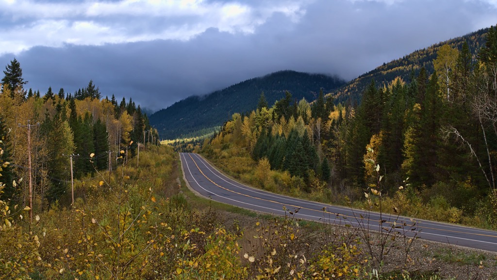
Kakwa Wildland Provincial Park is a vast and remote wilderness reserve. However, the picturesque forests, valleys, creeks, lakes, and waterfalls of the park require motivation and effort to experience. The primary route into the park requires foot, horse, or OHV travel from Twin Lakes Provincial Park, which is located to the north of the wildland.
The route from Two Lakes Provincial Park leads to Deadhorse Meadows, which is an equestrian camping area in Kakwa Wildland Provincial Park. From Deadhorse Meadows, there are about 100 km (60 mi) of mapped trails leading through the wilderness.
The most popular trails in the park lead to the stunning Kakwa Falls and Lower Kakwa Falls. Kakawa Falls is the tallest waterfall in Alberta, as it plunges 30 m (100 ft) to the river below.
Within the park, wildlife and plant enthusiasts can relish in the pristine wilderness while searching out traces of the rare plants and the many animals of the park. The park has over 450 different plant species, 30 of which are red listed in Alberta and 28 which are located at the extreme edge of their range.
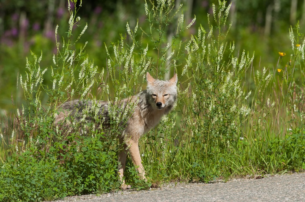
Visitors can catch glimpses of the majestic wildlife that inhabit the park. Some of the animals that inhabit Kakwa Wildland Provincial Park are woodland caribou, elk, bighorn sheep, mountain goats, moose, mule and while-tailed deer, grizzly and black bears, wolverines, lynx, and red foxes.
Kakwa Wildland Provincial Park is situated in a remote area of central Alberta adjacent to the border with British Columbia. The following are some of the larger cities and communities near the park that you can check out during your visit.
The town of Hinton was founded in 1911 when the Grand Trunk Railway built a station house at the current Hinton townsite. The town is located about 160 km (100 mi) to the southeast of Kakwa Wildland Provincial Park.
Hinton is home to the Wild Mountain Music Fest and is a popular staging area for expeditions into the Willmore Wilderness Park, which is located to the north of the town. Hinton is also a gateway to the incredible wilderness of central Alberta and the Rocky Mountains.
While in the town, visitors can walk the 3 km (2 mi) Beaver Boardwalk to view the beavers and other local wildlife. Hinton is also situated near the eastern entrance of Jasper National Park, which contains countless incredible trails to hike.
Grande Prairie is located about 160 km (100 mi) northeast of Kakwa Wildland Provincial Park. It is the seventh largest city in Alberta with over 60,000 residents and is the primary access route to Kakwa Wildland Provincial Park via Two Lakes Provincial Park.
Until the 1950s, Grande Prairie competed with the nearby communities of Dawson Creek and Peace River as the most important city in the region, at which point oil and gas exploration led to a dramatic increase in the city’s population, making it much larger than other nearby communities.
Some of the popular local parks and hiking areas around Grand Prairie include Muskoseepi Park and Crystal Lake. The city has traditional and disc golf courses as well as a local ski hill.
Saskatoon Mountain Natural Area, which features a number of archaeological sites, is situated just to the west of the city. The vast wilderness of the Far Northern Rockies is also located only 200 km (120 mi) to the west of the Grande Prairie.
Grande Cache was first incorporated as a town in 1966 to help open the area for coal development. The boom-bust cycle of coal affected the community so much that in 2018, due to a low population, the town was re-classified as a hamlet.
However, despite the lagging economy and industry, some of the residents of Grande Cache took the initiative to create an event to draw tourists to the hamlet and put the community back onto the map. In 2000, Paul Baily and Dale Tuck created the Canadian Death Race.

The Canadian Death Race is a 125 km (75 mi) ultra-marathon event. The race course summits three mountains, includes one major river crossing, and has over 5 km (17,000 ft) of elevation change. The participants have 24 hours to finish the race, and the fastest competitors finish in less than 14 hours.
If you’re not up for joining the Canadian Death Race, other great places for trail running and hiking around Grande Cache are in the nearby Willmore Wilderness Park, Kakwa Wildland Provincial Park, and Rock Lake – Solomon Creek Wildland. Mount Robson Provincial Park and Jasper National Park are located only a couple hundred kilometers away from the town, too.


