Scan the QR code and open PeakVisor on your phone
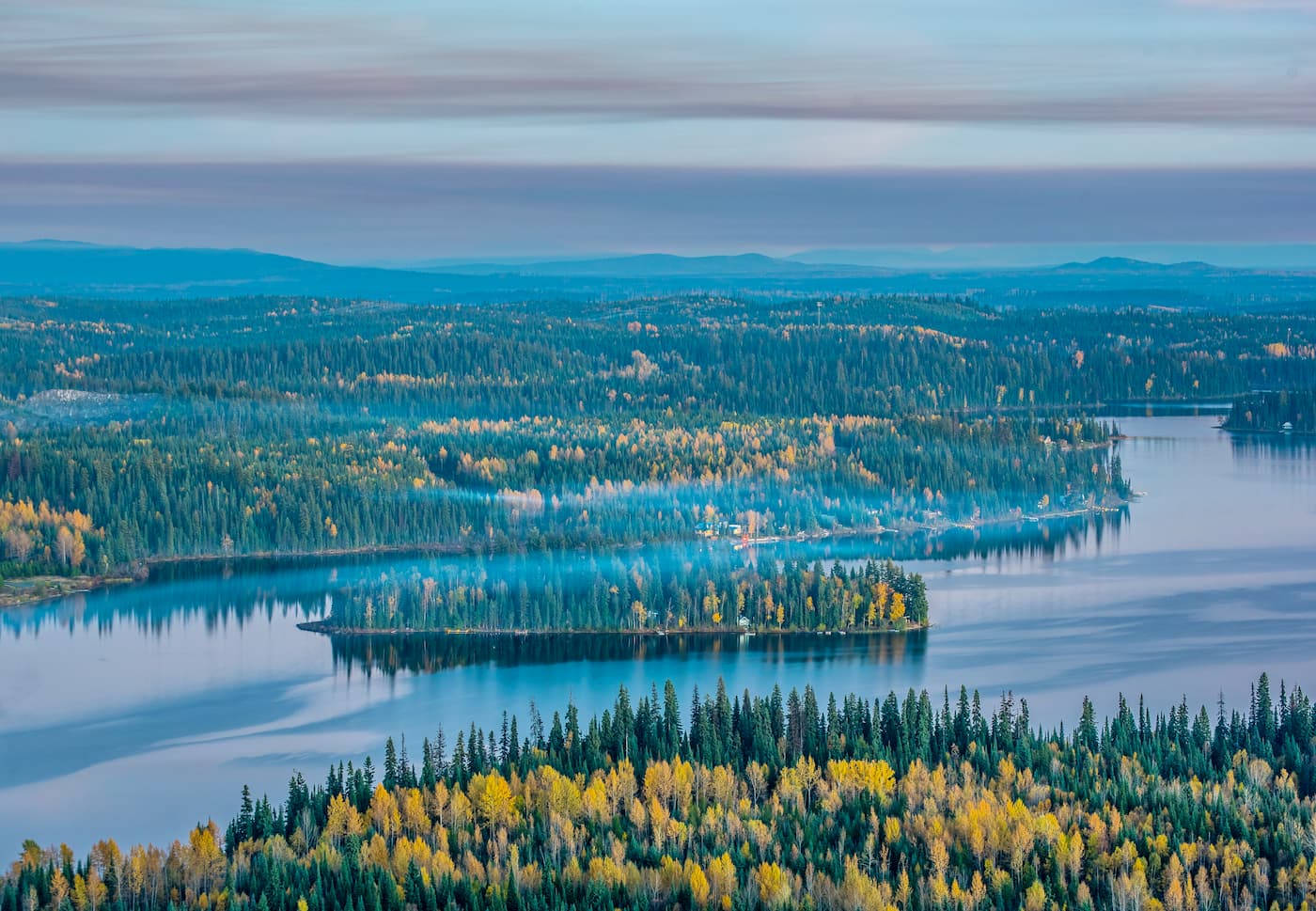
West Twin Provincial Park is located along Highway 16 in northern British Columbia, Canada. The park contains 7 named mountains, all of which are part of the Cariboo Mountains, a subrange of the Columbia Mountains. The tallest and most prominent mountain in the park is Mount Halvorson, which is 2,721 m (8,927 ft) tall and has 849 m (2,785 ft) of prominence.
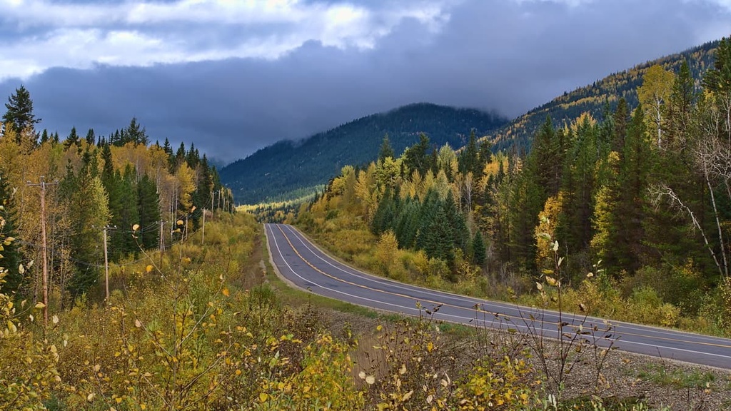
Located along the edge of the Rocky Mountain Trench, West Twin Provincial Park is situated on the eastern slopes of the Columbia Mountains in the eastern part of British Columbia, Canada. The park is accessible via Highway 16, which passes through the adjacent West Twin Protected Area.
There are six named mountains in the park, the highest and most prominent of which is Mount Halvorson. The most popular mountain in the park is likely Boulder Mountain, which has a trail leading to the summit and a cabin on its slopes that can be booked for overnight stays.
The region around West Twin Provincial Park contains many other provincial parks and protected areas that were created to preserve wilderness areas and recreational opportunities in eastern British Columbia. The following are some of the other parks and protected areas that are located near West Twin Provincial Park:
About 180 million years ago, the supercontinent of Pangea broke apart and the continents that it produced started to move across the Earth’s surface. Rifts subsequently opened in the middle of the Pacific Ocean and pushed the ancient North American continent to the west.
Since oceanic plates are denser than continental plates, oceanic plates generally subduct below the continental plates when they are pushed into each other. During such periods of subduction, volcanic island arcs and microcontinents that form on oceanic plates often accrete to or become stuck to the edge of the continent, creating a new continental coastline.
As North America moved westward and the oceanic plates moved eastward, the oceanic plates from the Pacific subducted beneath the west coast of North America and volcanic arcs accreted to the coast. The accretion of exotic terranes formed nearly the entire province of British Columbia and the current western coast of Canada.
In addition to adding new land to the western edge of Canada, the tectonic collision also pushed the continental margin inland, buckling it to form mountain ranges. The Columbia Mountains were the first mountains to be formed on the west coast of what is now British Columbia.
The mountain-building event, called the Sevier orogeny, that created the Columbia Mountains lasted from around 160 to 50 million years ago. The Columbia Mountains consist primarily of Proterozoic and Cambrian sedimentary rocks, principally quartzite, with significant granitic intrusions. The underlying rocks largely influence the current topography of the mountain ranges that we see to this day.
For example, where the bedrock in the region is composed of quartzite, the peaks are sharp and have continuous ridges, Meanwhile, the mountains that are underlain with granite tend to be larger, and they tend to have rounded peaks and irregular ridges that radiate from a central peak.
The east side of West Twin Provincial Park is dominated by the valley of the Rocky Mountain Trench. The trench, which divides the Rockies in the east from the Columbia Mountains in the west, formed about 65 million years ago.
Geologists theorize that shifting tectonic plates created the mountains by compressing the Earth’s crust. After the formation of the Canadian Cordillera, a reversal of the plates’ movement created a rift between the mountain ranges, which is today known as the Rocky Mountain Trench.
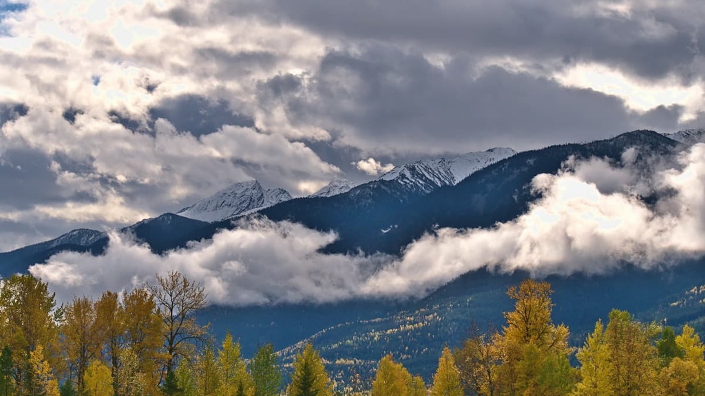
During the Pleistocene, the mountains were heavily glaciated. Intense cirque glaciation in the Cariboo Mountains created the sharp peaks and steep valleys of the range. The northern slopes in the region were typically affected the most by late-stage glaciation, creating a pattern of steep northern aspects in the range.
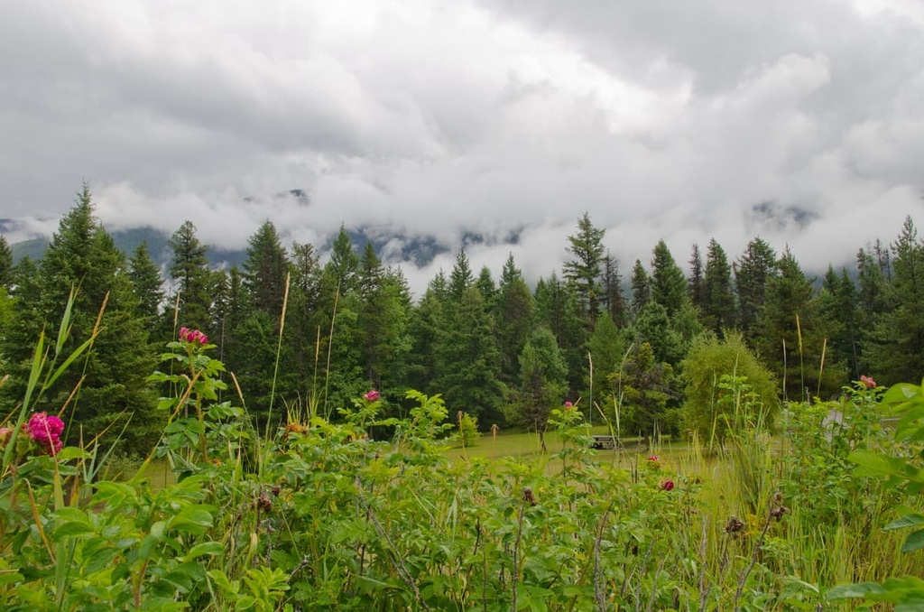
The valleys of West Twin Provincial Park are filled with inland temperate rainforests. These forests are dominated by tree species such as western hemlock and western red cedar, though there are also stands of hybrid spruce, subalpine fir, Douglas fir, and lodgepole pine in the park.
At higher elevations, the climate is cooler, so the cedar and hemlock fade out, and the forests transition to woodlands that are predominantly Engelmann spruce and subalpine fir, which are more tolerant to the cold. Subalpine fir is the most cold-tolerant tree in the region and tends to dominate the tree line. At lower elevations, the longer-living spruce usually dominates the forest canopy.
As one moves higher up in elevation, the forests thin out until the only trees left standing are the ragged krummholz. The alpine of the Cariboo Mountains receives significant snowfall during the winter months, too. Sedge and heather are the typical alpine vegetation species in the region and they primarily grow in protected areas around the summits of the park.
Bighorn sheep, mountain goats, marmots, and Columbian ground squirrels all inhabit the alpine areas of the park. Meanwhile, the subalpine is home to caribou, elk, mule and white-tailed deer, moose, grizzly and black bears, cougars, and wolves.
The area that is now West Twin Provincial Park is traditionally part of the territory of Dene and Interior Salish First Nations. There is archeological evidence and cultural knowledge that Indigenous peoples have inhabited the area for at least the past 7,000 years.
Many First Nations in the region lived a hunting and gathering lifestyle that continued until European traders and settlers started to arrive on the plateau. Alexander Mackenzie was the first recorded European to meet the First Nations of the region when he arrived in the area in 1793.
By the end of the eighteenth century, many First Nations in the region transitioned from a lifestyle consisting of seasonal migration and sustenance living to communities that were more based on fur trapping, trading with European settlers, and agriculture.
However, the area within what is now the park never saw substantial industrial development. The area around the park became substantially easier to access with the creation of Highway 16 in the 1940s. That said, the park itself wasn’t established until June 2000 when it was created to protect the region’s particularly biodiverse landscape.
Since it is located along Highway 16 in northern British Columbia, Twin Peaks Provincial Park is one of the more accessible parks in the region. The following are some of the trails and attractions that you can check out during your next visit to the park.
This 13.5 km (8 mi) out and back trail to the summit of Mount Boulder (Boulder Mountain) is a must-do hike if you are in the area.
The trail starts by taking you through thick vegetation, and it continues through a forest of cedar and Douglas fir until you reach an alpine meadow. From the edge of the meadows, it’s about 2.6 km (1.5 mi) to the summit and you pass a cabin along the way.
The hike is difficult, and you may be the only ones on the trail; however, the effort to attain the summit is worthwhile. The trail is well marked until you reach the meadows, where a bit of route finding is required to bring you to the scenic summit.
The West Twin Old Growth Trail is a casual 1.2 km (0.7 mi) loop through the forest that starts just off Highway 16.
This enjoyable loop is a popular hike in the area that takes hikers through forests of cedar, hemlock, and Douglas fir.
The area around West Twin Provincial Park is home to beautiful wilderness with countless opportunities for relaxation or adventure. The following are some of the municipalities located near West Twin Provincial Park that you can visit during your travels in the area.
Located along Highway 97 in central British Columbia, Quesnel is a city that’s situated about 300 km (180 mi) away from West Twin Provincial Park and Protected Area. Quesnel is surrounded by pristine wilderness that draws in numerous tourists each year who want to hike, canoe, hunt, and climb in the region.

Some of the incredible wilderness and hiking areas located near Quesnel include Wells Gray Provincial Park, Barkerville Provincial Park, and Bowron Lake Provincial Park. Additionally, if you’re in town for the day, you can check out one or more of a number of fun hikes, including the Riverfront Trail, Hogsback Trail, and the Wonderland Trails Loop.
Considered the capital of northern British Columbia, Prince George is a city situated on the western side of the Regional District of Fraser-Fort George at the junction of Highways 16 and 97. The city was originally founded as Fort George, a North West Company trading post established by Simon Fraser in 1807.
Prince George has grown into an important transportation and service hub for the northern part of British Columbia with all the amenities of a modern city. However, locals and visitors alike appreciate the wilderness setting of Prince George.
Popular hikes around the city include the Cottonwoods Island Loop, the Greenway Trail to Shane Lake Loop, McMillan Creek Loop, Troll Lake, Kakwa Lake Trail, and Forests for the World Lookout. Additionally, the city is located near several beautiful wilderness areas such as the Sugarbowl-Grizzly Den and Stuart River Provincial Parks.
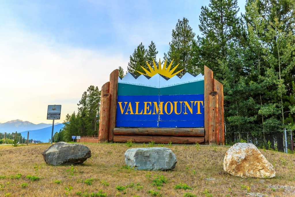
The Village of Valemount is situated to the west of West Twin Provincial Park. It is located between the Rocky, Monashee, and the Cariboo Mountains near British Columbia’s border with Alberta.
Centrally located among some of the world’s finest mountain terrain, Valemount is a popular destination for outdoor recreationists. The town is situated about 130 km (78 mi) away from West Twin Provincial Park, and it is also located close to many other incredible parks and wilderness areas.
Some of the hiking areas that you can easily get to from Valemount include Jasper National Park and Mount Robson Provincial Park. Additionally, Wells Gray Provincial Park, Cariboo Mountains Provincial Park, Bowron Lakes Provincial Park, Cummins Lake Provincial Park, Hamber Provincial Park, and the Willmore Wilderness Park are all located nearby.
While forestry is important to the local economy, the community has become a year-round tourism destination in recent years. It offers opportunities for hiking, fishing, backcountry excursions, skiing, snowshoeing, and snowmobiling, so there’s something for everyone to love at Valemount.