Scan the QR code and open PeakVisor on your phone
Hamber Provincial Park is a protected area located in British Columbia, Canada along the province’s border with Alberta. It is a part of UNESCO’s Canadian Rocky Mountains World Heritage Site. The park is bordered on three sides by Jasper National Park and it contains 15 named peaks, the highest and most prominent of which is Mount Scott (3,300 m/10,827 ft).
Hamber Provincial Park is a protected area located in the Canadian province of British Columbia, along the province’s border with Alberta. It is a part of UNESCO’s Canadian Rocky Mountains World Heritage Site. The world heritage site also includes Banff, Jasper, Kootenay, and Yoho National Parks as well as Mount Assiniboine and Mount Robson Provincial Parks.
Hamber Provincial Park is situated at the north end of the Columbia-Shuswap Regional District. It is bordered on three sides by Jasper National Park. The park features 15 named peaks and the beautiful Fortress Lake. The highest and most prominent peak in the park is Mount Scott, with an elevation of 3,300 m (10,827 ft) and a prominence of 937 m (3,074 ft).
The park is accessible by plane or by hiking over the Continental Divide from Jasper National Park in Alberta. The park currently encompasses 25,137 ha (62,088 acres) of the Rocky Mountain wilderness.
The geologic story of Hamber Provincial Park starts about 380 million years ago when the park would have been submerged beneath a shallow sea on the continental margin of North America.
During this time, cyanobacteria, also known as blue-green algae, were flourishing in the region’s warm waters and were responsible for the formation of significant layers of sediment as they died and sank to the sea floor.
The layers of sediment accumulated for millions of years as North America moved westward, away from its place as part of Pangea to where it currently resides between the Pacific and Atlantic Oceans. The layers of sediment grew to be many kilometers thick and were subsequently covered with continental runoff containing sand and silt.
About 180 million years ago, the Farallon under the Pacific Ocean collided with the western edge of North America and began to slide under the continent. As the plate subducted beneath North America, the buoyant volcanic island arcs and microcontinents that were located on the oceanic plate were accreted to the western edge of North America.
Most of British Columbia formed from volcanoes and exotic terranes that were subsequently attached to the west coast of North America. As the terranes accreted to the coast, the Farallon plate compressed the continental margin and uplifted to form the western cordillera.
The first mountains to form along the west coast were the Columbia Mountains. These were followed by the Coast Mountains and then the Insular Mountains, which include the Vancouver Island Ranges and Haida Gwaii. Most of these mountains were part of the Sevier orogeny, which occurred between 160 and 50 million years ago.
About 75 million years ago, the Laramide orogeny, which is the mountain formation event responsible for the formation of the Rocky Mountains, began. During the Sevier orogeny, an immense inland sea was created to the east of the region’s newly formed mountains.
During the Laramide orogeny, the tectonic collision started to compress the ancient coastline and raise the Rocky Mountains. Over 400 km (240 mi) coastal margin was compressed and folded to form the 200 km (120 mi) wide Rocky Mountains.
The force of the collision was such that the new Rocky Mountains rose higher than all the mountains to the west and became the high point of the continent.
As a result, it also became the Continental Divide, which separates the watersheds of the Pacific and the Atlantic oceans. The Continental Divide forms the border between British Columbia and Alberta until it meets the 120th meridian at approximately 53.8 degrees in latitude.
Toward the end of the Laramide orogeny, a tectonic slip occurred along the ancient continental coastline. This led to the opening of the Rocky Mountain Trench. This fault had previously been compressed while the surrounding mountains formed. But a tectonic “relaxing” occurred and a valley was created between the Rocky and Columbia Mountains.
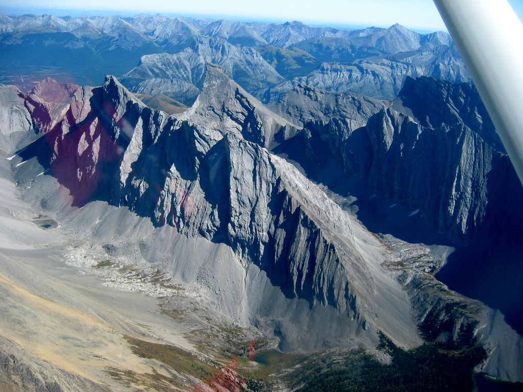
During the glacial maximums of the Pleistocene, vast ice sheets covered the entirety of the western cordillera, including the Rocky Mountains. The ice sheets and glaciers caused significant erosion of the mountains and continued carving away the softer layers of sandstone and shale from between the layers of limestone and dolomite.
The jagged peaks and rugged terrain of the Rockies are the result of the most recent glacial maximum. Though some of the tallest peaks weren’t subjected to the erosion of the ice sheet, localized cirque glaciers carved the limestone peaks and created the rounded valleys for tarn lakes while alpine glaciers created many of the U-shaped alpine valleys in the region.
There are two distinct ecologies represented in Hamber Provincial Park: alpine and subalpine. The elevation of the park is such that most of the park is part of the Interior Mountain-heather Alpine while the subalpine valleys belong to the Engelmann Spruce-Subalpine Fir ecology.
The alpine typically has deep snowpacks and relatively warm winter temperatures. The vegetation of the alpine contains a variety of species including sedges, herbs, wildflowers, and the dominant heathers.
Mountain goats and bighorn sheep are the typical large mammals you may encounter in the alpine, in addition to hoary marmots, Columbian ground squirrels, white-tailed ptarmigans, and American pipits.
Barren and rocky alpine tundra dominates the highest elevations of the mountains. It transitions to alpine meadows and eventually a parkland-like habitat with a mosaic of meadows and stands of trees at lower elevations.
Here, the cold tolerant subalpine fir dominates the tree line, with the highest elevation trees subjected to the fierce winds and storms, causing the stunted trees to grow in gnarled stands. From the tree line, the forest grows denser towards the valleys where rivers and creeks often flow.
Grizzly bears, wolverines, caribou, black bears, wolves, and moose are the large mammals that inhabit the dense forests around Fortress Lake. The dense forest of Engelmann spruce and balsam poplar around that provide shelter during the winter and allow many animals to stay in the area year-round.
The major cordilleran ice sheet is estimated to have melted from Hamber Provincial Park by about 10,000 years ago.
As the ice melted, the mountainous terrain acquired a tundra-like ecology of pioneer grass, sage, and scattered trees. The terrain was much more open than it currently is, and evidence suggests that humans have inhabited the region for the past 10,000 years.
Hamber Provincial Park is in the traditional territories of the Ktunaxa, Secwépemc, and the Sinixt First Nations.
Traditionally, the First Nations of the region lived a nomadic lifestyle that revolved around a seasonal schedule of hunting and gathering. The Sinixt and the Secwépemc are both part of the Interior Salish culture and have been particularly adept at fishing and harvesting fish as their primary winter food source.
The many First Nations of the Salish culture have inhabited the west coast of British Columbia for thousands of years, and around 3,000 years ago, the culture migrated inland.
The Ktunaxa First Nations are culturally unique among the other First Nations of the area. Like the Interior Salish cultures, the Ktunaxa lived a nomadic lifestyle following a seasonal migration; however, while they did fish for part of their food, they relied more heavily on hunting large game with bows and traps for most of their winter food stores.
There are no recorded archaeological sites within Hamber Provincial Park; however, there are many sites across the Continental Divide, in Jasper National Park in the Athabasca Valley as well as in the other nearby parks with sites dating from over 10,000 years ago to the more recent times of first contact with European fur traders.
European fur traders arrived along the Continental Divide by the late eighteenth century in search of routes across the Rockies to the rich wilderness of interior British Columbia and to the Pacific. The current Hamber Provincial Park had no noticeable part in this history except that the park was likely used to hunt game for subsistence and furs.
Hamber Provincial Park was originally designated in 1941. It initially included over 10,000 square kilometers (3,861 square miles) of pristine wilderness in the Rocky Mountains, along the Continental Divide, bordering the established Jasper, Banff, Yoho, and Glacier National Parks, and Mount Robson Provincial Park. At the time of its establishment, the park was one of the largest in Canada.
The park was named for Eric W. Hamber, Lieutenant Governor of British Columbia from 1936 to 1941. The original vision for the park was that it would bridge the gap between existing parks and that the federal government would be spurred to designate it a national park which would bring in funding for infrastructure as well as increase tourism revenue for the region.
Unfortunately, the Canadian Government’s attention was directed toward World War II and expressed little interest in the idea. By 1962, no tourist developments had been constructed and the proposed hydroelectric dams and forestry operations would significantly alter the park from its desired state and as such, the park was reduced to 2% of its previous area, now covering about 250 square kilometers (100 square miles).
Fortress Lake was first stocked with non-native eastern brook trout in the 1920s by the warden of Jasper National Park. Previously, there had been no fish in the lake; however, the population flourished and was stocked again in the 1960s and is regarded as one of the world’s best locations to catch trophy eastern brook trout.
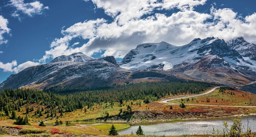
The major attraction of Hamber Provincial Park is the 11 km (6.6 mi) long by 800 m (0.5 mi) wide Fortress Lake. Such a large lake is unusual among the peaks of the Rockies, especially along the Continental Divide.
The lake was initially stocked in the 1920s and again in the 1960s with eastern brook trout. It is now regarded as a world class destination for fishing trophy eastern brook trout. There is a commercial fishing camp on the shores of Fortress Lake that provides float plane or helicopter transportation and remote, luxury accommodation for their clients.
The east end of the lake has a rustic campsite that has tent pads and pit toilets. It is accessible via the 22 km (13.2 mi) trail from the Sunwapta Falls in Jasper National Park. The hiking trail requires crossing the Athabasca and Chaba Rivers, though the rivers may be dangerous to cross.
There are no official trails in the park; however, there are some destinations and hikes in the park that are worth the effort. The following are some of the hikes and trails in the park:
Hamber Provincial Park is a remote wilderness park along the British Columbia side of the Continental Divide in the Canadian Rockies.
There are no roads into the park. While there is a 22 km (13.2 mi) trail from Jasper National Park, most travel into the park is via float plane to the fishing camp where anglers try to pull the trophy sized eastern brook trout from Fortress Lake.
The following are some of the nearby towns and cities where you would likely launch your adventure into the park:
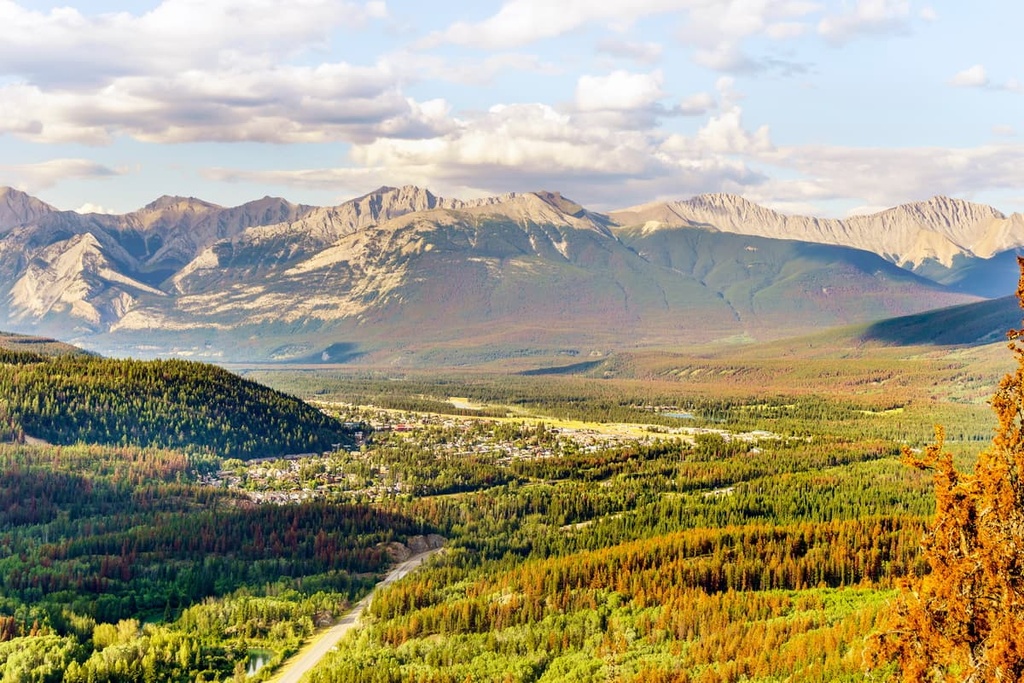
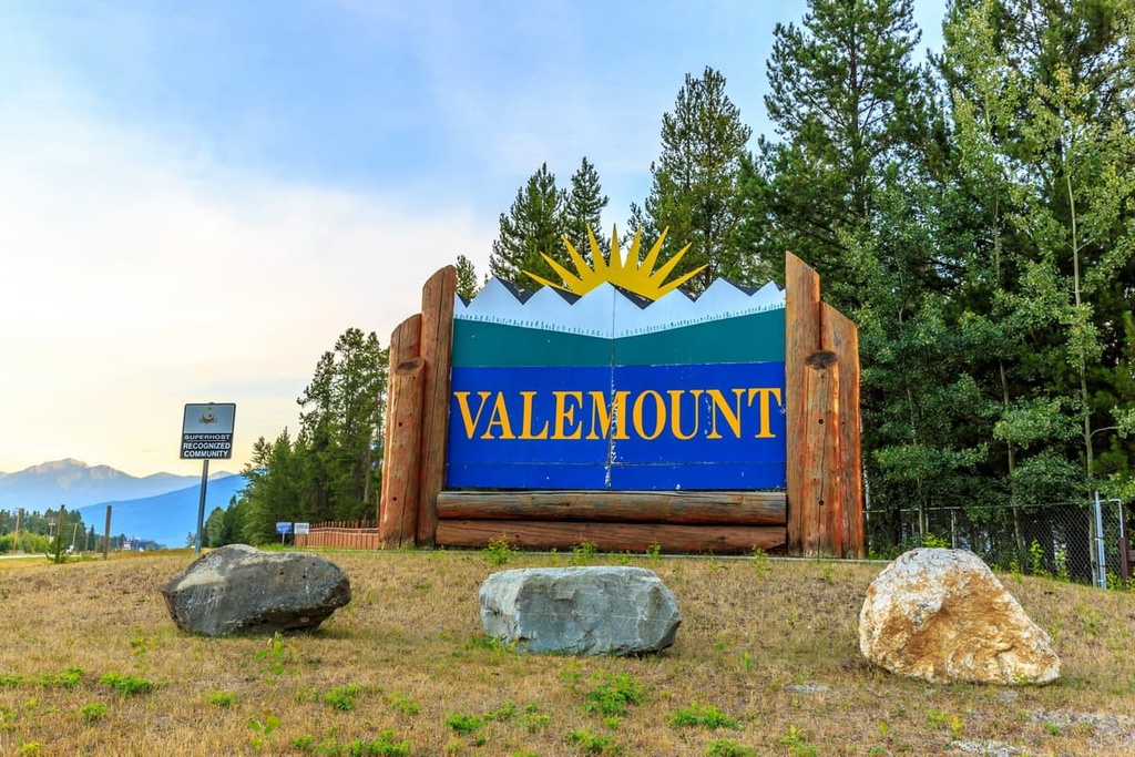
The Village of Valemount is the closest community to Hamber Provincial Park. It is located between the Rocky, Monashee, and the Cariboo Mountains. The village is the closest community to the west side of Jasper National Park and Mount Robson Provincial Park.
As it is centrally located among some of the world’s finest mountain terrain, the village is a popular destination for outdoor recreationists and is one of British Columbia’s 14 designated resort municipalities.
While forestry is important to the local economy, the tourism base has grown in recent years. The community is a year-round tourism destination and it now offers opportunities for hiking, fishing, backcountry excursions, skiing, snowshoeing, and snowmobiling.
Valemount is situated between some of Canada’s most stunning parks, including Jasper National Park, Hamber Provincial Park, Mount Robson Provincial, Wells Gray Provincial Park, and Cariboo Mountains Provincial Park.
Other notable wilderness areas near Valemount are Bowron Lakes Provincial Park, Cummins Lake Provincial Park, and the Willmore Wilderness Park.
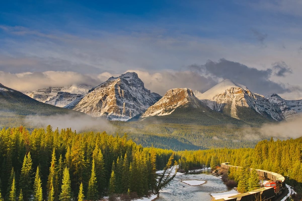
The town of Jasper is located about 55 km (33 mi) away from the trailhead at Sunwapta Falls, which leads to Hamber Provincial Park. It was originally a trading post named Jasper House that was built in 1813.
In 1907, Jasper National Park was established and the town of Jasper was created near the original fort site to be the commercial center for the newly established park.
Jasper National Park is part of UNESCOs Canadian Rocky Mountains World Heritage Site, which also includes Banff, Yoho, and Kootenay National Parks as well as Mount Assiniboine and Robson Provincial Parks.
Some of the most popular hikes from Jasper are the hike to Sunwapta Peak, the Sulphur Skyline Trail, and the Maligne Canyon Hike. Jasper National Park is considered to have some of the most stunning landscapes and scenery in Canada.