
Scan the QR code and open PeakVisor on your phone
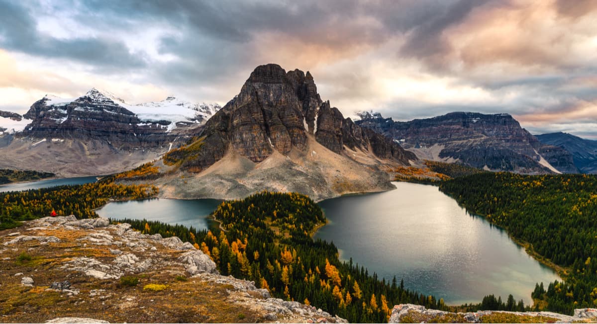
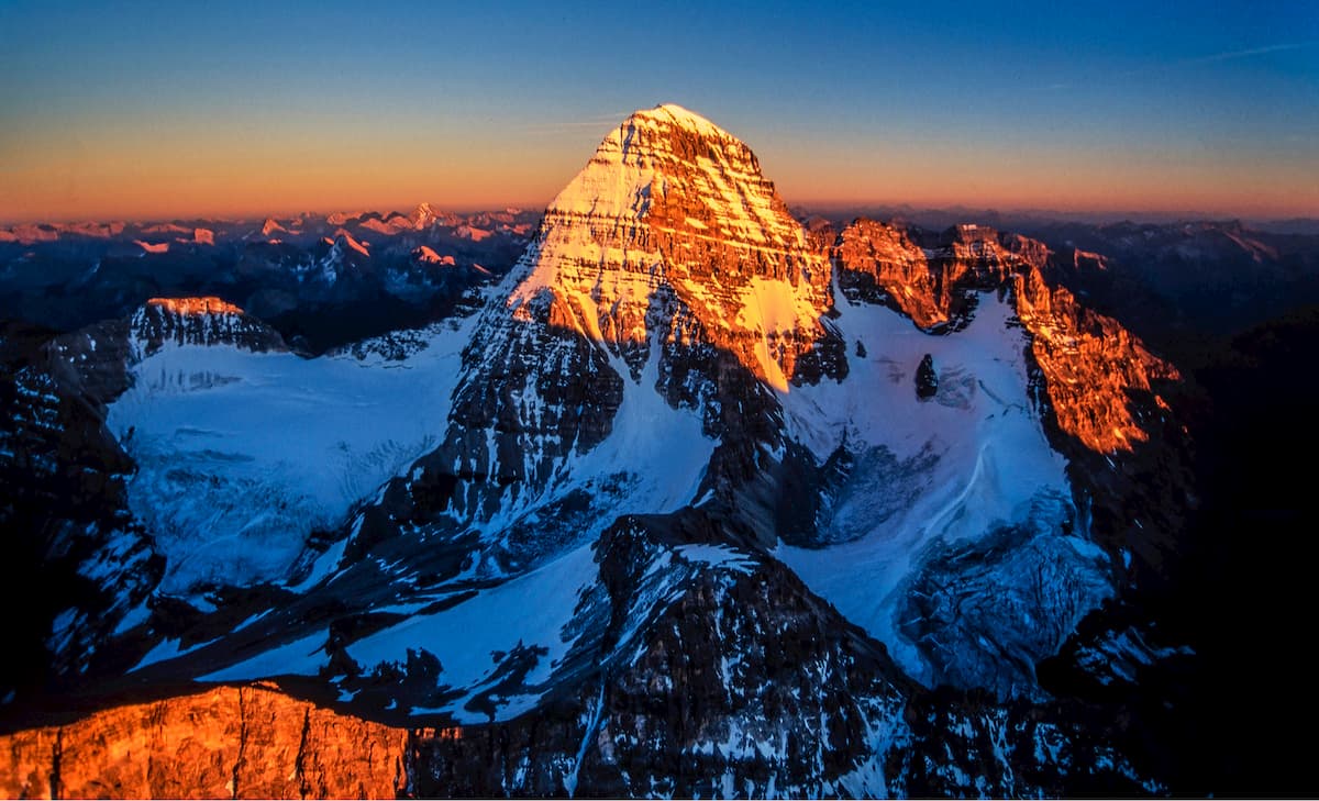
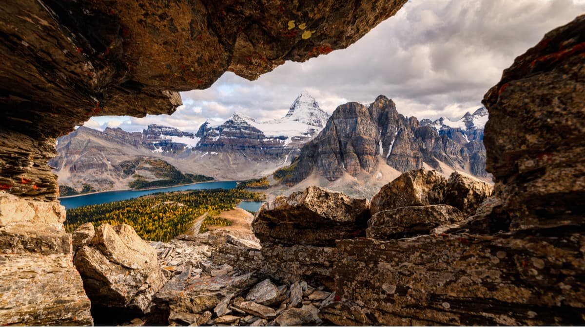
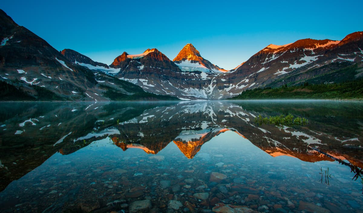
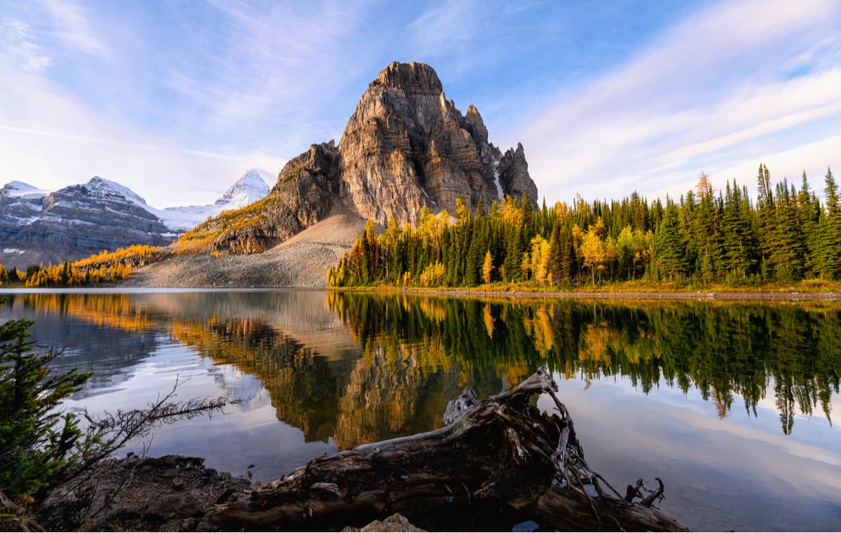
An awe-inspiring, 11,870-foot pyramidal peak sits on the Great Divide, straddling the British Columbia/Alberta border. Mount Assiniboine, which is admirably referred to as the “Matterhorn of the Rockies,” is the highest peak in the Southern Continental Ranges of the Canadian Rockies.
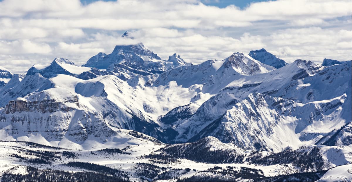
48 kilometers (29 miles) southwest of Banff, Alberta, outdoor enthusiasts can explore the summit’s namesake provincial park – Mount Assiniboine National Park. The park, which spans 39,013 hectares, is known for its brilliant alpine lakes, glistening glaciers, lush alpine meadows, and towering snow-capped summits.
The park was established in 1922 and was acknowledged as a Canadian Rocky Mountain Parks UNESCO World Heritage site in 1990. Together, Yoho, Banff, Jasper, and Kootenay national parks, as well as Mount Assiniboine, Mount Robson, and Hamber Provincial Parks are recognized for their extraordinary natural beauty and cultural, historical, and scientific significance.
Mount Assiniboine, which translates to “stone boiler,” was named in 1899 to honor the Assiniboine people. The area was well-known to indigenous peoples and there was a great deal of trading between tribes on various sides of the Rockies. The Piegans, Assiniboines, Blackfoot, and the Kootenai people all travelled and lived in the region.
In the early 1900s, enthusiastic mountaineers and climbers set their sights on conquering the peak’s iconic, triangular summit. In 1901, after a number of failed attempts, James Outram, a legendary mountaineer, and two Swiss guides, Christian Hasler and Christian Bohren, would become the first to reach the summit of Assiniboine. In 1922, the Alpine club of Canada urged the government to set aside a portion of the peak’s surroundings as a Provincial Park. And, in 1973, the park was expanded to its current size.

Unlike nearby national and provincial parks, there are no roads that access Mount Assiniboine Provincial Park. To experience the park, visitors will generally hike 27 km (17 mi) through Bryant Creek and over Assiniboine Pass. Others will opt to take a helicopter. Once within the park boundaries, visitors can camp, hike, mountain climb, fish, and even ski tour in the winter.
Aside from the region’s most notorious mountain, Mount Assiniboine, the park contains 37 named peaks, including illustrious summits like The Marshall, Mount Sturdee, Mount Magog, and Mount Strom. The park also protects a variety of wildlife species including elk, black and grizzly bears, moose, mountain goats, and bighorn sheep.
If you’ve ever seen a photograph of Mount Assiniboine, chances are it was taken from The Nublet or Nub Peak. This 7.3-mile out-and-back trail leads hikers to sweeping views of turquoise lakes and snow-capped summits, most notably Mount Assiniboine. The trail begins from Mt. Assiniboine Lodge and follows a wooden walkway before ascending into the woods. The Nublet, which sits before the true summit, offers incredible views of the surrounding peaks and lakes. However, hikers can continue on to The Nub or Nub Peak to soak in one of the most impressive views in the Canadian Rockies.
Lake Magog is another icon of Mount Assiniboine Provincial Park. The lake, which sits beside the park’s campground and lodge, is known for its stunning sunrise and sunset views of Mount Assiniboine. There is a footpath that encircles the lake, though most visitors will stick by the main viewing area.
Just 10 minutes from the Lake Magog Campground, Sunburst Lake is another popular destination within the park. The lake is the site of Sunburst cabin, where Lizzie Rummel, a German Canadian environmentalist, lived for many years. The lake is small, but beautiful, and features humbling views of Sunburst Peak.
The Naiset Huts and Hind Hut are owned by BC Parks and operated by Assiniboine Lodge. There are five quaint Naiset Huts that sit about 500 meters from the lodge. These huts, which were built by the Alpine Club of Canada in 1925, are rustic, one-room log huts that sit perched on the east shore of Lake Magog beneath Naiset Peak. The huts are equipped with everything you’d need and the Wonder Lodge Cooking Shelter provides visitors with a communal cooking and socializing space.
The Hind Hut is a climber’s hut that can only be accessed by climbing a steep headwall on a narrow and exposed ledge. Route finding and climbing skills are required to reach Hind Hut.
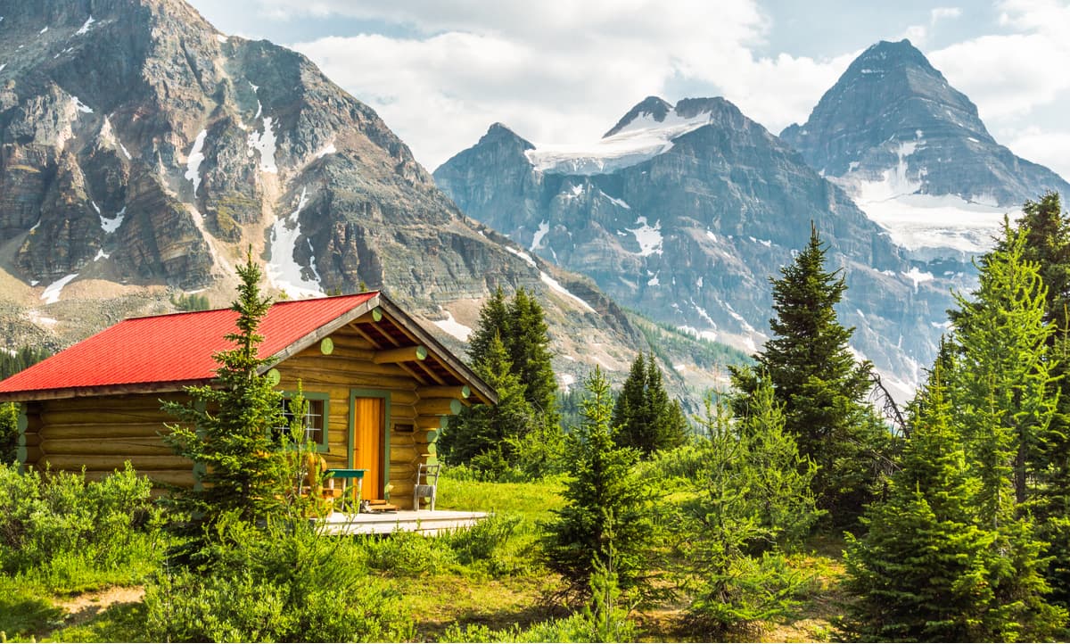
The Assiniboine Lodge was built in 1928 and, at the time, was North America’s first backcountry ski lodge. Today, visitors can ski the same meadows, hike the same trails, and tackle the same ski runs that were established when the lodge was built. The lodge sits at the base of iconic Mt. Assiniboine and is surrounded by incredible summits, larch trees, and crystalline lakes, making it the ideal destination to revel in the beauty of the Canadian Rockies.
The lodge offers visitors the opportunity to hike or ski tour with certified professional guides and, in the winter, the lodge provides visitors with all required and necessary safety equipment.Five rooms are available to accommodate guests in the main lodge and six historic one-bedroom log cabins are scattered among the larch trees.


ultra
11ers-bc
11ers-ca-rockies
fred-beckey-great-peaks
canada-sampler
british-columbia-ultras
alberta-ultras
ultra
11ers-bc
11ers-ca-rockies
fred-beckey-great-peaks
canada-sampler
british-columbia-ultras
alberta-ultras


