
Scan the QR code and open PeakVisor on your phone
Alberta is a Prairie Province located in western Canada that boasts a mix of landscapes, including the towering Rocky Mountains, glacial lakes, vast boreal forest, rolling foothills, productive prairies, and arid badlands. Alberta has 245 rivers, over 600 lakes, and 1888 named peaks. The tallest mountain in Alberta is Mount Columbia at 3,747 m (12,293 ft) in elevation, which is part of the Winston Churchill Range in Jasper National Park.
The province of Alberta is located in western Canada to the east of the Rocky Mountains. While considered the westernmost Prairie Province, Alberta is known for the mountainous scenery of Banff National Park, Jasper National Park, and Waterton Lakes National Park.
Alberta is bordered by British Columbia to the west, Saskatchewan to the east, and the Northwest Territories to the north. The state of Montana is Alberta’s neighbor in the US to the south with which Alberta shares an international peace park (Waterton-Glacier International Peace Park).
With an area totaling more than 600,000 square kilometers (231,660 square miles), Alberta is the sixth largest province or territory. However, Alberta accounts for only 6.6% of Canada’s total land area. It is also one of only two landlocked provinces, Saskatchewan to the east, being the other.
With a population of more than 4 million people, Alberta is the fourth most populous province in the country, behind Ontario, Quebec, and British Columbia. Over half of Albertans live in either Calgary or Edmonton, which is cause for a continuous rivalry between the two major cities.
With its vast and varied landscapes, Alberta has significant natural resources to manage and preserve. There are several classes of preservation for the wild and unique areas of Alberta, which are the following:
There are five national parks in Alberta: Elk Island National Park, Wood Buffalo National Park, Jasper National Park, Banff National Park, and Waterton Lakes National Park, several of which are UNESCO Heritage Sites.
The mountain parks of Jasper, Banff, and Waterton protect most of the Rocky Mountains in Alberta. Elk Island is a small park in central Alberta that was established to protect the wildlife and has the densest population of ungulates in Canada.
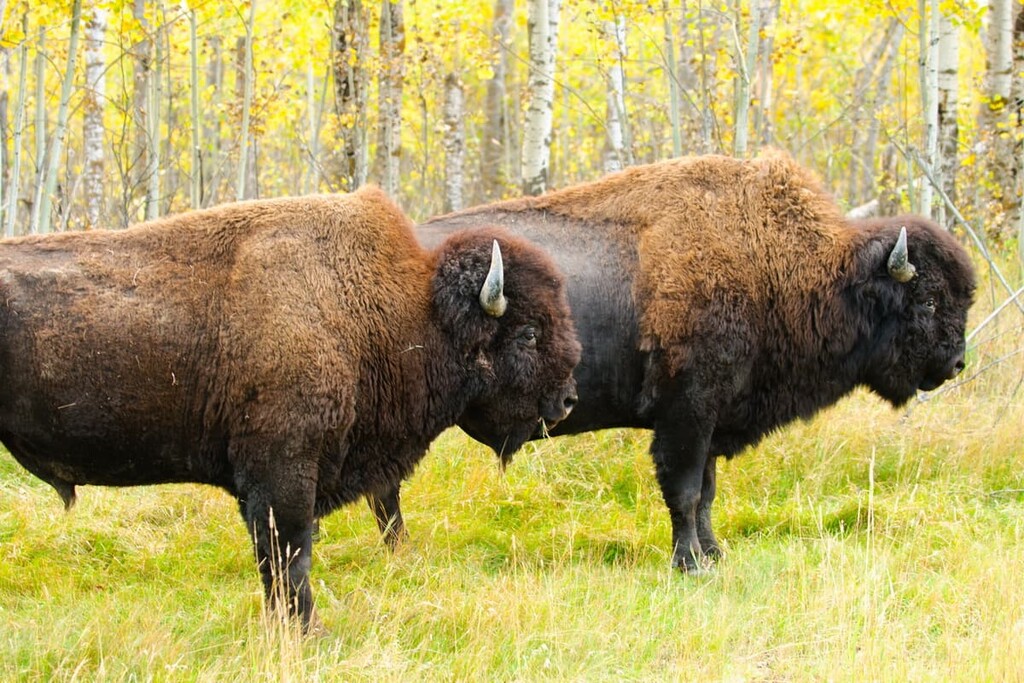
Finally, Wood Buffalo National Park in northeastern Alberta is the most ecologically complete Great Plains-Boreal grassland ecosystem in North America. As a result, it preserves an important region of biological diversity and a significant population of wild bison.
There are two designations of provincial parks in Alberta which are provincial parks, of which Peter Lougheed Provincial Park is the largest, and wildland provincial parks, such as Bow Valley Wildland Provincial Park. There are 76 provincial parks and 34 wildland provincial parks covering a total of 2,468 sq. km (953 sq. mi) and 33,334 sq. km (128,701 sq. mi) respectively.
The difference between the two types of parks is that provincial parks offer a variety of outdoor recreation opportunities with support facilities and greater road access. Wildland provincial parks offer outdoor recreation; however, there are minimal to no facilities in the parks and there is limited road access. Most road access to the wildland provincial parks is from the roads that border the wildland parks.
There are several other protected areas under provincial jurisdiction for conservation in Alberta. There are 204 provincial recreation areas that protect small unique areas for outdoor recreation. Provincial recreation areas can have facilities for camping, and others, such as the Nakiska Ski Area in Evan-Thomas Provincial Recreation Area.
The Willmore Wilderness Park is a unique designation that refers to a single area north of Jasper National Park. This area envelopes and preserves the remainder of the Rocky Mountains in Alberta that are located outside of the national parks.
Natural Areas, such as Beehive Natural Area, which is one of 139 natural areas in Alberta, are ecologically similar to surrounding areas; however, they were designated as natural areas to ensure the habitats and ecology remain strong.
Meanwhile, ecological reserves, of which Plateau Mountain Ecological Reserve is one of 15 such reserves in Alberta, protect specific, rare, and endangered features or ecosystems. For example, Plateau Mountain Ecological Reserve has unique periglacial features.
Heritage rangelands are the final protected area in the province and there are only two in Alberta. Like natural areas, heritage rangelands are areas that are similar to the surrounding area. However, natural areas promote all low-impact recreation while heritage rangelands restrict access to foot and horse only. Heritage rangelands are leased for commercial use to maintain the natural ecology, historic culture, and economic function of Alberta’s native rangeland.
Alberta is very geologically diverse; so, we will focus on the major time periods that created the layers of rock in Alberta. The oldest layer of rock in the province is made of granite and gneiss that is billions of years old. This rock was created from metamorphic events of which the most recent was the Hudsonian orogeny some 1.9 to 1.6 billion years ago.
These metamorphic and igneous layers form the geological basement of Alberta. The only place in Alberta where this geological period is visible is in the far northeast of the province. This area is often referred to as the Canadian Shield.
Upon the basement layer we find deposits of marine sediments that accumulated from about 541 to 251 million years ago during the Paleozoic. The Devonian period of the Paleozoic is known for the vast diversity of fish and marine life. Devonian layers are found in the northeast corner of Alberta, bordering the region of the Canadian Shield.
During the Paleozoic, a marine transgression flooded much of present-day Alberta, forming a sea in which marine creatures died and accumulated on the seafloor. The organic matter was covered in sediment which exerted pressure, increasing the temperature, and transforming the organic material into the vast oil reserves that underlie much of Alberta today. In a similar manner, the vegetation that grew along the shores and rivers formed coal reserves.
Paleozoic marine sediment is also found throughout the Rocky Mountains. The Rocky Mountains were formed from thick layers of marine sediment, including limestone and dolomite which were lifted above the sea about 50 million years ago.
Above the Paleozoic rocks in Alberta, layers of shale and sand accumulated upon the marine sediment during the Cretaceous. The Cretaceous layers hold a number of recognizable fossils such as the Tyrannosaurus rex. While the Cretaceous is the dominant layer that is visible across Alberta, there are an abundance of fossils found at Dinosaur Provincial Park near Drumheller, Alberta.
The formation of the Rocky Mountains started about 75 million years ago, and erosive forces immediately began to break them down. A significant erosive force was the sea that was being displaced as the layers of rock uplifted. It appears the water traveled perpendicular to the new Continental Divide, towards the northeast, stripping away over 1,000 m (3,281 ft) of rock from Alberta’s ancient landscape.
The more recent Cenozoic, which started 66 million years ago left layers of sediments with unique fossils in Alberta. The Paskapoo formation near the Rockies has fossils of gliding mammals and early pangolins.
Alberta is known for extraction of its underground resources, in particular oil and coal. Vast oil deposits are found in the oil sands (also called the tar sands) in northern Alberta and a large volume of natural gas has been found in the east, under what is now Medicine Hat.
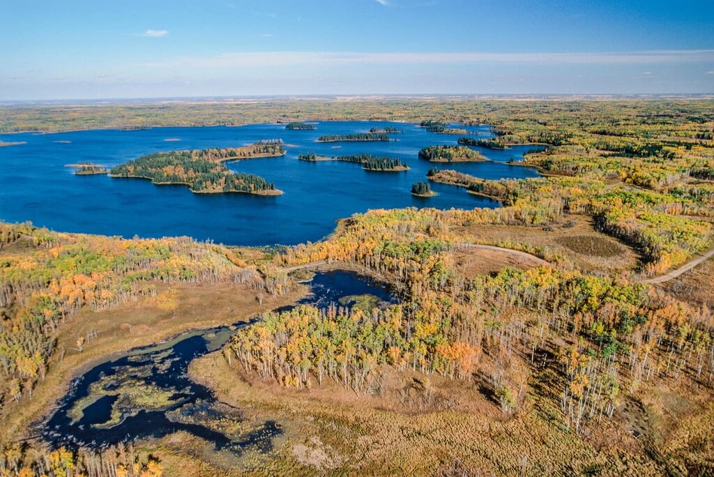
There are six major natural regions within Alberta that are used to describe the ecology of the province. These natural regions are the Grassland, Parkland, Foothills, Rocky Mountain, Boreal Forest, and Canadian Shield.
There are 587 wildlife species that migrate through or inhabit Alberta, many of which are protected or endangered. Some of the popular wildlife to sight are elk, moose, bighorn sheep, grizzly bear, bison, cougar, and wolf.
There are also the elusive lynx, bobcat, and wolverine to watch out for as well as other ungulates, such as mountain goats, white-tailed and mule deer, and caribou. Wildlife is also plentiful for birdwatchers and anglers.
Here’s a quick look at the different natural regions in Alberta”

The Grassland Natural Region covers approximately 14.4% of Alberta and includes the mostly flat and rolling landscapes in the province. This is the warmest and driest region in Alberta, and as the name implies, the natural area is dominated by native grass species. Animal species unique to the grasslands are the swift fox, greater sage-grouse, mountain plover, painted turtle, short-horned lizard, and the western rattlesnake.
The Parkland Natural Region covers about 9% of Alberta and is characterized by grassland mixed with aspen forests and willow shrubland. The parkland is a transitional zone between the dense forests and the prairies, so there is a mosaic of aspen and poplar stands, and grassland. Though thought of as boreal inhabitants, moose, snowshoe hare, and flying squirrel inhabit the parkland as well.
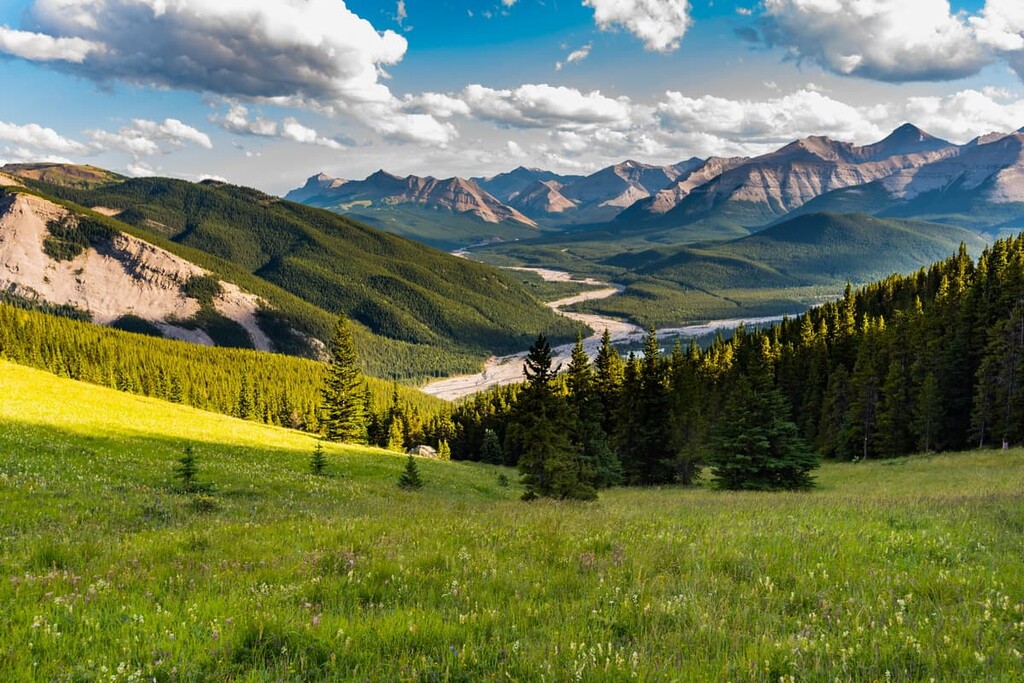
The Foothills Natural Region covers around 10% of Alberta and it is the transition zone between the Rocky Mountains and the prairies in the southwestern part of the province. With sharp peaks in the west levelling into rolling prairies in the east, the wide array of topography creates many unique habitats in the foothills for animals to enjoy. In particular, dense forests cover most of the foothills creating habitat for grizzly bears, wolverine, and woodland caribou.

The forests of the foothills typically contain lodgepole pine, Engelmann and white spruce, Douglas Fir, aspen, and poplar. The absence of lodgepole pine is what delineates the forests of the foothills with the forests of the Boreal Forest Natural Region.
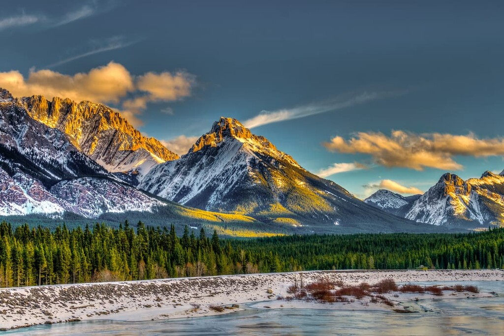
The Rocky Mountains Natural Region covers around 7.4% of Alberta and is located on the southwest border with British Columbia. The Rocky Mountains are a region with mountains, high foothills, and deep glacier carved valleys. It has cool summers and long cold winters and receives the most precipitation of all the regions of Alberta.
The alpine peaks receive the most precipitation creating glaciers and snow fields which contributes to the year-round flow of major rivers across Alberta. The alpine peaks have the least flora and fauna or any ecological subregion, while the lower elevations have abundant and the most diverse ecology of all the ecological subregions of Alberta.
The Rocky Mountain landscape is divided into a matrix of forest and grasslands. The typical Rocky Mountains forests have lodgepole pine, Engelmann spruce, aspen, subalpine fir, and larch. The forest and grasslands are prime grizzly habitat, and the region has large populations of ungulates, including mountain goats, elk, and bighorn sheep.
The famous Banff National Park, Jasper National Park, and Waterton Lakes National Park are all found within the Rocky Mountain Natural Region.
The Boreal Forest Natural Region covers approximately 58% of Alberta. It is found in the north of the province where the forests contain aspen, balsam poplar, white spruce, black spruce, and jack pine. Within this natural region, Wood Buffalo National Park helps conserve critical habitat for several species. Nesting grounds for the rare whooping crane are in this region as well as critical habitat for woodland caribou and wood bison.
The Canadian Shield Natural Region covers only 1.5% of Alberta in the far northeast corner of the province. This natural region has minimal vegetation, though it features large exposed areas of granite bedrock, coarse glacial deposits, hundreds of small lakes, wetlands, upland forests, rocky cliffs, and islands.
It is possible that parts of Alberta have been inhabited at times as far back as 70,000 years ago, however, changing topography during the Pleistocene has likely destroyed all cultural evidence from so long ago. Nevertheless, there is record of humans inhabiting the lands that are now called Alberta as far back as 11,500 years ago. Indeed, many unique cultures and nations lived in the region long before Europeans arrived in Alberta.
Alberta is the traditional territory of many peoples including the Beaver, Dene, Metis, Cree, Denendeh, and Akaitcho, who traditionally live in the northern boreal forests of the province. Meanwhile, the Aseniwuche Winewak, Secwepemcúl'ecw, Tsuu T’ina, Stoney, Ktunaxa, Blackfoot, and Očhéthi Šakówiŋ, consider much of Alberta’s mountainous regions and plains to be their ancestral homelands.
Human history in Alberta possibly began as far back as 70,000 to 50,000 years ago, the first known period in which Beringia was intact and there was a corridor through the continental ice. Further north, in Yukon, the Bluefish Cave archaeological site suggests that migration occurred to Canada at least 24,000 years ago; however, if people did ever inhabited lands further south, the glaciers have destroyed the evidence of any groups of people in the area.
The oldest known archaeological site in Alberta is a hunting camp from 10,500 years ago that’s located on the slopes of Mount Edith, near the Vermillion Lakes in Banff National Park. However, it is agreed that this site does not represent the earliest people in the region, it is just the oldest record that has been found.
By 10,500 years ago, Alberta was nearly ice free and megafauna were already migrating into the fresh, new landscape. Starting 11,500 years ago, the technology of the Clovis culture swept across the continent. They had created a distinct channeled hunting point that was extremely effective against large mammals. Whether through migration or interaction, their culture spread across the continent and into Alberta.
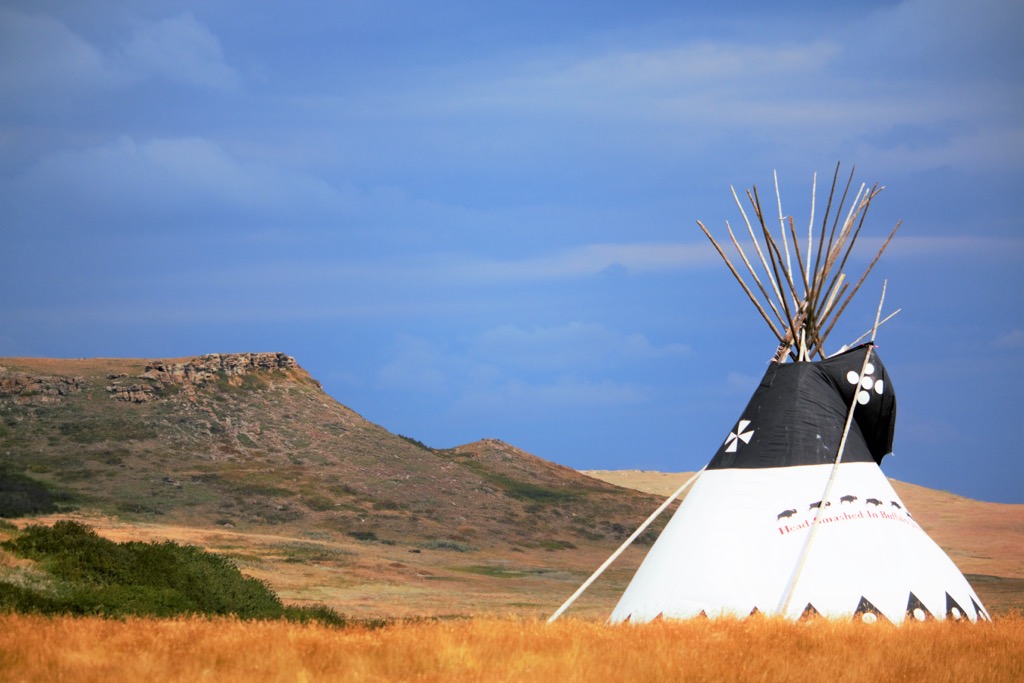
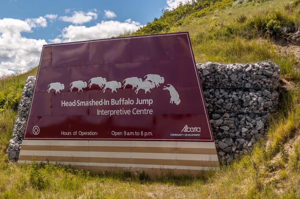
By 9,000 years ago the inhabitants of Alberta were specialized in the communal hunting of bison for their subsistence. Within wooded areas, groups would hunt bison by channeling herds into pens, while on the prairies the buffalo were stampeded off cliffs, a technique referred to as Buffalo Jumps.
The biggest, oldest, and best-preserved buffalo jump in North America is the Head Smashed In Buffalo Jump UNESCO World Heritage Site in southern Alberta. It is of substantial cultural importance as it was used for over 5,000 years by the people living on the plains, until the horse was introduced to the region in the 1730s.
The introduction of the Avonlea culture about 1,000 years ago, which was the first known culture to use bows and arrows in the region, started changing how hunting on the plains worked. Alongside the introduction of the horse in the 1700s, the bow revolutionized life on the plains for the First Nations in the region.
One of the first people of European descent to venture into what is now Alberta, Anthony Henday of England first arrived in the region in 1754. He came to strike deals with the First Nations in the region in order to expand the Hudson Bay Company’s influence. Upon his arrival there was confusion, because the local groups already had horses, which were previously obtained only through Europeans.
It is suspected that the western nations traded and stole horses from those to the east who had already been in contact with Europeans. The introduction of horses to the prairies changed the culture of the region, allowing people to control vast territories.
Henday recognized that the plains First Nations were not ideal partners for his fur trade because they lived far from the desired fur-bearing animals of the boreal forests in the north. So, while the company didn’t move into the territory, it opened the way for whiskey traders and whiskey forts, which left a violent mark on the relatively peaceful plains.
By 1870, the newly formed nation of Canada took greater notice of the western territories. The government encouraged settlers and homesteaders to move to the region, creating programs that would see significant immigration of Ukrainian, German, Norwegian, and Welsh immigrants, as well as many members of the Church of Jesus Christ of Latter-Day Saints.
Each of these groups would create many homogenous communities throughout Alberta. Additionally, many of these immigrant groups established farming operations in the province. Meanwhile, many others would come to work on the railroad, for logging companies, for mining operations, and as ranchers.
Furthermore, in 1717 fur trader Henry Kelsey likely became the first European to be shown the oil sands of Alberta. Waupisoo of the Cree brought Kelsey a sample of oil, which was mixed with spruce gum to create a waterproof coating that many First Nations used for their canoes. Some 250 years later, oil production began in the oil sands, though it’s worth mentioning that other oil and gas fields in the province were operational long before Alberta’s tar sands became commercially viable.
In fact, as early as 1883, while railroad workers were drilling a mine near Medicine Hat in southeast Alberta, they encountered flows of natural gas. Companies in Medicine Hat would then harvest the gas and then use it to heat comes, for cooking, and for power production.
In subsequent years, companies began earnestly searching for oil reserves across Alberta, with the first significant find made in Leduc County in 1947. This was the start of a resource-based economy for Alberta that continues to this day.
Alberta has some amazing destinations with scenic landscapes, unique ecologies, and abundant wildlife. The following is a list of some of the highlights that Alberta has to offer; however, by no means is this an exhaustive list of all there is to see and do in the great province of Alberta.
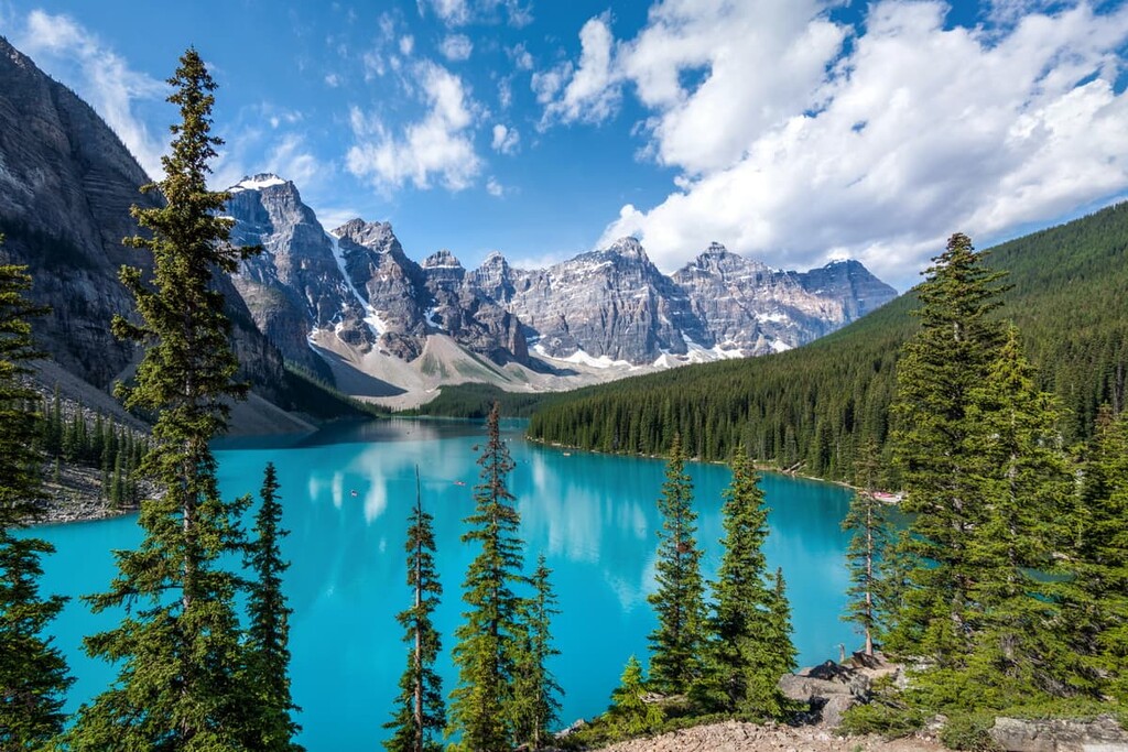
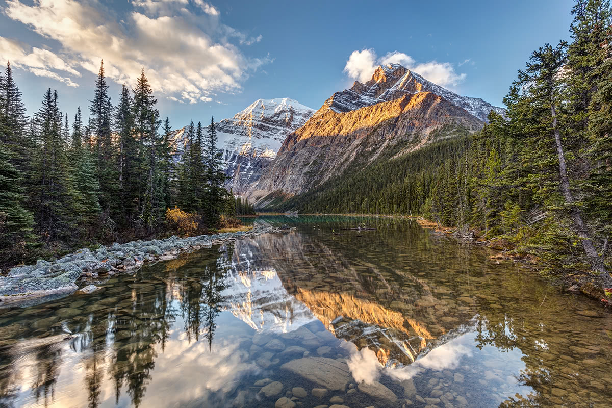
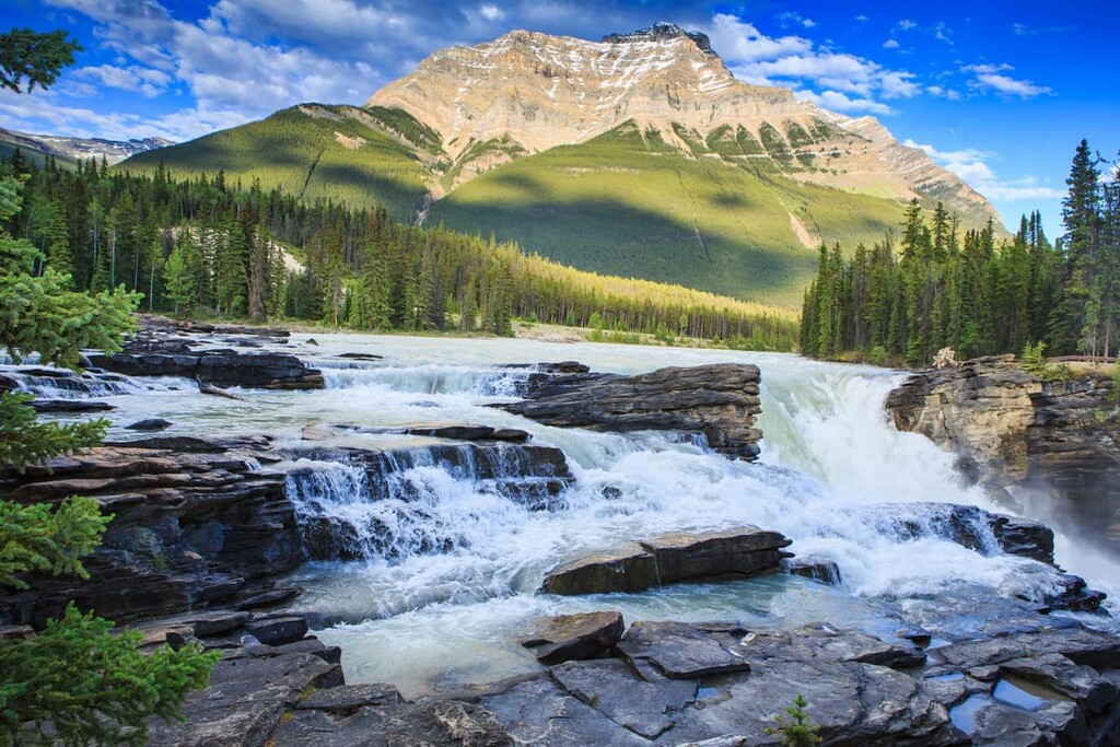
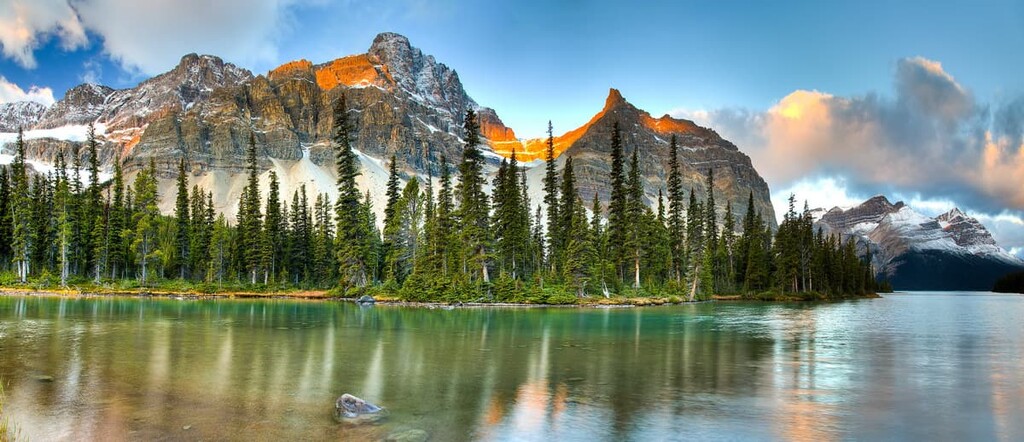
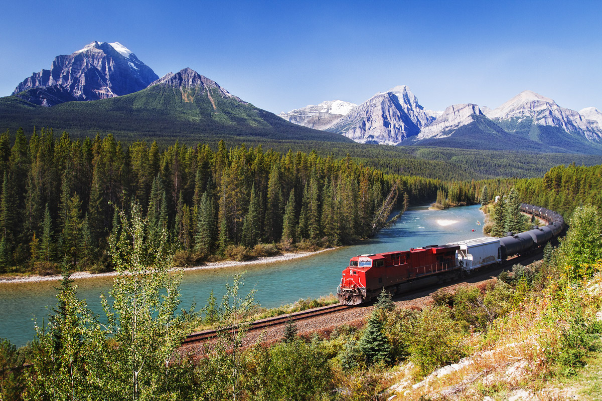
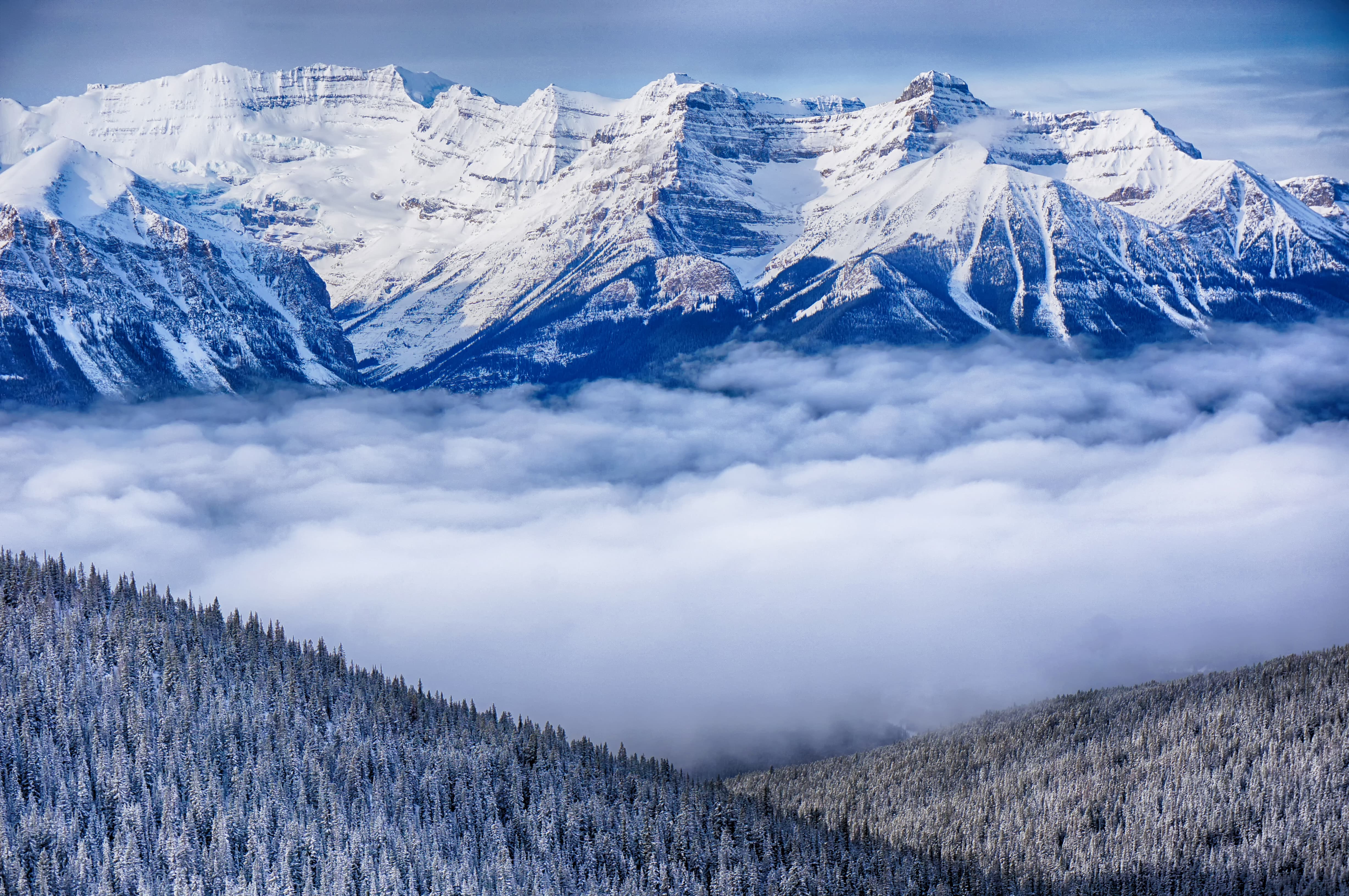
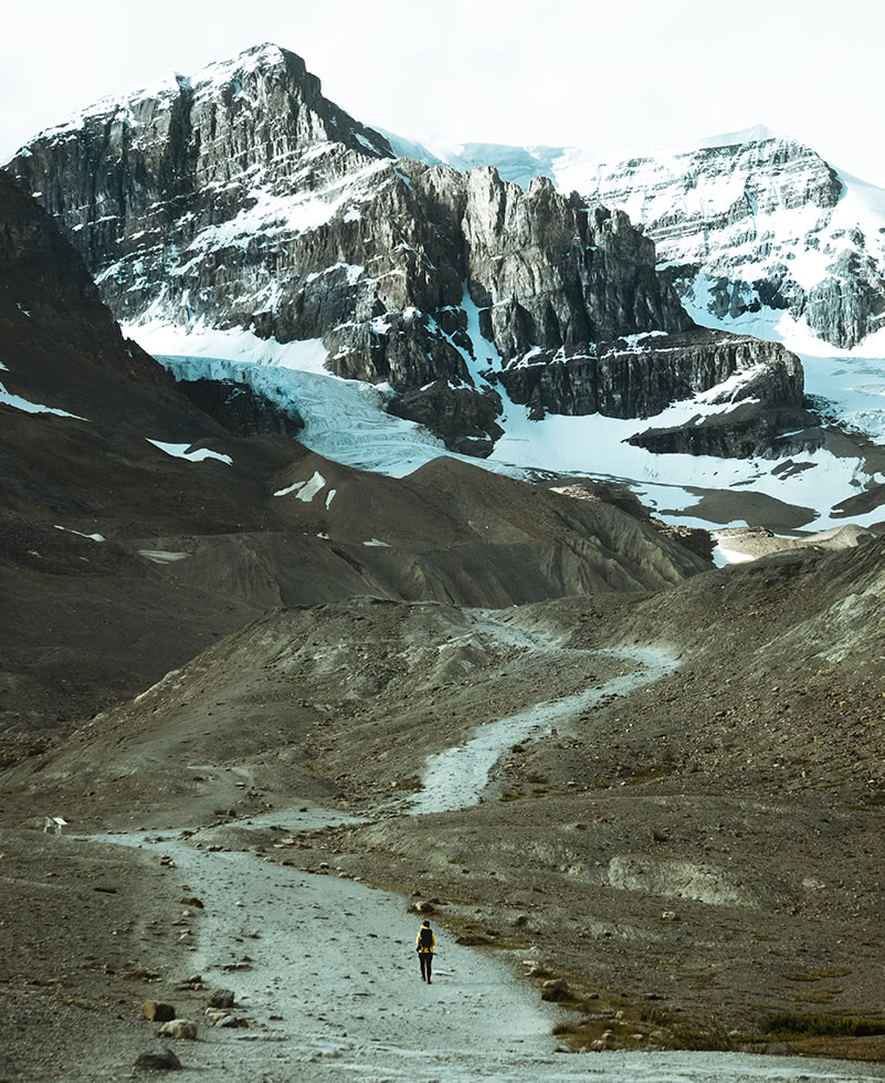
Located about 140 km (84 mi) to the west of Calgary, is the eastern gate to Banff National Park—the first national park in Canada. Established in 1885 upon the discovery of the Cave and Basin Hot Springs, Banff National Park encompasses 6,641 square kilometers (2,564 square miles) of mountainous terrain, glaciers, icefields, dense forest, spectacular rivers and waterfalls, and gorgeous turquoise lakes.
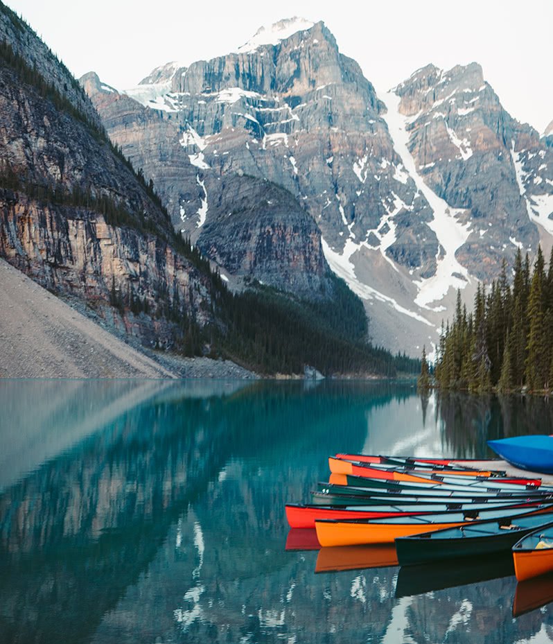
Some of the most popular places to visit in Banff National Park are the Banff townsite and Lake Louise, both of which have the grand hotels that the Canadian Pacific Railway built at the beginning of the twentieth century.
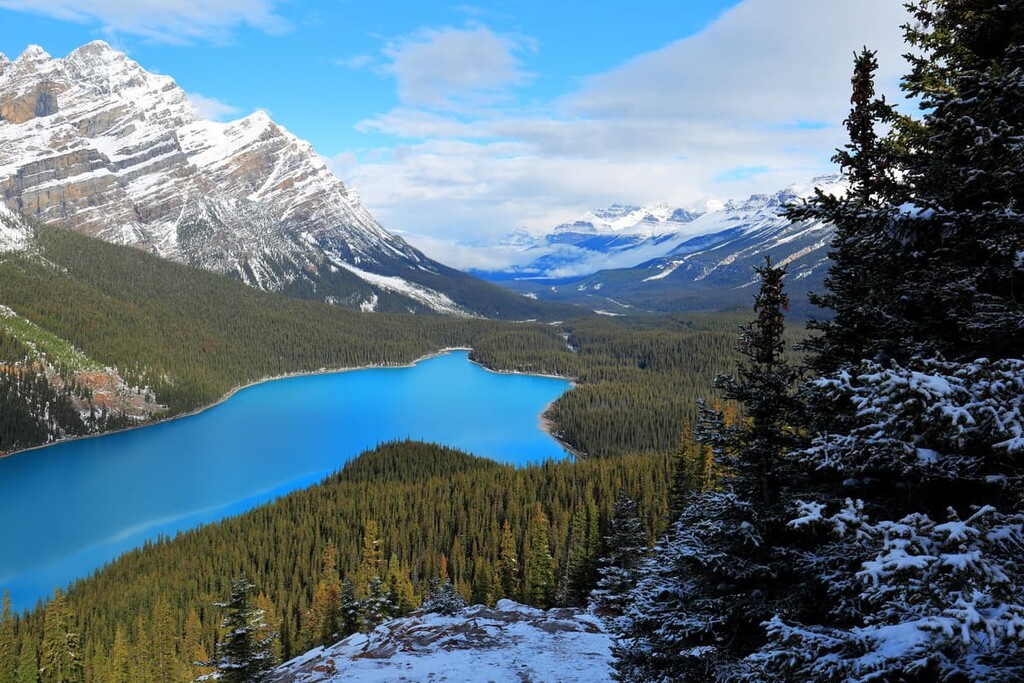
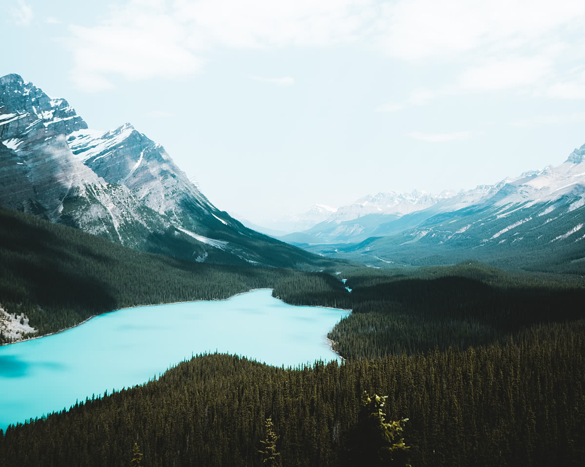
Furthermore, Peyto Lake, Moraine Lake, and Lake Minnewanka, the latter of which features a submerged townsite, are all lovely places to visit. There are also countless glaciers within the park to view, too. What’s more, the Icefields Parkway, which connects Banff to Jasper National Park passes through the Columbia Icefield, offers visitors a unique chance to travel upon one of the largest non-polar ice fields in the world.
Banff National Park’s entire history is based on conservation and tourism, so there are hundreds of kilometers of hiking trails and guest facilities. The region is managed to balance recreation and conservation, and the park is home to some of the most spectacular landscapes in the Rocky Mountains and in the world.
The other mountain national parks in Alberta deserve an honorable mention at this point, too. Indeed, Jasper National Park and Waterton Lakes National Park are both spectacular places to visit, and you can find detailed information on each park on their linked pages. All the mountain parks of Alberta are special places that offer unique opportunities for outdoor recreation and tourism.
Located some 35 km (22 mi) to the east of Edmonton, Elk Island National Park is 194 square kilometers (75 square miles) in area and fully enclosed, with the exception of the Yellowhead Highway, which runs right through it.
The park is representative of the northern prairies plateau ecoregion, thanks to its sprawling grasslands, aspen parkland, and boreal forest. The area contains over 200 archaeological remains of Indigenous settlements and tool making sites. However, the years after European contact were a period of over-hunting and over-logging in the region until a fire swept the area in 1894.
In 1906 a group of five men from Fort Saskatchewan petitioned the federal government and provided funds to set up an elk sanctuary, calling it “Elk Park”. By 1913, the park had received federal protection, leading it to become Elk Island National Park in 1930.
Elk Island is special because of the wildlife that inhabit the park. The park is home to the densest population of ungulates in Canada and a variety of other animals. Year-round residents include bison, moose, coyote, mule deer, white-tailed deer, beaver, elk, lynx, and porcupine. Black bears and timber wolves move through the area too.
There are over 250 bird species found in the park, including American bitterns, red-necked grebes, double-crested cormorants, American white pelicans, great blue herons, red-tailed hawks, and the trumpeter swans.
Wildlife conservation is a major role of Elk Island National Park and is responsible for ungulate conservation and repopulation efforts across North America. Native species have been successfully reintroduced to the park, including wood and plains bison, beaver, and trumpeter swans.
The wildlife from Elk Island National Park is transferred as seed populations to other regions. Elk have been transferred across Canada, and even to the United States as far south as Kentucky. Bison have been relocated across Canada, to Montana in the United States, and even to Russia.
The large diversity of mammals and birds within such a small area in Elk Island National Park also create plenty of opportunities to see lots of wildlife relatively up close in their natural habitats.
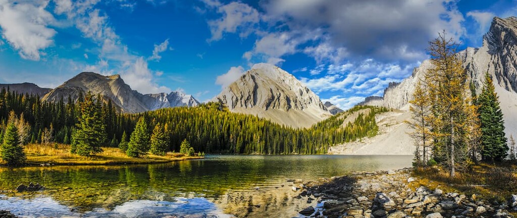
Near Alberta’s southwest border between Calgary and Banff National Park, Kananaskis Country is a real-life experiment of conservation and recreation. Officially created in 1978, Kananaskis Country is a mixed-use recreation zone allowing low impact activities such as hiking, cycling, and backpacking as well as higher impact activities such as OHV use, horses, cattle grazing, and random camping.
The experiment with the region is to provide as many different recreation opportunities as possible without compromising the natural environment and enjoyability for others. To make this work, Kananaskis Country is divided up into provincial parks, provincial wildland areas, natural areas, ecological reserves, and public land use zones.
Each designation carries certain responsibilities and freedoms for each area. As such, the fragile mountain ecosystems are limited to hiking and camping only in designated areas, while the public land use zones may allow OHV use and random camping.
Kananaskis Country is popular for locals and tourists, alike. There are hundreds of kilometers of trails to hike and cycle in the region. Numerous places to camp in the front and backcountry. There are also many large lakes to kayak, canoe, or SUP, and a couple rivers with white water and rapids for surfing. The lakes and rivers have abundant fish and the Bow River offers some of the best trout fishing in Canada.
Located about a two-hour drive east of Calgary, near Drumheller, Dinosaur Provincial Park is unlike any other park in Alberta. Situated along the Red Deer River, the park has striking badlands topography mixed with grasslands and cottonwoods along the water.
The topography appears otherworldly, though fossils are the major attraction to the area. There are many hikes and viewpoints within the park and region that pass by and overlook archaeological sites where fossils, ranging from microscopic fern spores to giant carnivores such as Albertosaurus, are routinely excavated.
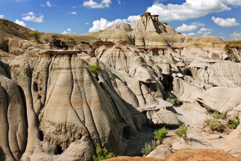
The park is a UNESCO World Heritage Site as it is one of the richest dinosaur fossil locations in the world. The Royal Tyrrell Museum is generally responsible for archeological studies in the area now, and fossils from 58 dinosaur species have been found, with over 500 specimens removed for display around the world.
It is possible and likely to encounter fossils while hiking in the park. Please leave artifacts in place and if they appear significant, notify the authorities or staff at the museum regarding your find. It is exciting to hike and explore the badlands outside of the park where the same rules regarding collection do not apply; however, there are local laws about the collection and keeping of fossils that would-be fossil hunters should be familiar with.
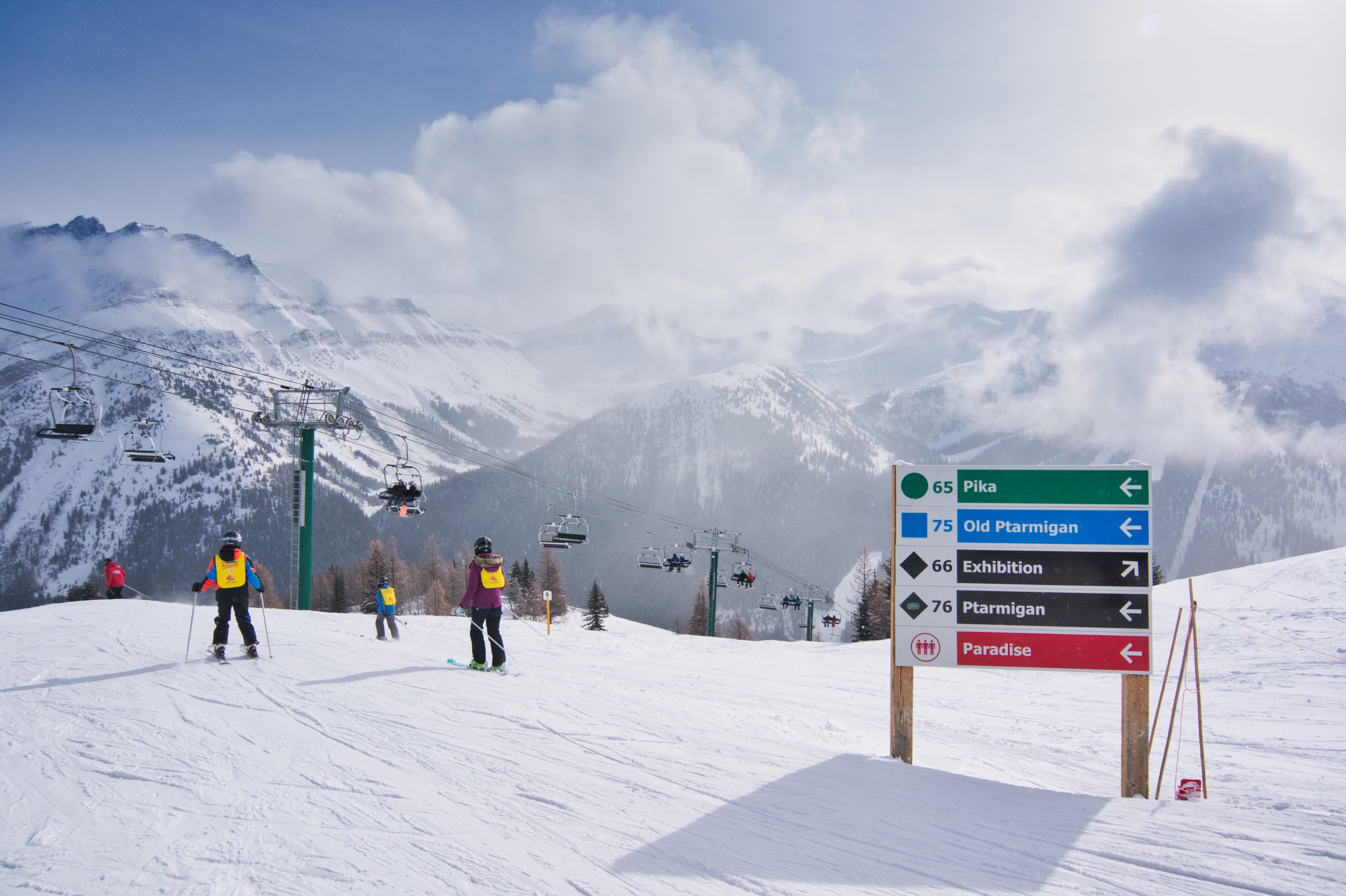
For skiing and snowboarding enthusiasts, there are more than 30 ski resorts in Alberta, which are located throughout the region, but mainly in its southern part, where you will find most of the resorts, including also the largest of them. It is also one of the main areas for skiing in the Canada mountains.
The largest ski resort in Alberta is Lake Louise with more than 140 km (87 mi) of slopes and more than 10 ski lifts.
Other major areas for skiing in Alberta with more than 50 km (31 mi) of slopes and more than 5 ski lifts each include Sunshine Village, Castle Mountain, and Marmot Basin–Jasper.
The main ski resort near Edmonton, the first of the two largest cities of Alberta, is Rabbit Hill Snow Resort with more than 3 km (2 mi) of slopes and more than 5 ski lifts. The main ski resort near Calgary, the second of the two largest cities of Alberta, is Canada Olympic Park–Calgary with more than 3 km (2 mi) of slopes and more than 5 ski lifts.
Check the Alberta ski resorts map as well as the larger Canada ski resorts map in the World Mountain Lifts section of the site. It includes information about open ski lifts / slopes in Alberta in real-time with opening dates and hours. There are also year-round cable cars, funiculars, cog railways, aerial tramways, and all other types of mountain lifts.
If you’re coming to Alberta and you need a place to say, here are some of the best places to check out:
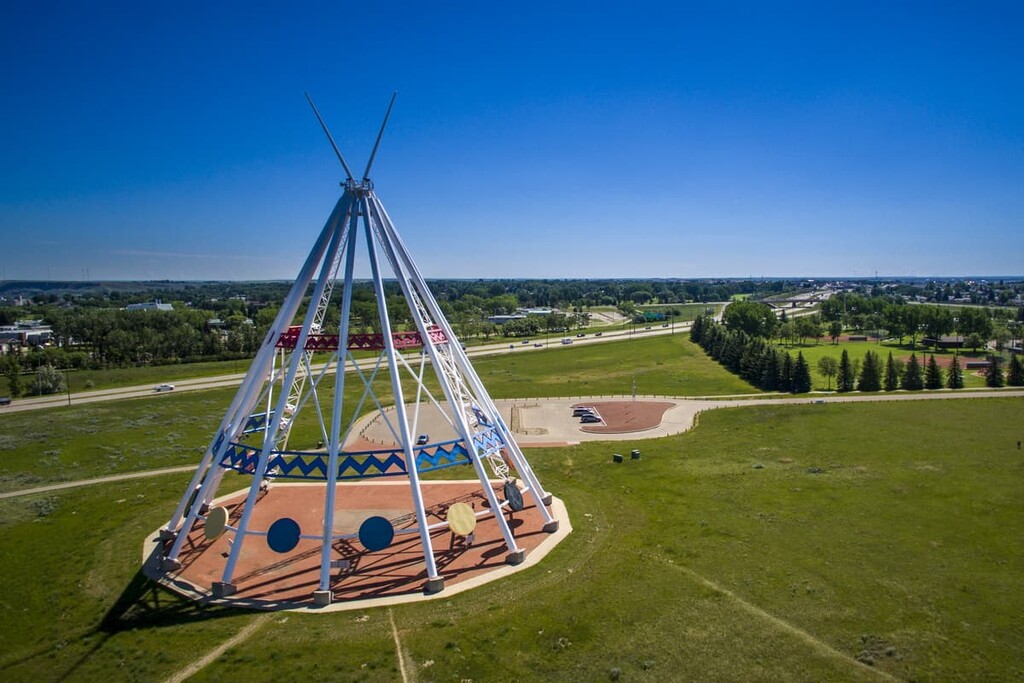
Located in the middle of Alberta, Edmonton is the capital city of the province and one of the two major cities in Alberta. It is the northernmost metropolis in North America the gateway to Canada’s wild and adventurous boreal landscapes.
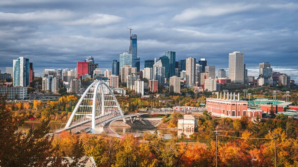
Edmonton is the political center of the province. It is also home to the Edmonton Oilers hockey team, a professional football team, the University of Alberta, and the giant West Edmonton Mall. Edmonton also has long summer days, over 50 annual festivals, spectacular views of the Northern Lights during the winter, and access to wild and rugged adventure.
Calgary has a thriving cultural scene with concerts, museums, restaurants, theaters, and more. Additionally, there is a strong culture surrounding outdoor recreation with many people participating in skiing, hiking, cycling, OHV use, camping, fishing, and more.
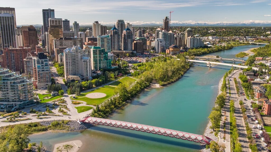
The largest annual event in Calgary is the Calgary Stampede, the self-proclaimed “Greatest Outdoor Show on Earth,” which happens every July for ten days. Western culture reigns during this time kicking off with a parade through downtown, daily concerts, agricultural events, blue jeans and cowboy boots, and nightly fireworks.
Medicine Hat is in southeast Alberta along the South Saskatchewan River. While the railroad construction was halted to build a bridge across the South Saskatchewan River, a tent city was built up and that was the start of Medicine Hat.
In search of water, railway workers drilled into a natural gas reserve west of town, starting the gas exploration that would map one of the largest gas fields in North America. By the early twentieth century, Medicine Hat had incorporated as a city and embarked on a program to supply natural gas to all residents for their personal needs. The gas fields still provide the gas for the historic gas lights in downtown Medicine Hat.
Medicine Hat is also noteworthy because it is the largest municipality near Cypress Hills Interprovincial Park. Cypress Hills are an ecological and geological anomaly in Alberta in which they are the remnants of an ancient plateau which remained unglaciated by the Laurentide Ice Sheet. As such, the Cypress Hills have unique ecosystems compared to the surrounding prairies and is a wilderness oasis within the grasslands.
The town of Banff and Banff National Park are the most visited tourist destinations in Alberta. Banff was originally only “Siding 29” for the Canadian Pacific Railway and, until the discovery of the Cave and Basin Hot Springs, there was nothing different about this mountain stop than any of the others.
After the discovery of the hot springs, Canada created a national park to preserve the region for future generations; however, William Van Horne and the Canadian Pacific Railway were encouraged by the beautiful scenery and the need for money that they hatched a plan to “import the tourists” to the area via train, since they couldn’t “export the scenery.”

Since the early days of Banff, the facilities in the region have been constructed to cater to tourists. The railway built the castle-like Banff Springs Hotel, golf courses, and encouraged domestic and international travelers, alike, to visit by train. Swiss guides, who were hired to lead the early mountaineering expeditions in the region, also left their cultural mark on the town. Banff is a beautiful example of a mountain town and is first class from its architecture to its amenities.


ultra
glacier
11ers-bc
11ers-ca-rockies
canada-sampler
british-columbia-ultras
alberta-ultras
ultra
11ers-bc
11ers-ca-rockies
fred-beckey-great-peaks
canada-sampler
british-columbia-ultras
alberta-ultras
ultra
11ers-ca-rockies
canada-sampler
alberta-ultras
ultra
glacier
11ers-bc
11ers-ca-rockies
canada-sampler
british-columbia-ultras
alberta-ultras
ultra
glacier
11ers-ca-rockies
alberta-ultras
ultra
11ers-bc
11ers-ca-rockies
fred-beckey-great-peaks
canada-sampler
british-columbia-ultras
alberta-ultras
ultra
glacier
11ers-ca-rockies
alberta-ultras
ultra
11ers-ca-rockies
canada-sampler
alberta-ultras


