Scan the QR code and open PeakVisor on your phone
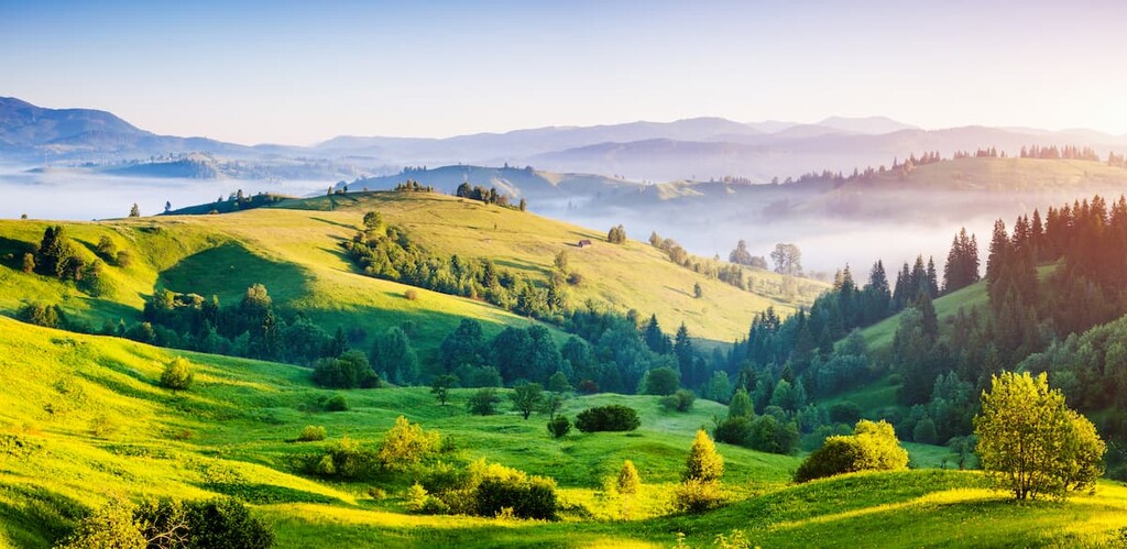
Ukraine (Україна), the largest country in Europe excluding Russia, is dominated by the Eastern European plain, but it features significant mountains as well. The Carpathians are a 1500 km (900 miles) range bisecting Ukraine’s western arm. Meanwhile, the contested Crimean region, which Russia annexed in 2014, is characterized by mountainous topography along its southeastern coastline. There are 4159 named mountains in Ukraine; Hoverla (2,061 m / 6,762 ft) is the highest, while the most prominent is Roman Kosh.
Ukraine is mainly flat, comprising fertile steppe across nearly its entire expanse. The abundance of fertile land, in combination with an ideal Mediterranean growing latitude ranging from 44° to 53°N, has made Ukraine one of the world’s largest grain exporters. Pre-war, Ukraine was the 5th-largest grain exporter, with 10% of the world’s total.
Ukraine’s coastline straddles the Black Sea, which, similar to the Mediterranean, is a moderating influence on the region’s climate. Ultimately, the Black Sea allows so much grain to flourish at these latitudes.
Ukraine’s territory spans 603,550 square kilometers (233,030 square miles) and boasts a shoreline extending for 2,782 kilometers (1,729 miles). However, these numbers have been compromised by the 2014 annexation of the Crimean Peninsula and the parts of the Donbas, as well as the 2022 invasion of the country’s easternmost regions.
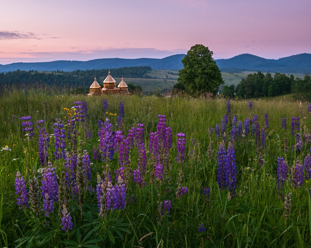
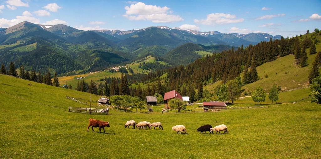
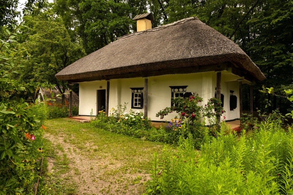
The Carpathian Mountains bisect Ukraine’s westernmost territory. Only 10% of the massive Carpathian range - 22,500 sq. km (8,700 sq. miles) - sits within Ukraine’s boundaries. About 50% is within neighboring Romania and 30% in Slovakia. Approximately 1.2 million Ukrainians live in this region, with the primary industries being forestry and agriculture in the form of animal husbandry.
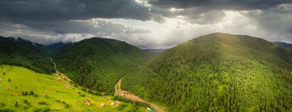
Ukraine is the poorest country in Europe in terms of GDP per capita, and the mountains are one of the poorest regions of Ukraine. The economy is primitive, featuring a negligible industrial presence, while the potential hydroelectric resources remain untapped. Nevertheless, although it spells economic hardship, the lack of industry contributes to the wild nature of these mountains.
Protected areas of the Carpathians include the Carpathian Biosphere Reserve, Gorgany Nature Reserve, Carpathian National Nature Park, Synevyr National Nature Park, Uzhanskyi National Nature Park, Vyzhnytsia National Nature Park, Skole Beskyd National Nature Park, Halych National Nature Park, Hutsulshchyna National Nature Park, and Zacharovanyi Krai (meaning ‘Enchanted Edge’) National Nature Park.
The Alpine Orogeny, which occurred between 64 and 2.5 million years ago, created the Carpathian mountain range. The orogeny results from the African and Indian plates colliding with the Eurasian plate, forcing the crust upwards. Nevertheless, the Great European Plain, which has remained untouched by tectonic mountain-forming forces for several hundred million years, characterizes most of Ukraine’s landscape. The Carpathians comprise only a small part of the nation.
The Orogeny is responsible for most mountain ranges along a belt stretching from the Pyrenees to the Himalayas. In many places, the orogeny is ongoing - namely, the Himalayas, because the Indian plate has only recently collided with Eurasia and continues to exert force on the crust.
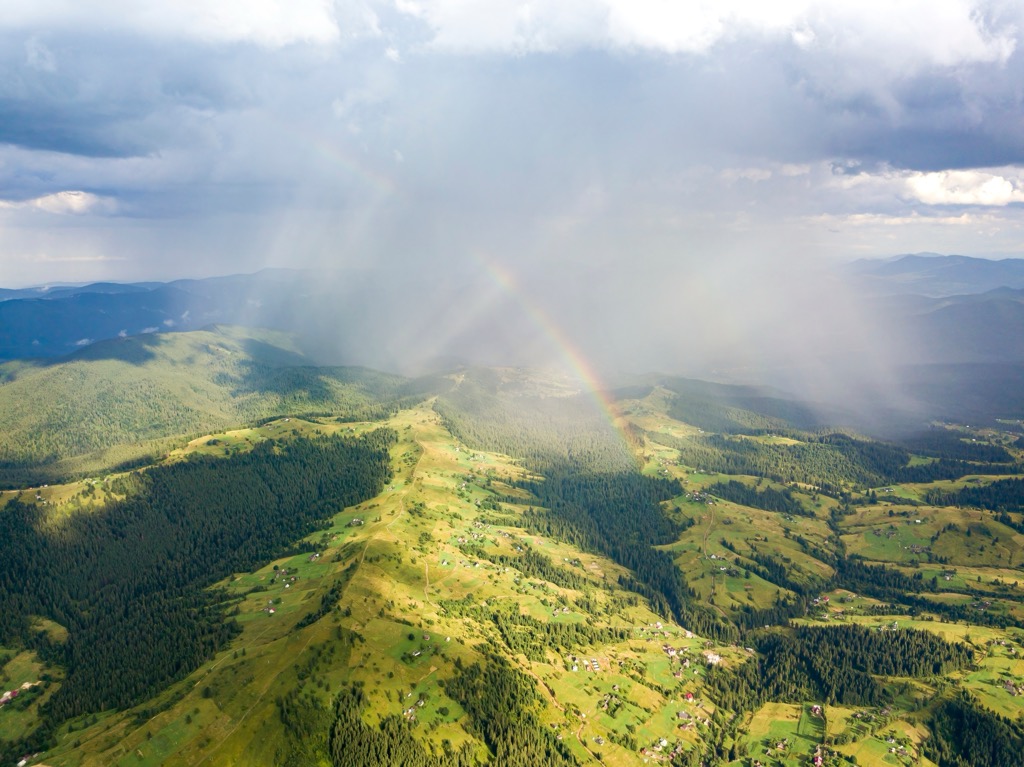
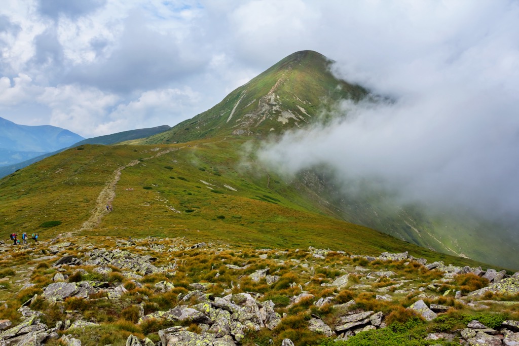
Even at a few tens of millions of years old, the Carpathians are still young - the range features higher, more jagged summits in neighboring Romania and Slovakia. However, the Carpathians are not as abrupt as many of the newly formed mountain ranges of the Orogeny, including the Alps and the Urals to the west and east. In Ukraine, only the Hustul Alps and Chornophora display alpine zones and signs of past glaciation.
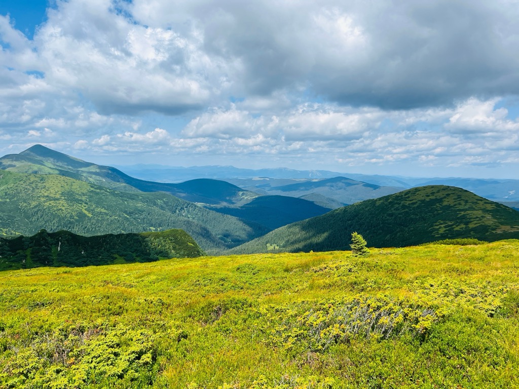
In contrast to the Western Carpathians, the flora here boasts greater diversity, encompassing numerous Balkan and Transylvanian species and a selection of endemic forms. Historically, the entire range was cloaked in forests and crowned with meadows and rocky terrain. About half of the region remains forested, although old-growth forests comprise only 11% of this total in Ukraine.
Lowland forests reach up to 600 m (2,000 ft). Oak dominates these forests, while hornbeam, maple, linden, elm, birch, and pine trees are also present. In the lower Transcarpathia, the forests are increasingly fragmented amid agricultural development.
Mountain forests exist above 600 m. In parts of the region, beech forests exclusively dominate, while mixed and coniferous forests prevail elsewhere. The undergrowth often consists of elder, mezereum, raspberry, currant, honeysuckle, and willow. The upper boundary of the beech forests is well-defined, situated at 1,100 - 1,200 m (3,600 - 4,000 ft).
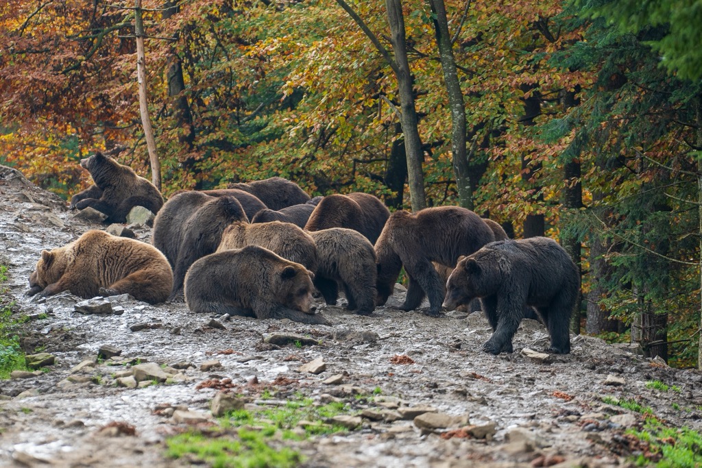
Most fauna comprises species typical of Central European woodlands, present throughout all altitude ranges of the Ukranian Carpathians. Among them are the brown bear, wildcat, red deer, roe deer, wolf, fox, forest marten, mink, otter, ermine, Carpathian squirrel, dormouse, mole, and bat.
High-mountain species include the alpine snow vole and alpine shrew. Certain taiga species inhabit the mountainous forest zone, such as the capercaillie, hazel grouse, woodcock, black grouse, and lynx.
The region’s diverse birdlife includes the golden eagle, hawk, owl, woodcock, black stork, rock thrush, and white-throated blackbird. Many avian residents are seasonal visitors, settling in the Carpathians only during the warmer months.
The Carpathians are also home to various amphibians and reptiles, with a particular abundance on the southern slopes. Notable species include the Carpathian newt, western bullfrog, spotted salamander, and smooth snake.
The mountain streams host trout, grayling, and Balkan barbel (Barbus meridionalis). The huchen (Hucho hucho) is endemic to the Cheremosh and Tysa rivers.
Ukraine faces many environmental issues. Some are problematic, while others, such as the Russian Ecocide, are extraordinarily severe.
On the ‘problematic’ side, unsustainable forestry practices and illegal logging continue to decimate Ukraine’s old-growth forests. Currently, more than half of the forested land in the Carpathians consists of young forests and deforested regions, whereas mature forests make up a mere 11 percent. Reforestation efforts have been insufficient. Notably, in the Gorgany Mountains alone, approximately 1,470 hectares of rocky slopes have emerged. The degradation has led to increased flooding while overall runoff has decreased.
The Chernobyl nuclear plant exploded on April 26, 1986. History’s worst nuclear accident has siphoned off an area of approximately 2,600 km2 (1,000 sq mi), known as the exclusion zone. In total, the accident is estimated to have killed about 300 people; less than 100 directly, and an estimated 200 from thyroid cancer following exposure in the subsequent years. A small number of locals have since returned to the exclusion zone and live there permanently.
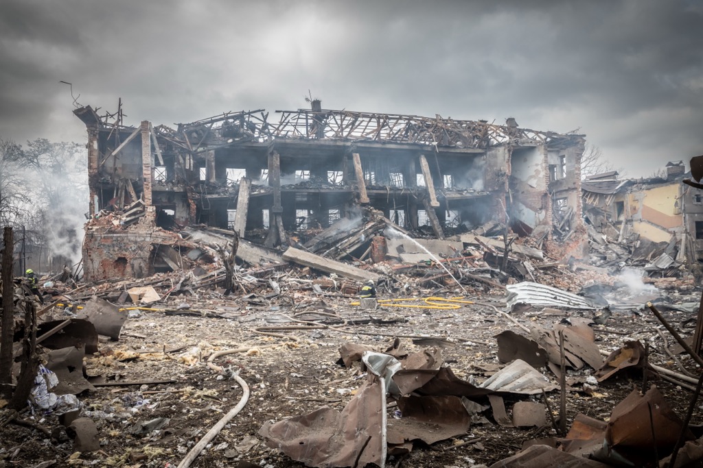
The 2022 Russian Invasion of Ukraine is Ukraine’s most pressing environmental concern to date. The trench-style, scorched-earth warfare has blackened enormous expanses of eastern Ukrainian. The countryside along the front lines is littered with mines that will remain for decades or centuries.
The Zaporizhzhia Nuclear Power Station site, one of the world’s largest, was compromised in the early days of the war and is still under Russian occupation. A fire broke out near the main complex, a high-caliber bullet punctured the outer wall of Reactor No. 4, an artillery shell struck a transformer at Reactor No. 6, and the facility’s capacity was reduced by 1.3 GW.
A targeted attack in the spring of 2023 destroyed the Kakhovka dam and released an immense volume of contaminated water into the Dnieper River (also known as the Dnipro River), ultimately flowing into the Black Sea. An influx of pollution, in combination with a cacophony of sonar signals from Russian warships in the Black Sea, has been killing dolphins and harbor porpoises at an alarming rate. While most experts agree that Russia was behind the attack, it is still contested.
Moreover, the environmental situation continues to evolve, and the effects of the dam destruction became more clear. For more information, follow the wikipedia page for the dam’s destruction.
The international community acknowledges four distinct categories of offenses as international crimes: genocide, crimes against humanity, aggression, and war crimes. Ukraine is currently developing a fifth category — ecocide — into this framework, collecting and meticulously documenting evidence in preparation.
Ukraine echoes a complex history. Its golden age is considered to be the Kyivan Rus’, a formative time for Slavic identity.
The origins of Kyivan Rus' remain uncertain; the nobleman Oleh the Wise, of Varangian (Viking) descent, is widely acknowledged as having laid the foundation for a principality in Kyiv around 880. While Kyiv had already existed, its origins are similarly shrouded in mystery.
While the Dark Ages enmeshed Western Europe, Kyiv became the most prosperous commercial center on the continent. Some of Kyiv’s most beautiful buildings still exist from this period, which lasted until the 13th century. Although powerful, Kyiv never represented a centralized government; the Kyivan Rus’ was a loose collection of principalities. This lack of control ultimately led to fighting among the various factions starting in the 12th century. The Mongol invasion put an end to the Kyivan Rus’ in the 13th century.
Ukraine remained occupied or controlled by other entities until 1991. However, a uniquely Ukrainian identity emerged around the 17th and 18th centuries, along with the Ukrainian language.
As many as four million Ukrainians perished in WWII, including one million Jews in the Holocaust. Famine followed as the Iron Curtain of the USSR swallowed the country.
Ukraine finally became independent after the Soviet Union’s collapse in 1991. In 2014, protesters overthrew the Kremlin-backed president in favor of a pro-Eruope democracy. Russia responded by annexing Crimea and the Donbas in 2014 and initiating an ongoing (as of Aug. 2023) full-scale invasion in February 2022.
Ukraine remains a very religious, conservative, and rural country. As change has come slowly to Ukraine, many older generations exhibit xenophobic, homophobic, and racist tendencies. It is home to the second-largest population of Orthodox Christians after Russia and is the poorest country in Europe by GDP per capita.
Ukraine and Russia are considered Level 4: Do Not Travel by the U.S. Department of State. Ukraine is a war zone; thousands of civilians have died in attacks with little warning. However, Ukrainians revere Westerners and will allow most Westerners into the country (although they advise purchasing ‘war insurance’).
Russian-occupied regions of Ukraine, however, are a different story. While it may be safer regarding war violence - you’re maybe less likely to get hit by a missile - Crimea is a no-go zone for Westerners. The best-case scenario is that you are turned away at the border. It’s more likely that you’ll be detained indefinitely on false charges. For now, Crimea’s natural beauty is reserved for the Russians.
Because they aren’t towering, Ukraine’s mountains are relatively accessible for the average hiker. The agrarian culture of rural areas makes for bucolic countryside. This guide will only include hikes in the Carpathians or on the mainland. Westerners should not travel to the Crimean Peninsula under any circumstances; arbitrary arrest and detainment are likely.
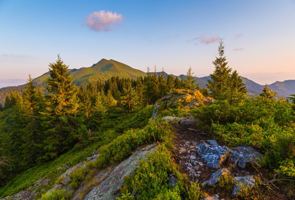
Hoverla is the highest peak in Ukraine and is in the Chornophora (translates to black mountain) subrange. Despite being 10 hours from Kyiv and five from L’viv, Hoverla is a popular hike - perhaps the most popular in all of Ukraine - and you will encounter many other people on the trail. After all, it is the tallest peak in the country.
Visitors drive part of the way up the mountain, then park at a base area of sorts. You can buy refreshments, and you’ll also have to pay a per-person entry fee. Don’t sweat it, though; it’s about $2. The main route from the base area is about 7 km (4 mi) with 800 m (2700 ft) of elevation gain. You can also hike in a loop, so you don’t have to come up and down the same way.
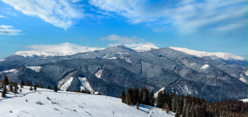
The route features easy beech and spruce forests before getting steeper and rockier to the summit. Hoverla means snow mountain in Hungarian. There is often snow and/or cold temperatures at the summit, so you need to come prepared. Frigid temperatures, high winds, and icy conditions greet mountaineers in the winter - this is Ukraine, it’s cold! Don’t make the same mistake as Napolean; come prepared with warm clothes.
Hoverla is also one of the nation’s best ski touring routes. Ukraine is quite far north.
This multi-day trail winds along a lofty, scenic ridge between the Zakarpattya (Transcarpathian) and Prykarpattya (Precarpathian) regions. The trail summits Hoverla, as well as the highest mountain lake and cave in the Ukrainian Carpathians. In fact, the route encompasses all six mountains surpassing the 2000-meter mark in the Ukrainian Carpathians: Petros, Hoverla, Rebra, Gutin Tomnatyk, Brebenskul, and Popivan Chornohirsky.
Dense beech and spruce forests and expansive alpine and subalpine valleys above the 1500-meter mark characterize the landscape. Unlike most mountainous regions of Ukraine, signs of glacial activity are evident, including cliffs, moraines, steep slopes, cirques, and alpine lakes.
The 53 km (32 mi) route will likely take 3 - 4 days. The elevation gain will total over 3,300 m (11,000 ft), making it hard to do more than 15 km daily.
This is the site of one of the premier trail races in Ukraine each year. The Skole Ultra is held in mid-June and comprises four options: 20 km, 34 km, 52 km, and 101 km. The 101 km (63 mi) route features over 4,500 m (15,000 ft) of elevation gain.
You can also just do the route as a backpacking mission and take your time. The trail makes plenty of loops through the mountains, so you can extend the hike as long as you want, similar to how they do it in the race. This is the closest trail on the list to Lviv.
Recreationists in Ukraine’s capital city, Kyiv, are served by this trail network. The whole route is 45 km (28 mi), but you can shorten it by cutting out the spur and just doing the loop. The trail is easily accessible from Kyiv and is popular with hikers, mountain bikers, as well as cross-country skiers and snowshoers in the winter. Don’t forget to bring your hardtail bike because this trail is relatively flat.
Kyiv is about eight hours from the closest mountains, so enthusiasts must settle for this trail or other local ones for weekday missions.
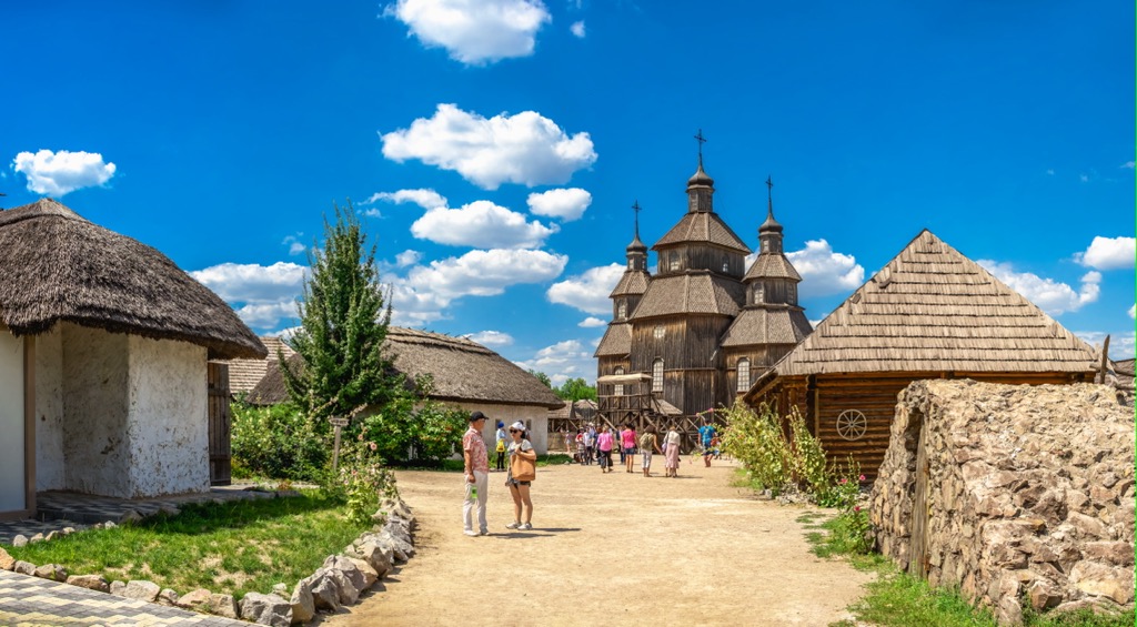
Khortytsia Island is the largest island in the Dnieper River, measuring 12.5 km (7.77 mi) in length and up to 2.5 km (1.55 mi) in width. It is part of the Khortytsia National Park and lies within the city limits of Zaporizhzhia, Ukraine. Zaporizhzhia translates to ‘beyond the rapids,’ referring to a turbulent section of the Dneiper River that has since been flooded by dams.
Khortytsia has been continually inhabited for at least the last 5000 years. In the last millenia, the island became a stronghold for the Zaporizhzhian Cossacks. The Zaporizhzhian Cossacks History Museum offers a perspective into this fascinating slavic steppe culture’s past.
Ukraine is a northerly country with some mountains, and you know what that means…skiing! There are over a dozen ski areas in Ukraine, but most are very small.
By far the largest and most famous of Ukraine’s ski resorts is Bukovel. The mountain boasts nearly 70 km of slopes accessed by 19 ski lifts. It tops out at a cool 1372 m (4,500 ft) and offers around 500 m (1650 ft) of vertical drop.
It’s a relatively new venture, having been founded in 2000 as a year-round destination resort. In addition to skiing, they offer a couple of artificial lakes, a bike park, and numerous trails for hiking and horseback riding.
Bukovel is cold and receives decent snowfall. They also have some snowmaking capacity. The mountain is not steep; most of the runs are intermediate. There doesn’t seem to be much off-piste skiing available and it’s unclear if you can ski much in the trees. They do, however, have an airbag, for all you aspiring park rats.

All cities in Ukraine are currently in Martial Law (August 2023), so it’s best to just take inspiration from this article and keep it on the bucket list for the bright days of peace which hopefully lie ahead. The author is a first generation American with a Ukrainian born father, and will be exploring the country as soon as it’s safe to do so.
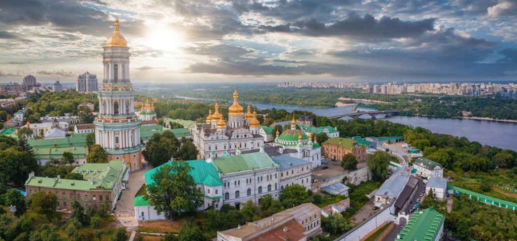
Kyiv is the largest and liveliest city in Ukraine and is the country’s political and economic capital. Pre-war, there were few safety issues for tourists in the city. You were more likely to get pickpocketed in Florence than hurt in Kyiv. The city is great for locals, with a thriving nightlife and art scene. Economically, it offers far more opportunities than the rest of the country and is the destination for young Ukrainians aspiring for a career rather than a life as a farmer.

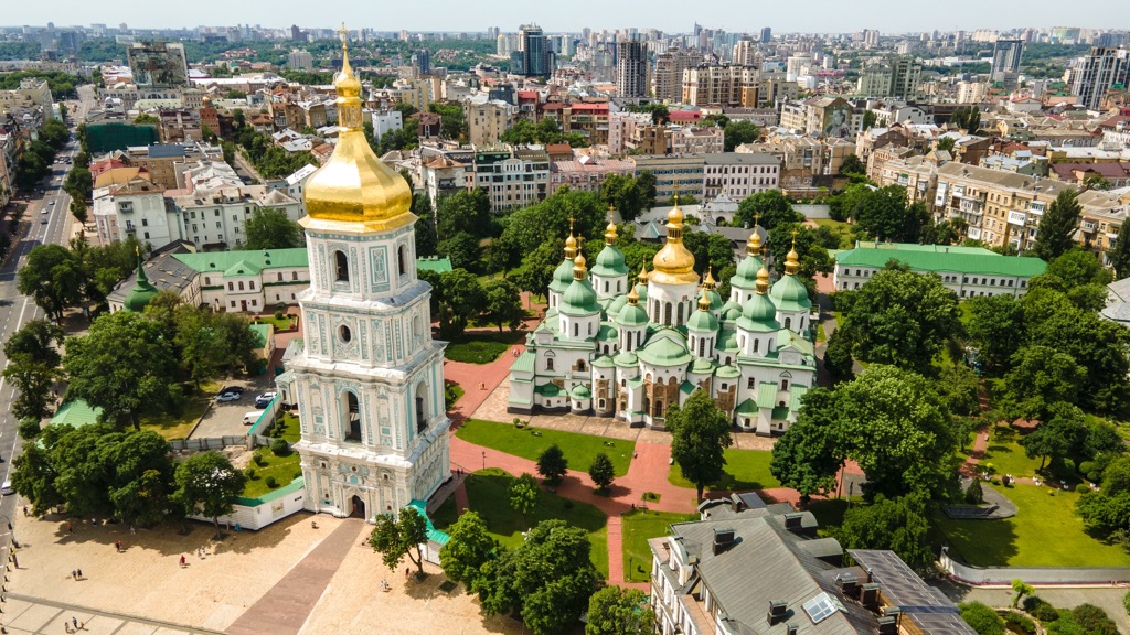
The St. Sophia Cathedral stands as one of the structures enduring from the era of Kyivan Rus'. Erected between 1011 and 1018, it is an architectural and monumental masterpiece of the period. The cathedral precinct hosts many open-air concerts and art exhibitions. The bell tower reaches 76 meters (250 ft), offering one of Kyiv's best panoramic vistas.
Podil, once an artisans' quarter during the Kyivan Rus' era, has transformed into a contemporary hub for hipsters and ravers. Pick a bar near the intersection of Yaroslavska and Mezhyhirska streets. If you show up with the right attitude, some locals might be interested in showing a foreigner around their city.

Murals and street art dominate the urban landscape of Kyiv. If you’re into that sort of thing, you could spend multiple days traversing the city and checking out the art.
While plenty of Berliners make the pilgrimage to Kyiv’s clubs, Kyiv isn’t the ‘new Berlin.’ Yes, we’ve forgiven the Germans for their sins, but that doesn’t change the fact that Kyiv is, and always will be, Ukraine.
Pre-war, Lviv had already earned the moniker 'truly European.' By no coincidence, it’s also Ukraine's westernmost major city. The downtown boasts fairy-tale architecture, a network of trams, limitless coffee shops, and trendy bars offering homemade liqueurs. The city is a vibrant epicenter of cultural vitality and is undoubtedly one of Europe's most overlooked gems.
Lviv is on the UNESCO World Heritage List. However, in the old town, the experience lies in meandering through its labyrinthine alleys and soaking in the bohemian ambiance as much as the architecture.
Rynok Square is the city's epicenter, with extraordinary architecture and a bustling street scene. Unlike most European cities, where such squares are geared toward tourists, Rynok Square is more of a local hangout. The Opera House is a must-visit, transporting you to a realm of opulence, with glorious golden chambers, ornate statues, and an air of elegance.
The High Castle, perched atop a hill, grants the best vantage point over the city. The entirety of the city and the encircling hills and mountains are visible.

Odesa is one of the most significant port cities along the Black Sea and Ukraine's third largest. Once the preferred summer getaway of the Russian aristocracy during the Tsarist regime, Odesa is now a premier vacation destination for Ukrainians.
Pre-war Odesa saw three million visitors annually, though that number has undoubtedly dropped precipitously. Still, before Russia’s annexation, Ukrainians supposedly preferred the Crimean Peninsula for beach resort vacations.
During the Soviet days, Odesa was the 4th largest city in the USSR, following Moscow, St. Petersburg, and Warsaw. The city offers a spectacle of tree-lined avenues, pastel-shaded neo-classical architecture, crystal-clear waters along sandy beaches, and bumping nightlife (a common theme in Ukraine). The city is also home to over a dozen universities and centers of higher learning.
Everybody comes to Odesa hoping to walk up (or down) the Potemkin Stairs, featured in the iconic film Battleship Potemkin. However, if you really want to get a taste of cinema in Odesa, hit up the international film festival, which lasts for a week each summer.
Odesa is not only culturally unique - you’ll never visit another city like it - but it also is one of the only cities in Ukraine that offers natural beauty along with its cityscape.