Scan the QR code and open PeakVisor on your phone
For many, the Urals are like The Wall from GOT by George Martin – the end of the world behind which lie the wildlands and White Walkers are stalking the lost souls. Despite this grim misconception, life is bustling there. The natural and man-made wonders are astounding, the hospitality is heart-warming and adventures are those of a ‘buck-list-of-a-lifetime’. The Urals is a must-experience place.
The Urals is called the Land of Legends and that is not for nothing. The lands are rich, diverse and remained pretty underexplored until the last 50 years or so. You can feel the true frontier experience and create your personal legend while traversing the Urals.
There are many versions about the origin of the word Ural, but the generally accepted is the Bashkir one. In the Bashkir language, ‘Ural’ means ‘belt’. Indigenous peoples (the Udmurts, Komi, Mansi, Khanty) call the Ural Mountains "Stone". And sometimes they say that about the Urals – “the Stone Belt".
Ancient historians mentioned the Ural Mountains in their chronicles often referring to them as the Riphean (Rippean) Mountains which some scientists later tended to connect with the Ural Mountains. There is a legend about the Riphean Mountains in which vultures guard the golden treasures. According to the Bashkir legend, there lived a giant who carried a large belt with pockets filled with countless treasures. And then one day he stretched his belt across the Earth. That's how the Ural Range appeared, stretching from north to south. Indeed, the Urals is a treasure trove of gold, silver and many precious stones.
The eastern foot of the Ural Mountains is a conventional boundary between Europe and Asia. This mountain range divides the territory of the West Siberian and East European plains. If you look at the map, this mighty mountain range will seem like a seam that stitches together two continents.
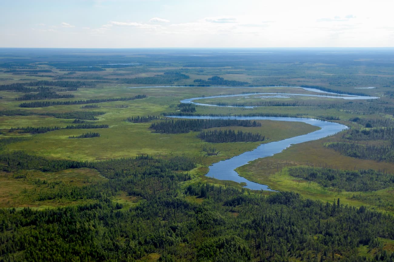
The modern Ural Mountains are a large mountain system that stretches from the shores of the Arctic Ocean to the steppes of northern Kazakhstan. Geographically, the Ural Mountains are divided into five parts, from north to south:
North of the Polar Urals there is the Pai-Khoy Ridge, which is about 200 km long. It stretches from the northern part of the Polar Urals to the Strait of Ugorsky Balloon and part of the range goes farther under the water up to Vaigach Island. Some scientists have proven that this ridge is an extension of the Urals by its geological structure. This ridge is a low-visit area. Thus, the Pai-Khoy mountain system can be considered the northern extension of the Urals Range, and the Mugodjary Range in Kazakhstan is the southern extension of the Ural Mountains, after the Southern Urals.
The length of the Ural mountain range is more than 2,000 km (with the Pai-Khoy and the Mugodjary it is more than 2600 km), the width varies from 40 to 150 km.
The highest peaks of the Urals:
The territories adjacent to the Urals from the west and east, the Cis-Urals and the Trans-Urals, are connected to it both historically and economically. In order to preserve the populations of animals, birds and mammals as well as the pristine nature, the Urals have legally been merged into protected areas protected by the state. A visit to almost all protected places of the Urals, except for national and natural parks, is strictly limited and travellers either can't get to their territory or need to get a special permit in advance. The only exceptions among the reserves are the Shulgan-Tash and Arkaim reserves, all others are open to the general public.
Historically, there have been quite a few versions about the origins of the Ural Mountains. In the scientific community, there used to be so many heated debates that it is impossible to enumerate every conceivable and inconceivable version of the formation of the Urals Mountains.

The two basic warring camps are those who support the continents’ movement theory and those who are after sea retrieval. The former tend to believe that during a certain period of development of planet Earth, the continents were mobile and clashed with each other. And the origin of the Urals Range is a product of these collisions.
The ocean-theory disciples are closer to the theory that once the Ural Mountains were washed by seas or oceans, or were completely hidden underwater, which stands to reason because the fact that the water actually washed the slopes of the mountains is confirmed by a remarkable amount of archaeological findings.
There might be more beautiful or higher mountain ranges, just remember those layered rocks of the Dolomites or the eerie Martian landscapes of the Tenerife islands, or the Rockies, the list is long indeed. Yet, the Urals are among the world richest rocks in minerals.
It is surprising that there are rocks here which originated practically in all time periods of our planet formation.
The Urals are famous for the inconceivably rich deposits of minerals, metals and fossils. There are oil and gas, gold and iron, diamonds and jasper, marble and malachite found in abundance here. At the same time, geologists assure that the Urals have not revealed all their underground secrets to the world yet.
The Polar Urals is the northernmost part of the Ural Mountains if you do not take into account the territory of the Pai-Khoy. Here the mountains divide the border between two Ural regions: the Komi Republic in the west and the Yamalo-Nenets Autonomous District in the east (YNAO).
In the north, this ridge begins with Konstantinov Stone Mountain and stretches to the upper Hulga River in the south. Only 40 km separate Konstantinov Stone Mountain from the Kara Sea. The scientists usually refer to the Polar Urals as the foothills of the Urals because the summits are not high and actually remind small gently sloping hills too modest to call them mountains. However, the Nenets people consider them the end of the Ural Mountains, naming them the Pamal, which in translation from the Nenets language means "the end of a stone".
The vegetation is rather scarce, dwarf birch and willow dominate the forest areas in the north and in open places moss grows allowing deer to graze. The dense coniferous taiga starts in the southern part of the Polar Urals.
The climate of the Polar Urals is severe, sharply continental, with strong winds. Summers here are short and snowy. The weather is very changeable. The western slopes receive 2-3 times more rainfall than the eastern slopes.
Travelling to the Polar Urals in terms of active tourism is a bit less exciting than in other regions of the Urals. There are no such high mountains as in the Subpolar Urals, there are no such rich rivers as in the Northern Urals, the climate is much colder than in the Southern Urals. But there are certain advantages. The lands are pretty wild which scares off many tourists so that you can enjoy true unity with nature. And if you are a keen fisherman, this is a place to go for valuable fish species, fishing tours are very common here. Also, it is easier to climb the mountains and hills of the Polar Urals compared to the mountains of the Subpolar Urals. But the harshness of the terrain and the adverse weather makes up for the challenge. Some peaks are difficult to reach, and mountaineering equipment can be of little help on some routes.
The average ridges of the Polar Urals rise to about 800m to 1200m. Starting from Mount Konstantinov Stone (483.2 m, according to some sources it is 492 m), the mountains are gaining height quite quickly once you move farther to the south. The highest mountain of the Polar Urals is Mount Payer (1,472m).
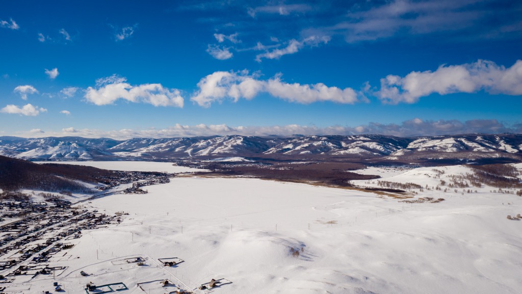
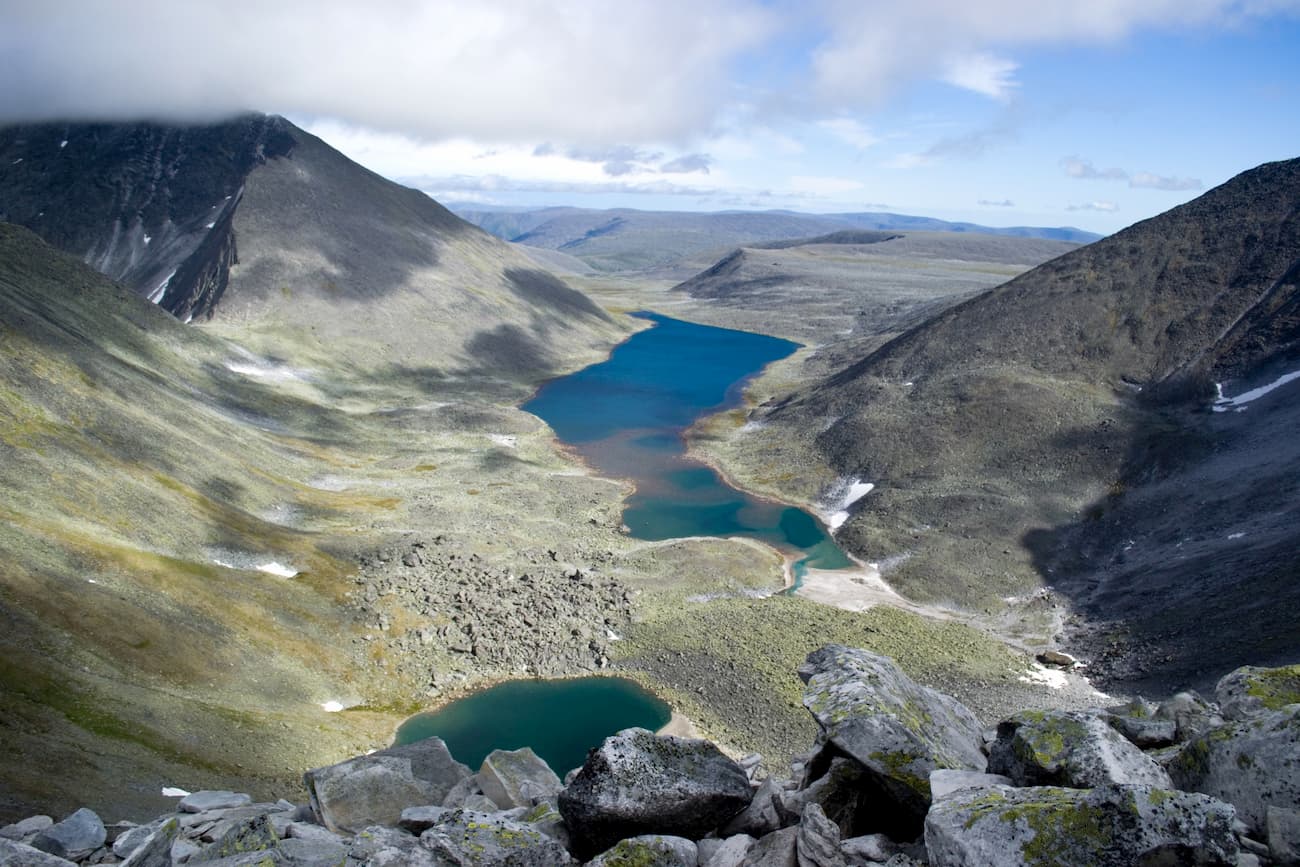
In the mountains, the snowfields are numerous, some of them do not melt even in summer. There are many glaciers, lakes, and jolly mountain rivers. The snowmelt starts rather late in the mountains, so the floods start only in early summer. This region has the largest lake in the Urals – Lake Bolshoe Shchuchye (136 m deep).
One of the features of the Polar Urals is low passes through water bodies. Those passes are usually 200-250 m above sea level. In the valley of the Sob River, one of such passes has the railway line of the Transpolar Mainline, which crosses the Ural Mountains and goes from Europe to Asia (to Harp and Labytnangi). Thanks to the railway, the southern part of the Polar Urals is quite popular among tourists and travellers.
There is a large number of extensive protected areas with pristine nature. The most significant of them is the Yugyd Va National Park. One can also note the Verkhne-Tazovsky Reserve, the Gydansky Reserve and the Yuribey Natural Park.
The Polar Urals offers a range of outdoor adventure, pack your things and go trekking, skiing, mountain skiing, rock climbing and mountaineering, fishing etc.
The most attractive hiking destinations are Mount Payer , Mount Konstantinov Stone, the Rai-Iz massif and the Glacier of Romantics. The Sob River is most popular among water lovers. Due to poor accessibility of most rivers, rafting routes are rather long and take 10-12 days on average. The rivers contain a lot of fish of valuable breeds, which is attractive for fishing enthusiasts.
It should be kept in mind that near the Rai-Iz massif, there is a technical road with a checkpoint, so a pass should be obtained in advance.
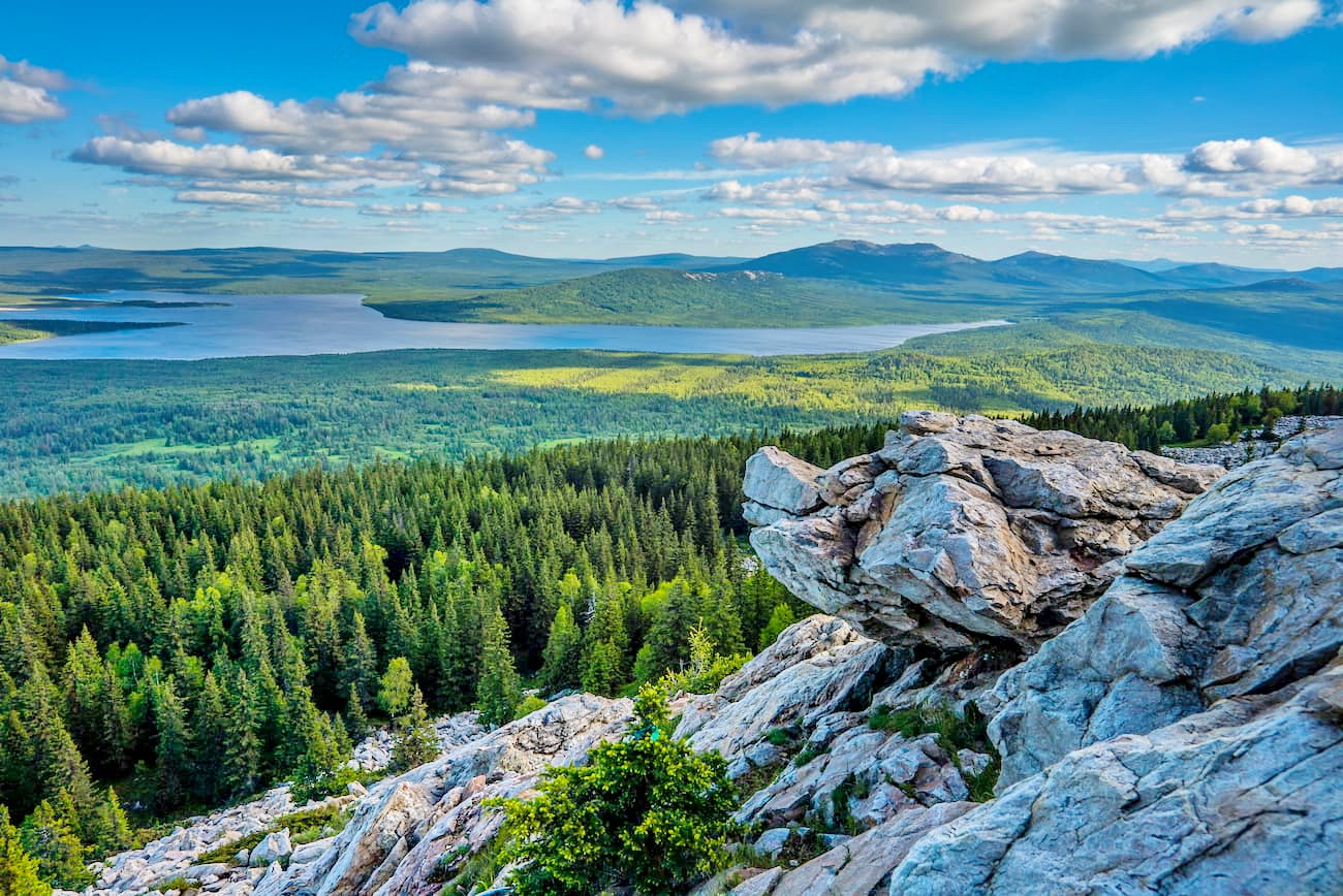
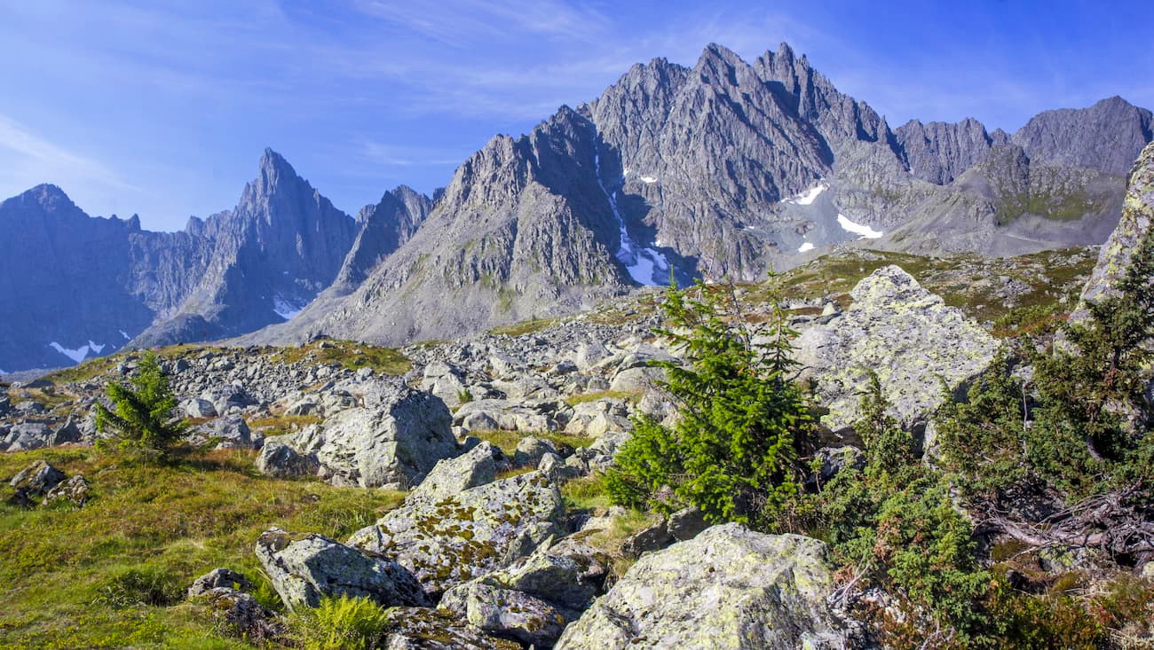
Administratively, the western part of the Subpolar Urals including the Yugyd Va National Park is located on the territory of the Komi Republic. The eastern part of the Subpolar Urals belongs to the Khanty-Mansi Autonomous District. Of all the parts of the Urals, the Subpolar is considered the most attractive and popular among active recreation enthusiasts. After all, it is the highest part of the Ural Mountains. The border runs in the north from the source of the Hulga River and in the south to the wide section of the Shchugor River. The length of the Subpolar Urals is 240 km, the width varies from 50 to 150 km.
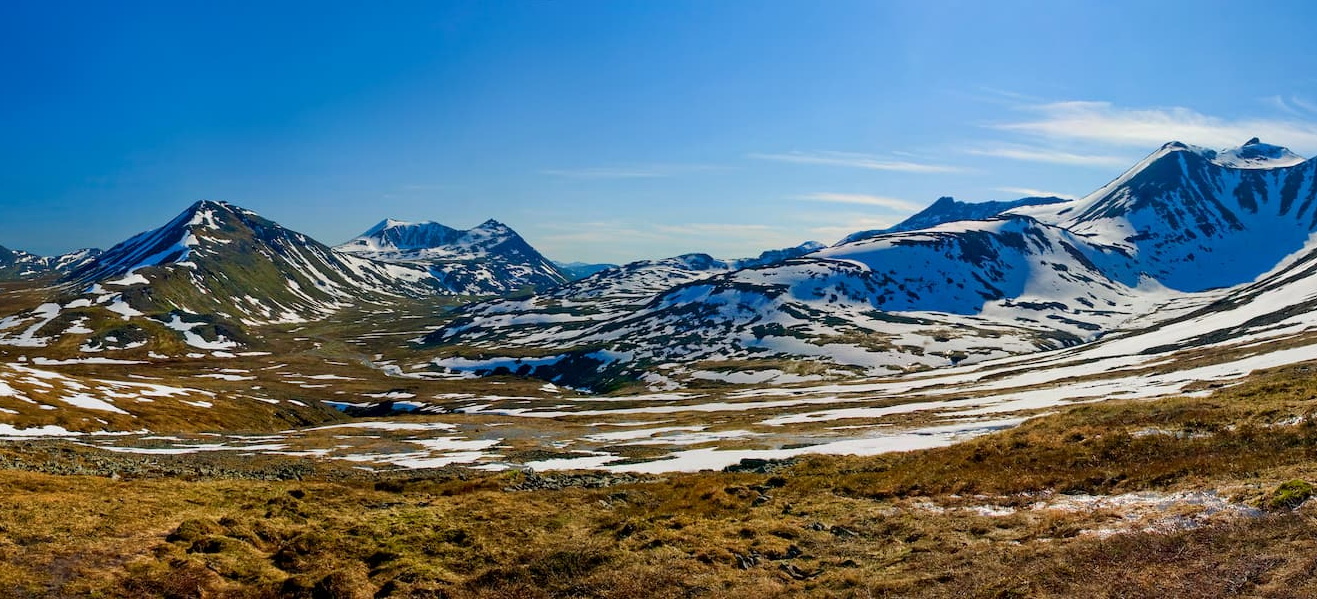
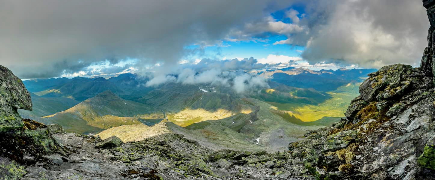
The landscape is diverse, there is tundra, mixed forests, alpine and subalpine meadows, and taiga. The peaks of the mountains here are not as smooth as in other regions of the Urals but have a pronounced alpine relief. Some peaks are difficult to reach and climbing them may require mountaineering equipment.
The climate is sharply continental. Even in summer, the weather is often cool, and in the mountains, the weather changes suddenly.
A hiking tour will open up ample opportunities to conquer Mount Narodnaya (the highest point of the Ural Mountains, 1,895 m), climb the most beautiful mountain of the Urals – Manaraga, and other peaks of the Subpolar Urals, e.g. Karpinsky Peak, Bell Tower Mount, Mount Sabre and so on. You can go rafting on a large number of mountain rivers such as the rivers Balbanyu, Kozhim, Kosyu, etc. The water in these rivers is so clean and clear that you can easily see what is happening there several meters deep. This area is very rich in fish but fishing is prohibited here. For those who like ethnographic journeys, it will be interesting to visit the camp sites of reindeer herders where you can learn about their life and culture, or ride a reindeer sled. There are well-preserved old mine adits for mining rock crystal, those are open for excursions.
A part of the Subpolar Urals belongs to the territory of the Yugyd Va National Park, many representatives of flora and fauna of which are listed in the Red Book and protected by UNESCO. This park is the largest in Russia. It is on its territory that the main peak of the Urals is located.
In the Subpolar Urals there are also other protected zones: the Malaya Sosva Reserve, the Yugan Nature Reserve, natural parks of Yugra (Samarovsky Chugas, Siberian Uvals, Numto Natural Park, Kondinskie Lakes park).
The Subpolar Urals basically offer the same range of entertainment as the Polar ones plus a bit more because the mountains here are much higher. You can go hiking, skiing, trail-running, rafting, climbing and mountaineering, mountain skiing, you can have combined tours.
The most popular destination points in this region are Mount Narodnaya, Mount Manaraga, Yugyd Va National Park.
When you take a boat and go along the rivers of the Subpolar Urals, the views are stunning and allow you to enjoy the pristine nature. You will forget you live in the 21st century. The river Balbanyu is especially rich in coastal rocks, there are plenty of legends about them among local people.
Speaking of the behaviour in these lands, we should mention the old tradition of being quiet and respectful towards the wilderness around you. It has always been customary for nomadic peoples to "be a guest" here. It was forbidden to shout loudly, sing, dance, behave arrogantly and defiantly; it was also forbidden to break something in the wild - to dig the ground, cut trees, tear flowers and herbs, and even crush stones. Even now, there have preserved spots of the so-called open-air temples, like those close to the mountains Old Man (Starik), Old Woman (Starukha aka Starukha-Iz) and Yerkushey. The passage between Starik and Staruha was called the Valley of the Ancestors. This area was considered by the Mansi as sacred land (yalping ma), it was forbidden to drink water from sacred lakes, spit and defecate on the ground. This area was forbidden for women - they could not get off the ground from a sledge or a boat, their face should be covered with a scarf.
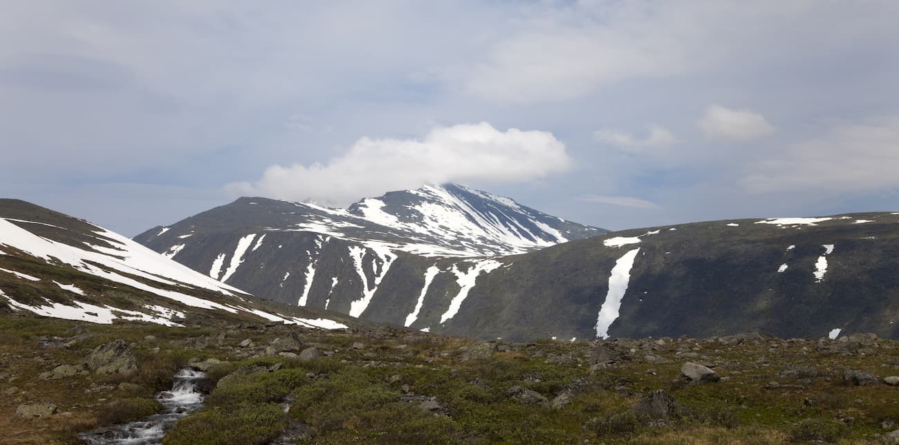
The Northern Urals is located in several regions. It partially passes through the Khanty-Mansiysk Autonomous Area, the Komi Republic, the Perm Territory, and the Sverdlovsk Region. In the north, its border is at the foot of Mount Telposiz, it runs along the valley of the Shchugor River, and the southern border is Mount Konzhakovskiy Kamen. The length of the Northern Urals is 500 km, and the width of parallel ridges is about 60 km.
Vegetation-wise, there are taiga and tundra zones. The plains at the foot of the mountains are usually covered with coniferous taiga. There are plenty of mosses growing in the area as well.
The climate is sharply continental. Summers are short with changeable weather, you can get super cool and quite hot days interchanging really frequently. Winter is harsh, it starts early, lasts about 7 months. There is much more precipitation on the western slopes of the mountains than of the eastern ones.
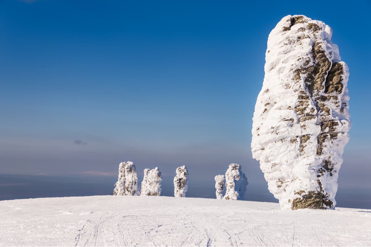
The peaks of the Northern Urals are flat or rounded yet you will see fancy stone idols generously sprinkled among them.
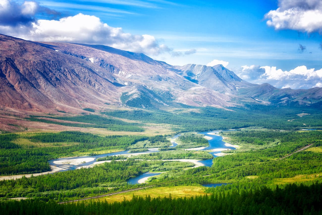
Many rivers flow in the Northern Urals, i.e. the Pechora, Vishera, Ilych, Kosva, Sosva, etc.. For the most part, they are full-flowing and have fast current. You can also find two glaciers here - the Govorukhin Glacier and the Southern Glacier.
There are a number of interesting and picturesque protected natural objects in the Northern Urals: the Denezhkin Stone Reserve, the Pechora-Ilychsky Reserve, the Vishersky Reserve and many more smaller sanctuaries.
From the point of view of tourism, the Northern Urals is more accessible and easier than other northern regions of the Urals since weather conditions are less severe, winters and summers are warmer, there are more sunny days than in Subpolar or Polar Urals, good transport accessibility to the initial and final points of routes.
The diversity of outdoor fun allows tourists of all shapes and sizes to get their fair share of joy. You can go hiking, trekking, skiing, rock climbing and mountaineering, trail-running, rafting, alpine skiing, and skyrunning (this is when you do your runs up the mountain at an altitude of at least 2,000 and with track average angle of at least 6% and some laps coming to 30%). You can have combined tours as well.
The main attraction points here are Mount Telposiz, Mount Konzhakov(skiy) Stone, Mount Kosvinskiy Stone, Mount Denezhkin Stone, the Main Ural Mountain Range, the Man-Pupu-Ner Plateau. Almost all significant natural objects are located in protected areas.
The most picturesque rivers are the Vishera, Pechora and Sosva, there are lots of rafting tours available to pick from.
The Middle Urals is located on the territory of the Perm Territory and the Sverdlovsk Region, and also occupies the north of the Chelyabinsk Region. The northern border of the Middle Urals passes through Mount Kachkanar, the southern border goes through a wide section of the upper Ufa River not far from the city of Verkhny Ufaley.
If we take into account the mountain strip together with the foothills, the width of the Middle Urals will be about 90 km, and without the foothills it is 30 km. The Middle Urals landscape is dominated by coniferous forests. The main and most widespread tree is pine but in the north of the region there are a lot of spruce and fir. Among deciduous trees there are birches and aspens. To the south, the forests are getting replaced by forest-steppe, which happens due to warmer and drier air.
The climate is continental. The winter is no longer that severe but strong frosts also occur when the Arctic winds break through to the region. Summers are generally warm but you can still experience some recurrent frosts. The weather is quite volatile: a sudden change in air temperature can occur within one day.
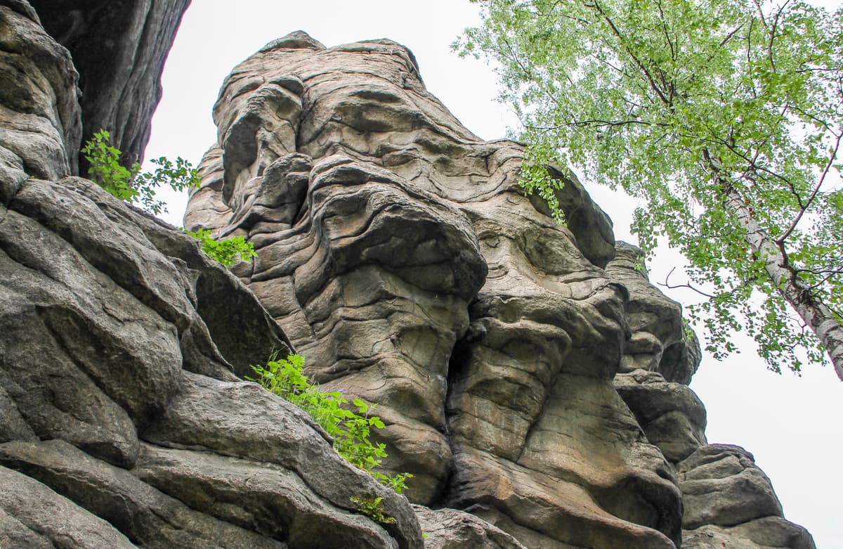
The mountains here represent the lowest part of the whole Urals. It is rare to find a peak that exceeds 700-800 m. Some lone-standing rocky massifs are often located within the city limits. The Middle Urals is remarkable for its karst formations. A lot of caves and grottoes are open for the general public and in general, they are just a paradise for speleologists.
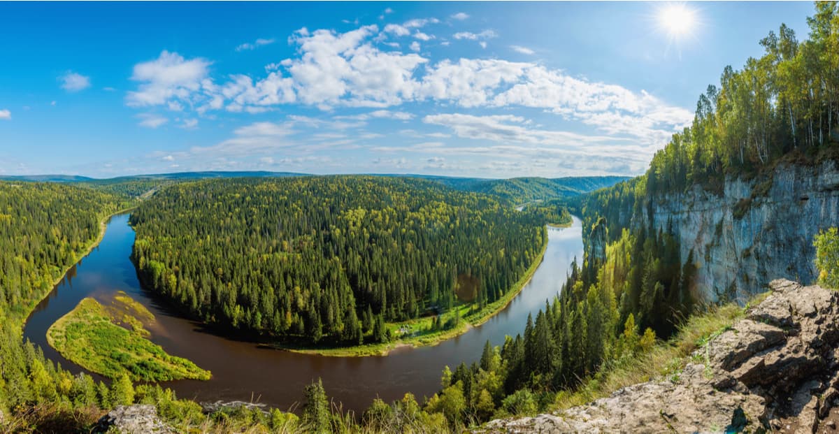
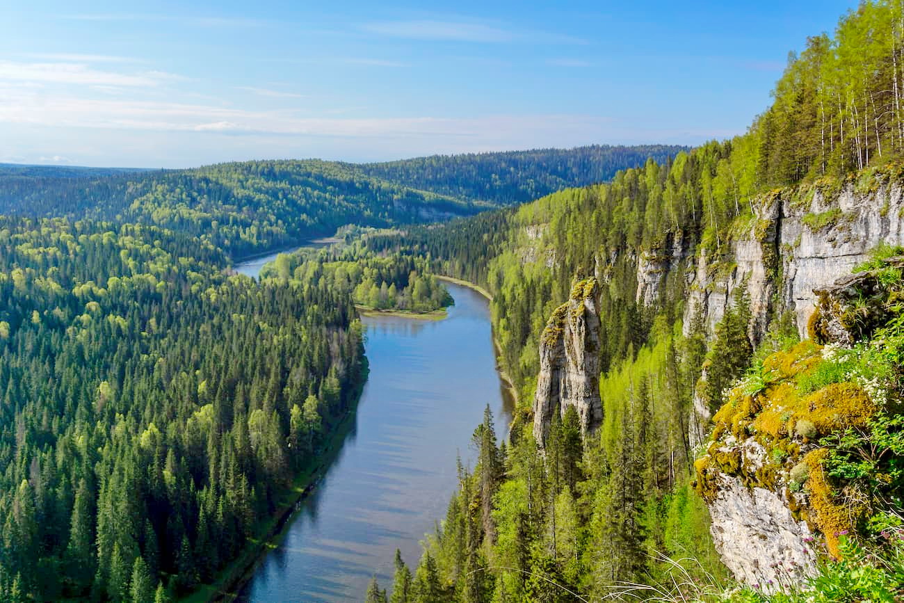
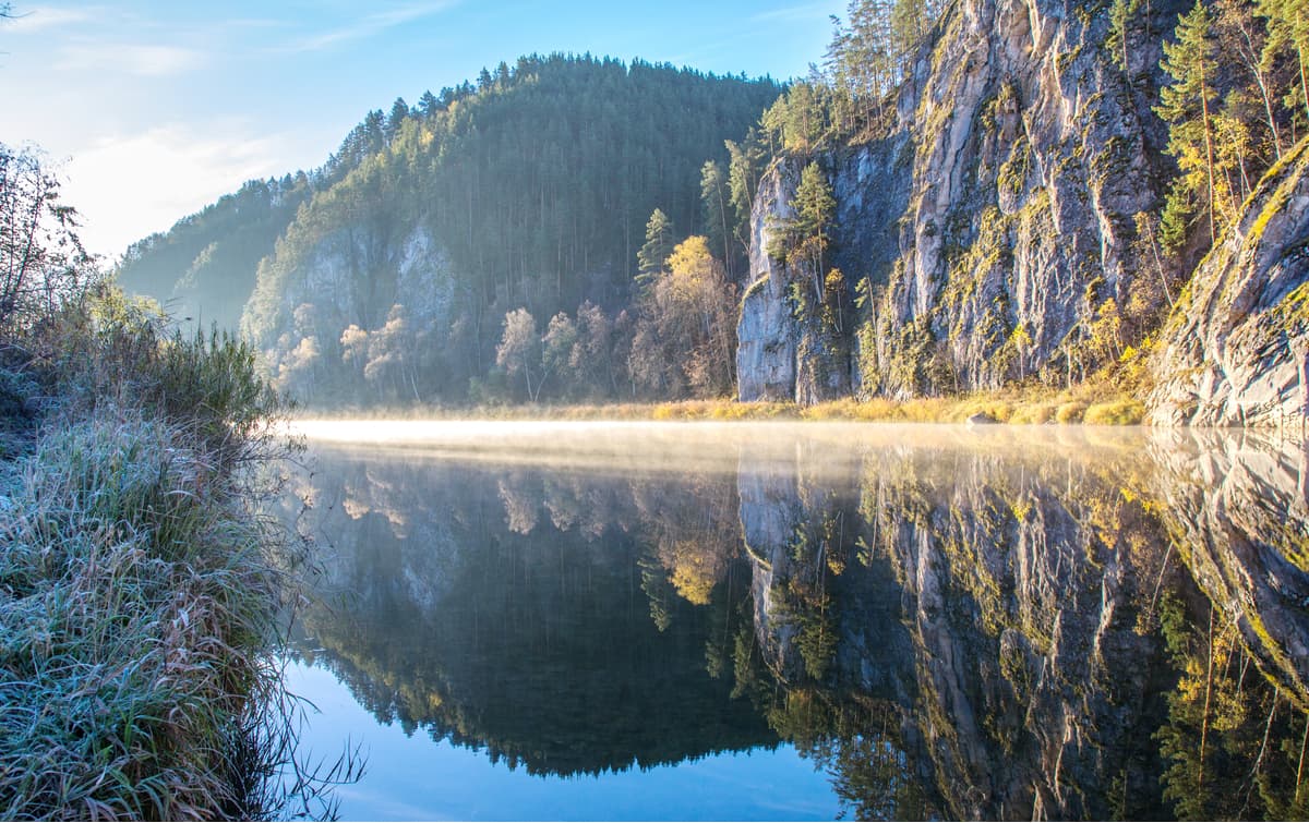
The river network in this region is dense, there are many beautiful lakes, as well as artificial reservoirs. The rivers in the Middle Urals are framed by picturesque rocky shores, which oftentimes have fantastic caves. Mysterious underground lakes, amazing forms of stalactites and stalagmites – all this underground kingdom is worth visiting at least once. The most popular rivers are the Chusovaya River and the Serga River. The latter is considered the cleanest river in the region. It flows in the Deer Brooks Nature Park and is its main attraction. This park, located in the Sverdlovsk Region, every year attracts tourists, speleologists, and fans of eco-tourism. Other protected natural objects of the Middle Urals are the Basegi State Nature Reserve, the Chusovaya River Natural Park, the Bazhov’s Lands Natural Park, the natural-mineralogical reserve called Rezhevskaya and other natural objects.
The Middle Urals opens its doors to recreation and a whelm of impressions not only for staunch outdoor lovers but also for those who prefer a more relaxed and leisurely holiday when they are contemplating the beautiful landscapes around. The Middle Urals are very children-friendly as well.
You can go hiking, explore the numerous caves, raft down the rivers, do some alpine skiing, or take up combined tours.
The most popular and frequently visited destinations are Mount Oslyanka, rocky massifs of the Devil's Fortress and the Peter the Gronsky (aka Petrogrom or Grony) Rocks, Druzhba Cave, Kungurskaya Ice Cave, Divya Cave, rocky shores and caves along the Serga and Chusovaya rivers, and natural parks.
The Southern Urals is the final part of the Ural Mountains, if we are not taking into account the Mugodjara hills that go into northern Kazakhstan. Administratively, it is located in the Orenburg and Chelyabinsk Regions, as well as in the Republic of Bashkortostan.
There are two points of view about the location of the northern border of the Southern Urals. According to one version, the border is considered to run along a wide section of the Ufa River in the area of the Lower Ufaley settlement according to the landscape approach. The other version is that the border is drawn along the northern foothills of Mount Yurma, near the town of Karabash according to the orographic approach.
In the southern mountains of the Southern Ural Mountains end with the Guberlin Mountains located in the Orenburg Region, which farther connects with the Mugodjars. The Southern Urals stretches from north to south for more than 550 km. Thanks to the foothills, this part of the Urals is the widest of the entire mountain belt. It is as wide as 250 km unlike the average width of 40-150 km. It is also possible to clearly identify the altitude zones in the Southern Urals. Forests usually cover the slopes of the mountains whereas steppes occupy the southern part of the region.
The climate is continental, summer is warm and winter is cold. Winds which blow mainly from the west cause much more precipitation on the western slopes.
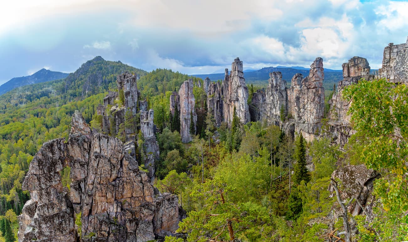
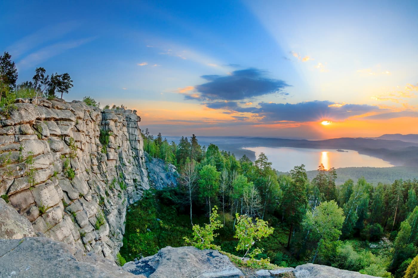
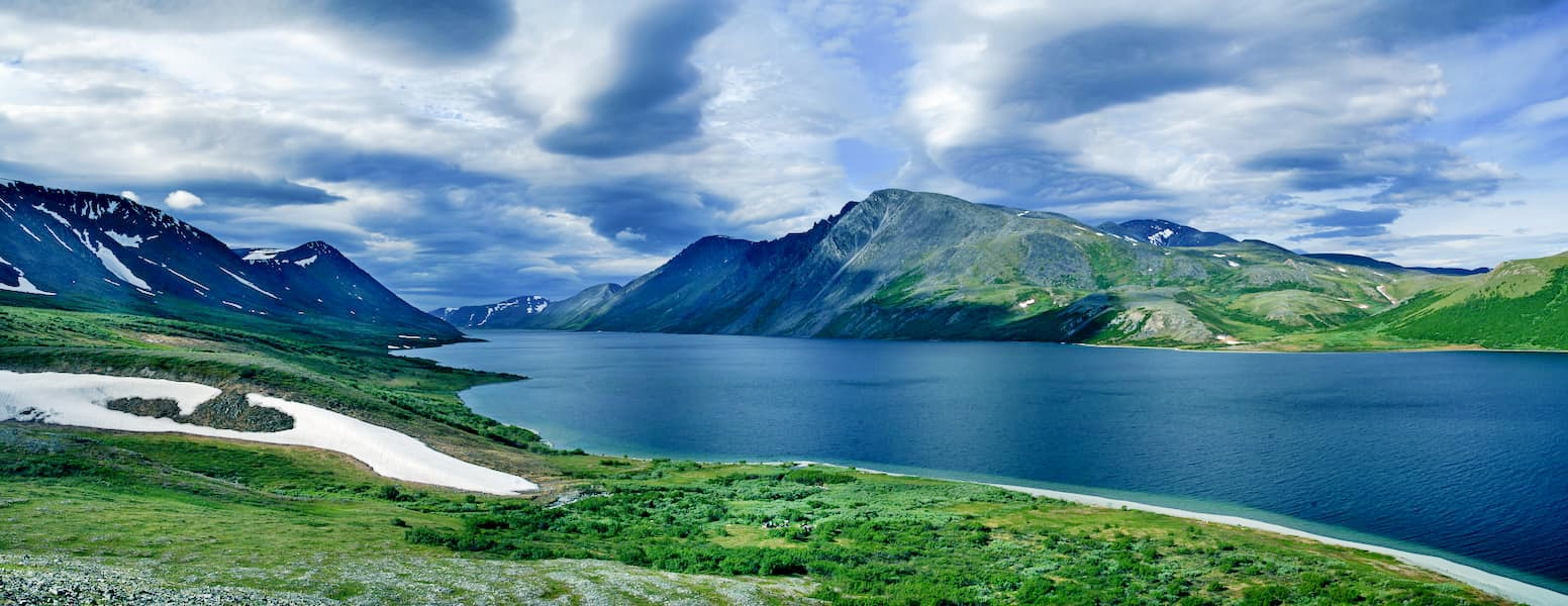
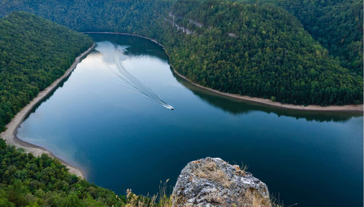
The mountain peaks here are picking up again, compared to the Middle Urals. The highest ridges and mountains are located in the west, and as you move south of the Belaya River valley they become lower. Some of them are framed by stone idols of amazing forms. Many beautiful rocks can also be seen on the riverbanks. An interesting feature of the local rivers is that most of them originate near each other. The most full-flowing rivers run along the western slopes of the mountains. There are many rapids on them. Here flows the longest river in the region – the Ural River which was formerly called Yaik. The Southern Urals are rich in lakes. Lake Turgoyak is surely the trademark of the region as well as the Kaslin. Lake Zuratkul, located in the reserve of the same name, lies at the highest altitude.
The protected areas of the Southern Urals are many:
The beauty and variety of the nature of the Southern Urals opens a wide spectrum of opportunities that would please even the most fastidious traveler. You can go hiking, trekking, skiing, biking, there is rafting for beginners and true connoisseurs, you can order ski-tours, and climb the mountains or run up those slopes. Visiting caves and speleo tourism are well developed as well. The Southern Urals is simple and safe, it has excellent transport accessibility.
Significant and the most popular natural destinations are Yamantau Mountain, the Zigalga Ridge, the Nurgush Ridge, the Inzer Stones Ridge, Otkliknoy Stone. There are lots of corroms, stone rivers, and caves – the Sumgan Abyss and the Sumgan-Kutuk Cave, the Suhaya Atya Cave, the Sugomak Cave. As to the rivers, the most popular are the Ai and the Yuruzan. The lakes to see are the Zuratkul, Taganai, Uvildy ect. Most of these lakes are located in protected areas.
For skiing and snowboarding enthusiasts, there are more than 5 ski resorts in the Ural Mountains, which are located in the Chelyabinsk Oblast.
The two largest ski resorts in Ural are Zavjalikha and Adzhigardak with more than 20 km (12 mi) of slopes and more than 5 ski lifts each. There are also Eurasia Center, Solnechnaya Dolina (Sunny Valley), and Minyar ski resorts with more than 5 km (3 mi) of slopes and several ski lifts each.
Check the Ural ski resorts map on the larger Chelyabinsk Oblast and Russia ski resorts map in the World Mountain Lifts section of the site. It includes information about open ski lifts / slopes in the Ural Mountains in real-time with opening dates and hours. There are also year-round cable cars, funiculars, cog railways, aerial tramways, and all other types of mountain lifts.