
Scan the QR code and open PeakVisor on your phone
Taganay National Park has 29 named peaks. The highest is Kruglitsa at 1,178 m. Other notable peaks include Otkliknoy greben', Dalnii Taganai and Icil.
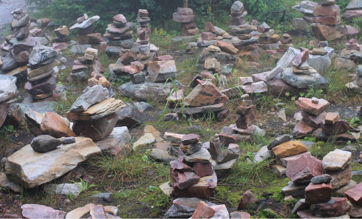
This is an eerie-looking place where mountains start floating on their own accord making you feel going crazy, where valleys feature stone idols that look like fairy-tale characters, where bards gather every summer and sing heart-rending songs, where Old Believers fled to find shelter from religious innovations. This is a place to go. This is Taganay.
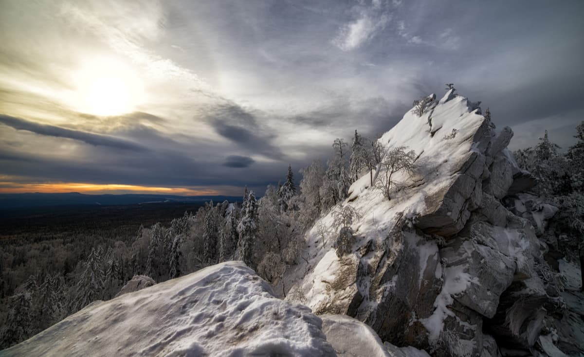
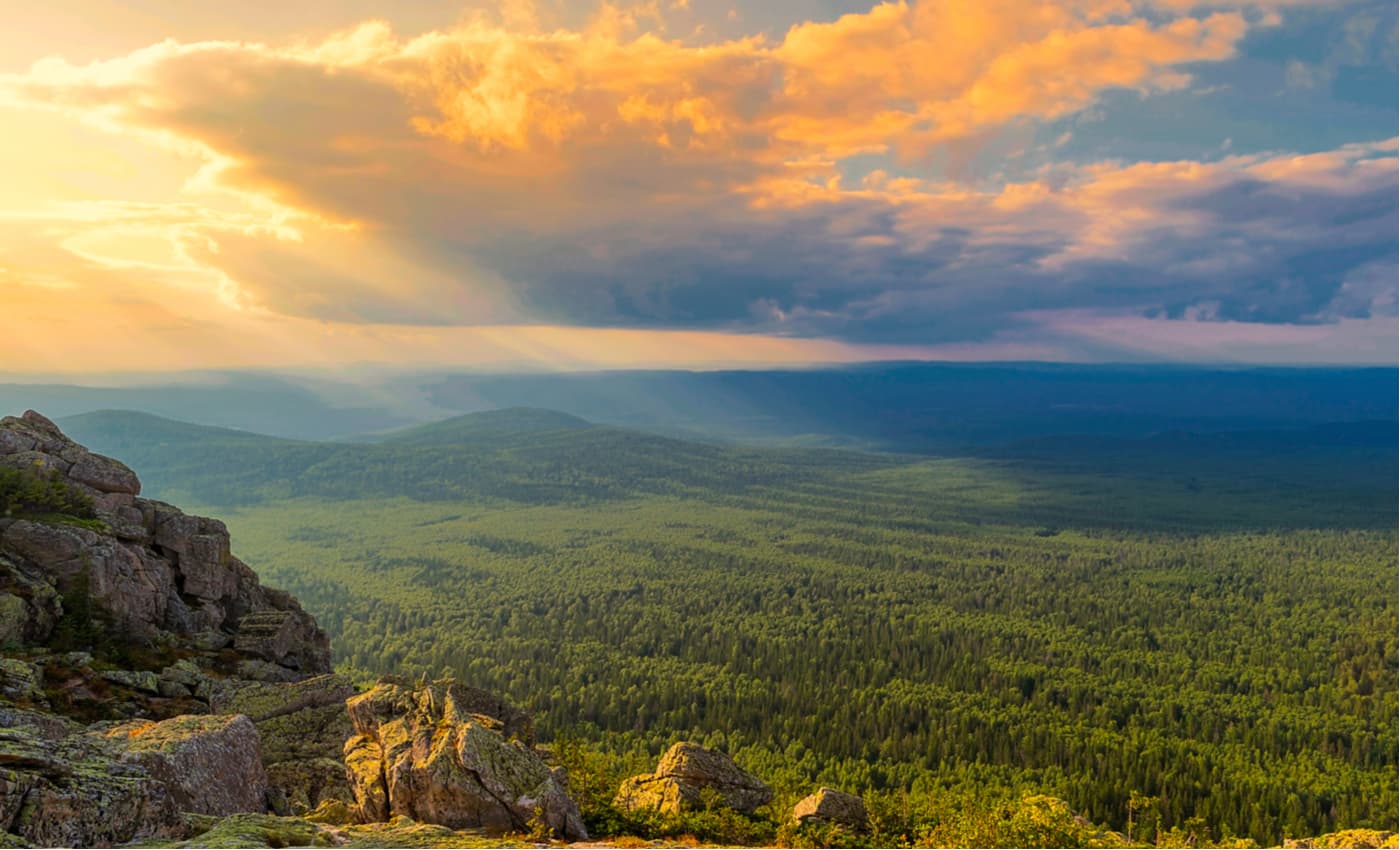
The Taganay National Park was established in 1991 and is considered the most beautiful and most popular in the Southern Urals. The park is located in the northern part of Zlatoustovsky urban district and a small part of Kusinsky district of the Chelyabinsk region. The area of the park is 56.8 hectares. In Bashkir language taganay means "a lunar tripod". The park is sometimes referred to as a small mountainous country with peaks, rapid rivers, alpine meadows, stone fields, mountain tundra, and small taiga.
The landscape is marked by parallel threads of the following ridges:

At the foot of the mountains, there are river valleys of the rivers Small and Big Tesma, Kamenka, Lubyanka, Shumgi, Chernaya, Gubenka, and Big Kialima. The springs and smaller streams are abundant in the park, to name a few: the Tarkhanov Spring, the Merry Spring, the Taganaysky Stream and the most famous – the White Spring. Water resources include the Tesma reservoir and several swamps, of which the largest in the Chelyabinsk Region is the Taganayskoye (located in the Kialimskaya Pad).
The climate of Taganay Park has conditioned the appearance of two climatic zones. One includes mountain peaks with meadows and forests, whereas the other features mainly valleys and foothills. The park is characterized by a change of temperature during the day by 10 degrees Celsius (18 degrees Fahrenheit), in summer fogs are frequent, in winter snowstorms enwrap the mountain peaks making many passages impassible.
The 97% of the territory of the national park is covered with forests of Siberian spruce, fir, pine, larch, maple, willow, lime, birch, alder, and aspen. The park contains about 750 plants, some of which are listed in the Red Book. The forest is a safe home for brown bears, wolves, lynxes, elk, martens, and otters. The park features over 180 bird species, over 55 mammal species and about 10 fish species. Some of them are listed in the Red Book.
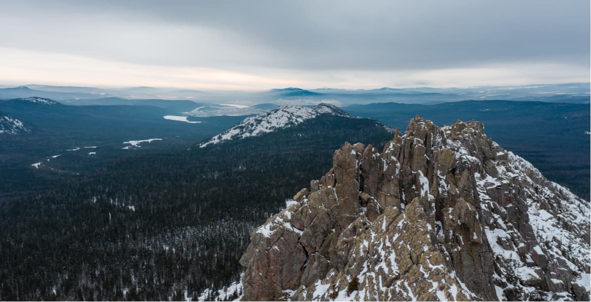
The Two-Headed Hill (or Top of the World) is the southernmost peak of the Big Taganay Range. A metal staircase which eventually dwindles down to a common footpath leads up to the top. The Hill is divided into two peaks: Perya or Feathers (1,034m) and Baranyi Lby aka Ram Foreheads (1,041 m). The hiking trail leads to the former. At the top of Feathers, there can be seen the remains of a metal structure – all that is left of the once standing here television retransmission station for the city of Zlatoust (it received a signal from the city of Sverdlovsk – now Ekaterinburg and transmitted it further).
The Two-Headed Hill is the most visited elevation point in the Taganay National Park. There are many tourists here all year round. It is very popular among climbers. On the southern slopes of the Hill, there is a rock-climbing wall, a testing area for climbing the Perya Rocks (Feathers). The path to the northern peak of the Hill is covered with numerous ledges, thanks to which the next rock – Barany Lby (Ram Foreheads) – was named.
The mountain's insides are rich in various minerals, the most valuable of which are considered to be aventurine stone deposits.
At the foot of the Two-Headed Hill, there are many springs, the most famous of which is the White Spring on the eastern slope. Its water is as mild as the water from the melted snow, and the water temperature even in summer does not exceed 3-4 degrees Celsius above zero (37.4 - 39.2 degrees Fahrenheit). The bottom of the spring is covered with fragments of white quartzite which creates a sensation that the spring is radiating light. Nowadays, the White Spring shelter has been created near the source.
Between the Two-Headed Hill and the Otkliknoy Ridge (north of the Two-Headed Hill) there are smaller hills called the Mitkin’s cliffs.
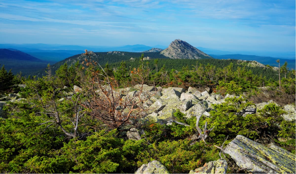
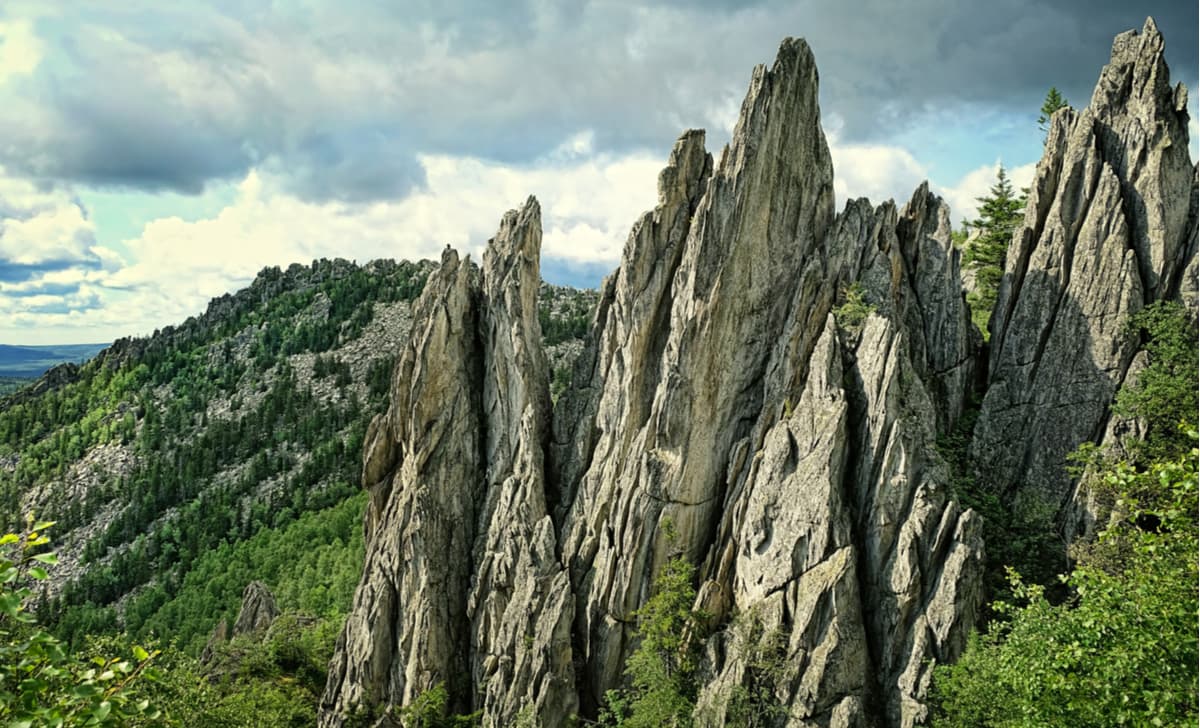
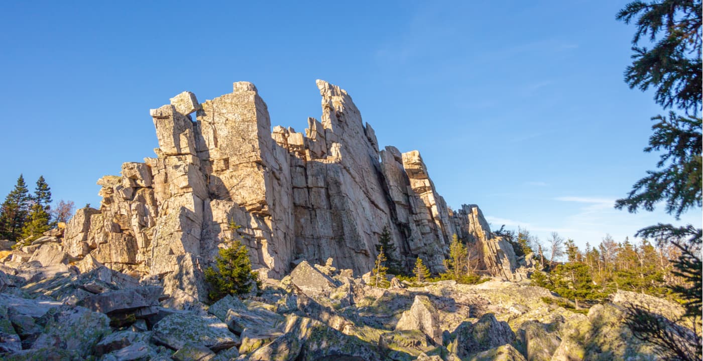
The Otkliknoy Ridge has the most dramatic appearance in the Bolshoy Taganay Ridge even though it is not the highest summit of the lot (1,155 m). It is not a ridge per se, but actually a peculiarly shaped peak. Why is it called a ridge then? It was named thus for its ridge-shaped contours and repeated loud echoes that occur due to reflections from almost vertical rock surfaces. The name ‘otkliknoy’ means ‘rebellow’ in Russian. The relative height from the foot of the cliffs is 150 m, the length of the ridge is about 800 m. There is a tectonic fault in the north-eastern part of the ridge. Nearby there are three upward springs, which often dry up in summer.
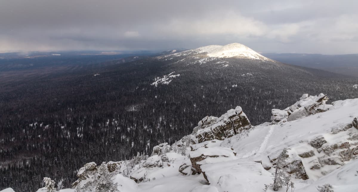
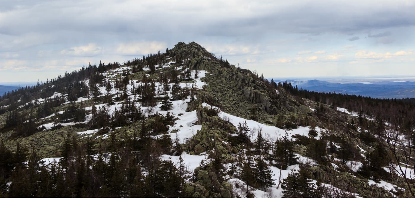
Mount Kruglitsa (1,178m) is the main peak of the Bolshoy Taganay Ridge and the highest point of the entire Taganay mountain range. The well-rounded shape prompted the name of the mountain. The top of the mountain resembles a Turkic headdress, due to which it also used to be called "a Bashkir hat" in ancient times. These places are sometimes called the foothills of the Riphean as well. The mountain is composed of quartzites (white, pink, cherry colours) with inclusions of aventurine. At the eastern foot of Mount Kruglitsa, there is a tourist shelter Taganay from which there is a 3 km long hiking trail to the top of the mountain. The ascent to the top is rightfully considered quite difficult because in the upper third of the mountain the terrain is covered with stone mounds, which are not safe to step on. The northern part of the mountain is a flat plateau covered with tundra.
This mountain also tests your power of imagination and the resilience of your nervous system. On a clear sunny day, you can see a fascinating phenomenon when the whole bulk of the mountain lifts in the air and seems gently soaring above the ground (say hi to Hauru no Ugoku Shiro). The explanation to the illusion is quite simple. The close proximity of the underground waters (marshy places at the foot of the mountain) and the streamlined round shape of the peak create the effect of swaying. Stones warmed by the sun attract moisture from cracks, and the air becomes transparent and easily movable, which makes one feel that the mountain is about to move from its foot.
Between the Otkliknoy Ridge and Kruglitsa, there is a pass called the Valley of Fairy Tales (the local name is the Sand Hills). The area is unique in its beauty created by low dark coniferous forest with generously strewn sculpture-like rocks that remind of fairytale characters. Back in the day, tectonic movements were rather intensive in the area of the Valley of Fairy Tales.
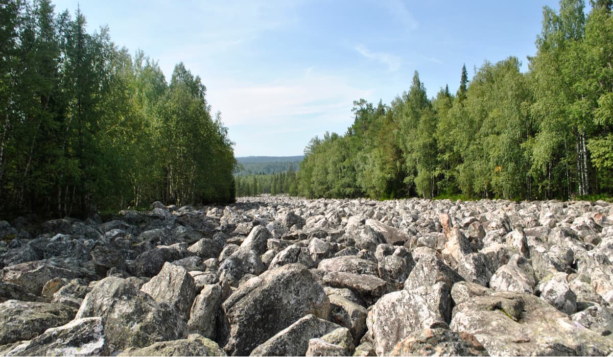
The Great Stone River begins at the southern foot of the Valley of Fairy Tales. It is no river per se, but a huge stone filed. Its length is 5-6 km, width is from 20 to 700 m.
The northernmost peak of the Taganay National Park is Mount Yurma (1,003 m). It is the roadstone for the start of the Southern Urals. The area to the north of the mountain is called the Middle Urals. In translation from Bashkir language Yurma means "do not go". Most part of the mountain top is covered with forests unlike most other high peaks in the Southern Urals. At the top of the mountain, there is a vast plateau covered with short spruces. You can see the rock buttes in some places. The highest point here won’t blow your mind away, it is marked by a modest wooden tower. On the other hand, in other parts of the mountain, there are rocks that are notable for their picturesque appearance despite their relatively small height. Among them are the rocks of the Devil's Gate, the Devil's Mound, the South Gate and the Fortress. On the ridge, there are the peaks of Dedurikh, Sapog, Severniye Perya (Northern Feathers), Hornovaya.
Yurma is made of quartz and mica-schist. The rocks have undergone massive erosion and contain numerous cracks. Passing under some overhanging rocks may sometimes feel pretty uncomfortable. The most popular among tourists are the rocks of the Devil's Gate (985m). Most of the tourists in Yurma are limit their visits to these rocks only. The Devil’s Gate has two markedly pronounced hills, which conventionally form the so-called gates. Since times immemorial, local people have associated this place with devilry and evil spirits. There are several parking lots next to the Gate. The Rock of the Devil's Gate (sometimes called the Middle Gate) is a natural geological monument and a part of Mt Yurma protected area. Should you wish to visit this part of the mountain and camp overnight, be ready to pay a fine.
To the east, at the base of Mount Yurma, there are Ufimskoe Lake (or Ufa Lake) and Lake Barakhtan. To the west of Yurma begins the river Kussa (a tributary of the river Ai). The River Ufa flows from Lake Ufimskoe.
Between Mount Kruglitsa and Dalniy Taganay there are rocky Cliffs of the Three Brothers. Their height reaches 30-40m. In the past, Old Believers used to hide here.
Mount Itzyl is located on the Itzyl Ridge, part of the Greater Urals Ridge. The mountain has two peaks over 1000 m high: southern (1,049 m) and northern (1,068 m). In the past, Old Believers found good shelter here as well as among the Cliffs of Three Brothers. "Itzyl" in Bashkir language means "a perpetual wind". The route of the park to this mountain is called To the Perpetual Wind. The winds blow here quite often indeed since the area is actually on the border between Europe and Asia. The mountain is located 24 km from the Central Estate of the Park. There is a weather station called Taganay Gora on it.
Black Rock (853 m) is one of the northern peaks of the Nazminsky Ridge, located 12 km north of the town of Zlatoust, 4.4 km west of Mount Dvukhglavaya Sopka (Two-Headed Hill) in the Taganay Massif. The rock is formed by mica-schist and black amphiboles. At the top of the rock, there is a crest that stretches from south to north for more than 200 m. The eastern slope is difficult to reach and breaks down precipitously. Still, you can climb the mountain without special equipment. There is a staircase to the top of the mountain and a bench at the very top of Black Rock. From here, you can see the panorama of the western slope of the Bolshoy Taganay Ridge.
This is also a host premise of the annual fest for bard songs.
A dozen mining sites are still there in the Taganay National Park, one of the most famous is the Akhmatovskaya Mine. Throughout the 19th century, minerals were extracted there. Here one could find blue marble, honey-yellow garnet, serpentine and other minerals. Since 1981, the mine has had the status of a geological monument and mining of minerals is prohibited here.
The Taganay National Nature Park is open for visitors all year round. There is a Museum of Nature in the Taganay forestry. The park has developed several routes of different complexity and duration to increase the environmental awareness of the visitors. Horseback riding tours are organized in cooperation with the local Equestrian Club.
The most popular routes include visits to the following places of the park: Dvuglavaya Sopka (Two-Headed Hill), Mount Kruglitsa, The Great Stone River, Black Rock, Otkliknoy Ridge, the Cliffs of the Three Brothers.
In the accessible proximity, there are shelters and camping lots. Make sure you have enough food supply for the whole period of visit, drinking water can be found every 5-8 km (mountain streams). Due to the extended length of walking routes, it is better to leave younger kids at home and take along older children with good stamina.
A visit to the Taganay National Park requires prior authorization and a small entrance fee. The visit permit can be purchased at the Administrative Center on the territory of the eco-tourist complex Central Estate and at the Visitor Center on the territory of the eco-tourist complex Black Rock. You can also buy a visit permit by e-mail indicated on the official website of the park, but this is usually for tourist groups that enter the territory of the park from the town of Karabash, the Gorely Pass from the town of Miass, the village of Magnitka.
Up-to-date information on routes and parking lots, on obtaining a permit and on how to get to the park can be found on the official website of the Taganay National Park.


The highest peak in Taganay National Park is Kruglitsa, at 1,178 m.
Notable peaks in Taganay National Park include Kruglitsa, Otkliknoy greben', Dalnii Taganai, Icil and Dvuglavaya Sopka.


