
Scan the QR code and open PeakVisor on your phone
There are many memes in Russia about Chelyabinsk. Let’s give a few so that you get the whiff of what it feels like to live in this beautiful yet tough land. The guys from Chelyabinsk are so tough, they don't drink coffee, they eat it with a spoon from a coffee can. The Chelyabinsk mosquitoes are so tough they suck their own blood. The Chelyabinsk weathercocks are so tough, they show the wind where it should blow. The list can be continued ad infinitum. The meme has actually been quite widely used by Russian stand-up comics.
The Chelyabinsk Region is situated in the southern part of the Ural Mountains, at the juncture of the Middle Urals and the Southern Urals, and partly in the West Siberian Plain adjacent to the mountains. It is a part of the Urals Federal District of the Russian Federation.
The Chelyabinsk Region borders the Sverdlovsk Region in the north, the Kurgan Region in the east, Kazakhstan in the south-east, the Orenburg Region in the south, and the Republic of Bashkortostan in the west.
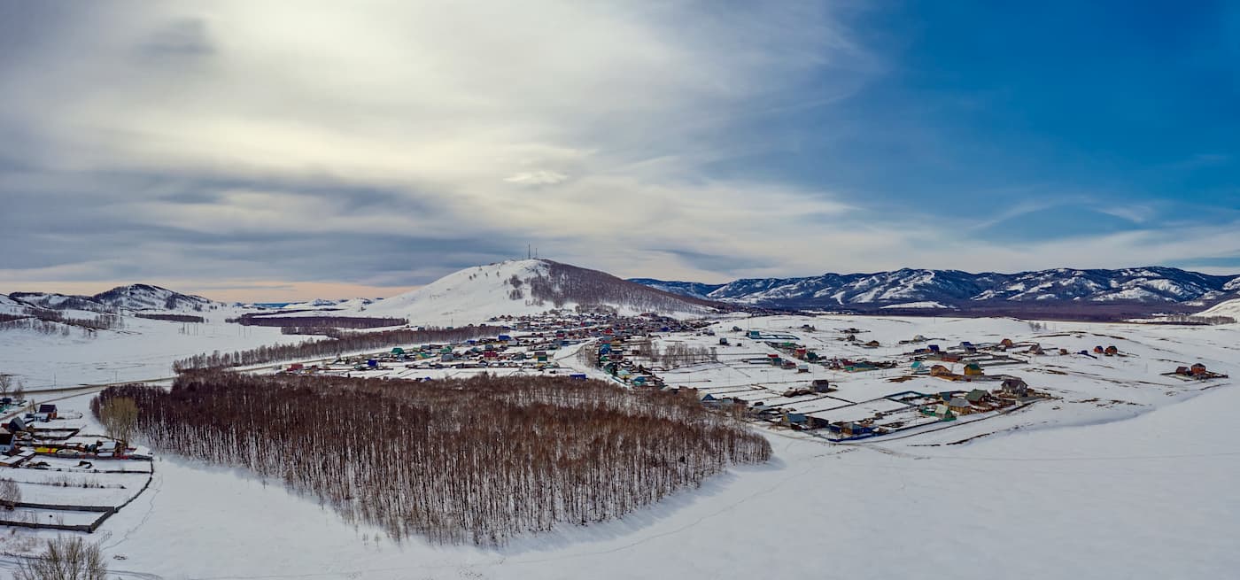
The area of the Chelyabinsk region is 88 529 sq.km., the total length of the borders is 2,751 km, the length from north to south is 490 km, and from west to east is 400 km. The population of the region is 3.466 million people (as of 2020). Of the Urals regions, Chelyabinsk is the most densely populated. In terms of population density, it is the second largest after the Sverdlovsk Region. The region includes 30 cities.
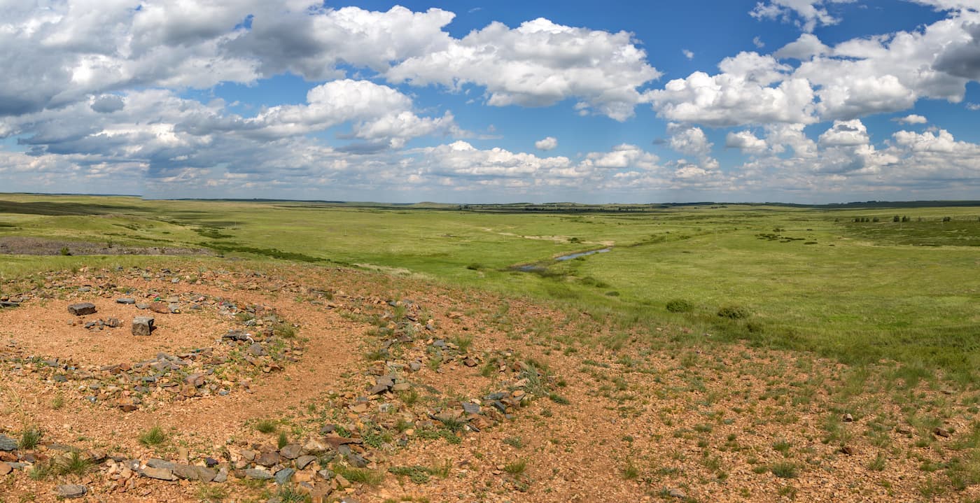
The landscape of the region is diverse: mountains, mixed forests, forest-steppes and steppes. At the same time, pristine nature is adjacent to places heavily polluted by industrial plants. Forest-steppes and steppes cover approximately the equal areas (38% each). The forest zone occupies about a quarter of the total area. Dark coniferous taiga prevails on the mountain slopes, and mountain tundra can sometimes be found at the tops of the mountains.
The flora of the region includes 78 species of mammals, 264 species of birds, 7 species of reptiles, 10 of amphibians, 48 of fish, about 13 thousand species of insects and molluscs.
The Chelyabinsk Region has a continental climate that increases its particular features if you move from north-west to south-east. The region is located in the depths of Eurasia, far from seas and oceans. The climate is significantly influenced by the Ural Mountains that create a perfect barrier for the movement of western air masses. Winters here are cold and long, and summers are hot with recurrent droughts. Winter begins around mid-November. The most powerful snow cover can be found in the mountainous forest areas. Typically, there are heavy snowstorms observed mostly in February and March. Spring usually starts only in early April and summer comes in the second decade of May. The average daily temperature in January ranges from -15°C (+5 F), with severe frosts reaching -44 or -50°C (-47 -58 F). The average daily temperature in July is +25°C (+77 F). The temperature can reach up to +39 or +40°C (+102 or +104 F) for several days in July.
There are no camels living in the natural environment in the Chelyabinsk Region, yet the flag and coat of arms of Chelyabinsk City, as well as the flag of the Chelyabinsk Region, feature a camel. It is explained by the fact that in the 19th century, trade was the main source of income of the city, so there were many camels in the passing caravans.
The Chelyabinsk Region is associated with the meteorite that fell here on February 15, 2013. When a meteorite flew over the region and exploded, it caused a lot of damage to the ground and injuries to people. Several pieces of the meteorite fell near Lake Chebarkul. After this event, a monument in the shape of a meteorite was erected near the lake.
Among the mysteries of the region, we should mention the Kyshtym Dwarf (aka Alyoshenka). The remains of this mysterious creature were found in 1996 in Kaolinovy settlement on the outskirts of the town Kyshtym. There were many assumptions about its origin, including the hypotheses that it was a humanoid or an alien, but the peculiar Dwarf was never attributed to any known species. The remains were lost, only photos and videos are left.
It is here that one of the most ancient civilizations on a planet used to live. The traces of human settlement have been found in an ancient settlement Arkaim.
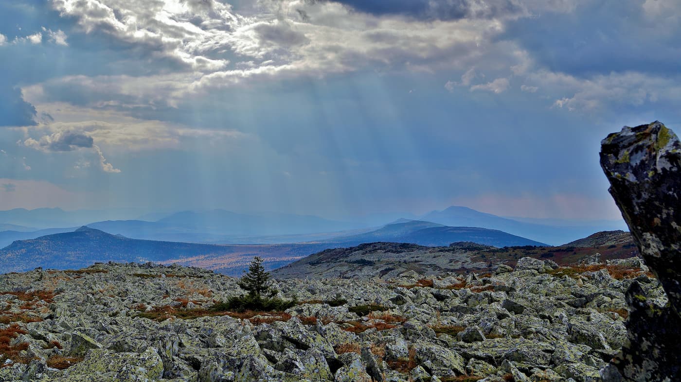
The Chelyabinsk Region has a stone river which is considered the largest in the world. It is basically a chaotic heap of huge stones that resembles a river bed. It is over 6 km long and up to 700 m wide. This river is "flowing" in the Taganay National Park. The region has its own Paris; it is a village with a copy of the Eiffel Tower.
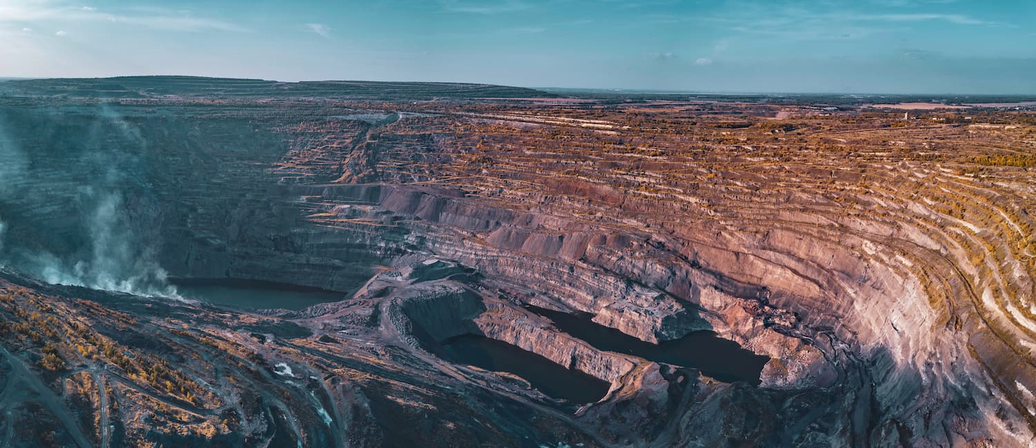
Near Korkino town in the Chelyabinsk Region, there is the deepest in Europe and the second in size coal mine in the world. Its depth reaches 500 m, the diameter of the coal mine funnel is 1.5 km.
The town of Troitsk is the sunniest place in the region as it enjoys 2218 hours of sunshine per year, which is more than in the famous Black Sea resort Sochi.
In some years it is possible to observe polar lights in the Chelyabinsk Region.
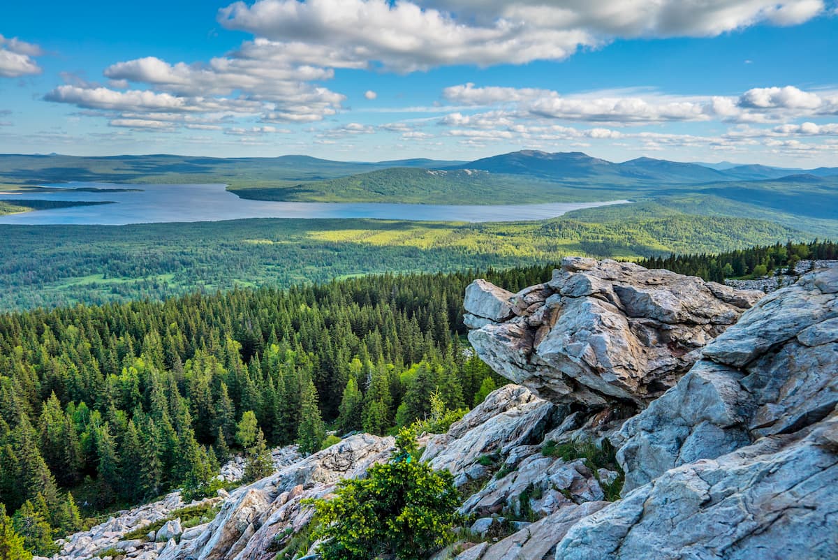
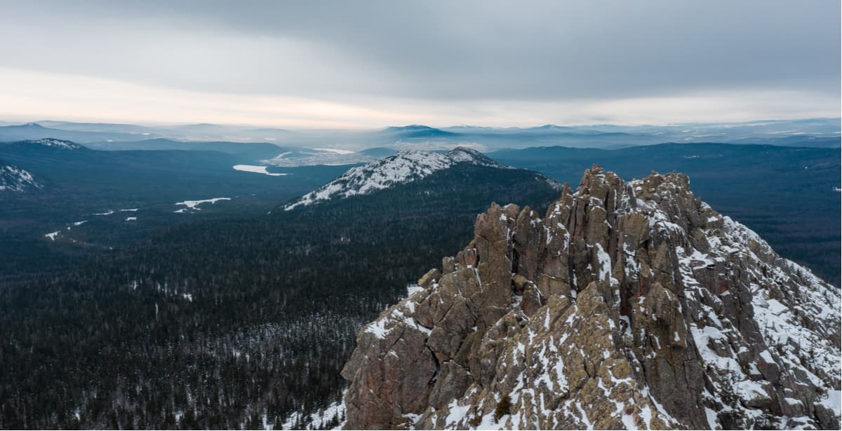
The region's mountains, lakes and forests are wonderful places for travel enthusiasts. Among the natural attractions are beautiful mountains and rocks. The highest mountains are located in the west of the region, including the highest point of the region – the Nurgush Range (1,406 m).
The most popular mountains and ranges are the Big Nurgush Range, the Taganay Ranges (the Big, Middle, and Small Taganay), the Zyuratkul Range, the Urenga Range, Mount Yurma, the Three Brothers Rocks, the Black Rock, the Chashkov Range, the Arakul Mounds, Mount Sugomak, Mount Alexander Hill, Mount Yegoza and others. Most of these ranges and mountains are located in national parks in the Chelyabinsk Region.
Mount Yegoza (607.7 m), also spelt as Egoza, is the highest point to the west of Kyshtym town. Like Mount Sugomak, Mt. Yegoza is present on the town’s coat of arms. There are many legends about Mount Yegoza and Mount Sugomak. One of them says that in ancient times there lived Sugomak and his beloved Yegoza who were not allowed to be together by hostile Bashkir clans. The story runs almost like notorious Romeo and Juliet. To prevent the lovers’ encounters, the clan people chained Sugomak and took Yegoza away and hid her in the mountains so those two would never be together. The lovers were worried that they caused a lot of trouble for their families. And they prayed to the gods and said that they were ready to sacrifice themselves but that the Bashkirs should have peace and they should be united forever. The gods heard them and a miracle happened. Since then, the Bashkirs have been living in peace. Sugomak and Yegoza became inseparable being turned into mountains standing next to each other. Tears that they shed weeping over their unsuccessful love formed lake Sugomak.
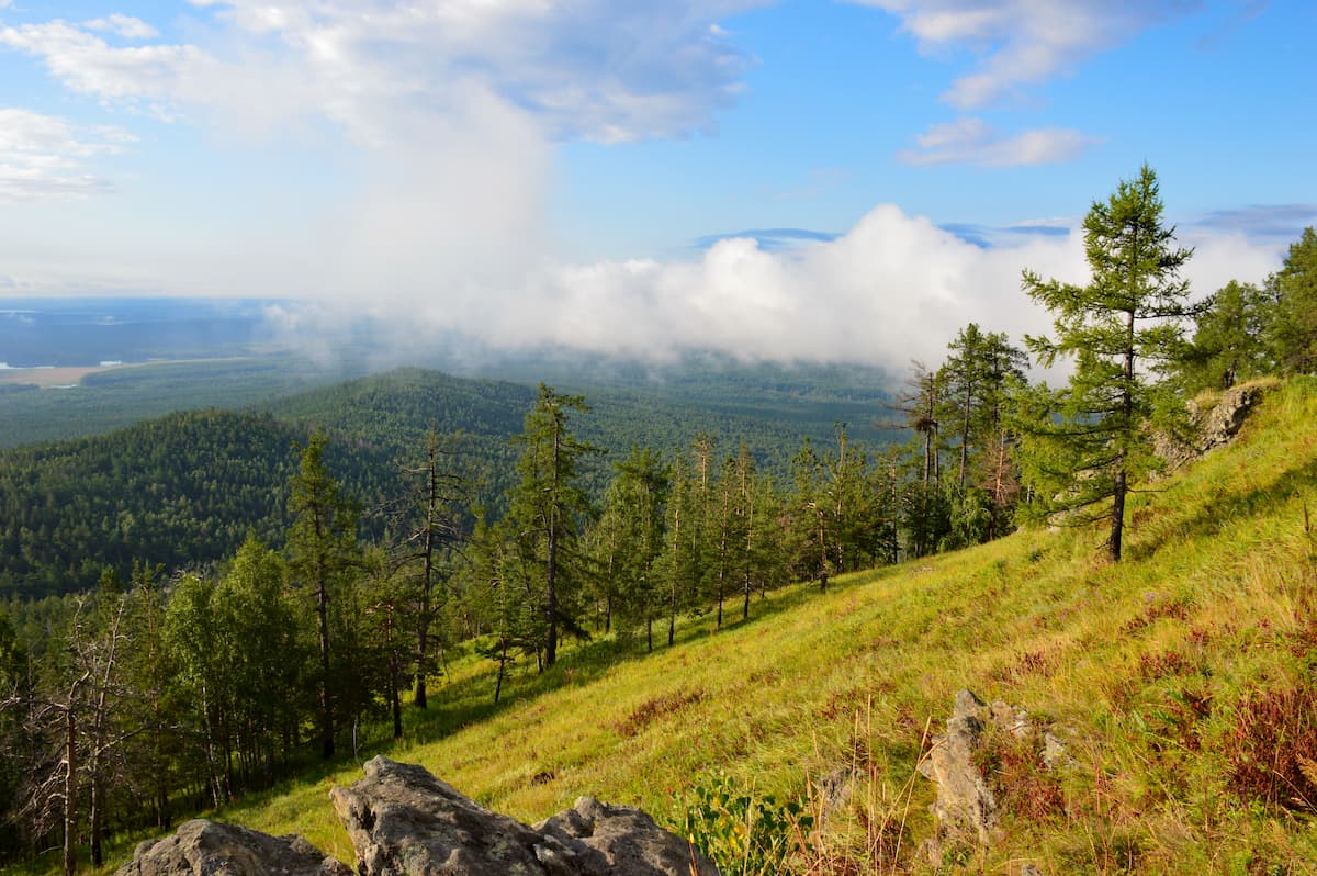
From the top of Mount Yegoza opens a beautiful panorama: in the west – the chain of the Urals, in the east – a view over Kyshtym, Kasli, Ozers, the towns of the Chelyabinsk Region, and picturesque lakes. In winter, the Yegoza ski centre operates on the mountain, the pistes are laid on the north-eastern slope. Mount Yegoza, together with the mountain and lake Sugomak, Golaya Sopka, Sugomak cave, is part of the Sugomak natural complex.
Alexander Hill (843 m), or Aleksandrovskaya Sopka is an imperial mountain in the Urals. Despite its small height even for the Urals, the mountain is quite famous. It was glorified by the Grand Duke and the future Emperor Alexander II, who made his first trip to Russia and visited this peak in 1837. Located in the Ural-Tau Range, this mountain received the "imperial" name. However, it is not the only emperor in the history of Hill’s life. In 1824, Emperor Alexander I inspected his possessions near this hill, and in 1904 at the foot of the hill, there was a train ride made by Emperor Nicholas II. He did not climb to the top, only looked out of the window at the granite obelisk "Europe-Asia" installed near the station Urzhumka. The Hill is easily accessible for climbing, trails lead to the top, and at its foot, there is a large spring. On the top, there are rocks typical for the whole Urals. Nearby is the town of Zlatoust. It is more convenient to start your trip to the mountain from the railway station Urzhumka.
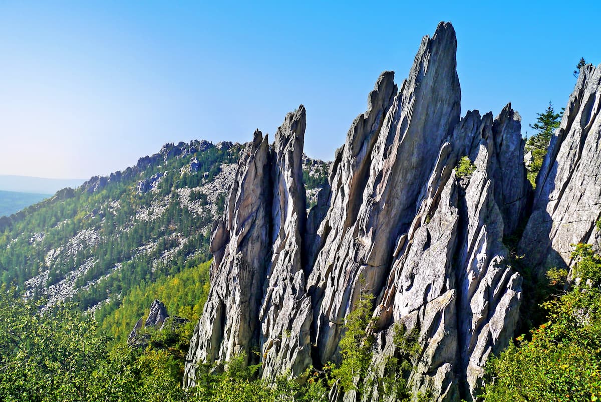
It is definitely worth visiting the Arakul Mounds (called locally ‘Shikhany’). The Arakul Mounds (or simply Big and Small Shikhan) are stony idols formed by huge blocks and slabs. The mounds stretch over 2 km south-west of Lake Arakul which likes near the town of Upper Ufaley and about 10 km west of the village Vishnevogorsk. The highest point is the summit of Chamberlain (80 m). Climbers have a training ground on the steep eastern slope where cliffs reach up to 60 m. And the gentle western slope allows climbing without special equipment, at its foot, there is a spring with clean drinking water - Mariyn Stream.
The Zigalga Ridge belongs to the mountainous part of the Southern Urals. Almost all its peaks exceed 1000 meters. The ridge is located in the basin of the Yuryuzan River. Its highest point is Big Shelom (1,489 m) – the third largest mountain in the Southern Urals. The administrative border between Bashkiria and the Chelyabinsk Region cust the ridge into the northern and southern parts. Its southern part, including Big Shelom mountain, is located on the territory of the Southern Urals Reserve and represents a chain of corrom peaks (made of clutters of large boulders) in the form of helmets, hence the name itself – Shelom, which means helmet in Russian. Visitation of this part of the ridge is limited. The northern part is more accessible for tourists; it has more gentle peaks with nice foothills. Up to the height of 750 m, the slopes are covered with forest, then start elfin woods, meadows, high bogs, the latter are the largest in the Southern Urals but quite passable. Once you hit a 1000 meter mark, you see stone placers (corroms) and stone idols. One of the attractions of the Zigalga Ridge is the Elokhta River with a canyon, a waterfall and a small lake in the northern part of the ridge. From the top of the Zigalga, there is a wonderful panorama of the highest ridges and mountains in the Southern Urals: the Nurgush Range, the Marshak, the Iremel, the Kumerdak, Yamantau Mountain and Nary Mount.
The Casarmenny Ridge is also interesting. It is a mountain range located at the exit of Asha settlement towards the town of Minyar. People call it the "Gate of the Southern Urals".
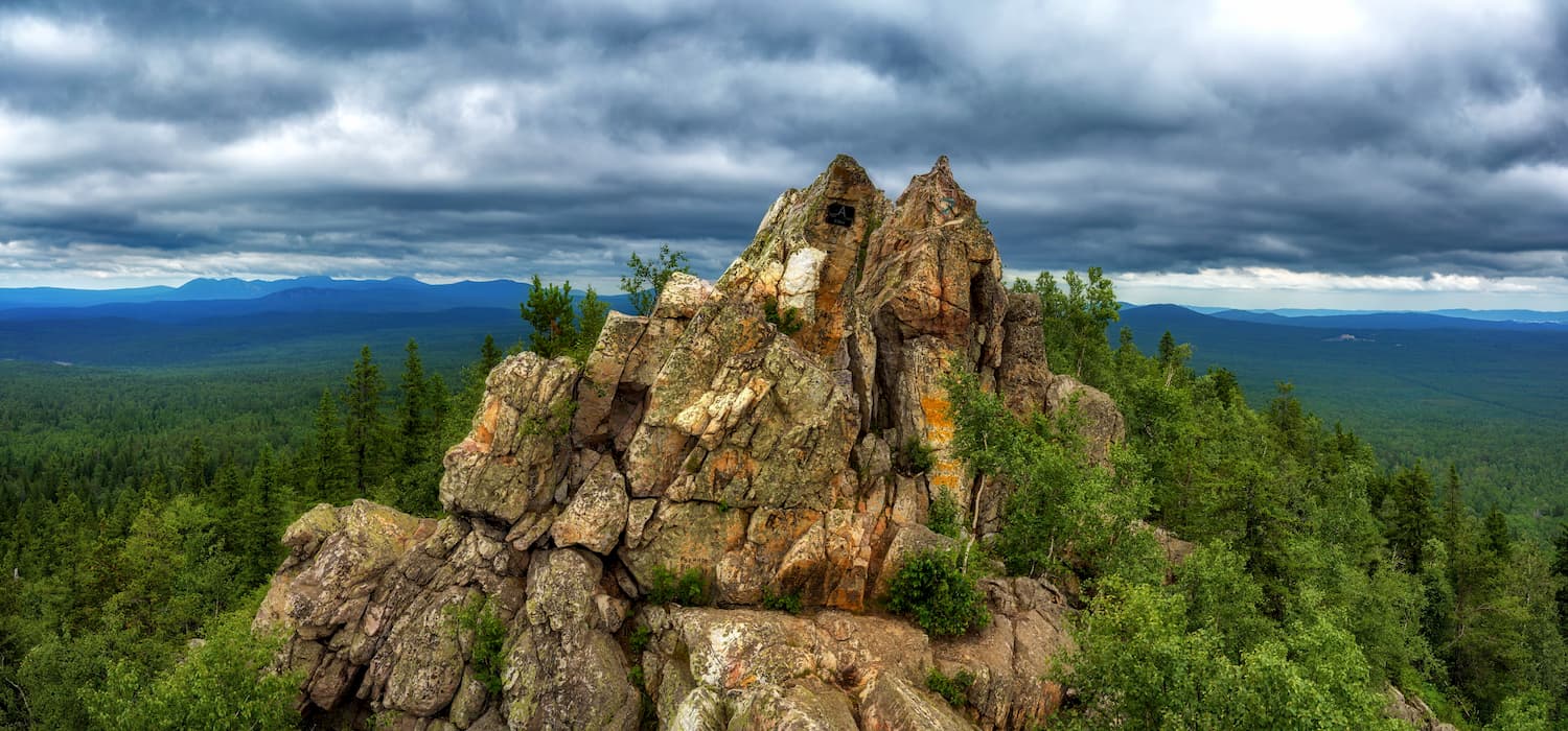
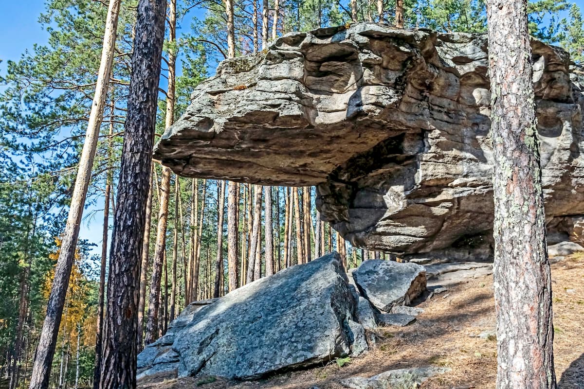
The Chashkovsky Ridge got its name for its semicircular shape, it has a form of a big cup or a goblet – chasha in Russian. Its main attraction is a fortified settlement of stone figures – rocky idols of bizarre forms scattered in the forest. Their height varies from 3 to 40 m. Stone sculptures remind of different silhouettes among which you can see the contours of a crocodile, dragon, eagle, turtle, camel, bear, etc. Some of the remains have holes and cavities in which tourists like to make wishes. Climbing competitions are held here quite often. The site is suitable for beginners as well as for experienced athletes. The ridge is located near the town of Miass.
For skiing and snowboarding enthusiasts, there are more than 5 ski resorts in Chelyabinsk Oblast of Russia. It is also the main area for skiing in the Ural Mountains.
The two largest ski resorts in Chelyabinsk are Zavjalikha and Adzhigardak with more than 20 km (12 mi) of slopes and more than 5 ski lifts each. There are also Eurasia Center, Solnechnaya Dolina (Sunny Valley), and Minyar ski resorts with more than 5 km (mi) of slopes and several ski lifts each.
In addition to the provision of ski slopes in winter, Euroasia Center organizes bicycle routes, competitions to overcome the off-road on quads (ATVs) and SUVs, horseback riding, as well as rafting on the Ai River in summer. There are also Horse Rifle Extreme Club Bystray and Equestrian Center Riphey.
(Speaking separately of the Ai River, beware of a rock called Bandit (or better say Rascal) on one of the river bends. It has historically caused plenty of trouble to the rafters and boatmen because the current in this part is really strong, the rock stands precisely on the bend and if you fail to navigate properly and manage the current, you will be smashed directly into the Rascal Rock.)
Check the Chelyabinsk ski resorts map on the larger Russia ski resorts map in the World Mountain Lifts section of the site. It includes information about open ski lifts / slopes in Chelyabinsk in real-time with opening dates and hours. There are also year-round cable cars, funiculars, cog railways, aerial tramways, and all other types of mountain lifts.
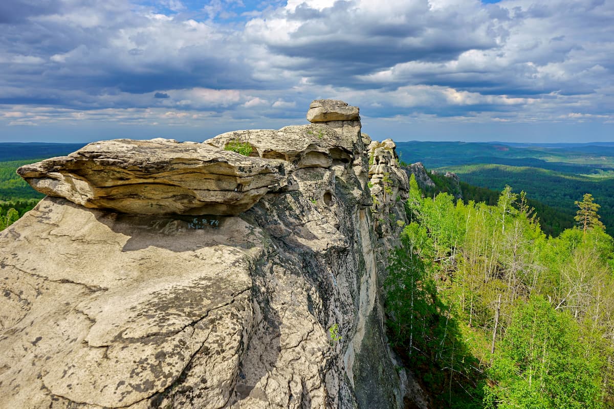
Almost a third of the territory of the Chelyabinsk Region is composed of karst rocks with very diverse terrain. There are caves, grottos, arches, niches, sinks and other karst phenomena. Most of the caves are located in the western and north-western parts of the region. Many of them are connected with quite ancient events and are natural monuments.
The longest cave in the region is the Danko Cave (2,840 m long) on the Sim River. The deepest cave in the region is the Shumikha (107 m deep) on the Ai River, but it has gone underwater recently.
The most popular caves are the Serpiyivsky Cave Town, the Sugomak Cave, the Ignatievskaya Cave, the Sukhaya Atya Cave, the Sikiyaz-Tamaksky Cave Complex, and the Kurgazakskaya Cave. In wintertime, when the water subsides or freezes, it is also great to visit the Fairytale Cave (aka the Shemakha Caves) near the village Skaz and the Zotinskaya Cave on the Bagaryak River.
The Serpiyivsky Cave Town (the Serpiyiv Karst) has received its name from the village Serpiyivka of the Katav-Ivanovsky district. The cave town is located between the cities of Ust-Katava and Sim. It occupies 15 km of the river Sim and exhibits a big variety of karst phenomena: caves here can be horizontal, vertical, in the form of a labyrinth and inclined, there are arches, niches, grottos, funnels, sinks, disappearing rivers, underground lakes etc. Speleologists have recorded here over 50 caves and grottoes.
The Ignatievskaya Cave has a long tail of legends attached. It is located on the right bank of the Sim River in the Katav-Ivanovsky district as well. At its far end, scientists found drawings of primitive people.
The Sukhaya (Dry) Atya Cave has long been considered the longest in the region with the explored length of the cave being 2,130 m. It is located in the Ashinsky district, on the right bank of the Atya River near the village of Sukhaya Atya. Despite the name, the cave is far from being dry, it contains a lot of wet clay which is not always easy to get through.
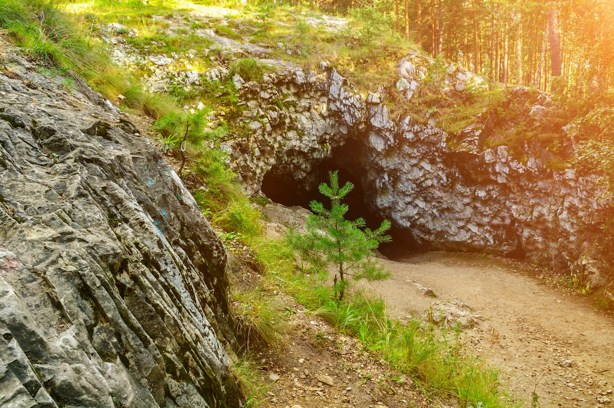
Sugomak is the name of a natural complex that includes three natural monuments, i.e. Mount Sugomak, the Sugomak Cave and Lake Sugomak. Often visited by tourists and even kids, Mount Sugomak (591 m) is the second-highest peak of the mountain range after Yegoza Mount. There are beautiful views opening from the mountain. On the one hand, there is a chain of the Ural Mountains that go beyond the horizon, and on the other hand, there is a lowland with picturesque lakes. The northern side of the mountain is precipitous, there are rocks at the top and the slopes are covered with mixed forests which look magnificently colourful in autumn. At the foot of the mountain, there are Lake Sugomak, the Sugomak Cave and the Mary Tears Spring.
The Sugomak Cave is the only karst cave in the Urals that is made of marble. There are only three explored grottoes: the Light Grotto at the entrance, it still enjoys the natural light, thus the name, and in winter, there are bizarre ice stalagmites and icicles; the Old Believers’ Grotto is the warmest and the wettest; and the Lake Grotto, which is just 10 meters, but it has a 1.5-meter-deep lake which is assumedly connected with the Mary Tears Spring. Some speleologists believe the third grotto might be hiding a way to more grottoes. In the Chelyabinsk Region, it is among the most visited caves.
The Sikiyaz-Tamak Сave complex is located on the border with Republic of Bashkortostan, in the northwestern part of the Satka District of the Chelyabinsk Region, on the right bank of the Ai River, approximately 1 km north of Sikiyaz-Tamak village. It includes about 40 caves, grottoes, arches, sheds and other karst objects. Traces of ancient people have been found here. In all likelihood, the caves served not only as dwellings but also as places of various religious rites. Apart from its historical importance, this cave complex is a natural reserve for rare species of animals and birds.
The Kurgazak Cave is located in the Satka district, on the right bank of the Ai River, 3 km west of the mining village Blinovka. The entrance is an elliptical arch 5 meters high and 14 meters wide. The total length of the passages is 530 m, it has three grottos. The cave is located on the popular route laid along the Ai River.
There are several nurseries and natural zoos in the Chelyabinsk Region:
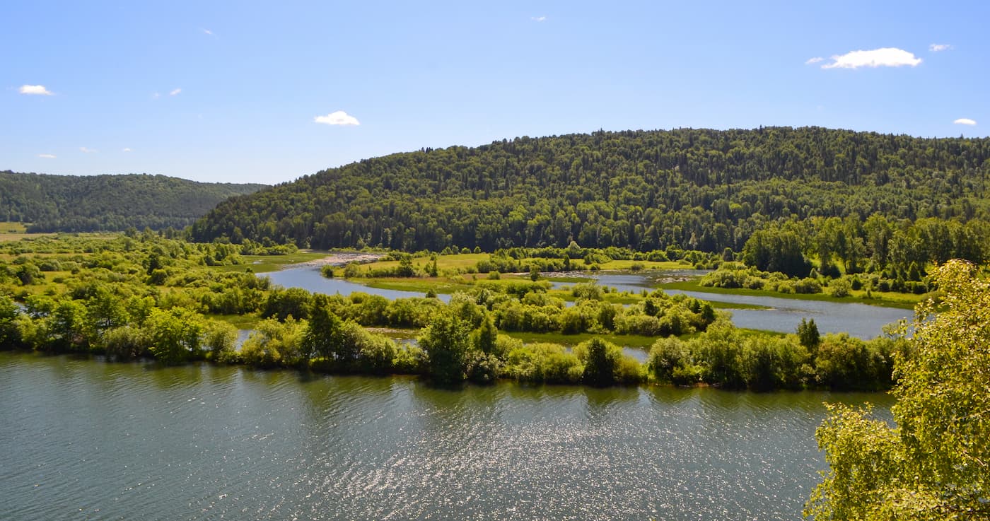
There is a watershed between the Kara and the Caspian Sea basins in the Chelyabinsk Region. The river network consists of 3,602 rivers with a total length of about 17.9 thousand km, most of them are small rivers and streams. More than half of the rivers (about 55.1%) are in the western mountainous part of the region. Those mainly belong to the Kama River basin. They have rapid currents, rocky beds, and precipitous banks. They flow in well-defined narrow valleys.
The rivers of the Tobol basin flow in the east of the region. They originate in the eastern spurs of the Ural Mountains, in the upper reaches they are wild and rapid, whereas once they hit the plain, they acquire a calm current typical of plain rivers.
The right tributaries of the Ural River originate in the elevated parts of the basin and have the character of mountain rivers, whereas the left tributaries are typically plain rivers. The feeding of the rivers in this area is predominantly mixed with snow-dominated feeds and, for mountain rivers, with snow and rain-dominated feeds. Rivers are characterised by high spring floods starting mainly in the first decade of April and low runoff during the rest of the year. In mountainous areas, there are two peaks of flooding. The first comes in the second decade of April and the second in the first decade of May and the summer-autumn low season is sometimes interrupted by rainfall floods.
In the Trans-Urals, the low-water periods are long and stable, with many small rivers drying up. Rivers freeze mainly in early November and open in April.
The region is often called a lake district, almost like in Britain. The Chelyabinsk Region has more than 3,200 natural lakes and artificial lakes with a total area of about 2,600 sq.km. including about 1,700 lakes with an area of more than 0.01 sq.km., and several smaller lakes (according to the Institute of Lake Science of the Russian Academy of Sciences). The lakes here are mainly fresh but in the areas of insufficient precipitation in the south and south-east of the region, there are lakes with high mineralization and salinity.
The area occupied by artificial lakes is much smaller than the area of natural lakes (they are most widely spread in the Tobol River basin). The Chelyabinsk Region occupies the last place in terms of the area of swamps and marshlands in the Urals, as well as in terms of marshlands in general. The marshes and wetlands take up about 2.18% of the territory of the Chelyabinsk Region (about 1,927 sq.km.). The area and the number of lakes and artificial reservoirs, swamps and marshlands are unstable since they depend on natural (climatic phenomena, water regime, etc.) and anthropogenic (drainage or watering of territories, regulation of runoff, etc.) factors.
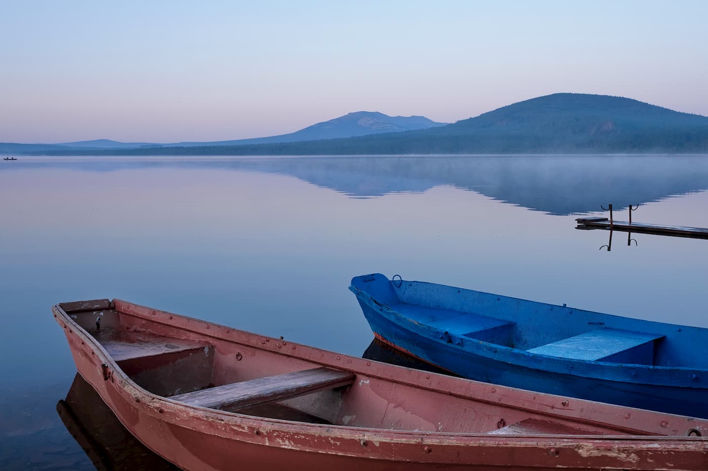
The Chelyabinsk region is known for its lakes. Lake Zyuratkul is the highest, it is located at an altitude of 724 m a.s.l. and surrounded by beautiful mountains and rocks. It is located in the Zyuratkul National Park. The most popular and beautiful lakes are Lakes Turgoyak, Uvildy, Itkul, Sugomak, Sinara, Arakul and Big Allaki. Many of the lakes in Chelyabinsk are hydrological monuments of nature. On the picturesque banks, there are many spas, resorts and holiday homes. For those wishing to improve their health, spas and resorts therapeutic muds and mineral waters. The lakes and rivers of the Chelyabinsk region will be interesting for fishing enthusiasts as well.
Lake Uvildy is the largest lake in the Southern Urals. It consists of three independent parts which are separated from each other by a chain of islands (there are about 50 of them).
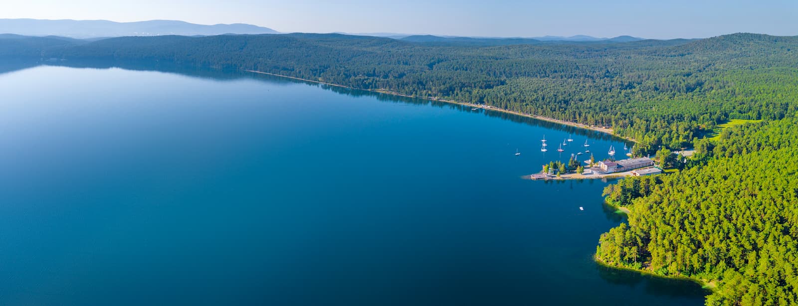
Lake Turgoyak is called the younger brother of the Baikal for the beauty of its shores and purity of water. The bottom of the lake can be seen up to 10-12 m deep. It is located in a deep intermountain hollow between the Ural-Tau and the Ilmensky ridges at an altitude of 320 m above sea level. There are 6 islands on the lake, the largest and most interesting of which is Vera Island. There used to be an Old Believers' hermitage here as well. It was believed that it was built by Princess Vera who fled from marriage with an unloved one. On the island, archeologists found the Neanderthals' site, an ancient quarry and the remains of ancient megalithic structures. Some megaliths were found near the island as well – there are huge granite boulders, clearly processed by people, which also indicates the presence of ancient people in the area of the lake in old times.
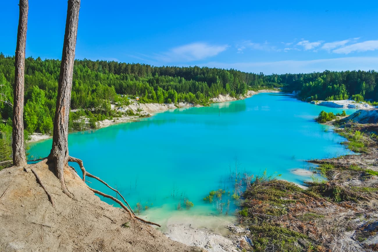
Some of the lakes were formed at the site of old quarries. The most interesting of them are Ural Bali Lake near Kyshtym, the Cheremshanskie Quarries near Upper Ufaley.
The Ural Bali is the name of the lake formed on the place of the former kaolin quarry near Kyshtym. Kaolin is clay of white colour, it consists of kaolinite. Like the popular island of Bali in Indonesia, the lake in the Chelyabinsk Region has very beautiful azure water color and white shores. Until 2011, the water from the quarry was pumped out but then there were ducts cut for water drainage and the lake was naturally filled with water quite quickly. So, Ural Bali is quite young. In summer, there are a lot of tourists here, as well as fans of spectacular photos.
Fans of rafting should have a closer look at the rivers Ai, Lemesa, Yuryuzan, Ufa, as well as Bagaryak (in spring time).
The Ai River has collected a lot of natural attractions around it and its rafting program is rich. The Ai is the left tributary of the Ufa river. In translation from Turkic means ai means "lunar". It originates from the Big Cranberry swamp located at the junction of the Urenga and the Avalyak ridges. There are three distinctive parts of the river: its source, the mountainous part and the plain part. The first part of the river runs from south to north along the mountain taiga from the Big Cranberry swamp to Kusa. On its way, the river is surrounded by the Urenga and the Ural-Tau ridges. The mountainous part of the river is from Kusa to the village of Lakly, this part is located within the Southern Urals. And the plain part of the river passes on hills and plains of href="https://peakvisor.com/adm/orenburg-oblast.html" target="_blank">Orenburg Region in the south, and the Bashkiria (from Lakly village to the river mouth).
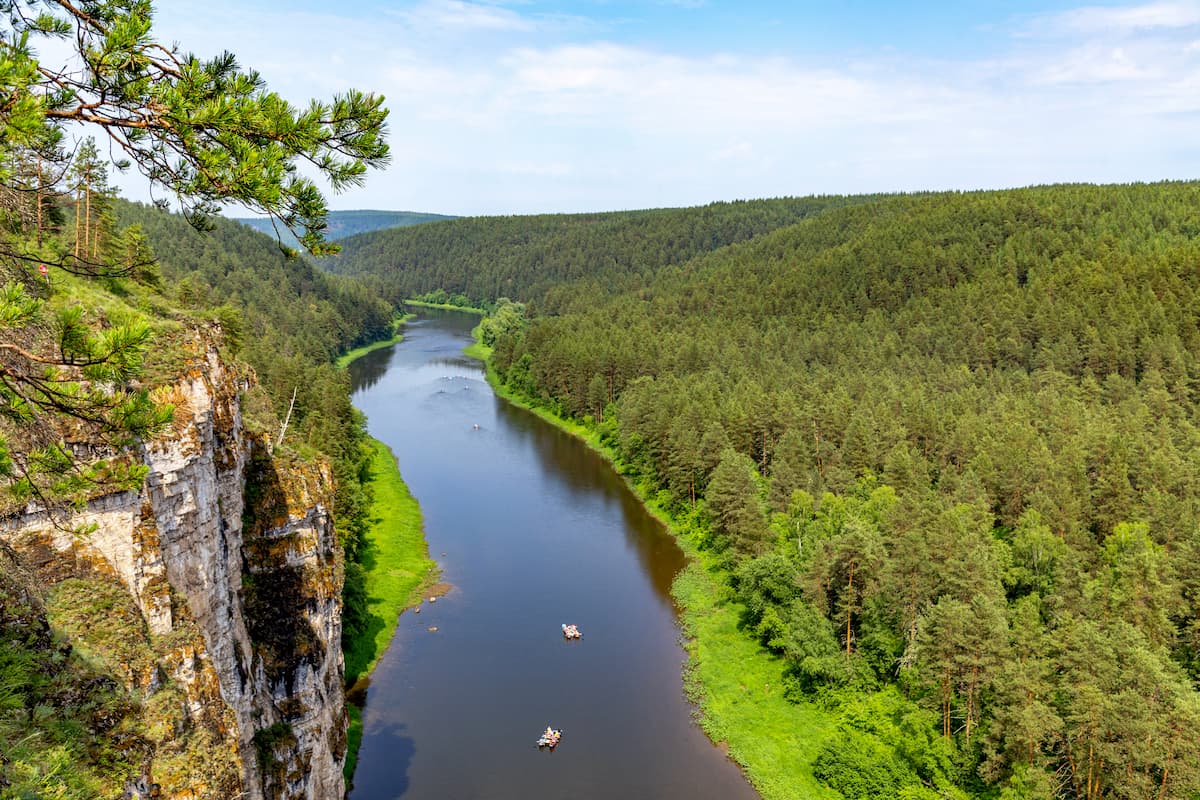
For rafters, the mountainous part of the river Ai is most appealing. It is possible to raft on catamarans and kayaks from May till October. There are no serious obstacles (apart from the aforementioned Rascal Rock), the current is slow, therefore rafting will suit beginners and families with children. Along the route, there are many caves. In fact, there is a cave virtually in every rock, on every tributary and in the nearby ravine. Therefore, a seemingly plain rafting easily turns into a fascinating water and speleological journey. When rafting, you can admire very beautiful coastal rocks and visit the Ai Fountain. The rafting route also includes climbing the Devil's Finger cliff (80 m high). Moving along the tributary of the Big Satka River, rafting can be combined with a visit to the Porogi settlement. Here you can find the Porogi hydroelectric power station – the oldest hydroelectric power station in Russia – and the dam which beautifully blends into the natural landscape, there is also a factory complex of the early 20th century. The factory and the power plant got their names due to rapids, and stormy current of the Big Satka River, which remained at the bottom of the pond after the dam was built.
The Lemesa River is the sportiest river in the Southern Urals because it offers plenty of opportunities for watersports. The river has its source in the relatively low Dry Mountains of the Chelyabinsk Region, and its mouth is in the Sim River in Bashkiria. The rafting is available from late April to mid-May when melting snow makes the river full to the brim. In summer, the Lemesa becomes shallow but you can still go rafting. You can start from several points including the four-meter Atysh waterfall. One of the most difficult Southern Ural rapids along the river is Karamantash (or the Black River). This river is suitable for experienced rafters only.
The Yuryuzan River flows in Bashkiria and the Chelyabinsk Region. It originates from the highest point of the Southern Urals in Bashkiria – Yamantau Mountain, and flows into the Pavlovskoye Reservoir on the Ufa River. The river is the leader among other Southern Ural rivers in terms of the difference of heights, which is astounding 710 m. There are beautiful rocks along its banks. The river is rafted from May to September. The current is fast enough but the rafting is relatively easy.
There are also some interesting places on the Miass River as well. You can drop at the Ustinov Canyon near Miass, or visit the rocks near Big Balandino village, which is near Chelyabinsk. And when you move closer to the Sim River, there is a pulsating spring called Eralashny (or the Missing Spring) of karst origin near the town of Minyar.
The transport network of the Chelyabinsk Region is well developed. This is due to the region's successful geographical location on the border of Siberia, the Volga Region, and Kazakhstan. The region has railways and major highways, and there is an international airport called Chelyabinsk in the north-east of the city, a military airfield and a sports airfield.
It is common practice to start with the city of Chelyabinsk, you can get here by air, train or by car from Yekaterinburg (it is just 215 km) or from another major city nearby.
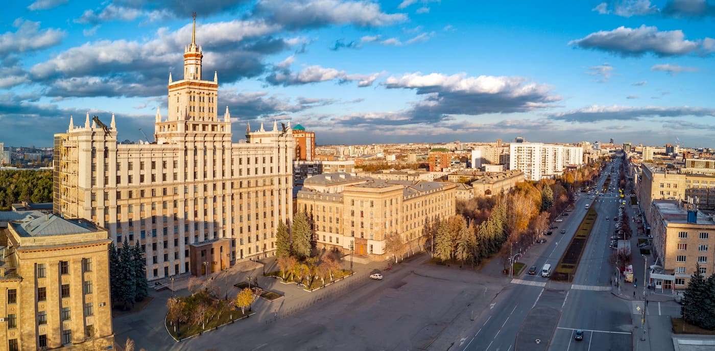
The capital of the Chelyabinsk Region, the city of Chelyabinsk, was originally built as a fortress in 1736 to protect food supplies against attacks by the then-wild Bashkirs. Gradually it grew into a factory and became one of the largest industrial centres in the Urals. During the WW2 years, tanks and military vehicles were produced there, so people began to call it Tankograd. However, due to the large volume of heavy industry, Chelyabinsk has serious environmental issues.
To get acquainted with the central sights, it is worth walking along Kirovka Street which is often dabbed the local Arbat (a famous pedestrian district in Moscow). This street has buildings of ancient architecture, monuments and various sculptures made of bronze.
You can also visit the Chelyabinsk State Museum of Local Lore, the Chelyabinsk State Museum of Fine Arts, the private House Museum of Stone and Gems, a zoo, the Gagarin Central Park and theatres.
The history of the town began with a small settlement whose inhabitants tried to find gold on the site of the present town. The quest for gold proved to be in vain, but the diggers struck on iron and founded a factory named Zlatoust in honour of St. John Chrysostom, famous for his eloquence. The settlement was officially laid in 1754, but it was not until 1811 that the main factory was finally purchased by the state and the settlement became a fully-fledged town.
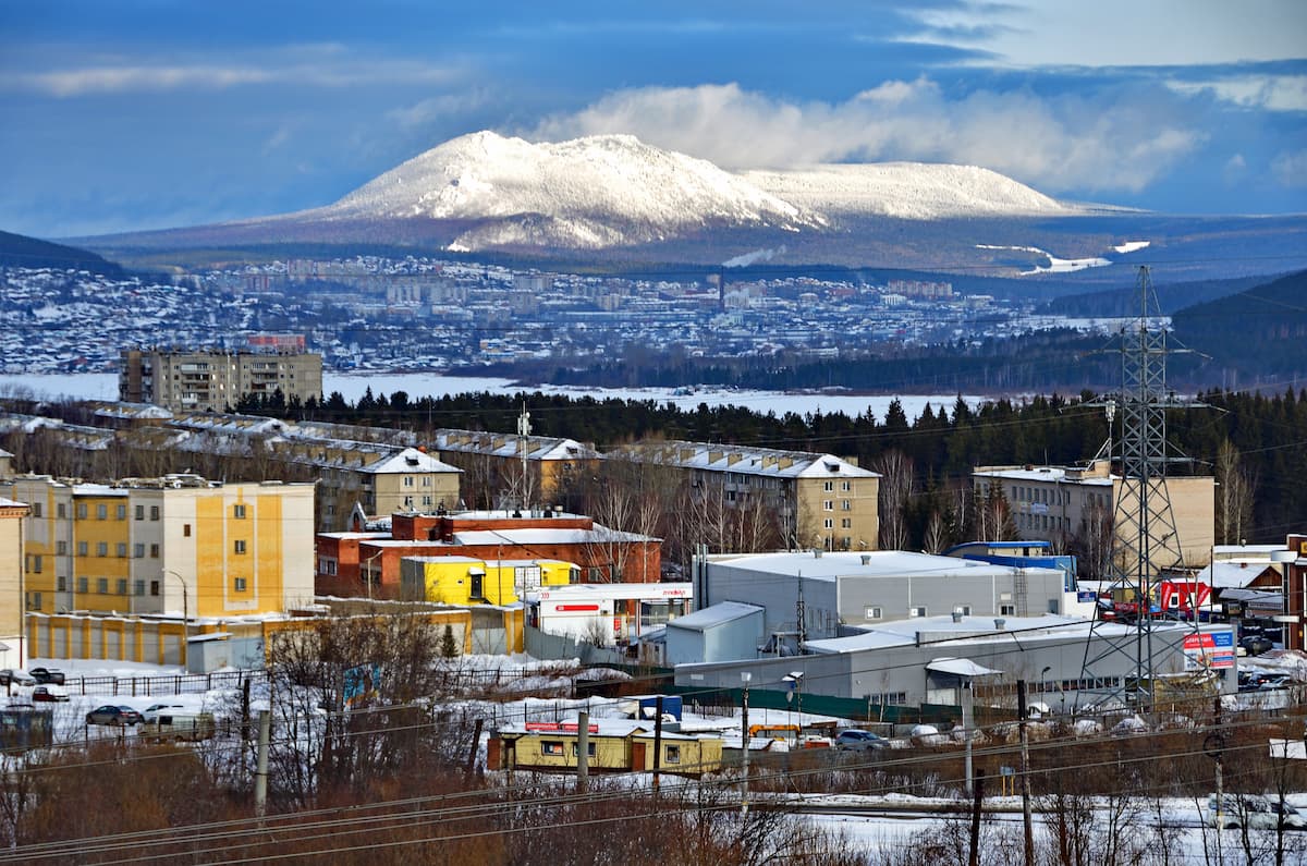
It is a real mining town which grew at the foot of two ridges – the Taganay and the Urenga. Its streets and blocks cover the slopes of the Ural Mountains. An excellent and unusual option for an excursion in the city will be a trip by tram. The route passes through the forest and mountains opens beautiful views of the Taganay and Urenga ridges, Kosotur Mount and Alexander Hill, the city pond, and also the Ai river. Steep descents and ascents during the trip are simply breathtaking!
Not far from the centre of Zlatoust, in the area of the Red Hill, there is a 53-meter-high bell-tower with the Chapel of St. John Chrysostom. Anyone can climb it and enjoy a magnificent view of the city and the mountain ranges. Among the sights are the Mountain Park named after P.P. Bazhov, the City Museum of Local Lore, and the Museum of Zlatoust Armory.


