
Scan the QR code and open PeakVisor on your phone
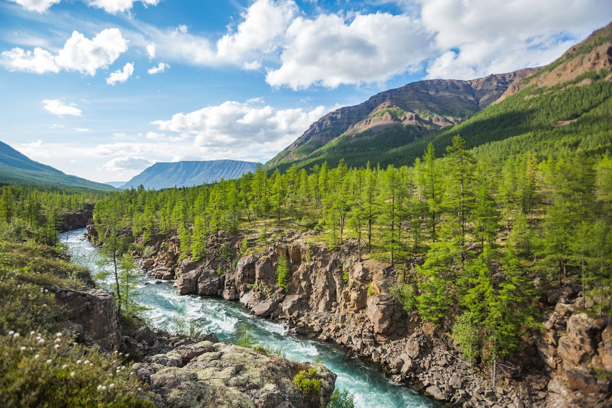
Vast is the territory, huge is the country, mighty is Russia. The Russian Federation can boast of the most diverse climate and terrain that stretches over 11 time zones. If you look at the physical map of Russia, the majority of colours you’ll see are yellow or brownish, which might lead to the conclusion that the country is dominated by uplands, hills and mountainous terrain. Yet, don’t be deceived by the colour codes, in reality, the mountains here occupy only 40% of the country's territory, while the rest (about 60%) have small differences in height and are flat. Plains prevail in the central part of the country and in the west, whereas the southern and eastern regions feature mountains. It should be noted that the European part of Russia has lower elevation a.s.l. than its Asian part. However, it is in Russia that the world's largest plains and the highest mountains in Europe are located.
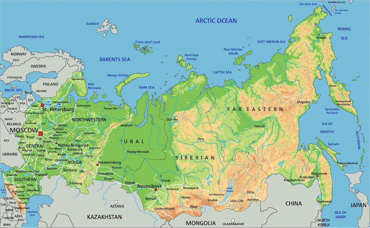
Russia is rather stable regarding tectonic processes, most of them happened in bygone times. Most of the country is located on platforms – ancient slabs of the Earth's crust, so Russia can be called a flat country. The oldest platforms are the East European and Siberian Plains, between them stretches a younger West Siberian Platform. The Scythian Platform, which adjoins the East-European one from the south, is one of the most recent tectonic formations. Folded areas have been formed at the joints of the platforms – these are called geosynclines. Those are young and mobile areas of the earth's crust.
The main folded areas are
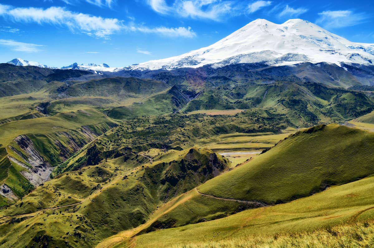
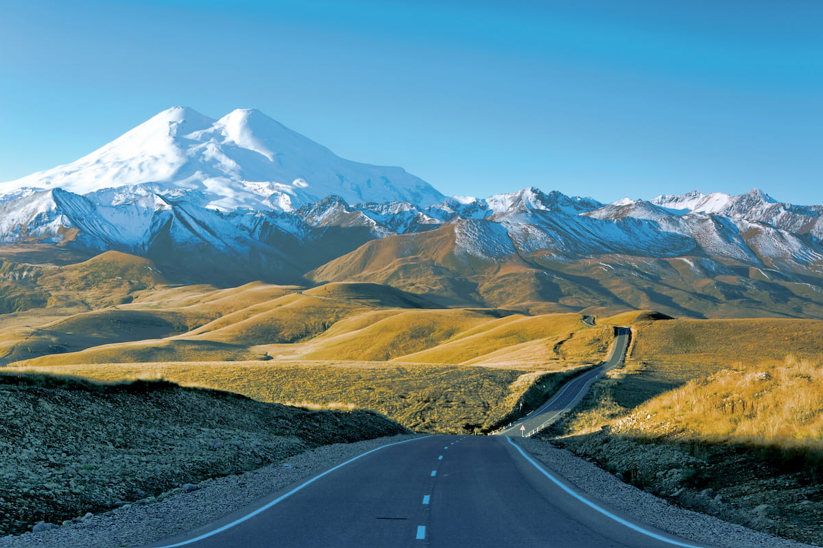
Interestingly, the lowest and the highest markers a.s.l. are located in close proximity to each other. The former is located in the Caspian Lowland, its height is only 28 m. The latter is Mount Elbrus (5,642 m) – the highest point of the Caucasus Mountains and Europe.
The Earth is never still, its internal forces that move magma to the upper layers of the Earth's crust cause spectacular volcanic activity. This phenomenon is called volcanism. In parallel with volcanic activity and for the same internal reasons, there may appear seismic activity as well. It is basically the tremours caused by oscillations of the Earth crust. Those regions with registered volcanism are subject to earthquakes. At the same time, some weak vibrations of the Earth crust are recorded even in the plains, more often they are the echoes of powerful deep earthquakes.
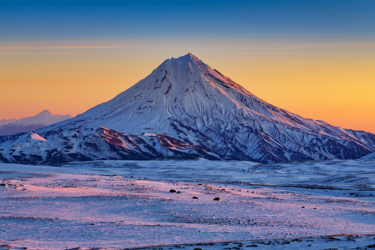
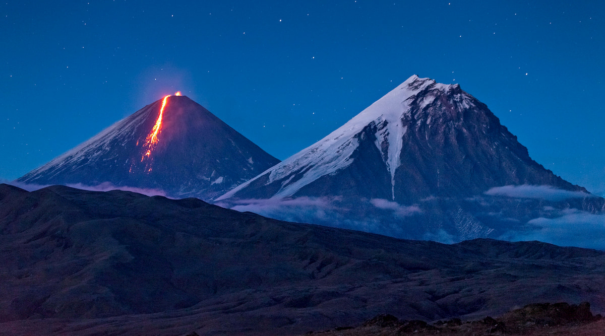
In Russia, the Far East, especially Kamchatka and the Kuril Islands are most exposed to earthquakes. Here, on the Pacific coast of Russia, volcanoes are located along the coastal line and belong to the Kuril-Kamchatka island arc, the length of which is almost 2000 km. There are on average about 300 tangible fluctuations of the Earth's crust per year. Historically, there have been earthquakes measuring 9 points on the Richter Scale with aftershocks of 4.5-6.6 magnitude. Fortunately, those powerful underground tremours of about 9 points and more are rather rare. Over 110 volcanoes are known on the Kuril Islands and about 170 on Kamchatka.
Volcanoes are present in some other regions of Russia: the Caucasus, the Primorsky Territory, Siberia.
In addition to active volcanoes, there are many extinct dormant ones. Among the extinct is a small stratovolcano Baranovsky located in the Primorsky Territory (160 m a.s.l.), there is a railways station in its crater now. A remarkable Tunguska meteorite dropped in blazing flames from the skies quite close to it in 1908. Other extinct volcanoes include Mount Pobeda (the highest point on the Chersky Ridge), Mount Kazbek (the Caucasus).
The most formidable and the largest active volcano in Russia is Klyuchevskaya Sopka, in Kamchatka. Its height is quite susceptible to eruptions and tends to vary from 4,750 m to 5,000 m depending on the damage caused by the volcanic outbursts. This volcano has a naughty character, it can come alive once every 5 years, or it can show strong indignation and erupt red-hot lava almost every year.
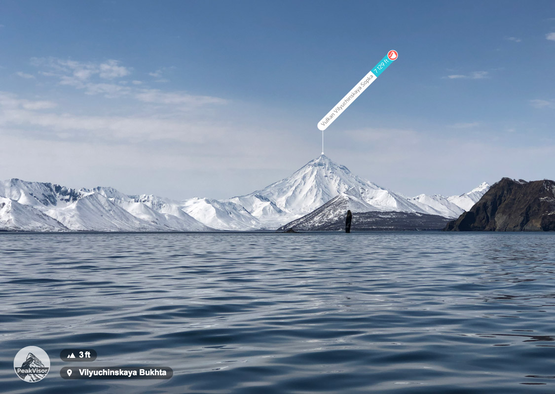
Other most famous volcanoes of Russia, also located in Kamchatka, are Avachinskaya Sopka and Ilyinskaya Sopka. The former can wreak havoc any time because the volcano is just 30 km from Petropavlovsk-Kamchatsky – the largest city in the Kamchatka Region. And the latter, according to scientists, led in its time to irreversible global climate change when it was the centre of the largest volcanic eruption more than 7.7 thousand years ago.
There are relatively harmless volcanoes in Russia as well. They might seem innocuous from the outside since during the eruption instead of red-hot lava they throw mud masses out of their vent funnel. The Krasnodar Territory is especially famous for such volcanoes. Among the mud celebs are Miska Volcano (65.4 m), Tizdar (210 m), Hephaestus (or Rotten Mountain, that spews mud up to 20m but you can safely bathe in its healing muds that gather in small pools of 4 m in diameter), Shugo (163 m). Ejected mud together with dissolved gases is rich in microelements and has curative properties, hence many mud volcanoes are considered the sources of healing powers of nature and are protected by the state.
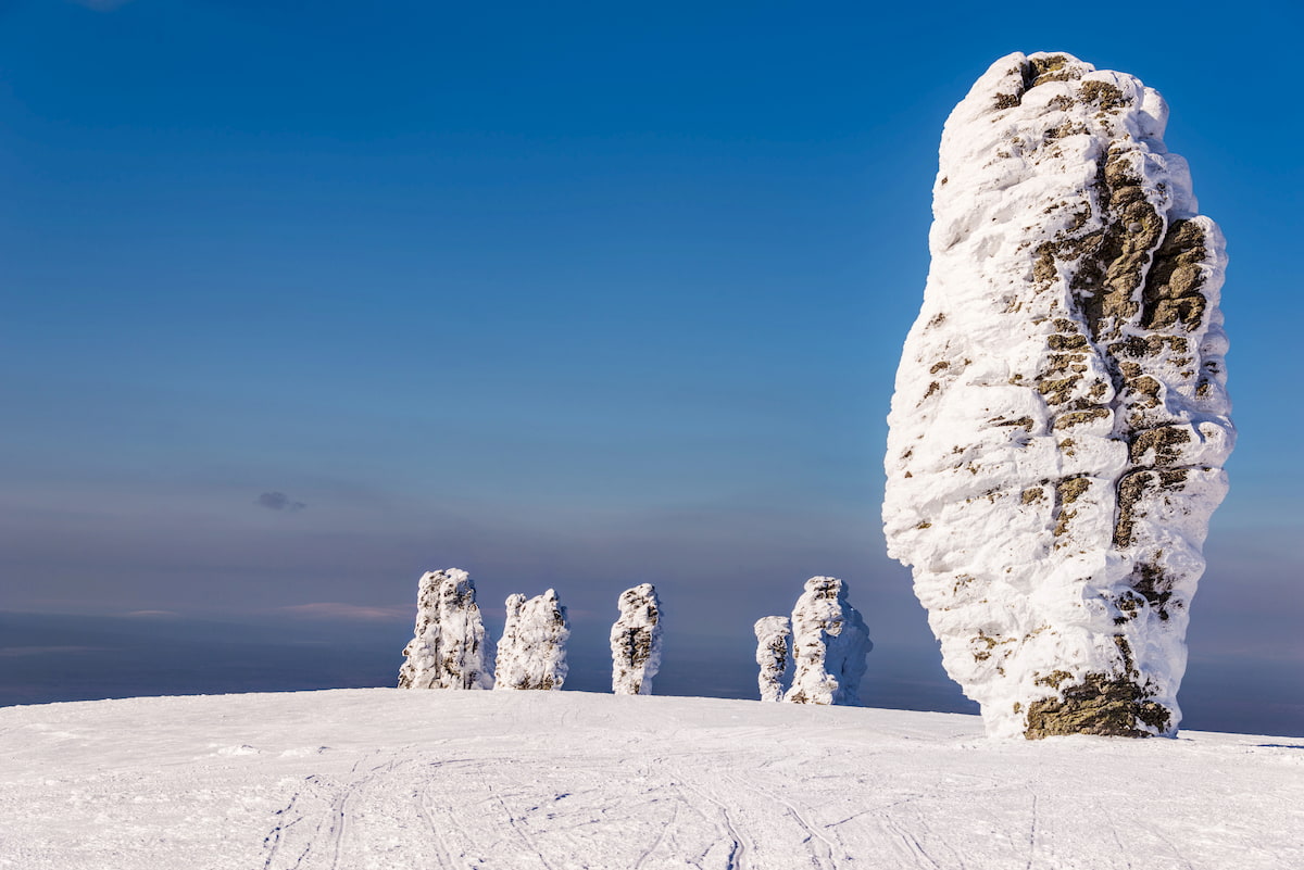
The impact of wind on the terrain should not be underestimated. It can carry fine grains of sand and small debris from one area to another, collect and accumulate them in certain places, this seemingly innocuous process can actually destroy huge rocks. Rock dilapidation and erosion caused by wind is called weathering. It can be physical, chemical, and biological. Frost weathering refers to the physical type of weathering; during warm seasons water gets into cracks and cavities of rocks and expands under the influence of frost which naturally leads to cracking as well as partial or complete destruction of rocks. One of the brightest examples of wind work is Pillars of Weathering or Man-Pupu-Ner. This natural wonder is located in the Komi Republic on the territory of the Pechora-Ilychsky Reserve and is one of the seven wonders of Russia.
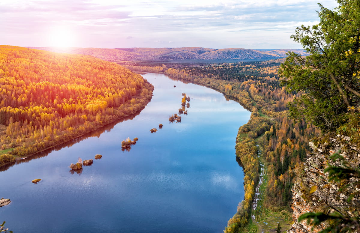
Water dripping day by day wears the hardest rock away they say. The mighty power of the water is one of the main forces in relief formation. On the one hand, water comes down as rain thus forming a surface runoff; on the other, when the snow melts, it seeps into the earth's bowels, penetrating any crevice it might find.
Surface waters represented by large and small rivers, streams and brooks, as well as temporary gutters, form various forms of relief due to the destruction of soil and rocks, the transfer of silt and debris over long distances, positioning them elsewhere. As a result, there appear bizarre hollows and potholes, ravines, and river valleys.
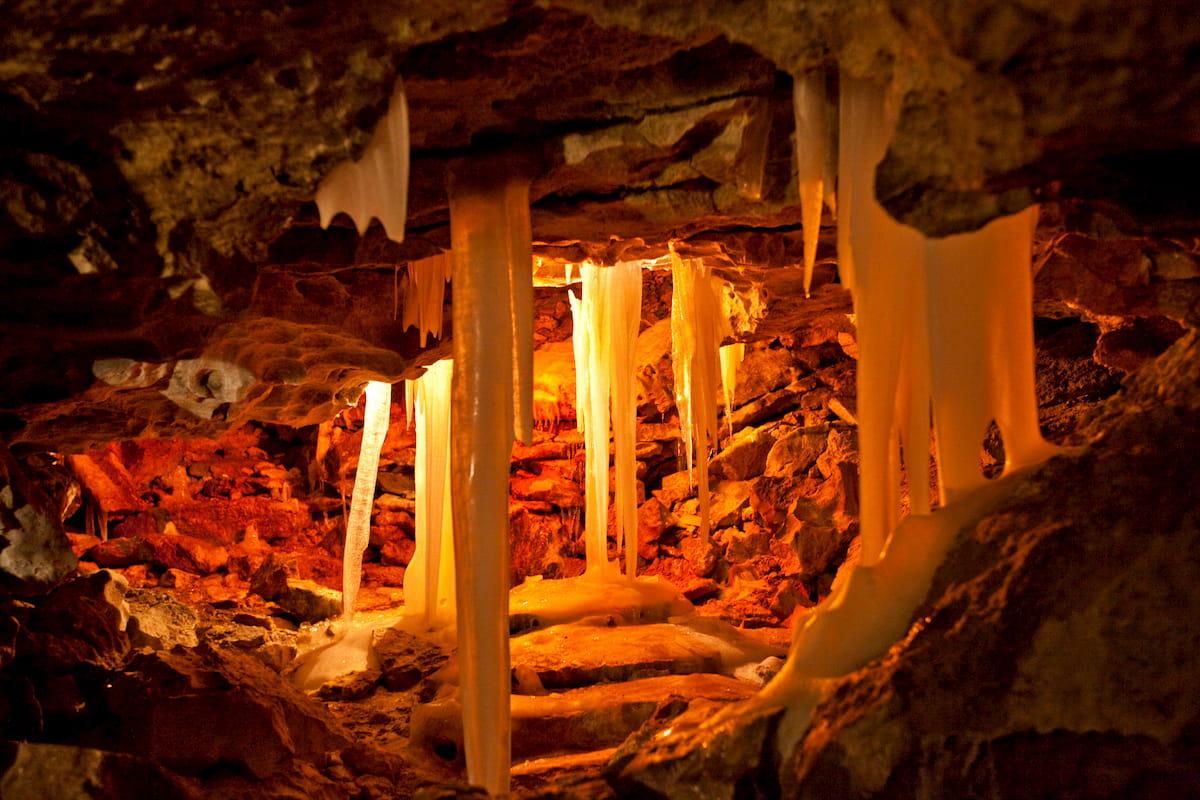
Underground waters have their effect on rocks from the inside. They carry, dissolve, and oxidize various substances which facilitate the formation of cavities and karst phenomena of various shapes and sizes. Russia has abundant caves with fabulous grottoes framed by stalactites and stalagmites.
The most famous caves of Russia are the Kungurskaya Cave, the Kapova Cave, the Sumgan-Kutuk Cave, the Batovskaya Cave, the Vorontsovskaya Cave, the Bolshaya Azishskaya Cave, the Barloga Throat, the Sablinskie Caves, Pandora's Box, the Divya Cave. Most of them are located in the Urals.
Ice Age could have been naturally shot in Russia as the country’s territory has experienced the most massive effects of the ancient glaciation age. Huge moving masses of frozen water, once filling part of the territory of modern Russia, have affected the entire natural environment. They smoothed out the unevenness of the terrain, creating glacial relief forms: they destroyed big elevations and huge rocks, carrying the debris over long distances and filling in the existing lowlands, yet leaving behind deep cracks and furrows. Some of the most impressive specimens of the glaciation retraction are located in Karelia. The rocks there are oftentimes called ‘ram’s forehead’ because the shape of the rock is even and flat on the slope where the glacier moved and rugged and curved on the reverse slope.
In Asian part of Russia, glaciation centres remain in the Polar Urals, some islands in the Arctic Ocean, the Taimyr Peninsula. These processes have left indelible traces – smooth mountains and rocks, multiple depressions in the mountains in the form of bowls, giant moraine ramparts, lakes on the plains in places of melted ice.
The towering majestic mountains of Russia rarely stand single. For the most part, mountains are adjoining each other and form continuous mountain ranges. These include the Caucasus Mountains, the Altai Mountains, the Ural Mountains and the Sayan Mountains.
The Gem, the Jewel, the Grand-Spa, whatever the grandeur name is it is fit for the Caucasus. Don’t get me wrong or biased but this great California-size divide between the Middle East and Asia deserves every positive superlative one can think of. The Caucasus stretch over 1,100 km between the Black and Caspian Seas, and cover the territory of 160 km between Iran, Turkey and the southern flank of the Russian steppe. It is home to the countries of Georgia, Armenia, Azerbaijan and the feisty Russian republics of Chechnya, Adygea, Kabardino-Balkariya, Karachaevo-Cherkessiya, Dagestan (not that violently gloomy as some wikitravel describes it), Ingushetia, Abkhazia and Ossetia, Stavropol and Krasnodar territories.
The Caucasus Mountains are rugged, of volcanic origin and young. They are believed to be about 25 million years old. The Caucasus Mountains are technically considered to be a continuation of the Himalayas as well as either part of Asia or part of Europe. They have historically served as a geographic barrier at the convergence of the continents of Europe and Asia, and due to specific tectonic processes, it has been hard to determine the exact course of the continental borderline, causing the border to change throughout the turbulent history of the region.
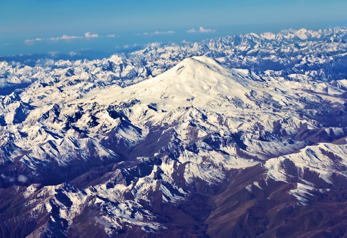
As there is no clear agreement on whether the Caucasus Mountains are a part of Europe or Asia, depending on the varying perspectives, Europe's highest mountain is either Mount Elbrus 5,642 m (18,510.5 ft) or Mont Blanc in the Alps, at the Italian-French border, with a height of 4,810 m (15,780.8 ft). We have a very nice article on the Caucasus, its structure, geomorphic features, hiking and climbing opportunities.
The Caucasus are a trekker’s paradise, lest you hike in lousy weather. The amount of trails to take, routes to wander and encounters to enjoy are numberless. You can find anything in the Caucasus: medieval villages, natural wonders, great cuisine across the region and much more. Unfortunately, the development of the region's international tourism has been hampered by some turmoil in the 1990s and now there is quite a vent of belligerent feelings in Nagorny Karabakh. Luckily, in most parts of the Caucuses travelling is quite safe, the only drawback though is there is not much information available online in English, but many tour agencies see a world of opportunity and start providing English-speaking guides or at least have their sites in English.
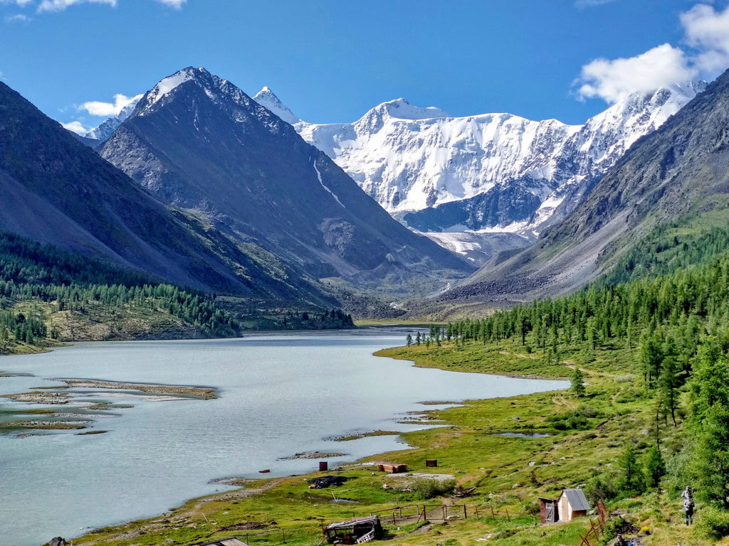
Being snuggly tucked in the centre of Asia, the Altai Mountain Range seems to be a no-man’s land. But such remoteness is deceptive. Despite rather huge distances and wild nature, the Altai is bustling with life. It is shared by four countries: Russia, Kazakhstan, China and Mongolia.
Topographically, the Altai mainly lies in the Southern Siberia and consists of high and middle-rise mountain ranges separated by deep river valleys and vast inland and intermountain troughs. It stretches from north-west to south-east for more than 2000 km. The Altai Mountains are the watershed between the basin of the Arctic Ocean and the northeastern region of Central Asia. The highest point is Mount Belukha (4,506 m).
There are UNESCO's protected areas in the Altai, among which five are located on the Russian territory, one in Kazakhstan, Mongolia and China have two each. Russian must-visit reserves include

The Russian painter, traveller and great visionary N.K. Roerich painted hundreds of pictures of the Altai. You can read about his travels in the Altai, the Himalayas, the Middle East and the US in our article here.
For many, the Urals are like The Wall from GOT by George Martin – the end of the world behind which lie the wildlands and White Walkers are stalking the lost souls. Despite this grim misconception, life is bustling there. The natural and man-made wonders are astounding, the hospitality is heart-warming and adventures are those of a ‘buck-list-of-a-lifetime’. The Urals is a must-experience place.
The Urals is called the Land of Legends and that is not for nothing. The lands are rich, diverse and remained pretty underexplored until the last 50 years or so. You can feel the true frontier experience and create your personal legend while traversing the Urals.
The modern Ural Mountains are a large mountain system that stretches from the shores of the Arctic Ocean to the steppes of northern Kazakhstan. Geographically, the Ural Mountains are divided into five parts, from north to south:
The length of the Ural mountain range is more than 2,000 km (with the Pai-Khoy and the Mugodjary it is more than 2600 km), the width varies from 40 to 150 km. The highest mountain is Mount Narodnaya (1,895m). You can read about the Urals in more details here.
Historically, there have been quite a few versions about the origins of the Ural Mountains. In the scientific community, there used to be so many heated debates that it is impossible to enumerate every conceivable and inconceivable version of the formation of the Urals Mountains.
The two basic warring camps are those who support the continents’ movement theory and those who are after sea retrieval. The former tend to believe that during a certain period of development of planet Earth, the continents were mobile and clashed with each other. And the origin of the Urals Range is a product of these collisions.
The ocean-theory disciples are closer to the theory that once the Ural Mountains were washed by seas or oceans, or were completely hidden underwater, which stands to reason because the fact that the water actually washed the slopes of the mountains is confirmed by a remarkable amount of archaeological findings.
The Sayan Mountains or Sayans are formed by two ridges in the south of Siberia – the Western Sayan and the Eastern Sayan Mountains. They are located in the Krasnoyarsk Territory, the Irkutsk Region, and the Republics of Khakassia, Tyva, and Buryatia as well as the northern regions of neighboring Mongolia. The name comes from a Turkic-speaking tribe of the Sayans who lived in the upper reaches of the Yenisei and Oka rivers. Interestingly, the local peoples used to call this range the Sardyk (for the Prisayan Buryats) or the Belogorye or Goltsy (for the Russian population). The name Sayans was used only by scientists, researchers and travelers, but it gradually penetrated the general usage.
The Sayan ridges are located at right angles to each other. The Western Sayans border with the Altai in the south-west. This range is rather flat and islet-shaped, almost free of glaciers. Its highest point is Kyzyl Taiga Mountain (3,121 m). The Eastern Sayans, on the contrary, are covered with ice caps. The highest peak is Munku-Sardyk Mountain (3,491 m). It is located in the ridge of the same name, and is considered the highest point of the Sayan Mountains in general. The mountain system has many lakes, mountain rivers, waterfalls, and a mysterious landscape.
There are two reserves on the territory of the Sayan Mountains - the Sayano-Shushensky Reserve and the Pillars (Stolby). The former is located on the left bank of the Yenisei and it is the realm of the snow leopard. This gracious animal is roaming here freely. The reserve can boast of 1 animal per 10 sq.km., the density unseen anywhere else in the world. The reserve with a curious name Pillars (Stolby) is located on the north-western shores of the Eastern Sayan. It is practically adjacent to Krasnoyarsk. The name comes from peculiarly shaped stones and rocks that stand tall as magnificent ancient pillars.
Apart from the regular bucket list filled with hiking, trekking, climbing, fishing, horse-riding in the Sayans, other fun must-dos include:
Welcome to Russia, the country of wild spirit and vast unexplored territories. This is an adventure of a lifetime.
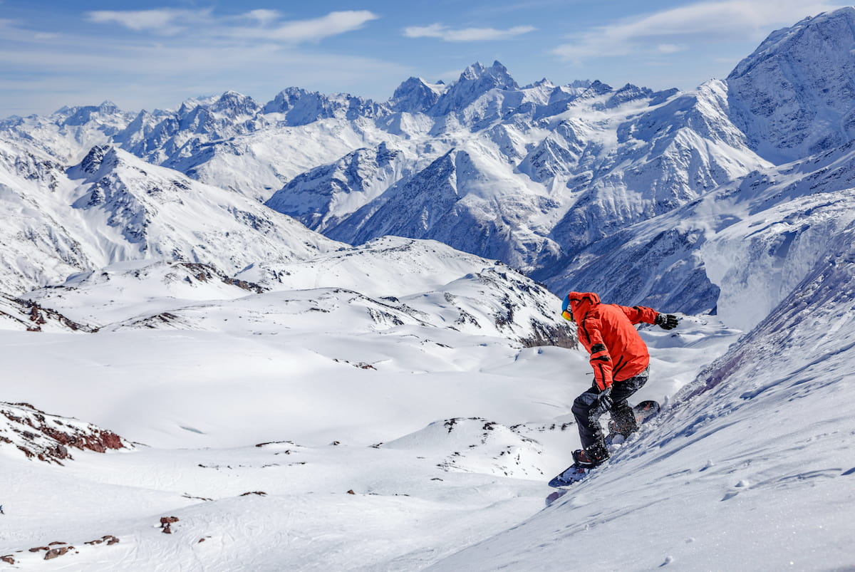
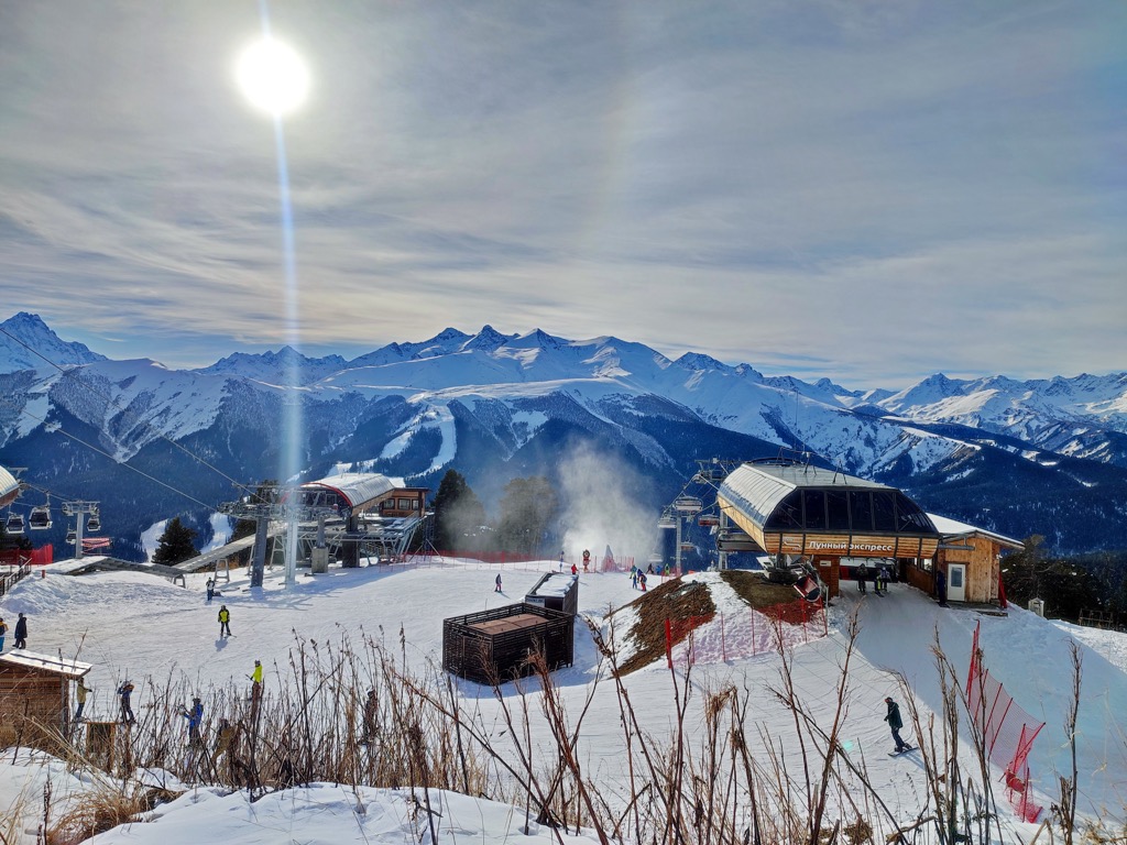
For skiing and snowboarding enthusiasts, there are more than 150 ski resorts in Russia, which are located throughout the country, but mainly in its southwestern part in the Caucasus Mountains, where you will find most of the resorts, including also the largest of them. It is also one of the main areas for skiing in both Europe and Asia.
The largest ski resort in Russia is Rosa Khutor in Krasnodar Krai with more than 100 km (62 mi) of slopes and more than 25 ski lifts, which was the site of the 2014 Winter Olympic Games. The second and third biggest Russian resorts are located just nearby in the same valley of the Mzymta River: Gazprom Mountain Resort with more than 50 km (31 mi) of slopes and more than 20 ski lifts and Krasnaya Polyana Ski Resort with more than 30 km (19 mi) and more than 10 ski lifts.
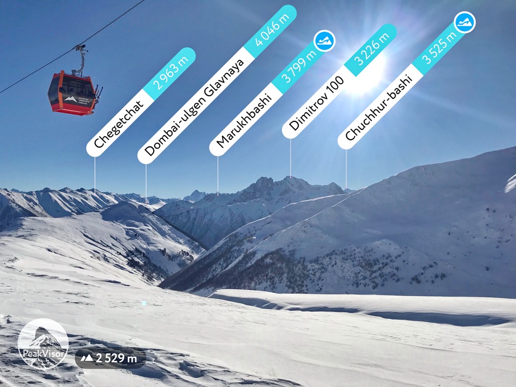
Other main but smaller ski resorts in the southwest of Russia, which can be considered as an alternative to Sochi, are Arkhyz and Dombay in Karachay-Cherkessia, and Mt. Elbrus and Mt. Cheget in Kabardino-Balkaria with more than 20 km (12 mi) of slopes and more than 5 ski lifts each. These are the main areas for skiing near Nalchik, Kislovodsk, and Pyatigorsk.
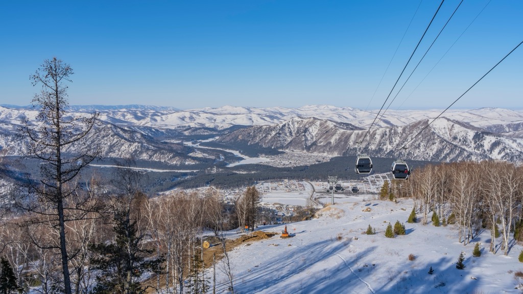
The main ski resort in Siberia is Sheregesh near Kemerovo in the Kemerovo Oblast in Western Siberia, with more than 40 km (25 mi) of slopes and more than 18 ski lifts. It is also the second-biggest in Russia.
The main ski resort near Novosibirsk, the largest city in Siberia, is Inya with more than 1 km (0.6 km) of slopes and more than 2 ski lifts. However, the city of Krasnoyarsk in the namesake Krasnoyarsk Krai is considered the capital of Siberia by many because of its more central locations and natural wonders. There is Bobrovy Log Ski Resort, which is much bigger than in Novosibirsk with more than 7 km (4 mi) of slopes and more than 3 ski lifts.
In southwestern Siberia in the Altai Mountains and the namesake Altai Republic, the main ski resort is Manzherok near Gorno-Altaysk with more than 15 km (9 mi) of slopes and more than 3 ski lifts.
The main area for skiing near Baikal Lake in Irkutsk Oblast in Eastern Siberia is Sobolinaya Ski Resort near the city of Baikalsk with more than 10 km (6 mi) of slopes and more than 5 ski lifts.
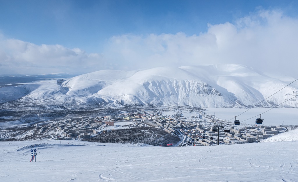
The third largest ski region in Russia is the Kola Peninsula in the northwest, where the biggest ski resort is Bigwood with more than 28 km (17 mi) of slopes and more than 10 ski lifts, respectively. It is also the main large ski resort near Murmansk, the capital of the Murmansk Oblast, as well as Saint Petersburg, which is 1,216 km (755 mi) to the south.
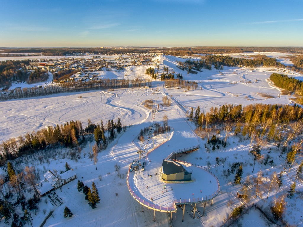
The main ski resort near Saint Petersburg itself is Krasnoe Ozero with more than 8 km (5 mi) of slopes and more than 10 ski lifts.
In the Ural Mountains, between Europe and Asia, in Chelyabinsk Oblast, named after the city of Chelyabinsk, there are also two great ski resorts—Zavjalikha and Adzhigardak—with more than 20 km (12 mi) of slopes and more than 5 ski lifts each.
Finally, in the Far Eastern Federal District of Russia, the main ski resort is Gorny Vozdukh on Sakhalin Island east of the city of Vladivostok with more than 25 km (15 mi) of slopes and more than 5 ski lifts.
The main ski resort near Moscow, the capital of Russia, is Krasnaya Gorka in Vladimir Oblast with more than 1 km (0.6 mi) of slopes and more than several ski lifts.
Check the Russia ski resorts map in the World Mountain Lifts section of the site. It includes information about open ski lifts / slopes in Russia in real-time with opening dates and hours. There are also year-round cable cars, funiculars, cog railways, aerial tramways, and all other types of mountain lifts.


top10
ultra
glacier
volcano
europe-4500ers
caucasus-4500ers
russia-ultras
top10
ultra
europe-4500ers
caucasus-4500ers
russia-ultras
top10
glacier
europe-4500ers
caucasus-4500ers
top10
glacier
europe-4500ers
caucasus-4500ers
top10
glacier
europe-4500ers
caucasus-4500ers
top10
ultra
glacier
volcano
europe-4500ers
caucasus-4500ers
russia-ultras
top50
ultra
russia-ultras
azerbaijan-ultras
top10
ultra
glacier
volcano
europe-4500ers
caucasus-4500ers
russia-ultras
georgia-ultras


