Belukha Mountain (Russian: Белуха, lit. 'whitey'; Altay: Ӱч-Сӱмер, Üç-Sümer, lit. 'three peaks'; Kazakh: Мұзтау Шыңы, Mūztau Şyñy, lit. 'icemount peak'), located in the Katun Mountains, is the highest peak of the Altai Mountains in Russia and the highest of the system of the South Siberian Mountains. It is part of the Golden Mountains of Altai World Heritage Site.
Since 2008, one is required to apply for a special border zone permit in order to be allowed into the area (if travelling independently without using an agency). Foreigners should apply for the permit to their regional FSB border guard office two months before the planned date.
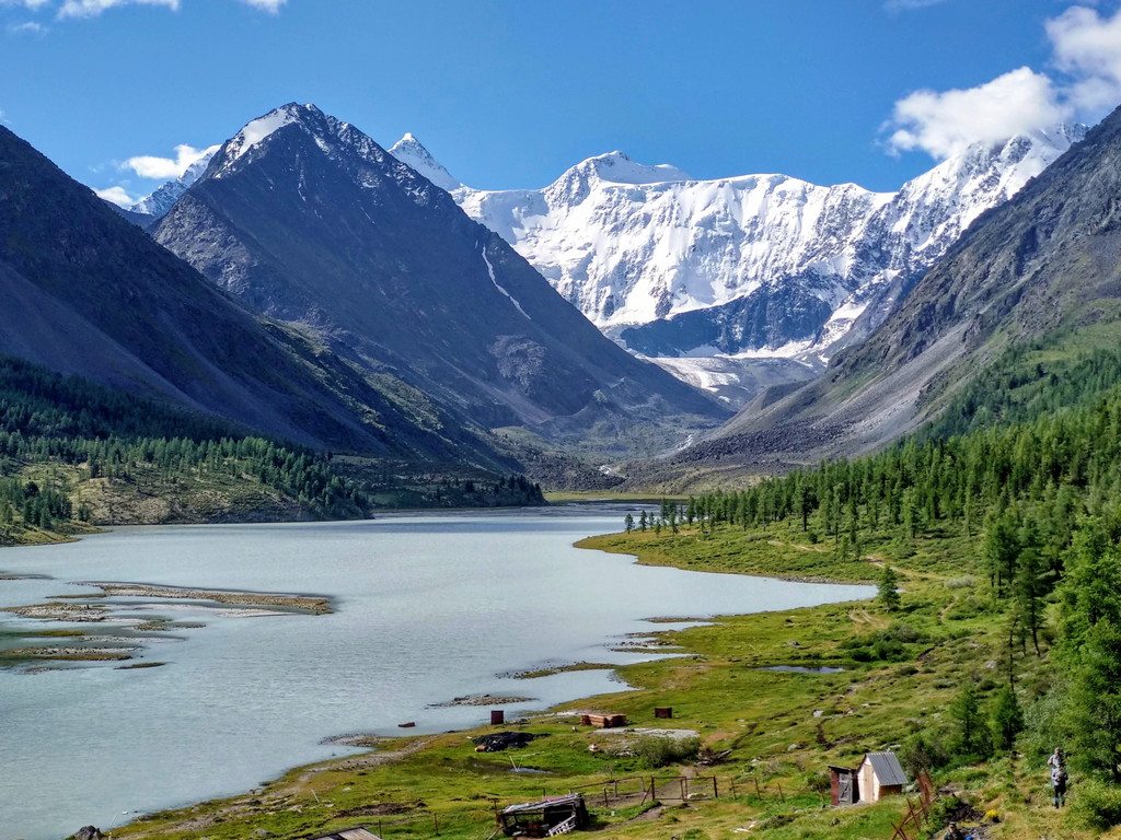
There's a demanding alpine trail (T5) leading to the summit.
By elevation Belukha is
# 1 out of 108 in Golden Mountains of Altai # 1 out of 597 in Altai Republic # 1 out of 62 in Ust-Koksinsky Rayon # 1 out of 171 in Kosh-Agachsky Rayon # 31 out of 4806 in Kazakhstan # 1 out of 1126 in East Kazakhstan Region # 1 out of 108 in Катон-Карагайский район # 43 out of 24823 in Russia # 1 out of 2106 in the Altai Mountains # 1 out of 22 in Belukha Nature Park
By prominence Belukha is
# 1 out of 108 in Golden Mountains of Altai # 1 out of 597 in Altai Republic # 1 out of 62 in Ust-Koksinsky Rayon # 1 out of 171 in Kosh-Agachsky Rayon # 1 out of 4806 in Kazakhstan # 1 out of 1126 in East Kazakhstan Region # 1 out of 108 in Катон-Карагайский район # 3 out of 24823 in Russia # 1 out of 2106 in the Altai Mountains # 1 out of 22 in Belukha Nature Park
We use GPS information embedded into the photo when it is available.
3D mountains overlay
Adjust mountain panorama to perfectly match your photos because recorded by camera photo position might be imprecise.
Move tool
Rotate tool
Zoom
More customization
Choose which peak labels should make into the final photo and what photo title should be.
Next
Photo Location
Satellitte
Flat map
Relief map
Latitude
Longitude
Altitude
OR
Latitude
°'''
Longitude
°'''
Apply
Register Peak
Peak Name
Latitude
Longitude
Altitude
Register
Teleport
PeakVisor
This 3D model of Sagarmatha National Park in Nepal was made using the PeakVisor app topographic data. The mobile app features higher precision models worldwide, more topographic details, and works offline. Download PeakVisor maps today.
Download OBJ model
PeakVisor
The download should start shortly. If you find it useful please consider supporting the PeakVisor app.
PeakVisor for iOS and Android
Be a superhero of outdoor navigation with state-of-the-art 3D maps and mountain identification in the palm of your hand!