
Scan the QR code and open PeakVisor on your phone
The Altai Mountains include 2,254 named peaks. The highest is Belukha at 4,509 m. Other notable peaks include Beluha Zapadnaya, Khüiten Peak and Delone.
Being snuggly tucked in the centre of Asia, the Altai mountain range seems to be a no-man’s land. But such remoteness is deceptive. Despite rather huge distances and wild nature, the Altai is bustling with life. It is shared by four countries: Russia, Kazakhstan, China and Mongolia.
The country-wise divisions are as follows. In Russia, the Altai covers three federal areas: the Altai Territory, the Republic of Tyva and the Republic of Altai. In Mongolia, it lies in the Bayan-Ulgi and Hovd provinces. In China, it occupies the Xinjiang Uygur Autonomous Region and in Kazakhstan - the East Kazakhstan Region.
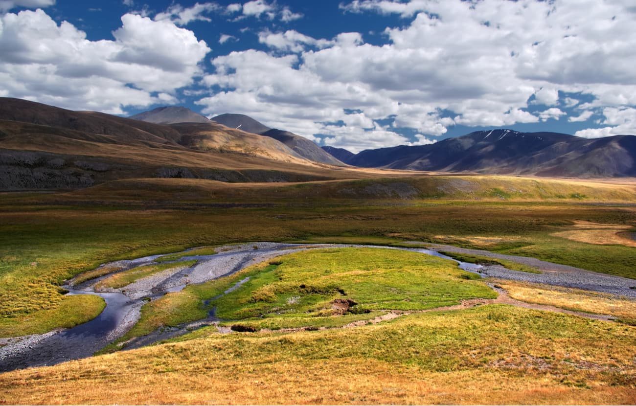
Topographically, the Altai mainly lies in the Southern Siberia and consists of high and middle-rise mountain ranges separated by deep river valleys and vast inland and intermountain troughs. It stretches from north-west to south-east for more than 2000 km. In the north and north-west, it borders on the West Siberian Plain. In the west, it is separated from the Kazakh hillocky area by the Irtysh River Valley. In the south, it is limited by the Junngar basin, in the south-east, there is the Gobi Desert, in the east is the Great Lakes Valley, and in the north-east, there are the mountains of the Southern Tuva and the Western Sayans.
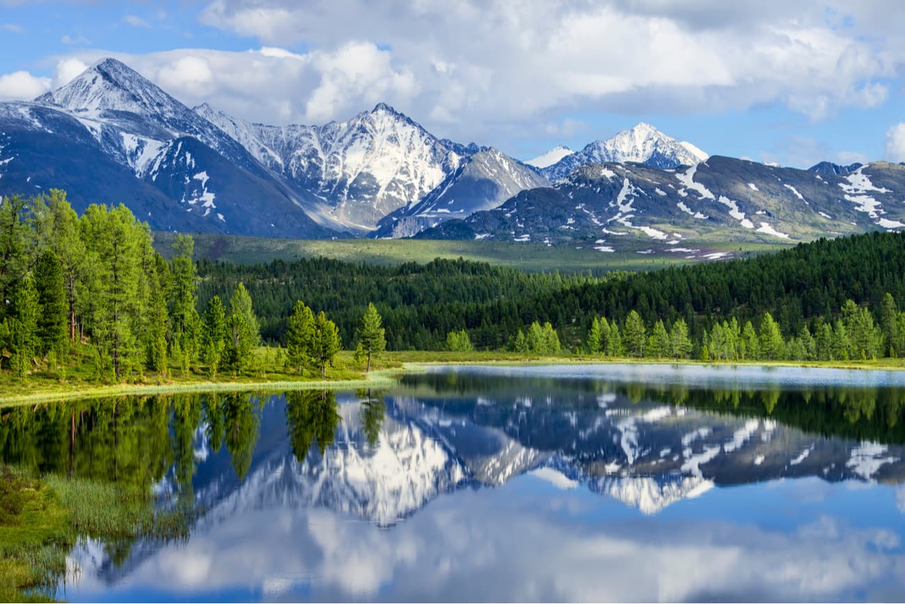
The Altai Mountains are the watershed between the basin of the Arctic Ocean and the northeastern region of Central Asia. The highest point is Mount Belukha (4506 m).
The Altai and Katun Reserves and the Ukok plateaus together form the UNESCO World Heritage Site called The Golden Mountains of Altai.
The name Altai is ancient, hypotheses about its origin vary wildly.
According to a German philologist and geographer Alexander Humboldt, Altai in Chinese and Mongolian means Golden Mountain (Altaun oola) or Kin-shan.
Another explanation of the origin comes from the Turkic word Alatau - "motley mountains", which is associated with the colour of the Altai highlands where there are areas with white snow, black rocky placers and lavish green vegetation.
According to G. Ramstedt, the name Altai comes from the Mongolian word alt - "gold" and the pronoun -tai, i.e. from the word alttai – "gold-bearing", "the place where there is gold". This version is confirmed by the fact that the Chinese used to call the Altai "Jinshan" - "golden mountains", which seems to be an obvious carbon copy of the Mongolian word.
The Altai formation is still ongoing. The evidence of this is the 2003 earthquake and the underground tremors after it. As a result, the southern ridges are rising by an average of one and a half to two centimetres per year. At the same time, there are no active volcanoes in the Altai (there are only ancient ones of different ages). The main source of geological events in the Altai is the collision of the Indian Peninsula with the Eurasian continent.
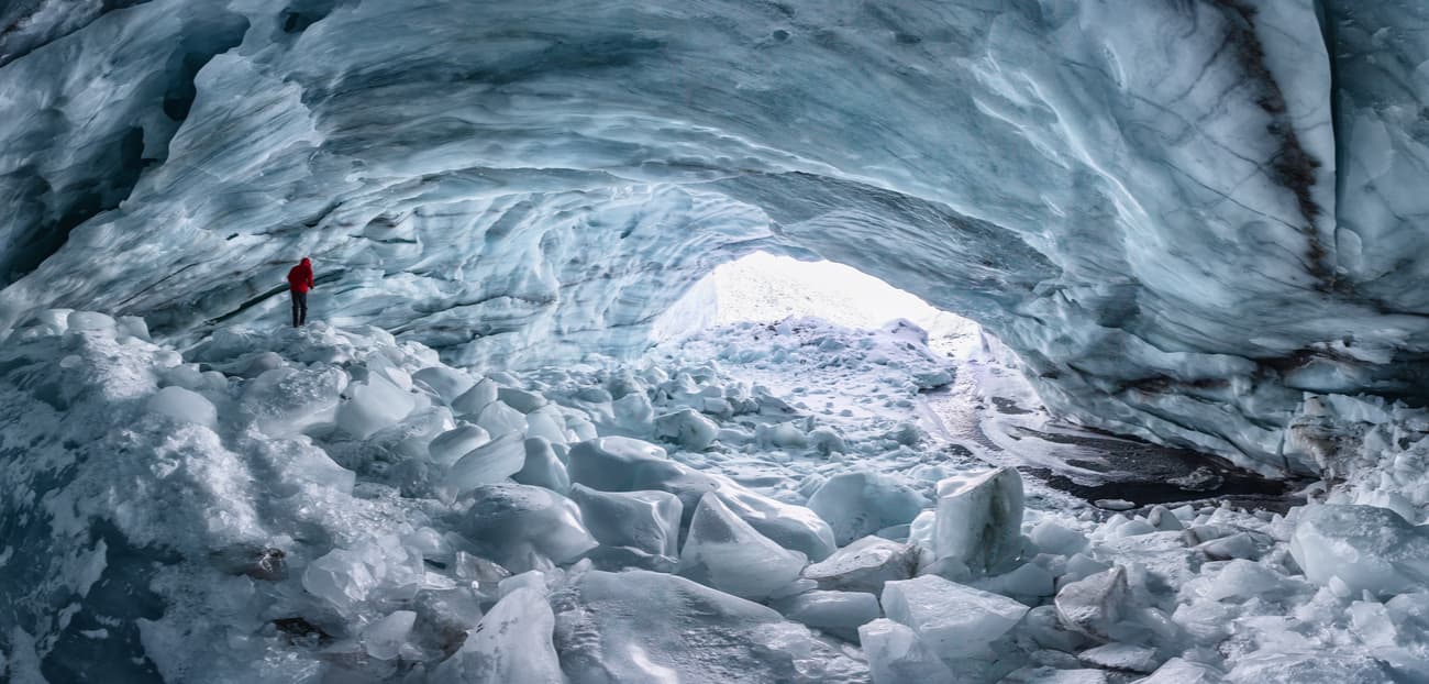
Due to the huge impact of the great Asiatic anticyclones, or high-pressure area, the regional climate is severely continental. The winter is long and bitterly cold. January temperatures range from −14 °C (7 °F) in the foothills to −32 °C (−26 °F) in the sheltered hollows of the east, while in the Chuya steppes temperatures can plunge to a bitter −60 °C (−76 °F). Long periods of low temperatures ensure some occasional tracts of the permafrost, just like in more northern Siberia (it is the ground that has a temperature below freezing for two or more years). Unlike winter, summers are short and don’t usually exhibit too high temperatures. July temperatures are warm and even hot occasionally — daytime highs often reach 24 °C (75 °F), sometimes up to 40 °C (104 °F) on the lower slopes—but summers are short and cool in most higher elevations. In the west, particularly at elevations between 1,500 and 2,000 metres, precipitation is high: 500 to 1,000 mm (20 to 40 inches) and as much as 2,000 mm (80 inches) may fall throughout the year. The precipitation total decreases to one-third that amount if you move farther east, and some areas have no snow at all. Some 1,500 glaciers cover the flanks of the highest peaks. They cover an area of roughly 650 sq. km.

Complex geological history has determined the diversity of minerals found in the Altai Territory. Among them are gold, mercury, iron, manganese ores, etc. Academician A.E. Fersman, who visited the Altai in 1916 together with academician V.I. Vernadsky (the inventor of the noosphere concept), wrote in his diary: “There is no other region in the world where gems have such a diverse colour”.
According to archaeologists, gold mining was conducted here in the third millennium BC. Traces of gold mining in the form of dumps in the floodplains of the Swan, Biya, Sadra, Charysh rivers have been well preserved to the modern day. In those gold-bearing sediments there were found large nuggets weighing up to 2-3 kg. There are also manifestations of alluvial gold found in the Anui, Pyzha, Koksa and other rivers. The known deposit of mercury near Aktash settlement was a base for development of the Aktashsky metallurgical plant.

A simplified mapping of the Altai complex system of ridges with a great abundance of spurs of different heights and lengths is usually presented as follows.
The Altai's Heart is the Tabyn-Bogdo-Ola (from Mongolian – the five sacred peaks) – the huge mountain massif near the borders of Mongolia, China and Russia. The highest peak is on the Mongolian territory, whereas the main mass of the Altai Mountain Range is in Russia. Ridges diverge from this colossal complex in a circle. All of them have a similar feature – their slopes lack symmetry, from the north-west they are steep, and in the south and south-west, the outline is very gentle.
Another Altai range shared by the countries is the Chikhachev Ridge located in the southeast of the Altai Mountains. The border between the Republic of Altai and the Republic of Tyva and the state border between the Russian Federation and Mongolia pass through the ridge. From the west, the Chikhachev Ridge borders the Kurai Ridge, while from the southwest it is separated from the Sailugem Ridge by the Durbat-Daba Pass (2,481 m). There are many mountain peaks in the ridge system: on the territory of Mongolia - Ongorkhoin-Uul (3,754 m), Turgen-Ula (4,029 m), Tevseg-Uul (3,745 m); on the Russian territory of Kosh-Agach district - Talduayr (3,505 m), Sailugem (3,411 m), Askhatiik-Dabani Hyar (3,094 m), on the territory of the Republic of Tyva (Russia) - Mongun-Taiga (3,717 m) and Burul-Taiga (3,185 m).
On the Russian territory, there are over 30 ridges in the Altai mountains with an average height from 2000 to 4000 meters. The north-western ones are lower and those lying in the south-east are higher.
Those 30+ ridges are roughly grouped in the four main branches:
The major peaks on the Russian Territory are Korona Altaya (4,178m), Maasheibash (4,177.7m), Russian Shater (4,117m), and some are shared with Mongolia and Kazakhstan.
In Kazakhstan, the main ridges are:
In Mongolia, the Mongolian Altai is the largest mountain system in the country. It stretches south-east and consists of mountains with an average elevation of 3,000-3,500meters. The major range is undoubtedly the Tavan Bogd, next come the Baatar Hayrhan Ridge, Tsambagarav Ridge, the Khangai Mountains Gobi-Altai Mountains. The highest points are Mt.Khuiten (4,356m, this peak is shared by Mongolia and China as the state border runs along its summit), Nairamdal (4,082m, the name means friendship, it is located where Russian, Chinese and Mongolian borders meet), Malchin (4,052 m, Herder), Burged (Eagle), and Ulgii (Land). Mönkhkhairkhan (4,231m), Tsast Uul (4,193m), Sutai (4,220m).
In China, the major Altai peaks are Öndör Khairkhan Mountain (3,914 m, it is permanently snow-capped) and Dünkheger (3,315 m), also known as Mount Altun Obo is the highest peak of Baitag Bogda.
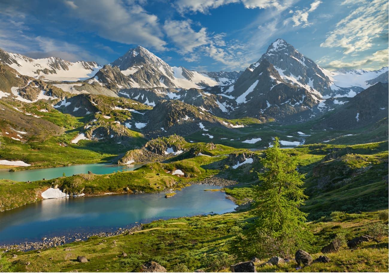
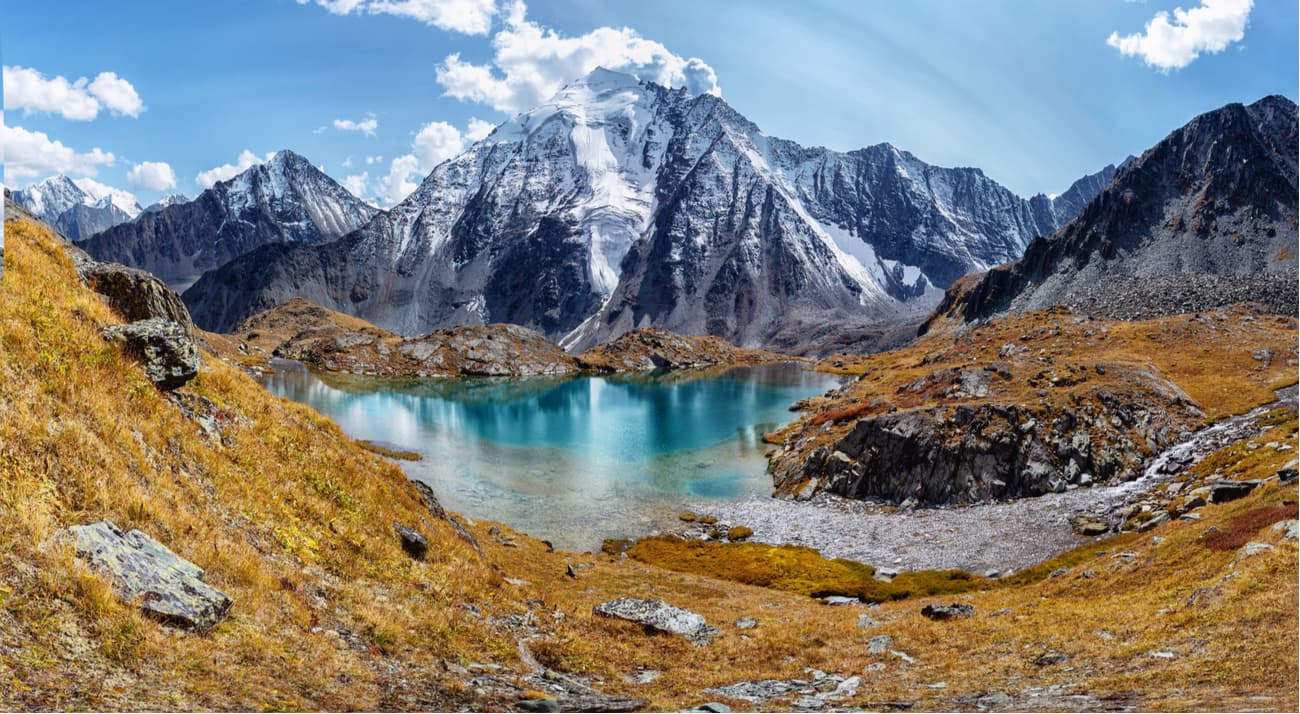
Belukha(4,506m) is the highest peak of the Altai Mountains and the highest peak of Siberia. Geographically, this mountain is about the same distance from the Arctic, Pacific and Indian oceans. The top of Mount Belukha is always covered with snow and ice, thus the name – white mountain.
It has two summits, the Eastern and the Western, the former being a bit higher than the latter. In 2002, two paragliders started synchronously from the Eastern summit (4,509m). Travelling by air is undoubtedly faster, but skier Dmitry Shchitov took up the challenge in 2003 and went downhill from the very top of Belukha in about 2 hours. Belukha is not a mountaineer-friendly mountain due to harsh weather conditions and the typically low atmospheric pressure, which at the top of the mountain is about half the normal. Moreover, the rocks on the slopes of Belukha are covered with a thin layer of leaky ice all year round, which makes them incredibly slippery. To add to the trouble, Belukha is located on a tectonic crease that generates earthquakes on a regular basis.
A famous Russian painter Nicholas Roerich made Belukha the star of several of his paintings.
The mountain is considered sacred both by Buddhists and Altai shamanists. It is considered to be one of the entrances to the mystical land of Shambala and the mysterious Belovodye (White Water Area). Modern esotericists and Roerich's followers consider the mountain a place of power and information pyramid that is receiving messages and energy from space.
The Altai people have many prohibitions associated with the sacred mountain. It is forbidden to make noise and loud sounds on the slopes of Belukha. Also, iron objects cannot be brought here, and hunting is not allowed in these places. As in many other sacred places in the Altai, women are not allowed to enter the lands of Belukha Mountain.
Once upon a time, there used to be a legend among the locals that everyone who dared to climb the top of Belukha, would go blind. It has a scientific justification as well – without special glasses the glow of light reflected from snow and ice can really damage the retina and impair vision.
Supposedly named by Genghis Khan himself, the Tabyn Bogdo-Ola (aka Tabyn Bogd or Tavan Bogd) mountain massif is located at the convergence of the borders of Russia, Mongolia and China on the Ukok Plateau.
The highest point of the massif is Mount Khuiten (4,374 m), located on the Mongolian-Chinese border and is the highest point of Mongolia. The mountain is sacred to all surrounding peoples, approximately until 1950 it was considered to be the highest point of the Altai (it is only 132 m below Belukha Mountain).
The other four oval-shaped snowy peaks of Tabyn Bogdo-Ola, with a height of about 4000 m, are clearly visible from the Warm Key Pass, from here they seem particularly majestic.
The peak of Tavan Bogd Uul (Kuitunshan 奎屯山, Tavan Bogd Uul) with a mark 4,104 m is located a few kilometers from Mount Kuiten Uul and is the junction point of the borders of Russia, Mongolia, and China. According to tripartite agreements, the coordinates of this point are 49°10′13′N. 87°48′56″ E. In view of the difficult accessibility of this peak covered with eternal snow, the bordering states agreed not to place a border mark on it.
To the south-east of the massif is the Mongolian Altai, in the west – the Betsu-Kanas pass and the Southern Altai Ridge. The northern slope of the massif abruptly breaks off to the Ukok plateau, to the east of which lies the Sailugem Ridge.
The glaciers of the Tabyn-Bogd Ola massif are the largest in the Altai. In the upper part of the massif there are 35 glaciers with a total area of about 150 sq.km, the largest of which and the Potanin glacier (19 km long; 56.5 sq.km) and the Przhevalsky glacier (10.8 km long; 30 sq.km), they are named after Russian explorers. The glaciers of the massif feed the largest rivers in the region: the Katun, the Kobdo and the Irtysh. The massif is also the watershed between the basin of the Arctic Ocean and the drainless basin of the Central Asian troughs.
The Tabyn -Bogdo-Ola mountain junction is sacred to the Altai, Tuvan, Mongol, and Chinese Buddhists.
On the mountain massif of the Tabyn Bogdo-Ola and the neighboring ridges small populations of argali (mountain sheep) have survived, there lives a snow leopard and a manul cat, the animals listed in the Red Book. The river valleys are home to bears, wolves and gophers. Below the glaciers, there are mountain tundras and alpine meadows, there are thickets of dwarf birch.

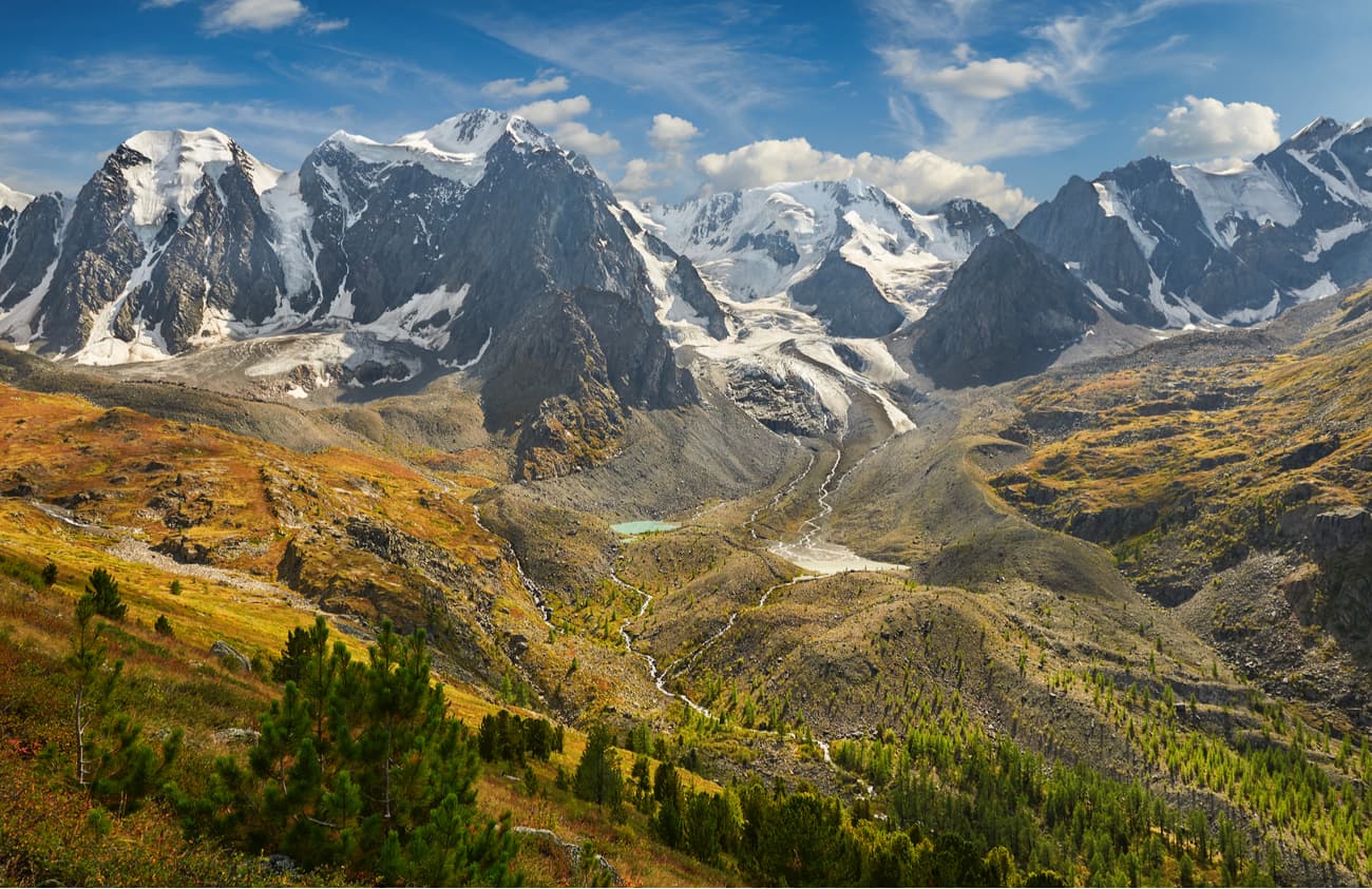
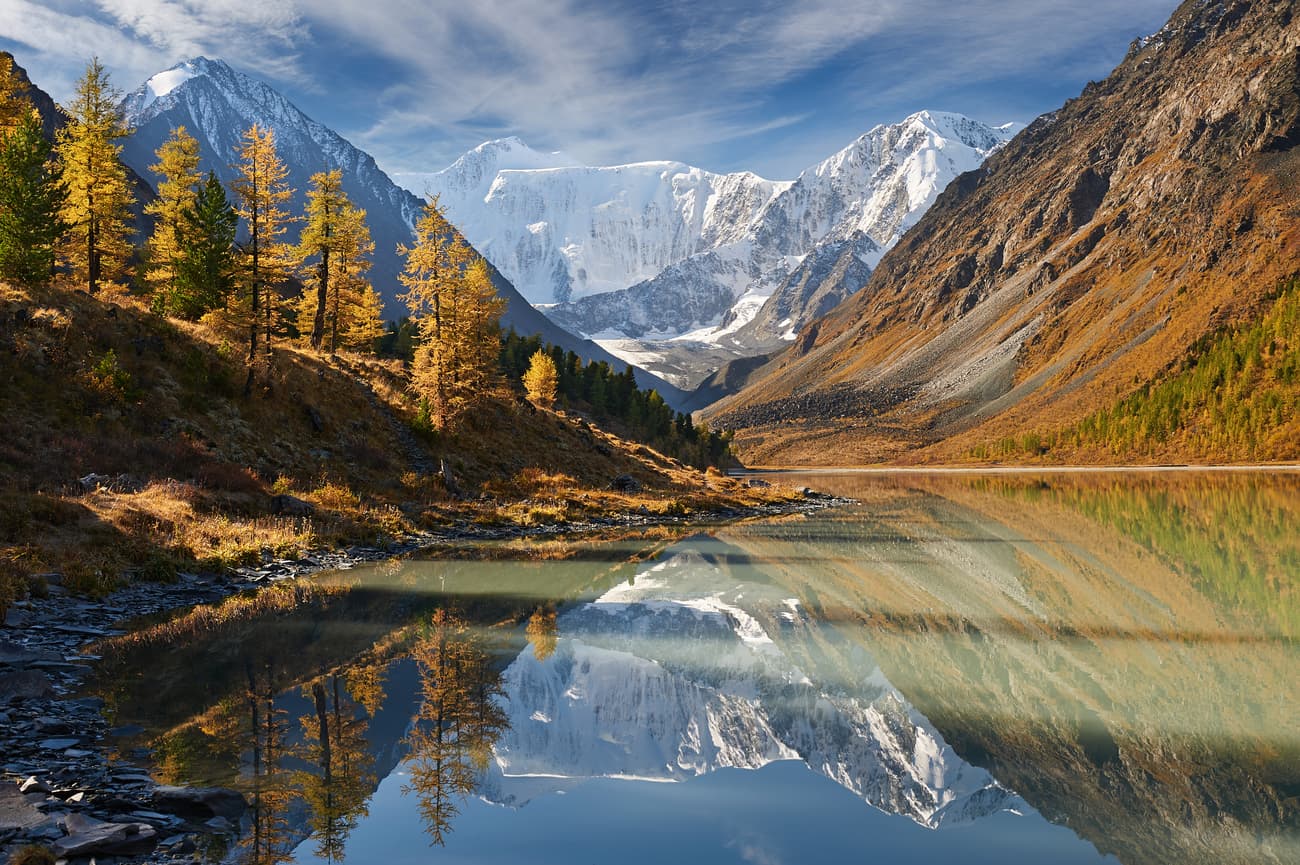
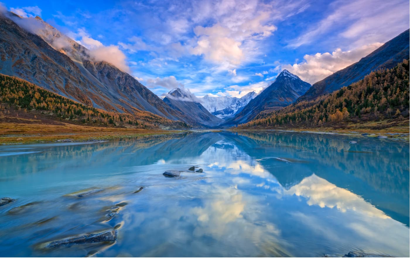
The Katun Ridge is one of the highest ranges of the Altai Mountains in the Republic of Altai (Russia). There is no forest above 2000-2200 meters, only rocks often covered with eternal snow and alpine meadows. In the central part of the range, the alpine relief prevails. On the slopes of the Katun Range, there are more than 386 glaciers, their total area exceeds 150 sq km. The Katun river flows from the Gebler glacier here. Just north of the Katun Range is the famous Uymon Steppe – an intermountain basin at an altitude of about 900 meters above sea level.
The length of the Terektinsky Ridge is about 150 km, the height reaches almost 3000 m. It is located along the Katun River and reaches the Kansk steppe. The ridge as a whole has a smooth character, the slopes are abundantly covered with coniferous forest, there is a large number of flat peaks and plateaus, the largest of which is the Tuguryuk. Thanks to the boggy nature of many plateaus, a huge number of small rivers originate here.
The North Chuy Ridge is especially popular among fans of active tourism not only due to a spectacular abundance of glaciers and lakes but also because of its convenient transport accessibility (the Chui Road is very close). The most famous lakes are the Shavlinskiye. The length of the ridge is about 100 km. The average height is about 3600 m, and some peaks exceed 4000 m (Maashey-Bash is 4,177 m, Aktru is 4,044.4 m). In the central part, there are about 200 glaciers with a total area of about 175 sq.km.
The Sumultinsky ridge spans parallel to the meridians and connects the areas of the Chuy road with Lake Teletskoye, which makes it one of the most visited places in the Altai Mountains. Glaciers are not found here since the maximum height of the mountains reaches only 2700 m, but many lakes and rivers cover its slopes. There are several hiking, horseback riding and skiing routes along the ridge. In Soviet times, these places were the All-Union tourist route No.77, which had the third category of complexity and was the most complex planned route in the USSR and at the same time a cult walking route of the Altai. Roads do not pass through the ridge, trails are present only in river valleys.
The western part of the Southern Altai Ridge is located in Kazakhstan, the eastern part separates Russia from the Xinjiang Uygur Autonomous Region of China. The total length of the ridge is approximately 125 km. There are over 180 glaciers here. The ridge feeds the rivers of the Irtysh basin: the Akkaba and the Bukhtarma, and the rivers of the Ob basin: the Ukok, Ak-Alakha, Betsu-Kanas, Muzdy-Bulak, Kara-Chad, and the Argamji.

There are also many small lakes such as Zelenoye (Green Lake) and Blandy Kul. At the foot of the Southern Altai Ridge ridge at the Ukok Plateau, there are such lakes as White, Kanas, Muzdy-Bulak and Gusinoe (Goose Lake).
The peaks of the ridge are as follows:
Jagyrtau (3,871.0 m) - China Kanas (3,440.7 m) - Russia, China Krutinka (3,276.9 m) - Kazakhstan Cholok Chad (3,217.5 m) - Russia Bertek (3,172.6 m) - Russia Altykyz (2,906.6 m) - KazakhstanThere are UNESCO's protected areas in the Altai, among which five are located on the Russian territory, one in Kazakhstan, Mongolia and China have two each.
On the territory of Russia there are five sites called the Golden Mountains of Altai.
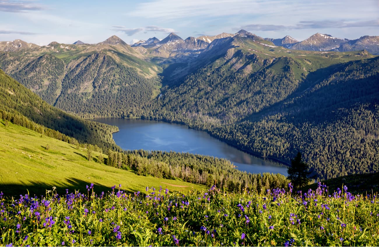
The Altai Natural Biosphere Reserve spans over 871,206 hectares of land and 11,410 hectares of the water area of Lake Teletskoye. There are 22 lakes in total in the Reserve, the most valuable and rarest in beauty is Lake Teletskoye (counted separately on the UNESCO Heritage list). The landscapes here are ethereal. The Reserve was established to protect cedar forests and restore the population of snow leopard, sable, elk, marals and other animals which are on the verge of extinction.
Along the borders of the reserve, there are high ridges: the Abakan in the north, the Chikhachev in the south, and the Shapshal in the east. Unfortunately, it is forbidden to to climb those mountains as they are located in the protected territory, but who can stop you from admiring them from afar? However, you are allowed to take one-day trips to the numerous lakes and waterfalls in the reserve.
The Katun State Natural Reserve is an untouched nook of wild nature located near the highest mountain peak of Siberia – the majestic Belukha. The main purpose of the Reserve was to preserve the typical ecosystems of the Katun mountain range, snow leopard habitats and rare species of flora and fauna.
In 2017, UNESCO approved the establishment of the first transboundary biosphere reserve in the Altai. It was established on the basis of the Katun biosphere reserve (Russia) and the Katon-Karagai National Park (Kazakhstan). This is the first transboundary biosphere reserve of such high international status. The joint territory is called The Big Altai. The Big Altai reserve covers an area of over 1.5 million hectares.
The Belukha Nature Park is named thus due to Belukha Mountain, the highest point of the Russian part of the Altai. The territory of the park begins from the town of Belukha and extends to the north and north-west up to the Katun River, covering the basins of its right tributaries – the Kucherla and Akkema rivers.
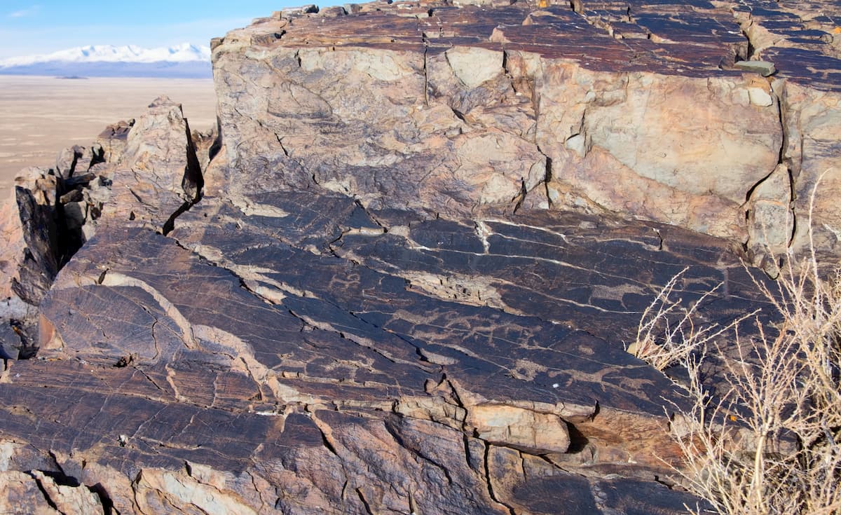
The main sights are the Tekelu waterfall (falling from a 60-meter height), Lake Akkemsk, Lake Kucherlin. The park is also known for its petroglyphs – the stone drawings of the early Bronze Age. The Kuylu Petroglyph has over 100 drawings made in a niche of a small rocky grotto, about a dozen more drawings are applied on separate stones within 1 km from the grotto. The main characters depicted are deer, goats, horses and humans. In general, the petroglyphs date from the Eneolithic Age to the Middle Ages. Petroglyphs of the Black River are silhouette drawings on rocks made by fine dot-cutting. There are about 30 images in total.
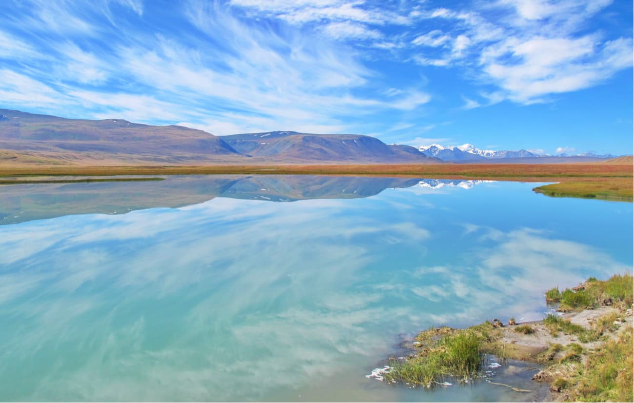
The Nature Park called the Ukok Calm occupies the southern part of the Ukok Plateau. The Bertek Basin is fully located within the park. In the east, the border of the park coincides with the state border between Russia and Mongolia (the Sailugem Ridge), whereas in the south, it runs along the border with China (the South Altai Ridge), in the south-west is borders with Kazakhstan.
The Ukok Plateau is located in the south of the Altai at an altitude of about 3 km above sea level. Ukok is an ancient name, it means "massive elevation with a flat top". The native Altai people believe that it is here, at the foot of the Tabyn Bogdo-Ola Mountains, that the mountain world called the second layer of heaven is located. It is very difficult to get here, but once you take a helicopter ride, you will see a stunningly beautiful and mysterious view of giant boulders and steep naked rocks, the majestic panorama of mountain peaks covered with eternal snow.
In the summer of 1993, an unusual discovery made the Ukok famous all over the world. A Russian archaeologist from Novosibirsk Natalia Polosmak, a PhD in Historical Sciences, discovered the burial place in the Ukok that contained a young woman's mummy. This find made an overnight sensation, the mummy was called the Altai Princess, her age is 2500 years old and she is in a very good state. The finding is extremely precious because the land where it was found was considered to be ‘a haven of Gods’ and no human could walk there.
Before going to the Altai, decide what you want to visit, as all the Golden Mountain sites are at a significant distance from each other. The Katun Reserve is located in Ust-Koksa village, the Ukok plateau is in Kosh-Agach village. Take into account that visiting the territory of the Altai natural reserve (located on the territories of Ulazhan and Turachak districts) requires a special pass. One must get it a month before the expected date, it is necessary to contact the central office of the reserve or fill out a special request on the site. This rule also applies to other reserves that are part of the Golden Mountains. You can get to the Altai reserve by bus from Gorno-Altaisk, next to Artybash settlement (the mouth of the Teletskoe lake), you can get there by boat. The lake connection is feasible only for summer.
The Katon-Karagai National Park is the largest national park of Kazakhstan. It is located in the Katon-Karagai district of the East Kazakhstan region. Its area is 643,477 hectares. The park was founded in July 2001, and in 2014 it was included in the UNESCO list of specially protected heritage sites due to its attractions, landscape and diversity of flora and fauna. It is a very popular attraction among tourists from all over the world, with a huge number of tourist sites and tourist routes on its territory. The park is mountainous and glaciated, with altitudes often reaching over 3,000 m.
The park borders on the north by the Altai Republic of Russia, on the southeast by China, on the west by the Farpusnaya River, and on the south by the northern slopes of the Sarymsakty and Tarbagatai ranges of the Southern Altai Mountains. 34% of the park is forested, the remainder being mountain meadows or rocky slopes and glaciers. The slopes are steep, with terrain formed by the glaciers: trough-shaped valleys, cirques, and moraines.The glacier-fed rivers are steep and energetic. The Kokkol Falls, at 80 meters, is the largest waterfall in the Altai Mountains. The nearest Railway Station is Zyryanovsk or you can get here taking Ust-Kamenogorsk - Zyryanovsk highway.
The petroglyph complex in the Mongolian Altai is a UNESCO World Heritage site located in northern Mongolia on the Chulut River. At an altitude of about 2000 meters above sea level, it stretches for more than 40 km through rocks and mountains. The images are dominated by those of deer harnessed in chariots. Even the spokes on the wheels of the chariots can be counted. The oldest of these appeared 5,000 years ago and the last about 3,000 years back.
The Altai-Tavan Bogd National Park (Tavan is also spelled as Tabyn) is a national park located on the territory of Bayan-Ulgiy province in western Mongolia. The park is named after Tavan-Bogd Ola, the sacred peak for nomads, which is located at the crossroads of Russia, Mongolia and China. It has common borders with Russia and China.
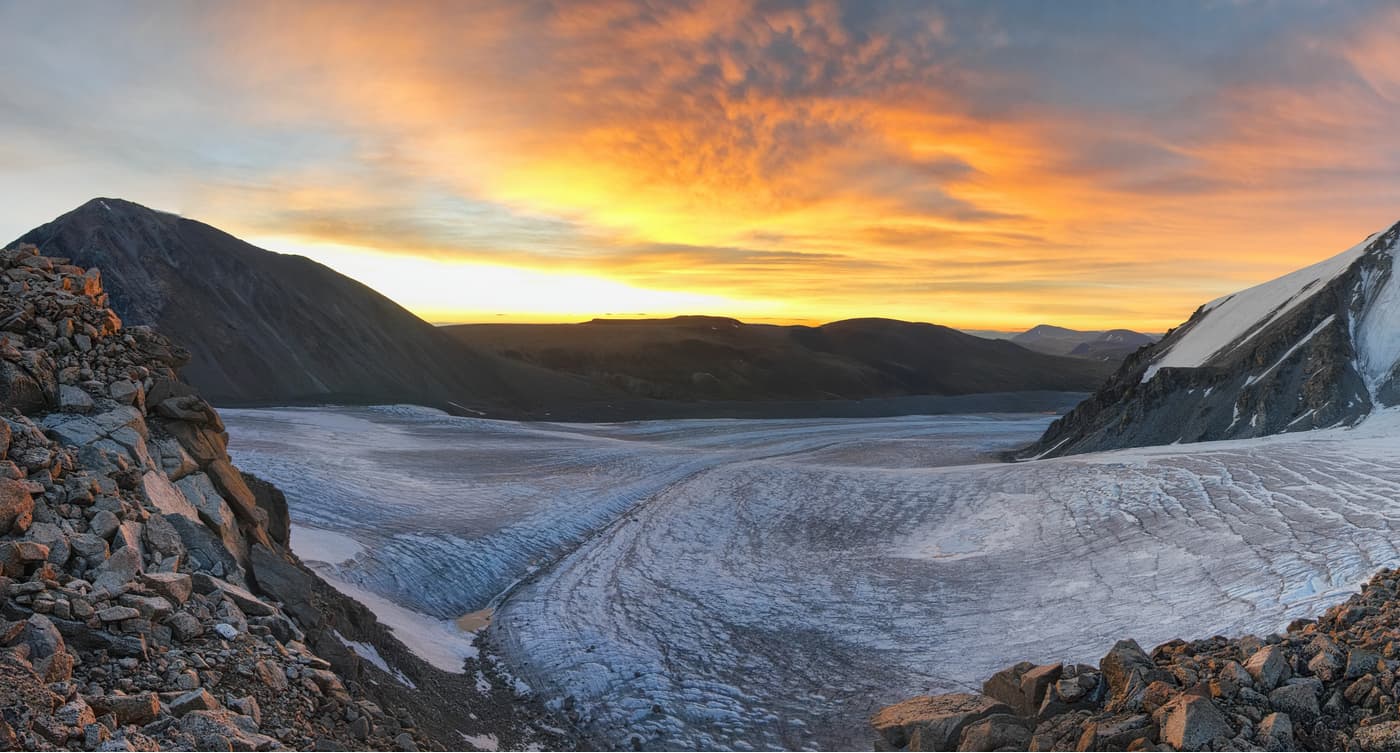
The territory of the national park includes ridges of the Mongolian Altai with vast masses of corroms (stone rivers), alpine forests, meadows and semi-deserts, lakes and river valleys. To the north of the park rises the peak Kuiten-Uul, the highest point of Mongolia (4,374 m). Close to it is the Potanin Glacier with an area of 23 sq.km. which together with other glaciers feeds the rivers flowing into the Basin of the Great Lakes.
In the park, there are large lakes Hoton Nuur, Hurgan Nuur, and Diane Nuur. Tavan Bogd is sacred to the local nomadic population, so hunting is prohibited in the area. Due to this, many birds and animals live here. There are a lot of swans, ducks, mountain goats, foxes, and hares. Nowadays there are many historical monuments of culture in the park - stone sculptures, rock paintings and barrows of the Scythians, Huns and Turks period. Here you can see the largest petroglyphs of the Hun's period.
The Kanas National Natural Reserve (UNESCO) is located in the heart of the Chinese Altai. It is rapidly developing thanks to huge investments and support of the Chinese government. It is the only place in China where you can see the Siberian taiga. It is where the largest tributary of the Irtysh River originates. The Irtysh is part of the Arctic Ocean river system.
The area of the reserve is 5,588 sq. km. It is the only Chinese reserve for the protection of plants and wildlife adjacent to the Siberian area.
The Kanas is a freshwater lake in the Altai Mountains located in the north of the Altai District of Xinjiang Uygur Autonomous Region of China. It is the deepest alpine lake in China. It is located at an altitude of 1,374 m above sea level, 30 km south of the western section of the Russian-Chinese border and the junction of the borders of Kazakhstan, China, Mongolia and Russia. The lake is surrounded by snow-capped mountain peaks, dense forests and lavish meadows.

The lake is very colorful, its multicolor creates a sense of fairytale world. Water changes its color with changing weather and with time of day. According to the legend of the local Tuvan peoples, the lake is home to a large water monster, and indeed, in recent years, scientific expeditions have repeatedly found here very large unusual fish.
In the north part of the lake there is a pillar of the snowy mountain Kuitun, which is known worldwide for its peak called Friendship.
Two great rivers originate in the China Altai. One of them is the Ergis River and it is the headstream of the international Erbi River which flows into the Arctic Ocean. The second one is the Ulungur River which is the second longest land-locked river of Xinjiang, and it is the main run-off of the second largest land-locked lake - Ulungur Lake of Xinjiang.
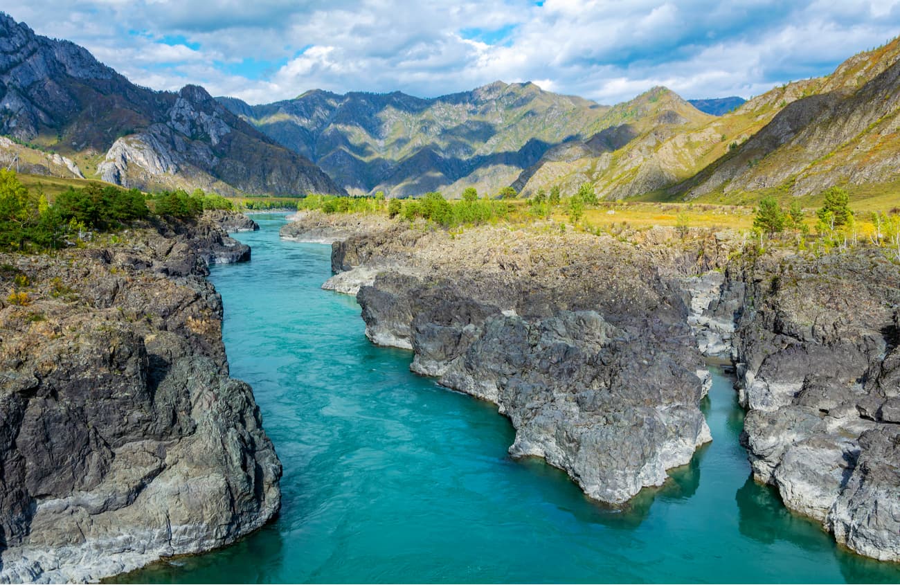
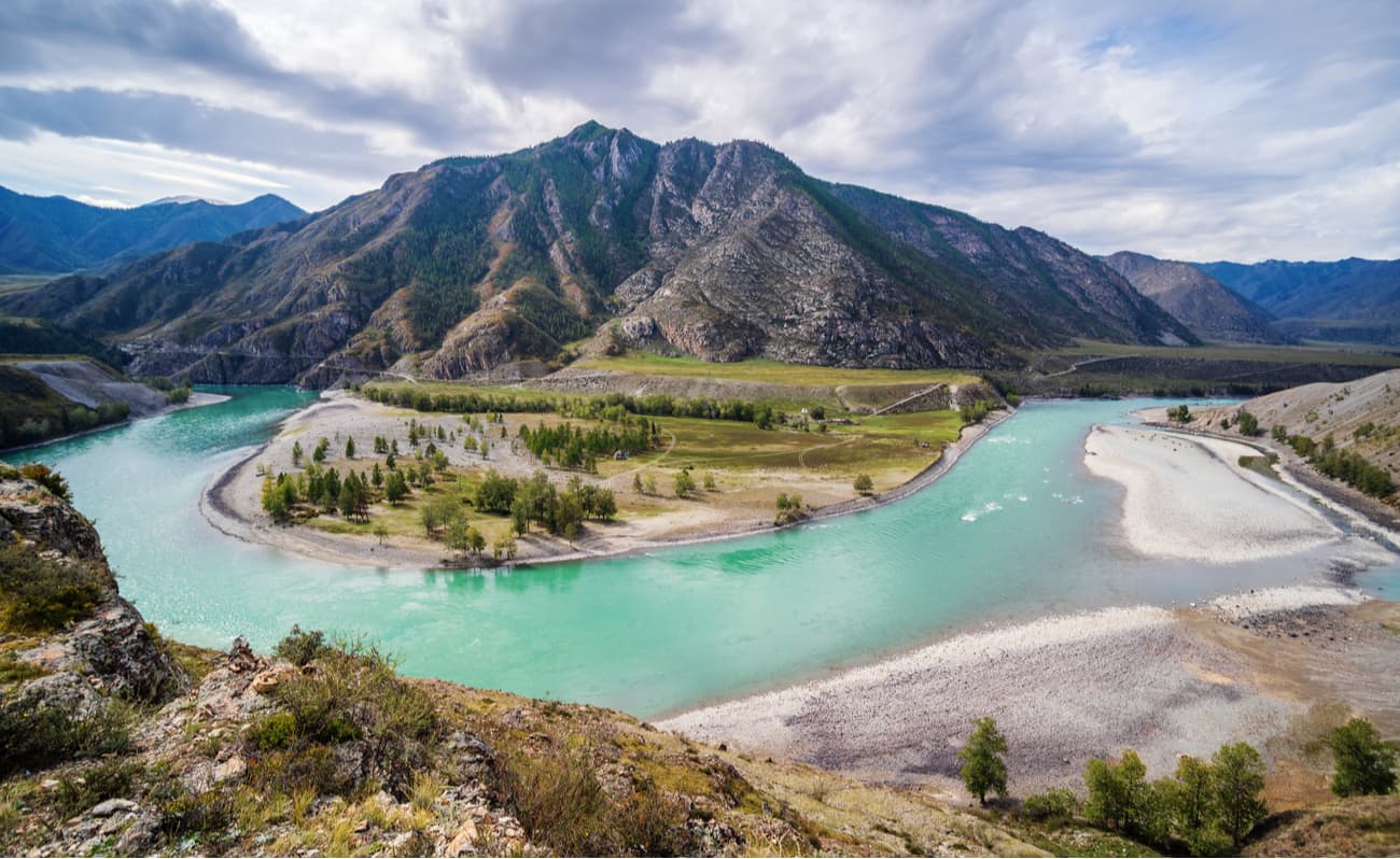
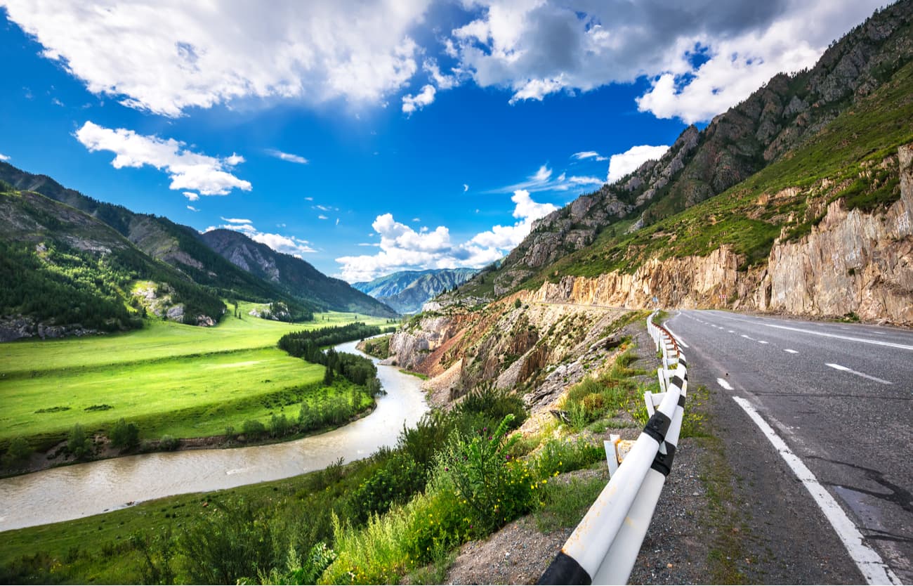
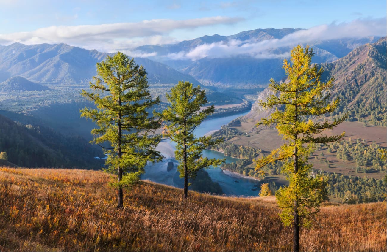
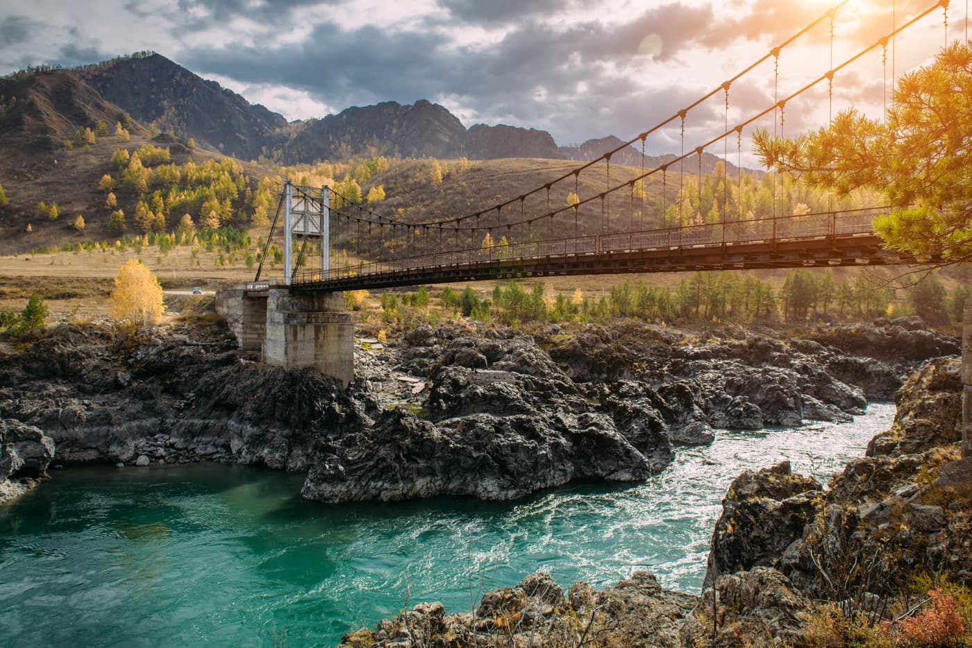
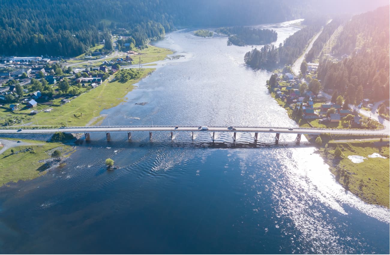
The Altai is dissected by a dense network of mountain rivers which are fed by melting snow water and summer rains, and characterized by long spring floods. Most of the rivers belong to the Ob basin, both its sources – the Katun and the Biya - are in the Altai and are its main waterways. The Altai is dominated by rivers less than 10 km long, the largest being the Biya (301 km), the Katun (688 km), the Argut (232 km), the Chuya (320 km), the Chumysh (644 km) and the Alei (858 km).
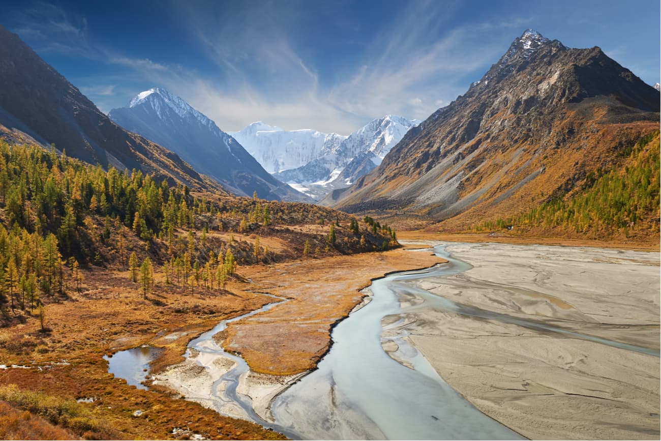
The Katun flows out of the Gebler glacier at an altitude of about 2,000 m and flows down the valley also shaped by a glacier retraction. After 2 km, the river Rassypnaya flows into it and the Katun becomes a rapid, full-flowing river, especially in summer when snow and glacier ice melt intensively. Depending on the slope and the nature of the riverbed, the river rumbles between rocks and boulders or flows quietly.
The Biya is the second most water-intensive river in the Altai. The length of the river is 301 km, and the basin area is 37 000 sq.km. It is the only river to flow out of Teletskoye Lake and when it confluences with the Katun River, they form the river Ob. The water in the section from Lake Teletskoye to the inflow of Sarykoksha river is clear and cold (10-15 °C), but in the lower reaches it warms up significantly.
The Biya is much loved for rafting (mainly by kayaks and catamarans). There are several rapids with up to 1 m and above on the section from the source to Upper Biysk. The basic thresholds are the Yurtok, Pyzhinsky, Kebezensky, Sarykokshinsky, Kipjatok (Boiling Water) in Turochak village. The last threshold is in village Udalovka. The river flows fast, usually at the speed of 1-1.5 m/s, the deposits of coarse gravel are found almost to Biysk.
The Argut is one of the major tributaries of the Katun. The name comes from the Altai word archyt – a bag for making koumiss, it is a special drink from horse’s milk. The Argut has a very rich basin composed of calm rivers and streams of the Ukok Plateau, as well as powerful, milky-white, boiling whirlpools of the tributaries that start from glaciers, and transparent, clean, rapid streams flowing from the lakes. The upper reaches of the Argut have been developed for a long time and are mostly passable, but the lower parts of the river valley are still an inaccessible gorge.
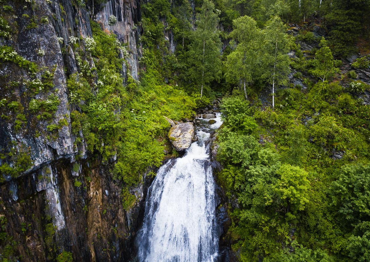
Most mountain rivers are not navigable due to fast currents and rapids. Many have waterfalls usually located at the sharp bends of the river channel and tectonic ledges. Waterfalls are particularly numerous and varied in the Central Altai. These are the Tekelyu (60 m), the Kurkura (20 m), the Kokkol (40 m), the Rasypnoy (35 m), the Tegheek (40 m), the Iedigem (30 m), the Shaltan (20 m), the Korbu (12 m).
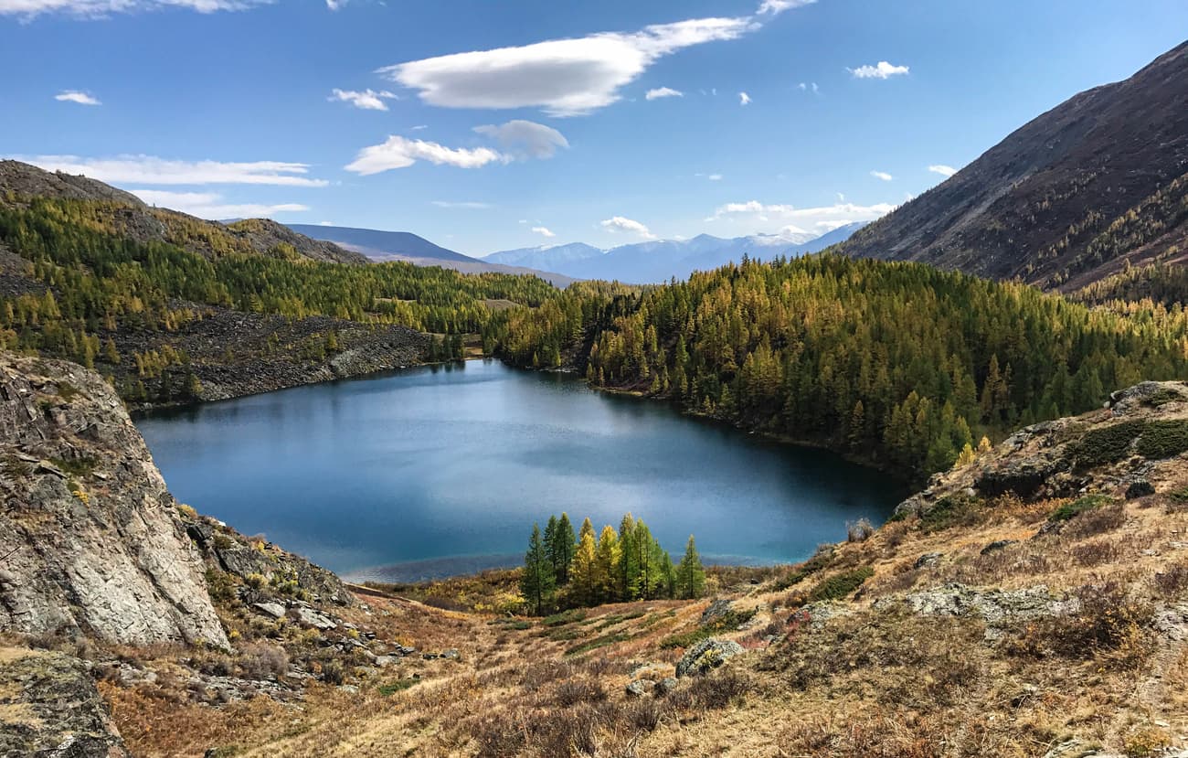
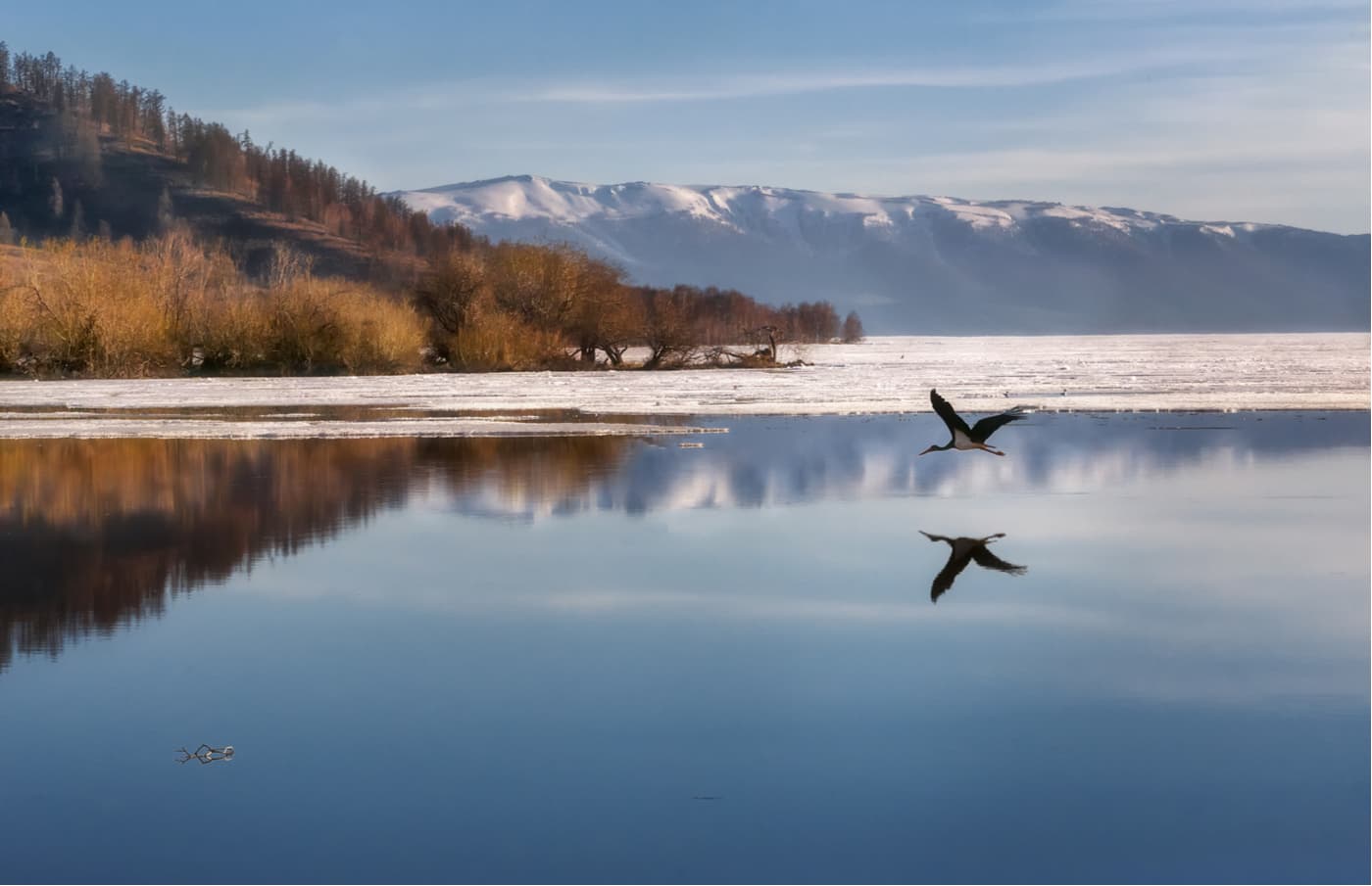
The total number of lakes in the Altai is 7000, the largest being Markakol and Teletskoye Lake. Many small, usually 1-3 sq.km or less, ancient glacial lakes often fill the picturesque deep valleys. In the north of the Altai Mountains, there are karst lakes.
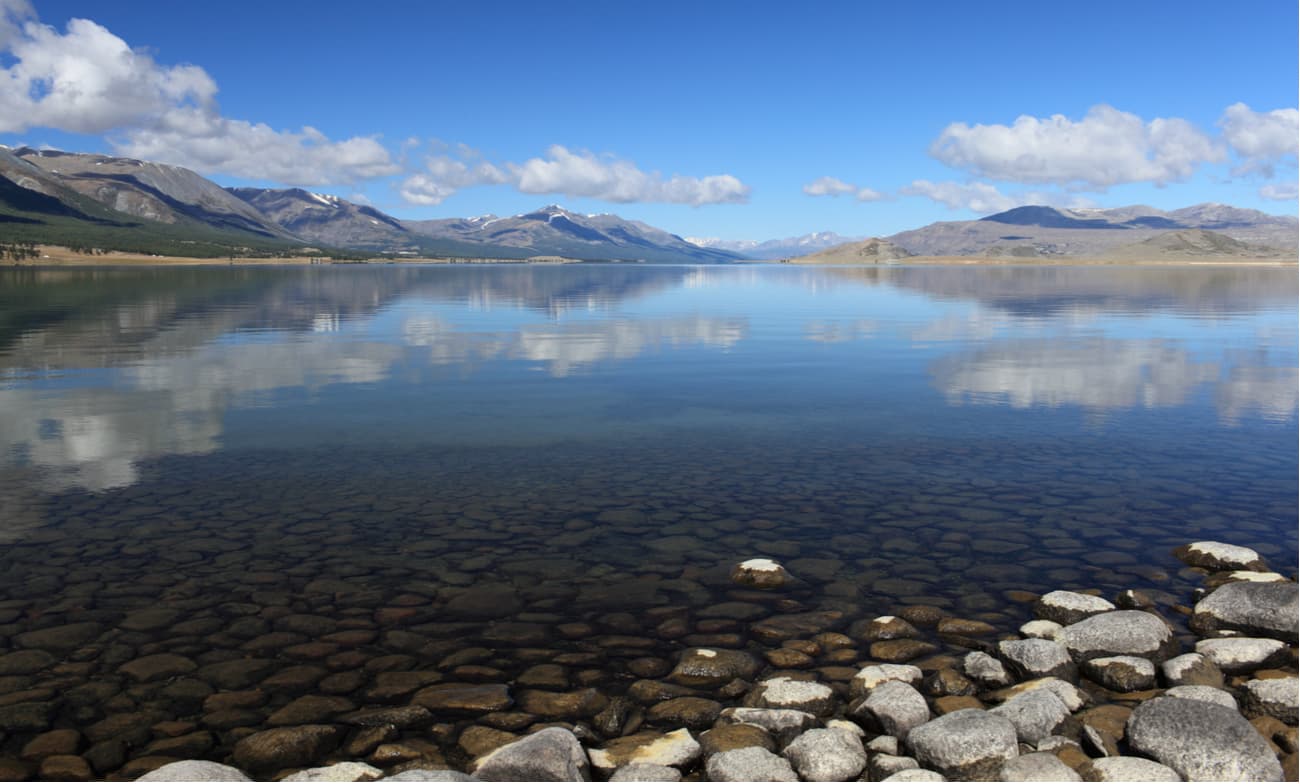
The Markakol is in Kazakhstan, it has an area of 449 sq.km. and stretches over 38 km with a maximum depth of 30 m. It is located in an intermountain hollow between the Kurchum Ridge in the north and the Azutau in the south at a height of 1,449 meters. The southern shores are precipitous, whereas the northern ones are rather flat lowland. It freezes in November and opens in May. A large number of rivers feeding mainly on melt water flow into the Markakol. The water in Markakol is very clear. The color range of Lake Markakol is diverse: from light blue or blue in clear weather, to gray-black or silver when the weather changes.
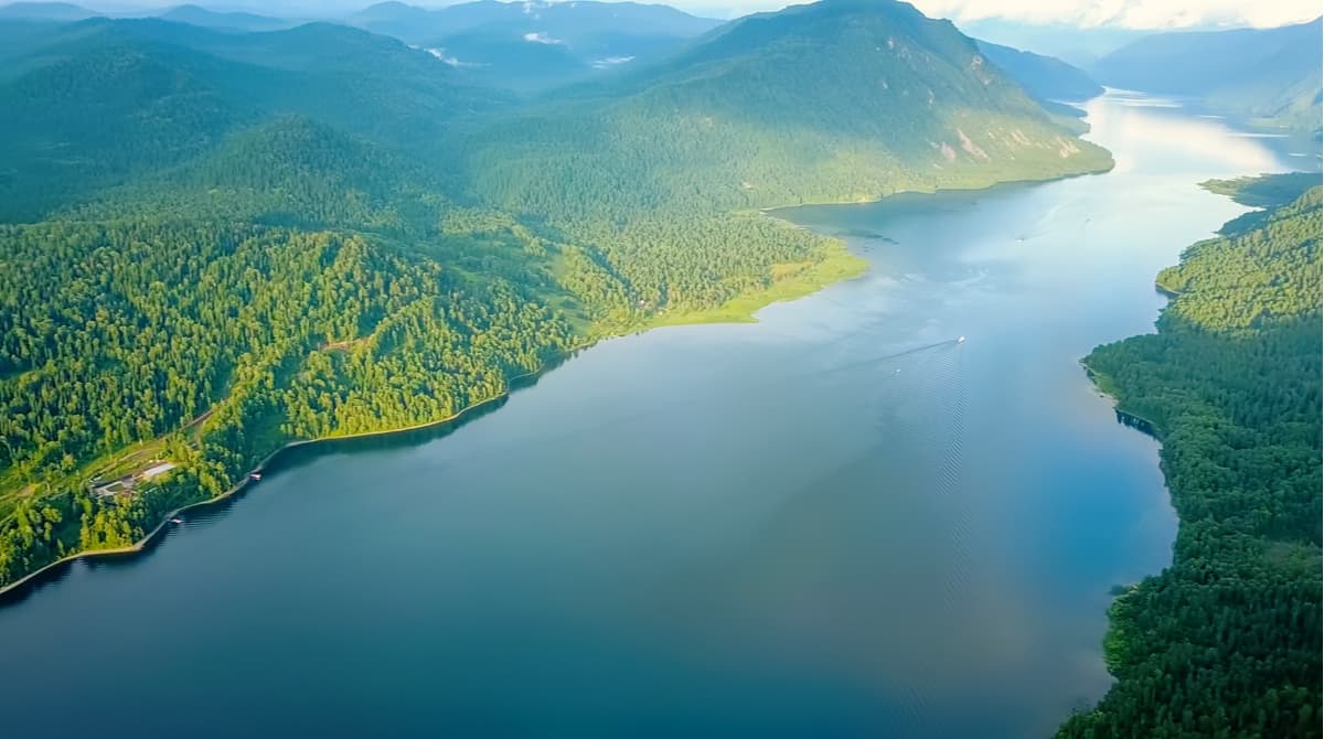
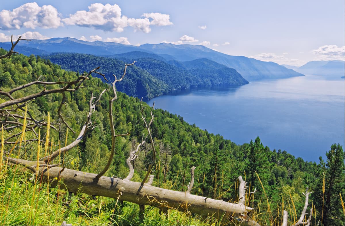
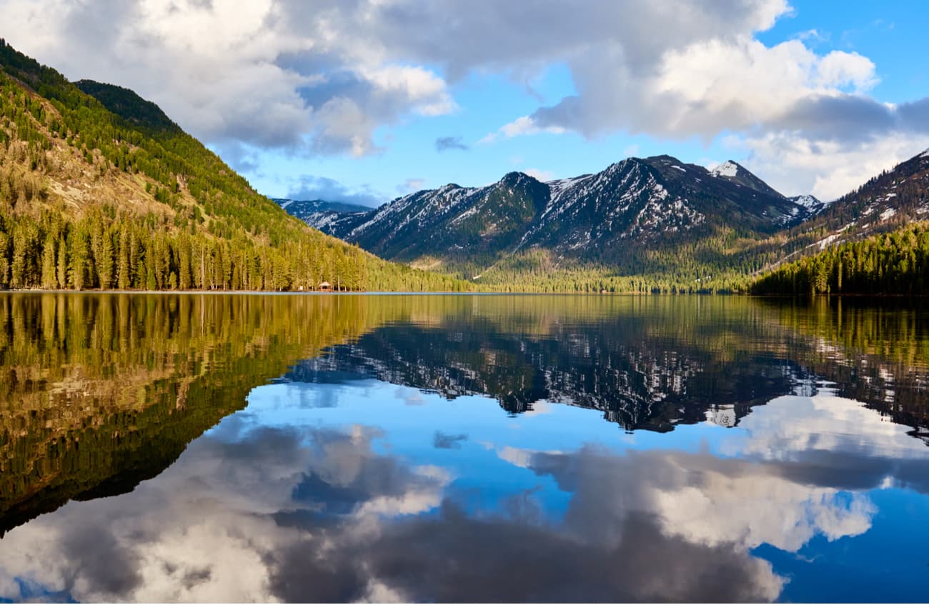
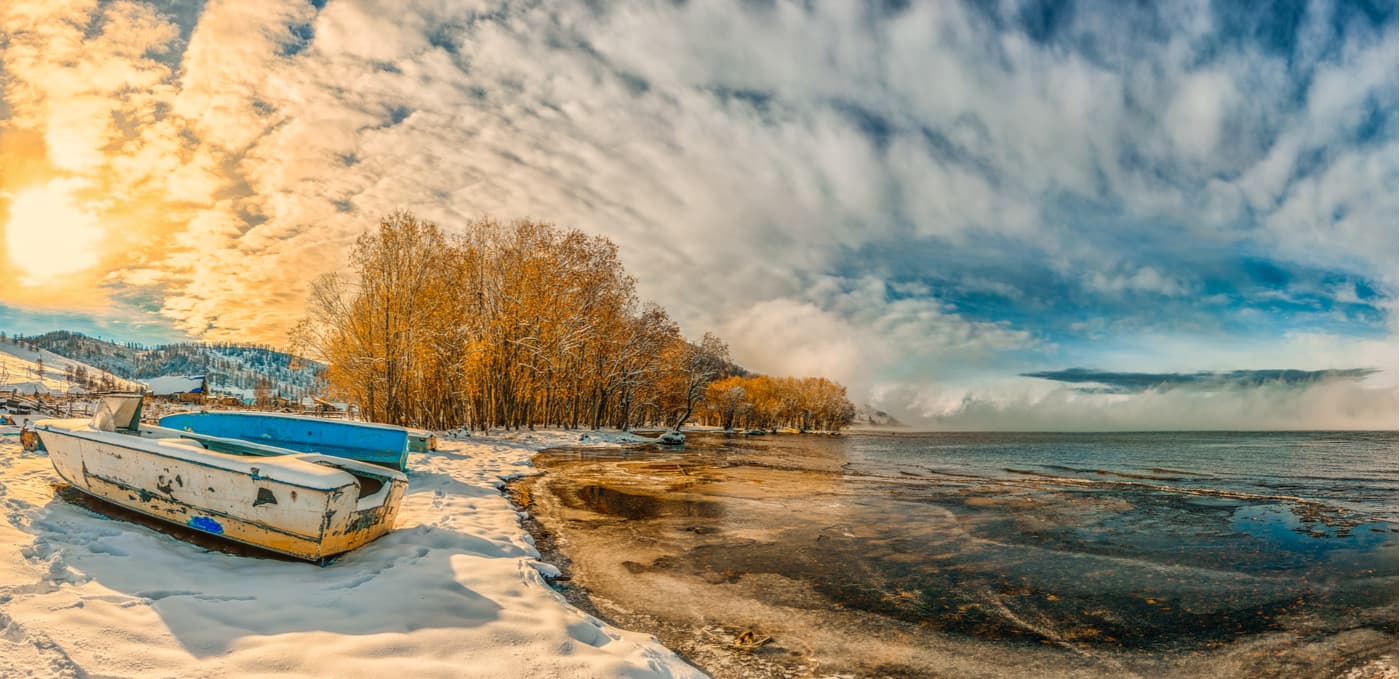
Teletskoye Lake occupies the fifth place in Russia as ranked by the depth. It is also called small Baikal of Western Siberia. Its length is 78 km and maximum depth is 325 m. The area of 223 sq.km, 70 rivers flow into the lake, including the main river Chulyshman. Teletskoye Lake feeds the Biya River, which in its turn is feeding the Ob River with its waters.
Teletskoye Lake fills a narrow hollow of tectonic origin, created by an ancient glacier. Four hundred years ago on the shores of the lake lived tribes that called themselves telets, that's how the name appeared – Teletskoye. The second name was Altyn-Kel aka the Golden Lake. It is explained simply - at sunset ripples on the surface of the lake acquire a shade of precious metal. The purest crystal water allows viewing the bottom of the lake up to 14 meters without any image distortion.
Teletskoe lake is one of the most visited places in the Altai Republic. Vacationers are accommodated in 18 tourist bases and camping sites. The Pioneer Altai motor ship operates regular runs on the lake. From villages at the northern tip of the lake (Artybash, Iogach) during the navigation season boats and smaller motor vessels can go to several local attractions:
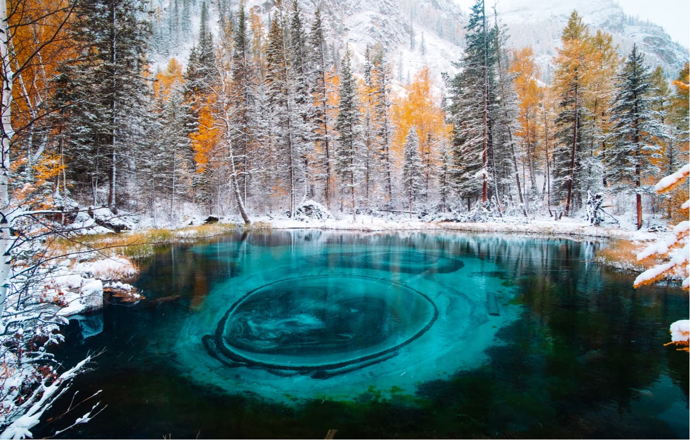
Geyser Lake is another wonder-like water body of the Altai Republic (GPS coordinates 50.289265, 87.667110). A small rounded pond with a 30-meter diameter hides thermal springs in its depths, which eject particles of blue clay and sand in a plume of whitish steam to the surface. As a result, the water is unevenly coloured in the unusual colours of green opal and bright turquoise. The reservoir is also often called Secret, Malachite, Silver, Blue or Geyser Lake.
Khoton Nuur is a freshwater lake in the province of Bayan-Ulgiy, Mongolia. It lies in the Mongolian Altai mountains at an altitude of 2,083.6 m above sea level. Larch forests grow on its western shore. Two rivers flow into the lake, they originate in the glaciers of the Tavan-Bogdo-Ula mountain massif. The Syrgal channel of the lake is connected to Hurghan-Nuur Lake from which originates the Hovd River. The lake has an island with an area of 0.5 sq.km. covered with forest.
The Khoton Nuur is located in the Altai Tavan Bogd National Park and is currently an active tourist destination.
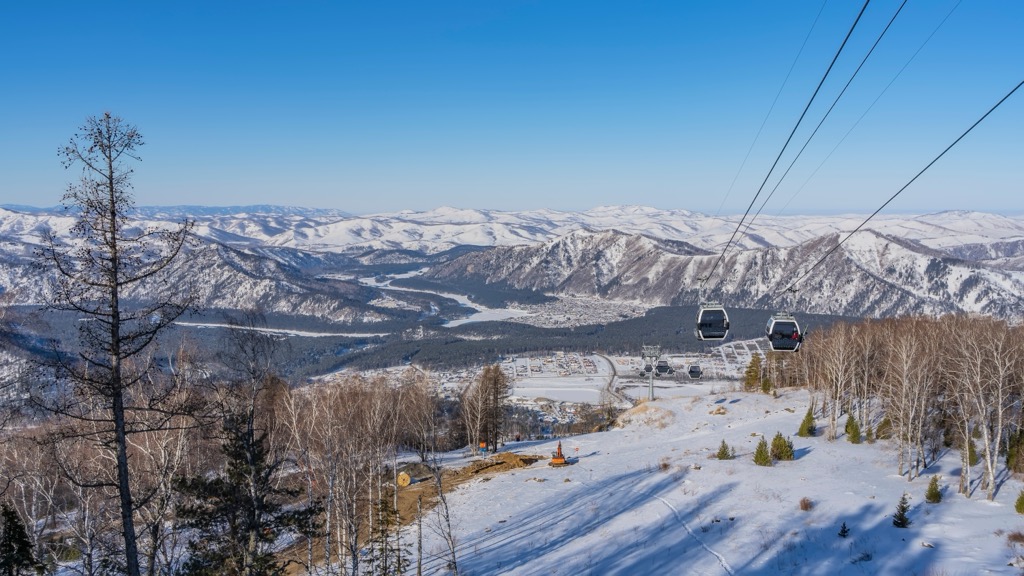
For skiing and snowboarding enthusiasts, there are at least 2 large ski resorts in the Altai Mountains: Manzherok Ski Resort near Gorno-Altaysk in the Altai Republic of Russia with more than 15 km (9 mi) of slopes and more than 3 ski lifts and Koktokay Ski Resort near the namesake Koktokay in Xinjiang province of China with more than 28 km (17 mi) of slopes and more than 3 ski lifts.
Check the Altai ski resorts map on the larger Russia and China ski maps in the World Mountain Lifts section of the site. It includes information about open ski lifts / slopes in the Altai Mountains in real-time with opening dates and hours. There are also year-round cable cars, funiculars, cog railways, aerial tramways, and all other types of mountain lifts.
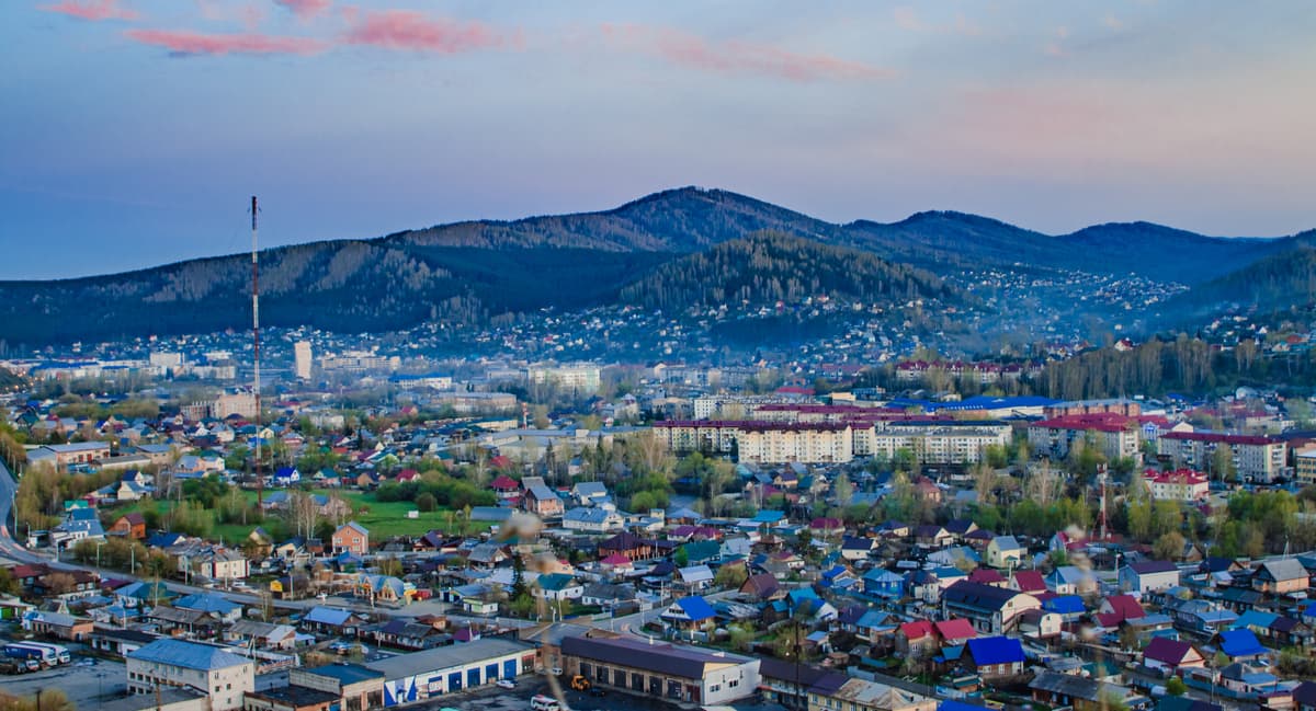
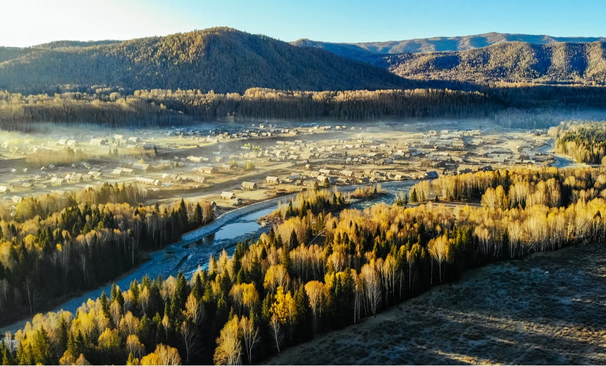
The capital and the only city in the Republic of Altai. Gorno-Altaisk Airport is 6 km west of the center. Should you wish to take a railway road, the closest station is Biysk, 100 km away. The city is located in the northwestern part of the Altai Mountains, in an intermountain basin surrounded by low peaks at an altitude of 270-305 m above sea level, at the confluence of the rivers Ulalushka and Maima which flow into the river Katun about 250 km north of Mount Belukha, the highest point of the Altai and Siberia.
Burchun is a county in Altai District of the Ili-Kazakh Autonomous Region of Xinjiang Uygur Autonomous Region of China. The county is named after the Burchun River flowing through its territory. On the territory of Burchun County there is a landscape tourist zone of Lake Kanas. In recent years, thanks to the development of the tourism industry in Xinjiang Uygur Autonomous Region as a whole, and the increase in the number of tourists visiting the area of Lake Kanas, in particular, the county is developing at a rapid pace, and now its appearance has changed greatly.
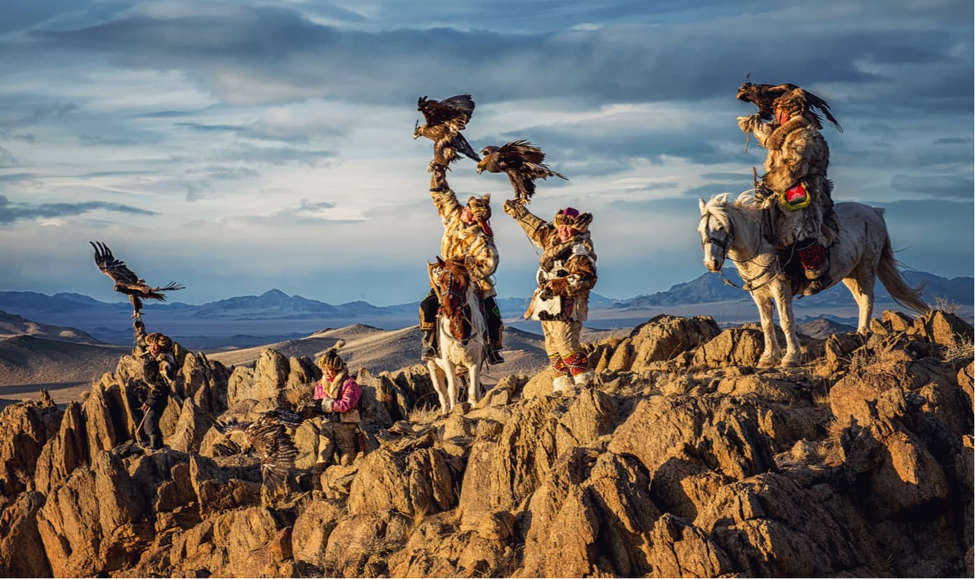
Unlike its neighbours, Mongolia cannot boast of many urbanized areas in the vicinity of the Altai Mountains, which makes it probably even more precious for a true aficionado of nature. Ulgiy is the closest town to the Altai Mountains. There live about 28K residents, the airport services regular flights to Ulan-Bator, Alma-Aty and Ust-Kamenogorsk. There is no public transport in the city, you should hire a taxi or a motorbike.
Ust-Kamenogorsk has a long history starting in August 1720 when the expedition of Ivan M. Likharev arrived in the area. Ust-Kamenogorsk is located in the eastern part of modern Kazakhstan, at the confluence of the Ulba River into the Irtysh River, about 280 km west of Belukha Mountain. This area of the Altai Mountain System is historically called the Ore Altai. Ust-Kamenogorsk is a starting point for traveling through the Altai Mountains.

Major landmarks feature:


The highest peak in the Altai Mountains is Belukha, at 4,509 m.
The Altai Mountains have 2,254 named peaks.


