
Scan the QR code and open PeakVisor on your phone
Tuva is home to 167 named mountains. The highest is Gora Mungun-Tayga at 3,966 m.
Located in the very heart of Asia, Tuva also called Tyva is a rich Siberian region in Russia. It can boast of a variety of natural belts and terrific landscapes. Here reign the centuries-old forests and endless steppes, here tower the snow-capped mountains and flow the mighty rivers, here are the crystal-clear lakes teeming with fish.
Tuva is the land of sacred mountains, most of which have animal names, plenty of ritual sites and very whimsical weather conditions which make travelling in Tuva quite a challenge.
The area is believed to have been populated since the 3rd century BC when the first Turkic nomadic tribes came here. The Tuva land has undergone many changes since those first settlers. In the Middle Ages, the territory was the property of the Uyghur Khaganate, the Kyrgyz Khaganate, and the Mongol Empire. It was also in the possession of Genghis Khan and the Qing Empire of China. By the early 1800s, the formation of the Tuvan ethnos had been completed. After the Xinhai Revolution in China (1911-1912, when China ceased to be a monarchy), the requests for the patronage of the Russian Empire started to come in, as a result of which Tuva voluntarily became a protectorate of Russia under the name of Uriankhai Territory and joined the Yenisei Province. Afterwards, it was renamed several times. It transformed into a republic (don’t get yourself confused, a republic in Russia is not a separate state, it is a constituent part of the Russian Federation, much like any state in the USA or a county in the UK) in 1991, a couple of years later the name Republic of Tuva was assigned to it, and since 2001 the names Tyva and Tuva have been legally equated.
Spread across Central Asia, the Republic of Tuva is a border region of the Russian Federation, bordering Krasnoyarsk Territory and the Republic of Khakassia to the northwest and north, Irkutsk Region and the Republic of Buryatia to the northeast, Mongolia to the south and east and the Republic of Altai to the west. With a total area of 168,604 sq.km., it stretches 420 km from north to south and 630 km from west to east. It includes two urban districts (Kyzyl, the capital of the Republic, and Ak-Dovurak) and 17 municipal districts (the so-called kozhuuns). The urban districts and regions, in their turn, are subdivided into 5 urban settlements and 120 rural settlements (soumons).
As of 2021, the population is 330,327, which is approximately the whole population of Iceland.
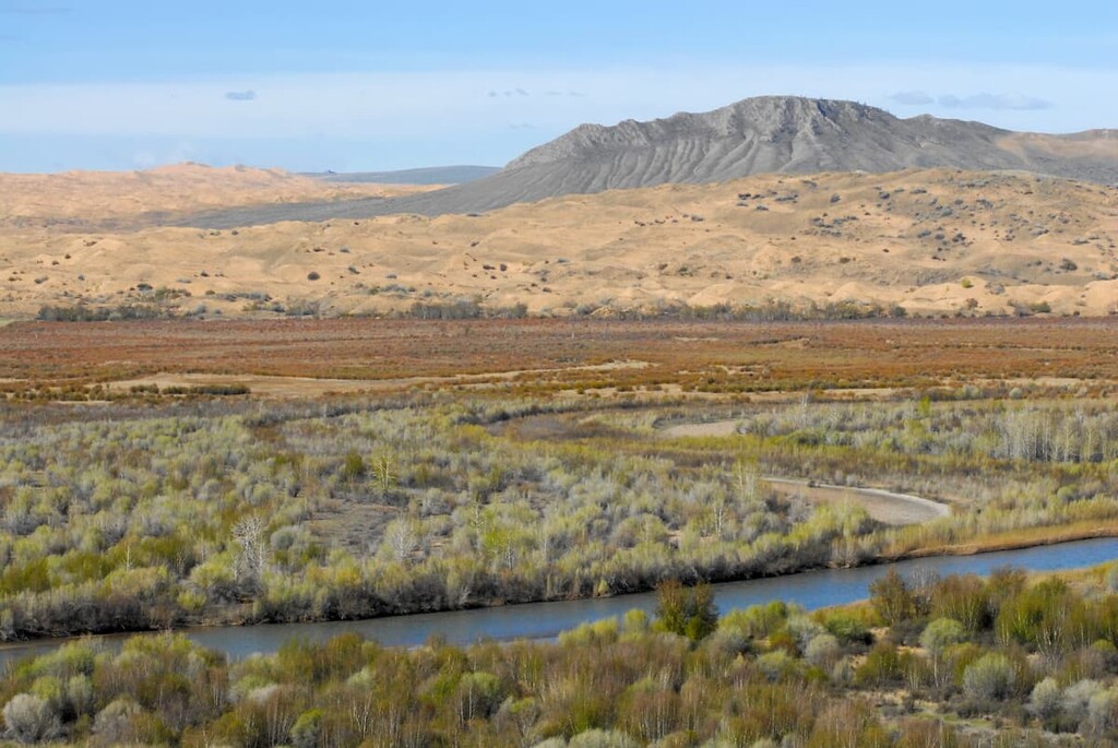
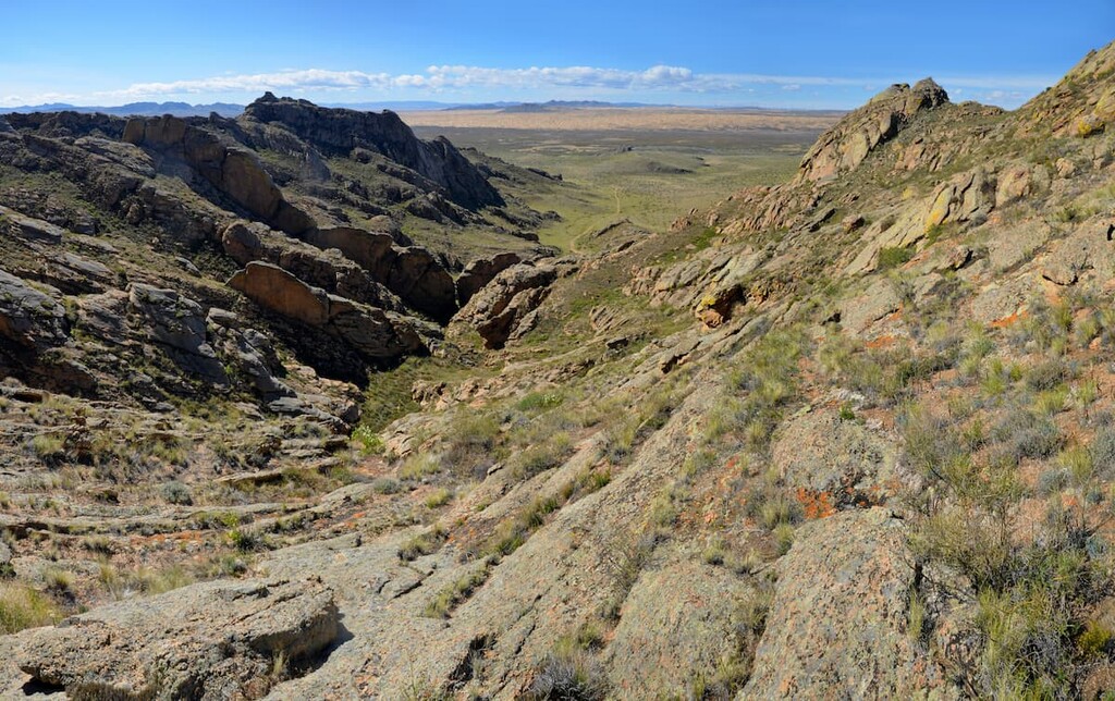
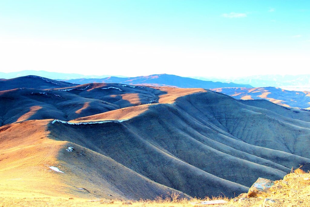
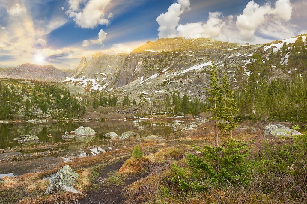
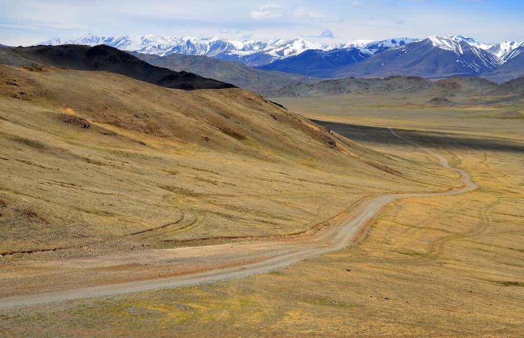
Lying in the midst of mighty mountains and intermountain plains, Tuva enjoys quite varied landscapes. The territory can be roughly divided into two parts:
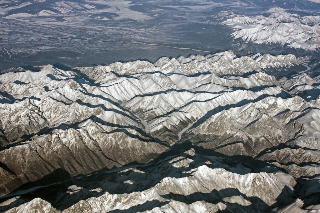
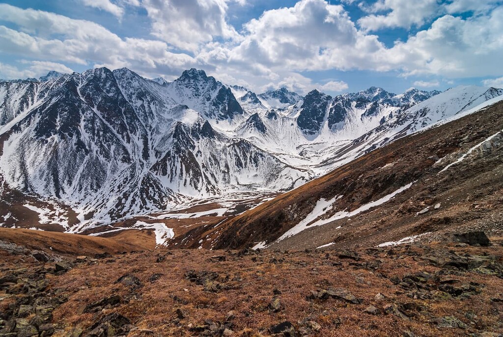
Mountains cover over 80% of the republic's territory, the intermountain basins account for the remaining 20%. There are about 45 majestic mountains with heights exceeding 3,000 metres.
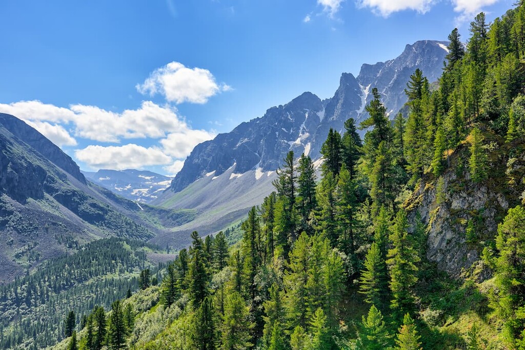
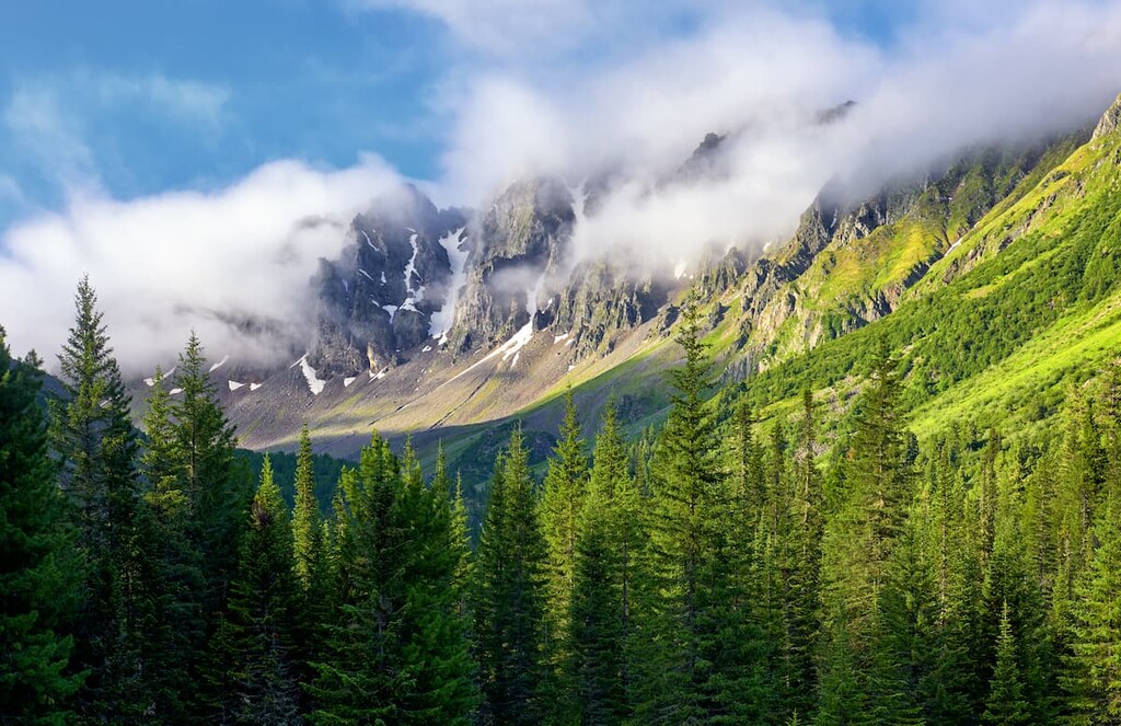
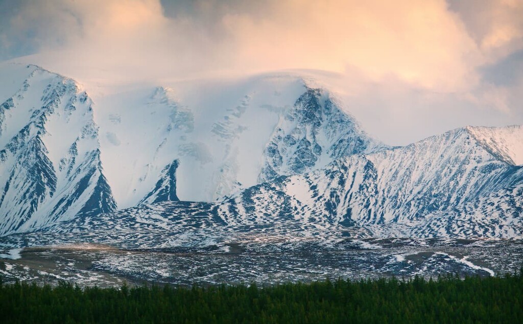
The western part of the Tuva Republic is dominated by the ridges and spurs of the Altai Mountains, with peaks over 3,000m. The highest of these are Mongun-Taiga Peak (3,976m, the highest point in the Eastern Siberia), Ak-Oyuk (3,608m), Mongulek (3,485m) and Kyzyl-Taiga(3,121m). In the north and east of the region, the Sayan Mountains and their spurs feature more modest peaks with the average elevation of 2,000-3,000 m. In the middle part of Tuva, the system of the Akademik Obruchev Ranges meets the East Sayans. Finally, Tuva can boast of 16 extinct volcanoes as well, they are concentrated at the source of the Biy-Khem River on the Derby-Taiga Plateau.
The mountains are still undergoing some formation processes with occasional seismic activities erupting the peace and quiet of the ancient land. Even though you will not see any active volcanic eruptions, earthquakes are rather frequent. The latest happened in February 2021 with the magnitude of 8.7 on the Richter scale, the epicentre being 10 km below the earth surface, which made the surface quakes equal 6.5 points. It is still a considerable tremor, luckily, earthquakes happen in quite remote and unpopulated areas.
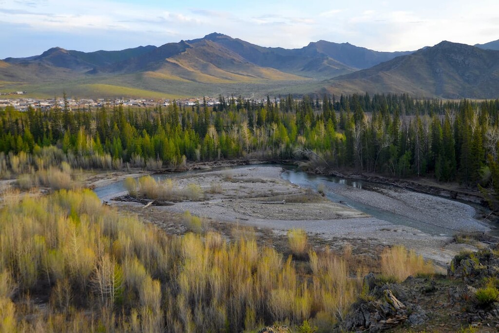
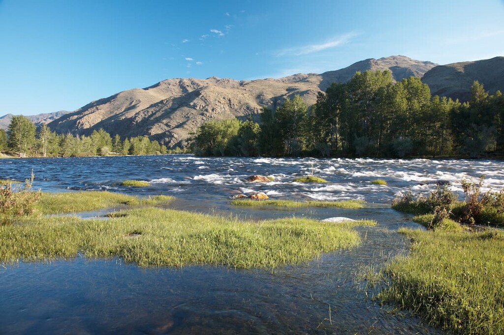
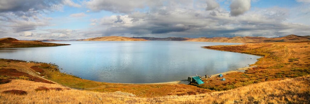
The region is rich in fresh water reservoirs. One of the largest rivers on the planet, the Yenisei (locally called the Ulug-Khem), has its source here. Two main rivers go confluent near Kyzyl, in the Tuva Basin – the Big Yenisei (the Biy-Khem) and the Little Yenisei (the Kaa-Khem). The rivers are mostly fed during the spring-summer snowmelt and the summer rains.
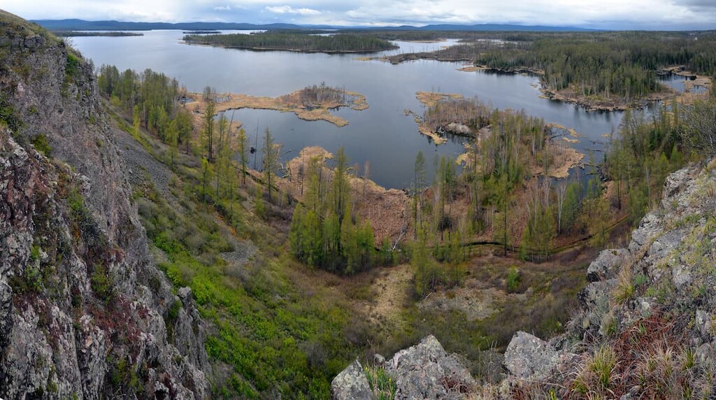
There are about 6,700 large and small lakes, most of them are of glacial origin. Apart from those, Tuva can boast of salty mud lakes and more than 50 mineral springs which can cure many diseases. There is a great variety of underground and mineral waters: carbonic (both cold and thermal), radon, siliceous thermal, sulphide, acidic ferrous, and just healing waters without specific components.
The bizarre co-existence of the East Siberian taiga and Central Asian semi-deserts ensure the staggering richness of flora and fauna.
Most of the territory is covered with forests (about 83% of the area). Conifers are predominant, accounting for 95% of the total forests. There are about 3 million hectares of cedar forests alone, which is 11% of all cedar forests in Russia. The rest of the territory consists of plains and mountain steppes. Preserving forests from illegal logging is currently of utmost importance because there are far too many Chinese sawmills and timber stores found on Tuva lands.
The flora of the region includes about 1,500 species of higher plants, of which 40 species are endemics of Tuva. The task of preserving these unique species makes the republic one of the most promising regions in restoring the gene pool of rare, endangered endemic and relic species of fauna and flora. Medicinal plants successfully used in folk and Tibetan medicine also grow here. In spring, you can see the Rhododendron daurianum (the locals call it rosemary) blooming.
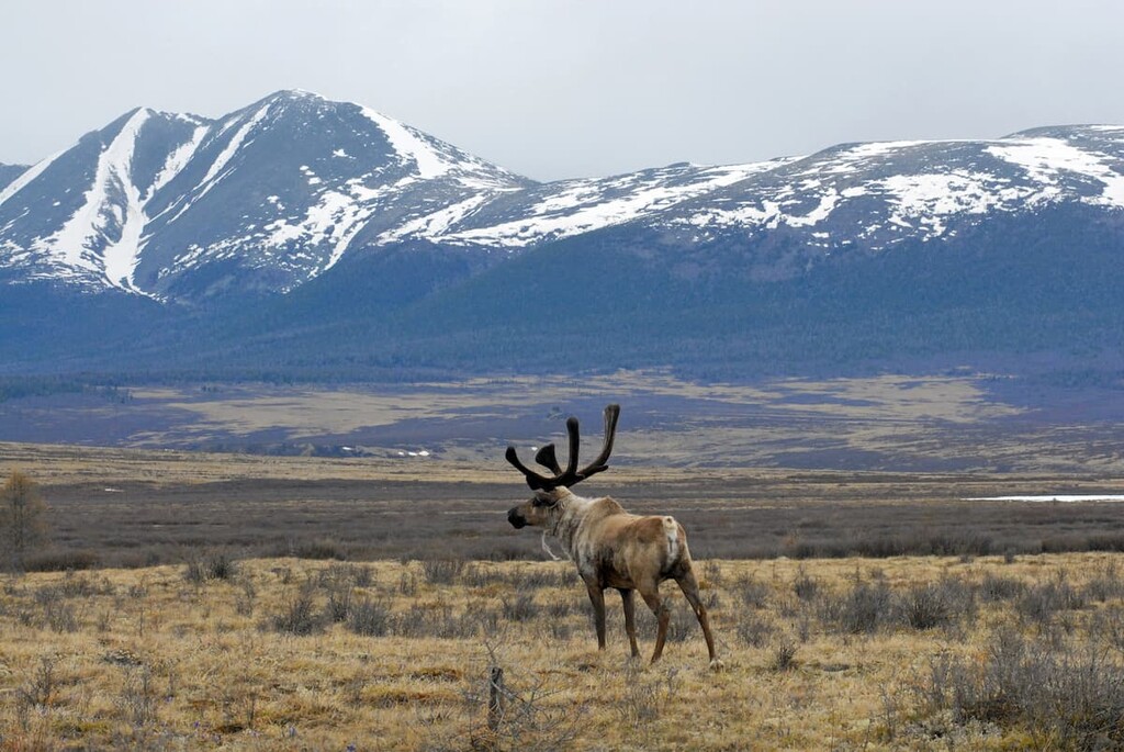
The animal world is also diverse. The snow leopard (Uncia uncia), argali (Ovis ammon ammon), red wolf (Cuon alpinus), forest reindeer (Rangifer tarandus angustifrons), Siberian marmot (Marmota sibirica), marbled polecat (vormela peregusna), manul (Felis manul), black-tailed gazelle aka dzeren (Procapra gutturosa) peacefully roam the lands here. You can also see the squirrel, sable, mink, ermine, muskrat, hare, wild boar, wolf, fox, musk deer, roe deer, lynx, badger, wolverine, brown bear, moose, Siberian stag, etc. Many of the animals are listed in the Red Book of the Russian Federation, the IUCN Red Book and the Red Book of Tuva.
Tuva is home to 85 species of mammals, 351 species of birds, and 7 species of reptiles. There are about 30 species of fish as well. In the Yenisei River basin, you can fish for grayling, Brachymystax lenok (a type of a salmon) and taimen, as well as pike, perch, Siberian roach, ide, bream and whitefish who live in backwaters and oxbow lakes. Lakes are teeming with whitefish, pike, ide, perch, roach, dog-fish, sprat, grayling, and peled. In the Sayano-Shushenskoye Reservoir, such fish as roach, perch, pike, burbot, bream and ide can be found. Lake Ubsu-Nur is home to the Altai sturgeon, which is endemic to the lakes of the Ubsunur Basin and is found nowhere else in the world. Fishing is concentrated mainly in the lakes.
Poaching contributes to the extinction of rare animal species, so the protection of fauna is crucial for the region.
The climate is severely continental due to its remoteness from seas and oceans as well as the high elevation of the territory above sea level. Towering almost like a notorious Wall from the Game of Thrones series, the Tuva mountain ranges isolate any outside influences, due to which the winters are frosty and windless, with little snow in the depressions, and summers are moderately warm. In the Tuva Basin, the average January temperature varies from -30C to -35C (-22F to -31F), in July the average temperature is about +18C/+20 C (64F-68 F).
Winter lasts from November to April. The snow cover is about 15-20 cm in late October and can reach 1-2 meters in the mountains. Snow melts in mid-April, while in the mountains it does not melt until May.
Spring in the region is short and lasts from April to May, but the skies are clear, there is little rainfall and the weather is oftentimes rather windy.
Summers are dry and warm; in the mountains they are shorter and cooler. In the intermountain areas there are even hot days when the temperature can rise above +35C (+95F). The warmest month is July. The average temperature in July in the flat part reaches +20C / +30C (68F to 86F), and in the mountains it is about +13-15C (55F to 59F). Autumn is very sunny and dry and is considered the best time of year. There are return periods of warmth in September, accompanied by a second bloom of herbs in the intermountain depressions.
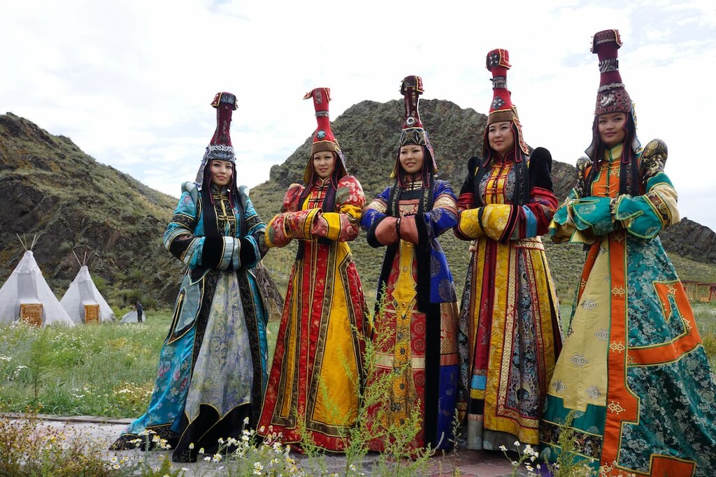
Being rich in historical, cultural and natural heritage, Tuva has unique ethnic culture that has been preserved in architectural monuments, folk crafts, local arts, folklore, and surely, throat singing also known to musicians as overtone chanting. You would never confuse it with any other sound, it is mesmerizingly hypnotic.
Tourist routes in natural reserves are not that abundant if we compare them to the ones in Altai, yet, they can please even the most fastidious traveler. There are more than twenty of them in this small region. The sacred Mount Kezheghe, Mount Haiyrakan, mounds, rivers, lakes, protected trails, forests, sandy deserts and tundra, rare birds and wild animals are all a big part of the region's natural riches.
This mountain is located near the Mongolian border, in the valley of the Tes River, on the territory of Erzinsky district (kozhuun). It is shaped like a not completely closed ring, with a small stream flowing through it. There is another natural wonder like that – a perfect ring mountain called the Kondyor in Khabarovsk Region. The name Kezheghe means the hairstyle of ancient Tuvinians who wore something like braids (male plaits) on their heads. On the outside, Kezheghe resembles an entire stone city, and the high stone clefts resemble mazes.
It is no wonder that many mysteries are associated with the mountain. According to one legend, in the olden days, a hunter of the Soyan family wounded a mountain goat here. While chasing it, he lost the scythe, which is one of the symbols of bravery of the Soyans, which eventually led him to demise in a battle and getting killed. Since then, one must not hunt here, even breaking a twig or picking a flower is forbidden. According to later legends, shrines from Tuva's Buddhist temples, which were destroyed during the Chinese revolution, are hidden here. The ruins of Buddhist temples themselves can be found near Kezheghe. The area is used for rituals; shamans replenish their powers here. The mountain is believed to grant wishes!
Haiyrakan (1,014m) or Khaiyrakan is one of the most revered places in Tuva. This marquee-shaped mount is located 105 km from the city of Kyzyl, between Shagonar town and Khaiyrakan village, on the left bank of the Ulug-Khem River, in the Ulug-Khemsky district and is thus depicted on the district’s coat of arms. In 1992, it was chosen as a very spiritual place blessed by the Dalai Lama XIV. At the foot of Haiyrakan, shamans and Buddhists hold rituals on a regular basis.
There are many versions as to the origin of its name. It is believed that the word Haiyrakan is an obsolete reverential name for the deity, spirit and master of the land, the bear. Externally, the silhouette of the mountain resembles a bear drinking water.
One of the legends tells that long ago the mountain was covered from all sides by taiga. A hunter lived at the foot of the mountain with his old mother, who could actually do some witchcraft. One day, the son went hunting. Whilst following his prey, he was about to take aim at a deer when suddenly a huge bear jumped on him, ripped him apart and dragged him to the den to devour some human meat later. The mother waited for her son for two days, and on the third day, all on pins and needles, she did some witchcraft and found out what had really happened. Being beyond herself with grief, the enraged woman unleashed a thunderstorm on the mountain. The taiga was struck by thunder and lightning, and together with its inhabitants it caught fire. Since then, the mountain has been standing bare, with no vegetation cover, and is now called Khaiyrakan, which means ‘bear’.
Another version of the mountain's name is derived from Mongolian language where 'khaiyrakan' means freestanding mountains with steep slopes and pointed peaks. Many sightseeing tours include a visit to this mountain.
Since Haiyrakan has huge deposits of limestone (approximately 400-500 mln tonnes), there is a nice old limekiln on the western slope of the mount.
Even though Haiyrakan looks rather bare with only modest shrubs and bushes growing closer to its foot, it is a beautiful sight to behold, its cliffs are steep, there are numerous caves and grottoes and even a small waterfall here. In early spring, buttercups and rosemary bloom and the rocks turn purple. In summer, everything is scorched by the sun, only grey feather-grass bends its head to the gusts of wind.
There are actually three mountains with the same name Haiyrakan - besides Ulug-Khem Haiyrakan, there is Haiyrakan in Tes-Khem and in Erzin. Yet, only the Ulug-Khem Haiyrakan is sacred and called the ‘celestial bear’.
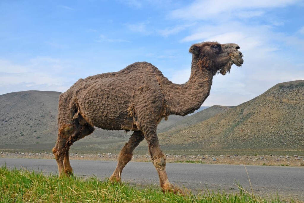
In the north-west of the Ulug-Khem Basin rises Buura Mountain. Buura is Tuvan for camel, the largest animal in the republic. The name Buura is a reflection of the local population's respect for the mountain's majesty. Its outline really does resemble a reclining camel. In mid-June, when the weather in the Ulug-Khem Basin is scorchingly hot, Buura is still covered in snow. Buura, as the locals believe, predicts the weather. Experienced gardeners, before planting tomatoes, will surely turn their eyes to Buura peak for the favourable planting days. In autumn, the mountain is the first to be covered in snow, which means it's time for harvesting.
There is a peculiar site here. You can see a stele, or a kind of a pylon (called locally kozhee) in the form of a white-headed stone woman with a large stone on the top of the pylon. It is said that the stone is special. If you drop it, the next day it's there again. It comes back on its own.
According to Tuvan legends, Buura Mountain is considered the saviour of the human race. One of the legends seems reminiscent of the notorious Noah’s saga. It tells about the global flood which submerged all the lands in water. Only Buura stayed dry. People were trying to escape on rafts. One of the rafts was moored to Buura. When the water receded, it turned out that all people had died but for those whose raft managed to stay on top of the mountain. That is how the people ended up there, and from them the human race descended. And it is said that the demir-sal, i.e. the "iron raft", still lies on the mountain top but it cannot be seen since it has been swamped during storms and covered with sand.
Mount Doghee (1,004m) is located near Kyzyl and, like most mountains in Tuva, has a sacred significance for the locals. The word ‘doghee’ is derived from the Tuvan word "døgheelenir", which means "to lie down". In the past, sheep and goats used to lie at the foot of the mountain and laze in the sun after eating. Tourists and pilgrims climb to the top of the mountain, there are many ovaas (the so-called pyramids made of stones) along the trail.
Doghee has now also begun to gain fame as the main Buddhist shrine in Tuva. On the slope of the south-western ridge of the mountain is a white inscription - the mantra Om mani padme hum. It is 120 metres long and 20 metres wide. The mantra was made from stone and painted with white paint with the help of the Kamba Lama of Tuva, the Tibetan Gyudmed Monastery, and the Enerele Public Foundation. Buddhists believe that it gives a harmonious existence to all living beings in the area. Every year on New Year's Day (according to the Oriental calendar), Tuvan men climb the southern saddle of the mountain Doghee, organize the "San Salyry" rite and meet the first rays of the sun there. A statue of the Buddha, who is designed to sit on a lotus flower like on a throne, has been under construction at the top of the mountain since 2011.
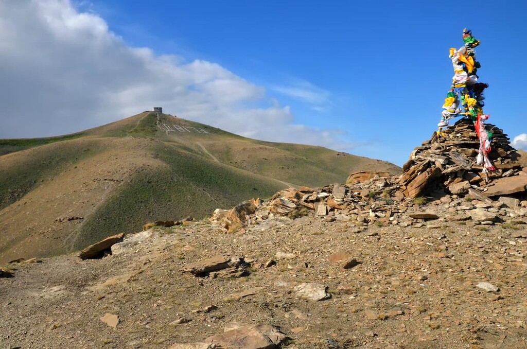
The top of the mountain is a place of communication with the spirits. Here one can also see stone pyramids with a pole in the centre (owaa), silk strips of cloth, scarves and ribbons decorating the bushes, and bonfires of sacred fires (san).
Kyzyl-Taiga (3,121m) is a sacred mountain in Tuva, the highest mountain peak in the Western Sayan Range. The name of the mountain comes from a Tuvan word kyzyl - red and taiga - a mountain covered with forest.
Kyzyl-Taiga Mountain is located at the headwaters of the Ak-Sug River, south of the Main (Vodorazdelnyi) Range. The mountain is composed of metamorphosed sandstones, siltstones and conglomerates, with traces of glaciation, which means there are plenty of karst formations and troughs which make walking on this mountain rather treacherous. The vegetation on the slopes includes such species as spoonberry poppy and Siberian larch.
Bai-Taiga (3,128m) is part of the Alash plateau located in the western part of Tuva in the Barun-Khemchuksky district. The word Bai-Taiga means "Rich Mountain". Indeed, Bai-Taiga contains rich deposits of coloured agalmatolite, which the Tuvinians call "Chonar Dash" - a stone that can be cut. Sculptures and figures made of this stone have made Tuva famous.
Bai-Taiga is also shrouded in legends and many traditions are connected with it. At any time of the year, the mountain is covered with clouds and fog, clear weather spells are very rare. On its summit, snow storms often form kind of swirls and funnels which the local shamans believe to be nothing less than a gate connecting our world with the cosmos.
Old men say that on the top of the mountain dwells a Spirit, the Master of All Tuva, who does not allow any man to reach the peak. Inceed, so far, no one has ever been able to climb to the top of the mountain. They say that when one approaches the mountain, a force pulls one away from the ground and carries the brave man to unknown lands. That is why people steer clear from climbing to the top, and pray to the sacred Bai-Taiga at the foot of the mountain. The ancestors knew that as soon as a person committed a worshipping service to this sacred mountain, he would immediately receive the favour of the great spirit, he would also be able to purify himself of negative energy and be cured of all diseases.
At the foot of Bai-Taiga's, beneath the sheer cliffs, lies Green Lake - Nogaan Hol, which is considered a healing and shamanic place of power, endowed with a special energy. Being near the lake, one may witness a unique physical phenomenon - the water in the lake strangely flows upwards on the mountain. This may be due to particularities of moving the air masses due to significant differences in atmospheric pressure. There is a powerful flow of air which is forced to the upper layers of the atmosphere at a very low pressure.
The Eastern Tuva Plateau is a highland in eastern Tuva, mostly located in the interfluve of the lower reaches of the Big and Little Yenisei rivers. The plateau consists of several mountain ranges (the average height is 1500-1600 m, the maximum height is 2,895 m in the Akademik Obruchev Range), which are separated by numerous depressions and troughs.
The Sangilen (Sengilyon) is a plateau in the south-eastern part of Tyva. It serves as a watershed between the rivers of the Little Yenisei and Tes-Khem.
The plateau stretches from west to east for 230 km, and its maximum width reaches 120 km. Its maximum height is 3,276 m. The peaks vary in shape from plateau-like to jagged ones in the areas of ancient glaciation. The Sangilen is home to snow leopards, that is why WWF is currently mounting a wide network of trail cameras to do the research on this very elusive and rare beast.
The northern slopes of the Sangilen Plateau are covered with pine-larch forests; in the central and southern parts incised by deep valleys woody vegetation is predominant; the slopes are covered with steppes which turn to mountain meadows and tundra at 1800-2000m a.s.l. There are deposits of ferruginous quartzite, nepheline, graphite and gold here.
The East Sayan Range covers the northeast of Tuva as well as the southeast of Krasnoyarsk Territory, west of Buryatia, southwest of the Irkutsk Region, and north of Mongolia (north of Khuvsgel Aimag). It stretches from north-west to south-east for over 1,000 km, from from the right bank of the Yenisei to Lake Baikal. Together with the West Sayan Range, it forms the Sayan Mountains. It adjoins the south-western edge of the Siberian Platform. The highest peak is Munku-Sardyk (3,491m) located in Buryatia.
The East Sayan Range is a true challenge for travellers, the range is prone to avalanches and it is hard to traverse it by four-wheelers.
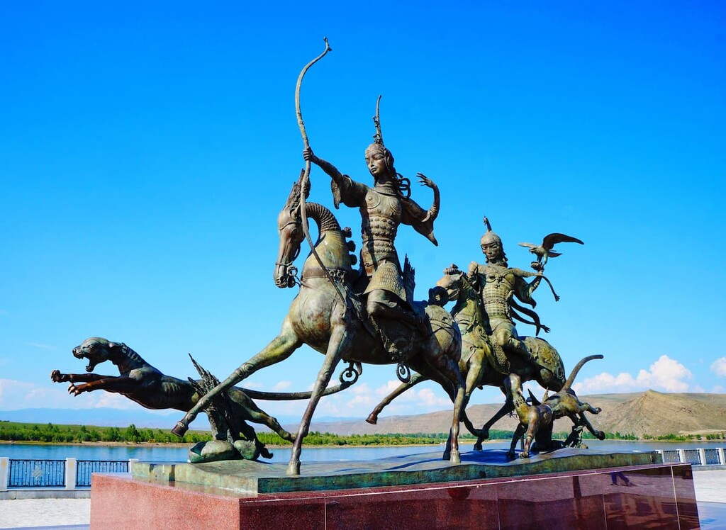
Another landmark connected with rituals is the massive stone statues located in the Barun-Khemchiksky Kozhuun. They represent warriors of ancient Turkic origin, holding ritual vessels in their hands. There are about 200 such samples of ancient sculpture in the area. The most revered of them are the objects of worship. The most famous statue is situated at the foot of the Bijiktig-Hai mountain range. Scientists estimate that this statue is about 1200 years old.
One of the main natural attractions in Tuva is the Ubsunur Basin Biosphere State Reserve. It has been included in the UNESCO World Heritage List. The unique reserve accommodates alpine meadows, tundra, taiga, glaciers and other landscapes found in temperate latitudes. Here towers the majestic Mongun-Taiga Mountain, whose name means ‘Silver Mountain’ in Tuvan language. The glacial dome atop the massif turns really silvery in the sunlight. Strong winds blow here permanently and blow relentlessly. The locals consider the mountain sacred and believe it is forbidden to climb. But it is an utmost temptation for trekkers and climbers. Several routes of varying difficulty lead to its summit.
At the eastern foot of the mountain lies Lake Hindiktig-Hol, the name translates as ‘a belly-button lake’. It is an enormous body of water with high shores and crystal clear water of glacial origin. The mountain lake is situated at an altitude of 2,305 m above sea level, and has two mountainous islets in its centre, which gave it its funny name.
The territory of the Reserve is of great interest for historians and archaeologists, there are burial mounds of the tribes who roamed Tuva lands in the distant past. Scientists estimate that there are not just thousands but several thousands of untouched burial mounds.
In the north-east of the Republic, there is another nature reserve, called the Azas. It attracts tourists with its rich fauna, awesome picture-quality-like lakes and picturesque mountain ranges. The Todjinskaya Basin located in the Azas is home to fur-bearing animals, rare species of animals included in the Red Book. The lakes are rich in fish.
Natural attractions of the region include healing springs, mineral lakes and therapeutic mud tubs.
More than four hundred fresh and salt lakes are known in Tuva, the most famous are the Azas, Beloye, Tere-Hol, Tore-Hol, Khadyn, Dus-Khol (Svatikovo), Chagytay, Sim-sim and Erzin. Tuvan lakes included in the Great Lakes Basin. Some of the lakes have salubrious mineralised water, and the mud from their beds is used to treat a whole range of diseases. Most popular among tourists and the locals are lakes Dus-Khol (translated as 'salt lake'), Khadyn (Tuvan for 'birch') and Tore-Khol (translated as ‘stirrup’, which corresponds to its shape). On the shores of salt lake Chedyr, there is therapeutic mud found in abundance. The Tuvinian lakes also offer a wide range of tourism opportunities: fishing, swimming, boating. On the shores of some of the lakes there are camping sites and campsites.
There are over 50 mineral springs, or arjaans, the name is translated from Tuvan language as holy water, mineral water, healing spring. Among them, there are carbonaceous and hydrogen sulphide, salty and sour, radon, arsenic, iron, iodine and bromine, and other mineral waters. The most popular springs are the Shiviling, Bai-Taiga, Kok-Teisky and Tarys springs.
It is common practice here to divide arjaans into two groups: mineral and fresh water springs. There are over twenty medicinal springs in the Arzhan-Khem district. The springs are well equipped with bathing facilities for tourists and other modern conveniences. One of them is the Kundustug arjaan (translated as "beavers"). It is located 2 km from Kyzyl. According to a legend, people learnt about the springs from beavers that used to come here to drink water. Actually, the Kundustug Springs feature more than 20 different streams and small springs here. Some water collects in small natural and man-made bowls, some water flows freely and gets dispersed. Each stream cures a particular disease. So travellers usually try the water from all the streams that they can reach.
Other large springs are the Ush-Beldir (Northern Arjaan) and Tarys (Southern Arjaan) hot springs, located in the mountains of eastern Tuva on the Academic Obruchev Range.
The cultural heritage of the Tuva Republic includes the Por-Bazhin fortress, Ustuuu-Khure monastery, Mugur-Sargol sanctuaries, the Aldyn-Bulak ethno-complex and others.
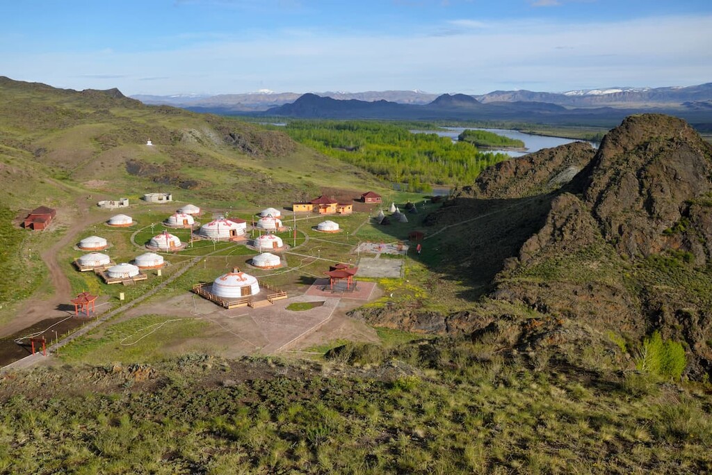
The Aldyn-Bulak ethno-cultural complex is located on the bank of the Yenisei River, 45 km west of Kyzyl. The name translated from the Tuvan language means ‘Golden Spring’. The complex is designed as a model of the Universe and symbolises the movement of planets in the galaxy. The yurts represent the sun and the planets. These constructions reflect the ethnic identity of Tuva.
There are 2 nature reserves, 16 wildlife sanctuaries and 14 natural monuments in the Republic of Tuva. Not only mountains, forests and their inhabitants, but also water areas (lakes, rivers, marshes) are protected.
Both nature reserves – the Ubsunur Basin and the Azas Nature Reserve – provide tourists with accommodation on their territory and organize guided excursions. You can take the routes only with the permission of the administration of the reserves. The Ubsunur Basin belongs to protected areas not only in Russia but also in Mongolia (Ubsu-Nur Lake area).
The main arrival point is Kyzyl, the capital of Tuva. You can fly from Moscow, Krasnoyarsk, Novosibirsk and Irkutsk to Kyzyl Airport, located in the southern part of the republic's capital. Or you can fly to Krasnoyarsk or Novosibirsk. From there, you can get to Kyzyl by intercity buses.
You can also take a train to Abakan. From there, you can also take a bus or a taxi to Kyzyl.
Mind you, Tuva is a border territory, there is a 5-kilometre strip of land along the state border between Russia and Mongolia. The border zones include such settlements as Solchur, Sagly, Khandagaiti, Chaa-Sur and Kachyk and public recreation areas, including Lake Tore-Khol. The up-to-date list of settlements can be checked with the Border Guards. If you are planning to visit the border area, you will need to obtain a permit in advance.
The permanent capital of the Tuva Republic, Kyzyl was founded in 1914 and bore the name Belotsarsk ('White Tsar', as the residents of the East called the Moscow Tsar). The word ‘Kyzyl’ means ’red’ in the language of the natives. Five years later, it was almost completely destroyed by a terrible fire. But Kyzyl was rebuilt. During the Soviet era, here appeared some mining businesses and later, schools and universities. Today it is the cultural and administrative centre of the region, with its own distinctive landmarks.
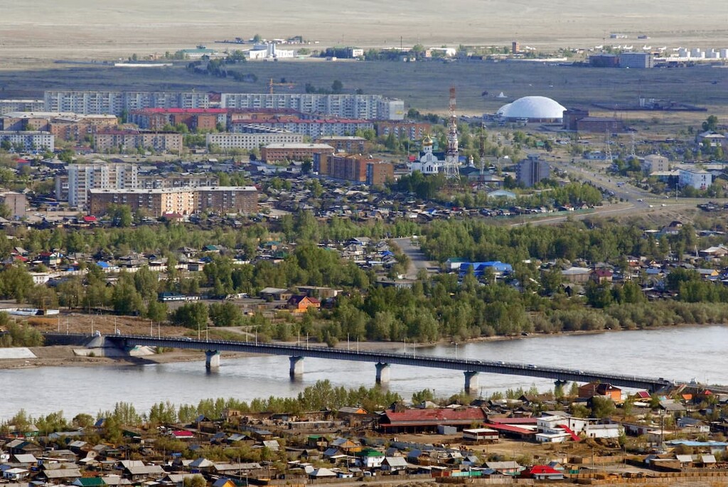
When you start exploring the city, it's a good idea to visit the Visitor Centre at the National Museum. Here, visitors can obtain information about attractions and tourist services, choose their favourite excursion tours, use the services of interpreter guides, and make hotel reservations. The National Museum has a unique collection of ancient Scythian artefacts found in the Valley of the Kings. The collection of shamanic paraphernalia is of great interest as well.
Speaking of the local museums, they have a distinctive character, they often host interesting thematic exhibitions that differ from their standard local history counterparts. There is also the Museum of the History of Political Repression and Nadia Rusheva’s Museum. Nadia was the first artist whose work was shown from outer space. And in 1993, a discovered planet was named after her.
Cultural enthusiasts might enjoy visiting the Philharmonic Hall, the National Musical and Drama Theatre, and the Tuva State Puppet Theatre.
There are several landmarks that represent the cultural heritage not only of the city, but of the entire republic. Every tour of the city usually begins with them.
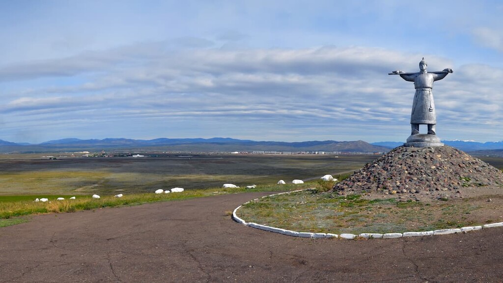
The Kadarchi Monument is situated opposite the city airport. It is considered a symbol of the whole republic. It is a sculpture of a shepherd dressed in national costume, leaning on a staff (a kind of a shepherd’s walking stick). Next to it, there are scattered white stones, which according to the sculptor's plan represent a flock of sheep. The monument is easy to reach: it is located at the 9th kilometre of the highway that leads from the town to Erzin.
The Centre of Asia Needle is a sculpture mounted in 1964 in Central Asia Square. Oriental dragons hold a globe on their backs. Above the globe with the contours of the continents rises a spire, which is 10 meters high. This spire depicts animals from the Buddhist horoscope.
The prayer drum in Kyzyl is considered to be the largest in Russia. The drum weighs almost a hundred kilograms. It is decorated with hieroglyphs and a peculiar ornament. Inside the drum are the scrolls of mantras. The relic was donated to the city by Buddhist monks from the Gyudmed monastery in India. To protect the prayer drum from bad weather, a special pagoda was built over it according to the rules of Feng Shui. A request to Buddha can be made by rotating the drum. It is located in Lenin Street, not far from the post office, on the square in front of the Music and Drama Theatre.
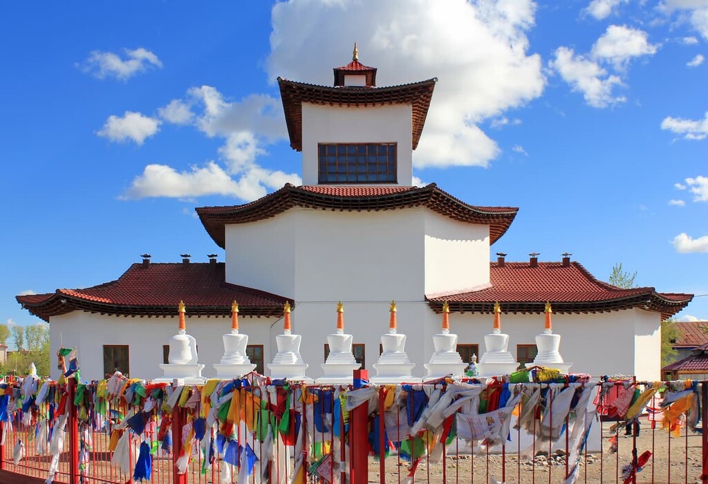
The Tsechenling Temple is one of the main Buddhist attractions in Kyzyl. It consists of two floors: the ground floor is the residence hall and the first floor is meant for prayers. Inside, there are classes on spiritual practices and languages (attendance is free, donations are welcome). From the outside, the corners of the building look more worn out, which is not surprising, since tradition dictates that you walk around the temple in a circle, touching its corners in the process.


Yes. Tuva has 167 named mountains. The highest is Gora Mungun-Tayga at 3,966 m.
The highest mountain in Tuva is Gora Mungun-Tayga, at 3,966 m.
Tuva has 167 named mountains.


