
Scan the QR code and open PeakVisor on your phone
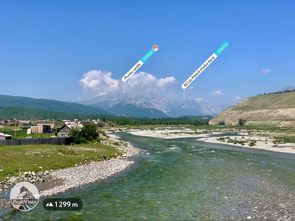
Buryatia is home to 774 named mountains. The highest is Munku-sardik at 3,491 m.
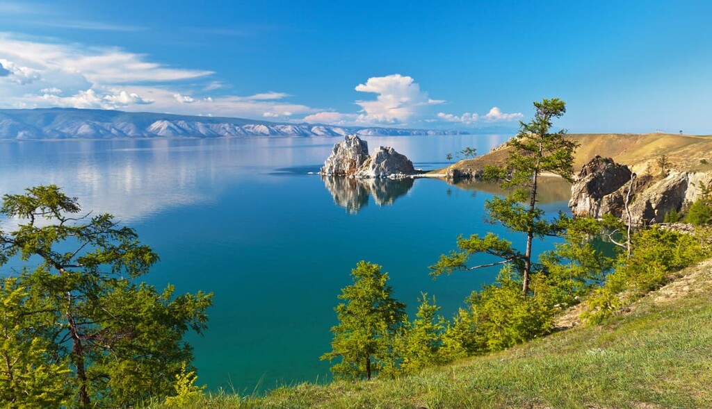
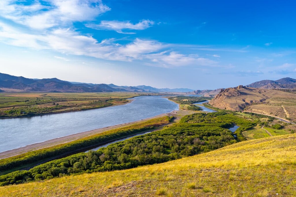
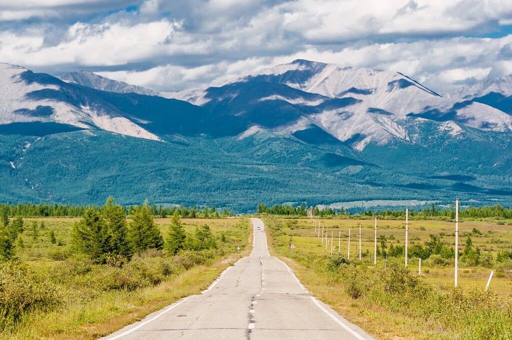
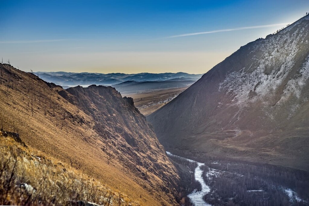
The land of inhospitable mountains and vast wild steppes, the Republic of Buryatia aka Buryat Republic belongs to the mountainous regions of the Eastern Siberia. Its territory adjoins the shores of the famous Lake Baikal, the deepest freshwater lake in the world. The region borders on the Republic of Tuva (Tyva), Transbaikal Territory, Irkutsk Region and Mongolia.
From prehistoric times dating as far back as the first stage of human development, the territory of modern Buryatia was already inhabited and had primitive settlement sites, which is confirmed by numerous archaeological findings. This was followed by a long centuries-long nomadic existence. Scientists are inclined to believe that the nomadic tribes of the Huns came to Europe from the very places where Buryatia is now located. In the 18th century the territory with its many ethnic groups was annexed to the Russian Empire. The Republic of Buryatia is officially considered to be established in 1923. At present, it is a constituent entity of the Russian Federation and a part of the Far Eastern Federal District with its administrative and cultural centre in the city of Ulan-Ude.
The territory of Buryatia is 351,334 sq.km. and includes 21 municipal districts, 2 urban districts, 263 urban and rural settlements. The population is 986,132 (as of 2021).
Massive mountain ranges traverse almost the entire territory of Buryatia. Lowlands are only to be found near rivers and in the valleys between the mountains.

Due to its considerable elevation, the region has a very low average atmospheric pressure. Lake Baikal has the lowest elevation at 456 m a.s.l., and the highest point of Buryatia is the glacier-covered Munku-Sardyk Mountain (3,491 m) located in the Eastern Sayan Range. The high ridges of the Baikal Mountains adjoin Lake Baikal. They include the Eastern Sayan Highlands which rise more than 2,500-3,000 m in their central part. Permafrost has spread over the entire northern Baikal region.
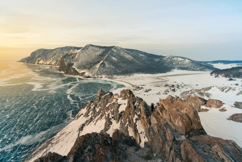
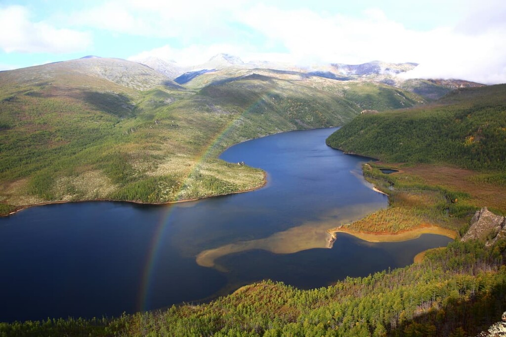
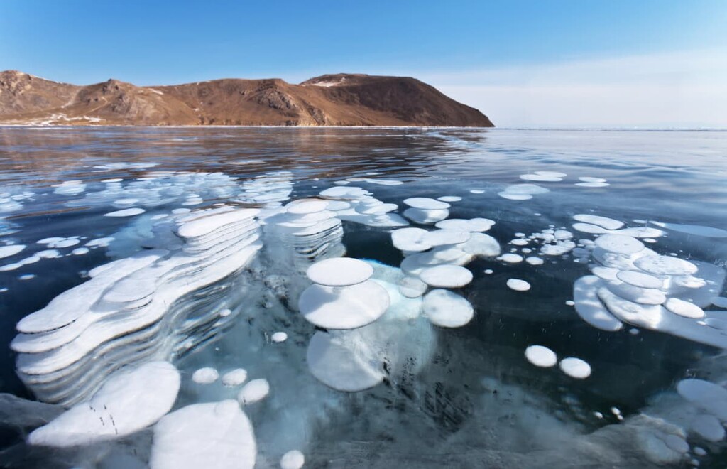
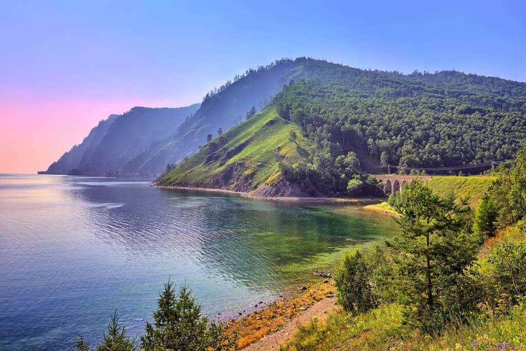
Lake Baikal is an ultimate must-visit on any traveller’s wish list. Most of it, about 60% of the shoreline to be exact, is located on the territory of Buryatia. Its maximum depth is 1,637 m and the average depth is 730 m. The lake is a natural reservoir of one fifth of the world's fresh water reserves of very high quality!
Home to the fabulous Lake Baikal, Buryatia can also boast of around 30,000 lakes and about 35,000 rivers. The most significant lakes besides the Baikal are the Gusinoye (Goose Lake), Bolshoye (Big Lake) Yeravnoye, Little Yeravnoye and Baunt.
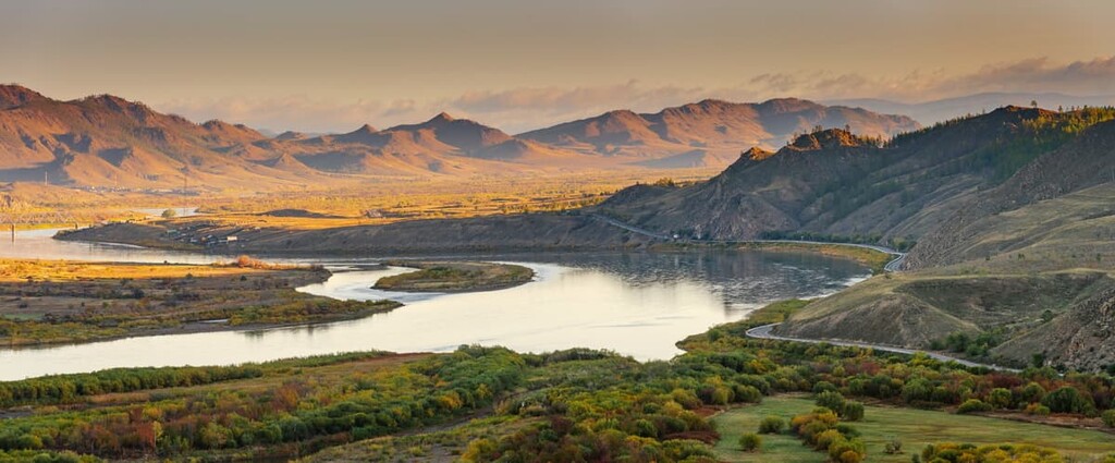
Local rivers belong to three large water basins: Lake Baikal, the Lena and the Angara. More than 99% of the rivers are small (less than 200 km long) and only 25 of them are large and medium-sized. Major rivers that replenish Baikal's water area are the Upper Angara, the Selenga and the Barguzin.
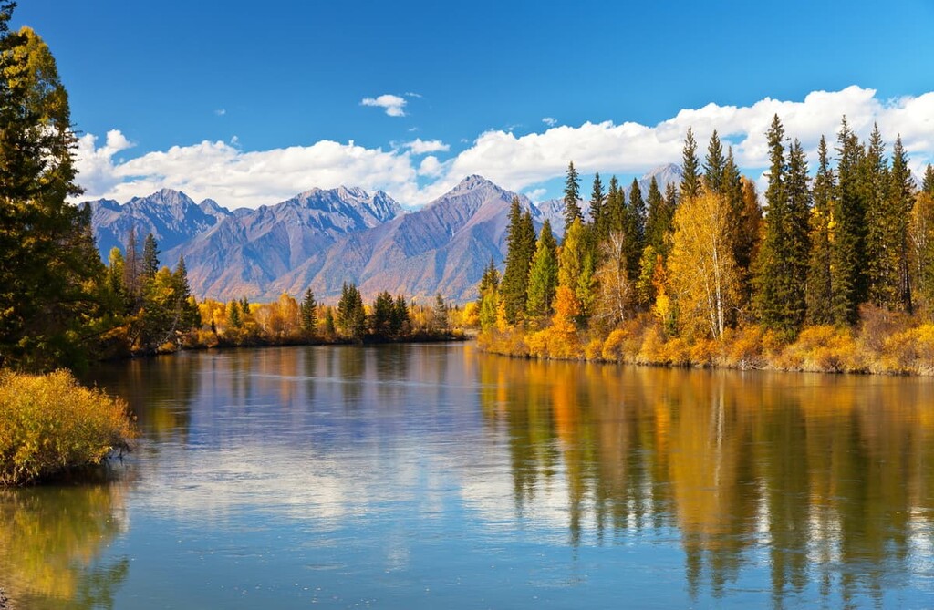
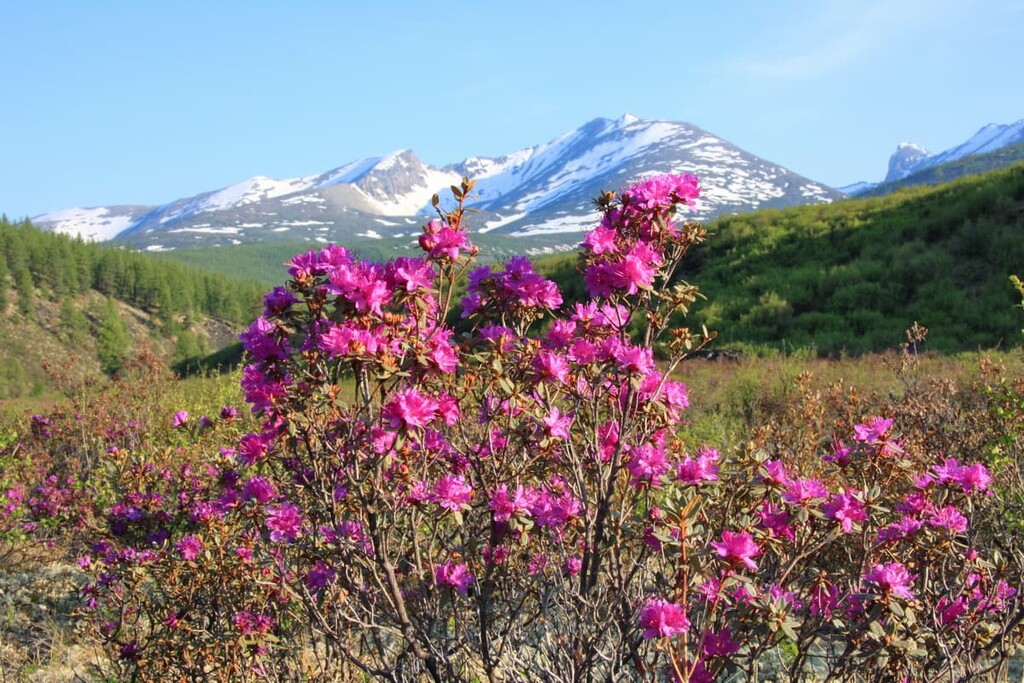
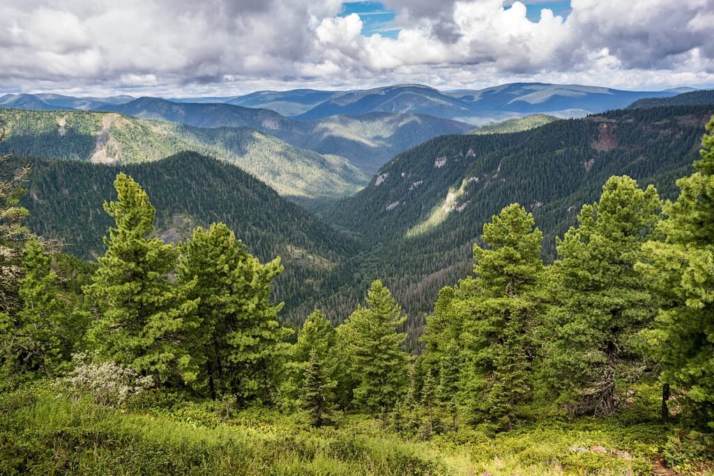
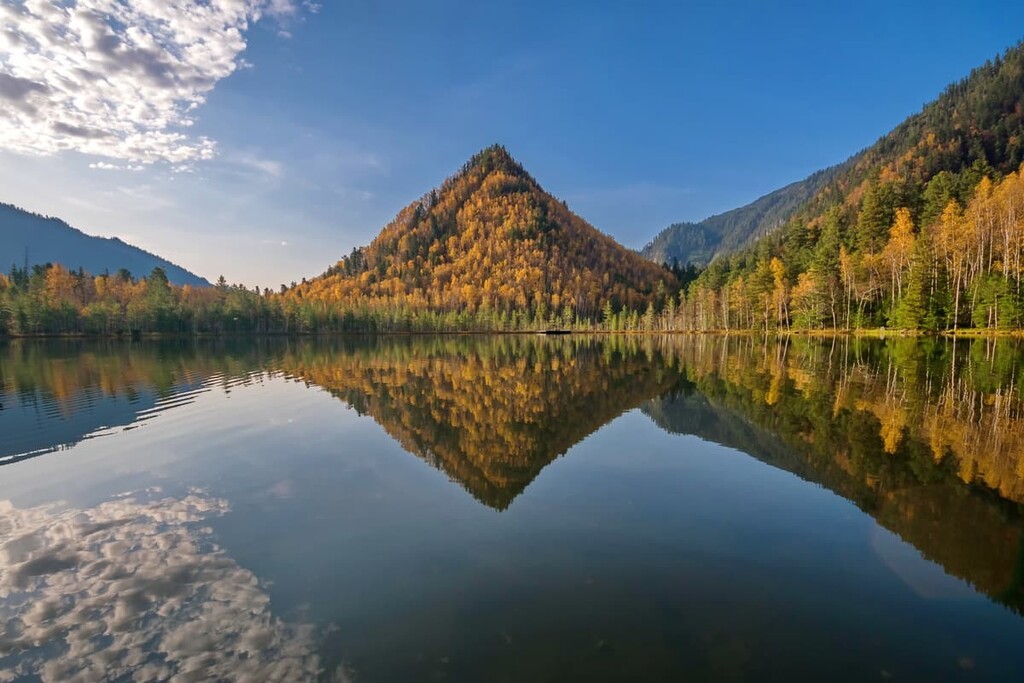
The natural resources of the region are unique and varied. Dense forests, wide steppes and river valleys are rich in grasses, berries and nuts. Forests occupy 83% of the territory and usually feature both deciduous and coniferous trees. The lavish green mantle is home to Siberian larch, birch, pine, cedar, spruce, fir, aspen and poplar. Medicinal plants growing here such as hawthorn, rhododendron, Ural licorice, thyme, Arctic root (aka Snowdon rose, or Rhodiola rosea), celandine, golden banner (Thermopsis lanceolata) are successfully used in folk and Tibetan medicine.
Speaking of beautiful flowers, the rhododendron shrub is not as simple as it looks. It goes by many names: wild rosemary, shaman tea, Buryat ginseng, white wing, sagan-dail (sagandail). It is not as widely known as its counterparts from the range of healing herbs, but its help is invaluable. There are many legends about its effects on the human body. Tibetan sages say that sagandail decoction prolongs life. In Buryatia, this tea is brewed and drunk by local shamans. Anyway, the local rhododendron is believed to be an excellent refreshment for long journeys.
The animal world of Buryatia is constantly changing, not only quantitatively but also qualitatively. Some species disappear or are on the verge of extinction, while others appear and settle in the local expanses. The forests are inhabited by bear, fox, hare, lynx, roe deer, musk deer, elk, wild boar, squirrel, marten, sable, muskrat, musk deer, wolverine, Siberian weasel and many others. Mountain goats and wild reindeer take fancy to the mountain slopes. There are many rare species which are included in the Red Book. There are 446 species of terrestrial vertebrates, 85 species of mammals, 7 species of reptiles and 348 species of birds.
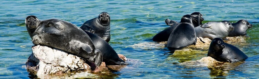
The richness of Lake Baikal and its surrounding area deserves special mention. There are about 2,500 different species of animals and fish, of which 250 are endemics. Some of the fish are included in the Red Book of Russia and Buryatia: the Baikal sturgeon, taimen, Frolikh char (Salvelinus alpinus erythrinus), white Baikal grayling and tench (Tinca tinca). Of interest are the Baikal cisco (Coregonus auiumnalis migratorius), a commercial fish of the salmon family, as well as the Baikal oilfish, a transparent fish without scales and fish-maw, this fish is a livebearer. The only mammal living in the lake is the Baikal seal. Zoologists are still arguing about its mysterious appearance in these parts. The main habitat of this eared seal (Pusa Sibirica) on Lake Baikal is Ushkansky Island and the Svyatoy Nos (Holy Nose) Peninsula, part of the Zabaikalsky National Park.
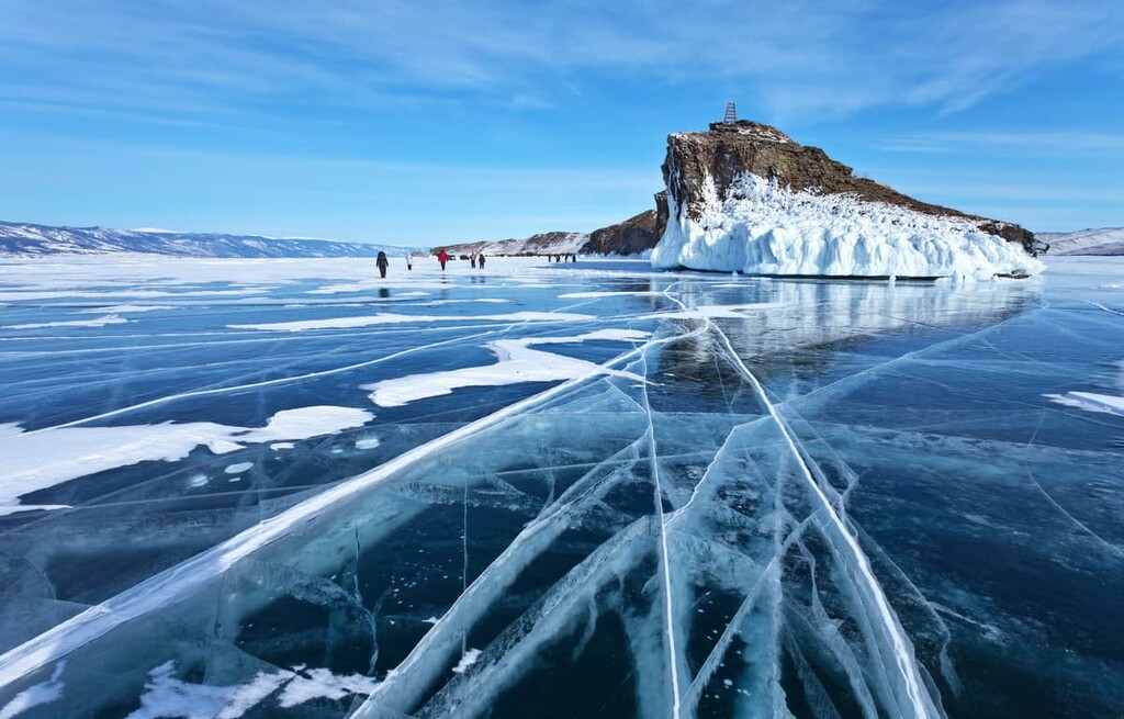
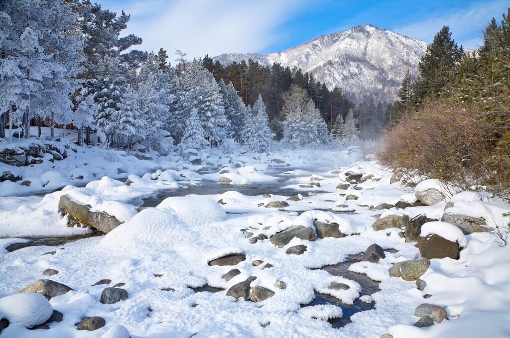
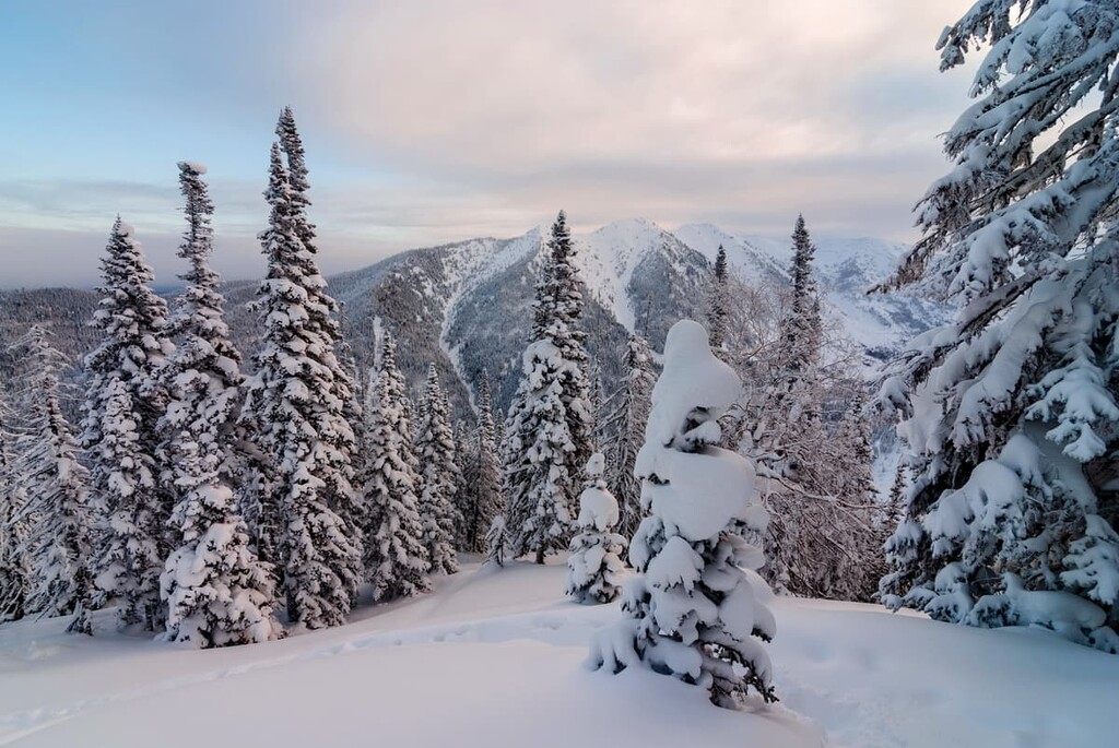
Buryatia has a harsh continental climate. Winters are cold, with dry frosts and little snow. The main snowfall occurs in November-December. The average winter temperature is -22°C (-8 F).
Spring is almost rain-free, with frosts and plenty of strong winds. Summers in the region are rather short, with hot days and cool nights. There is an abundance of precipitation in July and August. The average summer temperature is +18.5°C (+65 F). The most favorable time to visit Lake Baikal is the period from May till October. The temperature can reach +30°C (86 F) in July and August, and the shallow water can warm up to +25°C (77 F). Autumn comes unobtrusively, the temperature changes are not abrupt and in some years the heat stays for quite a long time. A feature of Buryatia's climate is the long duration of sunshine, which is as long as or sometimes even longer than in the southern regions of Russia.
Tourism in Buryatia is booming since it is one of the economic priorities of the local authorities. Buryatia welcomes visitors from all over the world. There is a well-developed network of spas and resorts, sports camps for active recreation, walking and helicopter tours, car and bicycle rides, rafting on catamarans and boats, horseback riding, winter sledding, mountain skiing and snowboarding, scuba diving etc. There is a river steamship line the boats of which can take you up to very remote places. If you are into fishing, Buryatia is a place to go. There are ample fishing opportunities all year round. Yes, there's even ice fishing! You can rent a boat, fish from rocks, stay at a fishing centre or pitch a tent. The most popular places for fishing are the Chivyrkuisky Bay, the Mukhor Bay, the shallow bays of the Little Sea, and the local rivers.
Tours to Lamaist temples and trips to historical monuments, including Orthodox churches, are organized on a regular basis. There are also guided tours for children. Lake Baikal, mountain ranges, nature reserves, waterfalls leave a life-long impression worthy of any long and hard trip needed to get in the middle of Siberia.
Many natural sites in Buryatia are located in protected areas in order to preserve the rare flora and fauna. These areas include:
The Baikal State Nature Reserve aims to preserve the unique nature of the Baikal and its ecosystem, thus it is partially inaccessible to tourists. The Reserve also includes an ethno-town and a nature museum.
The Zabaikalsky National Park covers a vast territory, including several bays, islands, peninsulas, and mountain ranges inhabited by various animals and birds. The park does a lot of research and has its own biological station.
The Tunkinskiy National Park is one of the largest natural parks in Russia. More than half of the park is covered with mountain-taiga forest and steppe.
Other protected areas are no less unique and interesting. Mind you that visiting nature reserves, wildlife sanctuaries and national parks will require a permit which is usually obtained well in advance from the officials of the parks you are going to visit.
If you look at the map of the republic, in the north-east lies the vast Vitim Plateau with the majestic Muisky and Ikat Ranges north to it, closer to the Baikal shores is the semicircle of the Barguzinsky Range, and in the south-west are the wooded spurs of the Khamar-Daban and Ulan-Burgasy. And the west of Buryatia is reigned by the so-called Tunka Alps - the Eastern Sayan Range.
The mountains here are the ultimate haughty lords of this land. They are harsh and mild, alluring and inaccessible, with glaciers and snow caps, with cloudy necklaces on their cold cliffs and crystal clear lakes. Since ancient times the Buryats worshipped them, they were not just peaks, but the embodiment of all the cosmic powers, the axis of the world, the vertical line permeating the sky and the earth, the symbols of the ancestral nomads. According to the legend, the earthly father of Geser (Abai Geser Khan), who is often identified with the son of heaven and patron of warriors, was the mountain spirit itself. Rites to worship the masters of the mountain and to protect them from various disasters were performed on the mountain tops and are still alive today. Here you will find oboos - ritual sites that model mountains and are closely connected to the mountain cult.
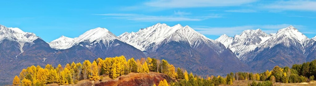
The Eastern Sayans Range, which closes the Tunkinskaya (aka Tunka or Tunkin) Valley from the north, is called the Tunka Alps because of its resemblance to the Swiss mountains. The 33 pointed peaks guard the lands. According to Shagdar Baiminov, a famous poet, connoisseur of legends and traditions of the Tunkinskaya Valley, they are the petrified warriors of Geser. And the most revered cult place of the Khongodors, Ehiritians and Bulagats is a rock sculpture of Bukha-noion, the ancestor of these Buryat tribes, near the village of Dalakhai. There used to be a Buddhist shrine and a Christian chapel on the mountain. Legend has it that when Bukha-noion roars, the waters of the two great lakes, Lake Baikal and Lake Khubsugul, will come together.
Munku-Sardyk (3,491m) is the third highest peak in Russia after Elbrus and Belukha and the highest point of the Eastern Sayan Mountains, located on the southern edge of Siberia between the Yenisei and Angara rivers. The name comes from two words: Munku which in Buryat language means ‘eternal, aeonian’ and Sardyk meaning ‘bald rocky mountain’.
There are several small glaciers on Munku-Sardyk, as well as on some other neighbouring peaks, but they are now actively receding. The most significant glaciation of the Eastern Sayans is located around Topographers’ Peak (3,044 m).
Once on top of Munku-Sardyk, you see a breathtaking panorama. To the south is the Mongolian brother of Lake Baikal, the freshwater Hubsugul Lake; to the north is the Tunkinskaya Basin and the Eastern Sayans; to the north-east is part of the Central Sayan Plateau (the Oka Plateau), where the Oka, Irkut, Urik and Kitoy rivers come from. There are also some lakes on Munku-Sardyk itself, the largest of them is lake Ilchir, the source of the Irkut River.
Another beauty of the mountain is the snow leopard (irbis) which lives here quite peacefully in winter time until the scientists come to watch it in summer and in their tries to capture this evasive animal disturb its normal life.

According to the Unified All-Russian Tourist Route Classification, there are three ascents of different difficulty categories to the summit: 1B, 2A and 2B. The easiest route is 1B. It is a classical route which runs along the northern ridge and is suitable even for not very well physically prepared tourists.
Climbing the mountain from the Russian side is possible only until the beginning of May. In summer, alpine ascent of Munku-Sardyk, which is suitable even for newbies, is possible only from the Mongolian side. Base camp called ETK Silver Coast serves tourists with a transfer from ETK to the foothill of Munku-Sardyk (18 km) up to an altitude of 2000m by motor transport (UAZ 4-wheeler), guides and porters. The whole route is covered during one light day. Upon arrival in ETK, you can relax in a Russian sauna, devour some hot smoked fish and beer.
The way up is along the glaciated bed of the Bely Irkut river up to Strelka base camp (1,500m), the place of the Bely Irkut confluence with the Muguvek River. The distance to the top is about 3 km (a 2-hour walk).
Overnight stay is usually organised at 2650m a.s.l. near the glacier lake Echoy with unusually gentle turquoise colour of water. There are rescuers’ headquarters here as well. For better adaptation of the body, it is advisable to have two stops along the way with the first overnight stay at Strelka.
One hundred metres to the summit of Munku-Sardyk, there begins a loose rock section. The rescuers have installed ropes for individual insurance that you can grasp during the ascent. The ascent from base camp and back takes about 10 hours in total, it is a route of about 30 km. The descent from the mountain is physically easier, but technically much more difficult and requires a lot of concentration.
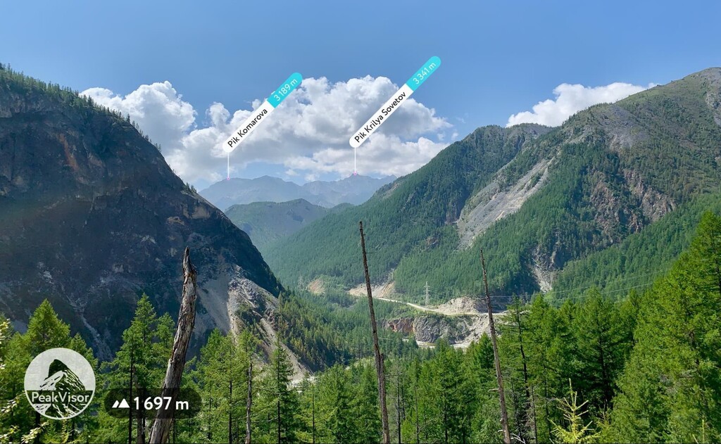
For those who have already been to Munku-Sardyk, there are other peaks with mountaineering routes on the ridge of the same name: Leonova Peak (3,391m), Dinamo (3,341m), Krylia Sovetov aka Wings of the Soviets (3,341m), Opasnaya Peak aka Dangerous (3,190m), Squadron (3,177m) etc.
Munku-Sardyk is a categorised mountain and in order to conquer it, you should be able to handle an ice-axe, walk in bundles or independently on a steep snowy or loose rock slope and wear mountaineering crampons. You will need a lot of paraphernalia starting with food and sunscreen and finishing with individual safety harnesses. In addition, you must be physically and mentally prepared for a long and arduous journey.
The best time for climbing is late April and early May, when the Irkut riverbed is still hidden under ice. Trekking in autumn and summer is also possible, but the route is more difficult as there is no snow or ice and you have to wade the river and overcome difficult mountain passes. The climbing is also hampered by the abundance of thunderstorms.
Since Munku-Sardyk Mountain is a border zone, you must obtain a special pass in advance. To obtain one, send a copy of your Russian passport (main page + residency page) together with the completed application form to the Department of the Russian Federal Security Service in the Republic of Buryatia. The deadline to receive the document is 1 month, and 2 months for foreign nationals. It is also possible to obtain the pass on the public services website (for Russian citizens only). You must also register with the Ministry of Emergency Situations 10 days before the trip and have your passport with you during the trek.
Also, Munku-Sardyk is considered to be a sacred mountain, a residence of Geser, thus visiting the place should be only for some specific purpose and after the sacrifice to the mountain spirits. Furthermore, women have historically been banned from climbing the mountain.
Munku-Sardyk has a nasty character concerning the climate. Often in the hot summer, when trekking through grey moss through dense thickets of Daurian rhododendron and cedar shrubbery, one may find oneself in a snowstorm, or a torrential rain or even hail accompanied with strong, gusty winds. The Buryats have always believed that this is the wrath of ‘the master of the mountain’ for the disturbed peace. By the way, the Mongolians, who also revere the mountain, consider it a forbidden, reserved place and never climb to the top. However, according to geophysicists, Munku-Sardyk is a huge cooling centre attracting various meteorological phenomena.
Mountains are the eternal symbol of the high and the sacred. There is the mythical Mount Meru (aka Sumeru) in Buddhist cosmology, Olympus in Greek mythology, Everest in the Himalayas, Elbrusin the Caucasus, the sacred Tien Shan peaks, Fujiyama in Japan just to name a few. The sacred Mount Alkhanai can also be ranked among the top league sacred summits.
In oral Buddhist tradition, Mount Alkhanai ranks third in holiness after Kailas (6,638m) and Mount Wutaishan (or Qingliang in Chinese, 3,058m) in China. Pilgrims make a so-called ghoroo - a respectful circumambulation of its shrines along the course of the sun. The small ghoroo begins at a mountain stream and continues to the stone statues of Dimchig sume, Sandemin sume, Munhe zula, Nara Hajjad, Munhein arshan, Dayane gher, Uuden sume, Zagurdi habsagai, Dara Ehin umai. The big ghoroo includes a detour around the whole Mount Alkhanai. In spite of the difficulty of this path, it is done even by the elderly who walk reciting mantras. It is said to prolong life and youthfulness.
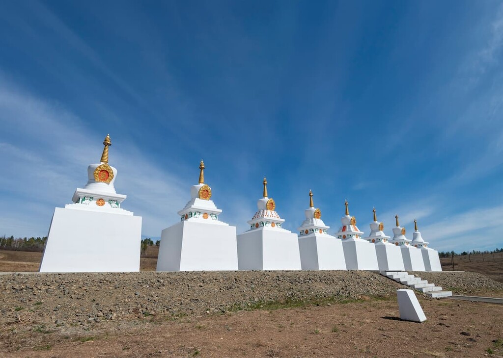
For a long time, Transbaikal Buryats have held their ritual rites at the Alkhanai oboo. The main oboo is 33 stone buildings - munkhans and baipurs - designed for sacrificial fires. The main munkhan symbolises the sacred Mount Sumeru. On their way to Alkhanai, pilgrims bow to the two Maaniyin Shuluun, stone stelae with the text of the mantra Om Mani Padme Hum engraved on them.
The true gem of Alkhanai is Uuden Suma - the Gateway Temple. It is a majestic rock with a through opening. Four laden camels can pass through it. It is believed that a sacrifice at the Gateway Temple reaches the master of Olkhon Island, also a common Buryat sacred place, by an underground axis. According to the legend, the passage under the archway cures various illnesses. In 1884, a suburgan was built here and consecrated by the great yogi Namnanai.
Alkhanai is a unique temple created by nature itself. This was first realized by the Buddhist monks who chose the mountain as their place of meditation. Today, almost the entire pantheon of Buddhist tantric deities has taken up residence in Alkhanai. The mountain has become a place of pilgrimage for every believer.
The Barguzin (or Barguzinsky) Range stretches for almost 300 kilometres along the northern part of the eastern shore of Lake Baikal from the Upper Angara River valley to the Barguzin Bay. The average width of the ridge in the northern and central part is about 80 km, and 30 km in the south, in the Chivyrkuisky Rridge.
Of the ranges surrounding Lake Baikal, the Barguzin is the highest and most powerful. Its average height is 2,400 m. The highest point is Baikal Peak (2,841 m) located in the middle part of the main watershed ridge.
The high-altitude part of the range has many pointed peaks with steep, rugged slopes, interspersed with gorges all along the range. The eastern slopes drop down to the Barguzin River Valley with rocky, often treeless massifs topped with pointed peaks. The western slopes are more gentle. The spurs go down to Baikal in kind of terraced layers which then turn into coastal lowlands that feature rivers and streams of Baikal's numerous inflows. The Chivyrkuisky Ridge that starts from the Bolshaya Cheremshana River Valley closes the Barguzin Range from the south. It is not a high ridge in comparison to its neighbours, the altitudes do not exceed 2,000m. To the north, the relief is rather smooth, but there are also pronounced rocky peaks.
Due to its remoteness and inaccessibility, the Barguzin Range is still largely undiscovered by tourists. The western, predominantly taiga slopes of the Barguzin range are the most interesting, although the most difficult to reach. Travelling in these places is possible only along river valleys, along which there are animal and hunting trails, sometimes partly improved by tourists, but on the whole traversing the Barguzin Range is very difficult.
Only one hiking trail has been laid and landscaped across the Barguzin Range. It starts at Barguzin village and ends at the Chivyrkuisky Bay. On the Baikal coast, all the trails lead to the Circum-Baikal Trail, which is still under construction.
Before Western Buryats and Russian Cossacks came to the Barguzin valley, the Barguts and Evenks had lived there. The place of their worship was the sacred mountain Barkhan Uula, one of the highest peaks of the Barguzin range, not far from the villages Baraghan and Yarikto.
It is said that those who climb the mountain will be bound to it by mystical power and become united with God for a year. They also say that the righteous may see the image of Buddha on the slopes of Barkhan Uula. Monks from the Ivolginsky temple come to climb the mountain, and a huge prayer service is written in Sanskrit to celebrate the sanctity of Barkhan Uula.
At the foot of the mountain are the ruins of the Barguzin temple, as well as a Buddhist temple where Yanzhima, the goddess of art and fertility, is worshipped. There is another place of worship close to the road leading to Kurumkan. Mind you, that women are not allowed to visit these places even though it is now the enlightened era of gender equality.
There was a contest called the Seven Wonders of Buryatia and Barkhan Uula was recognized as the main Buryat natural wonder.
The 30-50 km wide Khamar-Daban Range stretches along the southern shore of Lake Baikal for almost 350 km. The name comes from the Buryat words ‘khamar’ meaning nose (used in toponymy to mean a spur or a cape) and ‘daban’ meaning a high mountain pass or a saddle.
Gentle arching from the Tunkinskaya Depression in the east to the Selenga River Valley in the west, the range skirts the Baikal basin and consists of a series of vast mountain ridges with rounded peaks without a pronounced crest. The peaks of the Khamar-Daban Range with their stone placers rise above the level of vegetation to a height of over 2,000m. The peaks in the higher eastern part of the range down to the Selenga River valley rise to 2,300 m. The northern slopes of the Khamar-Daban drop steeply down to Lake Baikal to form majestic rocky promontories. In the south, the range descends gradually to the Maly Khamar-Daban Range and the Selenga Middle Range. The highest point of the range is Khan-Ula Peak (2.371m), the name means "Tsar Mountain". A little lower is Sokhor Mount (2,316m), and Chersky Peak (2,090m). The latter has long been considered the highest point of the Khamar Daban.
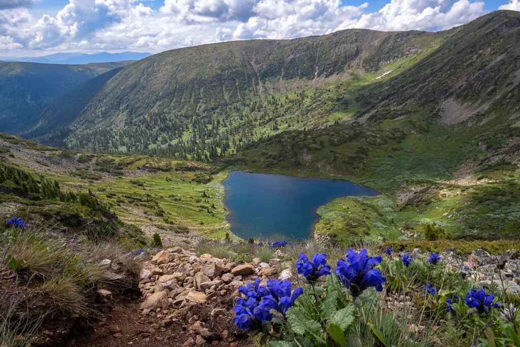
Chersky Peak (2,090m) is one of the highest and most interesting peaks of the Khamar-Daban Range. It is located at the source of the Slyudyanka river very close to the shore of Lake Baikal. The peak is cone-shaped, and close to the top, there is a pyramid made of stone slabs with notes from tourists who have climbed the peak. The panorama from the top is magnificent. In the north, you can see the water area of Lake Baikal surrounded by high mountains of the Eastern Sayan Mountains with snowy peaks, and in the south-west there are the snowy peaks of the Tunka valley and its ridges. In good weather, you can see the huge snow cap of Munku-Sardyk.
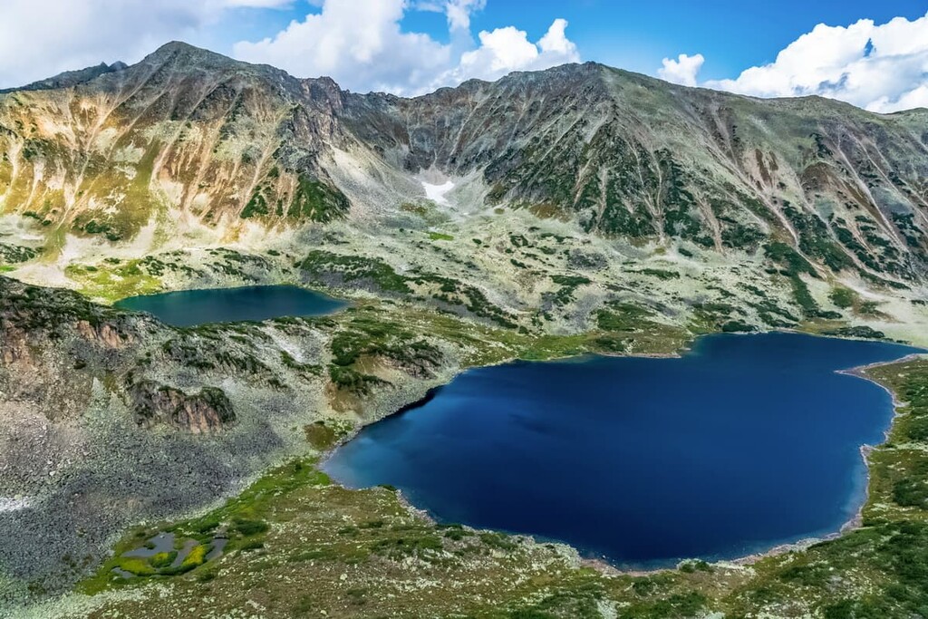
Just below the summit of Chersky Peak lies a picturesque Heart Lake with emerald water. There is a very interesting combination of Siberian taiga, meadows and snowfields, which together with the mirror-like smoothness of the lake create a unique landscape.
The lakes in the Khamar-Daban Range are mostly of glacial origin. Most of the lakes are located in the central part of the range in the upper reaches of the Khara-Murino, Snezhnaya and Utulik rivers. Glacial water in the lakes has a very low temperature and milky grey, sometimes emerald colour, depending on the admixture of glacial silt.
Apart from the lakes, the Khamar-Daban Range features many unexplored caves.
Mamay Mountain is actually a chain of several snow 'caps' of the Khamar-Daban mountain range which extends along the southern shore of Lake Baikal. It is a popular tourist and freerider attraction located on the western border of the Baikal Nature Reserve. The soft thick snow covers the slopes as early as October and only begins to melt in early summer. For more than 5 months, from November to April, thousands of people from all over Russia come here to ski and snowboard in perfect powder conditions.
Mamay covers the entire mountain region with the valleys of the Big, Little and Left Mamay Rivers. It is not far from the village of Vydrino. The distance from the southern shore of Lake Baikal is 10 km, from Vydrino - 19.4 km. The name has no relation to Mamay Khan who never came to the area. It is likely that the etymology is related to the Evenk word "moma", which translates as "wooded place".
The highest peak in the Mamay is 1,540.9m. More modest peaks - Mamay North, Mamay West, Mamay East and Mamay South - are situated next to each other along the river valley. Farther west are the peaks of Razdolniy Golts and Kedrovy Pupyr. Along the northern bank of the Big Mamay River rise the mountain peaks of Uzel, Forest (aka Meat) Pupyr, Little Mamay, Watchtower, Dvukhglavaya and Grebnevaya.
Mamai is a wild mountain with no ski lifts or other climbing facilities. You can only walk from the foot to the pass, or ski there or go by snowmobile. Pioneers have to hike through the untraversed snow to reach the pass.
The off-road vehicle can only drive from the trailhead to the beginning of the ascent, from where another 8 km remains to the Mamay Mountain area itself. This distance is to be covered by a forest road which begins at the signpost 193 km and goes up through the Big Mamay River. You don't need to cross the river: you should go along the riverbed up to the box van (kung). From here start all the uphill routes.
Sleeping Lion Mountain is one of the most popular tourist spots in Buryatia. Despite it being located 40 km from Ulan-Ude, newlyweds eagerly come here for wedding photo sessions. Most of Buryatia's tourist itineraries necessarily include a trip to the mountain, and almost every local has panoramas of the views from the mountain's surface.
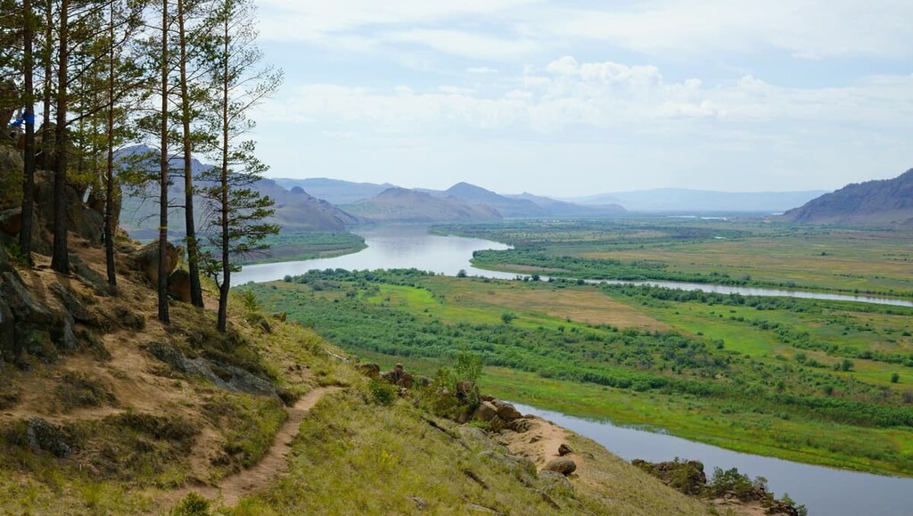
The mountain belongs to the Omulev Ridge, it sits on the right bank of the Selenga River, thus there is another name for the hill - Omulyovka, or Omulyovaya Sopka. According to one of the versions, this name appeared due to the fact that earlier a lot of Baikal cisco called omul locally which used to go to spawn on the Selenga, and fishermen climbed the mountain to see where the river was teeming with fish to set the fishing nets.
The second name, the Sleeping Lion, comes from the shape of the peak. It looks like a lion’s head with small shrubs on the top that form kind of a mane and front paws made of stones cascading to the river. The road leading to the top reminds of a tail.
The Sleeping Lion is a sacred place for shamanists and Buddhists. At the top of the mountain there are two large bowl-shaped depressions that are shrouded in legends. One legend has it that the bowls were formed by lightning. One of the depressions is called a bowl of water, the second is a bowl of fire. If a coin is thrown into the former, life will be peaceful and orderly, whereas a coin thrown into the latter bowl would make your life very eventful.
Another version is that the holes in the rock were man-made. Long ago, these openings served as a site for signal fires, which local Merkit tribes used to inform each other of an approaching enemy. The fires were kindled by day or by night, and the colour of the flames or columns of smoke varied depending on the added mixtures. Herbs and dung from various animals were used for this purpose.
The climb is not too difficult, but comfortable shoes will still come in handy. A long path leads from the gate to the top of the mountain. At the top, before climbing to the lion's head, there is a wide flat area. From here one can enjoy wonderful views of Bukh-Baatori Rock and the majestic Selenga.
The trail to the very summit is a steep stone climb, but the stones have formed a kind of natural staircase that makes the ascent less difficult. At the top are the signal wells. Tourists say the views from here are even more colourful.
The vegetation on the mountain consists mainly of mosses covering the cliff face and occasional trees, most of which are tied with ritual scarves and Buddhist prayer cloths. But even those who do not adhere to the faith tend to tie a handkerchief or rope to a tree here for luck or to make a wish.
There is no infrastructure either on the mountain itself or at its foot. There is only a car park at the side of the road.
The Ikat (Ikatsky) Range stretches over 250 km east of Lake Baikal, next to the Barzugin Range, it covers the territory of the Nature Reserve Dzherginsky in the Kurumkanskiy district in the north of Buryatia. In the north, at the mouth of the Nyandon River, the left tributary of the Kotera River, it joins the Severo-Muisky Ridge, whereas in the south it is limited by the Ulan-Burgasy Ridge. In the west and east the ridge is limited by the valleys of the Barguzin and Kotera, Tocha and Vitim rivers
The Ikat Range is home to the headwaters of the district's largest rivers: the Barguzin, the Tsipa and the Kotera. The Ikat is composed mainly of metamorphic shales and granites. On the lower part of the mountain slopes, up to a height of 800-900m, there is a mountain forest-steppe, and a belt of larch taiga goes up to a height of 1200m on the northern slopes and up to 1700m on the southern ones. Higher come thickets of cedar trees and mountain tundra.
The peaks of the ridge are predominantly flat. According to a 1980 aerial survey, the highest point is 2,574 m. Previously, Dorong Peak (2,538 m) was considered the highest point. It is located at the headwaters of the Kotera west of Lake Dorong.
The Ikat Range has little snow thus the avalanche hazard is low, which makes it attractive for winter mountain hikers. However, keep in mind that in freezing temperatures, the snow hardens and becomes friable, and skis can fall through almost to the full depth of the snow. Wet glaciers, icefalls and small canyons, which, however, are characteristic of the whole Transbaikal Region, should also be referred to the main obstacles of the area.
You can get here from the south, from Ulan-Ude by bus to Ulyunkhan Village. From the north, access can be made to Angoya or Novy Uoyan stations and farther to Ulyunkhan Village, Kurumkan. It should be noted that the winter road is the only road used to deliver goods from Ulan-Ude to remote Transbaikal villages. The road is very difficult, on an average the speed of a four-wheeler or a truck won’t exceed 10 km per hour. Trucks go rarely, about once a day. As a rule, these are private vehicles owned by shop owners in the villages in the north of Buryatia. Sometimes cars go as far as the reserve's cordon on the Bironkur River, where a little fee (kind of a token payment, no bitcoins though please) is charged at the cordon to visit it.
Suvo (Suvinsky) Saxon Castle is one of the main attractions in the Barguzin Valley, it is situated near the village of Suvo.
On the slopes of an unforested hill at the foot of the Ikat Range rise picturesque cliffs resembling the ruins of an ancient European castle. These are huge stone towers with loopholes, there is a narrow rock gorge between them and a stone ridge around the perimeter, resembling the remains of a fortress wall. The rocks are up to 50 metres high and are compactly arranged over a length of about 400 metres.
These rocks used to be a cult place for the Evenki people. The place is thought to be inhabited by the spirits of the local winds, among whom is the master of the legendary Baikal wind - Barguzin. That is why Suvo or Suvi in the Evenki language means ‘a whirlwind’.

There is a belief among the Buryats that the lords of Suvo Tumurshi-noion and his wife Tudugish-khatan live in the rocks, in honour of whom an obo and a wooden burkhan were erected. According to people's recollections, the locals used to gather for a prayer in honour of the Suvo lords and they gave a ram as a sacrifice.
According to one of versions, the Suvo cliffs once served as the last outpost of barguts - ancient inhabitants of the valley. But so far there is no scientific evidence that it was a bargut fortress.
The Suva Castle is easily reached by car from the village of Barguzin on the left side of the mountain. It is an ideal place for photo shoots featuring the scenery of the Barguzin Valley with its network of lakes and picturesque cliffs in the foreground.
There is a peculiar natural monument In the Tugnui Valley near the village of Galtai. You can see a stone that looks like a slightly clenched human palm with raised fingers. Time, wind and water have created this amazing sculpture on which you can see the lines and dashes like on a palm of a living person.
Taban khurgan, as the locals call it, means ‘five fingers’ in Buryat language. This hand symbolises the hand of a man begging for forgiveness, happiness, luck and prosperity given by the father of all things, the Eternal Blue Sky.
The Buryats worshipped the Five Fingers until the 1930s. During the Soviet era, the sacred rituals were discontinued for many years. It was not until 2006 that representatives of the Tangeri religious shaman organisation resumed the worship of the Taban Khurgan. Now, Buryat shamans hold a ritual here to venerate this sacred site every year.
Burin-Khan Mountain is another worshipping site and one of the five great shrines of Asia. It is located in the Borgoy steppe in the south of Buryatia. It lies on the watershed of the Temnik and Dzhida rivers, not far from the village of Inzagatuy in the Dzhida district of Buryatia.
The name Burin-Khan means "perfect (real) khan" in Buryat language. Compared to other surrounding mountains, Burin-Khan stands out for its height, beauty, richness of flora and fauna.
Mount Burin-Khan has three peaks. The southern peak, the tallest and most majestic, is called Khan, while the northern peak is called Khansha and the smallest peak, their son, lies between them. At 1600m, on the southern peak, surrounded by edelweiss growing on the green slopes, lies a large clear lake that also has a spring with healing waters. The lake is surrounded by the shrines of twelve Buryat clans, with one large oboo and 12 small oboos around it, each of which is revered by a different clan.
There is also a rough but still stately 5.5-metre-high red-green-gold statue of the Master of the Mountain, the statue is made of concrete and artificial stone and is depicting a man in warrior armour, riding a black horse with an ornate harness. The statue is believed to be dedicated to Burin-Khan, the patron saint of the area, who is mentioned in Buryat myths about the great hero Geser.
Another monument is a sculpture depicting five bright yellow roe deer running towards the mountain. Legend has it that when Genghis Khan saw these animals while hunting in the valley, he named the area "Inzagatuy", which means "roe" ("inzaga") in Buryat. The village nearest to the mountain still bears this name to this day.
On the second day of the last summer month according to the lunar calendar, worship and sacrifice are held on Mount Burin-Khan. Buryat clans living in the Selenga and Borgoi valleys gather at the summit on both sides of Burin-Khan (on the east - Tashir, Selenduma, Iro and Udunga and on the west - Inzagatui, Ichetui and Borgoi). According to a legend, every year Sagan-Ubugun, the guardian spirit and patron of the area, highly revered by the Buryats, comes to the top of Burin-Khan. Climbing the mountain, he looks at the surrounding countryside in all directions, admiring the cattle and pastures. And to all places within his benevolent gaze, he sends mercy and grace. We hope he has a 20/20 vision.
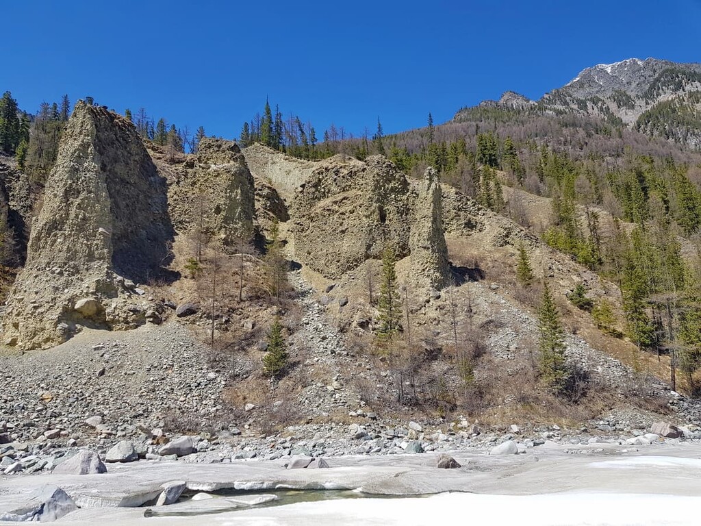
The unique Subutui Pillars Nature Monument is located in the upper reaches of the Subutui River, which originates on the southern slopes of the Hangarul Ridge.
Over many millions of years, weathering processes have given the rock formations the shape of pillars. One of the most remarkable features of the rock is its unusually regular fracturing. Granite columnar separations retain their shape from the base to the top. These natural columns are almost 2 metres in diameter at the bottom and gradually taper towards the top to 1 metre, forming a narrow bundle. They might remind you of the Giant’s Causeway in Northern Ireland to some extent.
At the foot of the Subutui Pillars, about 1,700m a.s.l., mineral waters with healing properties come to the surface, which attracts many holidaymakers and those seeking recovery from respiratory, heart, kidney, liver and joint diseases. One of the cliffs, named Wonder Rock, once had a huge eruption of clay. The clay is dark silver in colour and also has healing properties.
On the left bank of the Shumak River, the ancient limestone pillars rise up to 40 metres high. From afar, they look like man-made idols or totems, but researchers claim that the local water and winds just worked some natural wonders on their formation. According to legend, the spirit of river Shumak resides here. Even today the place is considered sacred by the locals. It is not recommended to go too close to it so as not to disturb and enrage the spirits that live there. Not far from the place, there is a so-called altar where women come to ask for a child.
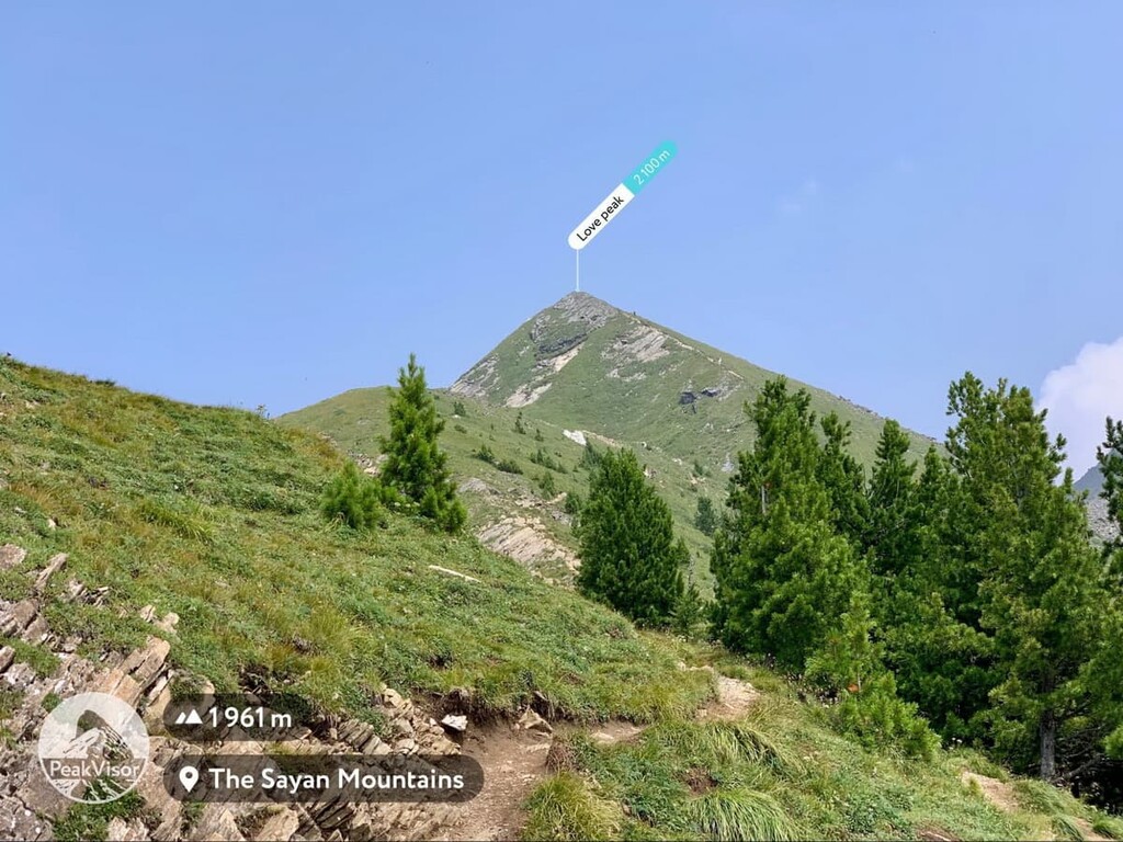
Love Peak (2,412 m) is one the most romantic places. It is located in the Tunkinskie Goltsy Range near the village of Arshan. The legend has it that if you want to never part with your beloved and live happily-ever-after for sure, climb the peak and make a wish at its top. It is a much loved place by the tourists and the locals. There is a path to the top, but the ascent, though interesting, is considered rather tiring. Even if you are not romantically inclined, Love Peak is a popular climbing destination for aficionados of active or even extreme holidays. From the top of the mountain, one can enjoy beautiful views of the endless taiga and the Tunkinskaya Valley.
The Tunkinskaya Valley has as many as 9 extinct volcanoes on its territory. Their height does not exceed 68.5 m. Talskaya Vershina, Khara-Boldok and Kovrizhka volcanoes are the largest among them. Stiff lava flows, which have been frozen for some time, are spreading for 70 km along the valleys of the Khi-Gol and Zhombolok. When you look at those fantastic black formations, they remind of a swollen dragon belly who has eaten a careless jaywalker, therefore, please mind your step while there because some terrain is treacherous. Surrounded by these lava fields one can observe two volcanoes with truncated cones of a regular shape, Kropotkina and Peretolchina volcanoes. Although they seem insignificant against the background of the mountain ranges surrounding them, up close they are impressive in size!
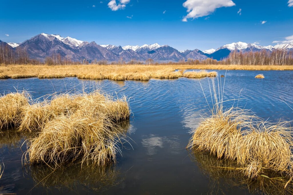
The largest peninsula of Lake Baikal, the Svyatoy Nos Peninsula, is located in the Zabaikalsky National Park. Forests grow dense here and hot springs emerge from under the ground. In ancient times, this area was considered sacred and filled with forest spirits. Shaman ceremonies were held here. Nearby is the archipelago of the Ushkany Islands, where the Baikal seals usually rest.

It is no mere coincidence that the peak got this notorious Russian tsar’s name. Its unusual shape is that of a spiky peak with a smooth edge, reminiscent of the Russian tsars' headdress. The mountain is located seven kilometres from the south-western tip of Lake Baikal, not far from Vydrino station. The mountain itself is not very high - it is just 685 m a.s.l., but from its top there is a panorama of beautiful surroundings: the neighbouring mountains and forests, lakes and the Snezhnaya River.
The Baikal is the true gem of Buryatia and its main attraction. It is listed as a UNESCO World Heritage Site. Some scientists call it a unique freshwater sea. It is also considered a sacral centre of the Earth and a place of power. There are many legends and beliefs about it. The Baikal is one of the oldest lakes on the planet, it is approximately 20-30 million years old. The main tourist areas on the lake are concentrated in the Chivyrkuisky and Barguzinsky bays. The clear fresh water, picturesque landscapes, walking and horse riding, healing spring waters, overnight stays in nomadic yurts – all this is just a tad of what the lake and its surroundings offer to its guests.
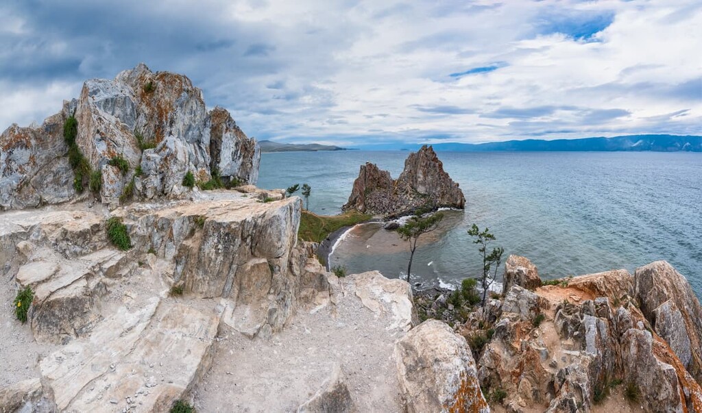
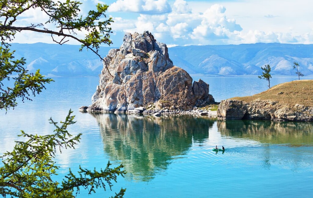
The largest island in the Baikal is Olkhon. This piece of land is the lake’s geographical and sacred centre. Its shape is reminiscent of the shape of Lake Baikal itself. It is as mysterious as the lake itself.
The Sarma Gorge is another fabulous spot. According to one legend, an evil spirit dwelt in the gorge and in the old days, local shamans tried to stop it from leaving the shelter. The proof of this heroic quest is the ancient stonework found here. Another version is that shamans tried to prevent strangers from entering the place. To this day, travellers passing by the gorge have preserved the tradition of adding stones to symbolise the strengthening of the barrier. Practically in the beginning of the Sarma Gorge, some ancient petroglyphs can be seen on the left bank of the river Sarma flowing at the bottom of the gorge.
The gorge is also the place where a very strong Baikal wind, often referred to as the Sarma wind, originates. This gale-force wind can blow at the speed of up to 60 metres per second.
Probably the most well-known waterfalls are situated on the Kyngarga River. There are the Kyngarga waterfalls near the village of Arshan. This cascade of waterfalls is located in a marble canyon. The highest fall drops its waters from a height of 10 metres.
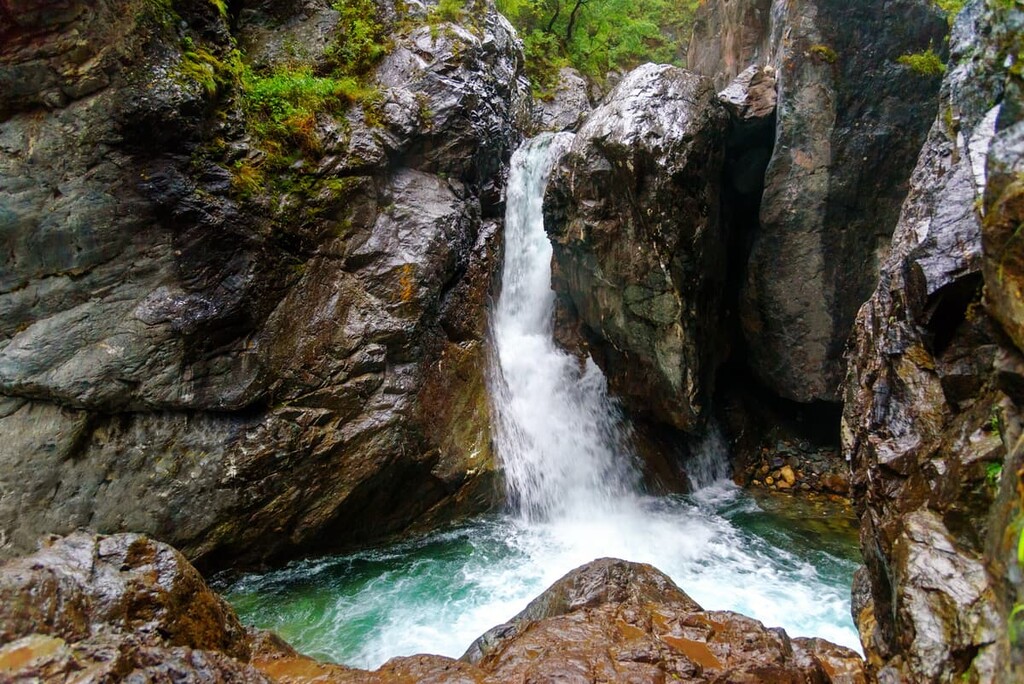
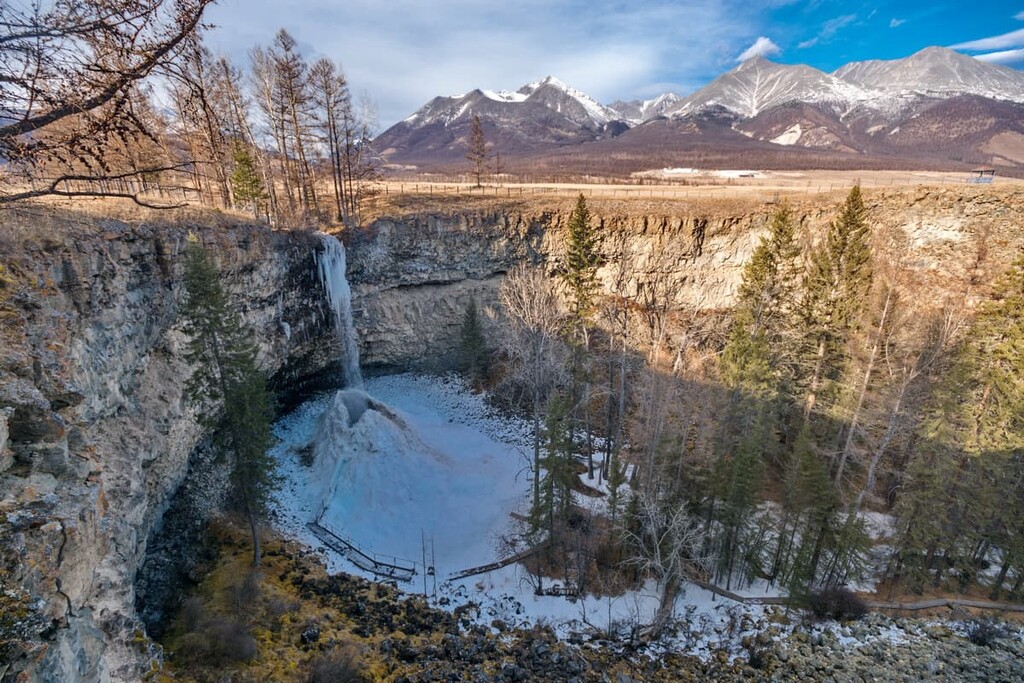
The Little Jom-Bolok Waterfall is also located on the banks of the river Kyngarga. It is 20 m high. There is an observation platform at the top, and at the base of the fall there are changing cabins, should travellers wish to go for a swim. In winter, the waterfall freezes completely and the tourists can admire the sparkling splendour. The area is also associated with many folk beliefs and is revered by the locals.
The gateway to Buryatia is Ulan-Ude, the capital of the republic. It has the only airport in the region, which is located 15 km from the city centre. The flight from Moscow by the Pobeda, S7, Smartavia airlines will take 5-6 hours. From the airport, shuttle buses No.28, 55, 77 will take you to the centre of Ulan-Ude in 20-30 minutes.
There is also a train station in Ulan-Ude, but the journey by train will take much longer than a flight. It is 5,519 km from Moscow to Ulan-Ude, the trip will last at least 4 days. The railway station is located 2 km from the city centre. It takes just 5 minutes by public transport (shuttle buses No. 4, 23, 36, 63) to get to the city centre.
This is probably the most challenging quest. Three federal highways cross Buryatia - M-55 Baikal Moscow-Vladivostok and A-165 Ulan-Ude-Kyakhta-Mongolia, and A-164 Slyudyanka-Orlik running through Mondy and then to Mongolia, Lake Khubsgul. It will take a 3.5-day non-stop driving at the average speed of at least 60 km. But let’s be real, Russian roads might be full of surprises.
The most convenient way to get to Baikal is from Irkutsk (Irkutsk Region, about 70 km from the nearest Baikal shore) or Ulan-Ude (Republic of Buryatia, about 140 km from the nearest Baikal shore). From Irkutsk you can see the western and southern shores of the Baikal and Olkhon Island, and if you travel from Ulan-Ude, you will see the eastern shores, the Chivyrkuisky Bay and the Ushkanyi Islands. To explore the northern part, Severobaikalsk and Nizhneangarsk can be a starting point, but as they are not directly connected to the central part of Russia, it will be more difficult to reach them.
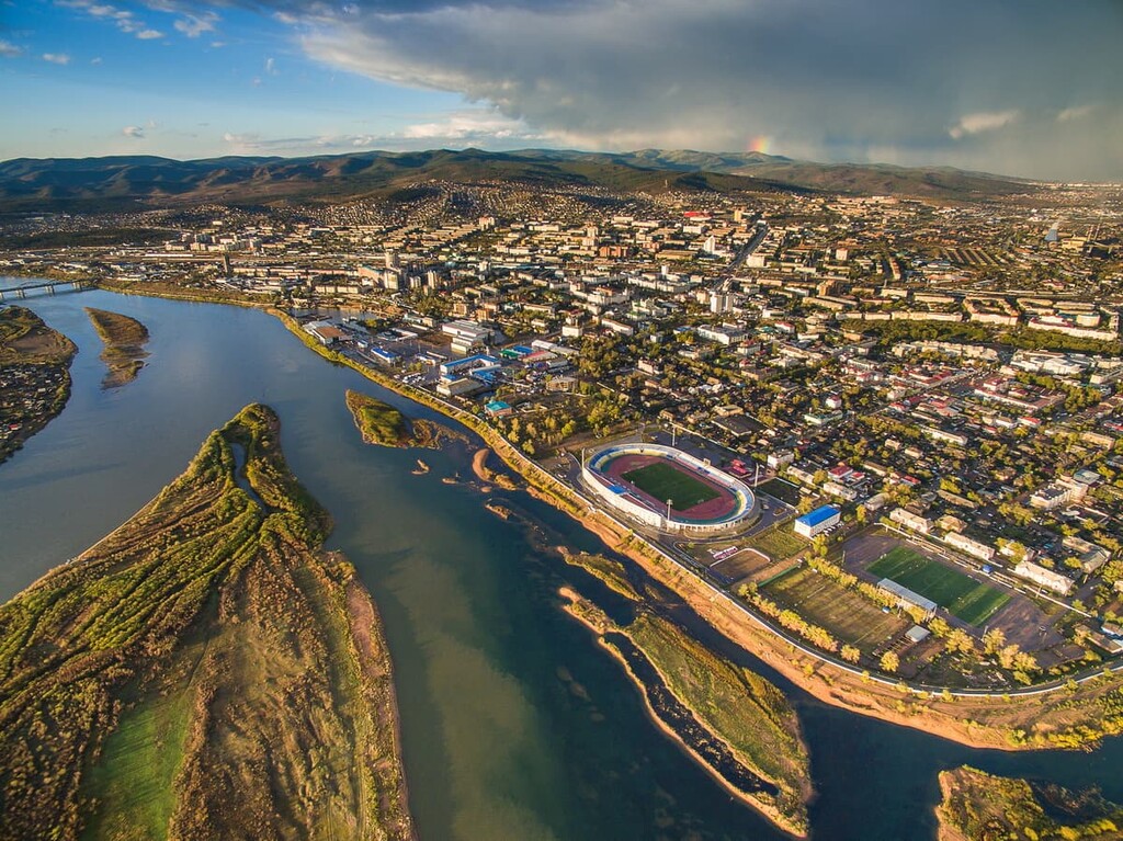
Ulan-Ude is relatively small if you compare it to other Russian cities. It stretches near the eastern shore of Lake Baikal. As the capital of the Republic of Buryatia, the city perfectly blends the traditions and culture of the Buryat people and the Buddhist architecture.
The history of the town began with a winter headquarters built by Cossacks in 1666 on a high hill on the banks of the Uda River. The place, chosen for a reason, was a crossroads of trade routes with Mongolia, China and Eastern Siberian cities. With time passing by, the number of houses increased and in 1698 the burg received the status of a town. The town got its now known name only in 1934, before that it was officially called Verkhneudinsk. The look of modern Ulan-Ude demonstrates a mixture of cultures of different ethnicities. You can see Russian Orthodox churches nestled comfortably next to Buddhist Lamaist temples. There are many historical monuments, public gardens and parks that lure with their authentic beauty.
The main attractions of the city are concentrated in the centre. For the convenience of tourists in Ulan-Ude, there is a special route, a so-called dedicated Green Path which will help not to miss the main landmarks of the city.
In the centre of the city stands a monument that the locals call Hospitable Buryatia. The 16-metre-tall sculpture of a woman in a national costume with a traditional Buryat khadak symbolizes kindness and hospitality. Khadak is a long ritual scarf, one of the Bhuddist symbols. It is usually presented in Mongolia and Tibet as a symbol of respect, friendship and good wishes. It can be yellow, black, or white colour, but most frequently it is blue.
The biggest monument to Lenin in Russia in the form of a huge cast head is situated in Sovetov Square. You can also find other monuments in the city: the Youth of Buryatia, War Eagle, monuments to A. P. Chekhov and A. S. Pushkin, a monument to Geser, a monument to a student, a pensioner, a memorial to WW2 victory and many others.
Ulan-Ude is home to the only Opera and Ballet Theatre in the region. There are also the restored Tsar Gates, they are basically the arch built to commemorate the arrival of Tsesarevich Nicholas (the future Tsar Nicholas II) to Ulan-Ude in 1891.
You can learn about the local art and culture by visiting the History of Buryatia Museum and the Sampilov’s Art Museum. Should you wish to feel the real spirit of Bhuddist culture, visit one of the local Lamaist temples. Ulan-Ude also hosts the biggest statue of Buddha in Russia.

In the Verkhnyaya Beryozovka district, there is an open-air museum complex called the Ethnographic Museum of the Zabaikalye Peoples. It is one of the largest open-air water museums in Russia.
We’ll be glad to hear about your travels to Buryatia, give us a shout at peakvisor@routes.tips


Yes. Buryatia has 774 named mountains. The highest is Munku-sardik at 3,491 m.
The highest mountain in Buryatia is Munku-sardik, at 3,491 m.
Buryatia has 774 named mountains.


